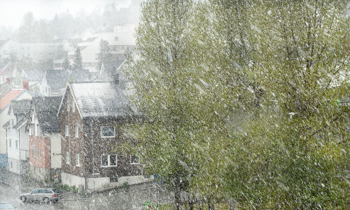
Tar du vårbilder?

What is the difference between these two photos?

Half an hour and round about 60 metres in altitude. The first photo shows – quite visible – a bunch of tussilago flowers, the second one – pretty hidden – a tombstone on the Elverhøy graveyard.

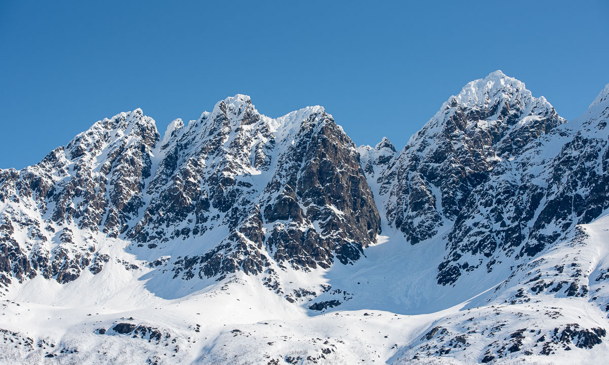
I cannot answer why the differences are so immense on the island Tromsøya. I only can observe that while it looks like spring is coming to the coastal parts the ridge of the island is still wintry. There are old ski tracks and the lake Prestvannet (96 m) is still covered with ice and snow.

I walk round the lake. Some parts of the way are free of snow, most aren’t.

I take a photo from a bench. A woman passes by and asks me: “Tar du vårbilder?” – do you take spring pictures? Well, kind of … .

I have an appointment at 18:00 so I leave the “mountains” of Tromsø and descend into town. While the small slide near Prestvannet is still snowed in the playground lower in town is completely free of snow. And I don’t think, they have underfloor heating. (Not impossible in Tromsø.)

Later, at 22:45 I walk to the bus that brings be home. It’s still quite light outside. No wonder, it’s only 20 days left to the period of the midnight sun.


A sunny car trip to Jøvik

As in many other countries 1. May is a rød dag, a red day which is an official holiday. The weather is beautiful and I decide to do something I haven’t done for a long time: a car trip.

I take the car to Jøvik, a village in Tromsø municipality located on the peninsula Lyngenhalvøya, home of the impressive mountain range “Lyngen Alps”. As soon as I leave the E8 travelling is slow. On the one hand there’s a lot to see, on the other side the roads are in a pretty bad shape.

Just some photos I took on this wonderful day trip:


My first Thursday paddling 2023

Today I was joining the “Thursday paddling” of the Tromsø Sea Kayakers Club. They started the season two weeks ago, I joined today for the first time this year.

At 18:00 a group of 13 kayakers left the shore by the boat houses and headed to Telegrafbukta, the small bay near my apartment. In the dull weather the kayaks and the paddlers in their drysuits always look quite colourful.

Although I’ve already been paddling in Sweden several times this winter it took me some time to find a rhythm. When I’m alone, I use to paddle slower.

At Telegrafbukta we decided to continue to Sydspissen, the southern tip of the island Tromsøya. There we turned back, paddling through snow showers.

We already saw it on the way there – there was very low water at Telegrafbukta, or just “Bukta” as the locals say. We took a break there but only a short one. The weather was too chilly to be comfortable.

We talked about the weather and came to the conclusion, that summer probably already was on first of May and now summer season is over. I’m not completely sure, if this theory will prove true, but on the way back spring or summer seemed to be far away.

It reminded me at last years first Thursday paddling. It was on 28 April and the weather was as snowy as today. Let’s see how the weather is next week.

Kronprins Haakon in between

Yesterday

Yesterday I took the car to the northern tipp of Tromsøya to get my tyres changes. When I drove back I had my studded “Nokian Hakkapeliitta 9” tyres in the car’s back and brand new summer tyres on the rims. On my way back I passed the port and there lay the ice breaker Kronprins Haakon.

I continued to the shopping mall Jekta to fetch a photo collage printed on a hard foam board. The photo show scenes from the expedition I joined last year with the very same icebreaker Kronprins Haakon (KPH or even KH for the lazy ones). At time it stands on my dresser. With 75×50 cm it’s larger than expected.

Today

Today I took the car to the port, parked it outside, went to kai 25 and went on board of Kronprins Haakon. Not to join a cruise but to meet my colleague M. on the bridge. Nice to be there anyhow. M. already had installed some GIS software plugins on a computer there. I configured another plugin on my computers that can show the ship’s position in realtime together with other map layers.

In three weeks

The ship’s position in realtime however works only when my computer is connected to KPH’s network. No use to have it home. But in three weeks I’ll enter the vessel again, then in Longyearbyen. Then I’ll join my second arctic cruise with the Norwegian Polar Institute that will lead us to the Arctic Ocean north of Svalbard. There’s a lot to do and I’m nervous because I have some tasks there that I never did before but I’m looking forward to it very much.


Taking orthophotos on Kvaløya

That’s me, nine days ago, near a parking place by the lake Finnvikvatnet on the island Kvaløya.

I just got a drone from the Norwegian Polar Institute, a DJI Mavic Pro 2. Since it is forbidden to fly a drone in Tromsø (too near to the airport) I chose a place on Kvaløya to check out the drone and practise a bit.

What you may expect from drone flying is photos like this:

What I actually did that day was taking a bunch of photos like these:

Back at home let the computer do some heavy work. That’s the result:

What I wanted to achieve is creating a so-called orthophoto. That is a stitched image that also contains geographical information. You need quite a lot of photos to get good results. In the map above it is only 9 photos and 11 photos in two distinct groups.

I used two softwares: First OpenDroneMap to create the orthophoto and then QGIS, an open source Geographic Information System, to present the orthophoto in a geographical context.

This afternoon I took a trip to Kvaløya again, this time to the way to Sommarøya and stopped by the lake Kattfjordvatnet. Here I pulled up the drone to an altitude of 80 metres and tried to navigate a rectangular zig-zag pattern with a lot of overlapping between the images. Beside of the fact, that the images are underexposed (and I was too lazy to correct them) I’m quite content with the result. The first image is an oblique shot, the second image is an orthophoto calculated from about 80 images and then placed into QGIS.

Plan for the next two weeks: getting more practise!

Snowy intermezzo

Last week it felt like spring is finally coming. Flowers were blooming in the forest, the snow had melted away rapidly and even the birch trees finally had become green.

Since then it had been raining a lot. Yesterday it got quite cold and the rain turned into wet snow.

There were snow showers the whole night and this morning, too with temperatures round 0–1 °C. Is this what spring looks like? And we’re talking about the end of May.

Alas it was only a short intermezzo and while the mountains still look whiter than before snow has melted away throughout the day.


Arctic Ocean 2023 – prelude

This article is part of the series “2023-06: Arctic Ocean cruise KPH”.

When it looks like this on my table …

… then I’m going to travel. I love packing lists and I need them so that I do not forget too much.

At 9 o’clock everything is packed (ca. 50 kilos!). At 10 o’clock the taxi fetches me and takes me to the airport in Tromsø. Two and a half hours we are in the air heading north.

It’s very cloudy but shortly before landing I finally can see something different than sky and clouds: Svalbard’s main island Spitsbergen.

Soon we will land in Longyearbyen, where I landed three month before. But there are some differences.

Last time I travelled with Annika and we went on vacation before I worked in Longyearbyen for a week. Now I’m travelling with some colleagues from the Norwegian Polar Institute. Shortly before we land on the airport I take a snapshot:

There it is: the vessel Kronprins Haakon which is more or less the reason why some colleagues of mine and I travelled north: Tomorrow we will go on board on this ice breaker and start an expedition way up north into the sea ice. For three weeks we will live and work on Kronprins Haakon and I’m so excited that I may be part of this.

Today I had some hours in Longyearbyen. I was quite curious how it would look like in late spring. According to a researcher there is a lot of snow for the season this year. But on sea level the snow has melted away and everything looks soaking wet and muddy. While Svalbard reindeer are probably happy I definitely prefer winter.

If everything goes according plan we will leave Longyearbyen tomorrow at lunch time. I guess it won’t be long until we do not have any regular internet. So probably I will not blog anything about this scientific cruise before I’m back in civilisation.

Bye bye – ha det bra!

P.S.: On Facebook a friend wrote to me: “You must have the best job in the world!”. My answer – short but genuine: “Yes!”