The last Thursday kayaking 2023

No, I haven’t joined many of “torsdagspadlinger” organised by the Tromsø sea kayak association this year. But at least the first one on the 4th of May and the last one this evening.

We were a group of ten heading to the island Grindøya in the west. When I arrived at the boat houses round half past five the sun was already disappearing behind the mountains of Kvaløya. Half an hour later we were on the water. The weather was quite warm and it was very calm –perfect conditions for a relaxed tour.

We headed to a sea mark – resting place for a small flock of cormorants. They flew away, when we gathered there.

While we were continuing to the northern tip of the island it was becoming dusky. We all had lights at our kayaks or our lifejackets. Less to see but to be seen.

After we passed the northern tip of Grindøya we turned left (meaning south) and calmly paddled along the forested island.

When we arrived at the beach at the southern tip it already had become pretty dark. The lights of the mainland illuminated the horizon. The single light at the left top corner of the next photo is the mountain station of the cable car Fjellheisen.

On the way back it was really dark. We paddled in pairs to ensure that no one was left behind and it was too dark to take snapshots. Just before we arrived at the boat houses again I took the iPhone out of its waterproof bag and took a photo. With a bit of help from Lightroom it’s surprisingly sharp.

It’s a pity that this was the last torsdagspadling but understandable, because it gets darker and darker every week. And if the weather forecast is correct it may snow next week.

Takk for turen – thanks for the tour, especially to the tour guides. See you next year.

Autumn tour to the glacier Steindalsbreen

After being abroad in Germany, “home home” in Sweden and on vacation in the Netherlands for almost a month I have returned to Tromsø, my “work home” one week ago. Time to work again for the Norwegian Polar Institute but not only that …

Some days ago my colleague Marika asked me if we should go out for a hike to the glacier Steindalsbreen in the weekend. I knew the place from hearsay but never have been there. I gladly accepted – I like hiking with good company. Yesterday on Sunday we met at 7 o’clock and off we went. First by car.

Car trip

Steindalen is on the Lyngen peninsula and round about 100 km away. According to Google it takes 100 minutes but we stopped several times, either to take pictures of the reflections in the fjord or the curious fox beside the road.

Through the forest

After the car was parked we started our tourat 9:25. The birch and alder trees were clad in autumnal colours. The path led westwards through the forest along a small mountain river.

To the cabin

After the path going up and down it led nearer to the river. We passed some moraines – witnessed from the ice age – and spotted a waterfall falling vertically down from a mountain. Then the cabin Steindalshytte came into view. There is a wooden bridge to cross one of the rivers.

Through the U-shaped valley

We followed an inflow of the stream and soon the valley opened more and more. And there it was – still in the distance – the glacier!

It gets rocky

The path went further up and the ground started go get rockier and we left the delta like wetlands behind. But still there were many crouching plants present, many of them in the brightest autumnal colours.

Approaching the glacier

A hill and the glacier Steindalsbreen came in full view, another hill also the glacial lake in the front. Quite depressing were the signs that marked the retreat of the glacier. Oh – so many hundred metres in so few years ;-(

Nearer and nearer …

The first photos Marika and I took from the edge of the glacial lake. Then we followed a path to the right that brought us nearer to the ice. Here we walked on gravel covered ice. I found a hole, perhaps 80 cm in diameter and 150 cm deep.

On the mud flats

As usual I hiked with rubber boots and so I could walk on the sandy mudflats right in front of the glacier. Oh, so beautiful the turquoise blocks of ice!

Mud, ice, and water

I also took some photos of the ground. Was it sand? Hard mud? Ice? Sometimes probably all the three.

Then I looked back to the lake. Hard to imagine that we hiked through autumnal forests some hours ago. This landscape looks eternal somehow although it is the opposite: very fragile and threatened by the global warming.

Heading back

After a meal break by a large rock it was time to head back. The times of midnight sun and bright nights are over and at 7 o’clock in the evening it would be dark. Just some more photos from our way back.

After round eight hours we were back at my car. What I great tour!

Takk for turen, Marika!

#escapism – midnight sun at Lyngstuva

Sunday, half past five in the afternoon. I just arrived in Breivikeidet by car, waiting for the ferry.

It was a quite spontaneous decision to take the car to the northern tipp of the Lyngen Peninsula to watch the midnight sun before the polar days are over in Northern Norway. Without the ferry I would have to drive 200 km one way, using the ferry it is less than half the distance. And there the ferry arrives.

Eight a clock. I have parked by car on a camping ground and the backpack is packed. Camera equipment, something to eat and drink, an extra jacket as well as sleeping bag and camping mat. Hopefully I can sleep in the tiny hut that is near the lighthouse I want to hike to. If not, I’ll sleep outside and get eaten by mosquitoes …

The way there is only 3 km. First I follow the broad gravel road then I turn right and hike along a path that meanders through the mountain landscape. The forecast of the Norwegian weather service yr was right: the weather is nice and mostly sunny. Hopefully it will be clear this night.

And there it is: Lyngstuva Lighthouse. The hut is tiny but it’s open and no one else is there. Nice!

Behind the lighthouse lies the open sea with the prominent shape of the island Nord-Fugløya (Northern bird island) in the north. On the sea there are surprisingly many ships, some of them large. The largest (and ugliest) is the touristic cruise ship Viking Mars with place for 930 passengers. Then there are two Hurtigruten ships. From the left comes Kong Harald on its way to Skjervøy, from the other side Richard With with destination Tromsø. Both have a capacity of 590 passengers.

As usual the ships greet each other with the ship’s horn. Again and again they toot, apparently checking who will have the last word.  Finally some minutes after she ships have passed, Richard With toots a last time for half a second and Kong Harald answers the same way. Then it gets silent.

I enter the tiny hut and take some pictures before I make myself at home. It’s cosy!

I soon realise, that I may have the hut for myself this night but definitely not the place. The french couple has gone but in the next hours many other people will appear “on stage”.

Dramatis personae: A couple from Amsterdam. Two people from Lithuania (he’s here for the 7th time) with friends. A group of Finnish scouts. Some more random people. M. and F. from Bavaria.

With the latter two I spend the evening and night. They are the perfect outdoor hosts. They already have collected wood for a campfire, that is soon is burning. We sit round the fire and chat about all sorts of things. I’m even invited to a glass of red wine if I have a glass. No, I don’t have any glass or cup but I have a pot of yoghurt. I only have to eat the yoghurt and clean the pot and – voilà – I have a high standard quality wine glass. Later this evening F. surprises me once more: He brought a travel guitar and so we have live music while we watch the sun slowly lowering but mostly wandering to the right.

At 0:28 the sun has vanished behind the island Nord-Fugløya in the north.

Will it be visible in the mountain gap at 0:44, the time when I think it’s lowest? Yes, at 0:42 it shows up and at 0:44 it is mostly visible again. It’s not my very first midnight sun I see, but a very beautiful one. I’m glad, that I have come here.

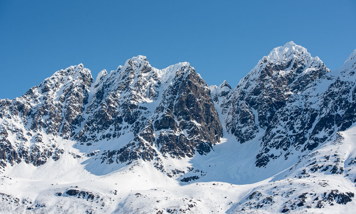
I take some more pictures – from the lighthouse and hut and from the mountains behind whose red rocks now seem to gleam by themselves.

Then I say goodbye to my “outdoor hosts” and enter the hut to sleep.

I decide not to take the tiny room under the roof but to roll out my camping mat in the main room. The camping mat and I have some disagreements on the topic of sleep comfort but anyhow I sleep quite ok. Just much too short. Because the next day is today and today is Monday and Monday is a working day. A quite tired working day but it was worth it. I never regret being in nature.

In Tromsø the first sunset will be in three days, at the Lyngstuva Lighthouse it will take another day, because it’s a bit more north. Now I’m looking forward to spot the first star. The last one I think I saw in the end of April.


Arctic Ocean 2023 – prelude

This article is part of the series “2023-06: Arctic Ocean cruise KPH”.

When it looks like this on my table …

… then I’m going to travel. I love packing lists and I need them so that I do not forget too much.

At 9 o’clock everything is packed (ca. 50 kilos!). At 10 o’clock the taxi fetches me and takes me to the airport in Tromsø. Two and a half hours we are in the air heading north.

It’s very cloudy but shortly before landing I finally can see something different than sky and clouds: Svalbard’s main island Spitsbergen.

Soon we will land in Longyearbyen, where I landed three month before. But there are some differences.

Last time I travelled with Annika and we went on vacation before I worked in Longyearbyen for a week. Now I’m travelling with some colleagues from the Norwegian Polar Institute. Shortly before we land on the airport I take a snapshot:

There it is: the vessel Kronprins Haakon which is more or less the reason why some colleagues of mine and I travelled north: Tomorrow we will go on board on this ice breaker and start an expedition way up north into the sea ice. For three weeks we will live and work on Kronprins Haakon and I’m so excited that I may be part of this.

Today I had some hours in Longyearbyen. I was quite curious how it would look like in late spring. According to a researcher there is a lot of snow for the season this year. But on sea level the snow has melted away and everything looks soaking wet and muddy. While Svalbard reindeer are probably happy I definitely prefer winter.

If everything goes according plan we will leave Longyearbyen tomorrow at lunch time. I guess it won’t be long until we do not have any regular internet. So probably I will not blog anything about this scientific cruise before I’m back in civilisation.

Bye bye – ha det bra!

P.S.: On Facebook a friend wrote to me: “You must have the best job in the world!”. My answer – short but genuine: “Yes!”


My first Thursday paddling 2023

Today I was joining the “Thursday paddling” of the Tromsø Sea Kayakers Club. They started the season two weeks ago, I joined today for the first time this year.

At 18:00 a group of 13 kayakers left the shore by the boat houses and headed to Telegrafbukta, the small bay near my apartment. In the dull weather the kayaks and the paddlers in their drysuits always look quite colourful.

Although I’ve already been paddling in Sweden several times this winter it took me some time to find a rhythm. When I’m alone, I use to paddle slower.

At Telegrafbukta we decided to continue to Sydspissen, the southern tip of the island Tromsøya. There we turned back, paddling through snow showers.

We already saw it on the way there – there was very low water at Telegrafbukta, or just “Bukta” as the locals say. We took a break there but only a short one. The weather was too chilly to be comfortable.

We talked about the weather and came to the conclusion, that summer probably already was on first of May and now summer season is over. I’m not completely sure, if this theory will prove true, but on the way back spring or summer seemed to be far away.

It reminded me at last years first Thursday paddling. It was on 28 April and the weather was as snowy as today. Let’s see how the weather is next week.

A sunny car trip to Jøvik

As in many other countries 1. May is a rød dag, a red day which is an official holiday. The weather is beautiful and I decide to do something I haven’t done for a long time: a car trip.

I take the car to Jøvik, a village in Tromsø municipality located on the peninsula Lyngenhalvøya, home of the impressive mountain range “Lyngen Alps”. As soon as I leave the E8 travelling is slow. On the one hand there’s a lot to see, on the other side the roads are in a pretty bad shape.

Just some photos I took on this wonderful day trip:


Tar du vårbilder?

What is the difference between these two photos?

Half an hour and round about 60 metres in altitude. The first photo shows – quite visible – a bunch of tussilago flowers, the second one – pretty hidden – a tombstone on the Elverhøy graveyard.

I cannot answer why the differences are so immense on the island Tromsøya. I only can observe that while it looks like spring is coming to the coastal parts the ridge of the island is still wintry. There are old ski tracks and the lake Prestvannet (96 m) is still covered with ice and snow.

I walk round the lake. Some parts of the way are free of snow, most aren’t.

I take a photo from a bench. A woman passes by and asks me: “Tar du vårbilder?” – do you take spring pictures? Well, kind of … .

I have an appointment at 18:00 so I leave the “mountains” of Tromsø and descend into town. While the small slide near Prestvannet is still snowed in the playground lower in town is completely free of snow. And I don’t think, they have underfloor heating. (Not impossible in Tromsø.)

Later, at 22:45 I walk to the bus that brings be home. It’s still quite light outside. No wonder, it’s only 20 days left to the period of the midnight sun.


Like ice in the springtime …

In the rare cases where the temperature rises above 0 °C something special happens: Ice and snow melt and become a liquid known as „water“. One of these rare occasions is called „spring“ and this is what has started happening right now. In these days many things happen that are related to ice, snow, and water.

8 April: Vattenplasket in Malå

Last Friday Annika and I visited our friends Lasse and Martine in Kusfors and stayed over. Lasse is a journalist and had a job in Malå the next day. There was a very special ski competition named “Vattenplasket” – the water splash. A ski hill and instead of a finish line a large basin with knee deep water. Is it possible to downhill on ski or snowboard and have enough momentum to cross the water? Let’s see:

Most of the competitors failed, two actually managed it. True sportsmanship showed a small boy that did not get enough momentum with his sled and just walked into the water. Kudos!

9 April: almost a kayak tour

On Sunday Annika and I tried to do another kayak tour. Five days ago the ice was stable, this day it had got holes and was not reliable anymore. While Annika stood on safe ice I tried to cross the old ice to the island but **splash!** broke through several times. No biggie, the water is quite shallow and we have drysuits but it is exhausting. When Annika started breaking through as well, we decided to return. Another time …

10 April: winter bath

Finally. Annika and I. Twice. And then: sitting on the rocks in the wet bathing clothes without freezing because the sun is so warm. Springtime!

12 April: ice work

This is a piece of ice seen from the side. You can see the different horizontal layers that accumulated over time.

This is however no glacier ice nor Arctic sea ice. It is a piece of ice from our way to our house. Annika and I have been chopping the ice bit by bit for many days and today was the day: the way to the car and the road is free of ice and snow.

12 April: another “almost” kayak tour

There are other parts that are free of ice: Most of the weak ice between land and the island Lillskär is gone. After work I tried to paddle around the islet. We had low water (-30 cm) and some of the stable ice was grounded while large parts of the sea were open.

The first part was easy but when I almost rounded the island I came into an ice field. I already had seen it before starting the tour and thought I could paddle through. In theory this was possible, but the wind and the layers of ice made it near to impossible to steer the kayak.

So I got off the boat, jumped into the 60 cm deep water and while standing turned the kayak back to course. Now I could continue my island circumnavigation. Anyhow I consider exiting the kayak on the tour cheating, that’s why I say: I almost circumnavigated Lillskär today.

Even though the ice floes may have been 7–8 cm thick you couldn’t stand on the ice any longer. The ice was “rotten”. Many tiny vertical channels had weakened the ice and made it sensible to vertical stress. You can see it on the next photo. The piece on ice is standing, the bottom part of the ice floe is on the left.

Skitour on the Austeråsfjellet

Slowly I’m gaining height with my fjellski. It is sunny and almost windless. Round -6 °C. I seem to be alone. I start traversing a slope while continuing gaining height. I’m nervous. I’m not a downhill skier and every metre I ski up I have to ski down again somewhere.

Mission accomplished: I’m above the tree line. Above me the blue ski, below the white snow. And, while I go further I get another blue: The sea.

When I look back I can see the whole island Tromsøya. Somewhere over there in the south, hidden by the wooded hills is my small rented apartment.

I didn’t plan a route for today. I just wanted to be out enjoying the winter. But when a heap of stones marks a top and it’s easy to reach I have to ski there. Mountain summit 1: Kraknesaksla (ca.335 m). With a nice view into the sound Grøtsundet.

According to the map there are some lakes a bit down. The lakes are invisible. There is only snow. What I can see are the buildings. One small cabin and a wee, tiny shed with a wind turbine. The cabin is closed and I cannot see any sign. Probably it’s private.

I continue my ski trip. I have reached a vidda – a plateau.

Now I start to see other people. A single skier, a group of three going uphills, a skier with a dog in the distance. Most locals love to be outdoors but perhaps not as early as I.

I decide to ski to a mountain top I found on my map app Norgeskart. It’s called Jerremaš (467 m) and is a kilometre away. On the way there I see that the group of three heads into the same direction while two others are already returning. Seems to be a popular place.

And it is. I’m not alone. Several other skiers are sitting there, enjoying the sun, talking Norwegian. Almost all of them are 65+.

I look at the 360 degree panorama. There are snowy mountain chains everywhere, the sound Kvalsundet, the island Ringvassøya and somewhere in the northwest the Norwegian Sea.

How shall I continue the tour? Skiing downhills and letting the others watch how I fall face first into the snow? As I mentioned before, I’m not a downhill skier. The others are probably all former Olympic athletes. I decide to take a small detour …

I start to ski down. To my surprise the hills are gentle and the snow is soft and uniform. I manage to ski downhill the broad, snowy slopes and I’m enjoying it. Sometimes I even think, it is too slow.

Much faster than expected I leave the vidda behind. I pass the first trees and see more and more tracks – and skiers. Many of them are skiing on the prepared ski trail that cuts through the valley like a German Autobahn. Others just sit on a mat in the snow taking a break.

A hole in the snow triggers my curiosity. I ski there and look down. A shallow mountain stream flows down there. Open water. It’s comforting that the snow layer is more than a metre thick.

Now it’s only some more kilometres to ski back to the parking lot where I started my ski tour this morning. Although I’m avoiding the prepared ski trail it is obvious, that more and more skiers have been here the weekend. Ski tracks everywhere.

After round about 17 kilometres I’m back at the car. Pretty exhausted and thirsty but very satisfied.

Here’s a map from today’s ski tour. I went counterclockwise. Red is faster than green but still not fast. I’m not a downhill skier.


12 more photos of Longyearbyen

This article is part of the series “2023-03: Svalbard”.

3 March

It is the first evening of Annika’s and my stay in Longyearbyen, Spitsbergen, Svalbard. We already strolled through the settlement after arrival. Now it is dark but the full moon illuminates the end of the road of Nybyen, one of Longyearbyen’s districts. What a special feeling to be in one of the world northernmost settlements on Earth. And a slightly tense one. It’s the edge of town, are there any polar bears around?

8 March

When you are in Svalbard you have to keep distance to animals to protect them. The animals do not follow this rule. This is a Svalbard reindeer, an own species of reindeer living here. It is looking for food in the middle of the city.

9 March

I didn’t expect to see ptarmigans on Svalbard but on our guided minibus tour we get to see a whole flock, again in Longyearbyen. Magnus is so kind to stop so that I could take a photo from the road.

10 March

This day is quite warm for Longyearbyen: Only -8 °C. When I took this photo however it was windy. Average wind wind 16 m/s, gusts 21 m/s and snow is blowing in the streets.

12 March

Annika is on her way home, I’ll stay for another week and today I enjoy the beautiful weather by the coast. The mountains on the other side of the fjord Isfjorden look quite near today – especially through the big telephoto lens.

15 March

I take an after work stroll along the coast and through town. It is cold and even with the modest wind of 6 m/s windchill is below -30 °C. It looks arctic, it smells arctic (the nose hairs freeze together immediately) and it feels arctic. No wonder – I am in the Arctic. Even the petrol prices show, that you are not in mainland Norway any longer. Petrol is cheap because Svalbard has reduced taxes.

18 March

Another walk in town. Up the hill to Taubanesentrale (the central of coal mining cableway), down to the center and up again to the elevated way in the east, part of the avalanche protection.

19 March

Sunday. Tomorrow I’ll fly back to Tromsø, today I’m quite lazy but finally I walk to the coast again because of the wonderful weather. Even with my hood on I can hear something above me. I look up and see the first two seagulls since I have arrived here. It is two glaucous gulls that draw large circles above the coastal line.

I try even to take pictures of the incredibly coloured mountains on the other side of the Isfjorden but the turbulences in the air make clear pictures impossible. I’ll keep it in my memory as I’ll do with my whole stay in Longyearbyen.