Jämtland tour 22 – signposts and waymarks

This article is part of the series “2022-08: Jämtland and Trøndelag”.

If you want to hike you need either a good map and a compass, or a GPS, or you have an area with designated hiking trails. Then you in most cases have only two issues: find the right trail and follow it.

Easy, isn’t it? Yes, but wait – what’s that?:

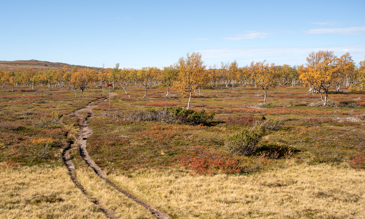
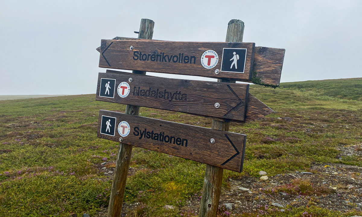
Why are there two trails to Storerikvollen? Check the symbols. One shows a skier, the other a hiker. That’s the first think you have to know: There are summer and winter trails in the Swedish mountains. The latter ones are often a bit less hilly but can lead over bogs and lakes. So choose the right track. Quite often they go together for a while and then split up again. That’s where you have either to check a map (take an up-to-date one) or follow the right waymarks.

The waymarks for summer trails use stones and red paint. In Norway it is a red T, in Sweden it is mostly a red dot. Mostly they are painted on large stones, rocks or on cairns – heaps of stones. The advantage of cairns: they are easier to spot when it is foggy.

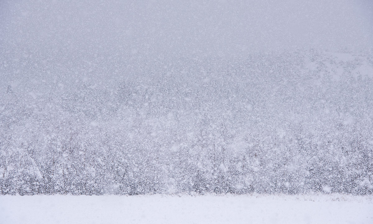
In wintertime most summer waymarks are hidden under a deep snow cover. Then it is the time of the winter waymarks: Red diagonal crosses.

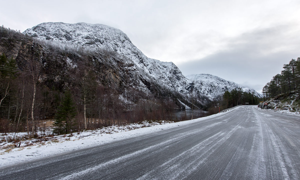
The poles can be several metres long because of the snow, the depth of which can vary greatly. When you have snowstorm conditions in winter you sometimes just can spot the next cross. When you’re lucky. I took the following photo on 20 February 2020 on a ski tour. Two hours later we experienced average wind speeds of 25 m/s. Then you start to love the waymarks that guide you through the storm.

Back to our August Jämtland tour this week. We could watch some people replacing the old winter waymarks by new ones. An important job, probably done on a voluntary base. Voluntary work is so important in Norway that it has its own word: dugnad.

I guess the best sign posts we found in Nedalshytta in Norway. One “summer signpost”, one “winter signpost” and even ratings for the trails from green to black.

It’s always nice to meet some signposts on your way, but not all of them show the distances. I like the last one. The letters are holes in the metal sign, so it won’t snow over so easily in winter time.

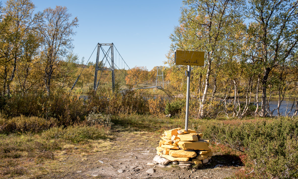
But not all signs are about following the trail. They can show you the Swedish-Norwegian border. Or the way to the toilet. Or the toilet – often a “privy” – itself. Or where to park your dog in case you have any.

And some of the signs or marks are quite creative. I almost missed this “in-tree” waymark in Norway. Perhaps more funny than helpful.

But the clearest sign we directly spotted on our first hiking day in Storlien:

The words say henan, dittan and hittn which are apparently words in Jamska, a group of Jämtland dialects. They mean something like here, →there and →here. I cannot express it better. Anyhow this is an article about signposts and waymarks, not about linguistics.

Jämtland tour 22 – the trail

This article is part of the series “2022-08: Jämtland and Trøndelag”.

On the photo above you can see the trail from Blåhammaren to Storulvån. It is in fact two trails together: the winter trail that is marked with red crosses and the summer trail that mostly is marked with stones with a large dot of red paint on it. We didn’t follow this trail I only took the photo because of the beautiful evening colours.

Many parts of the trail are just like this. They lead through heather, grass, crowberries, and dwarf birches. Other parts of the trail lead over hills, across rock fields, through forests and sometimes over a reindeer fence.

This is when the trail is dry. But often it isn’t. The trail can just be very wet of last nights rain as we had it on our third day.

The trail can be boardwalks that lead over swampy area or bogs. Some of them may be under the water which makes them rather slippery.

And then there are rivers, streams and brooks. Some of them are crossed by a bridge. Some bridges are big, some are – well – small, simple, and pragmatic.

And then there are rivers that you have to ford. I ’m used to hiking in rubber boots and so I could splash through while my fellow hikers had to switch to sandals and wade through the ice cold water. Already Douglas Adams said: You have to know where your towel is.

And then there is mud. It can be slippery and sometimes quite deep, especially right before or after a plank. When you have a plank.

Especially the first day trail section StorvallenBlåhammaren was in an extremely poor shape. The others went around all these muddy patches while I – hey, I have rubber boots! – just continued straight ahead. But then at one point it happened. I made a step ahead and my right leg sank thigh deep into the mud. On the trail! Luckily Blåhammaren had a dry room.

But don’t be afraid, that’s not typical. Many sections of the trail look more like this:

How long the trail was? I don’t have the exact numbers but I think we hiked round about 135 km on 8 days, so round 17 km a day.

Jämtland tour 22 – the cabins, part 1

This article is part of the series “2022-08: Jämtland and Trøndelag”.

On our hiking tour in the Swedish Jämtland and a bit of Norway we hiked from cabin to cabin. These cabins are quite different, both in concept and in standard.

Ok, the photo above does not show a mountain cabin, it shows the Ringve Musikkmuseum in Trondheim that we visited the day before. Sorry folks, I couldn’t resist.

½ – the first emergency hut

Since the weather in the Swedish mountains can be quite rough, there are emergency huts on the trail. The first one lies between Storvollen and Blåhammaren, our first destination. You may rest inside the hut, but do not touch the fire wood or the emergency box – they are meant to save life.

1 – Blåhammaren

With an altitude of 1086 metres it is the highest STF mountain cabin. Famous for its fire beacon and its three-course dinner. We however use the self-catering kitchen to cook pasta with tomato sauce. A great first stay on our tour.

1½ – Endalen raststuga

Another emergency hut. The sun comes out and invites us to take a break. From here it’s only a kilometre to the Norwegian border.

2 – Storerikvollen

Two signs, that we are not in Sweden anymore: All roofs are grass-covered and the inside is full of carpets, wall pictures and other things to make the cabin individual and hyggelig – cozy.

A thing that makes Storerikvollen special: free-roaming sheep and Icelandic horses.

3 – Nedalshytta

After the longest distance of ca. 23 km we gladly arrive at Nedalshytta. As in Storerikvollen this cabin does not provide a self-catering kitchen in the season. We have pre-booked half board and now order dinner. What we do not know yet: the cook is very gifted and the dinners are awesome! A good place for a rest day.

This is by the way the only cabin with road access on our tour.

3½ – Ekkordörren

We are back in Sweden again. Time to take a short rest in the hut Ekkordörren before we follow the trail over the pass.

4 – Sylarna

Without loosing too many words: this is the worst cabin I know! A tiny shop with ridiculous prices, a dysfunctional self-catering kitchen with five soup plates in total, insufficient drying space and so on, and so on. The personal is friendly and pretty uninterested.

We will meet other people on our trip – cabin hosts as well as guests. No one likes Sylarna. But it’s only a single night and now it gets better. Much better!

Stay tuned for part 2 of the cabin article. Coming soon …


Back from a hiking tour

This article is part of the series “2022-08: Jämtland and Trøndelag”.

Hello, my dear blog readers. Three weeks of holiday have come to an end today. Mostly I was aborad. The main attraction: an eleven day hiking tour with my wife, my sister, my brother-in-law and my younger nephew.

We mostly hiked in the Swedish Jämtland but visited two Norwegian cabins as well. Our route: StorlienBlåhammarenStorerikvollen (Norway) – Nedalshytta (Norway) – SylarnaGåsenHelagsFältjägarenRamundberget. That’s a total of about 135 km.

Today I scrolled through the photos I made on the tour – it’s more than 1500. So it will take some time to go though, edit them and write some blog articles.

Anyhow, here is a sneak preview. 9 photos of the tour.

On the road IV and V

Back to Sweden · Sneringsvika—Rötviken – 315 km

Have I told you, that the weather in Norway is constantly changing? So it was as well when I continued my road trip the day before yesterday.

It wasn’t cold, but most of the precitipation came as snow and even by the sea everything was white.

In Hofles I waited for the ferry to Lund which takes 25 minutes. I love standing onboard and watch the snow covered hills and mountains pass.

On the other side there was first less snow, …

… but as soon as the road climbed up a bit everything was white again. Here are two photos from a barbecue hut by the road 74 to Sweden. The first one from now, the other made in August 2016.

This time I have booked a cabin in advance. It is in Rötviken, 20 km behind the Norwegian-Swedish border. Although the campsite is by the road it is really quiet. Hardly any car uses this road.

I was tired from all the driving of the last days and fell fast asleep. The next day I would take it easy.

Arrival · Rötviken—Orrviken – 139 km

What a beautiful morning! The sun came out the first time since I left Solberget four days ago. Two dogs were barking. Did they bark at me? Now, it was the two moose that were about to cross the road but then turned too the the lake Hotagen.

This day I didn’t have to go far, just 140 km along broad roads through the Swedish forest. Easy to drive but a bit boring to look at.

I made a short stopover in Östersund, the largest town in the county Jämtland.

Then I continued to Orrviken.

Today I will spend my day here and repack my things for a ski tour that I will start with two friends tomorrow. Then I’ll be offline for about two weeks.

Vi hörs – see ya.

Jämtland hike part II: hejdå Sweden, hei Norge!

This article is part of the series “2016-09: Jämtland and Norway”.

Annika and I are in the mountains in Jämtland and have just reached our first destination: Blåhammaren, where we slept in a 14-bed room.

Tuesday, 13. September

Sleeping in a 14-bed room can be quite demanding, especially if you have this kind of snorers in your room, that could awake a frozen mammoth. However Annika and I were really lucky, no snorers at all! After our breakfast we had to decide where to continue our tour. From Blåhammaren you can hike back to civilisation or continue to two other destinations. Most of the hikers continue to Sylarna which is very central and part of the Jämtland Triangle, a very popular three-day-tour, that connects Storulvån, Blåhammaren and just Sylarna. We were keener to cross the border and hike to the Norwegian lodge Storerikvollen and so we did.

With an altitude of 1086 m Blåhammaren is the highest tourist station of the STF – the Swedish Tourist Association – so first the trail ran over the treeless mountain plateau, over rocks and moss, crossing some swamps and brooks. After a while we descended and the first yellow coloured birch trees came into view again.

Swedish summer trails are marked with red coloured dots on rock or tree, while winter trails are marked with poles bearing red crosses. You really shouldn’t follow the winter trails in summer unless you want to stand in front of a lake or find yourself deep in a bog – both are easy to cross only in wintertime. But quite often there’s a year round trail which makes navigation extremely easy even on less walked routes.

One kilometre behind Endalen, an emergency shelter, where we rested for a short while, the Sweden-Norwegian border came into view. It’s hard to mark a border less spectacularly than this one: A sign amidst of a pile of yellow painted stones, that’s it. The large bridge that crosses the river Enan (Sami: Äjnänjohke) directly after the border offers far more spectacularity.

We detected a real nice resting place on the other side of the river, where we planned to enjoy the warm summerly weather, but two other hikers – by the way the first ones we met that day – coming from the other side chose exactly the same slab of rock to rest. Luckily we found another place, at least as nice as the first one. We unmounted our backpacks, took of our boots and dangled our feet into the ice-cold water.

(I like the photo with the drifting yellow birch leave and the dead mosquito. It illustrates, why I prefer the autumn to summer: Beautiful colours and no biting insects left!)

In Norway the summer trail marks change, now the trail was marked with big bright red T-s. The red T is also the logo of the DNT, the Norwegian Trekking Association.

Do you see the dark piece of something on the top of the stone? It’s animal droppings, but I’m not sure of which species. I asked for help on Facebook and the favourite answers are reindeer and (arctic) fox.

We continued our tour until we came to another swing bridge, this time crossing the river Djupholma. On the other side of that river lies a nice sandy beach where I took a refreshing bath (the only one of the whole tour). It was only two other kilometres to walk to our destination, the cabin Storerikvollen, where we arrived round six o’clock.

Oh, so nice these Norwegian lodges are. They seem less “funkis” (the Swedish functional style) and more “hyggelig” (the Norwegian word for cozy, snug, or homelike). Just gemütlich! And we got a two-bed-room for a good price. The only thing you should know, when you visit the Norwegian side: These cabins hardly sell any food and there is no public kitchen as in the Swedish cabins. So you have three options: (1) take a camp stove with you and cook outside. (2) cold dishes! Hopefully you have all with you. (3) eat the dinner and breakfast provided by the lodges (and pay the Norwegian price).

We chose (2) and had a nice dinner with salami, crisp bread and fresh water outside in the evening sun, enjoying both our simple meal, the warm air and the beautiful view. Later the almost full moon rose above the reddish mountain chain – what a beautiful evening!

Wednesday, 14. September

The next day would lead us to the Nedalshytta, which is between 20 and 24 km away, depending on which map or sign post you rely on. So we got up quite early.

We had to go back yesterdays route 2 or 3 km where the trail divided. Now we turned south and had to ascent. Soon again we were above the treeline. When we looked back, we could see parts of the big lake Essandsjøen and even spotted – beside of some reindeers – the now tiny Storerikvollen, that we left some ours ago.

After a while we came to the river Fiskåa, where we had to ford. My rubber boots were high enough and I just splashed through the water, whereas Annika changed boots with trekking sandals and waded through the river.

Since rivers use to flow through valleys we had to ascend again and walked up along a reindeer fence. The weather was still warm and sunny, but you could see a cloud layer approaching afar. Would it rain in the evening as the forecast told us?

Only the map showed us the progress of our longest tour so far. We went a bit up, a bit down, a bit to the left, a bit to the right, down a small valley and up again. But finally trees came into view once more and soon we stood on an exposed plateau not far away from the yet invisible Nedalshytta.

Come on, just less than a kilometre to go … . Final spurt! A short while later we arrived at the beautiful lodge. Again we got a nice two-bed room, this time right below the grass roof. And we got: pizza! Perhaps not the best I ate in my life, but walk 20 – 24 kilometres with a backpack by yourself and you’ll know, how delicious a warm pizza slice can be!

The tour so far:

Continue with part three …

Picking cloudberries

One week ago I still was in Mosvik in Norway. On Saturday we went out to pick cloudberries. These berries that look a bit like orange raspberries are rich in taste and very healthy due to the high amount of vitamin C and trace elements. There’s only one disadvantage: They can be quite hard to pick.

First of all they prefer wet and swampy soil. Then they ripe in July, the heyday of mosquitos and biting horseflies. Then they grow quite solitary – one berry here, one over there.

H., J., F. and I were quite lucky last Saturday when we collected two buckets of these little delicacies for it rained almost the whole day. And much rain means less mosquitos. When we came home, A. directly started to make jam from our collected cloudberries. One glass of jam I took home. It is still closed and I will save it for later. I love cloudberries!

Translation:

EnglishGermanSwedishNorwegian
cloudberryMoltebeerehjortronmulte

757.5 – from Mosvik to Skelleftehamn by car

Last week I’ve been in Mosvik (Norway) to visit friends. Yesterday I drove back home, not directly but with a detour via Nordli and Røyrvik (Norway) and Stekenjokk, (Sweden).

According to google maps the direct way is 671 km, taking 8 h 38 min. With the detour it is only 67 km, but 1 h 46 min longer. That says a lot about the small and steep gravel roads near the Swedish–Norwegian border …

For me the journey didn’t take 10.5 hours, but more than 15. For one thing I don’t drive fast, especially in Norway and for another thing I took many smaller rests for taking pictures as well as a lunch and a dinner break. I left at 9 o’clock; at quarter past midnight I finally was home again. Total distance by car: 757.5 km.

See my travelogue of the journey by clicking the first image and navigating through the images. Swipe on touch devices and click or use arrow keys on other computers.

By the way: After nineteen articles without any photo with snow, this is the first article showing at least some patches of snow again.

A trip above the treeline

Today the weather was really nice in Venneshamn in Norway. I took the car to drive to a mountain area not far away. At least, if you can fly … . If you take the car in Norway, there’s always at least one fjord you have to drive round, in this case the Verrasundet. So it took a bit longer than excepted taking the ways 191, 193 and 720 round the fjord. Finally I approached the street to the lake Ormsetvatnet. Street, well … it’s more like a steep gravel path, that you can drive up some kilometres to a parking place. The last kilometre to the lake is closed for cars and I had to walk it.

At Ormsetvatnet I crossed a dam wall, walked up a tree covered slope and soon was above the treeline. To be honest, I’m not too fond of forests, when it comes to taking pictures and I’m always glad, when I leave the trees behind when doing a mountain trip.

Now I was on a hilly plateau, the Vakkerheia. Some of the flat mountain tops were marked with piles of stones.

In the plain valley between the hilly tops the ground is soft and wet. Sometimes I had to go round shallow ponds and bogs, but mostly the ground was easy to go. In and round the swampy ponds the cotton grass was blooming. To my big delight there were many cloudberries plants growing in the lesser wet parts and the berries were ripe and ready to eat!

Picking cloudberries can be tedious, because of the many bloodthirsty horseflies that seem to guard them. I think, I slew most of them, but some bit me anyway.

After some hours of a really relaxed mountain hike I took another way back until I came to the gravel road again, where my parked car waited for me.

Half a day later

A thunderstorm approaches from the west. The center seems to be above the very same area that I wandered some hours earlier. The thunder and lightnings were as impressive as the intense colours, that I could see from the other side of the fjord. I was glad, that I haven’t been on that plateau – there would be hardly any place to seek shelter from the massive rain fall or to protect from the dangerous lightnings.

Addendum

And since we’re living in the age of selfies …

Moon jelly

It’s nice to snorkel at the west coast of Norway.

In opposite to the Bothnian Bay – that’s the northernmost part of the Baltic Sea – where I live, here are crabs, starfishes, forests of seaweed as well as many shells and conches. And there’s jellyfish, too. Seeing a jellyfish underwater is fascinating, but I was glad that all belonged to the speciesmoon jelly, a species that doesn’t sting.

Translations:

EnglishGermanSwedish
starfishSeesternsjöstjärna
jellyfishQuallemanet
moon jelly(fish), common jellyfishOhrenqualleöronmanet