After work visit of Kvaløya
A bit of hiking – a bit of dining – a bit of bathing – a bit of geocaching – a lot of sun.
All after a regular work day, together with Annika.
A bit of hiking – a bit of dining – a bit of bathing – a bit of geocaching – a lot of sun.
All after a regular work day, together with Annika.
This article is part of the series “2026-06: Obbola—Finland—Tromsø”.
Part four of the journey from Obbola to Tromsø
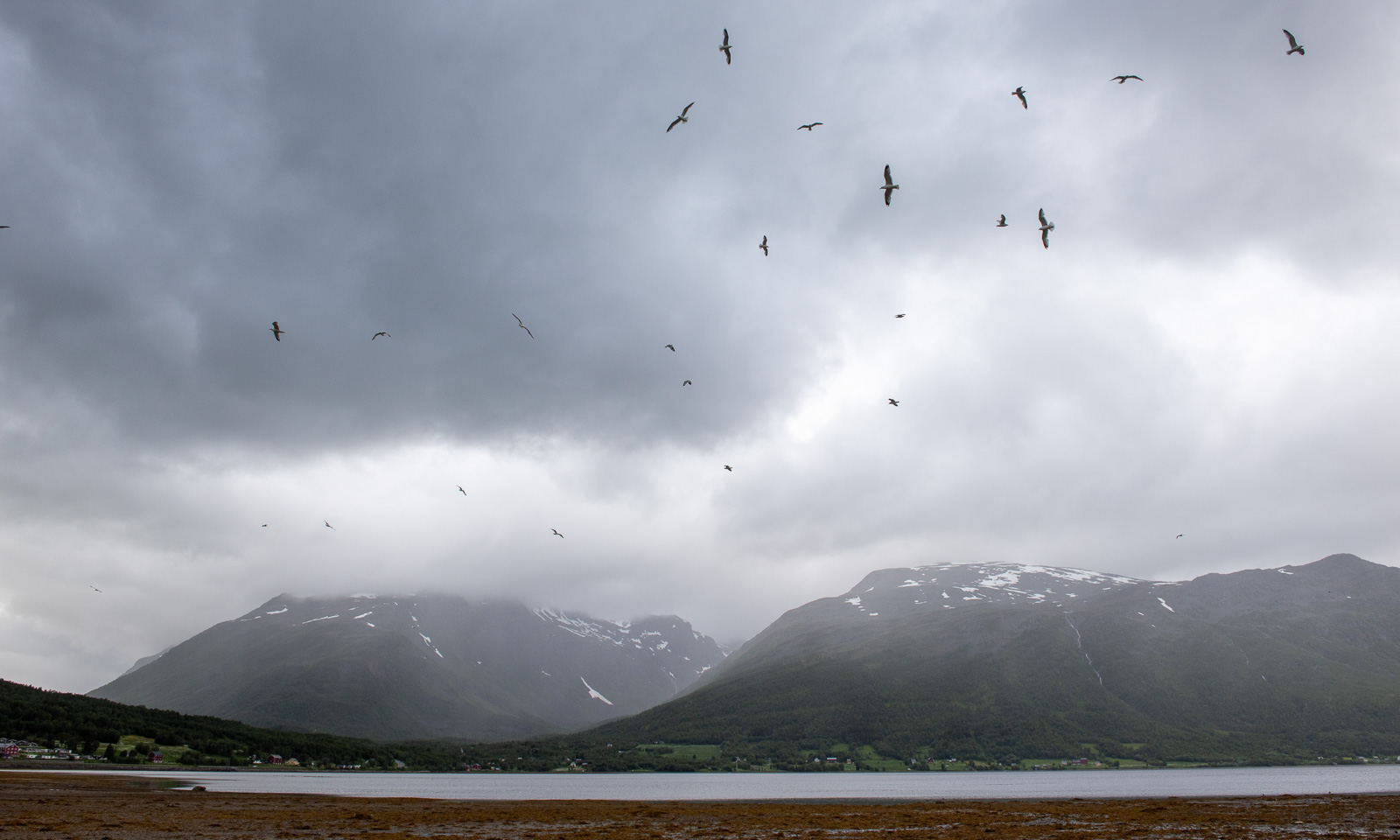
It is Saturday morning. My wife Annika and I are having breakfast in the kitchen of the campsite Skoganvarre Villmark. It is raining and people passing outside are wearing pyjamas and carrying umbrellas or wearing raincoats and crocs. Campsite fashion. Skuvvanvárri (Northern Sámi) or Skoganvarre (Norwegian) is located in Norway, but most of the guests here are Finnish, and it seems to me that more or less all of them are here for fishing.
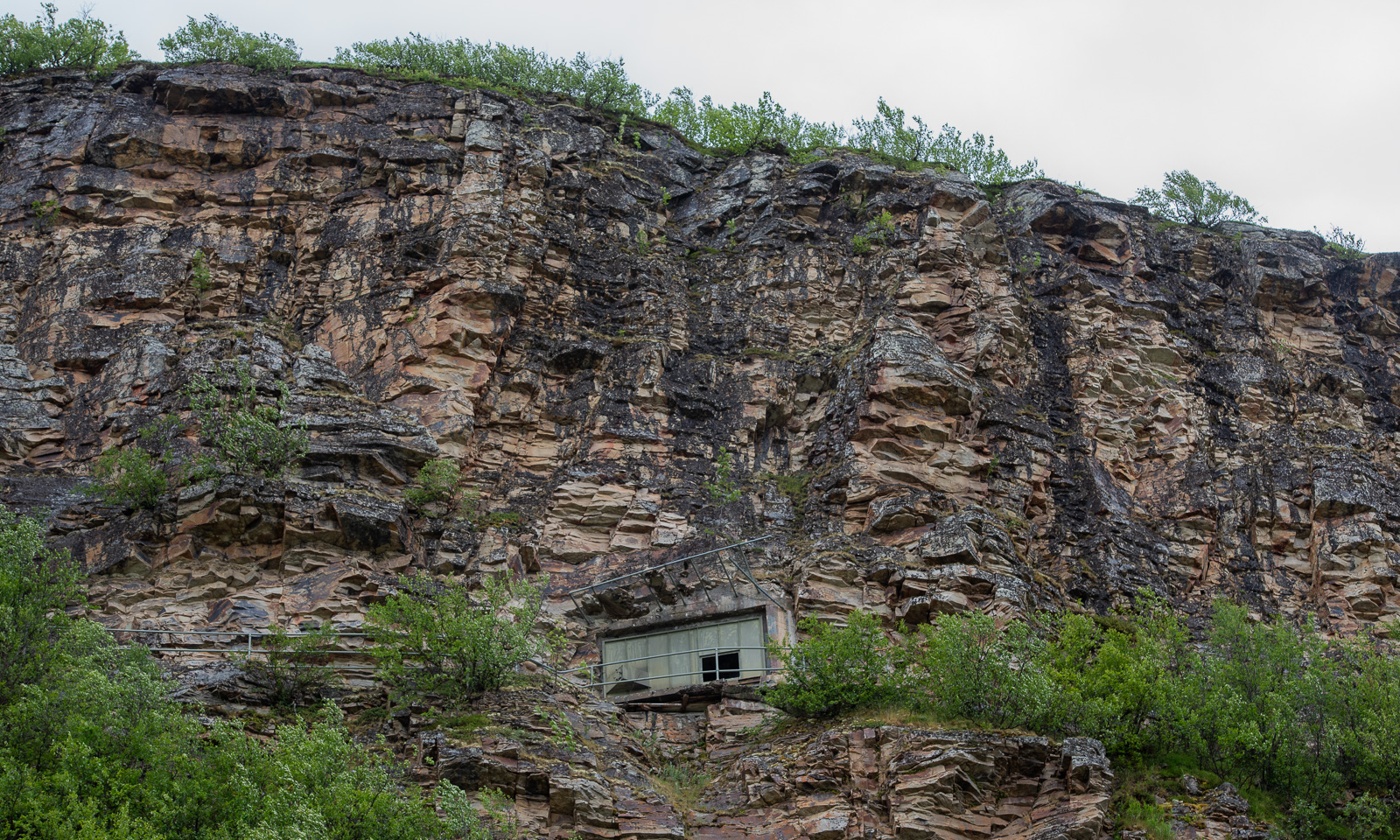
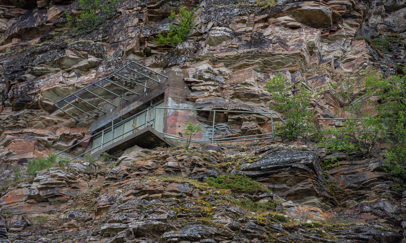
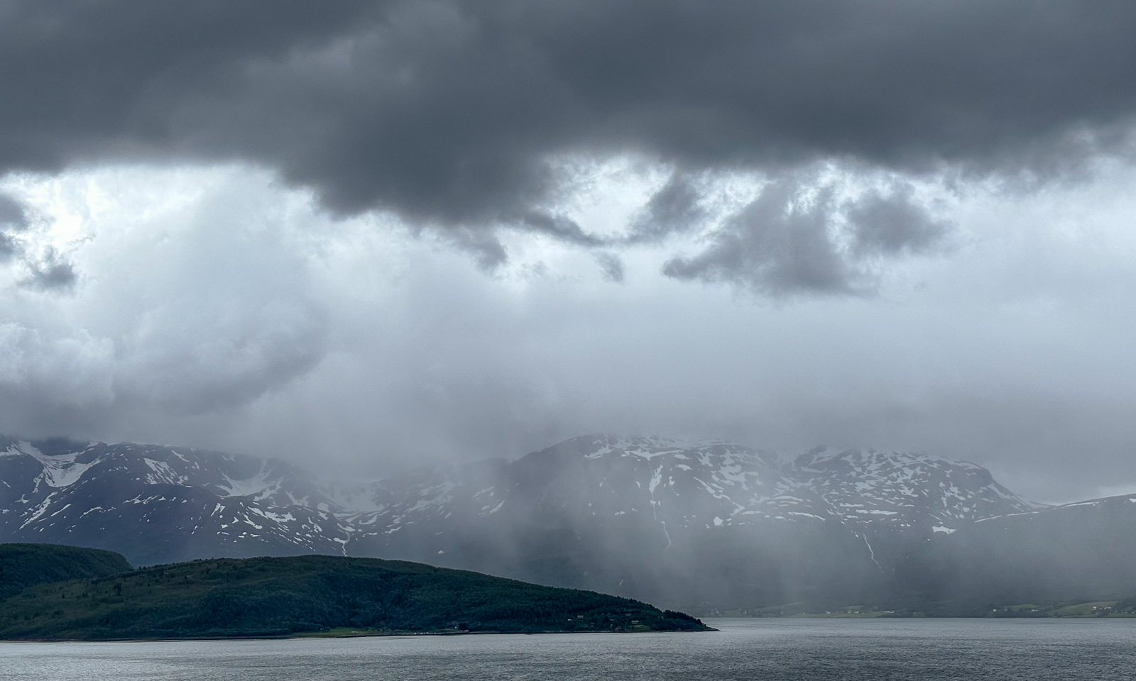
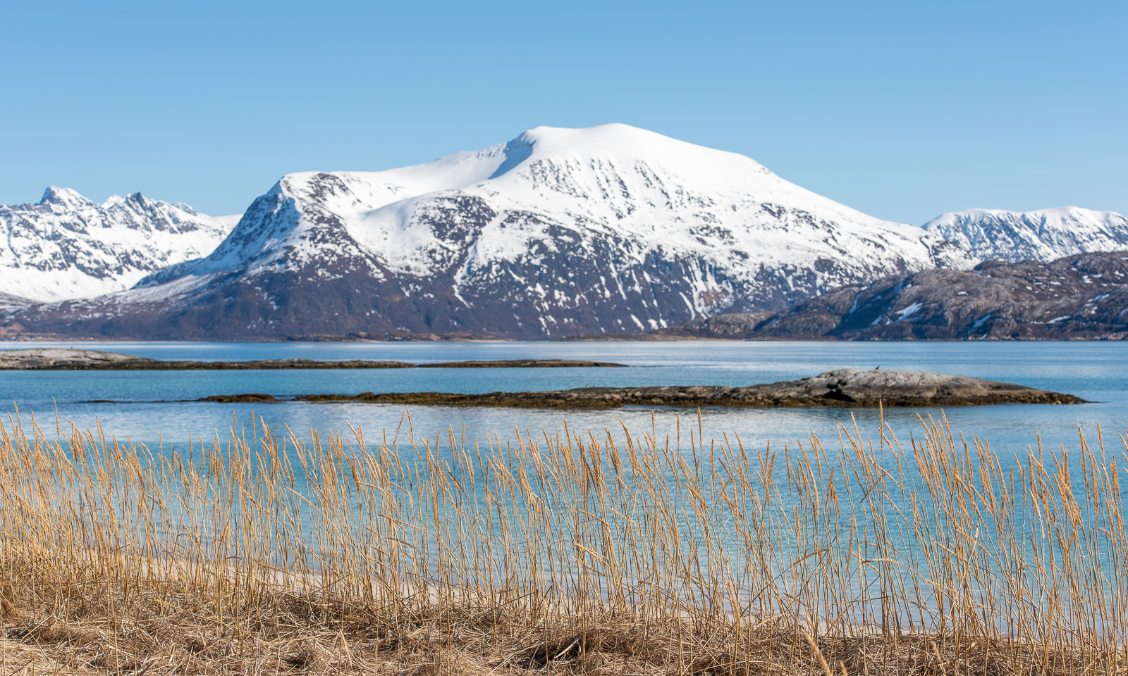
The grey weather follows us to Lakselv where we meet the sea again in the form of the southern end of the huge Porsangerfjorden, the fourth longest fjord in Norway. We passed the road leading north before, but it was the first time that I saw the fortification high in the mountain walls left of the road. It is part of Banak fort, started by the Germans in WWII and continued by the Norwegians and used until 1987.
On the other side of the road the scenery is completely different. Stabbursnes nature reserve is a large protected area dominated by wetlands.
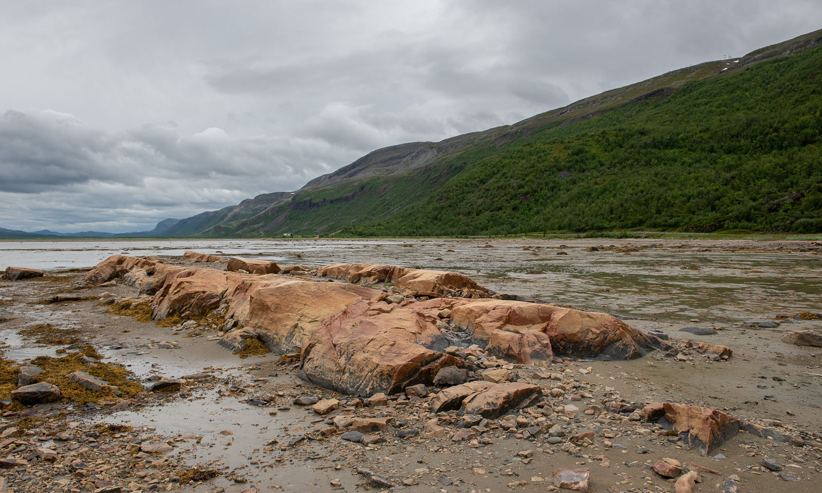
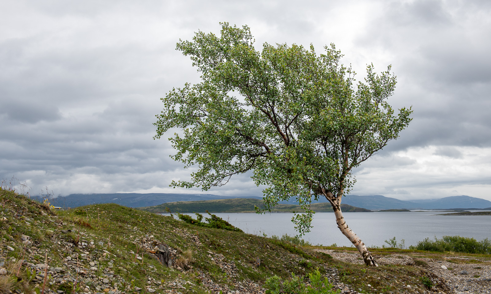
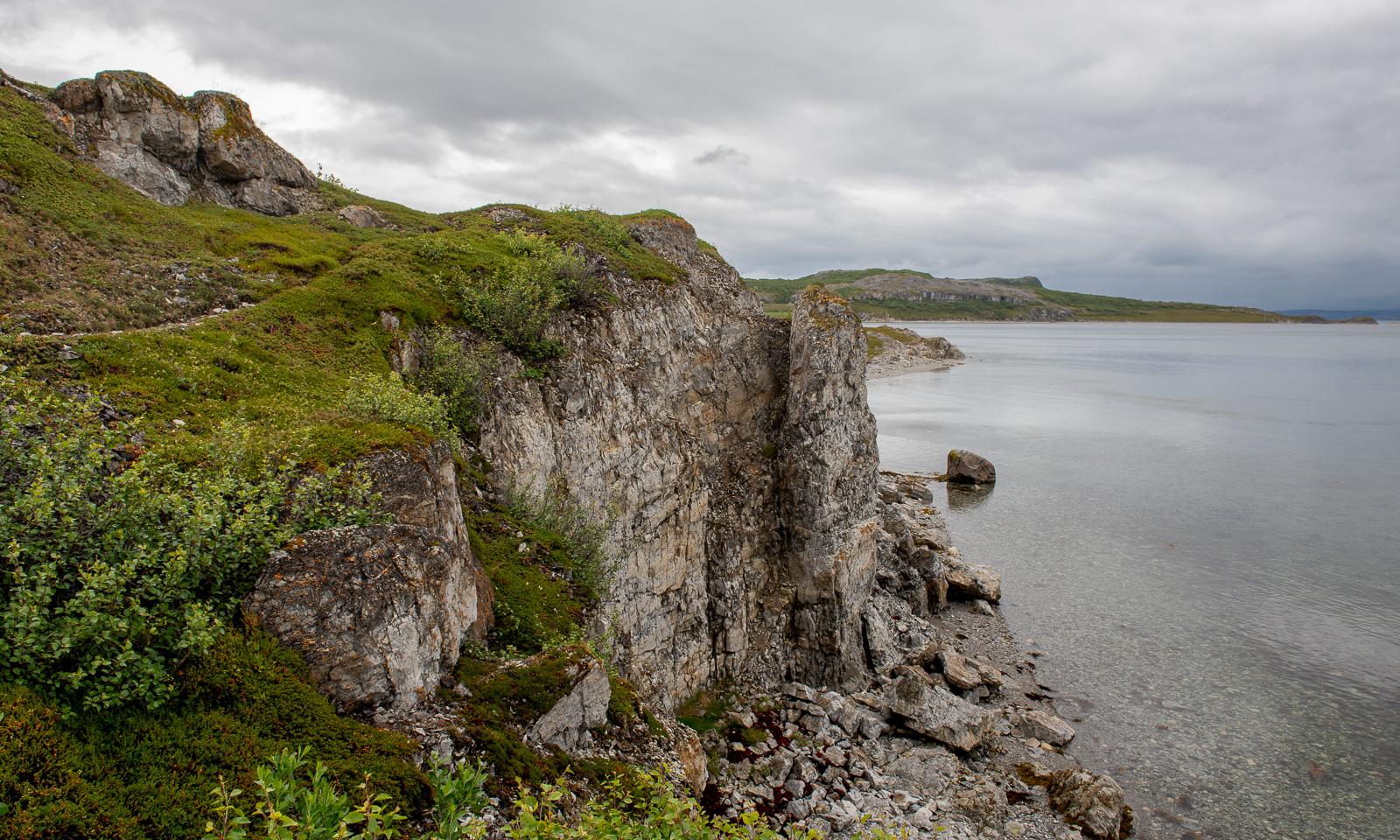
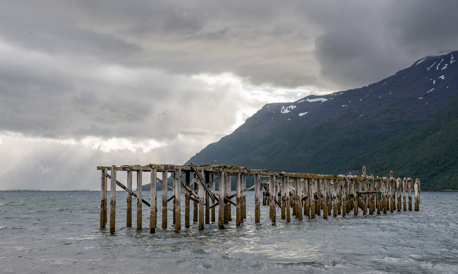
Annika started geocaching a while ago. Sometimes I join her in the search for I found a place to park the car, sometimes I focus more on looking for photo subjects, ideally I do both. At one of the geocache locations behind a gravelly area I first find this lonely birch and then surprisingly beautiful coastal cliffs, although it looked a bit dull in the grey weather.
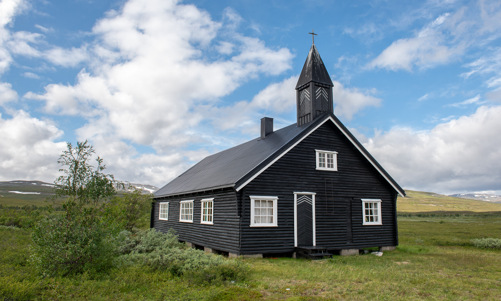
I hardly take any photos of one of my favourite landscapes on this stage of the journey – the plateau of Sennalandet. I only stop for the Aisaroaivi kapell after the sky has cleared up a bit.
Some more photos from this day:
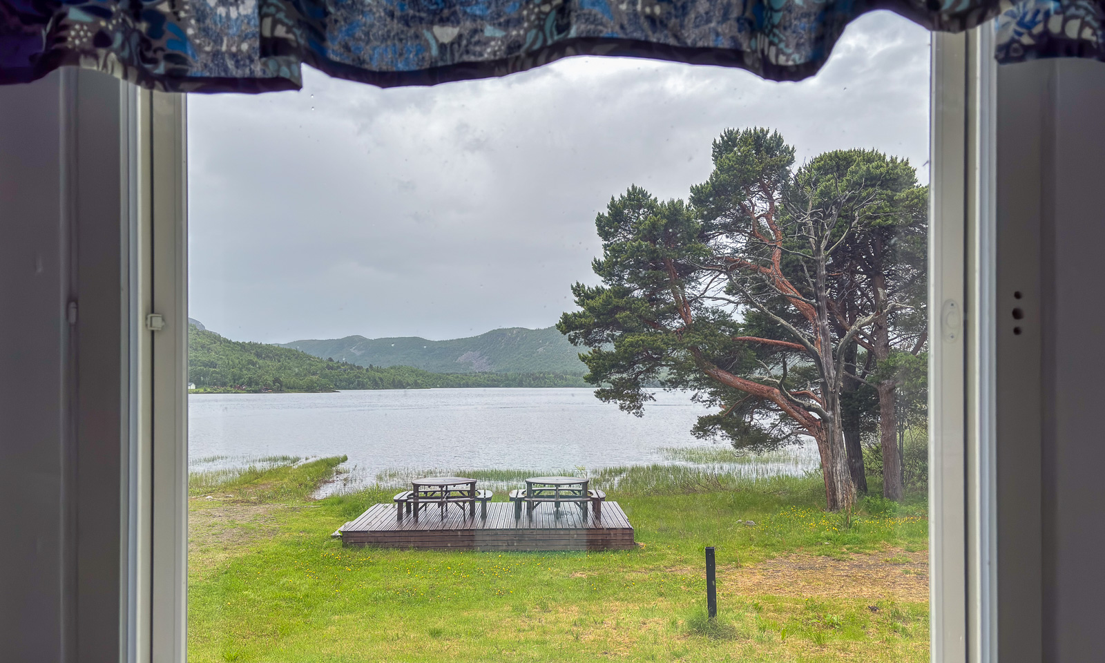
At 7 o’clock in the evening we arrive at our last overnight stay of this road trip near Sørstraumen. This time we used Airbnb and found a real gem, owned by Gunn, who is a fantastic host. Gunn rents out rooms in her private home and not only invites her guests to her kitchen for a chat but also provides huge amounts of waffles with jam. I can highly recommend her when you like meeting interesting people. We met two Germans who wanted to go north for fishing and a motorcyclist, who is driving all coastal roads of mainland Norway to collect money for ME-fondet, part of Norges Myalgisk Encefalopati forening. We are talking about 50,000 km – what a trip! This is his Facebook page: Around the Coast 2026.
A last photo of this day.
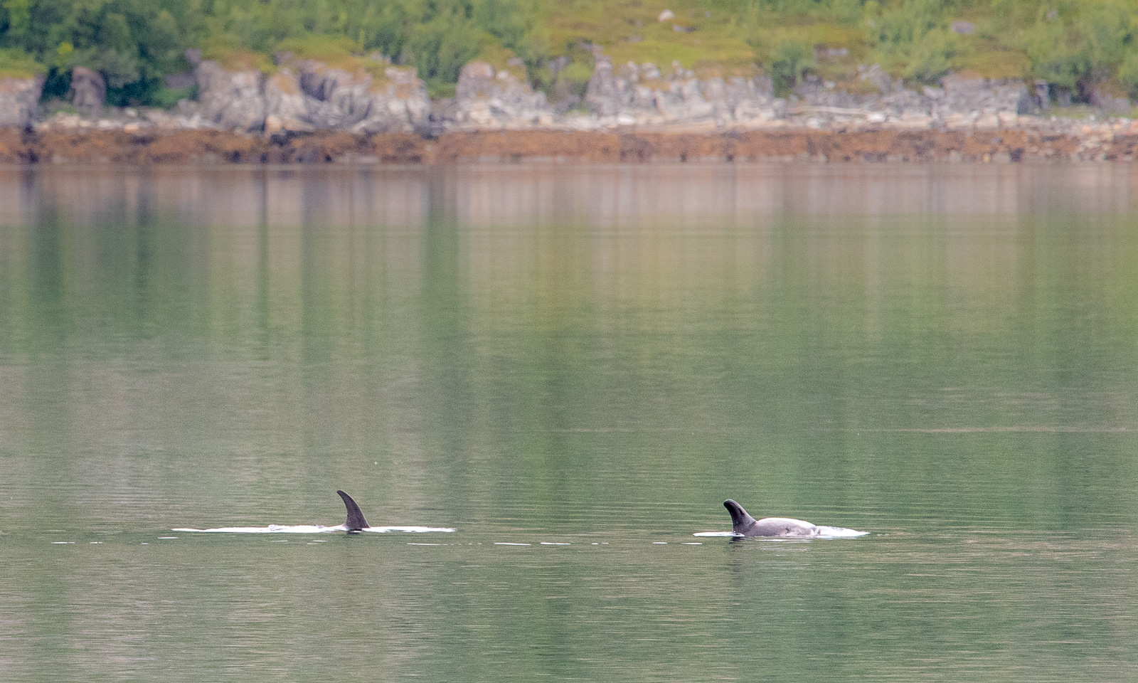
The next day at Gunn’s place began a bit like the evening before: a lively chat and waffles. One thing was different, though. Gunn already told us about whales she saw and showed some videos. While eating another waffle I looked at the fjord and saw movements on the surface. It was a school of white-beaked dolphins passing by the house. We observed them for a while, swimming, jumping, blowing and hunting. They were far away, so even with the big telephoto lens I only got images like this one:
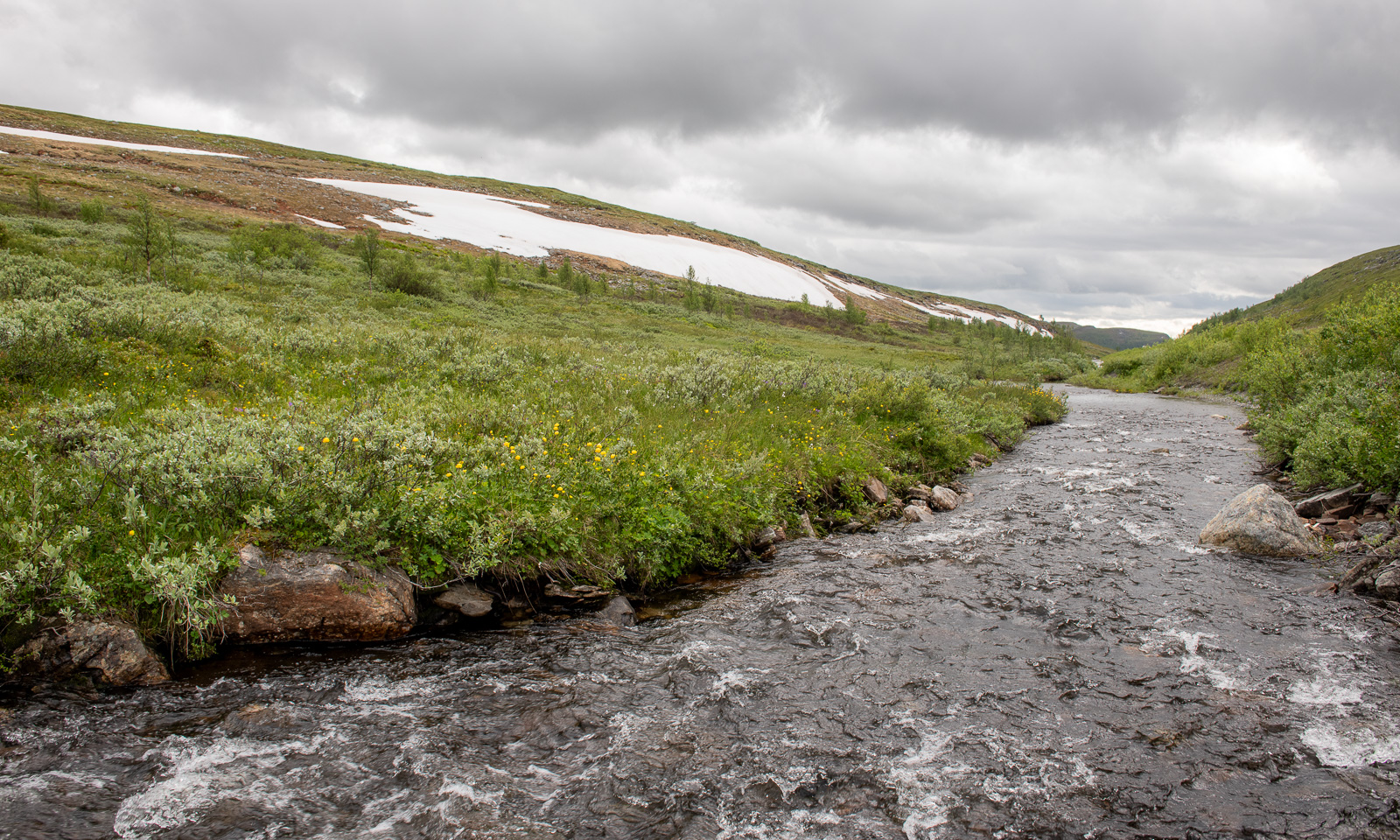
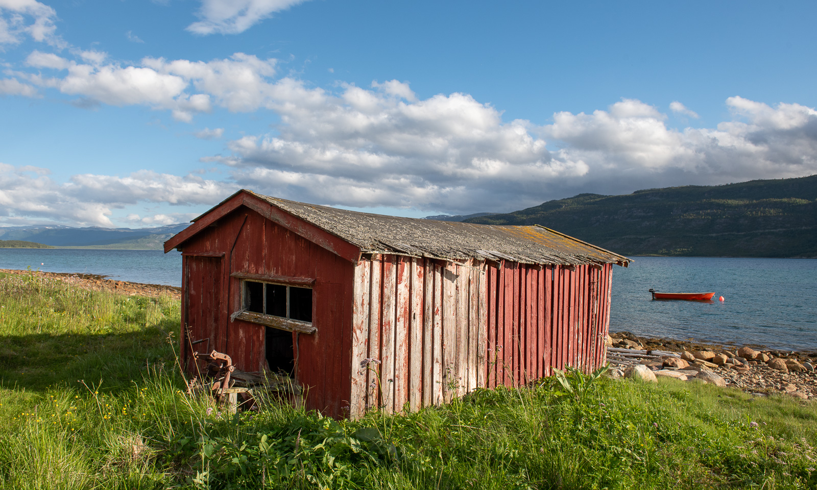
Later than usual, we left this wonderful place to drive the last stage to Tromsø. We could have made it in four hours but it took us seven and a half. The reasons: geocaches, photo stops, detours and an outdoor lunch break. Here are some photos.
Around 18:00 we arrive in Tromsø, my “work home”. I’ll be here for about four weeks and Annika will join me the first two weeks.
Yesterday and today our department “Miljø og kart” MIKA at the Norwegian Polar Institute had a two-day seminar on the Malangen peninsula.
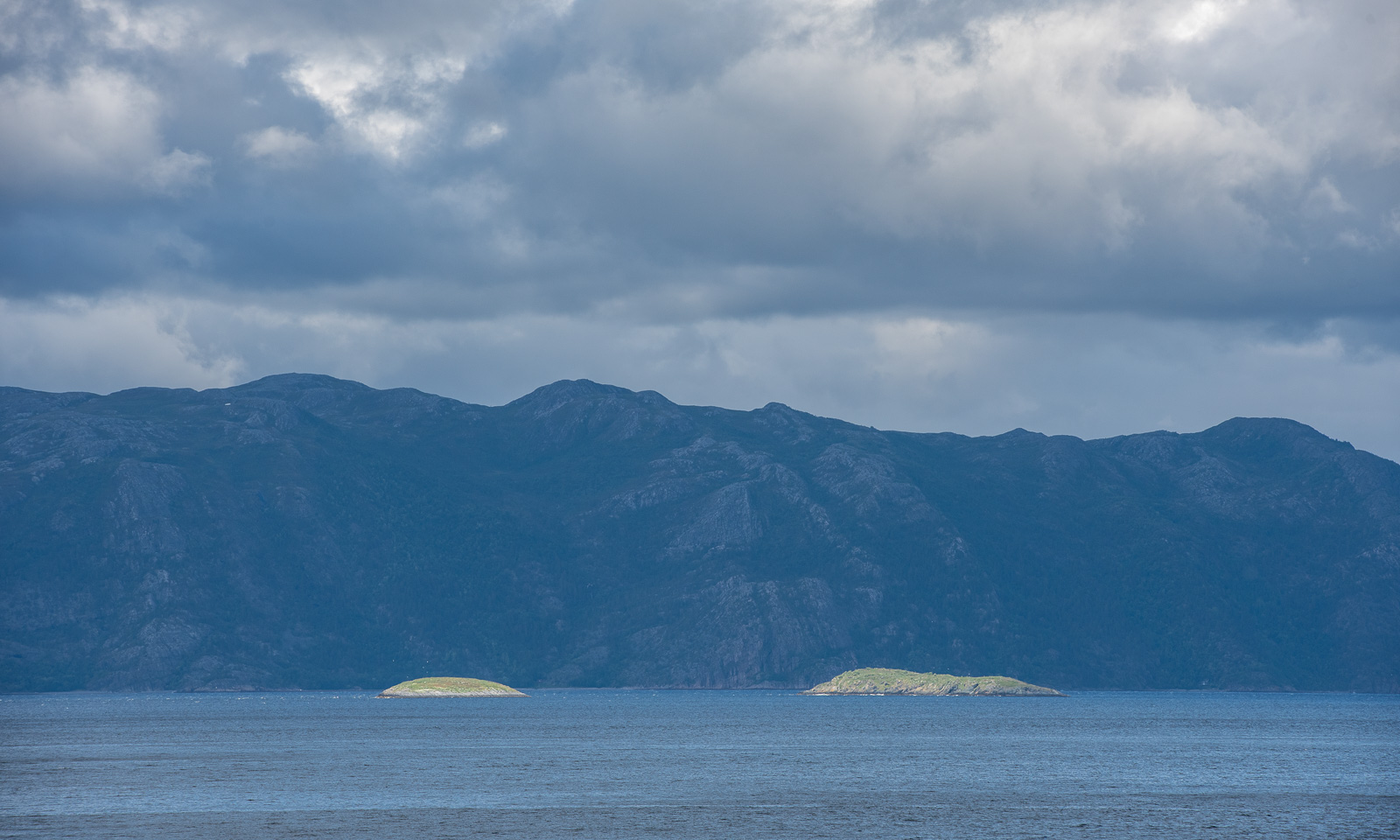
We travelled there by bus while in glorious real summer weather. Two photos I took from the bus:
Between the last presentation in the afternoon and dinner we had a few hours off. A group of us headed to a spot by Lake Nikkavatnet and I went round the lake with a colleague. It was a beautiful walk of about 2 km, revealing another facet of Northern Norway: Forest and lake – with snowy mountain ranges on the horizon.
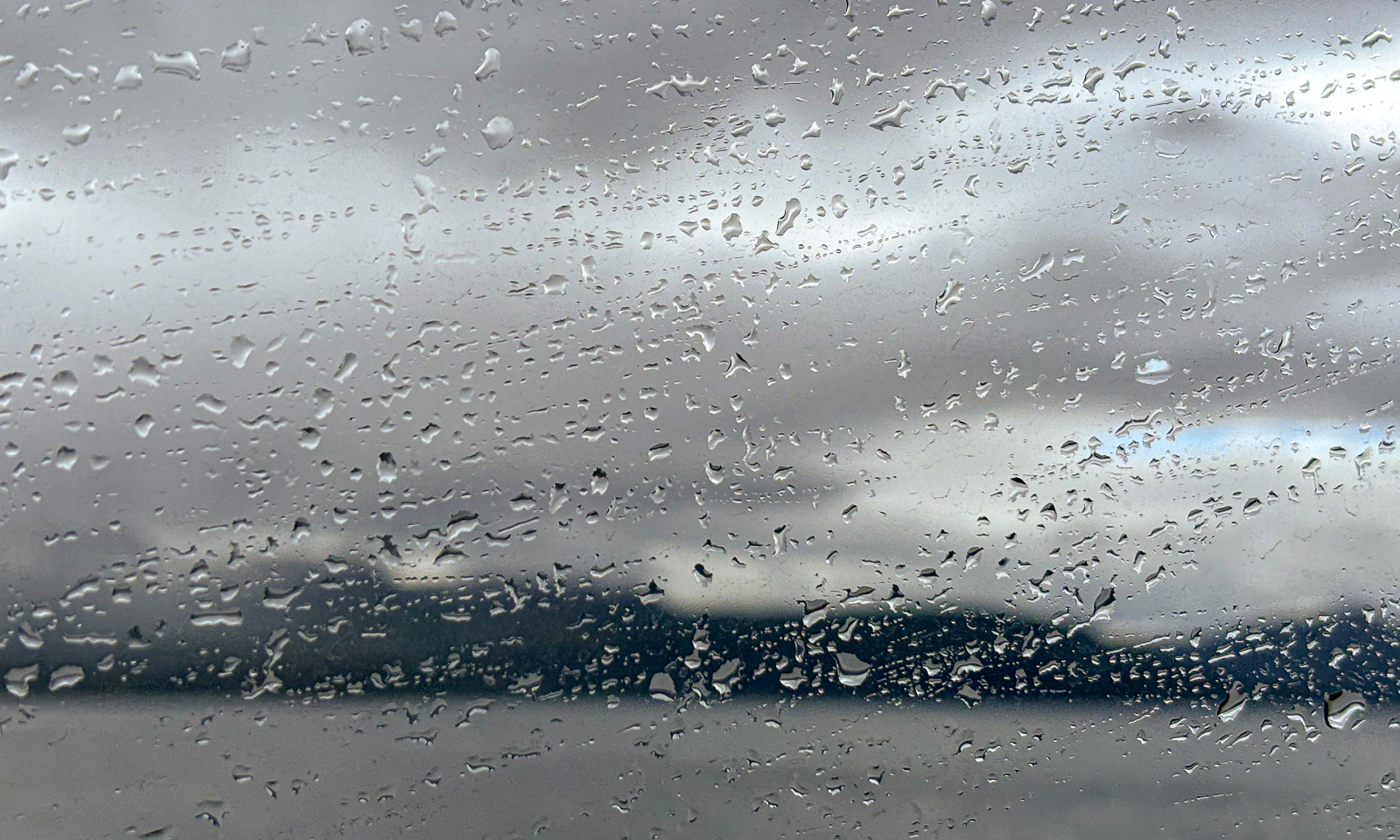
During the night the weather changed completely. This morning it was about ten degrees colder and it was cloudy with occasional rain showers. Therefore the view from the bus on the way back was quite different:
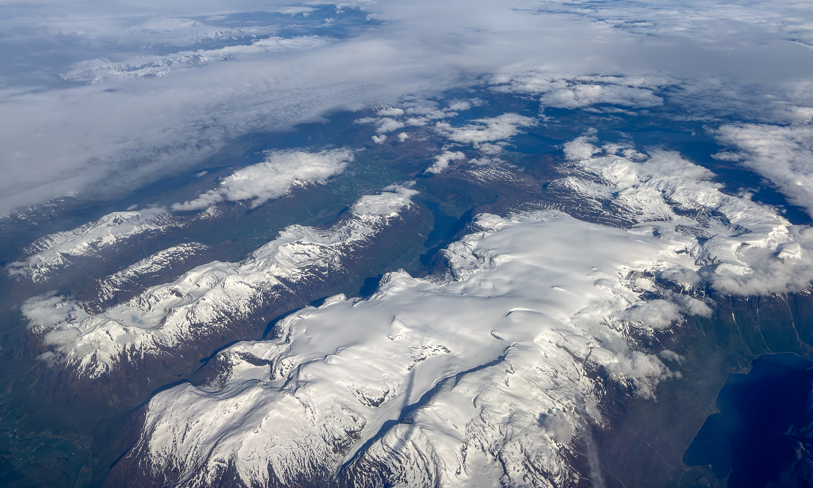
28 May – I am sitting on a plane to Bergen, Tromsø lies behind. Finally the layer of clouds has opened and Vestlandet – Western Norways reveals itself with vast glaciers, mountain ranges, fjords, forests, archipelagos and the open sea.


The reason I am in Bergen is sea ice in the Arctic. On board the ice-breaking research vessel Kronprins Haakon there is a special radar used for navigation through sea ice. Researcher Polona Itkin wants to store this data for scientific purposes. The companies Sea-Hawk Navigation AS and dspnor AS are responsible for the hardware, I handle the software to read and store the data. And since these companies are in Bergen and have a working setup including a radar on the roof, I am working there for two days. The only work-related detail I will mention is this: the data volume to be stored is immense and can exceed 2 TB a day. Quite a challenge.
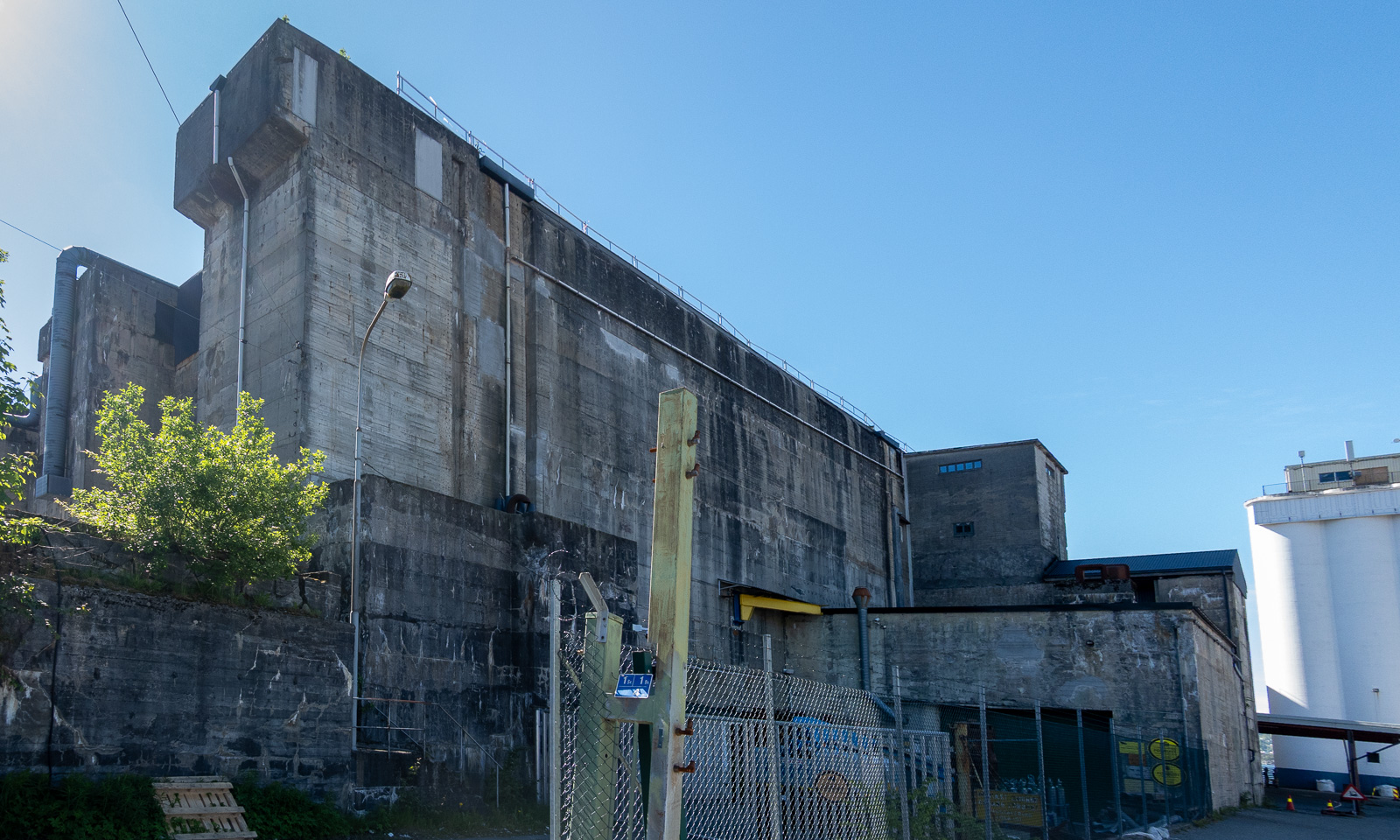
At 16:00 I finish work. Since the weather is warm and sunny, I decide to walk to the hotel in the centre of Bergen on the other side of Puddefjorden. Let’s go down the concrete ramp and start our tour. First, I walk through an industrial area …


… but then the surroundings change revealing marinas, parks and older wooden houses.


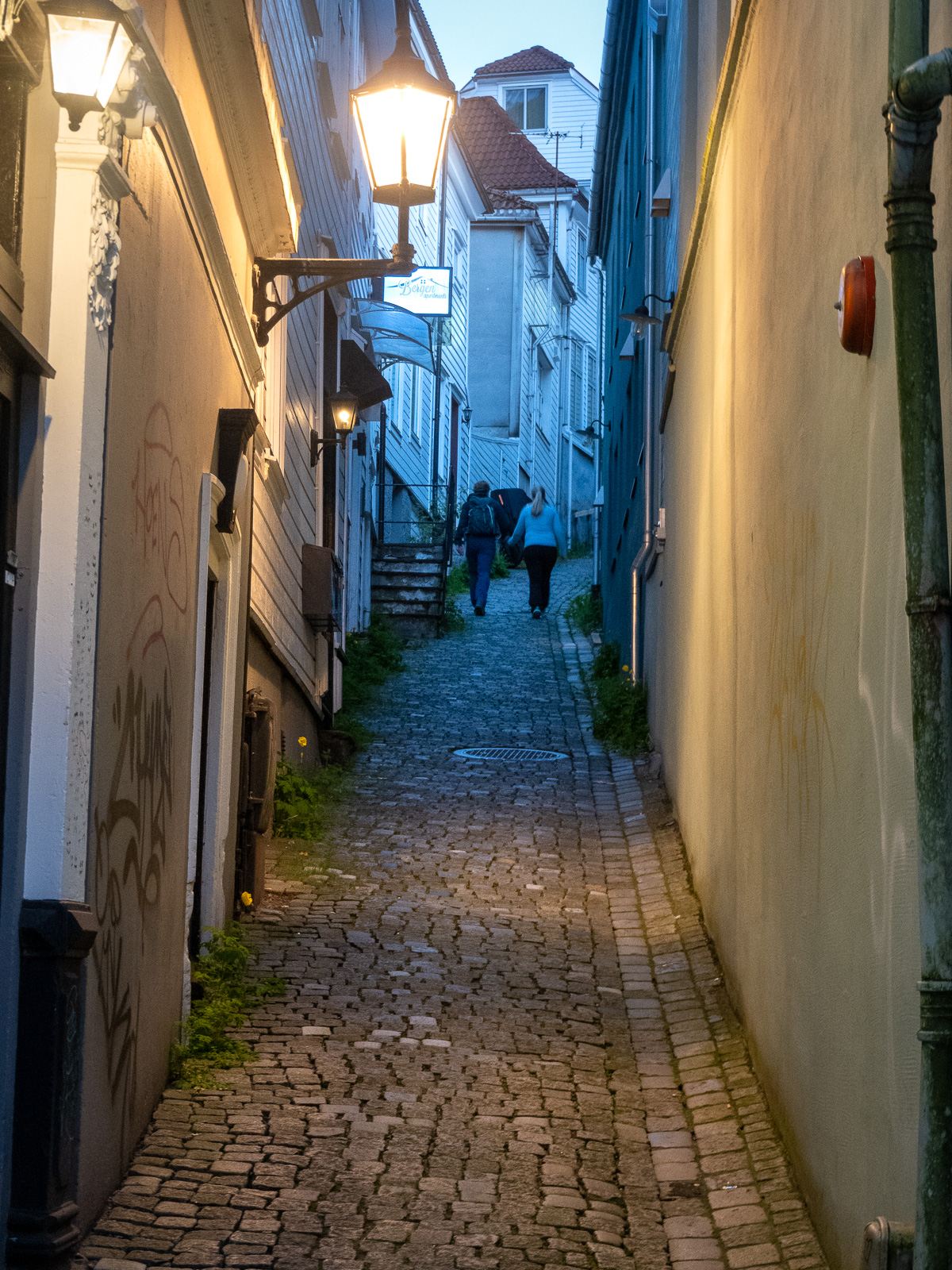
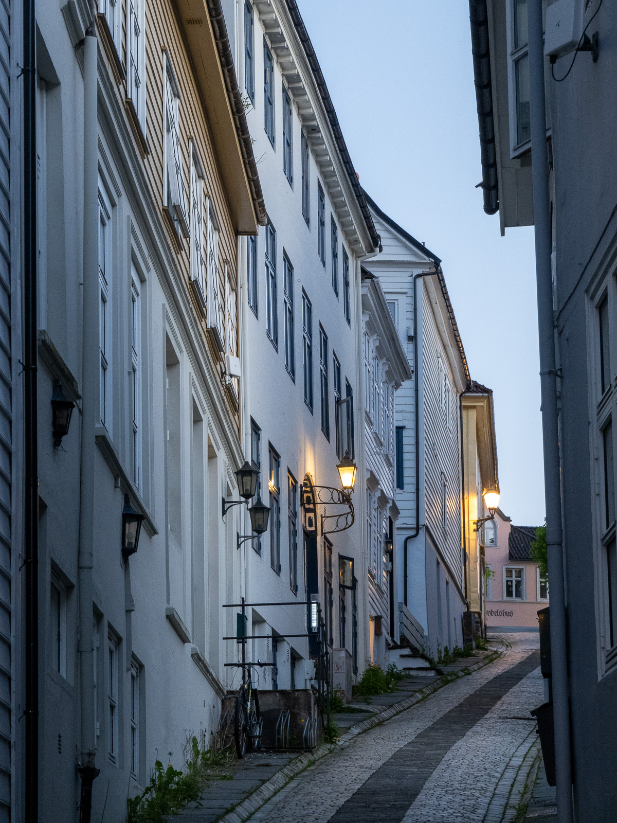
I cross the Damsgårdssundet and head towards the centre. A myriad of small alleys, footpaths and stairs make me ignore the polite navigation of Google Maps and stroll around, enjoying the town in the sun.


I don’t want to own this car, but I envy the driver’s parking skills.

But of course Bergen is an evolving city, not a museum and a lot of contemporary architecture is found there too. But sometimes the glassy facades reflect the older world.
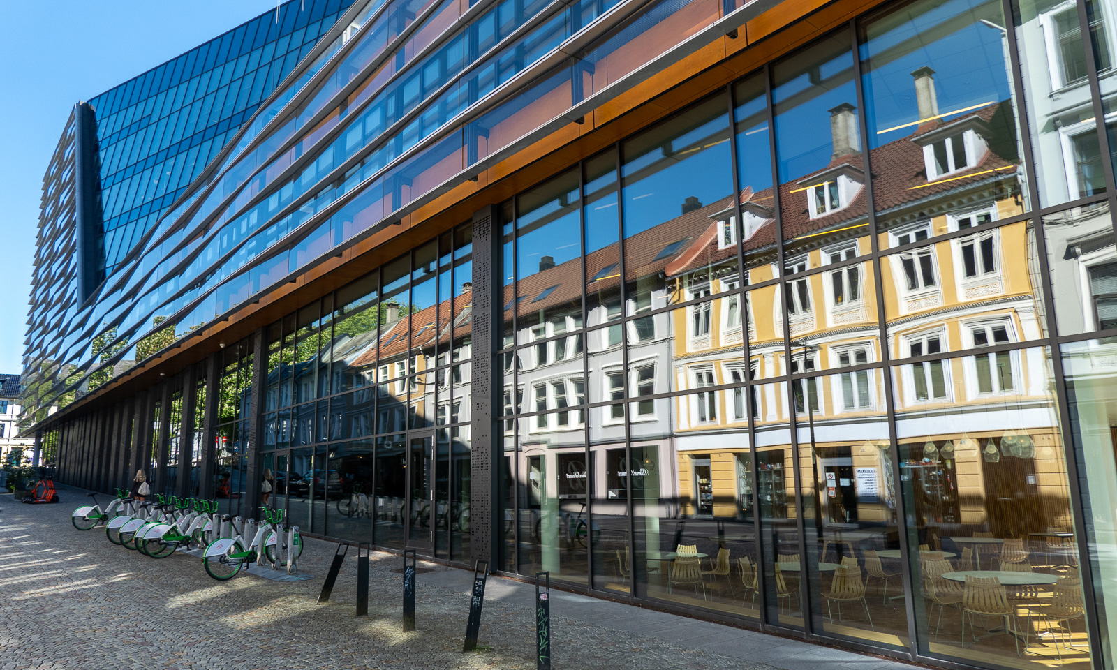
From there it is not long to Vågen, the central harbour bay with a view of the historic quarter Bryggen.


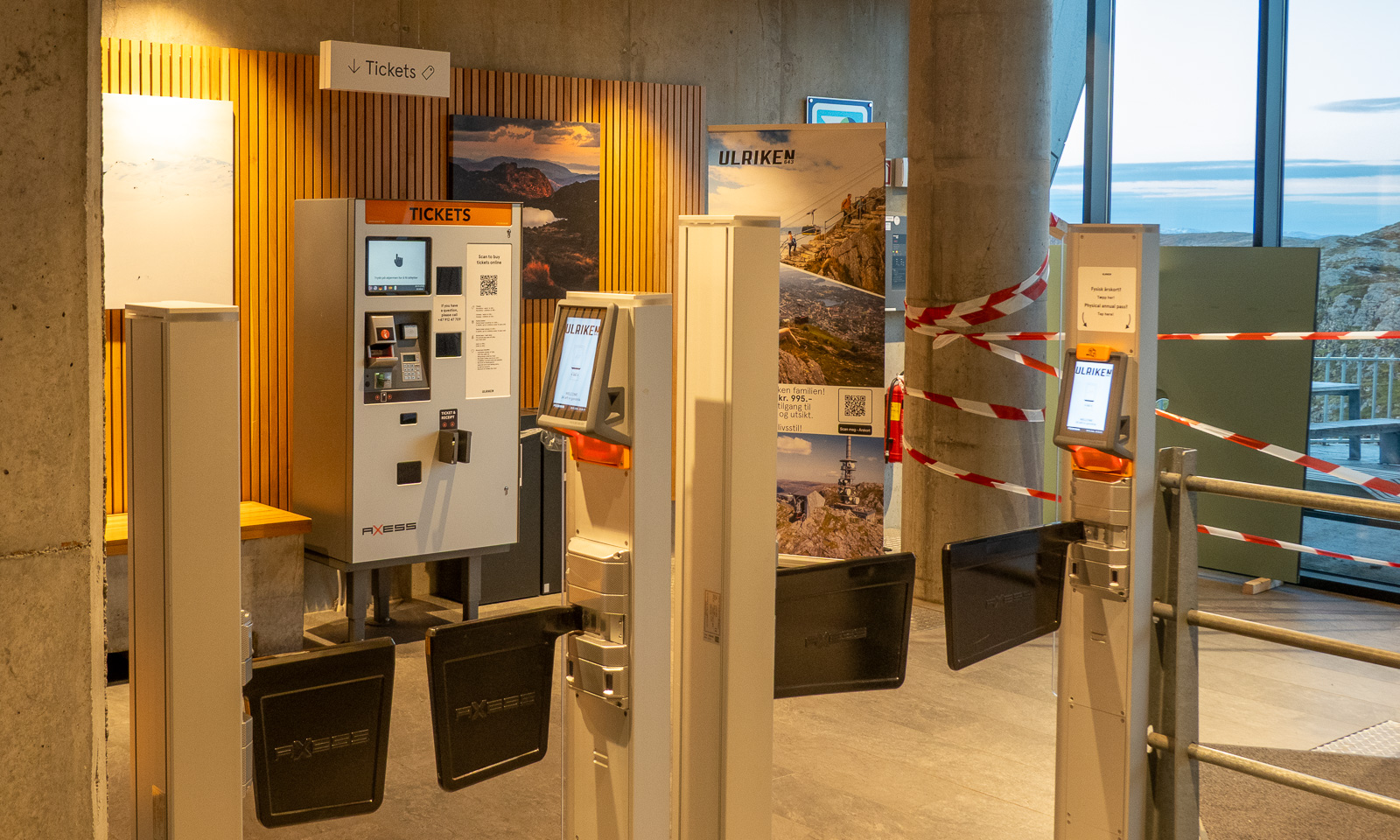
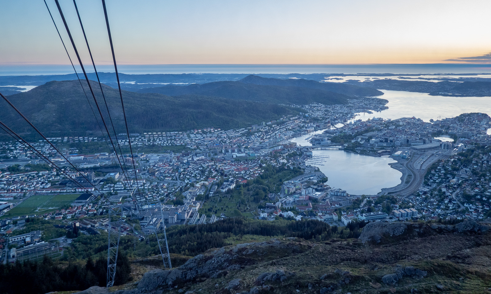
I check in at the hotel and leave again straight away, first to get some food (Pasha – Peruvian food – not cheap but delicious) and then to take Fløibanen, a 848-metre-long funicular railway that leads up to the mountain of Fløyen (320 m).


Of course I could have walked up the 302-metre ascent, but I have a plan: I want to walk to the mountain of Ulriken (643 m), the highest of De syv fjell that surround the city centre of Bergen. The route is between 13 and 15 km long and leads through hilly terrain. From there I want to take the cable car down and the last one leaves at 23:00. So I don’t have the whole day, just a long evening.
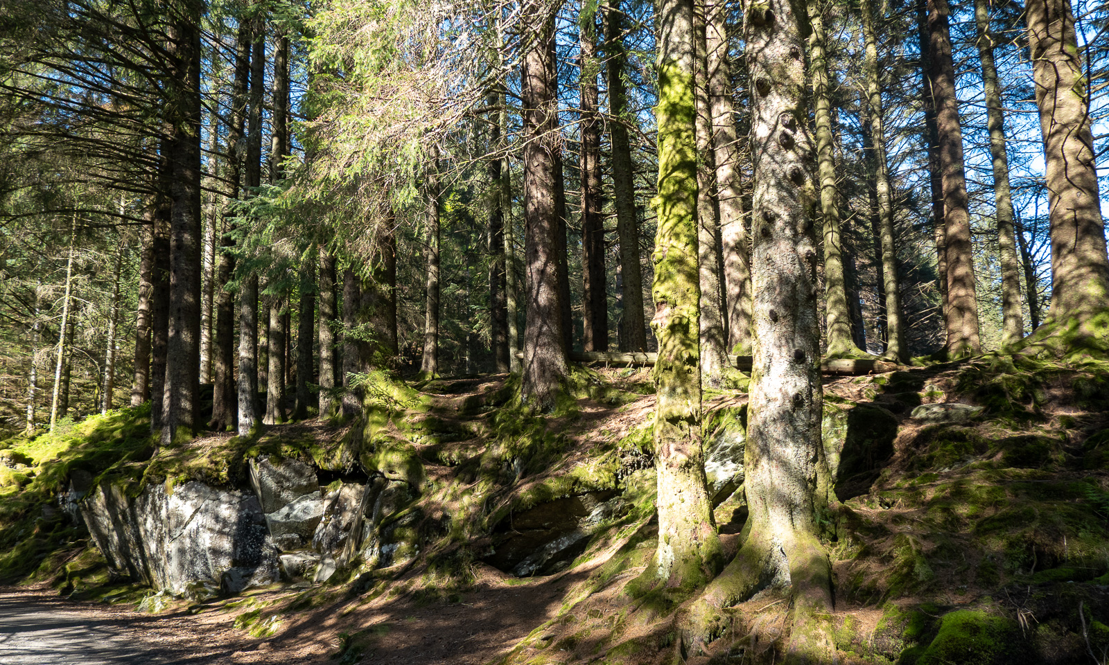
At 18:45 I start my tour. First, I cross a small, but surprisingly dense forest then I follow the wide hiking trail.


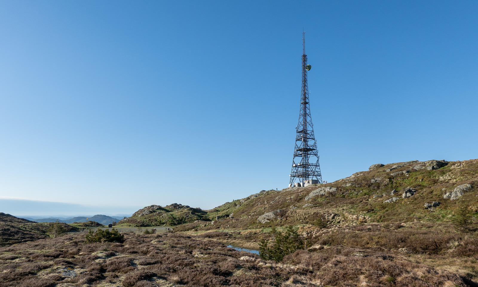
When I approach the mountain Rundemanen with its tall radio mast, the trail branches into many paths leading in different directions. I ask for directions twice and get it – together with the warning that it is a long hike. The younger women told me it would take four hours from here, another woman said it would take her six hours. I decide to walk a bit faster and see where I am after two hours. I could still turn back then.
Now the trail looks more like a mountain trail. Smaller, steeper, rougher and sometimes very wet. Normally I walk with rubber boots but on this journey I only have an old pair of low shoes, so I try to avoid all the wet patches walking around them or stepping onto the stones.


I pass the lake Øvre Jordalsvatnet, use the stone causeway to cross the small stream that transports water to the lower lake Tarlebøvatnet. My planned destination, the TV tower near Ulriken, can already be seen.


Now the trail is excellently marked by large square cairns with a sign “←Fløyen, /Ulriken→“. It is easy to follow them. I try to walk at least 4 km/h, ideally 4.5 to catch the cable car. At 20:30 I reach one of the few signposts with distances. I’m happy, because I made more than half the distance in one hour, forty-five minutes. Decision made: I carry on.


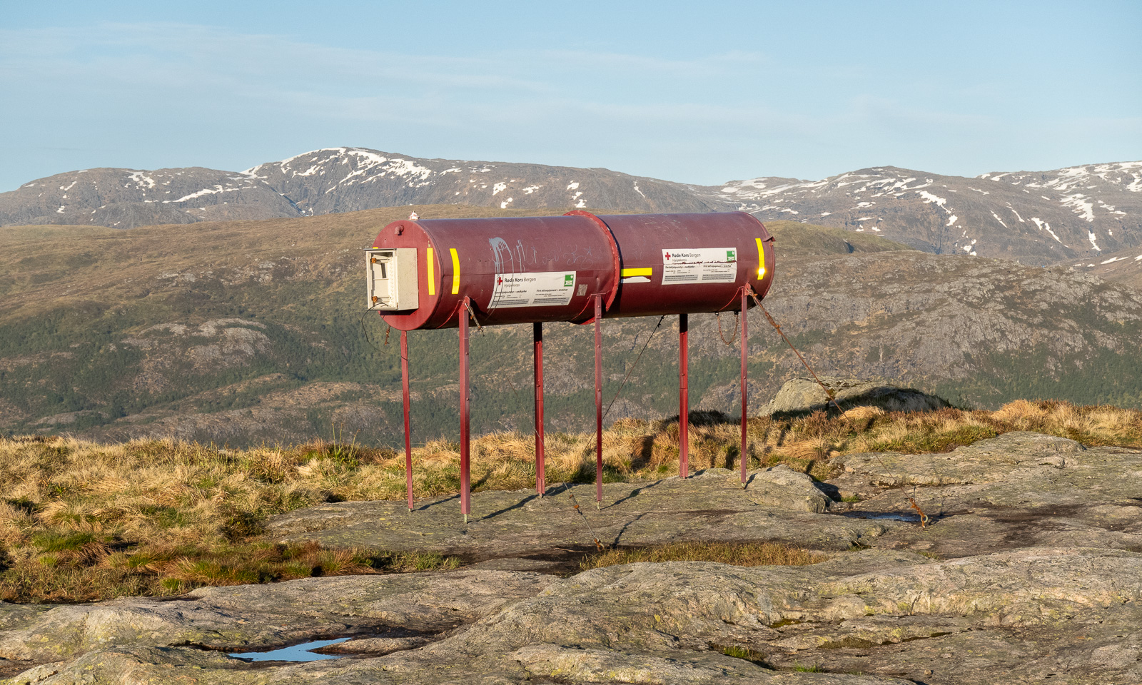
And on I go across the Vidden. Sometimes the point of interest is nearby, such as the tube with the first aid equipment including a stretcher. Sometimes it is far away, such as the snowy mountains in the east. Will I see snow here as well?

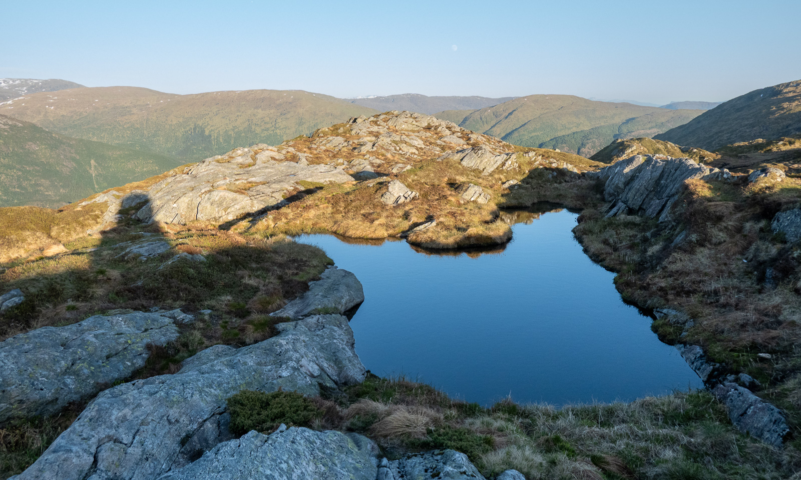

And there it is: one of the two patches of snow on the Vidden plateau.

Slowly the sun is setting and the light gets warmer. I walk against the sun and have to protect my eyes with one hand when the path descends steeply into one of the valley cuts. But I’m sure I’ll arrive in time.


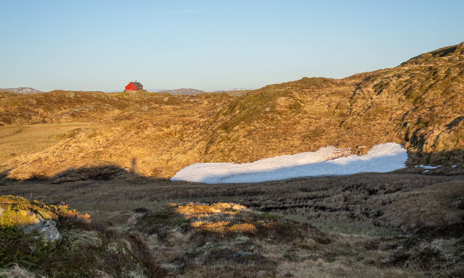
I spot some cabins, first a small red one then a larger one. When I researched this while writing, I found out that this is Turnerhytten, a DNT cabin with thirty beds. I think that when I plan a trip to Bergen again, I should stay there rather in some hotel in the centre.

I decide not to climb to the top of Ulriken but to go straight to the cable car station. I’m tired and exhausted because my only rests were to take photos and once to put on a jacket. I follow the signs to the station, take another photo, one of the TV tower, buy a ticket at the ticket machine and two minutes later I am in the cable car that leads me down. It is 22:30, so the hike – 14½ km long – took me 3¾ hours.


From the descending cable car I watch the sunset …
… then I’m in town again. It is five more kilometres to my hotel, so I take a bus (the wrong one), a tram, and another bus. At 23:15 I am in my hotel room.
Today I walked around 25 kilometres in total and now I only want to take a shower and fall into bed and sleep until breakfast at 7:00 the next morning.
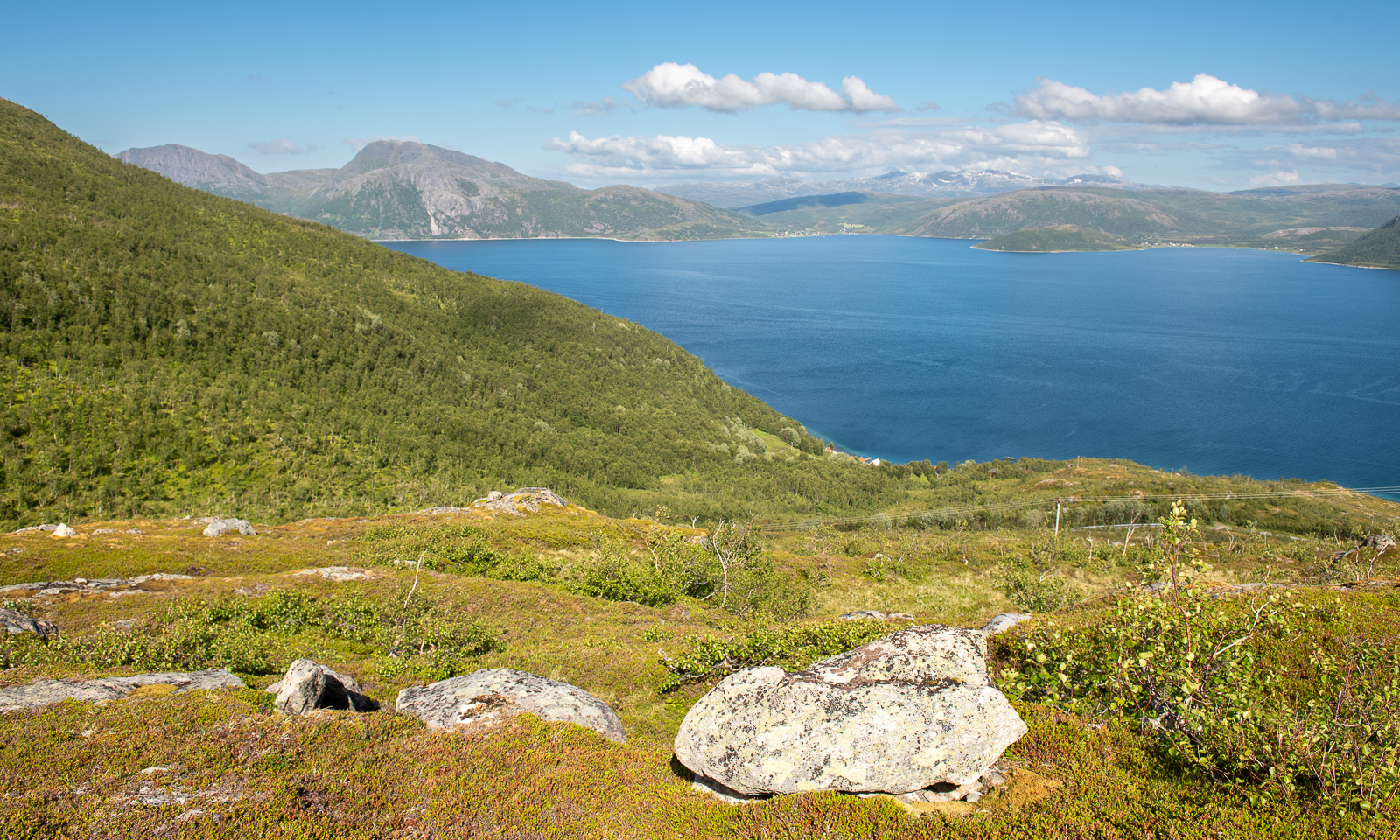
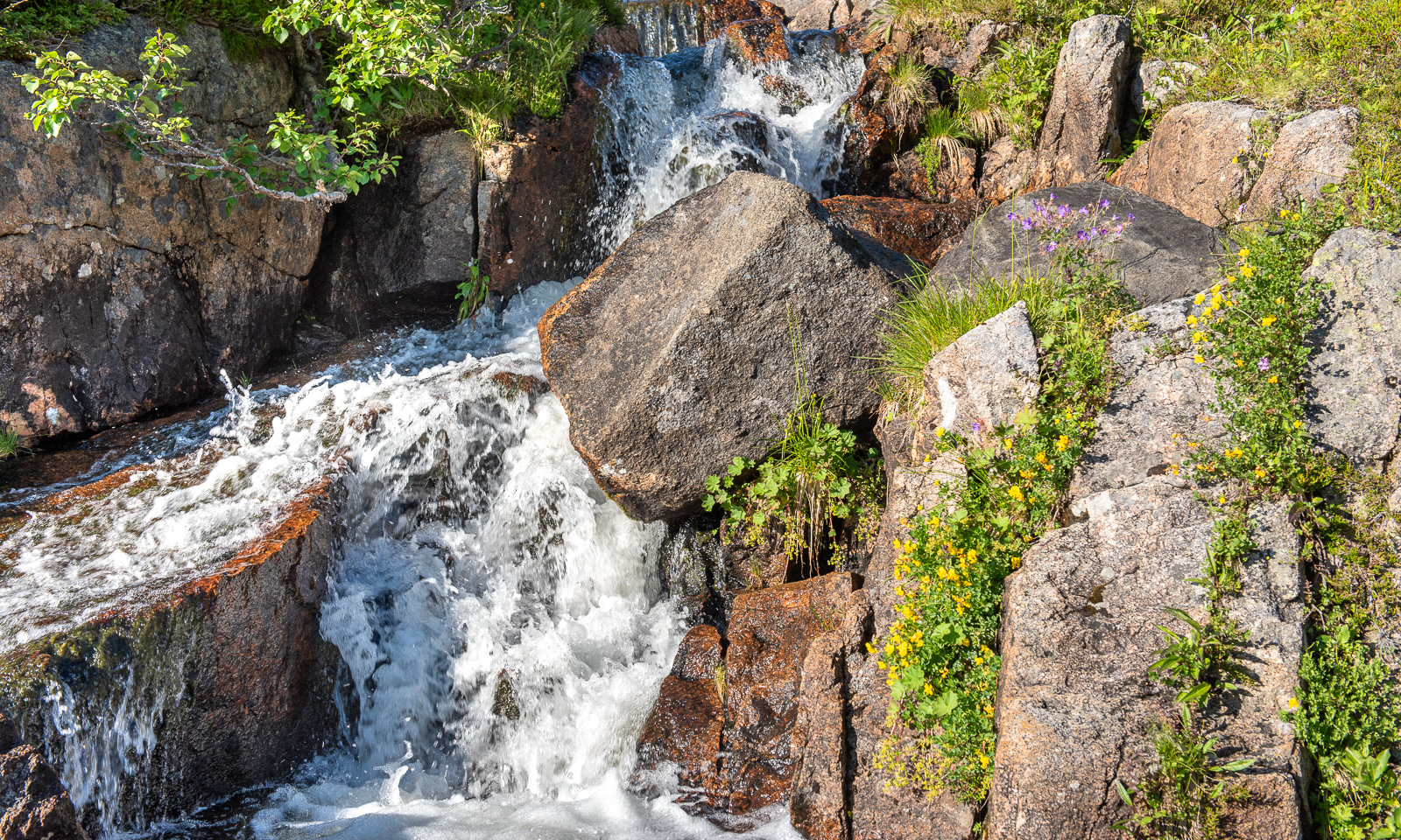
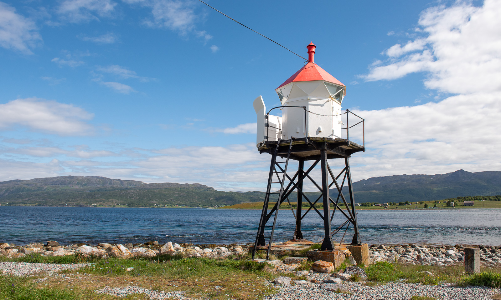
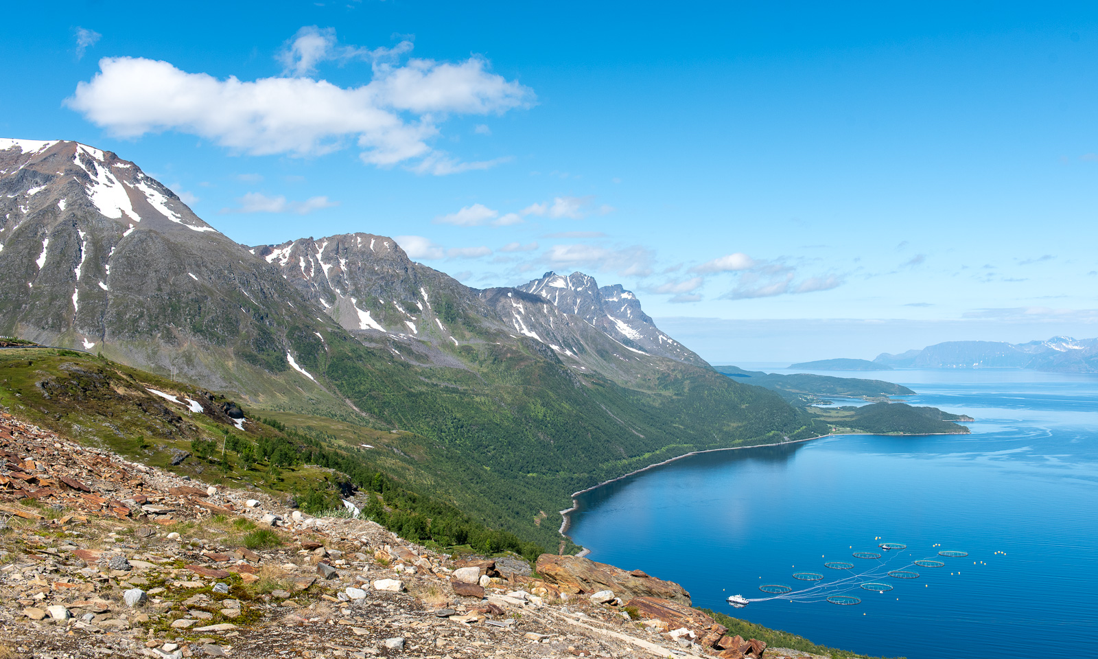
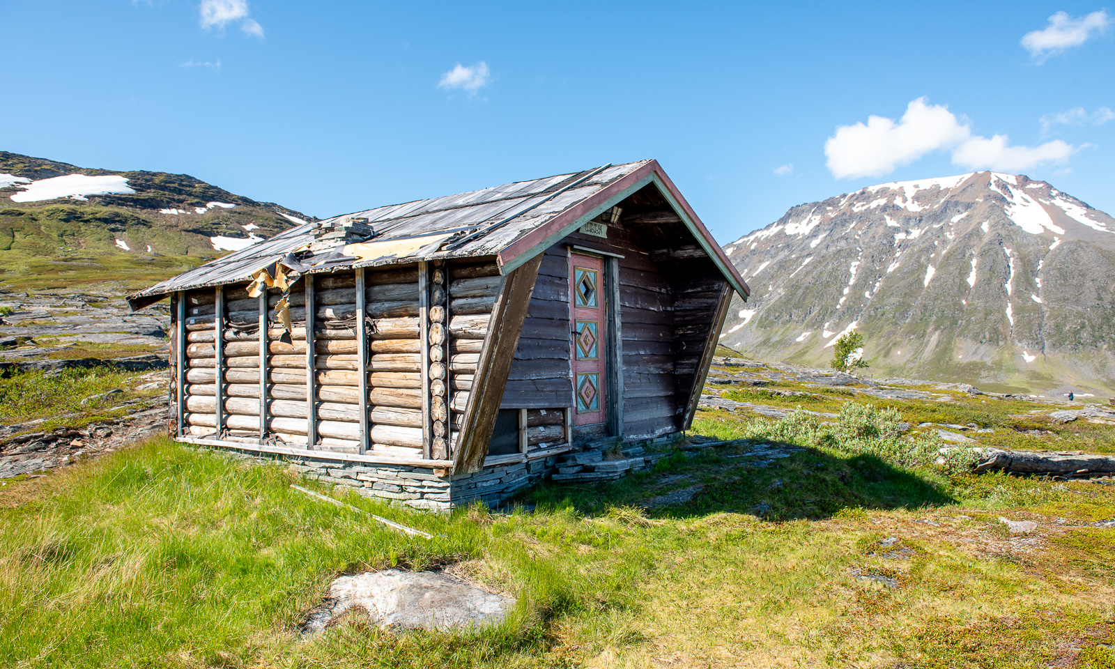
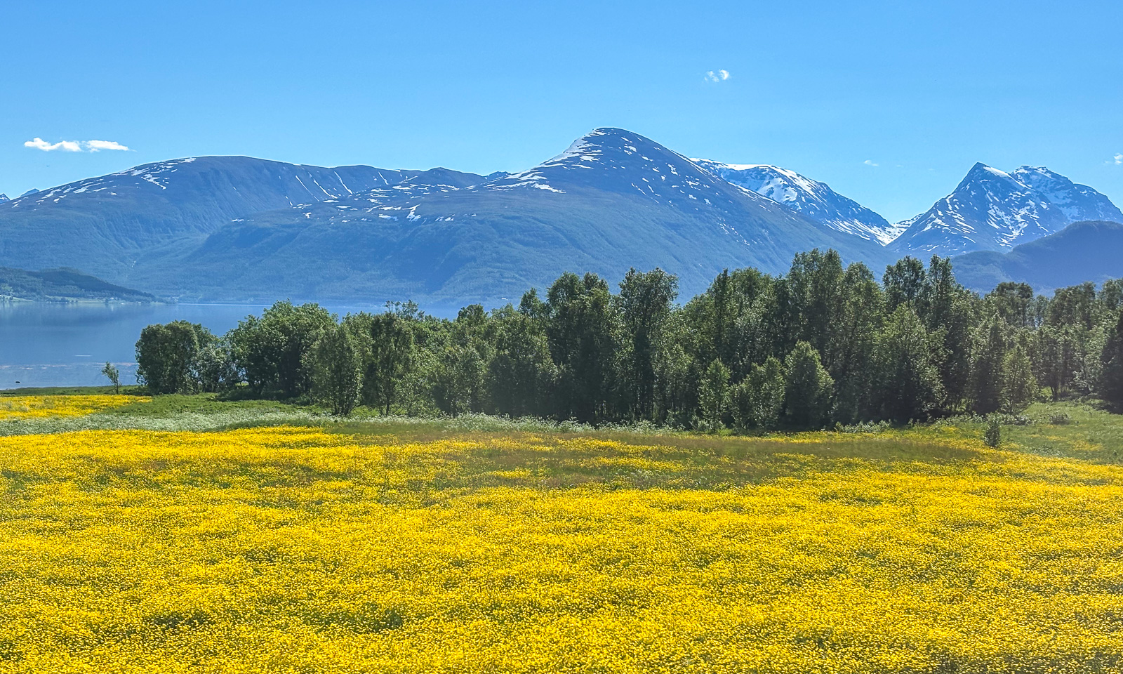
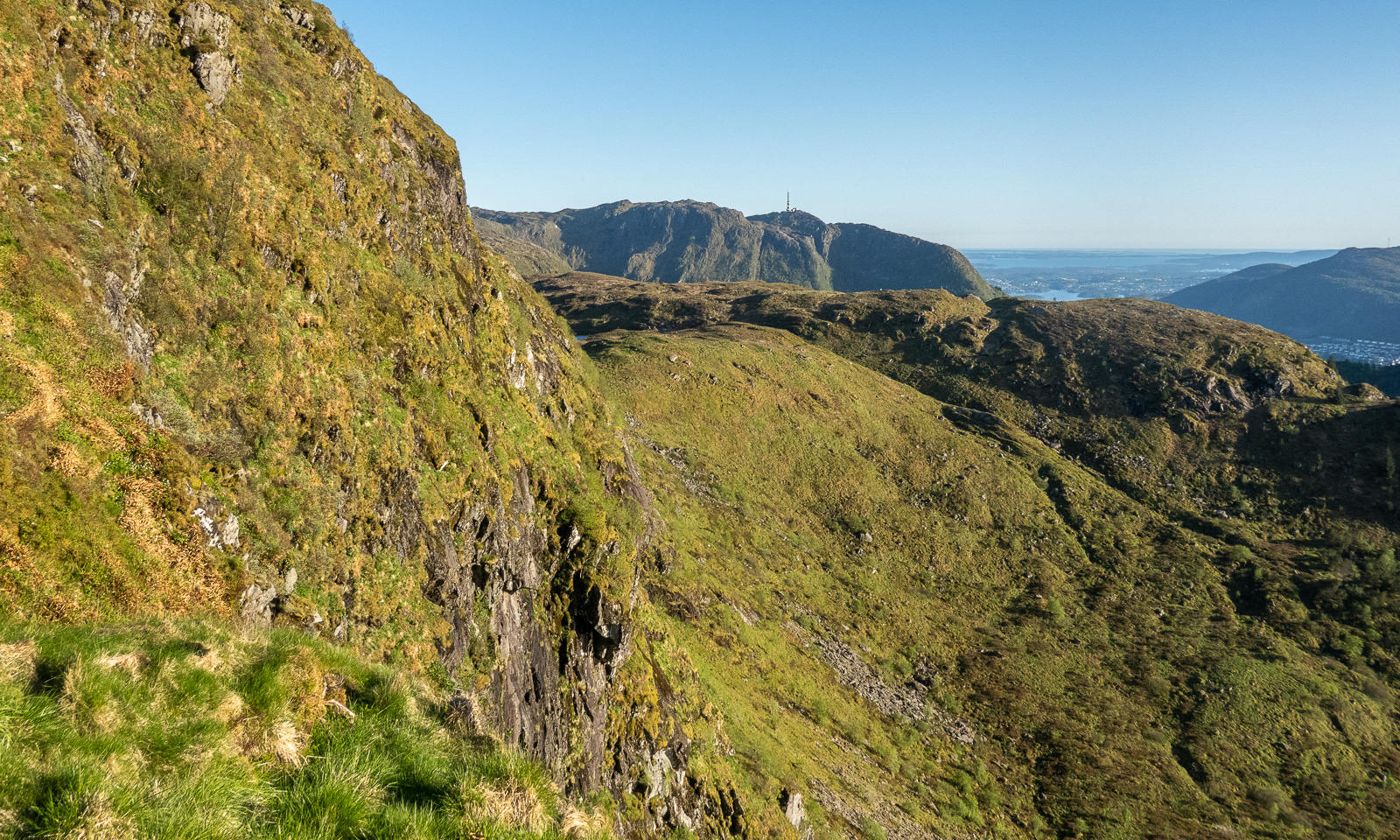
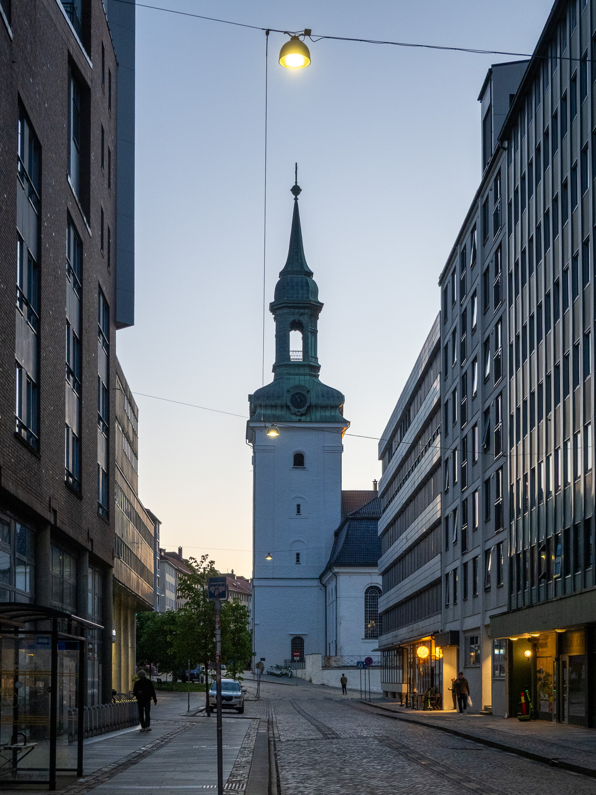
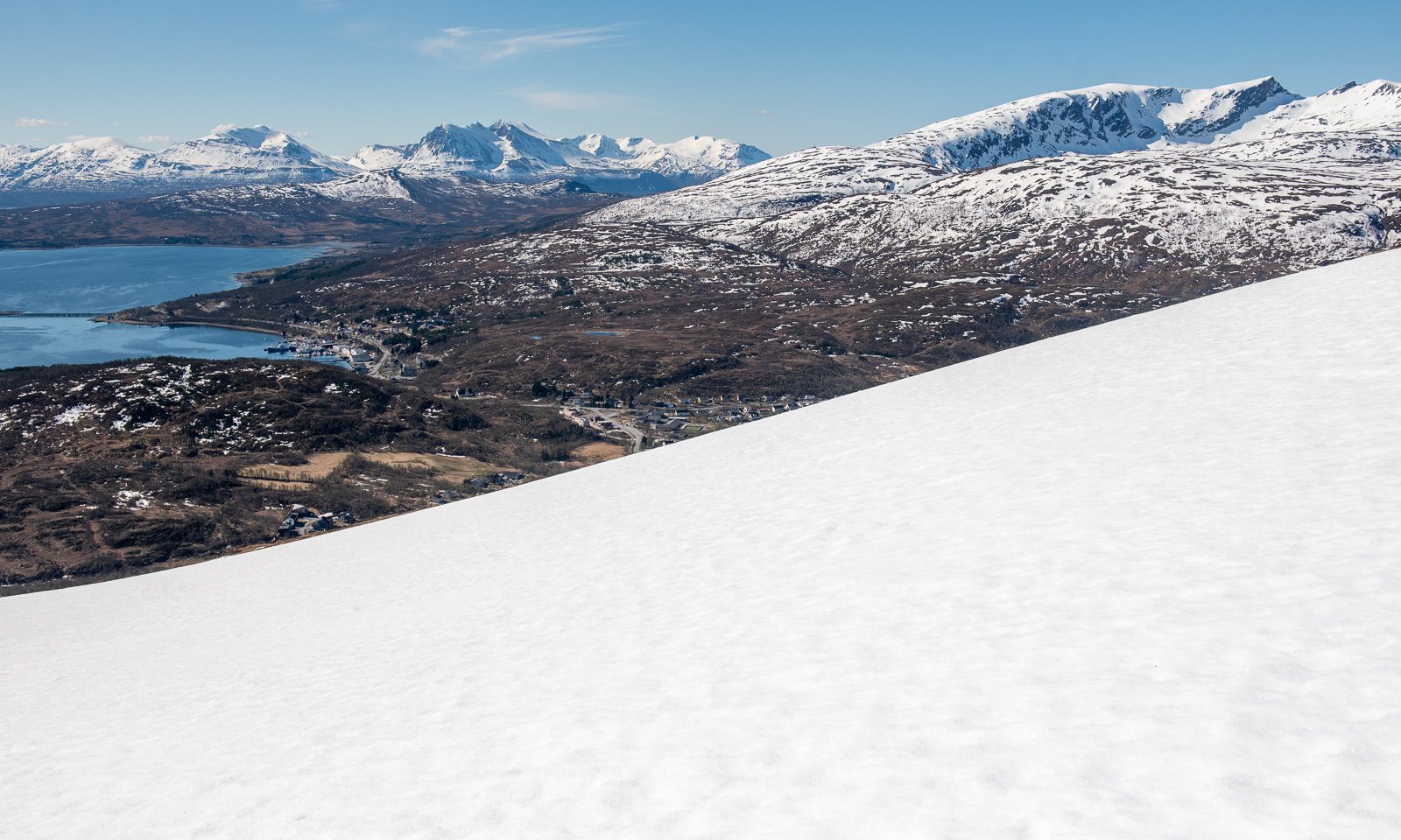
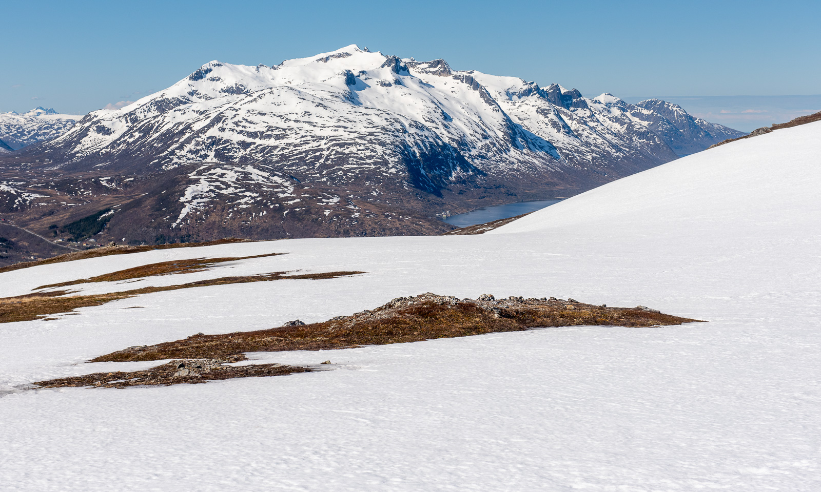
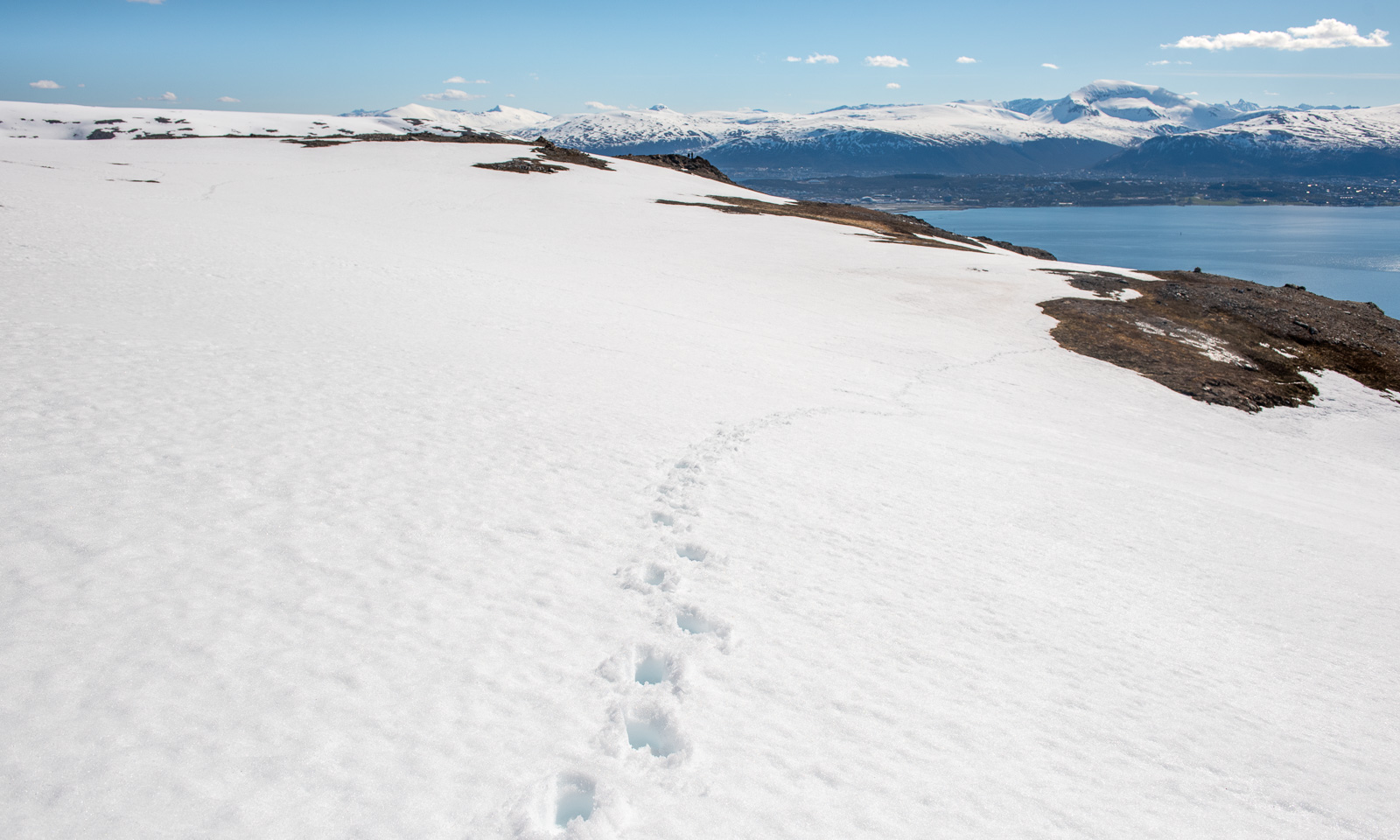
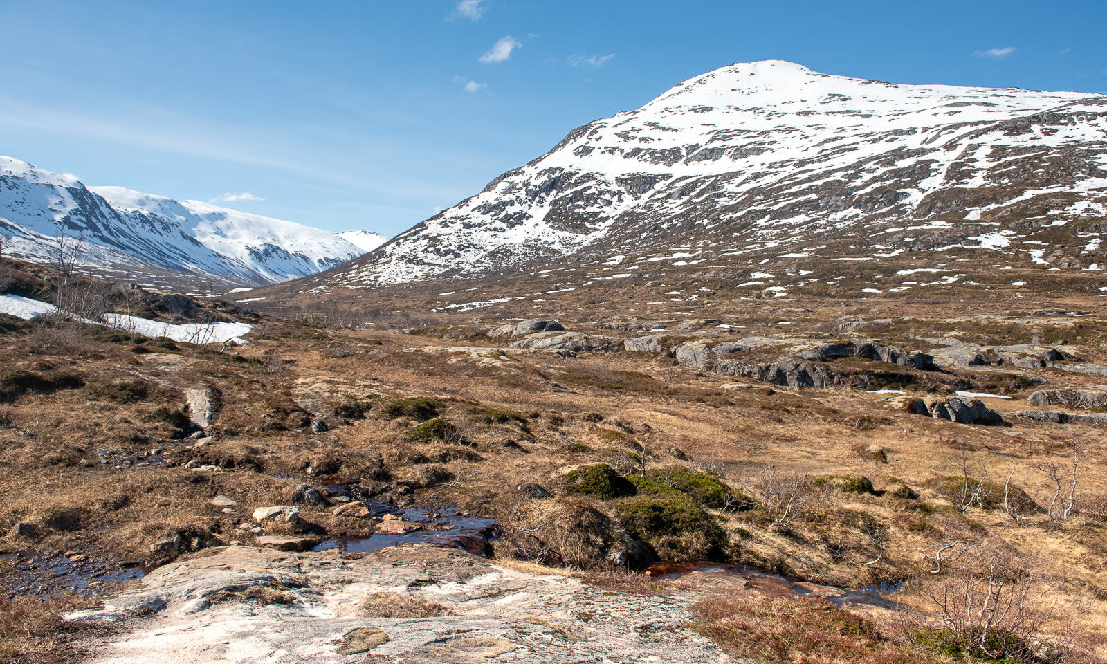
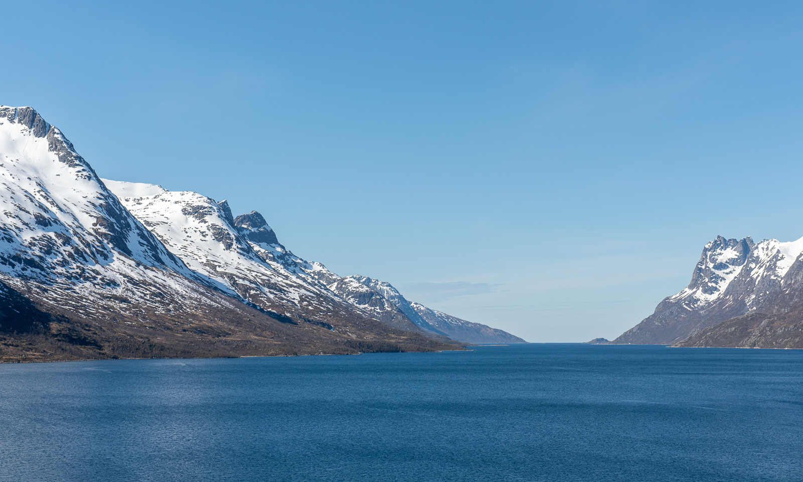
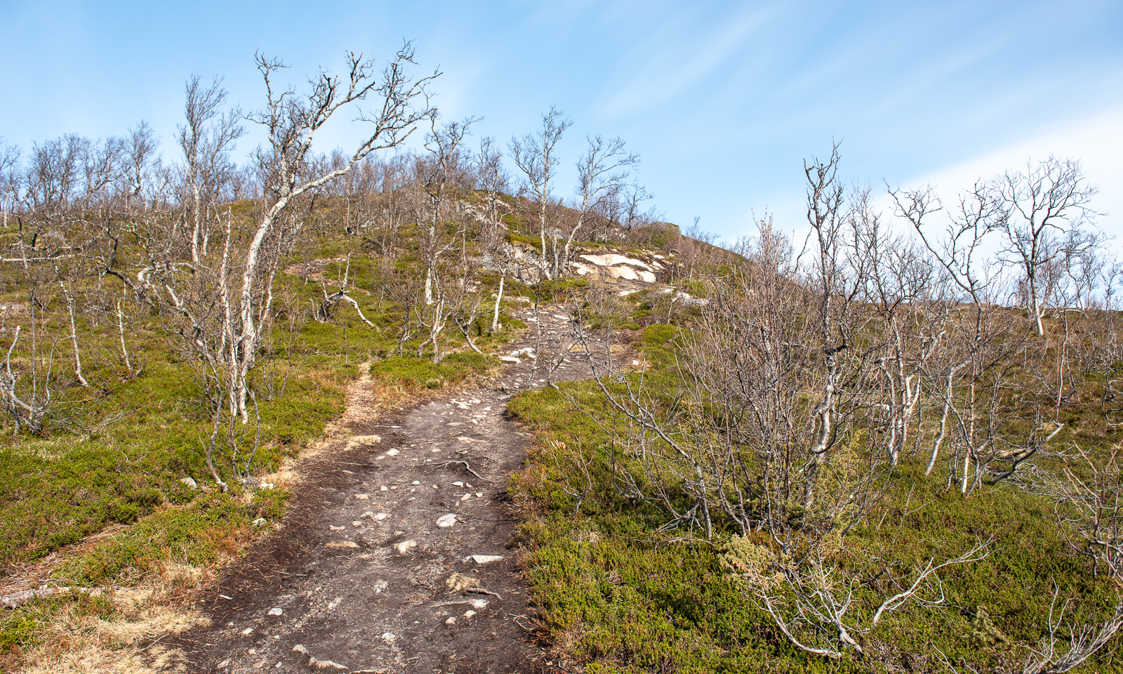
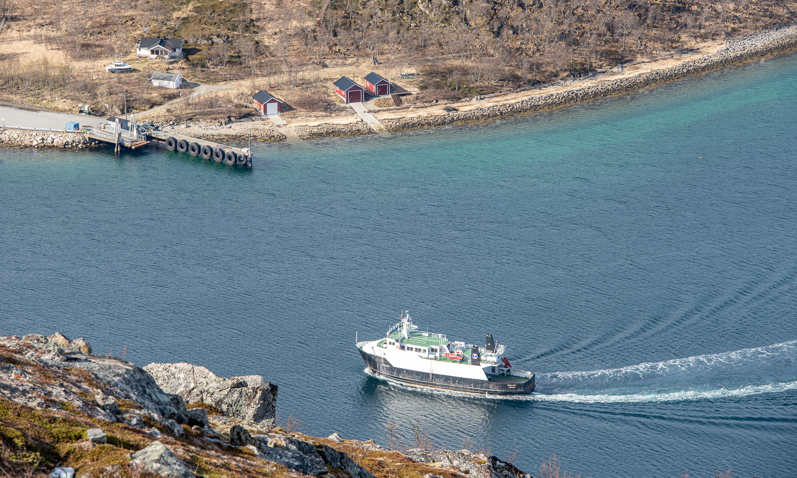
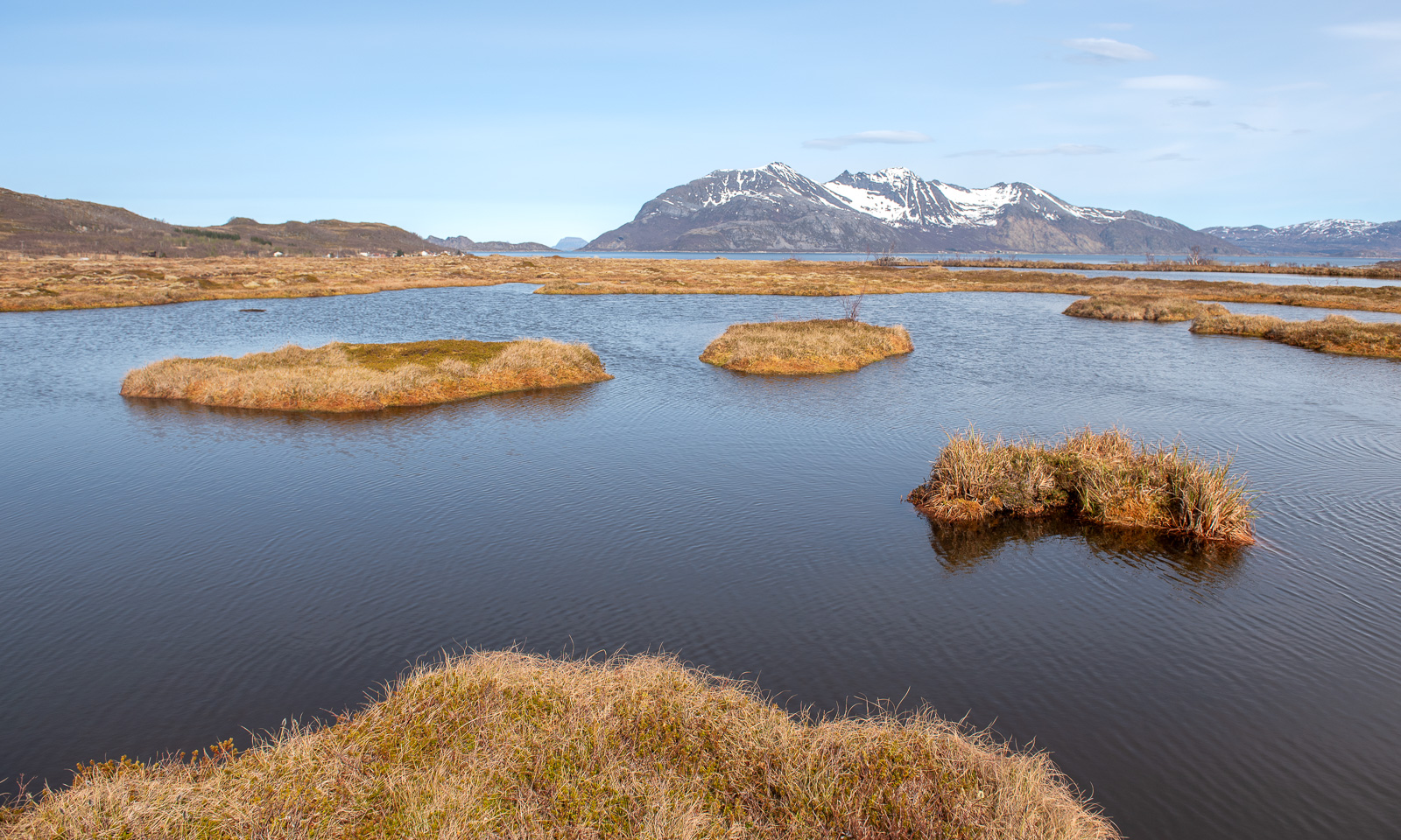
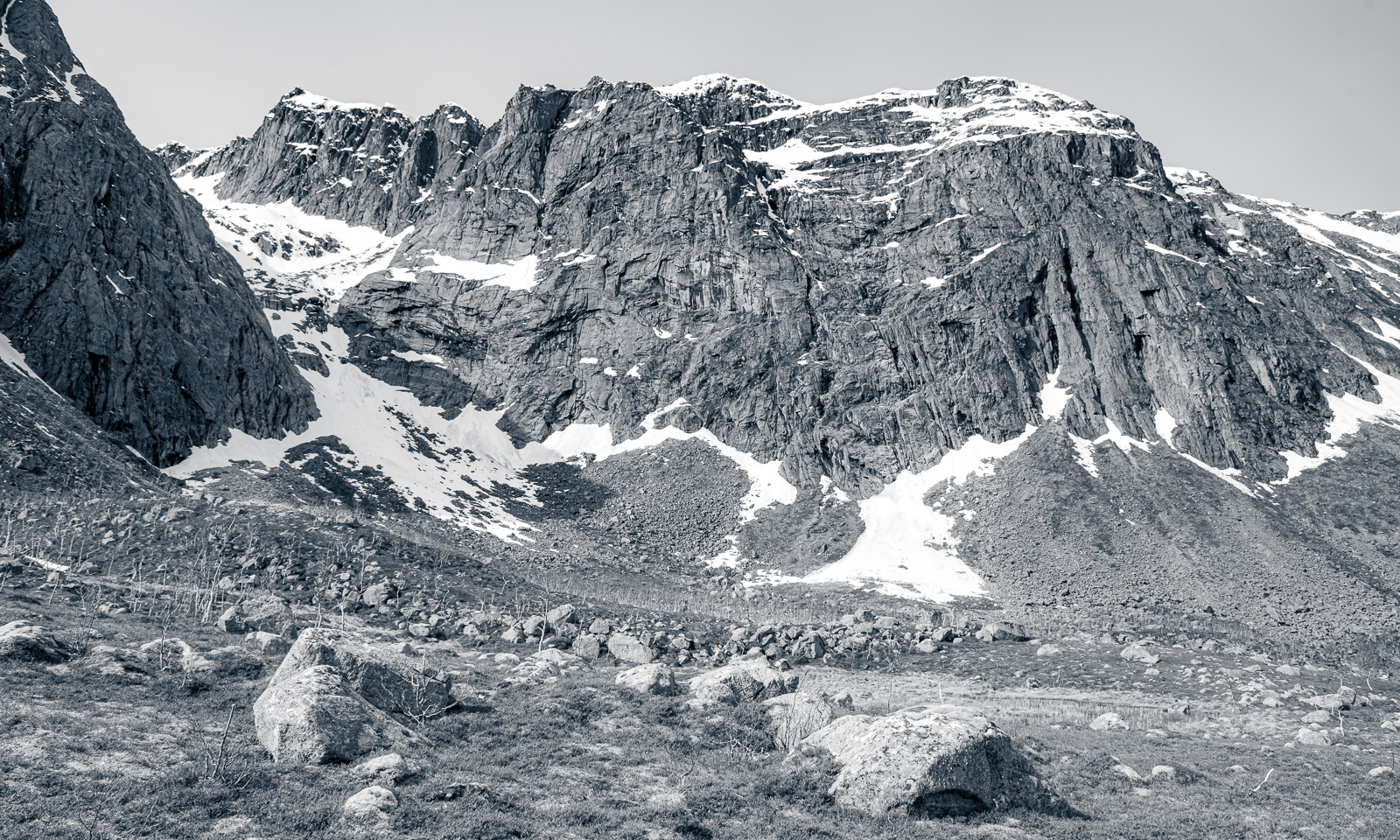
Today I did my thrid hill hike within 8 days. After Trehørningen (283 m) and Nattmålsfjellet (296 m) I chose Ruksesvárri (470 m) today. Most people refer to the mountain by its Norwegian name (Rødtind), which more or less means the same as the Sámi name: red mountain peak. Like the other hills Ruksesvárri is located on Kvaløya.
I park the car in Storelva, put on my rubber boots and shoulder my camera backpack. From there it’s about one kilometre along the river Stuorajohka/Storelva until I leave the wide gravel hiking path and branch off. From now on the track may be wet and – looking at Ruksesvárri – snowy.
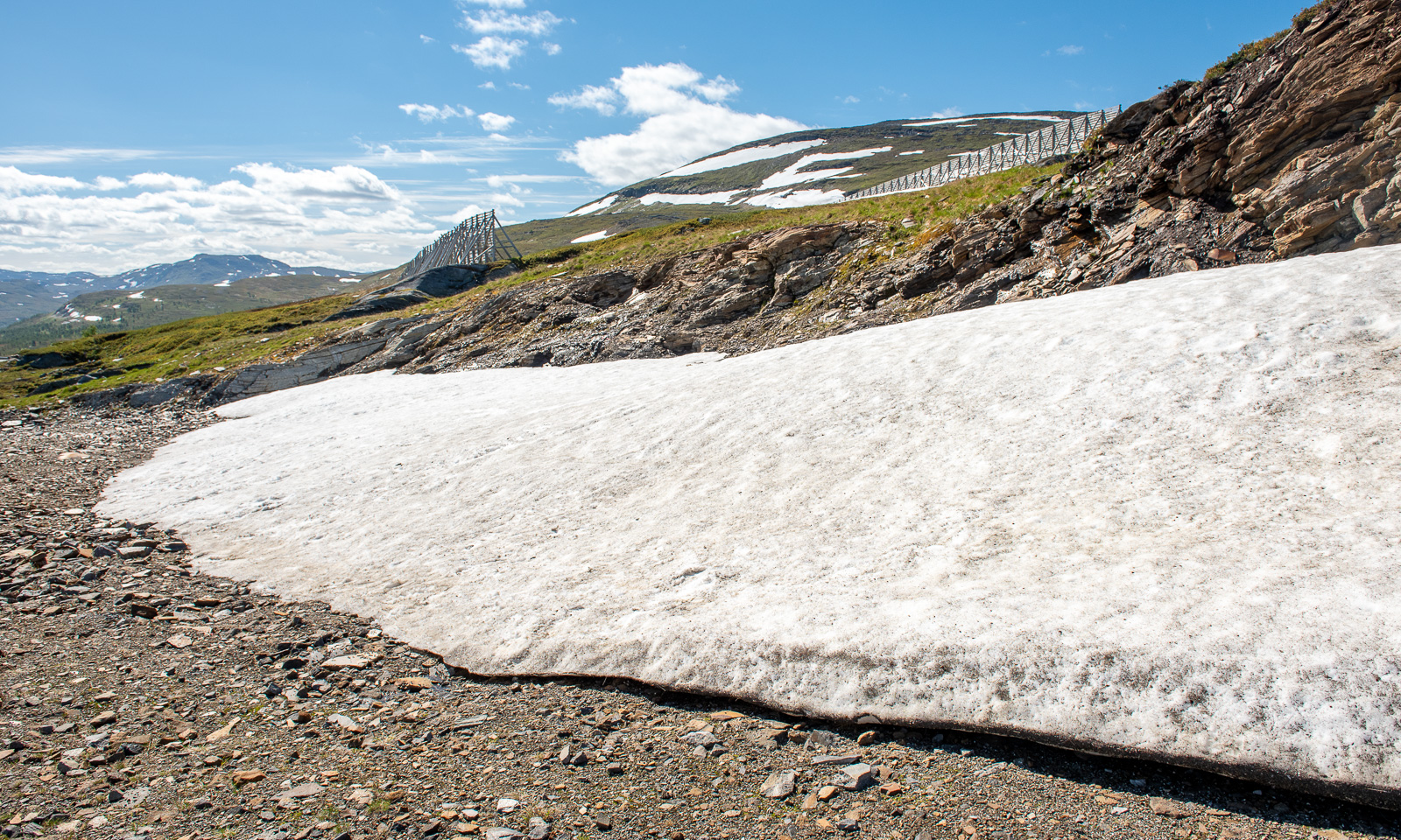
I hike up, following the track. Soon it vanishes under the first larger snow field.
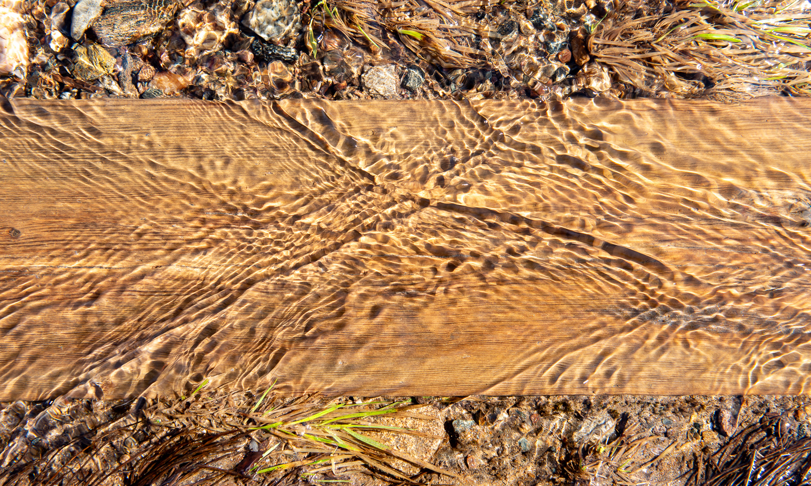
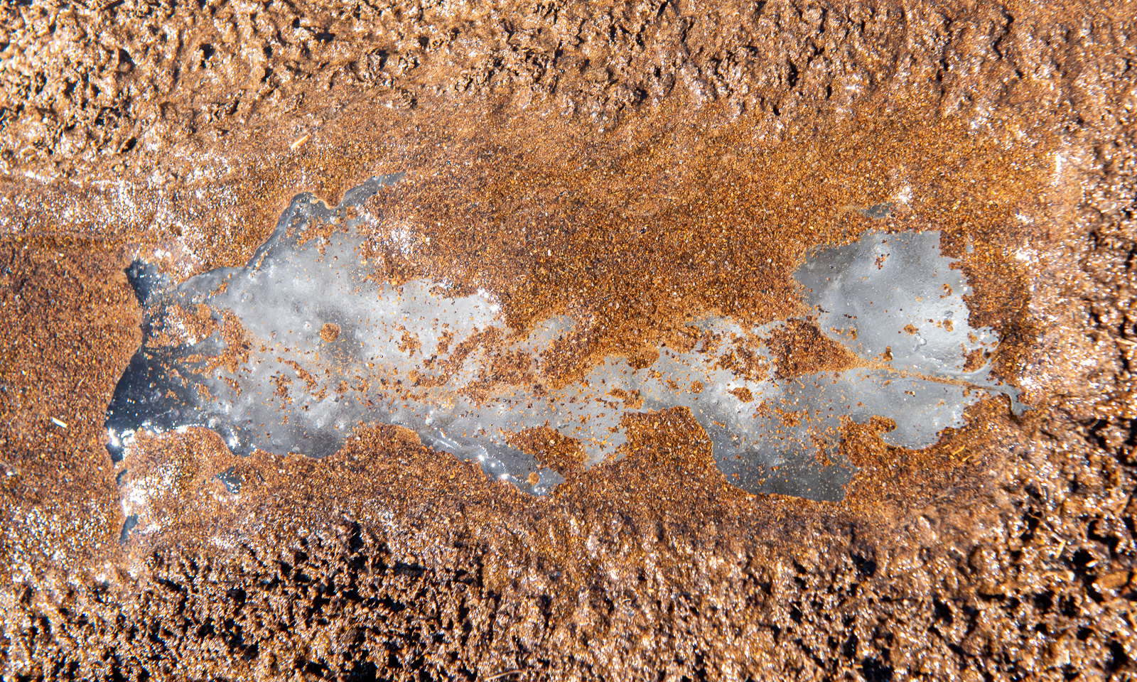
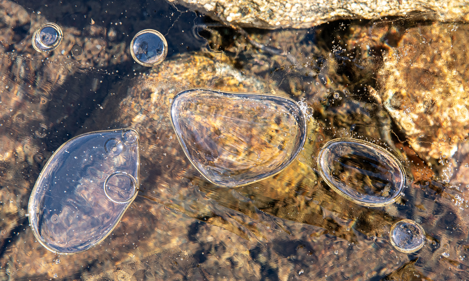
The track is less muddy than I remember but wet, because the snowmelt turns everything into a brook, even the boardwalks. Further up I see that under sand and water there is blank ice. However, it is the only patch I see.
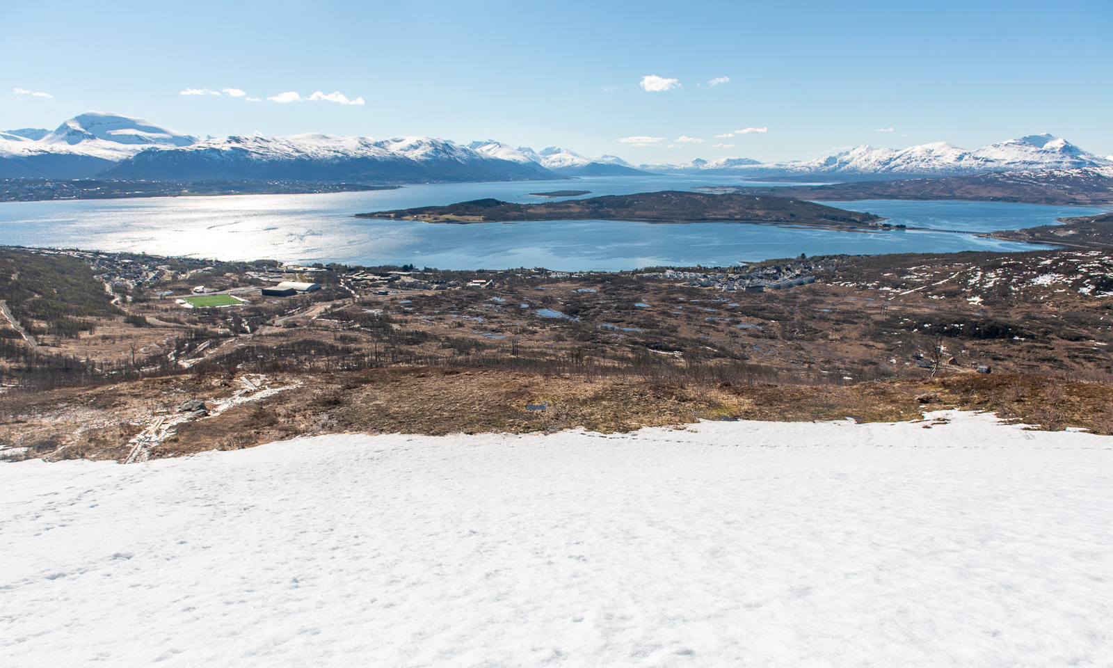
I look back. To the south I can see the island of Håkøya and mountain chains in more or less all directions.
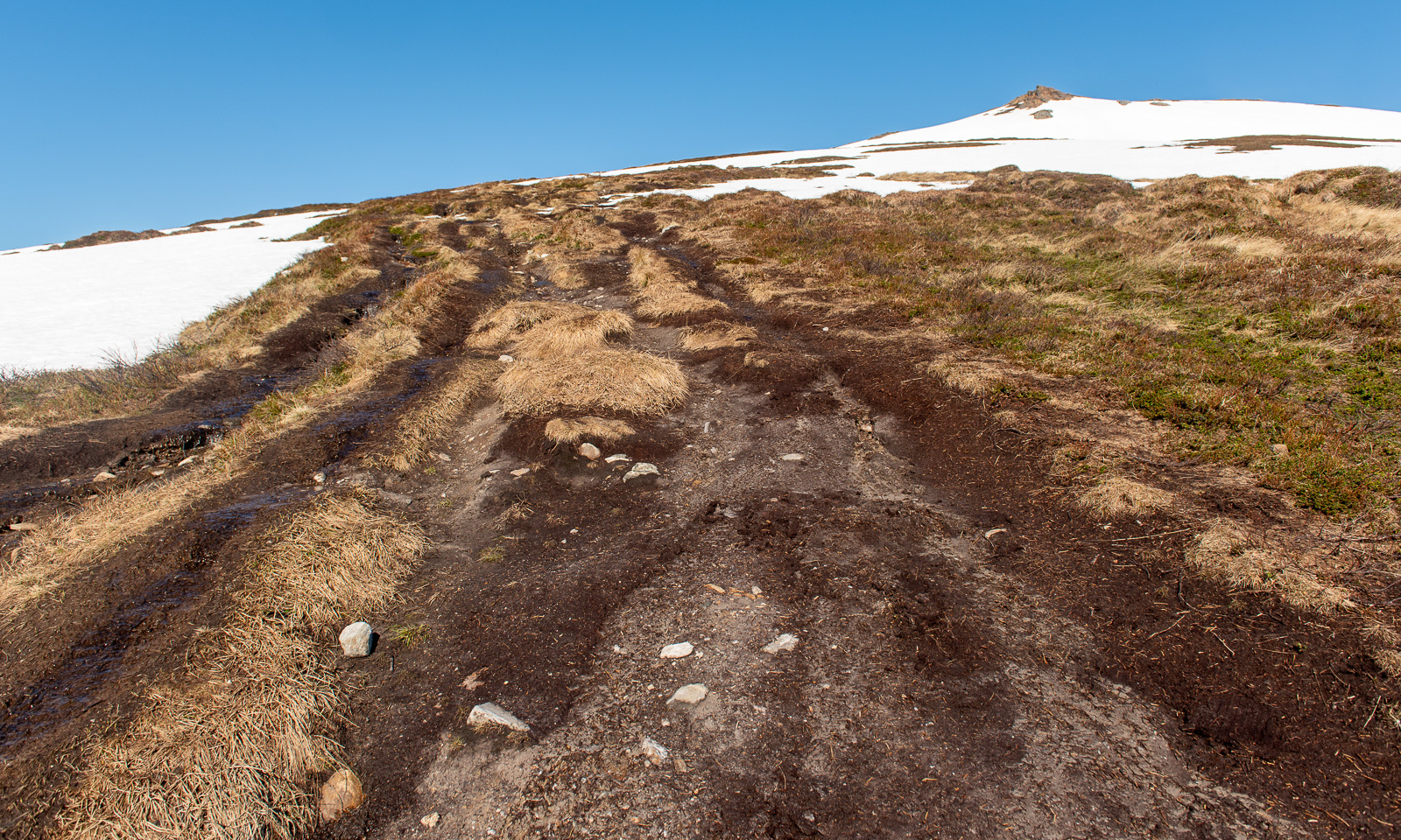
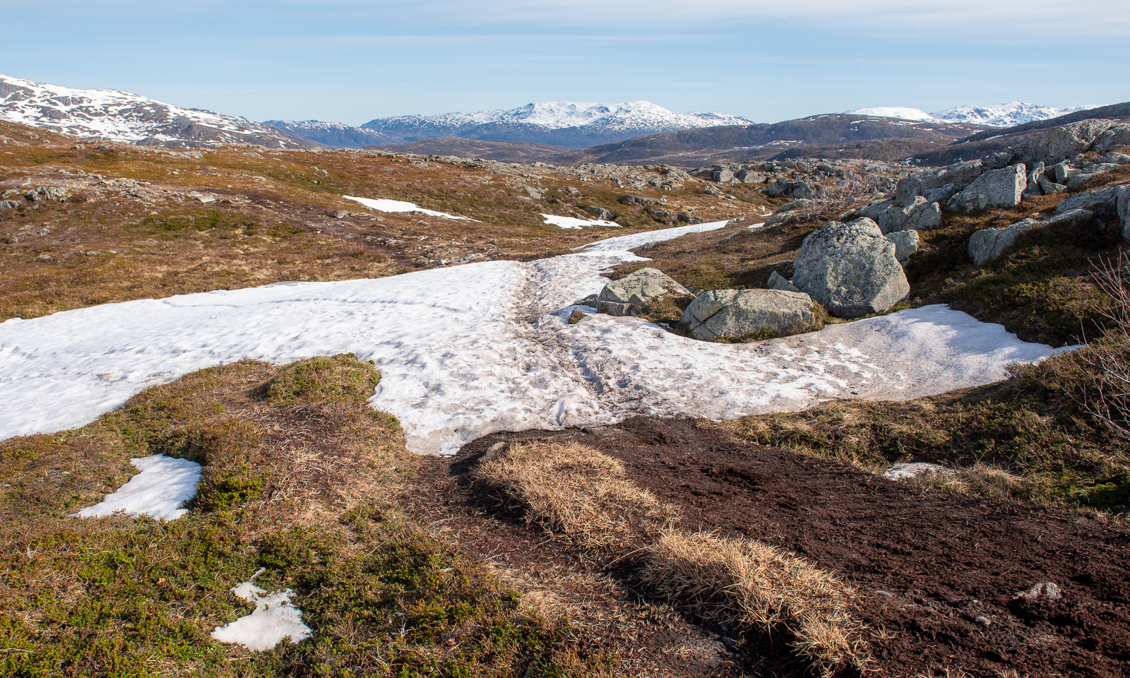
The further up I go, the more the terrain is covered in snow. The barren sections show, how popular this hike is: the track is several metres wide.
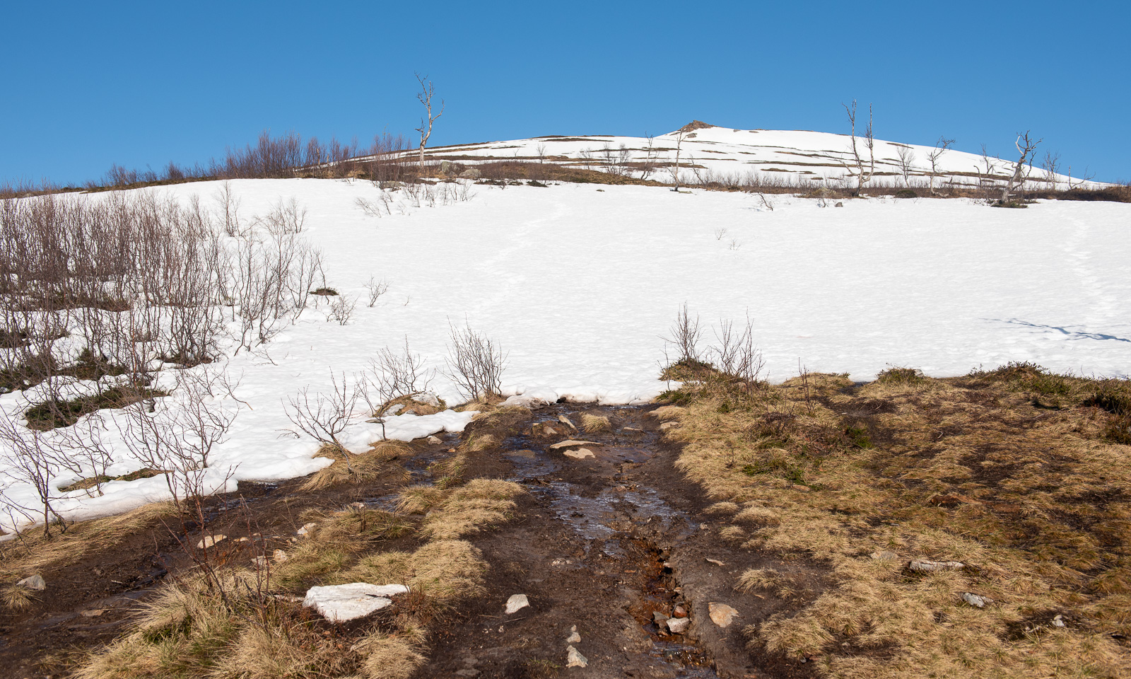
Now I am above the timber line and snow dominates the scene. Mostly it is good to walk on and I do not sink in too much, but there are some nasty holes, especially above the mountain brooks, where you can easily break through up to your thighs. I’m on a gentle slope, angled at 10–15°.
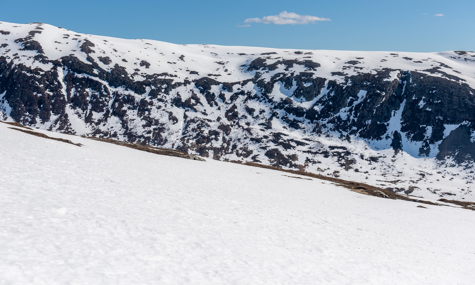
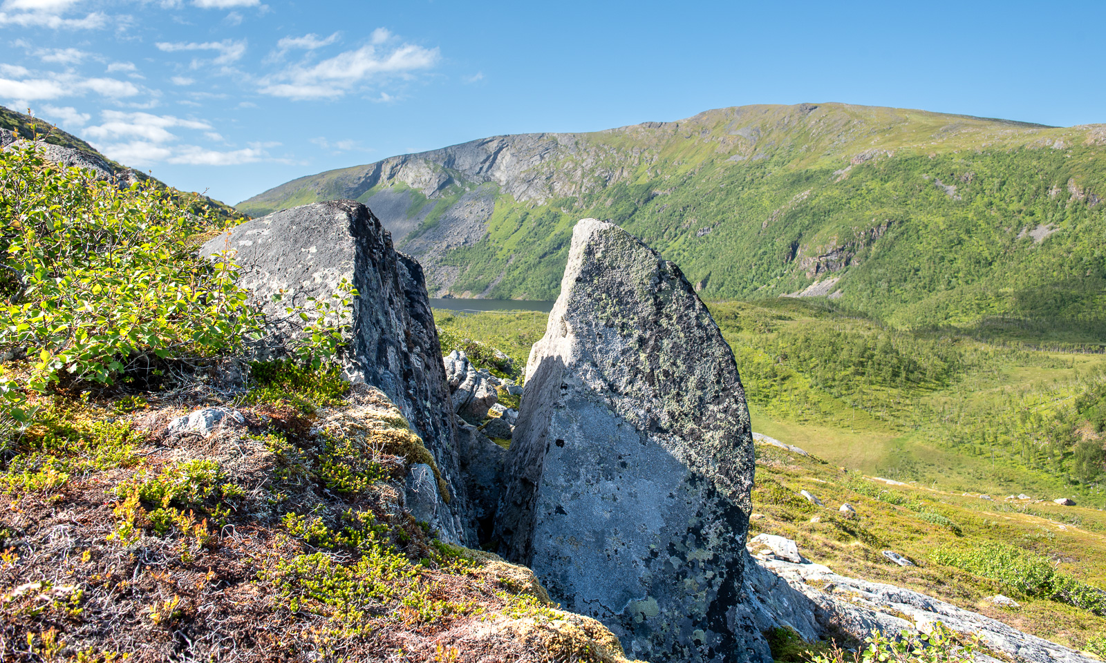
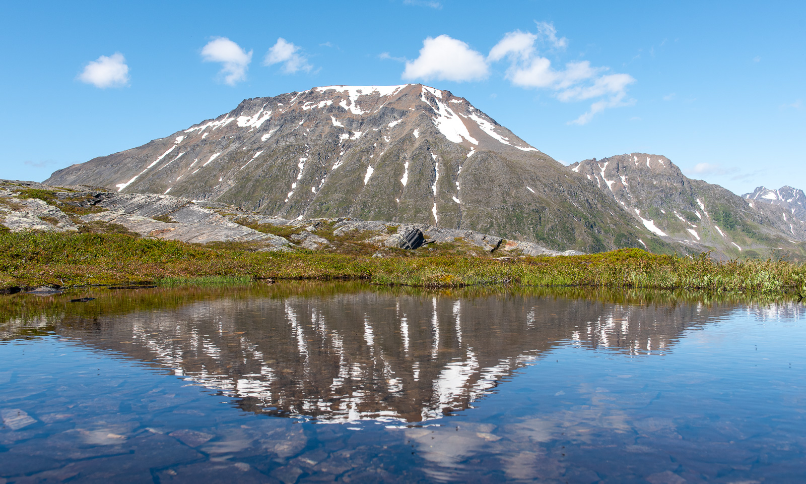
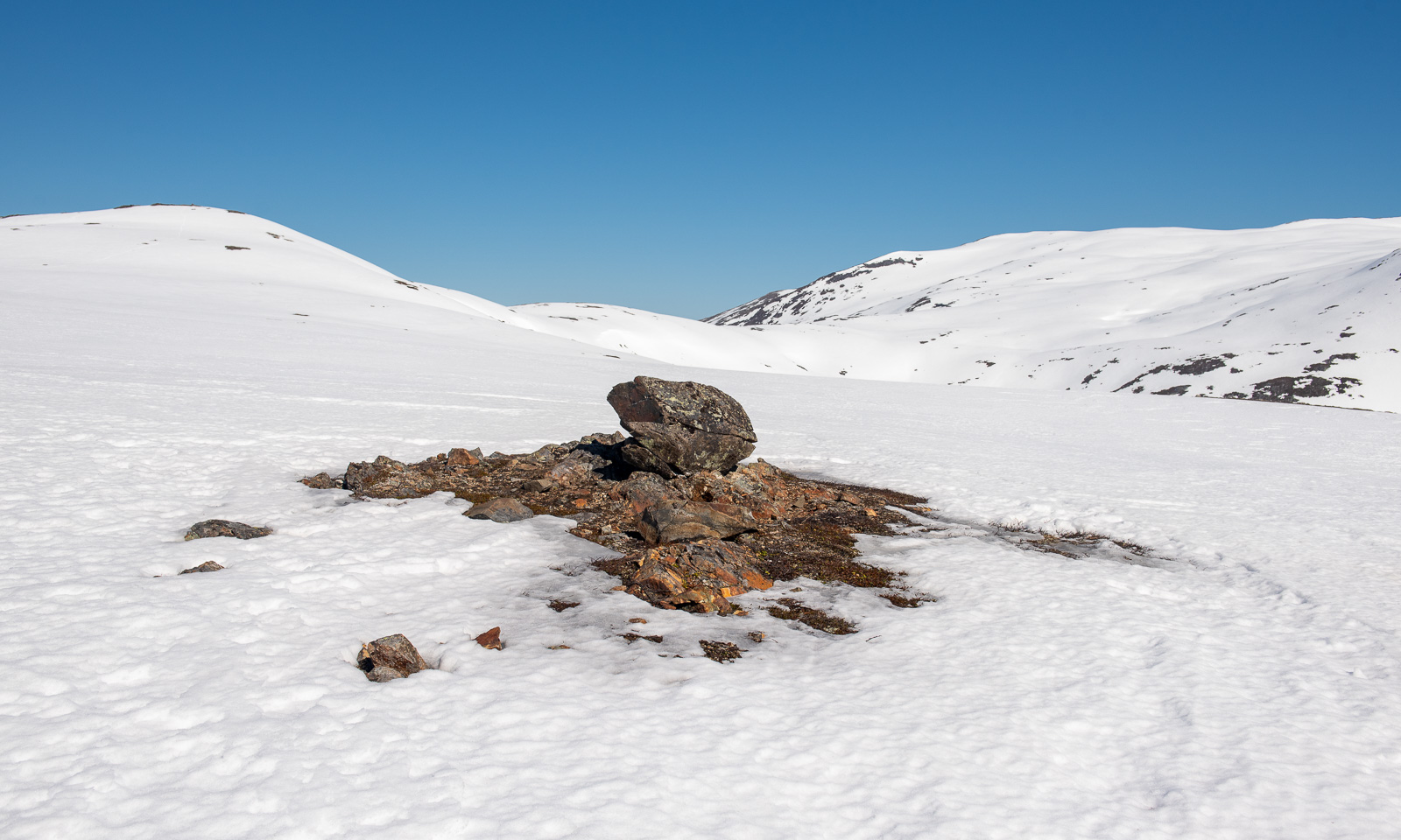
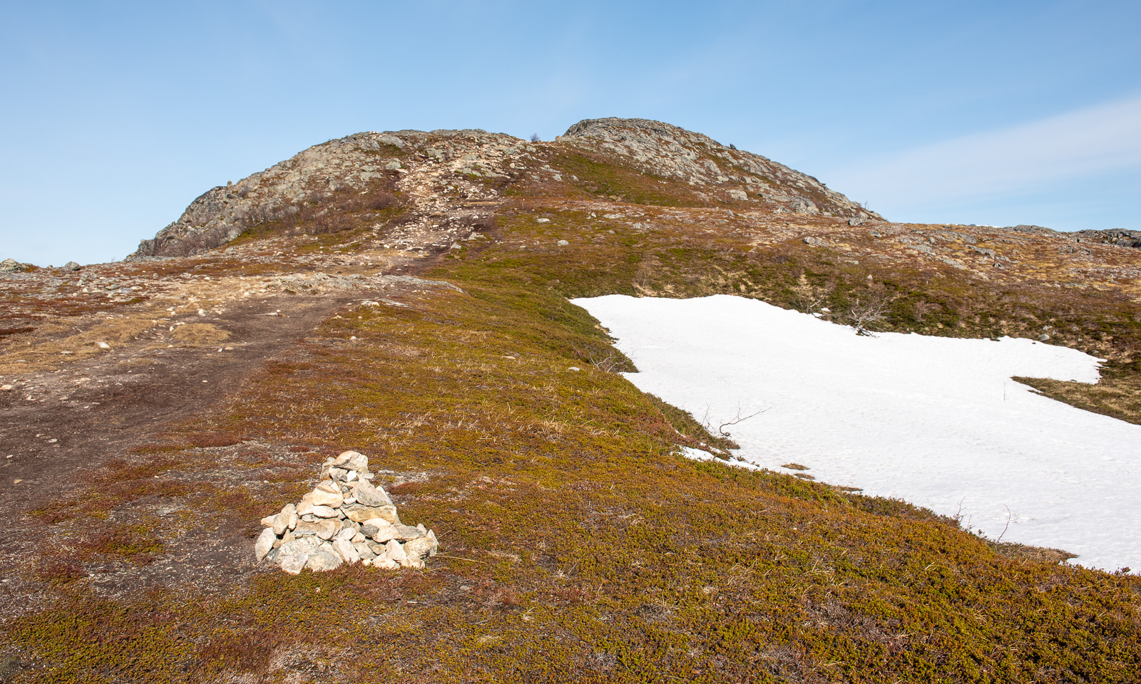
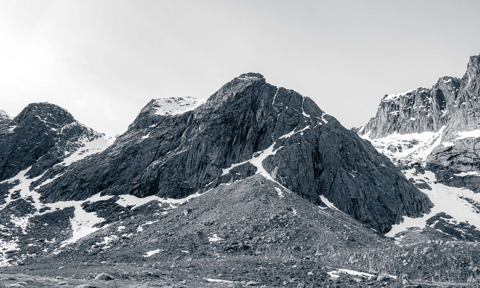
I reach the saddle below the peak. In summer the path gets steeper and rockier, now all I can see is the peak and snow. The snowy slope is pretty steep.
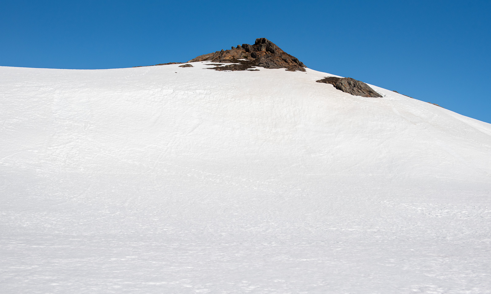
I wasn’t the first one today. I met an elderly man who was already on the way down. Perhaps it’s his footsteps that I follow now on the way up. At the steeper part I use my hands as well. Then I reach the top plateau, cross another snow field and stand on the surprisingly unimpressive peak.
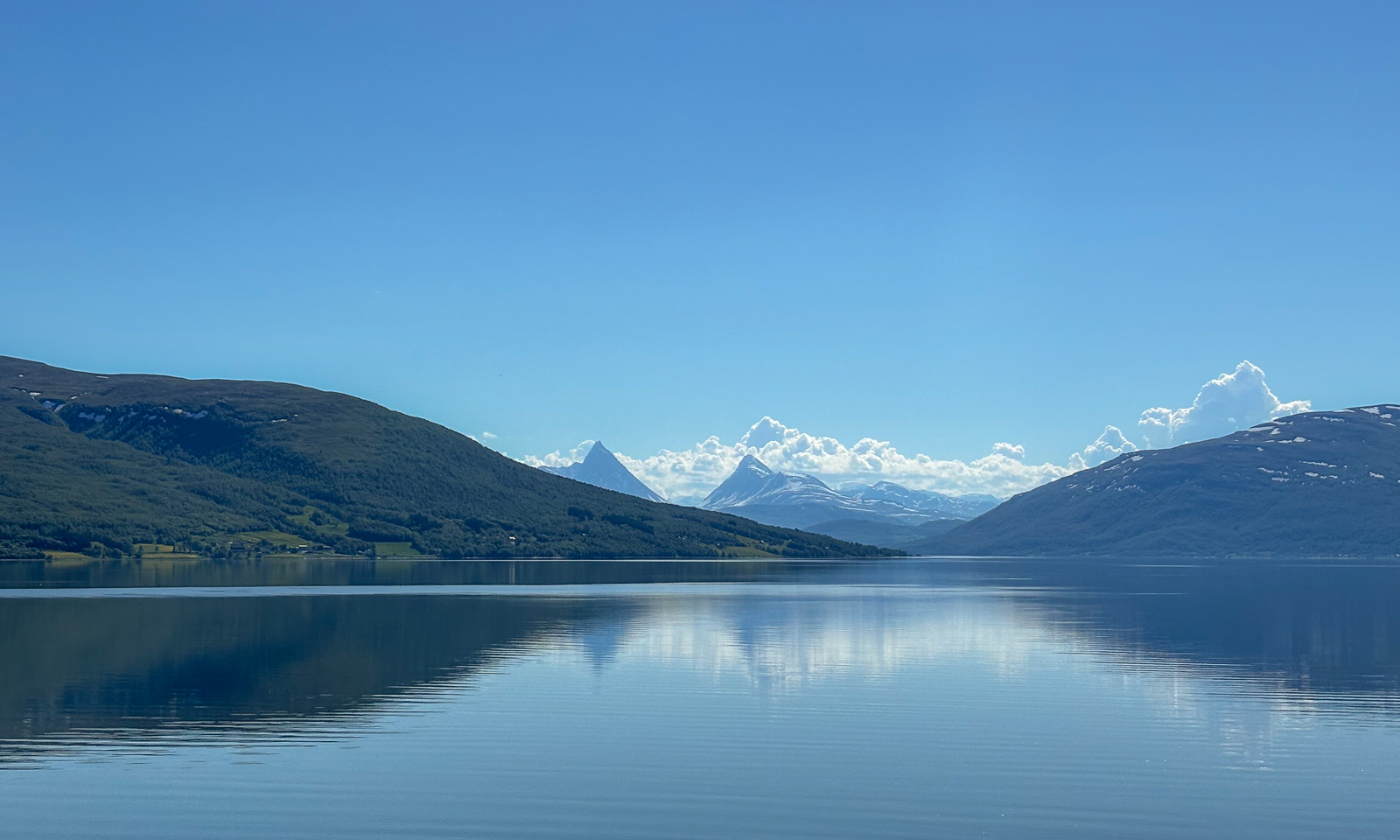
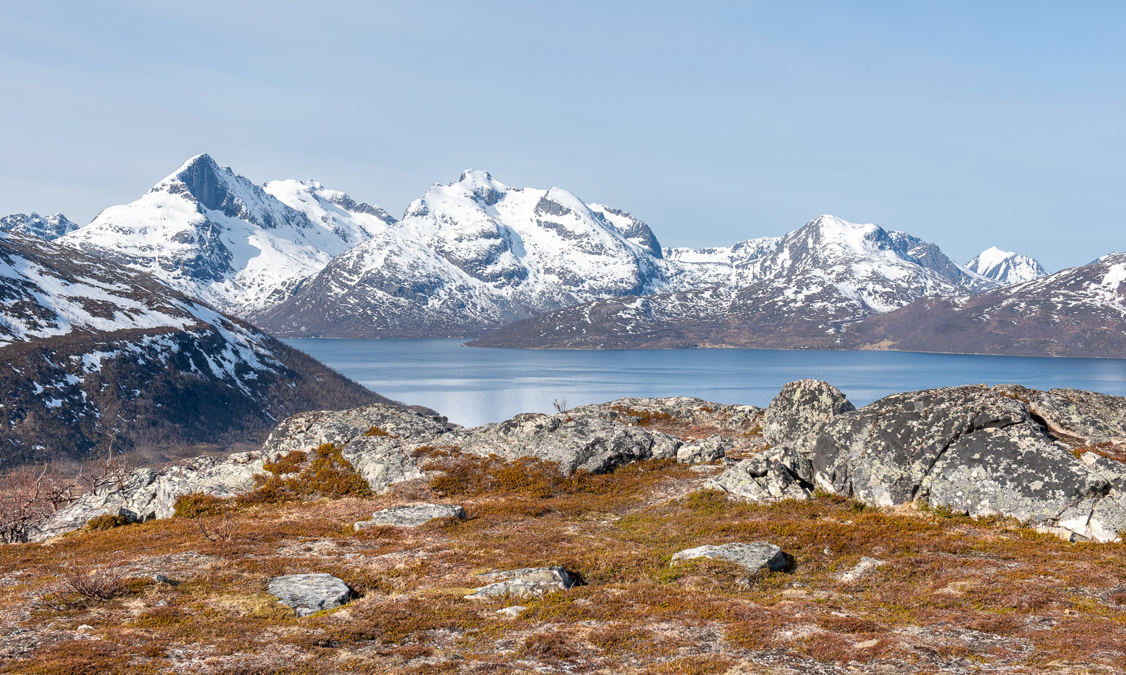
The impressive part are the views, especially to the west and the north.
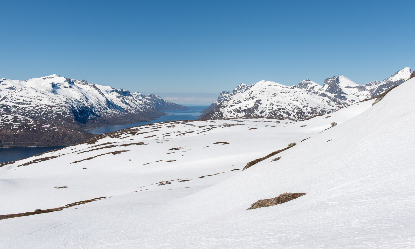
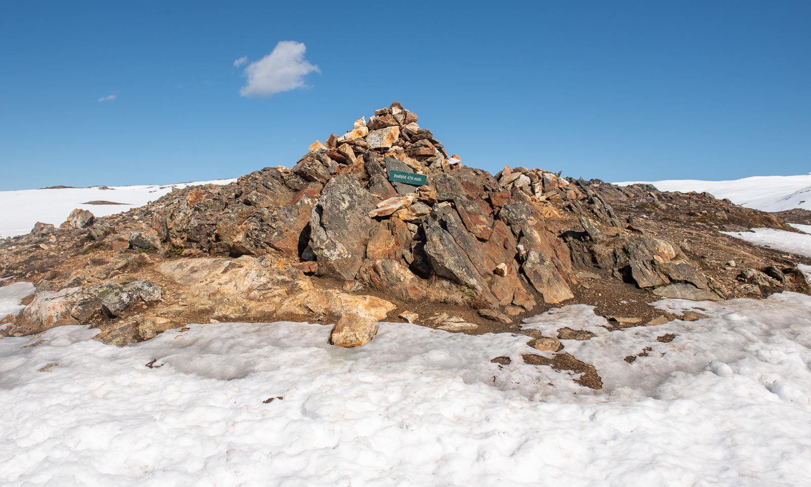
At the tall cairn from where I can see Kaldfjorden meet the open sea is my turning point today. If I had skis or at least snowshoes I would continue. Without then, it’s time to return.
This hill walk was 7.2 km long. Elevation gain and loss: about 500 metres.
The weather is still sunny while I am editing the photos. In one of the photos I can see a small figure – the man who passed me on my way up. On his left side he has something blueish. I magnify the photo to 400%. It’s a pair of blue snowshoes strapped to his small backpack.
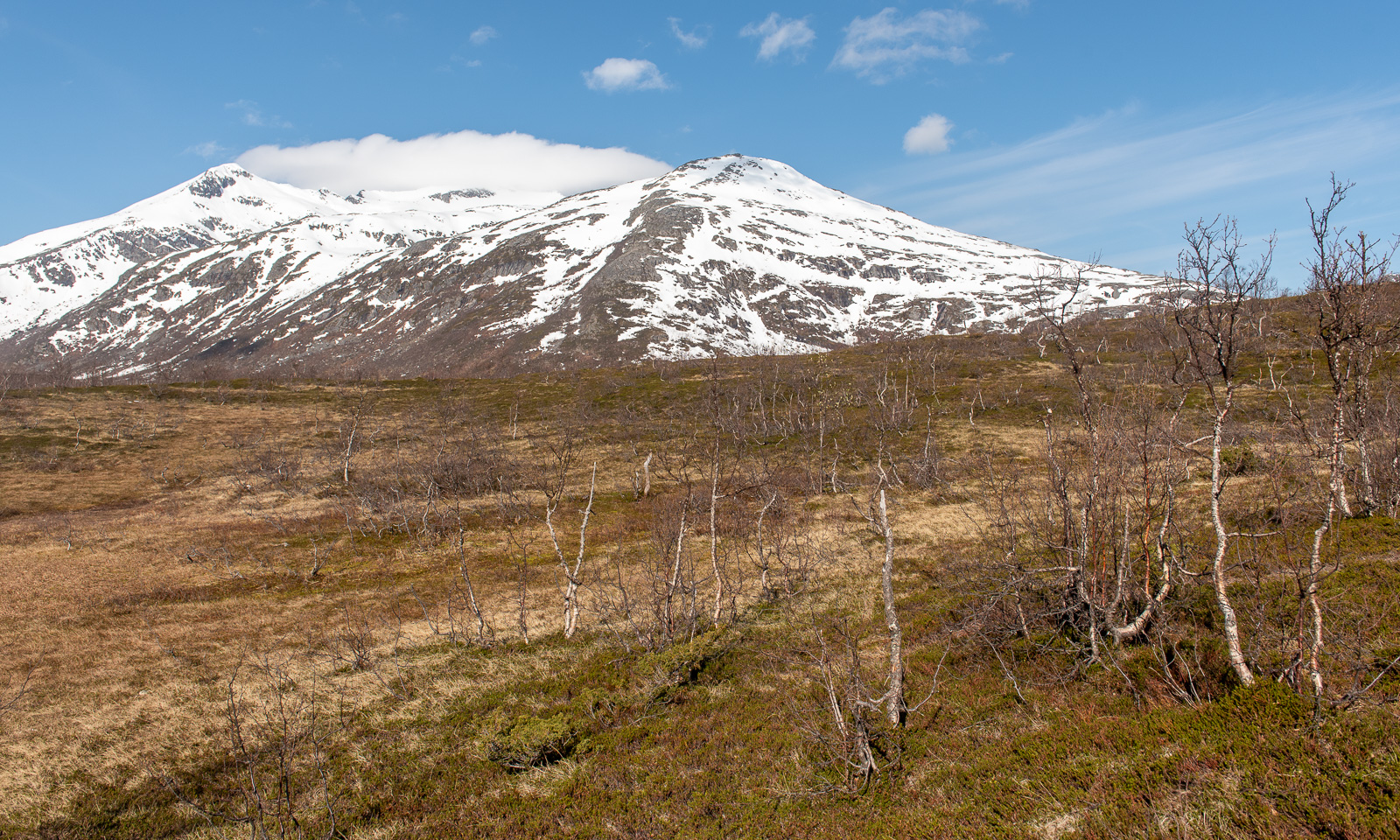
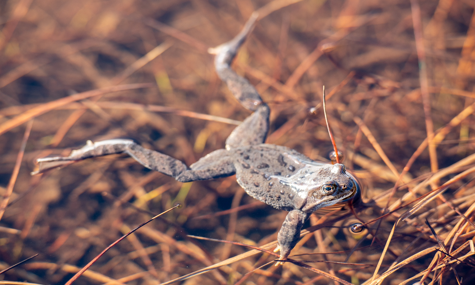
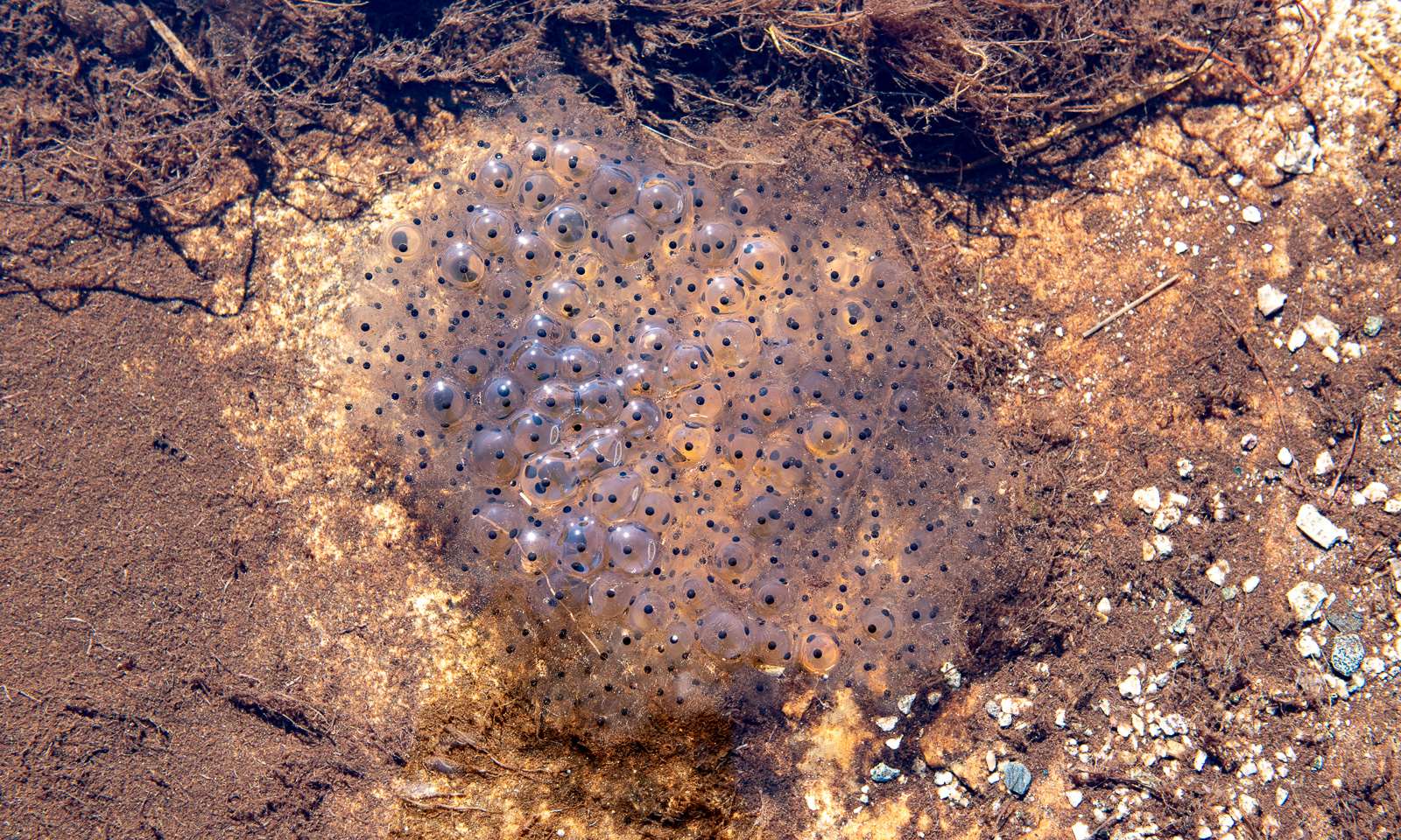
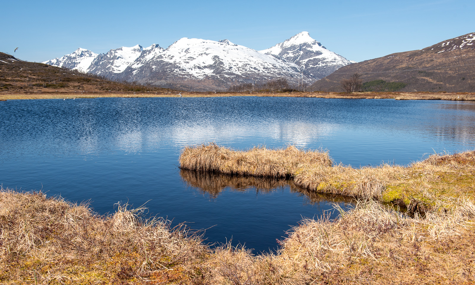
Today I decided to hike up another small mountain. It is called Nattmålsfjellet and is 296 m high. As Trehørningen it is on the island of Kvaløya.
I park my car and soon I am out in nature in Northern Norway. High mountains, covered with snow. Open birch woodland, the birches still bare. Small lakes and ponds, halfway covered with snow and ice. Small mud bogs with wet patches. And views of the fjords and the open sea. All under a blue sky with temperatures above 10 °C.
While this pond looks freezing cold, it is inhabited by common frogs. They have already spawned and large clumps of frogspawn are floating in the water.
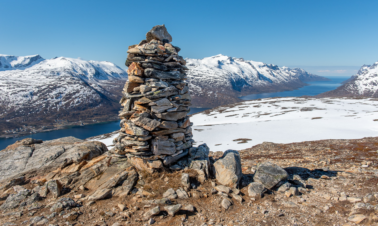
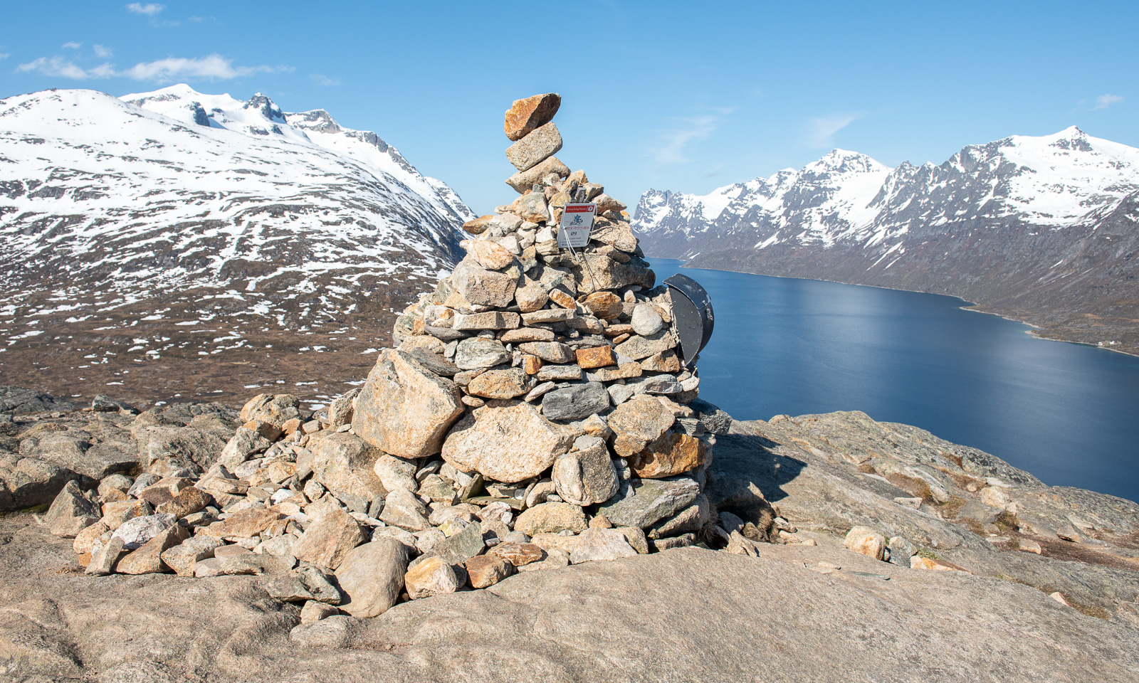
It does not take long and I am on the summit, marked by an impressive cairn that looks half as high as the mountain itself.
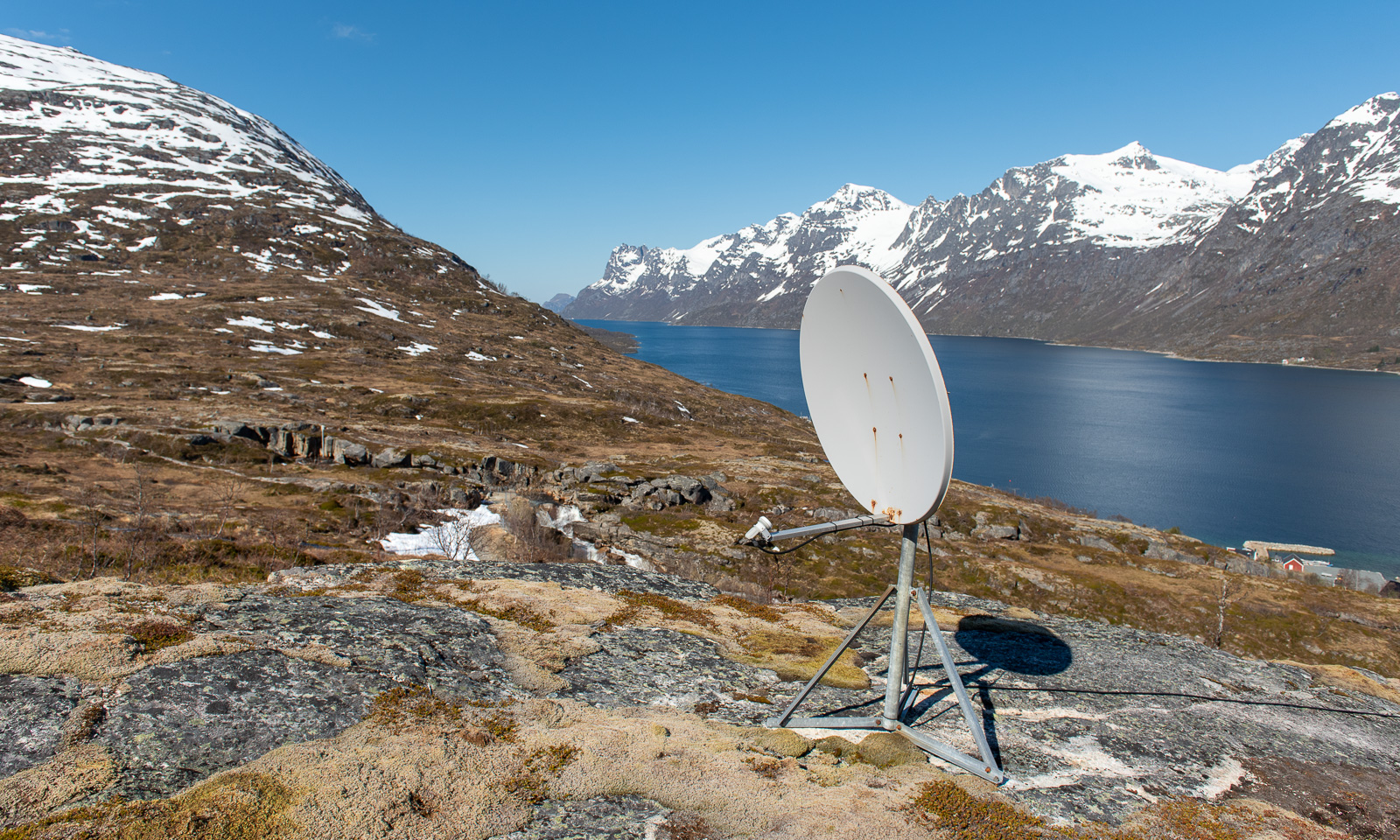
I decide to take another way down. This brings me near the village Ersfjordbotn, but I stay above to follow a track that leads around Nattmålsfjellet which brings me back to my car. Before I leave the village behind I pass this artefact that clearly shows that I’m hiking in nature but not in the wilderness. Someone had mounted a satellite antenna on a small ledge. The cable leads downwards, probably to one of the houses.
First the track leads through some wet mud bogs but then it winds through an open landscape with views of the boggy grasslands below and the snowy mountains above.
After seven kilometres, I am back at the car. Elevation gain and loss – round 330 m.
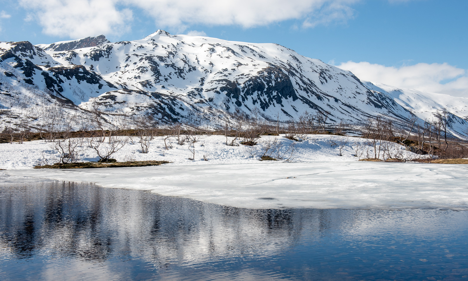
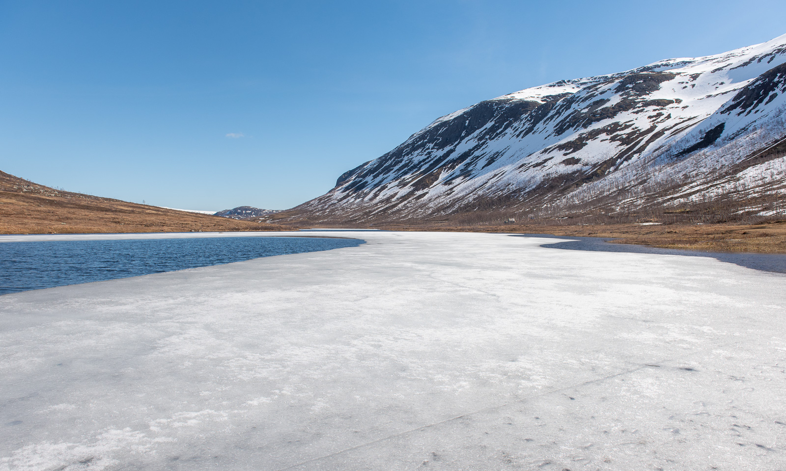
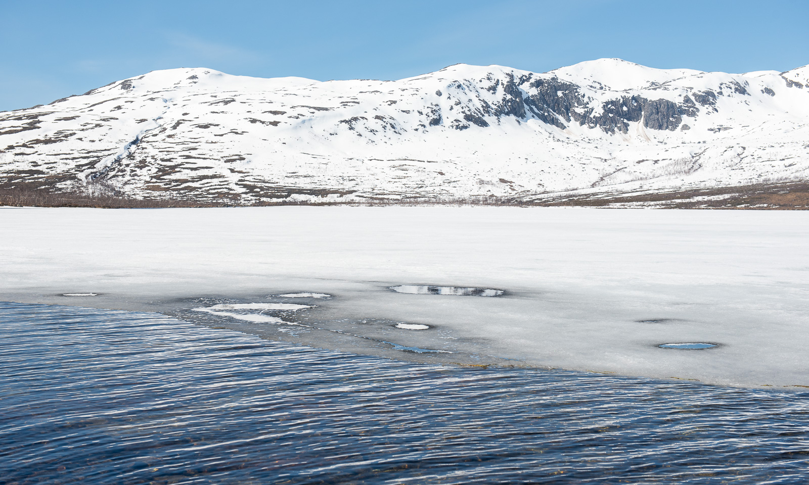
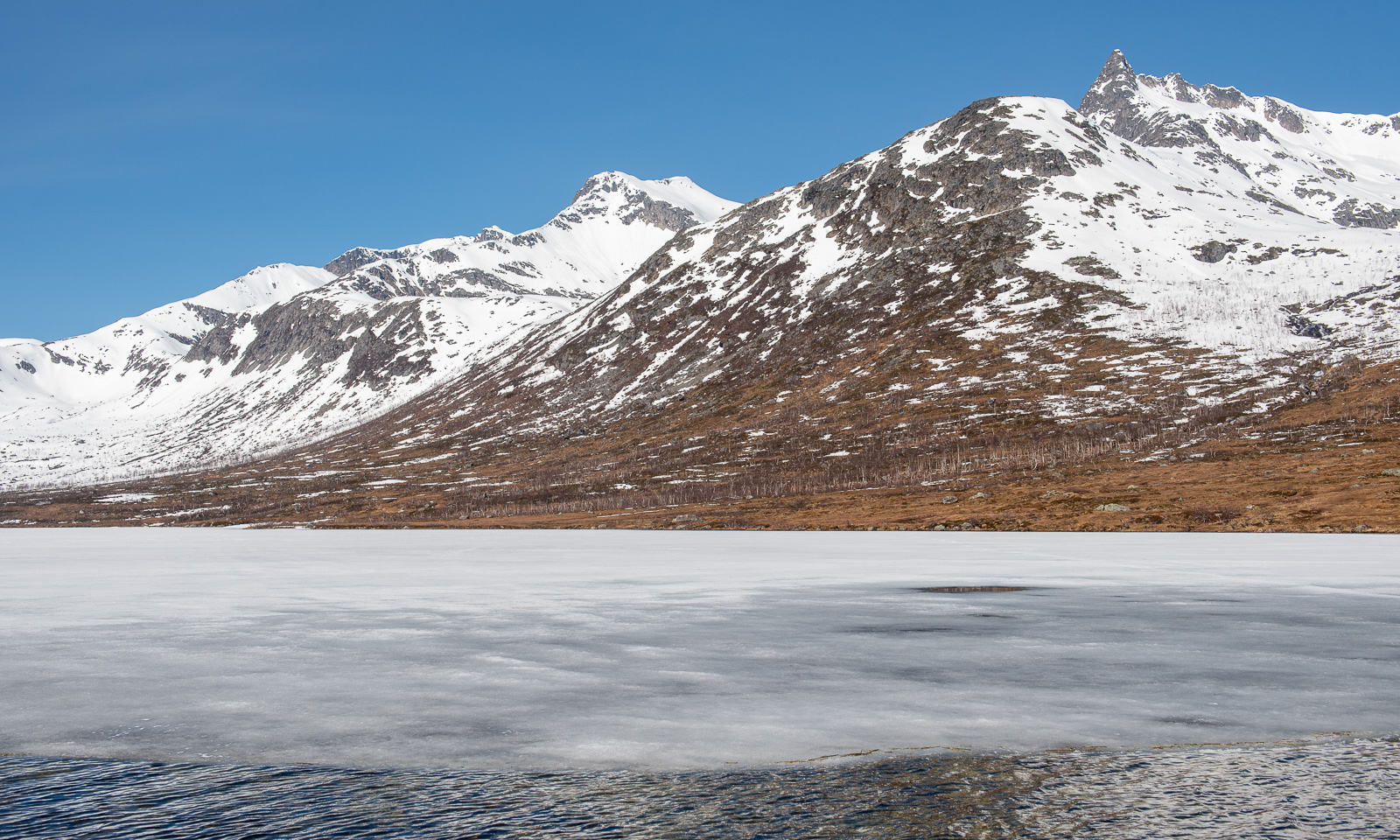
After the hike I drive further west to the lake Kattfjordvatnet. Most of it is still covered with ice, but I don’t think it will stay long. Even the snow line rises with each day. This however is no argument for the locals to stop doing alpine ski tours and they always seem to find a snowy patch by the car, to avoid carrying up their skis. Meanwhile, cross-country skiers have now switched to roller skis and use the roads. Other locals walk their dogs or run downhill on the muddy path happily chatting to each other.
Then I take the car to Ersfjordbotn and stopped at the gravel car park at the viewpoint, apparently the only one in the village. I was too lazy to walk to the waterfall but at least I took a photo of the fjord Ersfjorden which faces directly west.
On my way back home I make another stop in Eidkjosen and take a walk uphill to Lomvatnet.
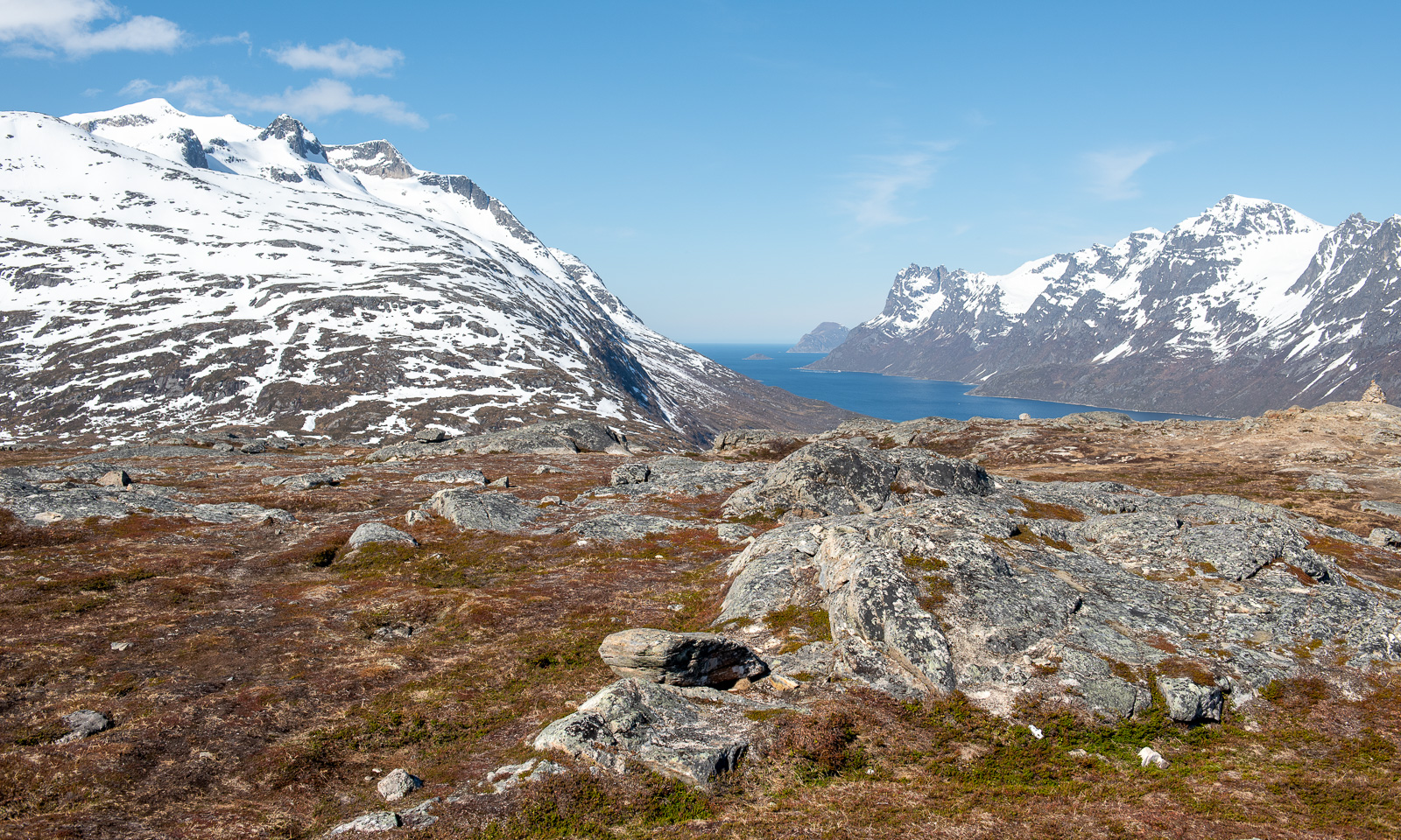
While the mountains around Tromsø are still snowy and the locals are still going ski touring I was looking for a mountain or hill that I can actually walk on by foot. On Facebook people were talking about Trehørningen, not the large one but the small and child-friendly one near Skulsfjord with an astonishing height of 283 metres. Today I drove there, because most places are not accessible by public transport which makes hiking a bit of a motor sport most of the time. I arrive at around half past eight and I’m the first there. After three minutes I and a bit of ascending, I get the first views of the fjord Gállafjerda or Kaldfjorden and the mountain range around the Store Blåmannen.
At first, the path is muddy but then the ground is much drier. The track leads up through an open forest of birch trees. They are still bare.
A bit further up, there is a plateau with a beautiful view of Gállafjerda and the mountains behind.
There are some small snow fields, but only one covers a few metres of the track.
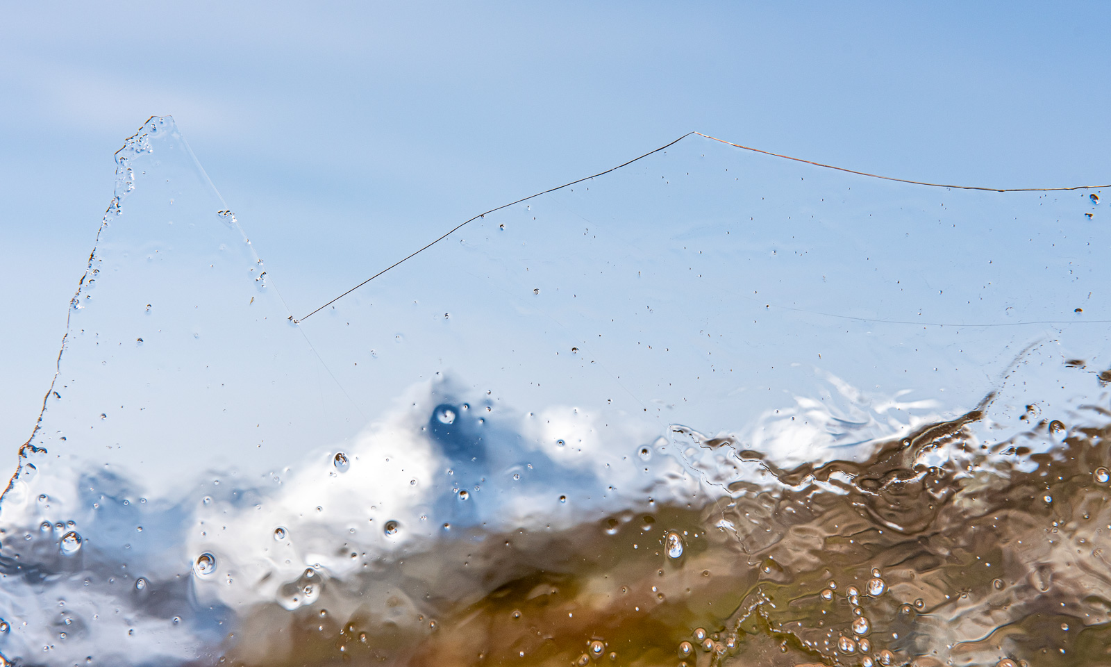
By that snow field there are some water-filled depressions. To my surprise a thin layer of ice covers these puddles. Was there frost last night?
While I am taking these pictures another hiker passes. I’m not alone anymore. Anyway, the mountaintop is near, as usual marked with a huge cairn.
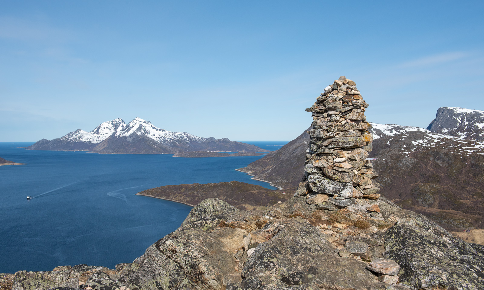
The view is awesome. In the background you can see the island Vengsøya with its mountain Kvantotinden. The island is surrounded by islets and skerries, behind that the Norwegian Sea.
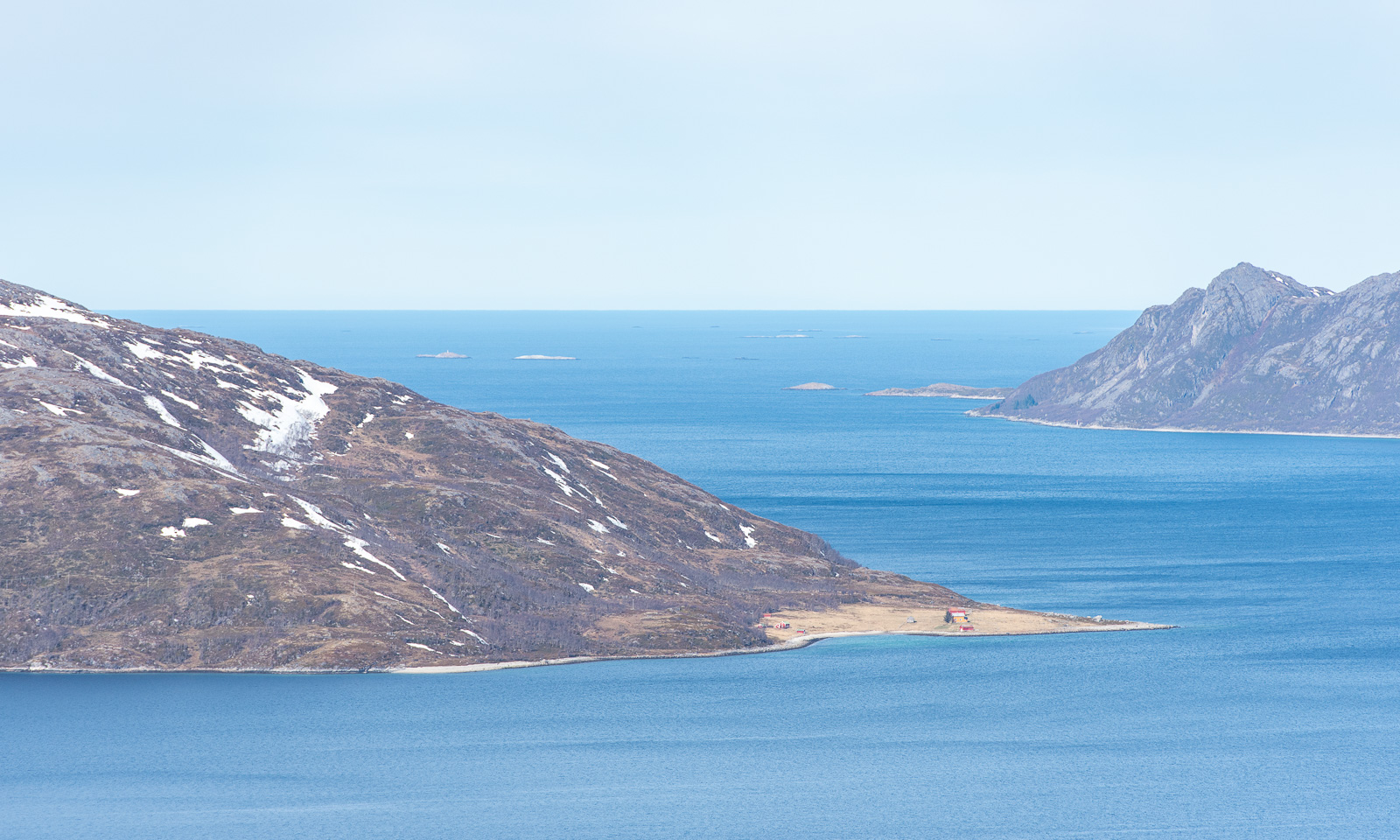
Vengsøya can be reached by ferry. It was just heading back while I was at the top.
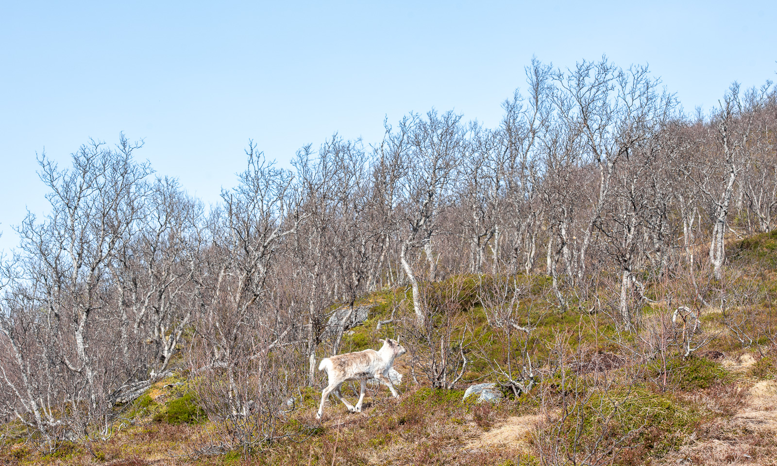
The sun makes the air feel warm but the wind on the top wins: The air is still cold and I put on my anorak again, hood over my head. As often, I take less photos on my way back. I only want to take another photo of the bare birches. While I looked through the viewfinder I saw a movement. A reindeer that I haven’t noticed before it trots into view. Does it want to be photographed? Probably not. It continued its walk carefully looking at me to see what I intend to do.
After a four-kilometre hike I am back at the car. Six other cars are parked there now. I liked the tour. It is easy and the parking area is just 20 km away from Tromsø so you could do it as a small after-work trip. You get clean air, awesome views and maybe – if you’re lucky – a reindeer trotting by.
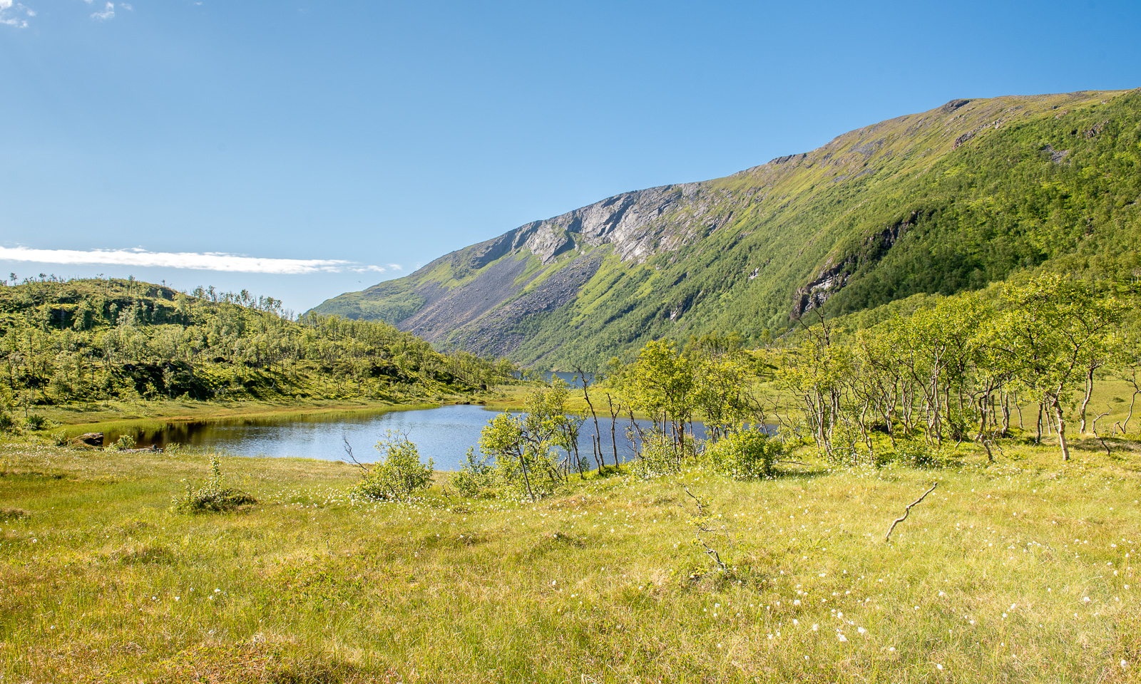
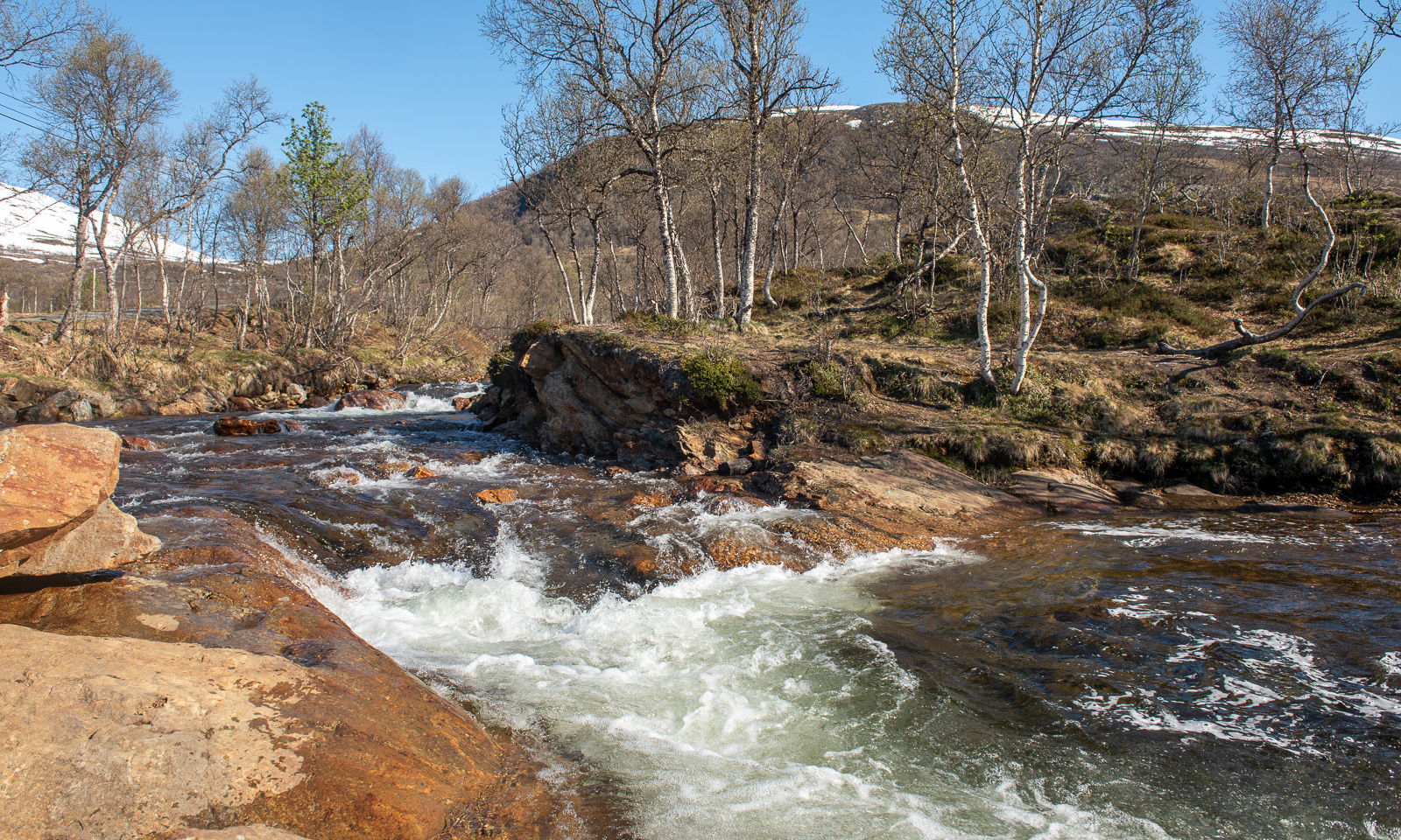
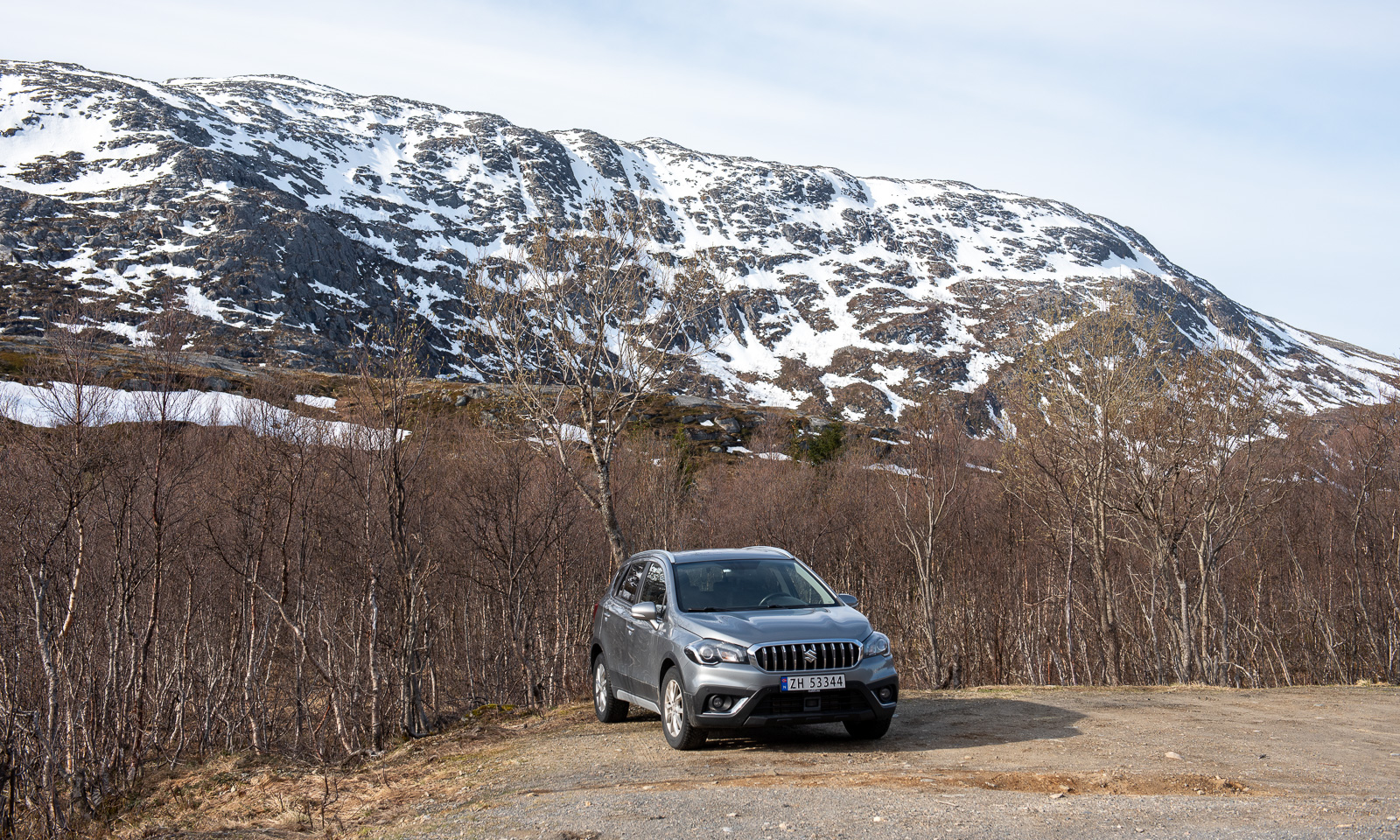
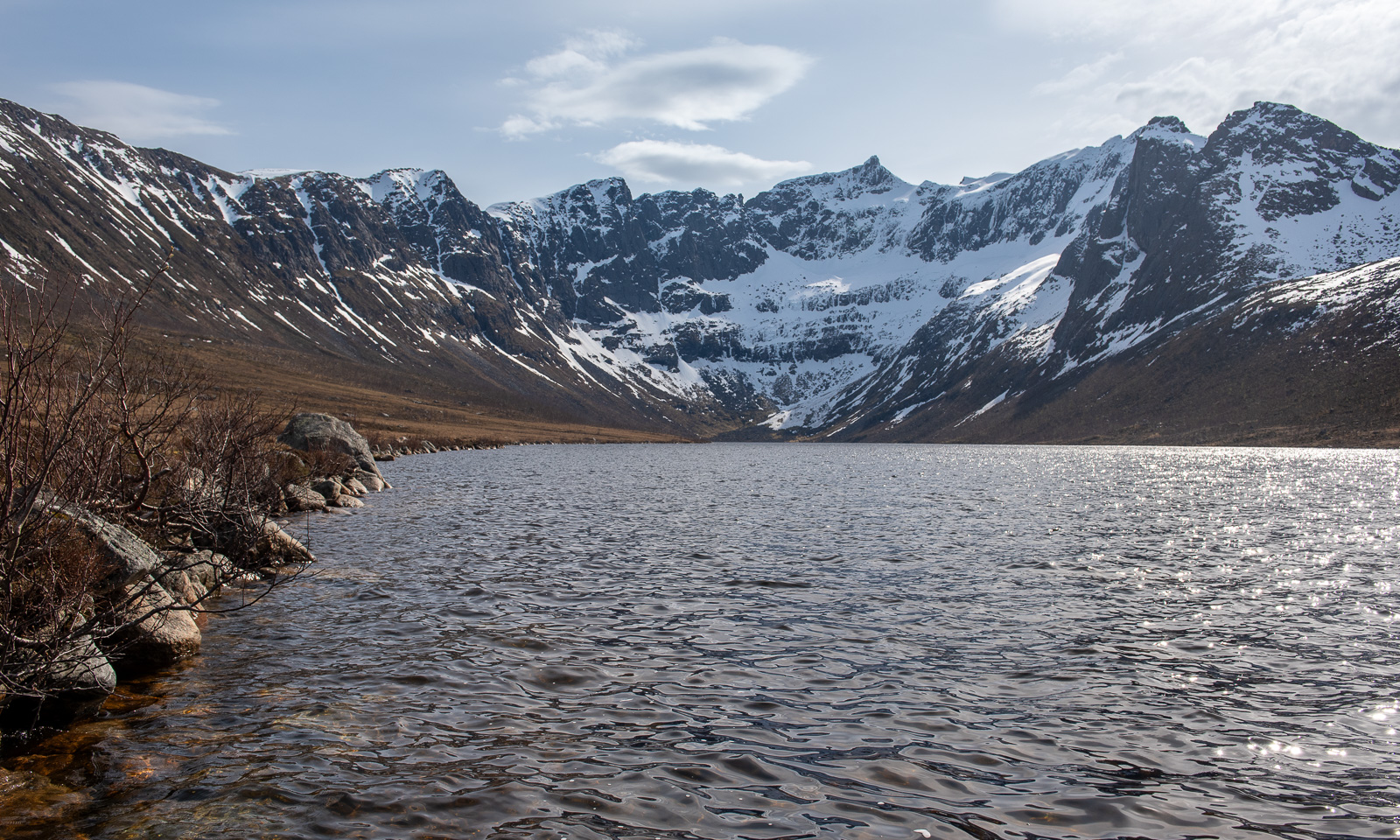
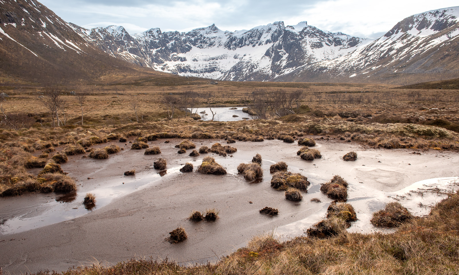
I had another tour in mind. A tour that could become pretty wet. I want to walk from Tromvik to the lake Storvatnet, but not on the track east from the river Storelva but instead crossing the mires and bogs. First I have to go there by car. Both Trehørningen and Tromvik are on the island Kvaløya but it’s a one hour drive. Remember, Kvaløya is the fifth largest island in mainland Norway. Then I put on waterproof clothes – you never know what happens and start my tour.
To make a long story short: I think, the lake is pretty boring. I took a souvenir photo, here it is. I guess this view is much nicer, when the lake is calm and the sun comes from the other direction.
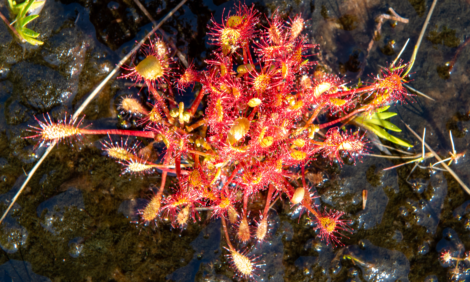
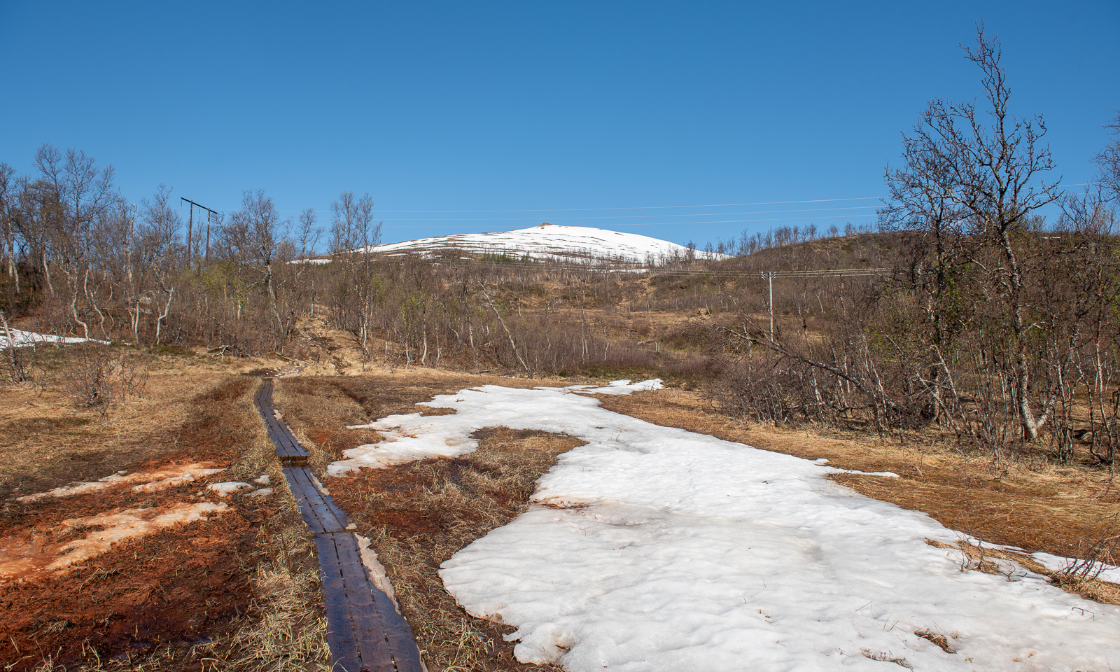
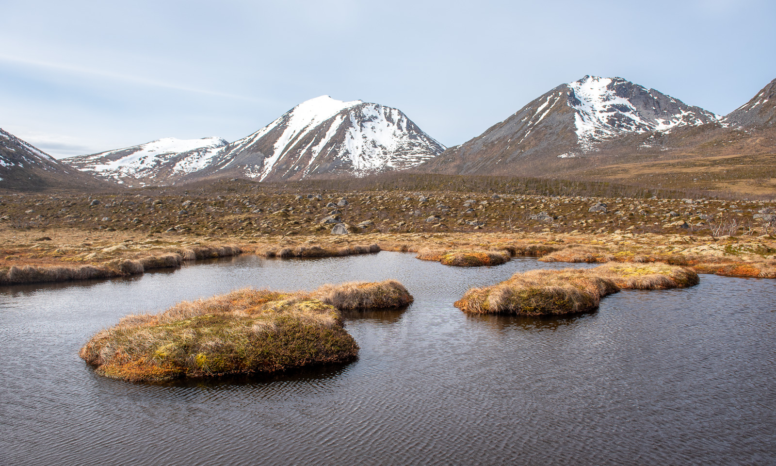
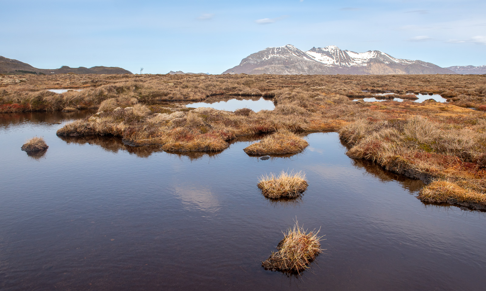
Much more interesting were all the small ponds with mossy islets and also the muddy peat flats with their scattered grass tussocks forming small islands. Pretty fascinating. Some photos:
After a six-kilometre hike – a pretty wet one – I am back at the car. I liked this tour, too and I plan to come back on a sunny night this summer. Then the sun should be low in the north illuminating the mountains behind Storvatnet. Hopefully …
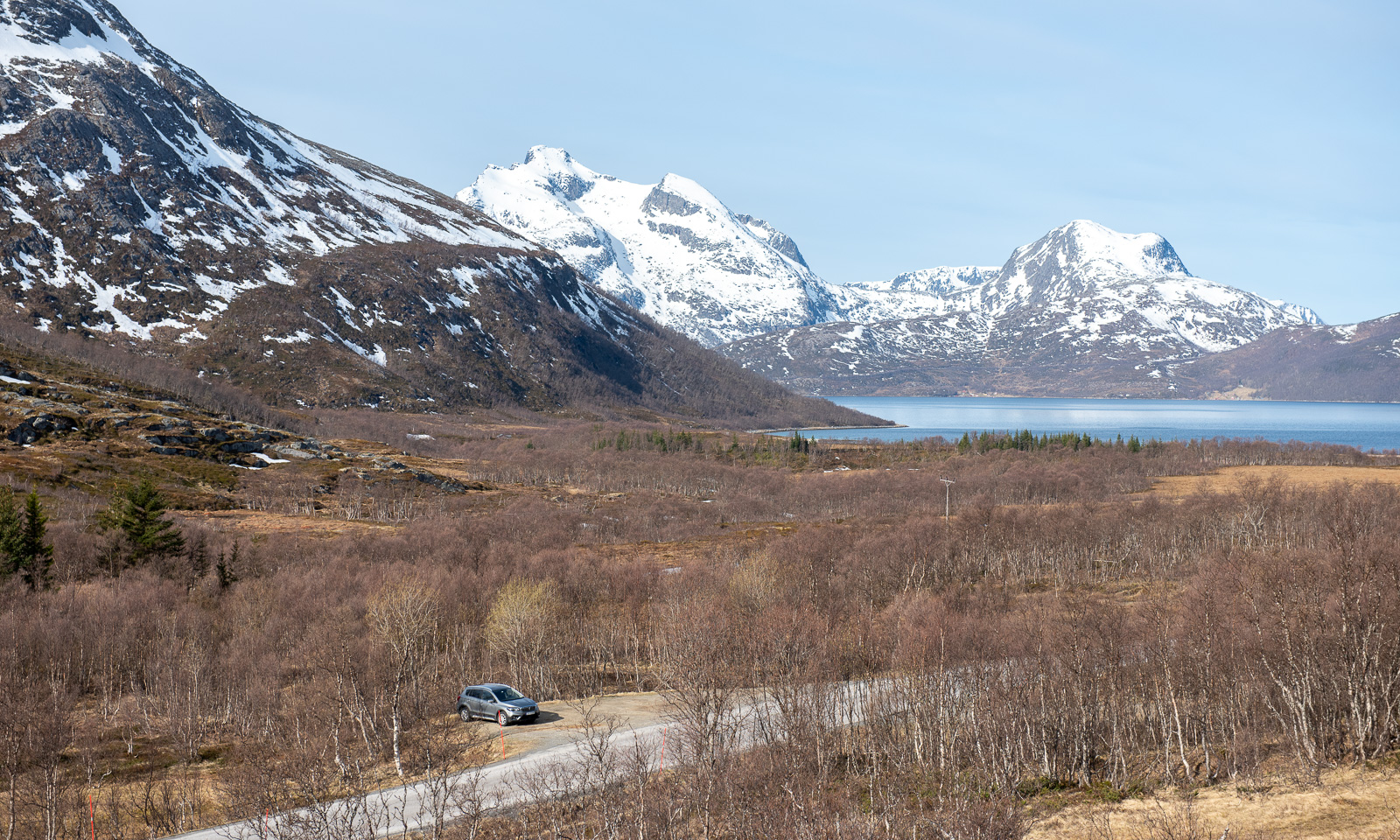
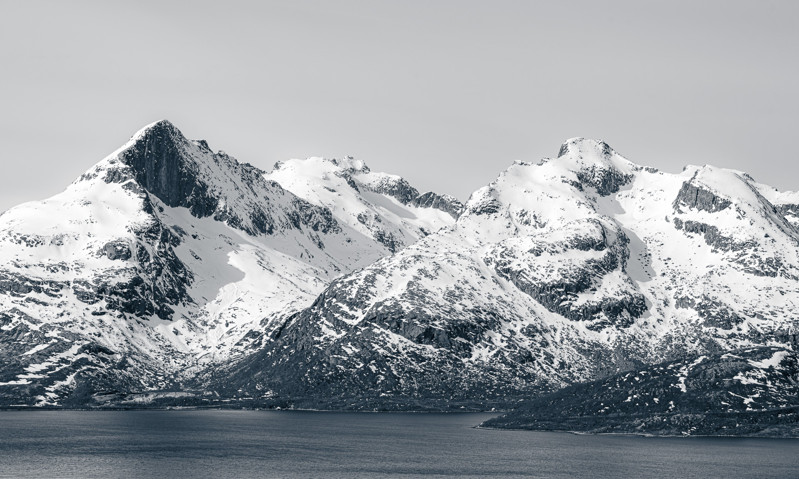
Some mountains and mountain ranges are extremely fascinating in their combination of white snow and rough rock. The first photo I took from Trehørningen, for the other two I stopped the car on my way to Tromvik.

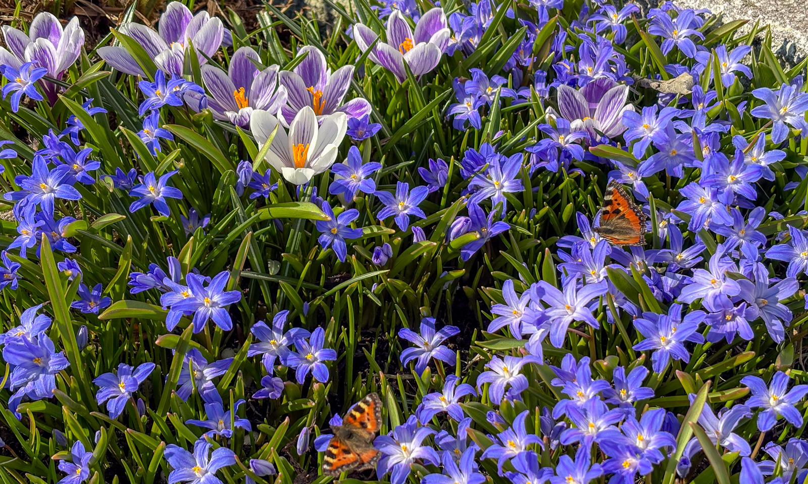
Saturday morning my car was covered with frost. But don’t be fooled by the photo, because winter in Tromsø is gone and in the lower parts of the city the wild flowers tussilago bloom everywhere together with planted flowers such as crocuses or scillas. The first butterflies and bumblebees fly from blossom to blossom and winter seems to be just a memory.


Yesterday my wife Annika and I went on a trip to Kvaløya.
With the flowers in mind I am surprised to see a thin layer of ice on the sea at the bay at Eidkjosen.

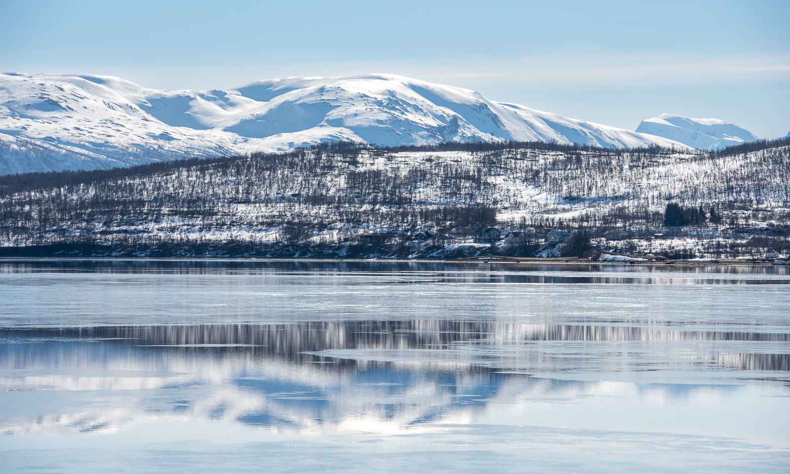
We take the road 862 to Sommarøya through the valley Kattfjorddalen. Although the elevation is only 150 metres, it is still winter here although the edge of the lake Kattfjordvatnet starts to melt. We see many cars with kayaks passing by while most cars parking here belong to ski tourers.

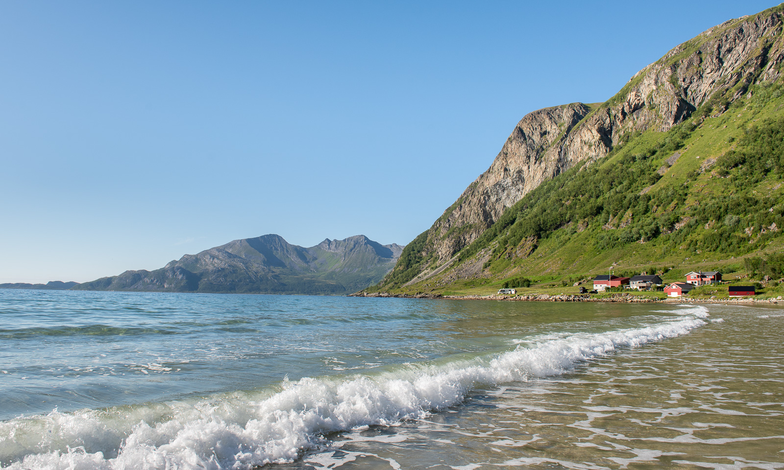
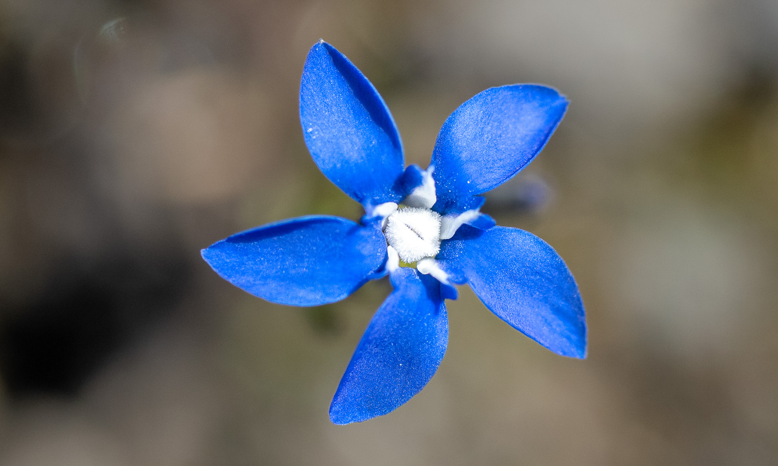
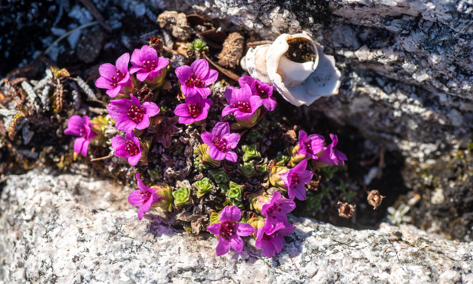
We park our car before the tunnel and walk along some sandy beaches. The sun is warm enough that we walk back in T-Shirts. On one of the hills I spot another flower that uses to bloom quite early – the purple saxifrage, one of the northernmost plants in the world.


Next stop is Sommarøya were we take a short circular tour. Beside of some patches all snow is gone. On the water there are large flocks of common eiders – you can hear them from everywhere.


Back again through Kattfjorddalen. Some skiers return, others just start their tour, while tourists are standing around enjoying the scenery which is probably very exotic to many of them.

We turn left and head to Tromvik to visit the café Søstrene Kafè. It is quite a detour but it is worth it – both for the scenery and the café. And yes – I like the harbour, too.


Finally I take a detour by car to the village Rekvik. The road is pretty rough, but again the scenery is awesome.

From here it is 53 km home. I drive back without further stops. We have seen a lot and it is fair to call the tour “Norway in a nutshell”. Only the mammals were missing. No reindeer, no seals and no otters.
Note: the text is just a draft. I publish the article anyway and will polish it later.
The morning is cold. -14 °C. The sea has been freezing over. At the horizon lies a layer of clouds. Will they bring snow? Ice fog indicates open water. Later this morning I walk Spåret, the local circular hiking trail. There is hardly any snow, but the ice on the ponds is covered with frost patterns.


The weather has changed back from winter to autumn. Rain and storm dominate. The crushed sea ice gathers in our bay and big waves roll up the beach of Vitskärsudden. Even the last tiny bit of snow has gone.


We got some centimetres of snow and Vitskärsudden looks completely different. Our plan to take the car to the inland with our German guests however was stopped by the weather. Too slippery the wet and icy roads. At least we make it to Umeå, where parts of the river Umeälven are frozen over.


The snow is gone. On 4 December my wife Annika and I leave our house behind …


… and we are on our way to Tromsø. First stop is the village Gagsmark in Sweden, where we visit friends and stay over night. Next morning we continue our journey. We pass Piteå and Luleå, leave the E4 in Töre and take lunch in Vippabacken, a small restaurant with a back-room museum. We buy food in Pajala and cross the border to Finland. We stay the night in the village Palojoensuu.


The road between Palojoensuu (FIN) to Kilpisjärvi (FIN) is lonely. Beside of the village Karesuvanto (population: 140) hardly anyone seems to live here and only a few other cars pass. As soon as we cross the border to Norway snowy mountain ranges come into view. Near Skibotn we see the first fjord and at a quarter past two we arrive in Tromsø.
Next day is the second Sunday of advent but I only have a single candle. I have to cheat with a mirror.


I am member of two choirs and Christmas is near. That results in a pretty busy week, where I have three rehearsals and three concerts beside of my regular work. The first concert is in the hospital, which is in walking distance. While Obbola was free of snow 60 cm lie in Tromsø.


After the second concert, this time with the Sami choir Romssa Rástát we got Northern lights. Annika and I watch them from the balcony. I try to make photos with my Nikon and a tripod as well, but the aurora has weakened and I had some camera issues.


On Saturday we open the skiing season. It is polar night, so we ski round noon, when it isn’t dark. In the evening I am singing the last concert, this time with the choir Ultima Thule in the Tromsø Cathedral, a wooden church in the very centre of Tromsø.


On Sunday Annika travels back to Obbola. I will take bus and train a week later (that’s tomorrow) and spend the rest of the year there, too. Will we get a white Christmas? Probably not. It is plus degrees and rainy weather both in Tromsø and in Obbola. While the Christmas decoration in the office building looks cozy, the streets in the centre of Tromsø don’t. Brown ice and sleet and water puddles dominate and it is extremely slippery.


On Thursday I have a special workplace: The research ice breaking vessel Kronprins Haakon lies in the port of Tromsø for two days. I walk down with my spiked Icebug shoes. On board of the ship I test some of my software components that read from the ship’s systems. It is always a relief to see your software to work in real life, not only with simulations. And I get a free lunch :-) . I get a bit nostalgic. I joined three scientific cruises on board of this ship. Will I ever join a cruise again, standing on the helicopter deck while we break through the ice? I hope so.
A photo of another Northern light in the evening ends this photo series.


This article is part of the series “2025-10: Northern Scotland”.
My wife Annika and I have stayed in a hostel in the center of Thurso. If you took a ship from here and head north you could reach the North Pole without crossing any land mass. We however have no ship, but a rental car and after breakfast we continue our road trip westward.
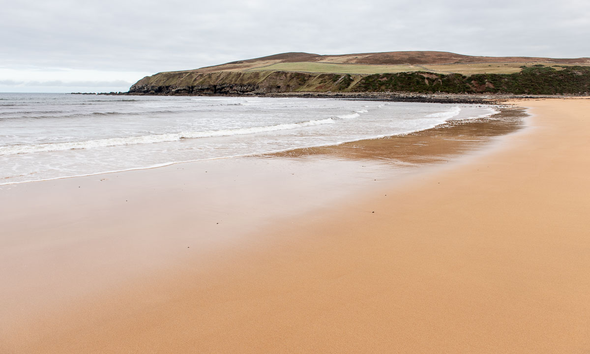
Our first stop is Melvick Beach, where we go for a walk. The beach is embedded in a bay. At the eastern end Halladale River flows into the sea. In this section of the beach it smells bad, because large amounts of rotten seaweed cover the sand. Maybe it was torn from the sea by Storm Amy a fortnight ago.

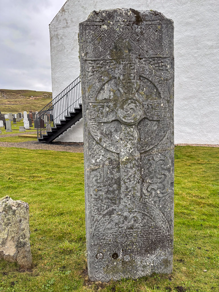
Our next stop is Bettyhill, just 20 km to the west. While there is a beach here as well – we come to this later – there is something else to see: Erected in the Bettyhill Cemetery there is an ancient Pictish symbol stone, the Farr Stone. It is dated to around the year 800. Little is known about the Picts. That makes this carved stone all the more mysterious.
The old tombstones from the 17th century are pretty impressive as well with their pictogram-like symbols: The hourglass, the bell, the coffin, the skull with crossbones and grave-digging tools. When this tombstone was carved, Johann Sebastian Bach was still alive.

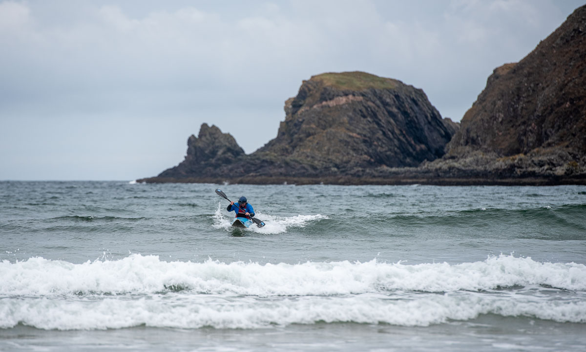
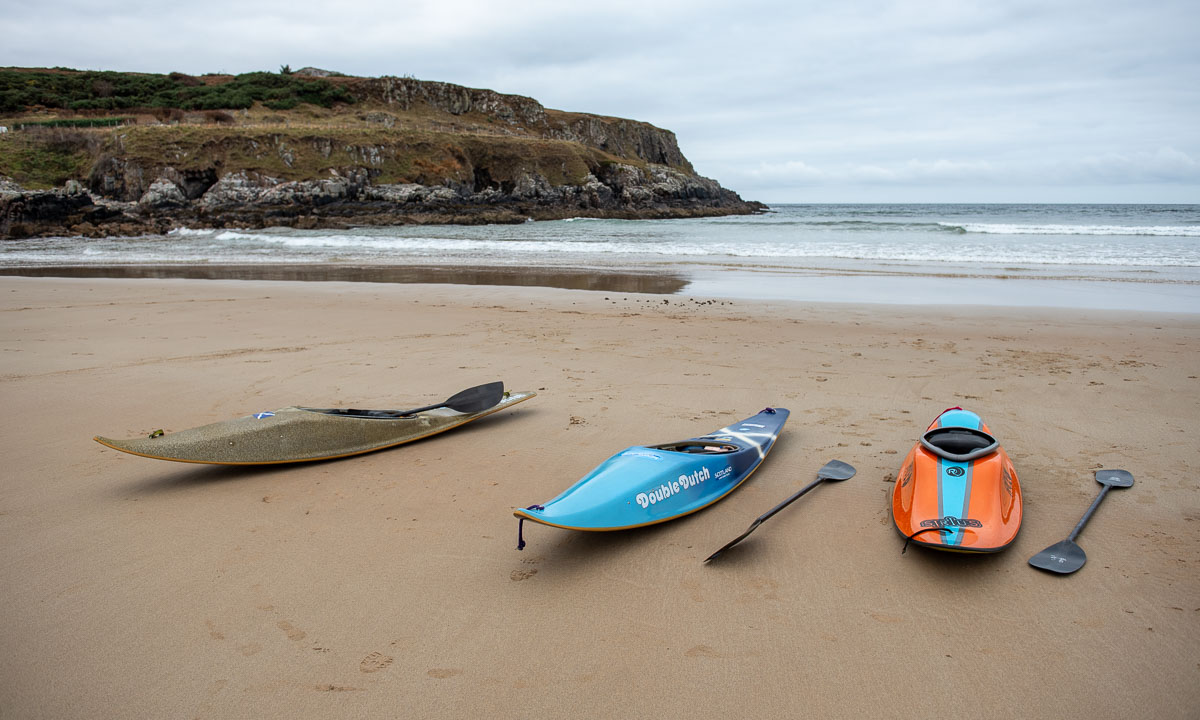
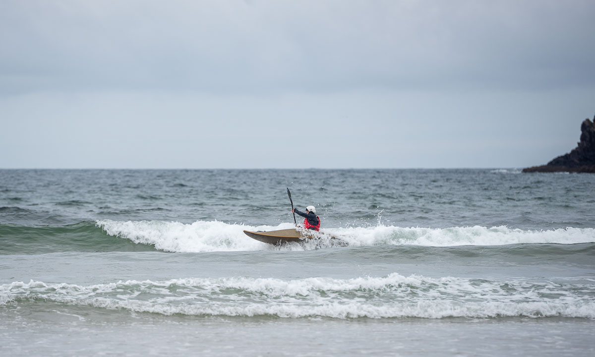
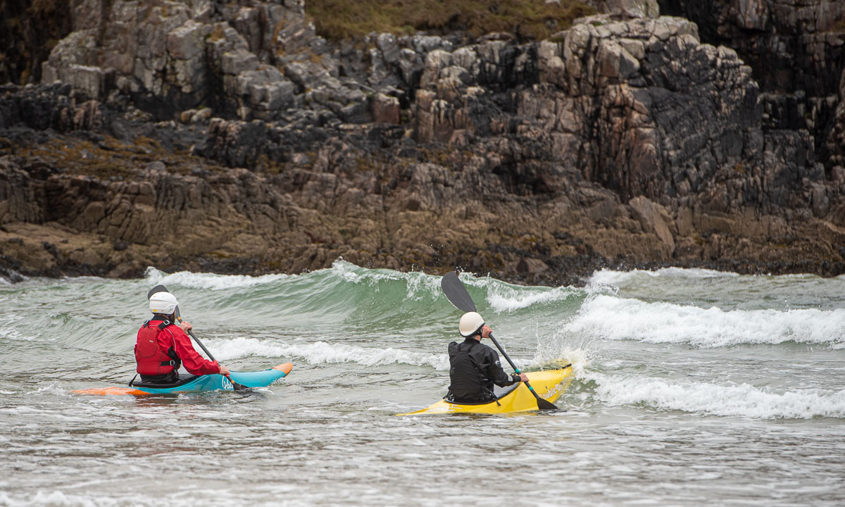
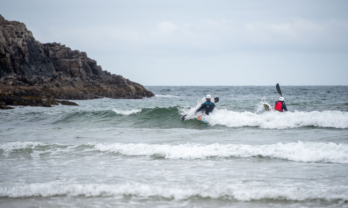
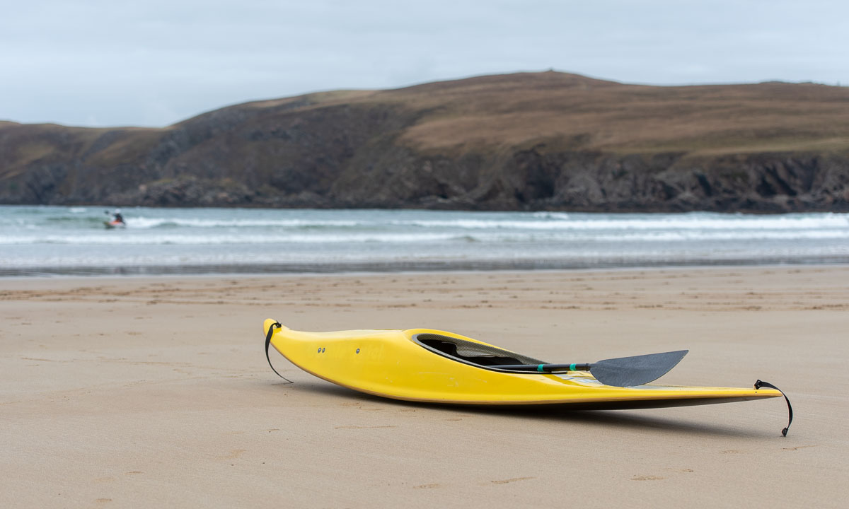
Back to the present. And time to visit Farr Beach nearby. We are not alone. There are kayakers out in the sea with short surf kayaks. I wish I had a tenth of their skills. On the beach, we strike up a conversation with a man. We learn that it is his friends being out there playing in the waves. Among them are some of the most skilled kayak surfers in Scotland. The waves are not high, they are just playing around and it is fun to watch them while chatting. I wish I had a twentieth of their skills.
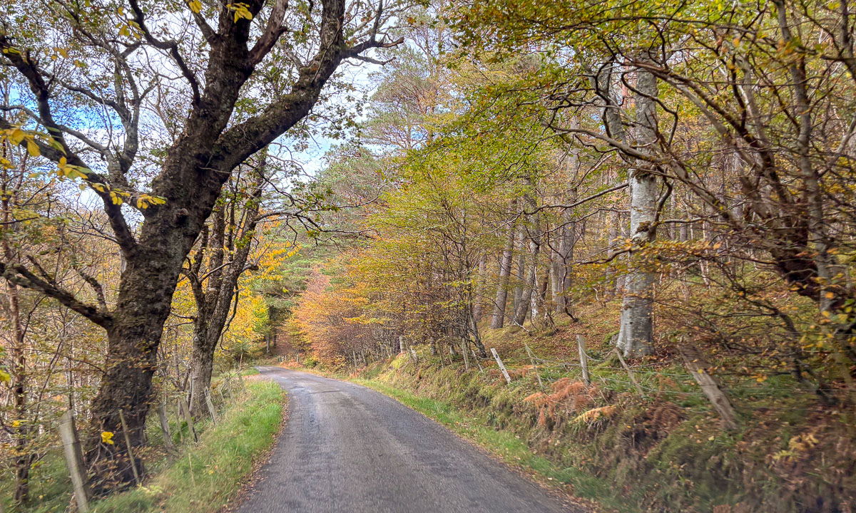
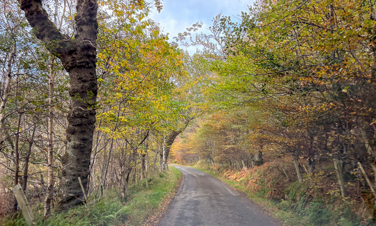
Back in the car we continue west but we make a detour. We follow a small road lined by trees. Sometimes the treetops touch each other so that a tunnel of trees is formed. That makes these single track roads look even narrower. Luckily the road is pretty empty.
We see the island Eilean nan Ron from above. The road rises, then descends nearly to sea level and we come to the main road, where we reach the Kyle of Tongue, a shallow sea loch. Before we cross it using the bridge, we have lunch on the car park by the loch. Each of us has a “meal deal”. That’s a cold meal such as sushi or salad, combined with a drink and a snack. Available in most supermarkets.
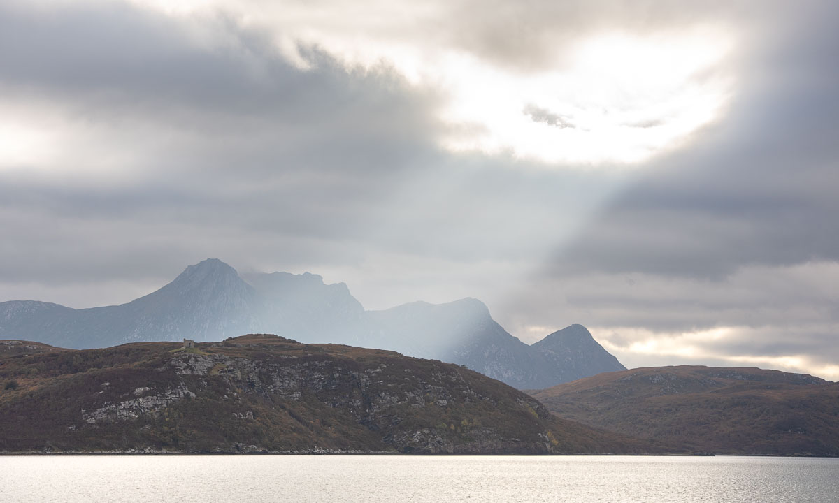
It has been pretty grey today, but there are holes in the clouds and the sun illuminates different parts of the mountains in the south.
Our original idea was to follow the NC500 further to Durness further west, but we couldn’t find any affordable accommodation. Therefore we had booked a room in Altnaharra the day before. After the booking we learned that there are many accommodations in Scotland, which are not on booking.com, but today’s room is already booked. So let’s head to the Scottish highlands!
We take the bridge over the Kyle of Tongue and turn left to follow the bay southwards until it looks more like a shallow slough with mudflats sticking out of the water. A pity, that the light is quite dull.
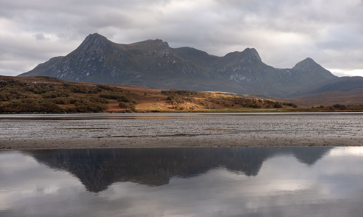

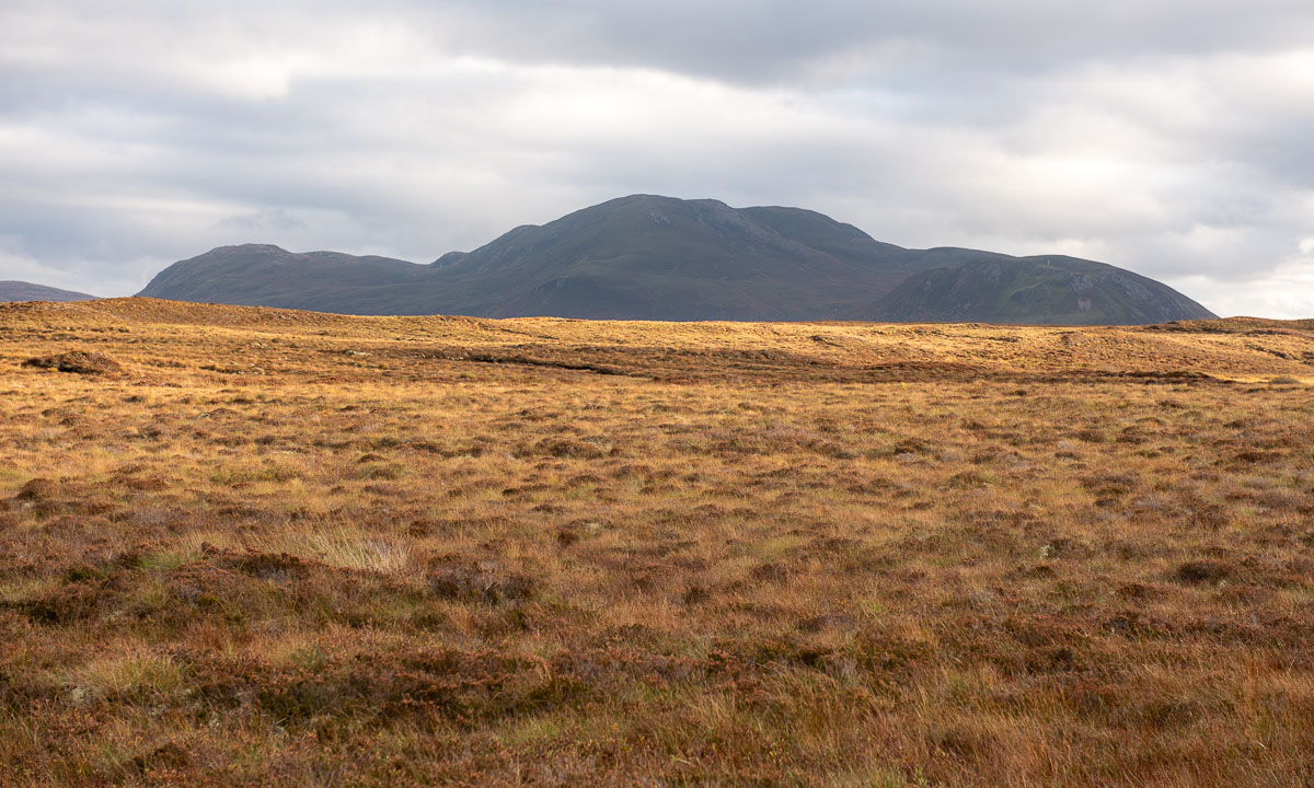
And then we cut through the moorlands in the Scottish highlands. The red-brown colours of the grass are intense – these are the colours of Scotland in my humble opinion.
Forty minutes later we sit by the open fireplace at the reception of the hotel in Altnaharra.
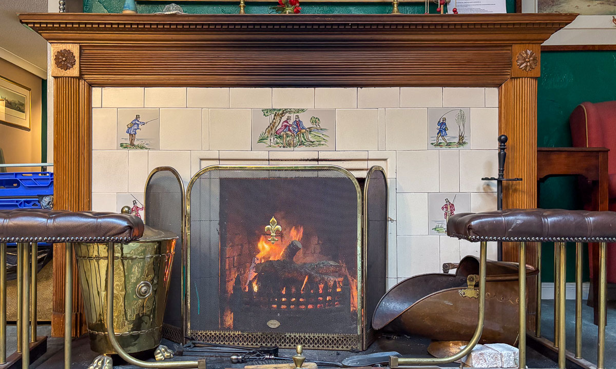
Soon we are given a comfortable room upstairs. To my delight it includes a bathtub. After dinner I’m having my first hot bath in years. Oh – so delightful!