Skoganvarre—Tromsø – the last stage of our car trip

This article is part of the series “2026-06: Obbola—Finland—Tromsø”.

Part four of the journey from Obbola to Tromsø

It is Saturday morning. My wife Annika and I are having breakfast in the kitchen of the campsite Skoganvarre Villmark. It is raining and people passing outside are wearing pyjamas and carrying umbrellas or wearing raincoats and crocs. Campsite fashion. Skuvvanvárri (Northern Sámi) or Skoganvarre (Norwegian) is located in Norway, but most of the guests here are Finnish, and it seems to me that more or less all of them are here for fishing.

The grey weather follows us to Lakselv where we meet the sea again in the form of the southern end of the huge Porsangerfjorden, the fourth longest fjord in Norway. We passed the road leading north before, but it was the first time that I saw the fortification high in the mountain walls left of the road. It is part of Banak fort, started by the Germans in WWII and continued by the Norwegians and used until 1987.

On the other side of the road the scenery is completely different. Stabbursnes nature reserve is a large protected area dominated by wetlands.

Annika started geocaching a while ago. Sometimes I join her in the search for I found a place to park the car, sometimes I focus more on looking for photo subjects, ideally I do both. At one of the geocache locations behind a gravelly area I first find this lonely birch and then surprisingly beautiful coastal cliffs, although it looked a bit dull in the grey weather.

I hardly take any photos of one of my favourite landscapes on this stage of the journey – the plateau of  Sennalandet. I only stop for the Aisaroaivi kapell after the sky has cleared up a bit.

Some more photos from this day:

At 7 o’clock in the evening we arrive at our last overnight stay of this road trip near Sørstraumen. This time we used Airbnb and found a real gem, owned by Gunn, who is a fantastic host. Gunn rents out rooms in her private home and not only invites her guests to her kitchen for a chat but also provides huge amounts of waffles with jam. I can highly recommend her when you like meeting interesting people. We met two Germans who wanted to go north for fishing and a motorcyclist, who is driving all coastal roads of mainland Norway to collect money for ME-fondet, part of Norges Myalgisk Encefalopati forening. We are talking about 50,000 km – what a trip! This is his Facebook page: Around the Coast 2026.

A last photo of this day.

The next day at Gunn’s place began a bit like the evening before: a lively chat and waffles. One thing was different, though. Gunn already told us about whales she saw and showed some videos. While eating another waffle I looked at the fjord and saw movements on the surface. It was a school of white-beaked dolphins passing by the house. We observed them for a while, swimming, jumping, blowing and hunting. They were far away, so even with the big telephoto lens I only got images like this one:

Later than usual, we left this wonderful place to drive the last stage to Tromsø. We could have made it in four hours but it took us seven and a half. The reasons: geocaches, photo stops, detours and an outdoor lunch break. Here are some photos.

Around 18:00 we arrive in Tromsø, my “work home”. I’ll be here for about four weeks and Annika will join me the first two weeks.

Oulanka National Park, the Russian border, long dirt roads and Lokka reservoir

This article is part of the series “2026-06: Obbola—Finland—Tromsø”.

Part three of the journey from Obbola to Tromsø

Our first car trip today is short. From our mökki (cottage) by the lake where we slept to the Oulanka National Park it’s only 22 km. In the car park there are more reindeer than cars. While the older reindeer are undergoing a coat change and look quite ragged the younger ones look like animals from an old Disney film with their soft fur, their thin legs and their huge, dark eyes.

Our hiking tour to the Kiutaköngäs rapids starts through a beautiful, wild forest. After a while you can hear the roar of the water and then you see the narrow gorge through which the water of the river Oulankajoki rushes downwards.

The moss-covered rocks by the gorge look as impressive as the rapids – as if from ancient times.

We follow the yellow dots that mark the shortest circular route. The landscape is now less spectacular than the rapids but in its variety, it’s beautiful to walk in.

We pass a bog lake named Ylimmäinen Hiidenlampi. We are not alone, a group of students is doing research on freshwater and invertebrates.

For most of the walk, we were lucky with the weather but in the end we get caught in a rain shower. While we have lunch in the visitor centre our jackets start to dry.

Change of scenery. We are in the eastern part of Finland, a country that has a 1340-kilometre border with Russia. We take a small road to the east leading to the border. In the end, it is just a small forest road. It just ends with a simple barrier and a warning sign saying “Border zone—no entry without special permit” in five languages. On the other side there is an information sign – that’s it.

While this road probably never was a border crossing, there is one northeast of Salla. Or rather, was, because all checkpoints were closed in April 2024. Hardly imaginable that I crossed the border here on a journey to Murmansk in March 2019.

When will Russia’s terrible war against Ukraine end? Will there be a regime change in Russia that makes it possible to travel there again in my lifetime? I don’t know.

Change of scenery. We travel to Lokka, the most remote location we found with accommodation for overnight stay. Several roads marked in yellow on our paper map lead there and we decide to take some of them to get there. First there are some visible signs of other people – a cottage, a passing car, then we are all alone. We follow the roads according to Google’s navigation. First we drive on asphalt roads, then gravel roads and in the end narrow dirt roads with grass growing in the middle.

At one junction where we should turn right the road is closed. I follow the other road but it is difficult to know if we are on the right track. There are too many other dirt roads and there are no signs, nor is there any mobile coverage. Finally we find a way back to Hietaniemi that we passed perhaps an hour ago. From there it’s another 50 km back to a paved road. Another minor road finally leads us to Mummon Mökki, our cozy overnight stay where we arrive around 8 o’clock Finnish time.

The last part was fascinating. We passed Lokka Reservoir, one of the largest artificial lakes in Europe. There are large areas of grass and some birch trees by the shore. When I walk there after dinner I realise that these immense mats of grass are actually floating on the lake. Fascinating but not a place to stroll around. I take my photos from the safety of the road.

Around ten o’clock I’m back at the mökki. I try to jump in as fast as possible to keep the mosquitoes outside and take a hot shower. Then it’s time to sleep after this long and varied day.


Obbola—Tromsø via Finland – part one

This article is part of the series “2026-06: Obbola—Finland—Tromsø”.

Obbola—Oulu

I face the shark, we look into each other’s eyes. I am standing and so is the shark. It waves at me. On its stomach is the word “Wasaline”. That’s the name of the ferry to Finland that we are on.

My wife Annika and I are travelling from our house in Obbola, Sweden, to my workplace in Tromsø, Norway. We have a whole week, so it’s a vacation, not just travelling. We decided to take the ferry from Holmsund, Sweden to Vaasa, Finland. Holmsund is just on the other side of the river Umeälven and we can see the arriving and departing ferries from our house. It is 7:50, the ferry Aurora Botnia departs ten minutes ahead schedule.

I am standing outside taking photos and looking for the lighthouses. About four months ago I walked to four of them over the frozen Baltic Sea. Now, when I see the small skerries and the isolated lighthouses surrounded by the sea it feels unbelievable. Two different worlds! After we passed Storbränningen, the lighthouse furthest away, I go inside to join Annika at the rich breakfast buffet.

Some hours later we cruise through the Finnish archipelago near our destination, Vaasa where we arrive at 12:30 Finnish time, which is one hour ahead. We leave the ferry and drive north, partially on the main road E8 (it would lead us to Tromsø), partially on smaller detours, which are nicer to drive. The weather is mostly sunny and we start looking for beaches to go for a swim.

We turn left to the beach Kalajoen Hiekkasärkät which is surprisingly large. Boardwalks lead along the dunes and to the sea. The sea is pretty shallow. That kills my motivation a bit and we stay on land.

We enjoy the windy but fair weather for a while before we continue our travel north. We start to get hungry and I am looking for a restaurant in Raahe, about an hour away. Many restaurants close already at 18 o’clock, but I find an Asian restaurant that is open longer. When we arrive there and enter the building we are confused. There is nothing but an elevator. We enter it and find only three levels to choose from: (1), (12), and (13). And there – in level 13 is the restaurant with a wide view over land and sea and a huge buffet of sushi and Chinese and Thai food. The reviews on the web were a bit mixed but I liked it very much.

After two more hours of driving we arrive in Oulu, a major city in Finland which is European Capital of Culture this year. We take a short walk and get wet in the only rain shower of the evening. I like the many bridges, the areas of water, the fact that Oulu is a very bicycle-friendly city and the meeting of historical and contemporary architecture.

In the apartment house right in the center where we’ll stay two nights we have another elevator encounter. This vintage “hissi” looks like from the fifties and has no inner door, which gives it a bit of a steampunk appearance.

Tomorrow we’ll spend the day in Oulu. The weather forecast looks great, perhaps I’ll go for a swim tomorrow.


Swedish summer paddling 2026

It has become a tradition that, when I’m home in Sweden in summer, I’ll take my kayak and paddle the 3.5 km to Bredviks havsbad to check if Nouri is there. In summer he runs the kiosk by the beach and that means (a) good food and (b) good music. Today I was lucky: he was there and I got my ćevapčići. It is also great to paddle on the Baltic Sea in Sweden again which is very different from paddling in Tromsø.

The sea and the mountains

Back in Tromsø after some travelling I joined the “Thursday paddling” organised by the Tromsø Sea Kayakers Club. We were eleven kayakers and it was proposed and we decided to paddle to Grindøya, one of the common tours.

On Sálljnjárnuorri / Sandnessundet, the sound between Tromsøya and Kvaløya, it was windy and short waves came from the right. Here I preferred to hold my paddle and didn’t take any photos. In the lee of Grindøya, I started taking photos again.

We paddled alongside the island and took a break at the southern tip.

After half an hour, we continued our tour. The wind had calmed down and so did the waves. We paddled around the island and then headed to Monsterbygget (the monster building), a landmark on Tromsøya often used for kayaking navigation. After three hours, we were back at the boathouses.

Next day, another tour. I stopped working early to meet my friend Christine. We took my car to a parking area on Kvaløya and went up the Sørtinden. This is a short tour, about 4 km long with 250 metres of elevation gain., but you are immediately in the mountains.

Some parts were still covered with snow while others were covered with carpets of flowers. Even the cottongrass was blooming.

Gaining altitude, we had views of the lake Finnvikvatnet and the mountains behind, such as Kjølen.

The top of Sørtinden is a bit like a cliff. Here, you also have a view of the sea and the island Vengsøya. After a rest on the windy summit, we went back the same way.

Bergen reloaded

On Sunday I flew to Bergen once more. While it had been sunny a few days ago, it now presented itself as Bergen is known for: rainy.

It was not the normal rain with raindrops falling from above. It was more like an omnipresent moisture coming at you from all directions. Invisible to the eye but you get wet anyway.

On Monday I went to work. I went from the hotel in the centre to the Port of Bergen, where it took me a while to find the entrance and then to get on the list for a day visit aboard the icebreaker Kronprins Haakon.

My pocket was full of cards – one for my hotel room, one visitor card for the port, one for the ship.

One of the instruments on the bridge is a radar used for sea ice navigation. On this day an engineer from Sea Hawk was installing additional hardware that delivered the radar video signal and additional data such as GPS and gyro to an auxiliary network. My responsibility was the other half: the laptop and the software to read and store the data. And so my workplace looked like:

After some hours of work the “radar” laptop showed the same data as the large overhead display on the bridge. The engineer calibrated the scan streamer unit and I used the rest of my working day to catch one hour of radar data as an example. As expected the amount of data was immense: about 74 GB per hour.

Then it was time to head back to my hotel in Bergen, the city with about two hundred days of precipitation a year. Even the shops here reflect the omnipresence of rain.

Tor te rest of the day, I was a tourist and took some tourist photos in Bryggen, the famous historic quarter.

A day and half a night in Bergen

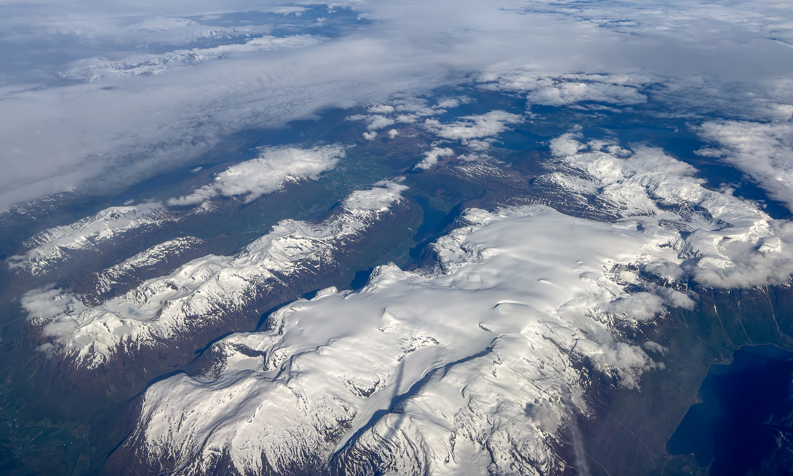
28 May – I am sitting on a plane to Bergen, Tromsø lies behind. Finally the layer of clouds has opened and Vestlandet – Western Norways reveals itself with vast glaciers, mountain ranges, fjords, forests, archipelagos and the open sea.

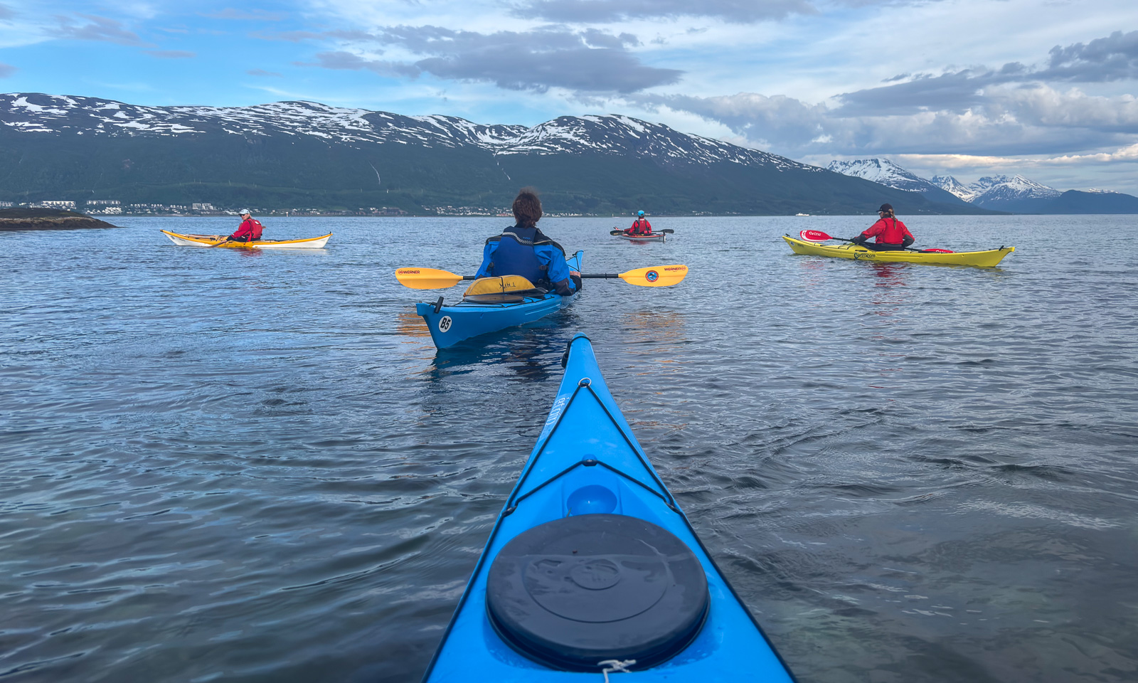
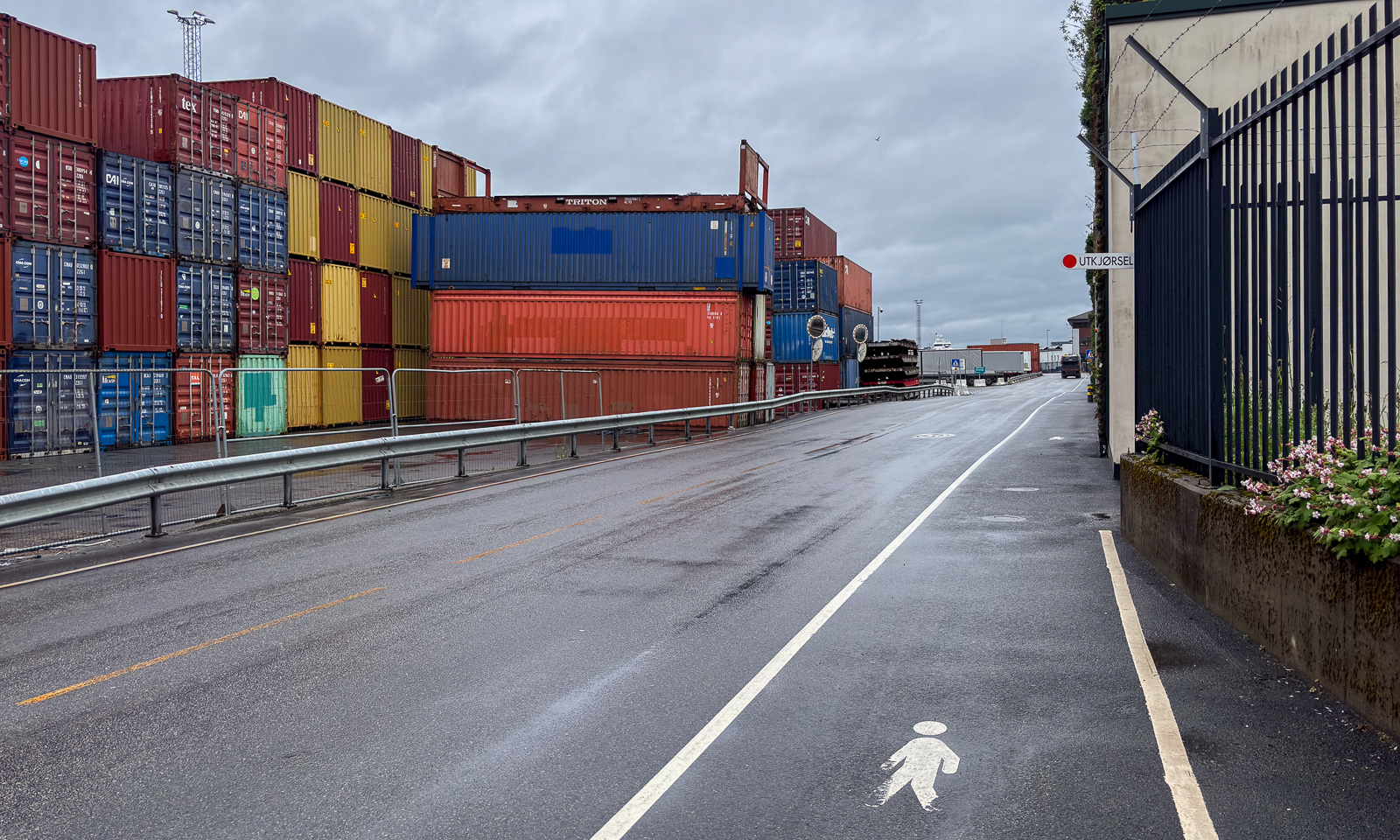
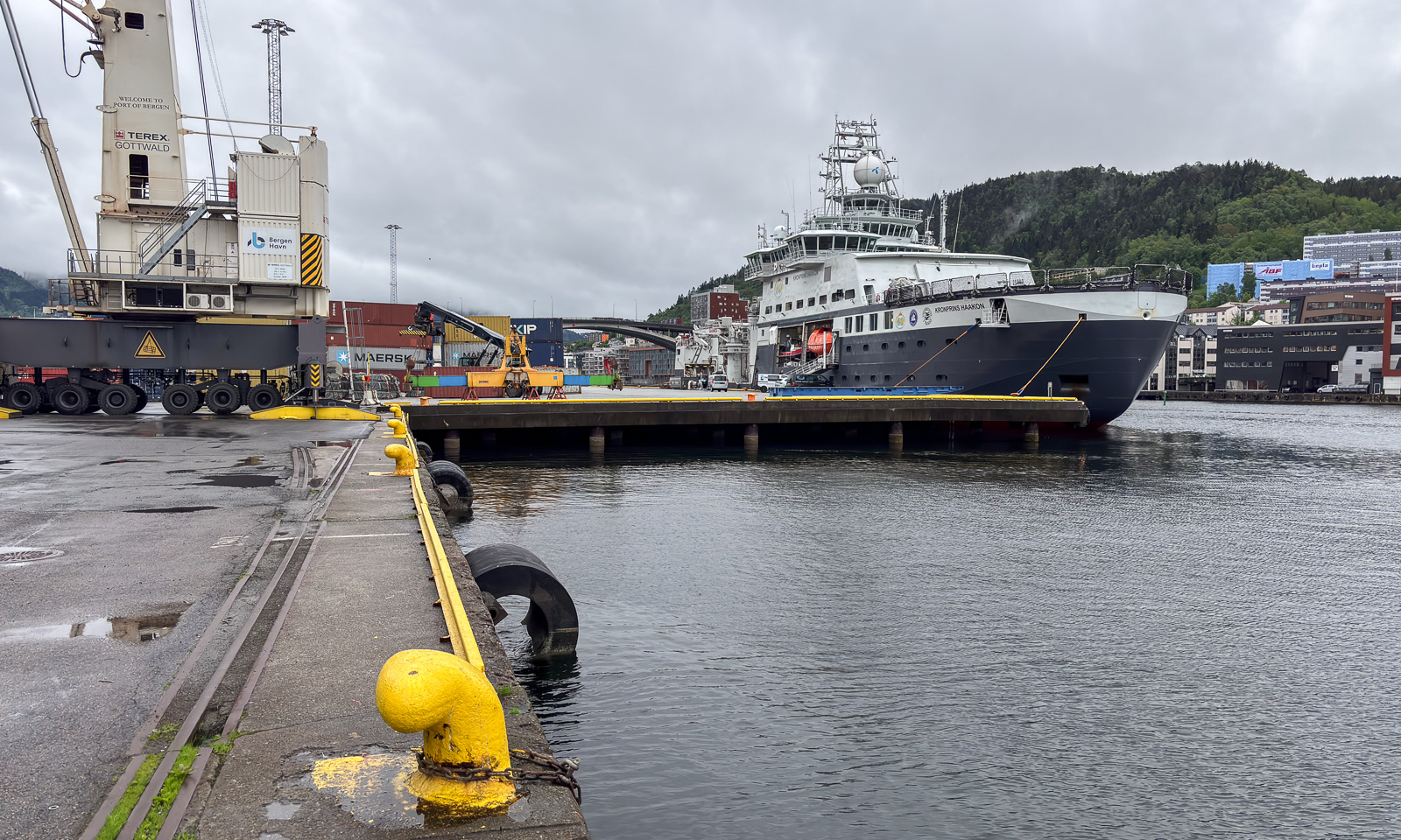
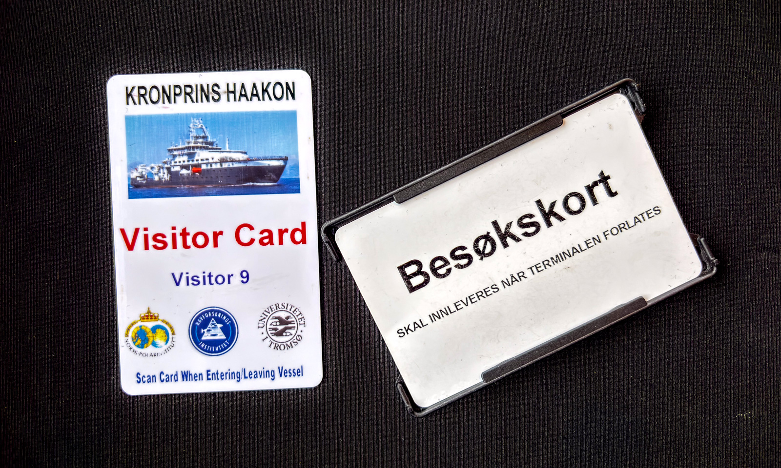
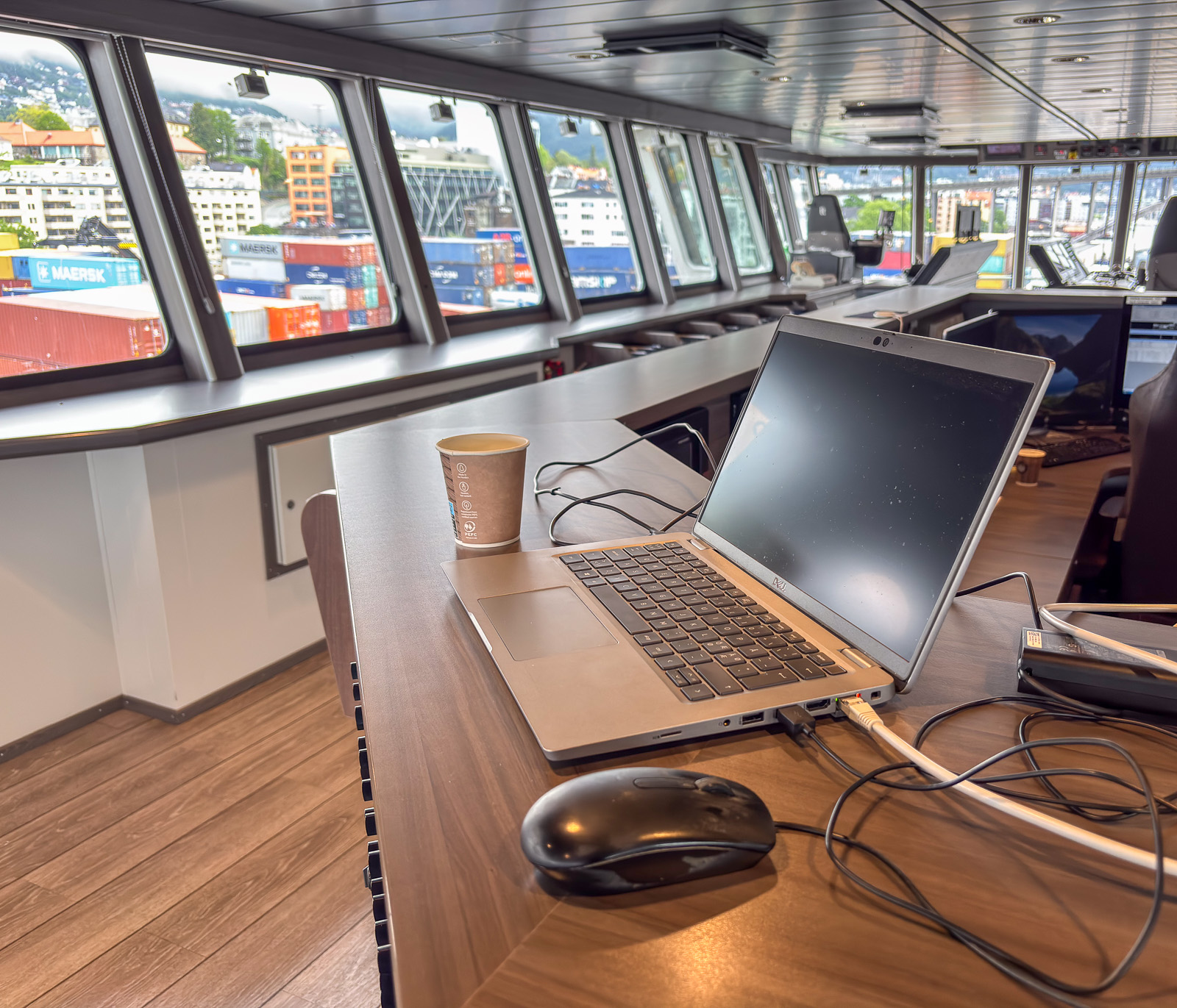
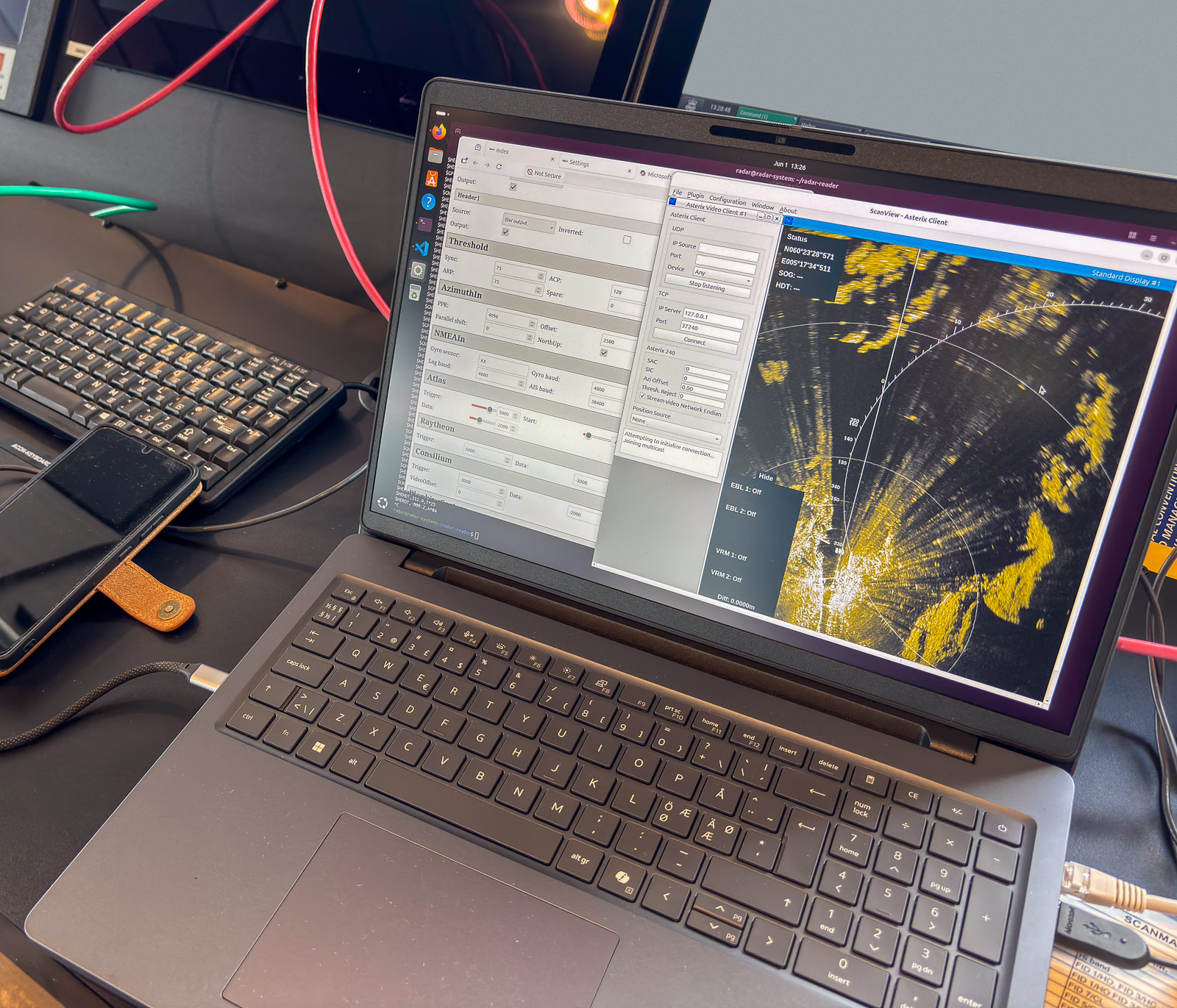
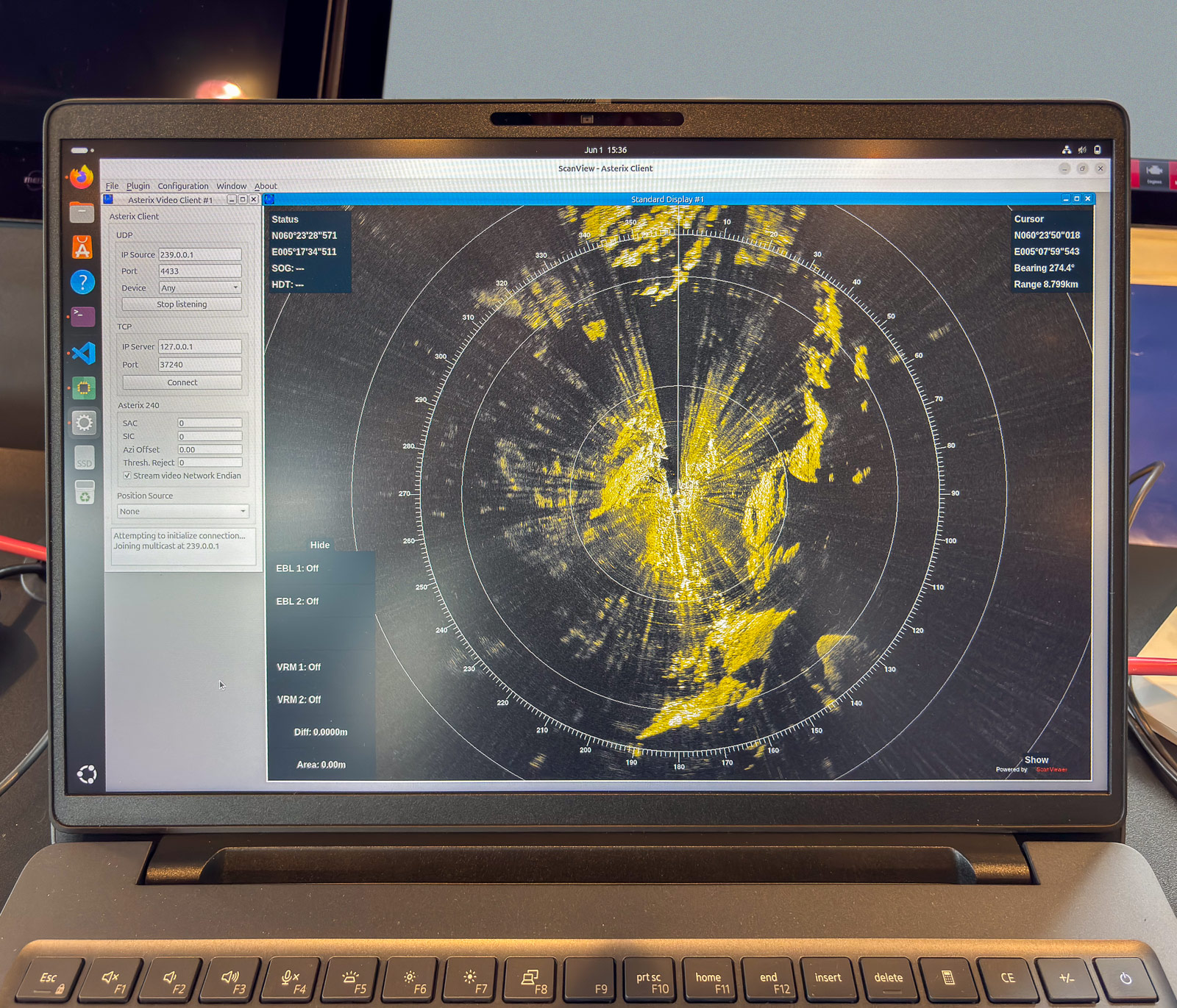
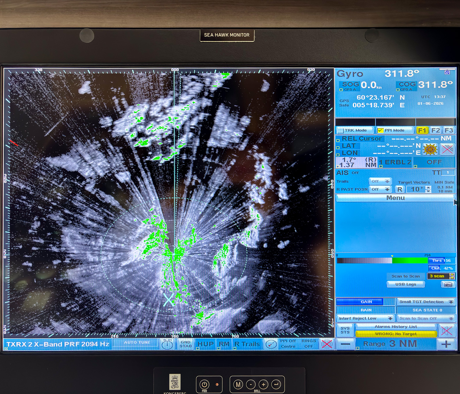
The reason I am in Bergen is sea ice in the Arctic. On board the ice-breaking research vessel Kronprins Haakon there is a special radar used for navigation through sea ice. Researcher Polona Itkin wants to store this data for scientific purposes. The companies Sea-Hawk Navigation AS and dspnor AS are responsible for the hardware, I handle the software to read and store the data. And since these companies are in Bergen and have a working setup including a radar on the roof, I am working there for two days. The only work-related detail I will mention is this: the data volume to be stored is immense and can exceed 2 TB a day. Quite a challenge.

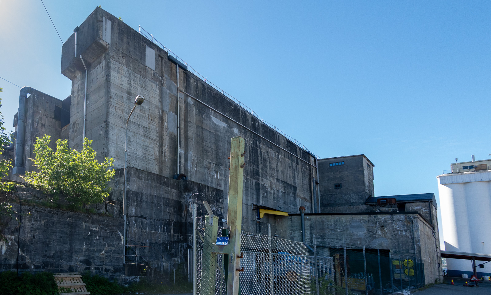
At 16:00 I finish work. Since the weather is warm and sunny, I decide to walk to the hotel in the centre of Bergen on the other side of Puddefjorden. Let’s go down the concrete ramp and start our tour. First, I walk through an industrial area …

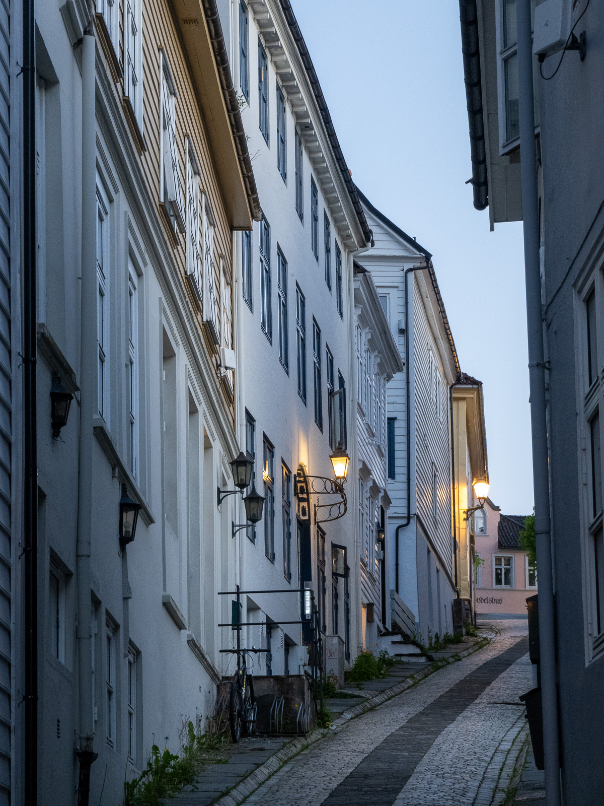
… but then the surroundings change revealing marinas, parks and older wooden houses.

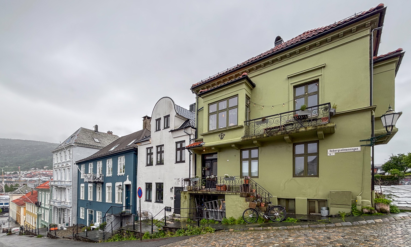
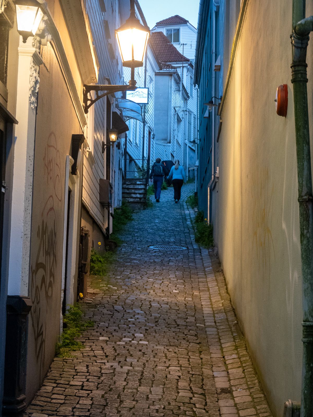
I cross the Damsgårdssundet and head towards the centre. A myriad of small alleys, footpaths and stairs make me ignore the polite navigation of Google Maps and stroll around, enjoying the town in the sun.

I don’t want to own this car, but I envy the driver’s parking skills.

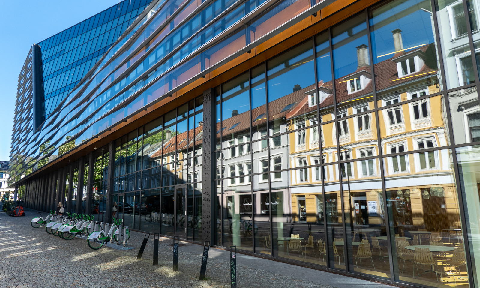
But of course Bergen is an evolving city, not a museum and a lot of contemporary architecture is found there too. But sometimes the glassy facades reflect the older world.

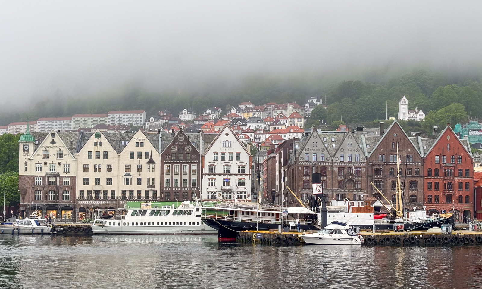
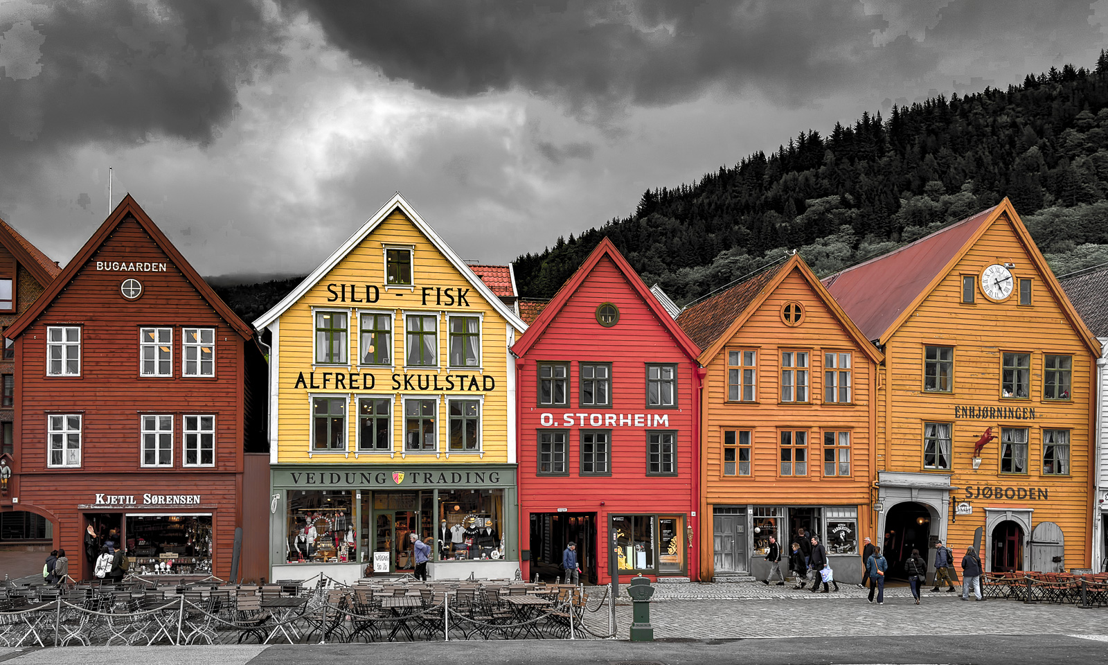
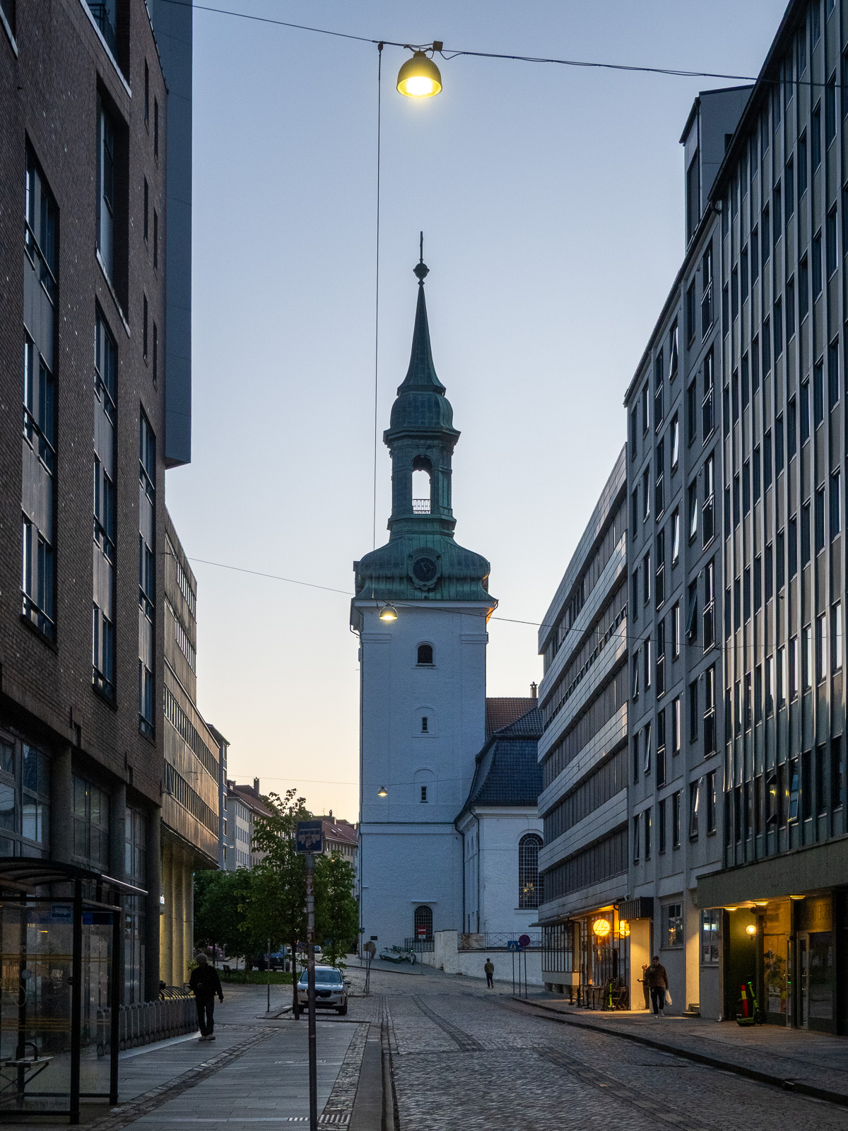
From there it is not long to Vågen, the central harbour bay with a view of the historic quarter Bryggen.

I check in at the hotel and leave again straight away, first to get some food (Pasha – Peruvian food – not cheap but delicious) and then to take Fløibanen, a 848-metre-long funicular railway that leads up to the mountain of Fløyen (320 m).

Of course I could have walked up the 302-metre ascent, but I have a plan: I want to walk to the mountain of Ulriken (643 m), the highest of De syv fjell that surround the city centre of Bergen. The route is between 13 and 15 km long and leads through hilly terrain. From there I want to take the cable car down and the last one leaves at 23:00. So I don’t have the whole day, just a long evening.

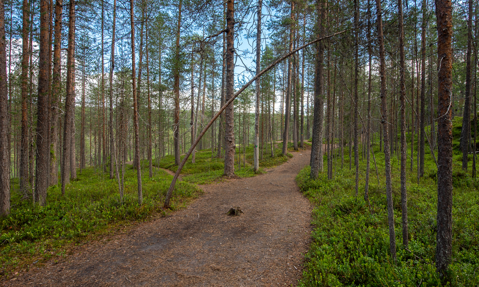
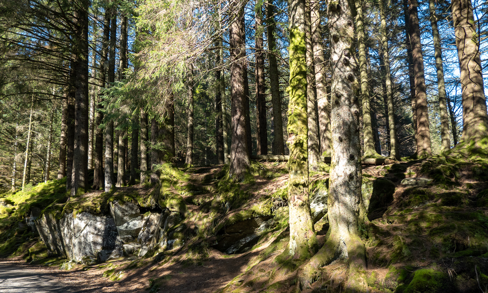
At 18:45 I start my tour. First, I cross a small, but surprisingly dense forest then I follow the wide hiking trail.

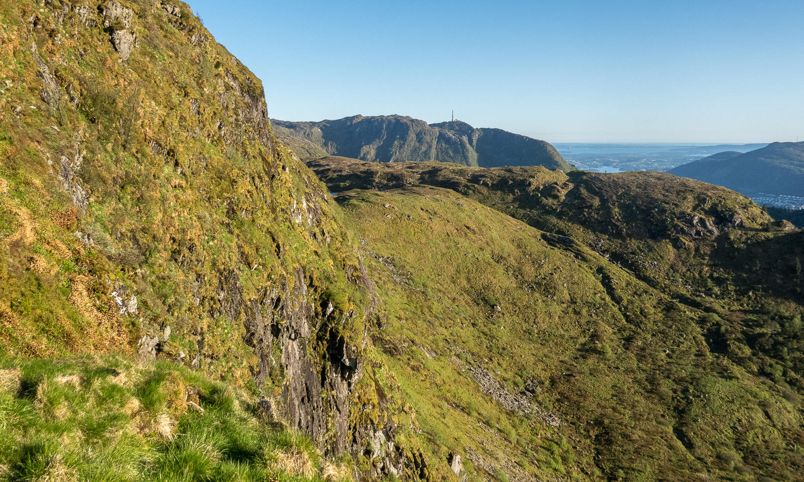
When I approach the mountain Rundemanen with its tall radio mast, the trail branches into many paths leading in different directions. I ask for directions twice and get it – together with the warning that it is a long hike. The younger women told me it would take four hours from here, another woman said it would take her six hours. I decide to walk a bit faster and see where I am after two hours. I could still turn back then.

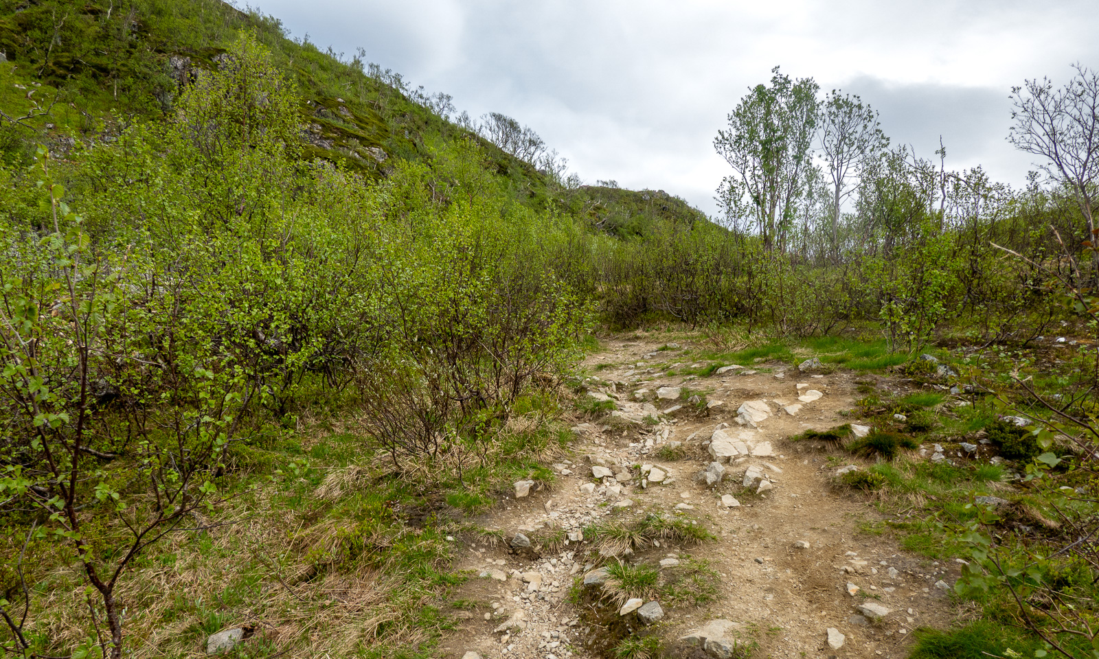
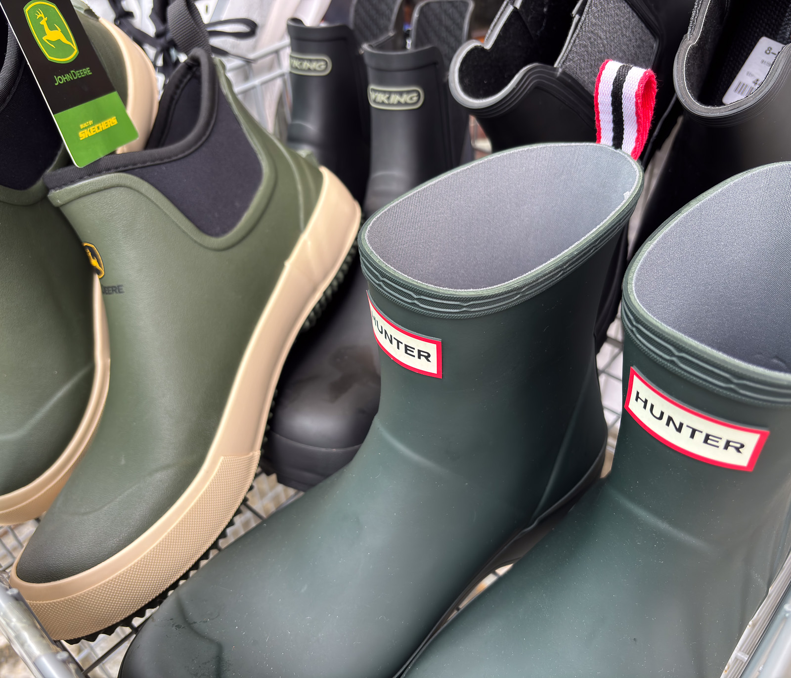
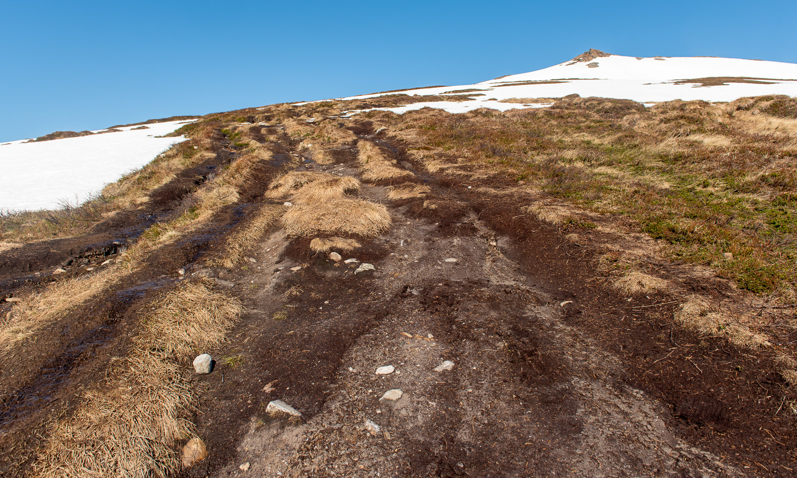
Now the trail looks more like a mountain trail. Smaller, steeper, rougher and sometimes very wet. Normally I walk with rubber boots but on this journey I only have an old pair of low shoes, so I try to avoid all the wet patches walking around them or stepping onto the stones.

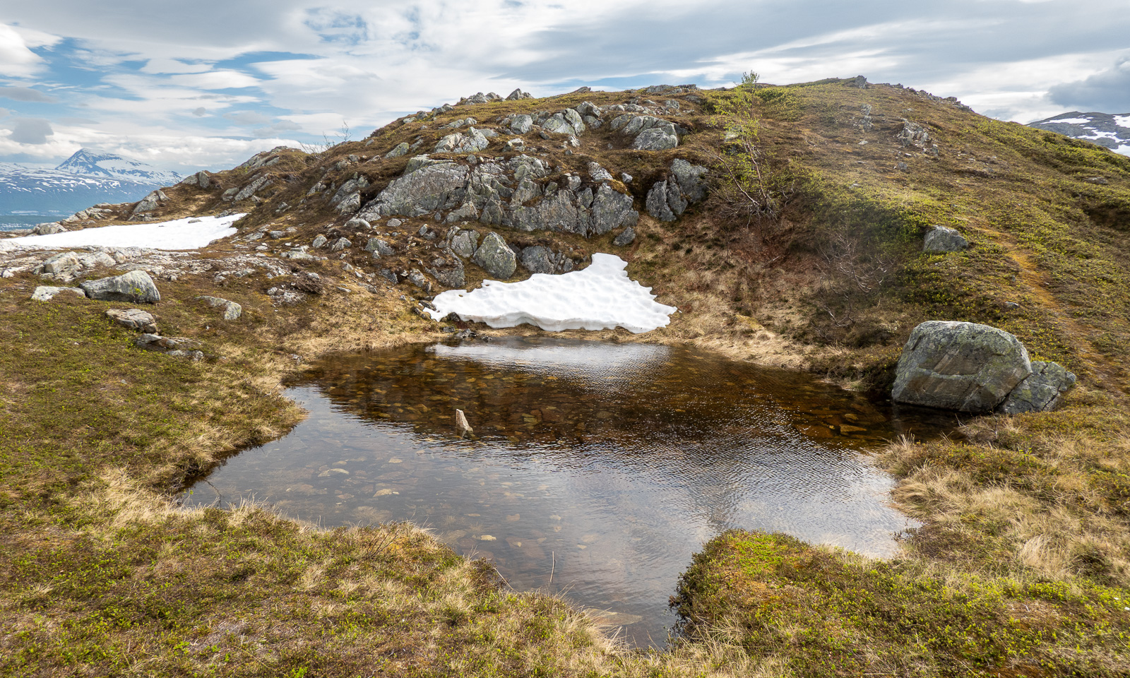
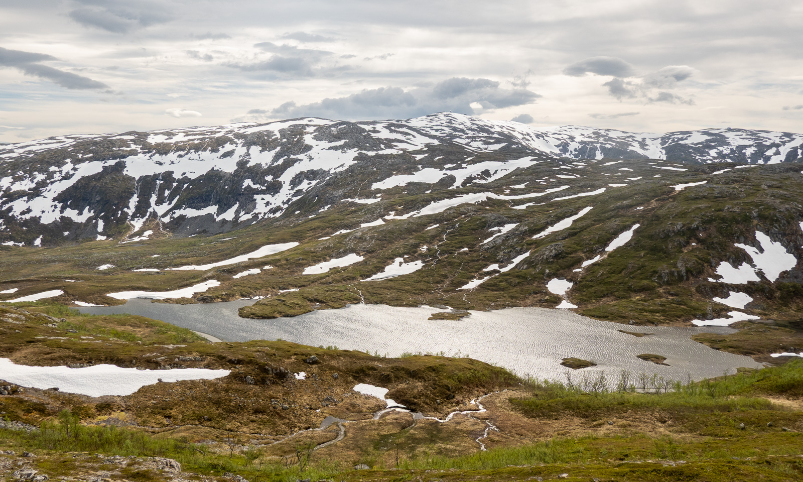
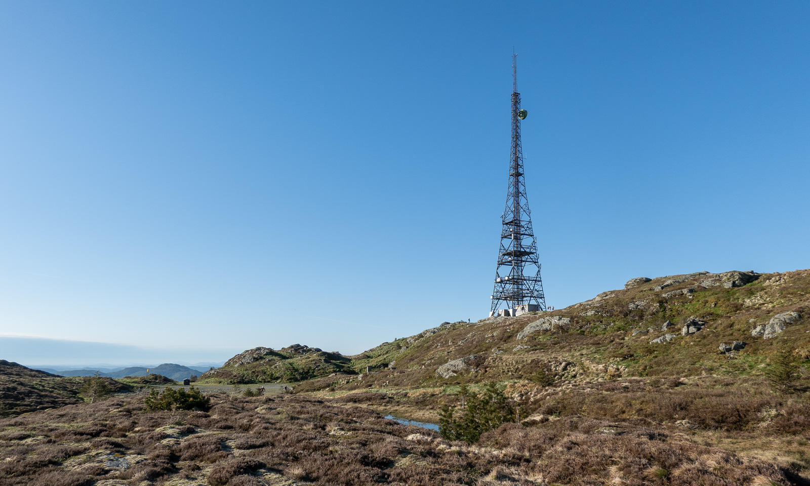
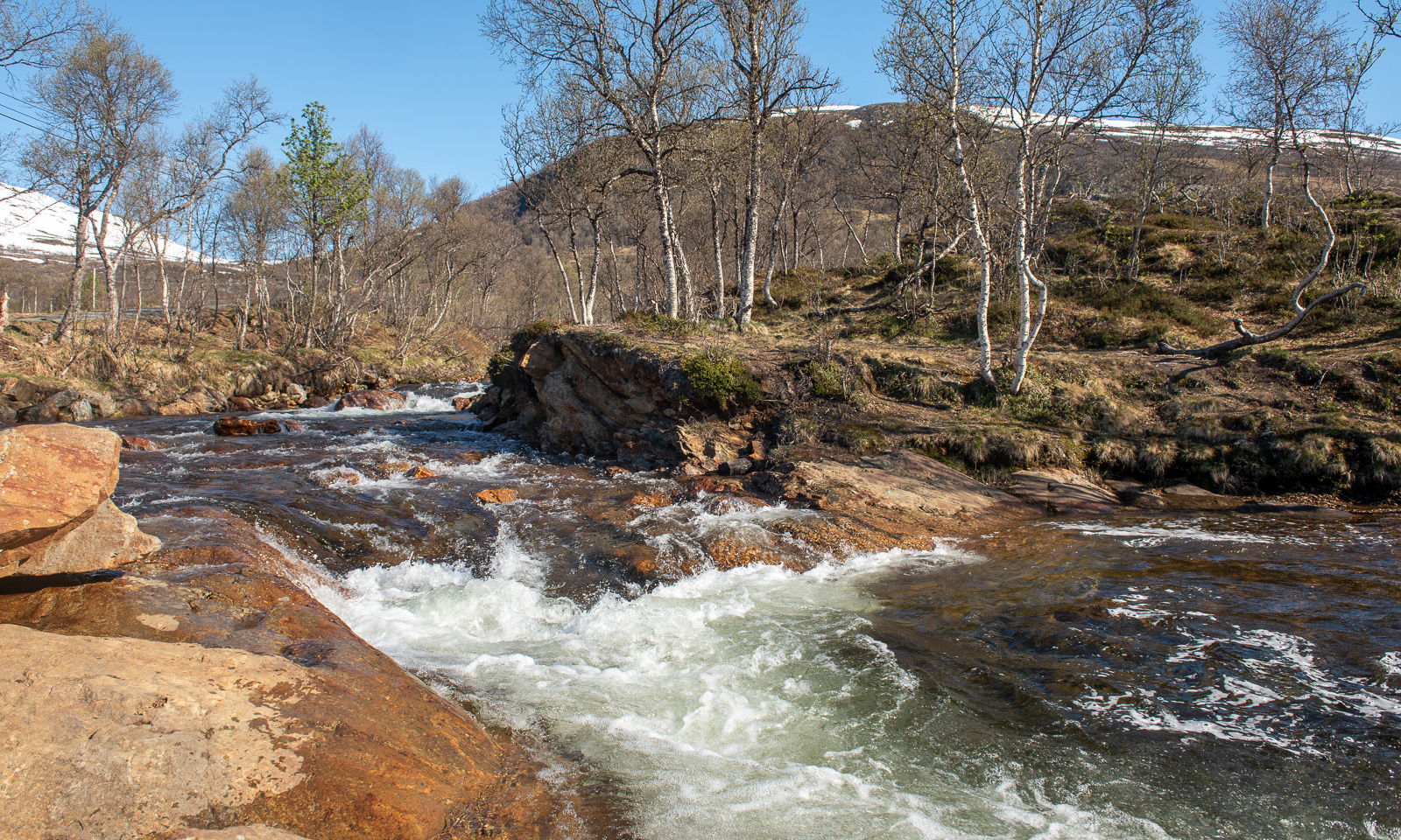
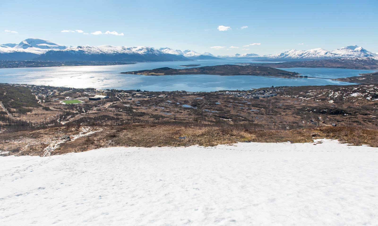
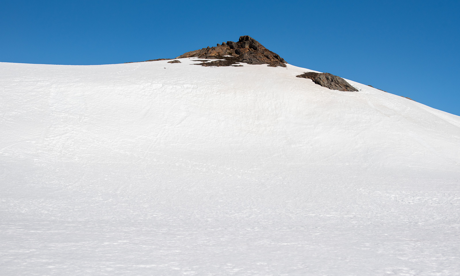
I pass the lake Øvre Jordalsvatnet, use the stone causeway to cross the small stream that transports water to the lower lake Tarlebøvatnet. My planned destination, the TV tower near Ulriken, can already be seen.

Now the trail is excellently marked by large square cairns with a sign “←Fløyen, /Ulriken→“. It is easy to follow them. I try to walk at least 4 km/h, ideally 4.5 to catch the cable car. At 20:30 I reach one of the few signposts with distances. I’m happy, because I made more than half the distance in one hour, forty-five minutes. Decision made: I carry on.

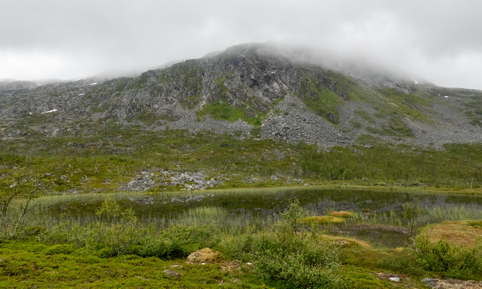
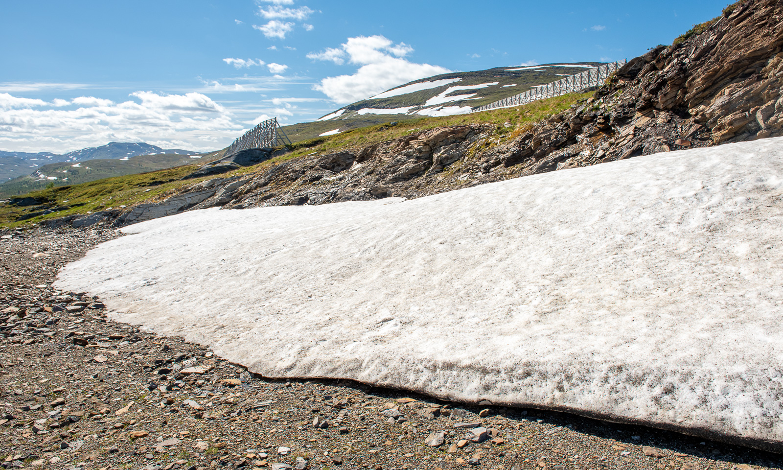
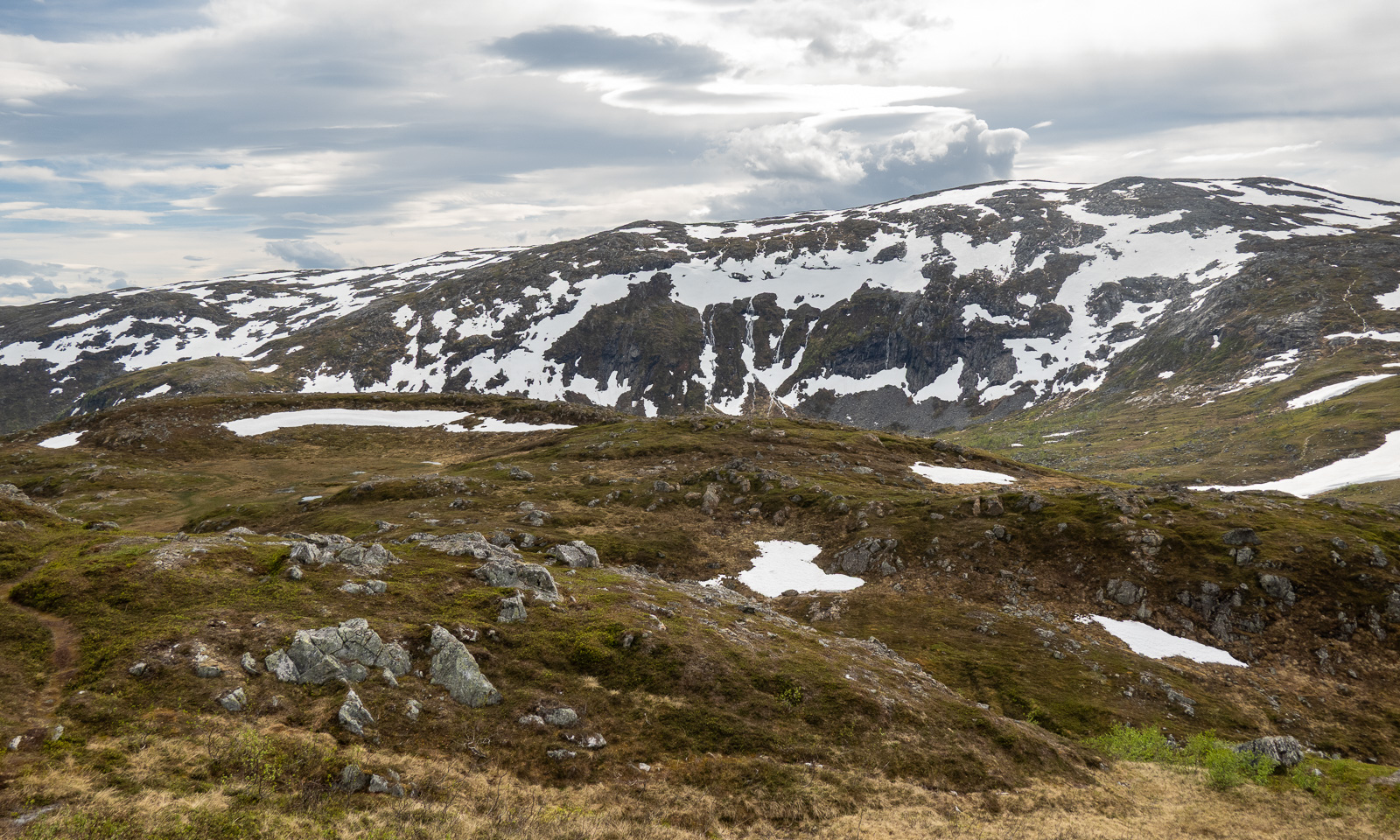
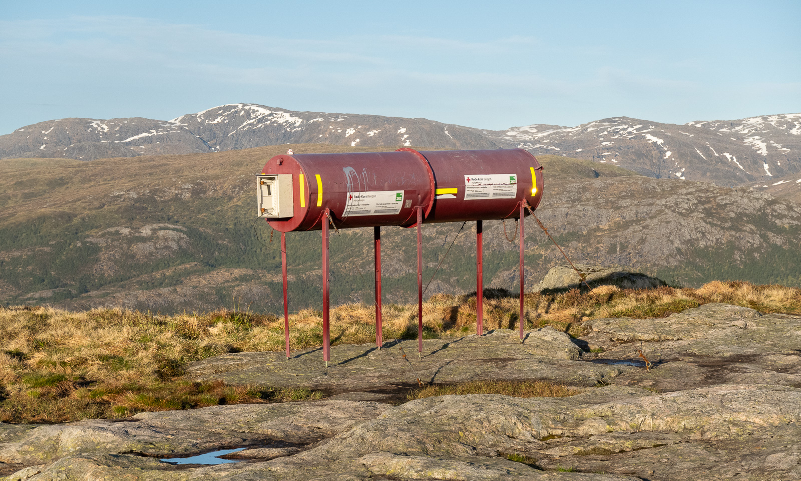
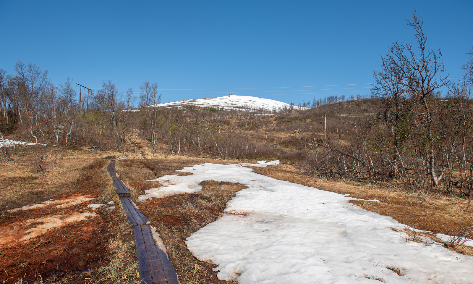
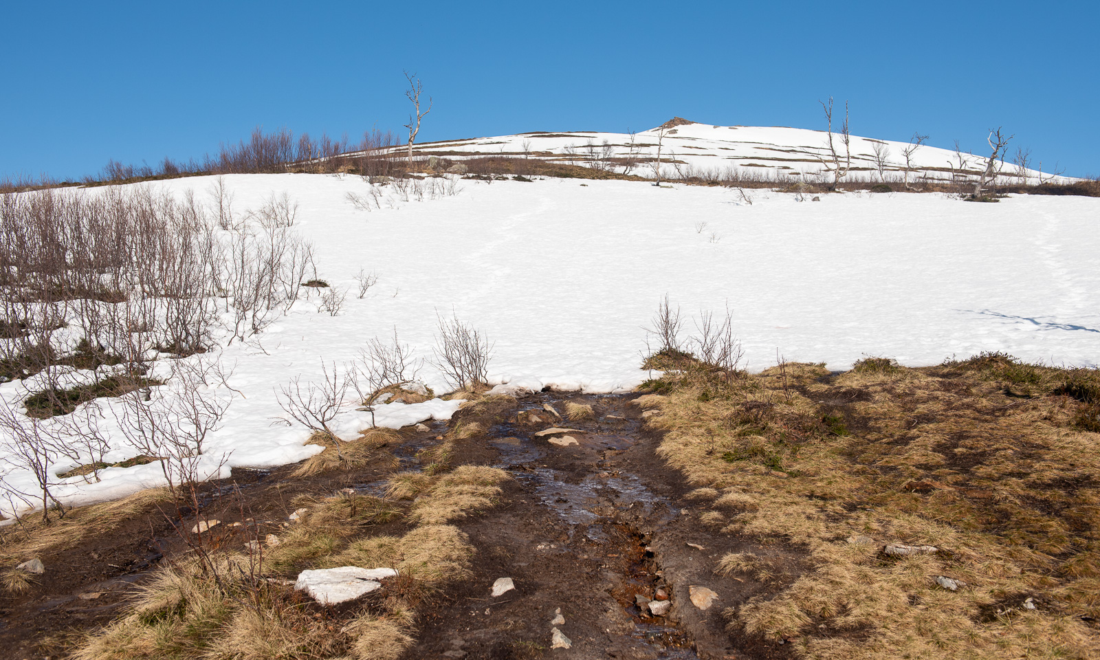
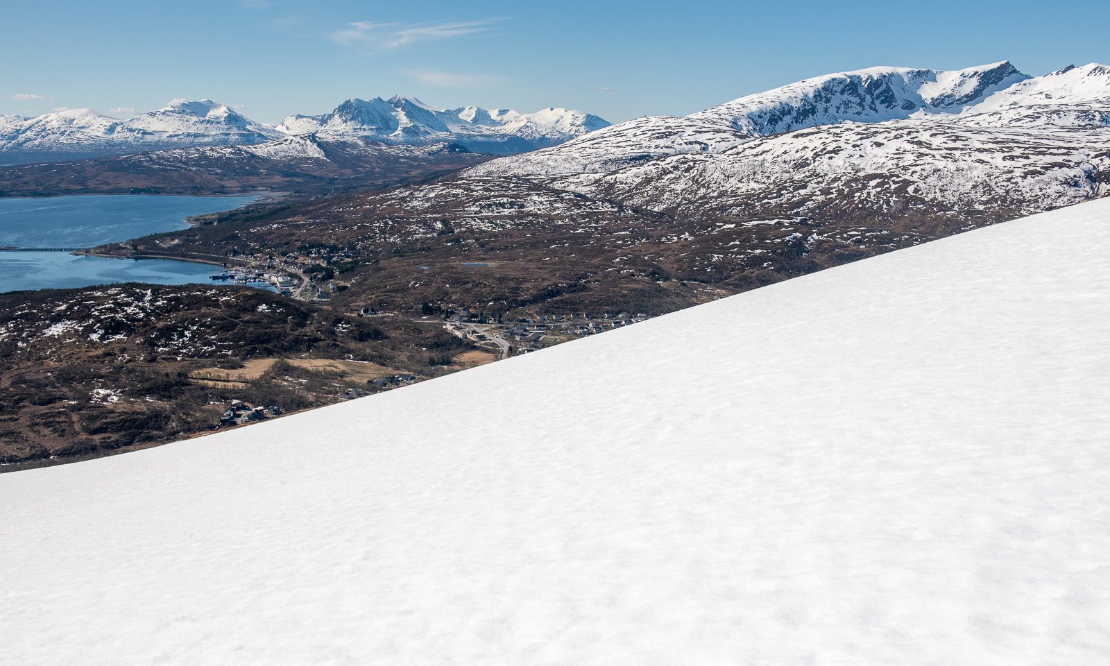
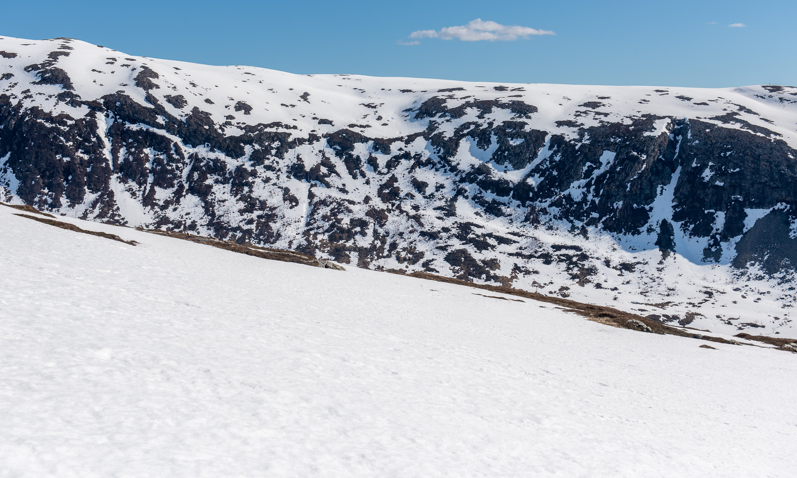
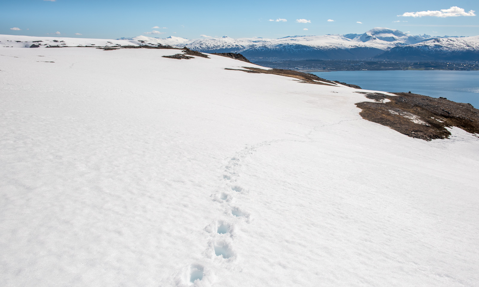
And on I go across the Vidden. Sometimes the point of interest is nearby, such as the tube with the first aid equipment including a stretcher. Sometimes it is far away, such as the snowy mountains in the east. Will I see snow here as well?

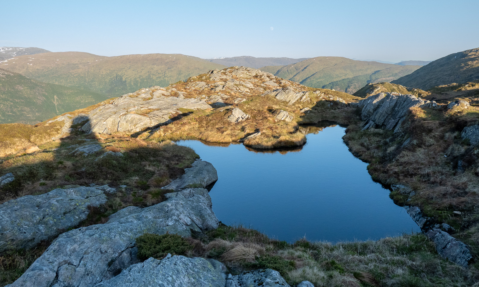
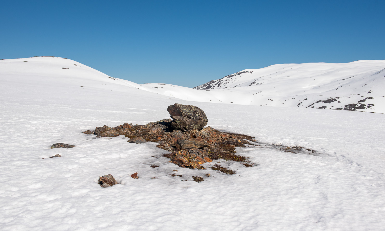
And there it is: one of the two patches of snow on the Vidden plateau.

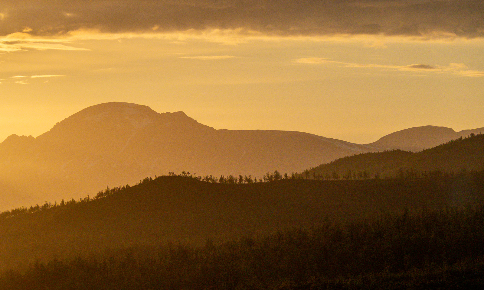
Slowly the sun is setting and the light gets warmer. I walk against the sun and have to protect my eyes with one hand when the path descends steeply into one of the valley cuts. But I’m sure I’ll arrive in time.

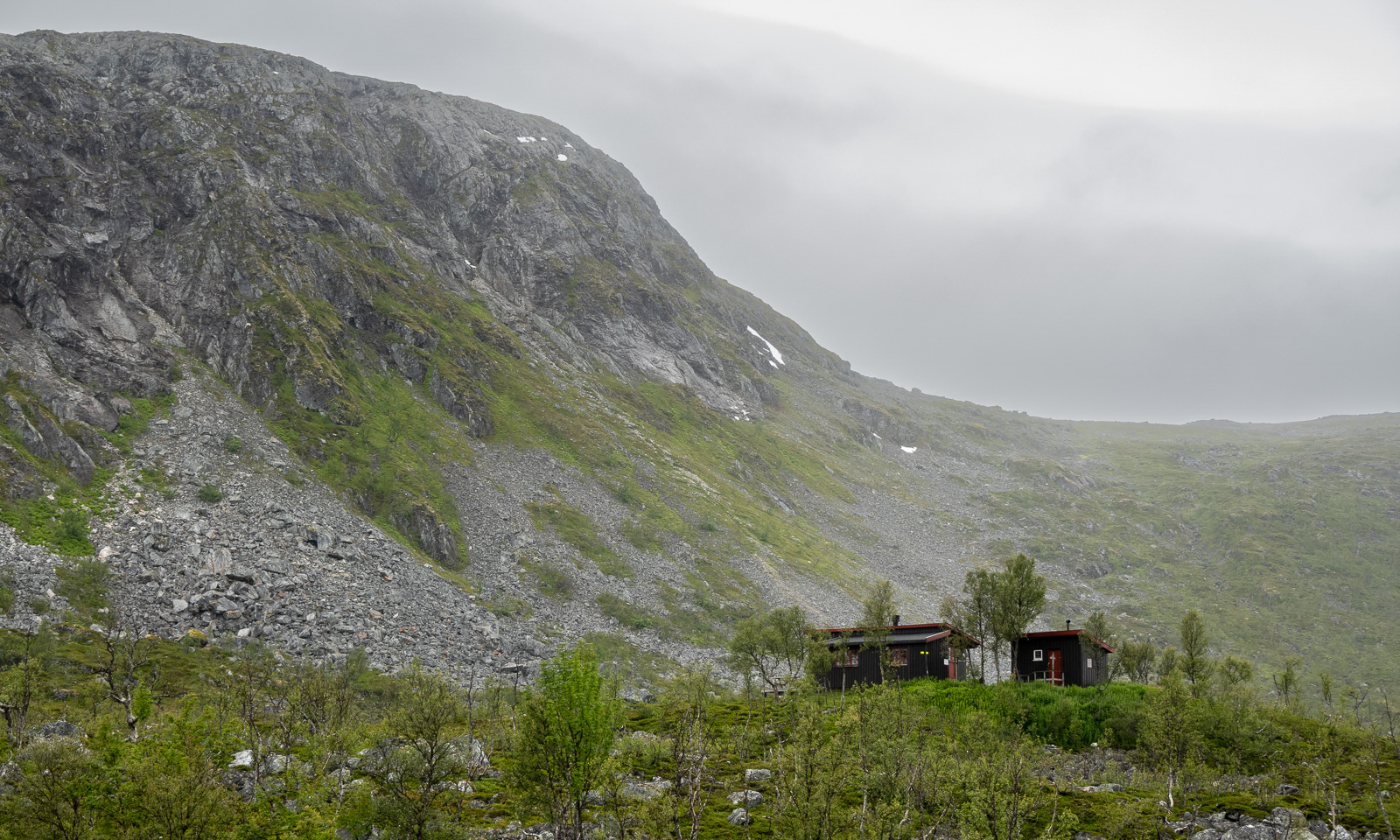
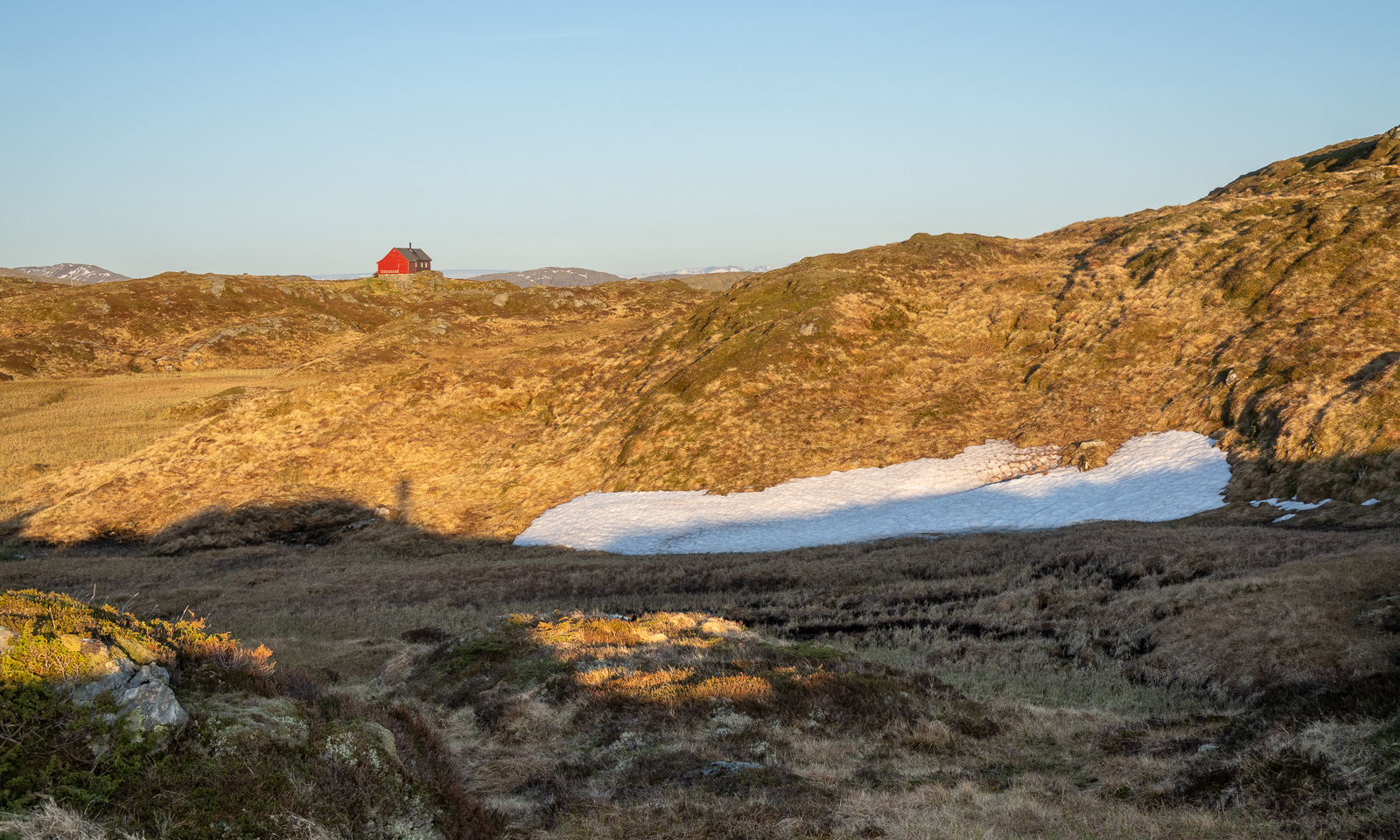
I spot some cabins, first a small red one then a larger one. When I researched this while writing, I found out that this is Turnerhytten, a DNT cabin with thirty beds. I think that when I plan a trip to Bergen again, I should stay there rather in some hotel in the centre.

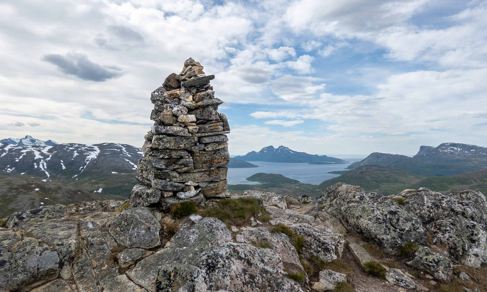
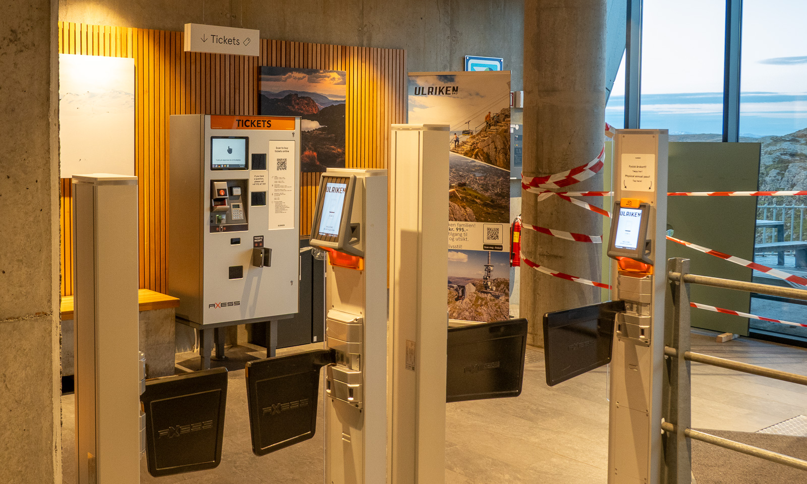
I decide not to climb to the top of Ulriken but to go straight to the cable car station. I’m tired and exhausted because my only rests were to take photos and once to put on a jacket. I follow the signs to the station, take another photo, one of the TV tower, buy a ticket at the ticket machine and two minutes later I am in the cable car that leads me down. It is 22:30, so the hike – 14½ km long – took me 3¾ hours.

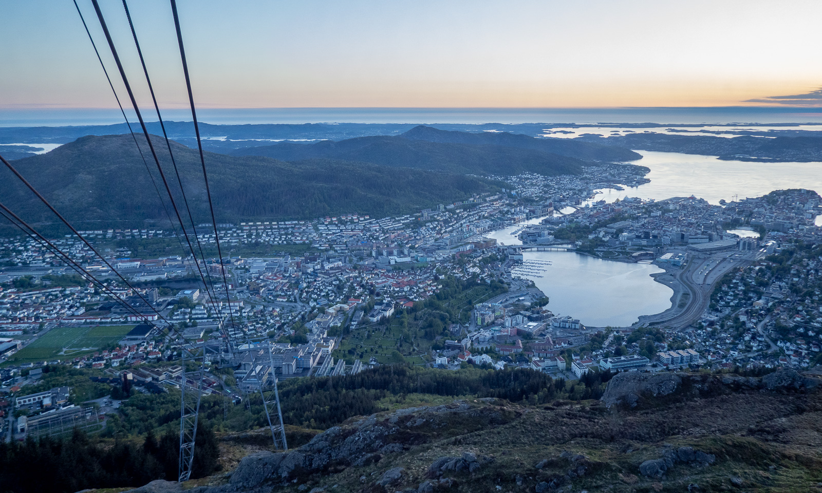
From the descending cable car I watch the sunset …Sunset over Bergen

… then I’m in town again. It is five more kilometres to my hotel, so I take a bus (the wrong one), a tram, and another bus. At 23:15 I am in my hotel room.

Today I walked around 25 kilometres in total and now I only want to take a shower and fall into bed and sleep until breakfast at 7:00 the next morning.

Hill hike III – Ruksesvárri

Today I did my thrid hill hike within 8 days. After Trehørningen (283 m) and Nattmålsfjellet (296 m) I chose Ruksesvárri (470 m) today. Most people refer to the mountain by its Norwegian name (Rødtind), which more or less means the same as the Sámi name: red mountain peak. Like the other hills Ruksesvárri is located on Kvaløya.

I park the car in Storelva, put on my rubber boots and shoulder my camera backpack. From there it’s about one kilometre along the river Stuorajohka/Storelva until I leave the wide gravel hiking path and branch off. From now on the track may be wet and – looking at Ruksesvárri – snowy.

I hike up, following the track. Soon it vanishes under the first larger snow field.

The track is less muddy than I remember but wet, because the snowmelt turns everything into a brook, even the boardwalks. Further up I see that under sand and water there is blank ice. However, it is the only patch I see.

I look back. To the south I can see the island of Håkøya and mountain chains in more or less all directions.

The further up I go, the more the terrain is covered in snow. The barren sections show, how popular this hike is: the track is several metres wide.

Now I am above the timber line and snow dominates the scene. Mostly it is good to walk on and I do not sink in too much, but there are some nasty holes, especially above the mountain brooks, where you can easily break through up to your thighs. I’m on a gentle slope, angled at 10–15°.

I reach the saddle below the peak. In summer the path gets steeper and rockier, now all I can see is the peak and snow. The snowy slope is pretty steep.

I wasn’t the first one today. I met an elderly man who was already on the way down. Perhaps it’s his footsteps that I follow now on the way up. At the steeper part I use my hands as well. Then I reach the top plateau, cross another snow field and stand on the surprisingly unimpressive peak.

The impressive part are the views, especially to the west and the north.

At the tall cairn from where I can see Kaldfjorden meet the open sea is my turning point today. If I had skis or at least snowshoes I would continue. Without then, it’s time to return.

This hill walk was 7.2 km long. Elevation gain and loss: about 500 metres.

The weather is still sunny while I am editing the photos. In one of the photos I can see a small figure – the man who passed me on my way up. On his left side he has something blueish. I magnify the photo to 400%. It’s a pair of blue snowshoes strapped to his small backpack.


A hill hike and a bog walk

Trehørningen

While the mountains around Tromsø are still snowy and the locals are still going ski touring I was looking for a mountain or hill that I can actually walk on by foot. On Facebook people were talking about Trehørningen, not the large one but the small and child-friendly one near Skulsfjord with an astonishing height of 283 metres. Today I drove there, because most places are not accessible by public transport which makes hiking a bit of a motor sport most of the time. I arrive at around half past eight and I’m the first there. After three minutes I and a bit of ascending, I get the first views of the fjord Gállafjerda or Kaldfjorden and the mountain range around the Store Blåmannen.

At first, the path is muddy but then the ground is much drier. The track leads up through an open forest of birch trees. They are still bare.

A bit further up, there is a plateau with a beautiful view of Gállafjerda and the mountains behind.

There are some small snow fields, but only one covers a few metres of the track.

By that snow field there are some water-filled depressions. To my surprise a thin layer of ice covers these puddles. Was there frost last night?

While I am taking these pictures another hiker passes. I’m not alone anymore. Anyway, the mountaintop is near, as usual marked with a huge cairn.

The view is awesome. In the background you can see the island Vengsøya with its mountain Kvantotinden. The island is surrounded by islets and skerries, behind that the Norwegian Sea.

Vengsøya can be reached by ferry. It was just heading back while I was at the top.

The sun makes the air feel warm but the wind on the top wins: The air is still cold and I put on my anorak again, hood over my head. As often, I take less photos on my way back. I only want to take another photo of the bare birches. While I looked through the viewfinder I saw a movement. A reindeer that I haven’t noticed before it trots into view. Does it want to be photographed? Probably not. It continued its walk carefully looking at me to see what I intend to do.

After a four-kilometre hike I am back at the car. Six other cars are parked there now. I liked the tour. It is easy and the parking area is just 20 km away from Tromsø so you could do it as a small after-work trip. You get clean air, awesome views and maybe – if you’re lucky – a reindeer trotting by.

Peat bogs south of Tromvik

I had another tour in mind. A tour that could become pretty wet. I want to walk from Tromvik to the lake Storvatnet, but not on the track east from the river Storelva but instead crossing the mires and bogs. First I have to go there by car. Both Trehørningen and Tromvik are on the island Kvaløya but it’s a one hour drive. Remember, Kvaløya is the fifth largest island in mainland Norway. Then I put on waterproof clothes – you never know what happens and start my tour.

To make a long story short: I think, the lake is pretty boring. I took a souvenir photo, here it is. I guess this view is much nicer, when the lake is calm and the sun comes from the other direction.

Much more interesting were all the small ponds with mossy islets and also the muddy peat flats with their scattered grass tussocks forming small islands. Pretty fascinating. Some photos:

After a six-kilometre hike – a pretty wet one – I am back at the car. I liked this tour, too and I plan to come back on a sunny night this summer. Then the sun should be low in the north illuminating the mountains behind Storvatnet. Hopefully …

Mountains

Some mountains and mountain ranges are extremely fascinating in their combination of white snow and rough rock. The first photo I took from Trehørningen, for the other two I stopped the car on my way to Tromvik.