The ice road in Avan

Today I had a meeting in Norrbotten, Sweden’s northernmost län (county). It was the annual general meeting of Barents Press International, a joint network of journalists in the Barents Region. I joined this organisation a few weeks ago and took the meeting as an opportunity to meet members of Barents Press in real live.

The projects presented at the meeting were really impressing. In addition to that the people were both very friendly and extremely interesting.

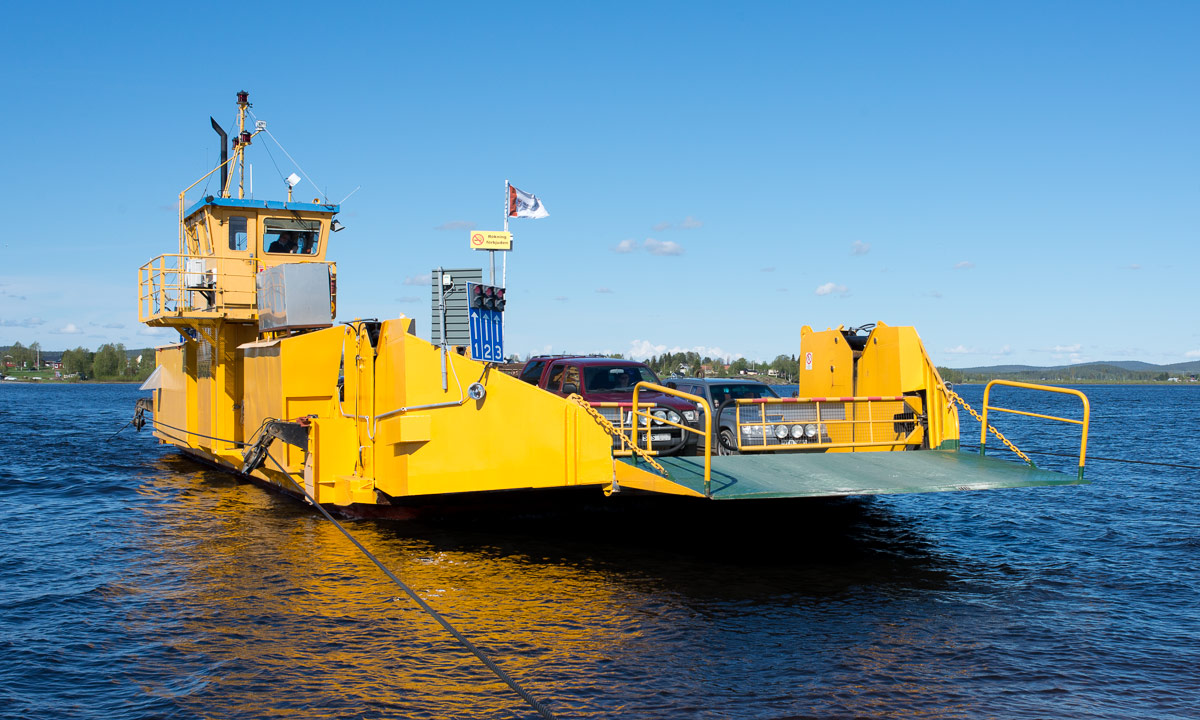
The meeting was in Avan near Luleå, 150 km from here or as the Swedes say: 15 miles. The name Avan rang a bell, but it took a look on the map to remember that it’s the place where Annika and I had used the ferry to cross the river Luleälven in May 2015. And later that day we had been forced to wait before a bridge, where people tried to get out a ship with a crane. (It didn’t work.) After a long time of waiting we had been able to continue the tour.

But back to today. It’s 2 February, -18 °C and the Luleälven had been frozen for many weeks.

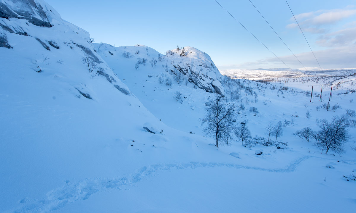
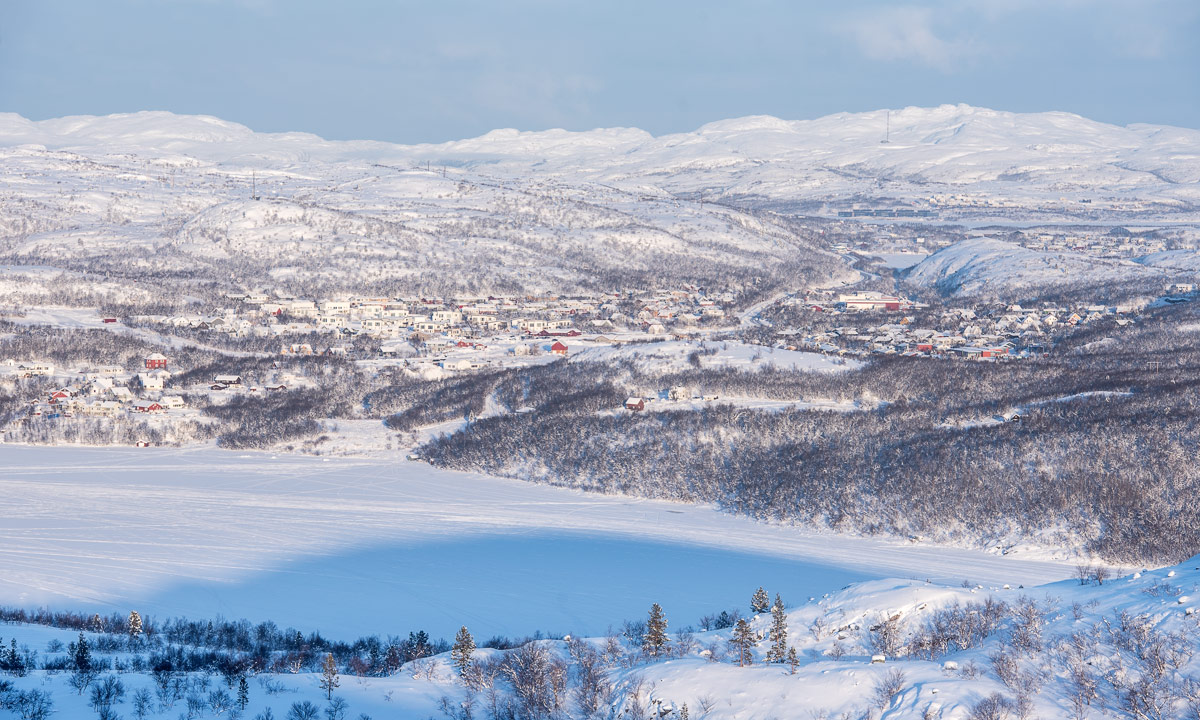
I had left the E4 and drove the road to Avan. It was picture-perfect weather. Everything was covered with soft snow. It was snowing gently and since it was quite early, the snow looked still a bit blueish.

Some hours later – we had finished the meeting and went upstairs to have fika. This Swedish coffee break took at least twice the time of the official meeting, but fika is anything between 15-30 minutes (most common) and open end …

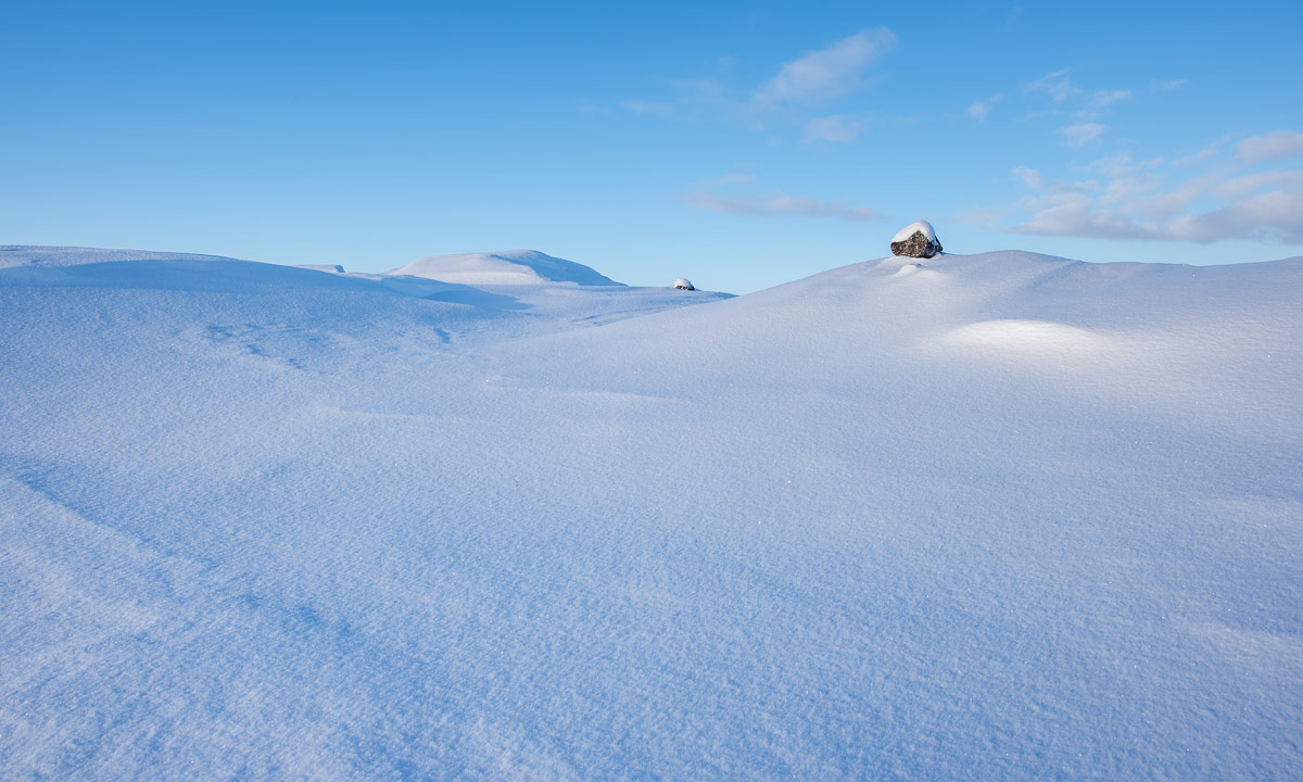
While we were holding fika and it was still snowing the sun came out. The sunlight made the scenery look even more beautiful. What a gorgeous view the house owners have!

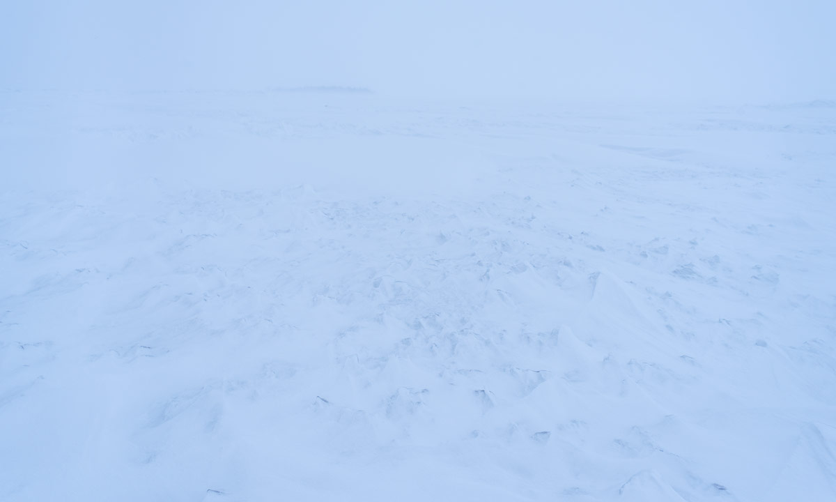
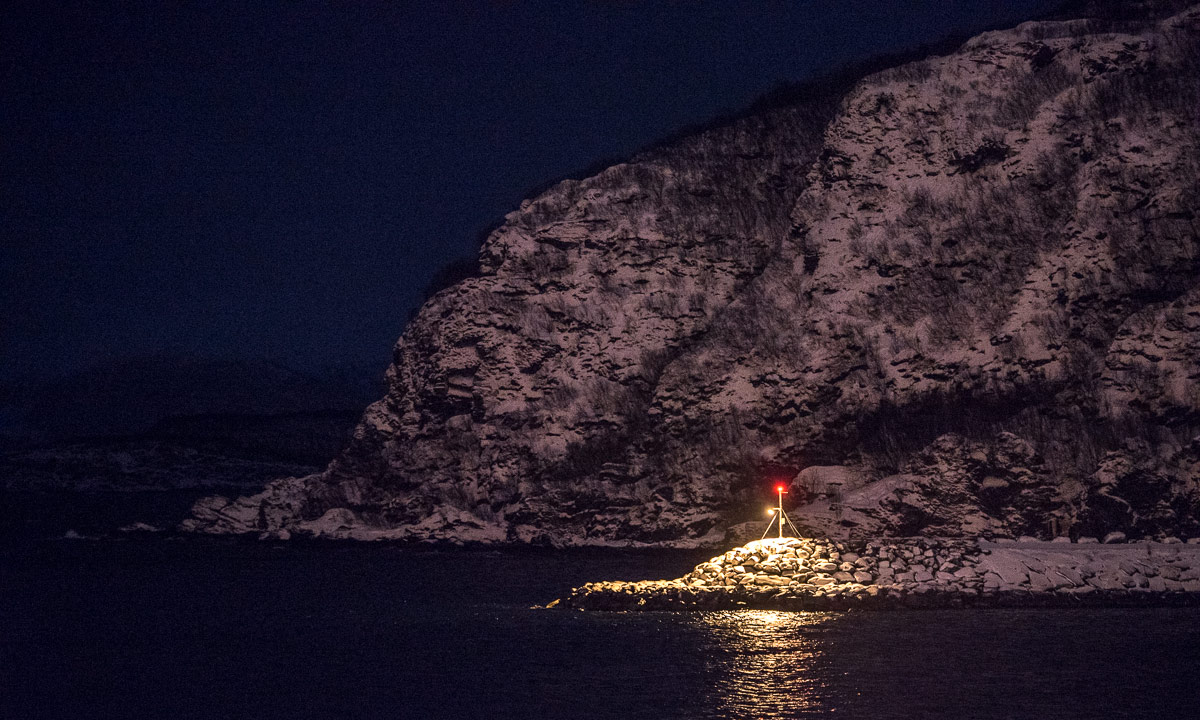
Half past twelve I thanked the hosts and left Avan. I had got an idea: I remembered that there was an ice road crossing the river in wintertime. I was not sure if it was open but it was not far away. I drove there and right, the ice road over the Luleälven was open.

It had stopped snowing and the sun was shining. I parked the car and took some pictures (and was annoyed with myself that I only took the small camera with me).

I saw other cars using the ice road, otherwise I wouldn’t have dared to cross the river, which still is a river with water under the ice. Flowing water. Ok, let’s go …

And so I have got my ice road premiere today. Check ✔︎. I took some photos on the other side and decided to drive back again because I prefer the southern road which I came from.

It was still sunny but clouds had started gathering in the south. While I drove back south it got more and more cloudy. When I made a stopover at my favourite Thai restaurant in Skellefteå it was quite windy and my mobile phone displayed a message:

Warning class 1 snowfall Västerbottens … Snowfall which from Sunday morning to night to Monday can give 20-30 cm. In coastal areas in combination with fresh northeast wind. Snowfall contin…

Later there were the first snow showers. Let’s see, what will happen tomorrow.

Snowy night, snowy day

When I returned from Avan two days ago the Swedish weather institute SMHI had issued a snow warning: 20-30 cm snowfall and at the coast fresh winds from northeast. Yesterday the wind increased and in the afternoon it started to snow. Soon the snowfall increased, too and the wind made the snow whirl round the houses and through the streets. More and more snow came falling down and soon the street was snowed over completely.

“Beep! Beeep! Krrrr. BEEEP! KRRRRR!” – these sounds woke me up this morning at 5 o’clock. The sound of snowploughs and shovel loaders clearing the roads. They beep when they go backwards and the shovels make loud scraping noises.

While the shovel loaders take the snow and move it to other places the snowploughs just push the deep snow aside. Both are important but the latter create work for the locals. They create a so-called plogkant – compact walls of snow – along the street and so right in front of your driveway.

This plogkanten was 60 cm high and the loose snow behind was of almost the same height. Before I could use the car I had to shovel snow. A lot of snow, at least 2½ m³. Fortunately the temperatures where round -10 °C and the snow was loose and fluffy. A good workout anyway. Finally I could get camera and tripod and took the car to two places by the sea.

The garage at the pilot station was surrounded by meter-high snowdrifts. The snowdrifts in the lee of the house were even higher. The gaps in the fence created a nice stripe pattern on the snowdrift outside. It was still quite dark and there was not much to see otherwise.

At the “beach” of Storgrundet the stormy gusts of wind blew the snow horizontally from left and right and in the dawn the scenery looked very harsh.

Great weather for a ski tour on the sea ice, isn’t it?

Two and a half hours later: Chris – a friend of mine from Kirkenes who arrived yesterday – and I had just come to the very same place to start a ski tour. We mounted the skies, put our hoods on and slipped into the gloves. It still was snowing and quite windy.

And when it’s windy at the mainland you can bet that it’s much more windy on the sea ice which is completely exposed to the elements. And so it was. The island Storgrundet was in the back and we could see the pale schemes of some other islands in the northwest. The northeast however looked like the Arctic Zone.

Chris was following my ski tracks. She looked like an arctic explorer with the white void in the background.

Here’s one of of the rare photos of me, that is no selfie. If you look closer you see that my ski tracks go zig-zag. That’s because even on the sea ice of the Baltic Sea there were many snowdrifts with sharp edges and I could hardly see whether it went up or down. Skiing was not exhausting but we were slow due to the wind and the bad sight. (… and taking pictures.)

We skied to a headland which had been in sight for a while.

As soon as we reached the lee of the headland it was almost windless. What a huge difference to the exposed parts of the sea where weather was quite rough. In the shelter of the headland we took a break. (We forget the tea in my kitchen but at least we had a bit of chocolate.) On the headland were summer cottages, now snowbound in meter-high snowdrifts.

The way back was easier. The gusty wind had started calm down a bit and the snowfall lessened. The view to the west however was still extremely arctic.

We were however no arctic explorers but had the luxury of a parked car and a heated house just some minutes away. The ski tour was short in distance but rich in experience and that’s what counts!

Takk for turen, Chris!

It continued snowing until dark. The fence in my backyard had been buried in snow almost completely. The fence is 85 cm high.

Later in the afternoon I continued clearing snow. Not with a front loader but with a wide snow shovel. Chris has parked her car on the street and both the snowfall and the snowplough had buried it up to the top of the wheels. I pushed all snow into the front yard where the snow pile got higher and higher.

I’m a quite curious person when it comes to snow depths. I made a step on the top of the snow pile and as I guessed the snow was quite loose:

If the forecast is right we get calm, sunny and colder winter weather tomorrow. We consider to start the very same ski tour again just to see the difference.


A sunny ski tour on the Baltic Sea

What a beautiful day! It’s calm and sunny with temperatures round -20 °C. After breakfast Chris and I start another ski tour at the very same place as the day before. Between these photos lies a day:

As the day before we ski to the near island Storgrundet and cross it, but then we turn right. The Baltic Sea is covered with ice half to Finland but you hardly see the ice anymore. It is covered with snow.

The last two days have brought round 30 cm of fresh snow, but the Baltic Sea is not evenly covered. There are snowdrifts and patches with bare ice and the wind has created sharp snow patterns. They are called sastrugi. Sastrugis can make skiing very demanding when they are hard, but these were still soft and easy to ski on.

It is colder than the day before but it feels much more comfortable and warm because the absence of any wind. We ski along the islands, first Storgrundet, then Norrskär. Here we turn left because another island catches my eye. Northeast from Norrskär there’s a smaller island called Norrskärsgrundet. Here a lot of snow has accumulated.

Chris and I ski to the island and take a break. We both have about the same tempo and like to photograph – always a good reason to slow down.

We walk round and take pictures, then we mount our skis again and “climb” the island’s top. Some fresh animal tracks are visible. A fox, a hare, and a place where the snow tells a story. Here a fox apparently caught a bird. We see a deep track of the foxes jump in the snow and feathers everywhere.

We turn right and reach the esker that connects the islands Norrskär and Bredskär. It’s time for skiing back and also time for a break with hot cocoa and chocolate that we take on the ice by a tiny nameless island. We are glad about our puffy down jackets because we instantly feel the cold when we stop moving. After the break we continue our way back to the parked car. The sun is low and our shadows have grown long.

Soon the snowy surface we ski on lies in the shadow of the island Brambärsgrundet. Only the cottages on Storgrundet have still sun. We reach the car round sunset – good timing.

I love snow storms as well as sun and blue ski and I love especially the contrasts. Therefore this ski tour is strongly connected to the one we made the day before, the day that brought the snow we ski on.


Stopover in Bjuröklubb

Standing on the wooden platform by Bjuröklubb’s lighthouse you have a wide view over the Baltic Sea. And as the ice report says, the sea is covered with ice and snow as far as the eye can see.

Just three photos from today.

Light pillars and northern lights in Bjørnevatn

This article is part of the series “2019-02: Northern Norway”.

I have seen light pillars in my life and I have seen the aurora many times. Today I got the perfect combination of these two light effects. And never ever saw I light pillars as clear as today.

To see light pillars you need cold weather. When I was out, it was between -22 °C and -24 °C, probably colder on the frozen fjord. Light pillars are caused by hexagonal ice plates that tend to hover horizontally and therefore reflecting the light vertically. The light source can by natural, as e.g. sun and moon or artificial.

I was very lucky that it was cold and clear today so that I could observe them and make some pictures.


Travelling to Bjørnevatn

This article is part of the series “2019-02: Northern Norway”.

After visiting me home in Skelleftehamn Chris and I continued to Jokkmokk on Thursday. We visited the winter market and then drove to Solberget, where we stayed overnight.

The next day we started a long drive with her car. Chris lives in Bjørnevatn near Kirkenes and we planned to arrive there the very same day. At 7:10 we started our journey that would lead us through Sweden, Finland and Norway.

First the sky was cloudy but the visibility was good. Then it started to get a bit foggy.

Normally that’s no problem. This icy fog however started to cover the windscreen more and more and we had to stop often to scrape of the ice.

In Gällivare we stopped at the gas station and had some breakfast. We also bought a bottle with de-icer for the windscreen and continued our trip.

The de-icer didn’t help, we had to stop many times to scrape away the ice from the freezing fog. We were not the only ones. The headlights and the number plate were covered with several millimetres of ice, too. I never had experiences something like this before.

Only the bottom 15 cm of the windscreen were free of ice. While Chris crouched into the seat to be able to see I gave up taking pictures from the road and photographed sideways.

We approached the Swedish town Karesuando. This small town is located directly on the Muonio älv, which also forms a natural border with Finland. On the other side the town is named Karesuvanto where we took another break.

Strangely the ice problems stopped right after the Finnish border. We continued to Palojoensuu without any problems. There we turned left onto the road 93. An hour later we were at the Norwegian border.

After being stopped by the customs and assuring them that we have neither alcohol nor cigarettes with us, we continued driving through the snowy plains. Next stop: Kautokeino, where most inhabitants are Sámi. Here we ate a hamburger with chips, a typical meal if you travel through Northern Norway.

Until now, Chris had driven a car. Now it was my turn to drive to give her at least a short rest. The first time I drove a diesel.

Round two hours later we arrived in Karasjok. What I already had suspected, confirmed here: It was cold outside: -30 °C.  Time for another break.

Back in the car, Chris was driving again. It was dark, it was cold, we were tired and still more than four hours to go.

I started to get bored and played around with my camera.

A pale green stripe appeared above the street. A northern light. The next hour we got quite nice northern lights, mostly directly in front of us. Though being tired we got at least entertainment. The photos are awful, northern lights are not made for being photographed free-handed from a car on a bumpy road.

Finally we came to Tana, where we crossed the river of the same name. A quarter hour later we arrived in the small town Varangerbotn, were we took the last stop of our long trip.

Now we drove along the fjord Varangerfjorden. Anyway, beside of some street lights and the weakened aurora it was pitch black and I couldn’t see the fjord. Beside of that I just longed for a bed.

But finally we arrived at Chris’ home in Berg near Bjørnevatn. Arrival time 23:40, 16½ hours after we started in Solberget.

Here I’ll spend the next days.

Link to the route on Google Maps


MS Spitsbergen

This article is part of the series “2019-02: Northern Norway”.

Today it was cloudy and much warmer in Bjørnevatn than yesterday day and evening. Chris and I took breakfast at the Thon Hotel Kirkenes. This breakfast is just superb! There is a wide variety of food and the quality is excellent. While we had breakfast it started snowing. I looked out of the window and watched a small icebreaker. Two years ago the Elvenesfjorden was completely free of ice. This year however it had been so cold the last weeks that the whole fjord is frozen. Or would be, if the icebreaker wasn’t going back and forth and crushed the ice.

Kirkenes is the endpoint of the Hurtigruten line, that connects many Norwegian coastal towns as e.g. Bergen, Trondheim, Bodø, Tromsø, Hammerfest and Kirkenes. As long as the weather allows the ship arrives at 9:00 and departs at 12:30 every day. Many tourist go ashore to discover the city or to go dog sledding in the Snow Hotel.

Today it was the MS Spitsbergen that was in the harbour. It is possible to visit the ships and so Chris and I took a small tour to explore the ship.

The MS Spitsbergen both operates the Hurtigruten line Bergen—Kirkenes but also makes cruises to places like Iceland (from 4373 EUR), Svalbard (from 7058 EUR) or even Franz Josef Land in Russia (from 7696 EUR). Great destinations but much too expensive for me.

P.S.: Don’t ask me why there is dried fish on the top deck of the MS Spitsbergen.

Going by snowcat

This article is part of the series “2019-02: Northern Norway”.

It’s dark outside. I’m in the cozy house, where Chris and Ørjan live and reading. But what’s that blinking orange light outside? I peek through the door and what I see is a snowcat.

Ørjan is about to start a tour to prepare trails, both for his employer, the Snowhotel Kirkenes and for the local skiers. Preparing trails for the latter is a dugnad, that means voluntary work. Dugnad is very popular in Norway.

I ask Ørjan if I could join him on the tour and I am allowed to. Time to take some handheld pictures.

It’s fun to go by snowcat through the dark. I looks quite easy to operate and I would like to have my own snowcat. But neither do I need one nor could I pay it.

Takk for turen, Ørjan!

A snowshoe tour over the snaufjell

This article is part of the series “2019-02: Northern Norway”.

After some very lazy days I decided to make a snowshoe tour today. I just had to move! I’m here without my own car and therefore with quite limited baggage, but I was lucky to be able to get snowshoes from the Snowhotel Kirkenes.

First I followed a marked snowshoe route. It was -8 °C and in contradiction to the forecast the sun was shining. After some time I left the trampled path and made my own tracks. That’s what snowshoes are made for.

I went around and up some of the higher hills. First I love the view and then I love the snaufjell, the part of the mountains above the treeline. In Swedish it is called kalfjäll, but both words mean the same: bare fell. And soon I got my views.

One thing is special: There are boulders everywhere. I guess it’s leftovers from the last ice age but I don’t know why you hardly find those round-shaped boulders at other places on the bare fell.

The sun had vanished behind a layer of clouds and it started to snow. Sometimes the snow underneath my feet was of such a perfect white that I could not see whether it was going up or down. At least the sight was good and the terrain is easily accessible.

I navigated only by sight, therefore I cannot give you the name of the mountain top that was marked with a pile of stones and a wooden stick.

After some time I started my way back and descended from the snaufjell until trees got more common again.

I walked down through the fresh white snow – sometimes knee deep even with snowshoes – until I came to the trampled path again. Here the snow was so firm that I unmounted the snowshoes and went the rest of the tour without. Three hours later I was back in my host’s house.

It doesn’t happen often that I have a clear photo favourite of a certain day. Today I have:

A lake named after Anders

This article is part of the series “2019-02: Northern Norway”.

Ascending and descending hills and mountains and three selfies at three different places

The forecast was right, today it was sunny. Morning temperatures were round -9 °C – good conditions for another snowshoe tour.

Chris gave me some tour tips and I decided to go south to a nameless hilltop. I crossed the road and followed the snowmobile trail that cross the river Katojoki. To be honest, without having looked on the map before I hadn’t realised that it was a river. Now I put on my snowshoes and left the trail.

It was quite exhausting to walk through the snow because even with snowshoes I sank 20 – 40 cm into the snow with each step. Snow was falling on top of the snowshoes giving them additional weight. The terrain was rising and I had to make several short breaks to catch my breath. When I came near the hill, it got steeper but since the hill is only 151 meters above see level I was soon on the summit, a snowy platform with a 360 degree view. Here I took a break.

To the north I could see the small town Bjørnevatn and snowy mountains at the horizon. To the east I could see the Fjord Uhcavuotna or Langfjorden. On the snow covered frozen fjord I watched the snowmobile groups and the dogsleds. It’s high season for tourists. Looking to the south I saw the fjord disappearing in the fog. In the colours of the still low sun the scenery looked quite unreal.

It was half past ten. Definitely too early to return. In the southwest I spotted a higher mountain range, which I already knew from the map. Between the mountain range and my resting place on the hilltop there was a valley. I wasn’t sure if I would manage to climb the mountain range but I could try. I zigzagged down the hill to avoid the steeper parts, crossed the valley – phew, deep snow again – and went up a small snowy hill.

You see the picture above? There are two possible ways up the mountains. A steeper and higher one to the right and a shorter and less steep one to the left. The right one could be too steep for me and my snowshoes and I was afraid of avalanches. Therefore I chose the left one. It worked! After ascending the snowy slope I stood on a small plateau.

I had to climb another slope, shorter but steeper, then I reached the sunny vidda. Vidde is Norwegian for expanse and for plateau or tableland. You may know the word from Hardangarvidda, a large plateau between Bergen and Oslo.

That’s the landscapes I love – less is more!

After walking around and going up another small top I reached a flat snowy plane. If it’s completely flat it’s probably not a bog but a lake and so it was. It was the lake Andersvatnet (136 m above sea level).

On the other side another hilltop, according to the digital map 183 m above sea level. Strange that all these summits and tops do not have any names, at least not in the official maps. I decided to climb this top, too. The borrowed snowshoes are not very good for steeper passages so I had to look for a good way up and more than once I slid back or had to use my hands to pull me up. But finally I “conquered this hostile mountain”!

The first photo above shows Andersvatnet. If you look at the enlarged picture you can see my snowshoe tracks.

I didn’t make a long break because I wasn’t sure about the continuation of my tour. I would love to stay up for a while and then descend at another place, but according to the map it could be quite steep. I went northwest and went along the edge of the mountain range.

I looked for a possibility to descend the plateau but finally I had to realise that all slopes were much too steep to descend. Therefore I continued by circular route until I could see the same power pole again that I passed on my way up. I ascended another small top, again with a gorgeous view. Time for another break.

I felt cold. Probably it was because I was exhausted and a bit sweaty. While I didn’t close the down parka at all at my first break I closed it completely this time and even put on the woollen mittens. Wrapped up like this I could enjoy the sun and the views in all directions. But then it was time to continue the tour and to leave the bare mountains. I found my old snowshoe tracks, followed them and went down, mostly in my own tracks.

After I left these mountains behind I went back straight ahead. Again deep snow, but less exhausting than climbing all hilltops. I was back to civilisation. I could hear the roaring of the snowmobiles and the barking of the huskies. Later I saw them both. A group of white dressed snowmobilers – probably hunters – and the huskies pulling the dogsleds. Still I was 100 meters above sea level – high enough to have wide views. Do you see the dogsled on the next photo?

I reached a large trail prepared for the dogs. It was solid enough that I could go there without snowshoes. What a blessing! Snowshoes are great for mountain tours like today but I always feel clumsy wearing them. I passed some dog teams – guides sorting the dogs and tourists wrapped in winter coveralls sitting in the sleds or taking pictures.

The inner of my nose started to tickle, normally a sign that it’s -15 °C or below because then the nose hairs start freezing. Even my eyelids started to freeze together. When I arrived home the thermometer showed -16 °C. So it has become colder over the day.

Now it’s 22:15 and outdoor temperature has dropped to -22 °C. Probably the last cold night for a long time, since much warmer weather is on its way.


Inside the Snowhotel Kirkenes

This article is part of the series “2019-02: Northern Norway”.

After two great snowshoes tours I took it easy today. I went to the Snowhotel Kirkenes nearby, took some photos of the huskies, that didn’t have to work, visited an acquaintance who works in one of the restaurants and went inside the Snowhotel itself. I’ve been there before, but since the hotel is rebuild from scratch every year it looks always different.

Which photo of the lobby do you prefer? The first one, where the room is empty or the last one with the blurred people in it?

Boarding the MS Lofoten

This article is part of the series “2019-02: Northern Norway”.

After some days in Bjørnevatn near Kirkenes I start my journey home today. But I’ll take a long, long detour!

Some hours ago I boarded the Hurtigruten ship MS Lofoten. It’s both the oldest and the smallest of the ships that serve the coastal route BergenKirkenes. It was built 1964 and is therefore older than me. It can accommodate 153 passengers.

I will travel four days and leave the MS Lofoten in Trondheim where I hope to catch the train back to Sweden. I already bought WiFi access for the next four days and found a nice place for blogging.

Here are the stopovers of the next four days:

Kirkenes – Vardø – Båtsfjord – Berlevåg – Mehamn – Kjøllefjord – Honningsvåg – Havøysund – Hammerfest – Øksfjord – Skjervøy – Tromsø – Finnsnes – Harstad – Risøyhamn – Sortland – Stokmarknes – Svolvær – Stamsund – Bodø – Ørnes – Nesna – Sandnessjøen – Brønnøysund – Rørvik – Trondheim

Travelling with the MS Lofoten: Kirkenes – Øksfjord

This article is part of the series “2019-02: Northern Norway”.

Friday, 15 February

While I moved into my cabin the Hurtigruten ship MS Lofoten still anchored in the port of Kirkenes. I had a windowless 2-bed-cabin for myself and was able to spread out my belongings. But before that I took a photo with my fisheye lens. With the fisheye-like distortion the cabin look huge!

I used the Hurtigruten twice before, in 2017 from Vardø to Stokmarknes and last year from Båtsfjord to Ørnes. So the section KirkenesVardø was new to me. And it’s the first time without my car on board.

We were in the harbour till half past twelve.

Then we left Kirkenes and my 3rd and longest Hurtigruten journey had started. I stood at the stern of the ship and looked back.

Soon I changed place from stern to bow – at the MS Lofoten you can stand next to the bridge – and looked ahead. Far away, a bit to the port side I could spot a white plain – part of the Varanger peninsula.

[Live interruption: We have reached the open Lopphavet between Øksfjord and Skervøy. The ship has started to rock again. I am interrupted by the sound of a plate falling down from the table. Thanks to the soft carpet it survived]

Annika and I travelled a lot on the Varanger peninsula last winter. I stood on the port side of the ship and tried to spot all places we have been: There’s Vadsø, the largest town – there, far away is Ekkerøy with it’s beautiful beaches. And there is Kiberg, where we had a good time with Trond, our host of Cape East Arctic Adventure. And there’s his house! I found it! Let’s see, what about Kibergsneset, the easternmost point of mainland Norway where Annika and I had been last year? It was farther away from the village than I remembered, but finally I found it, too. Both photos are taken with 600 mm from a rocking ship with a vibrating motor, so the quality is bad, but it was nice to take these pictures.

Half an hour we arrived in Vardø, stop #1. (Vadsø is left out on the southbound direction.) We arrived late and I decided to stay aboard. I’ve been in Vardø before.

When we left Vardø behind, it was too dark to see the scenery. I have breakfast included but not the other meals, because I think they are quite expensive. I have my own food with me. This day however I didn’t have a proper breakfast so I bought a large bread with salmon and scrambled eggs.

The MS Lofoten went along the northern coast of Varanger. It was windy and the sea was a bit rough. The MS Lofoten was exposed to the elements. It is not only the smallest operating Hurtigruten ship but also the only one without stabilisers. It was rocking in every direction and the swell got stronger and stronger. Sometimes the bow of the ship was hovering in midair and then scended into the next trough. I’ve never been seasick before but I started to sweat and to feel quite uncomfortable. I tried to ignore it for a while, then I interrupted my photo edit session, went down to my cabin and went straight into bed. Whether it was my lying position or the fact, that the cabin was nearer to the center of the ship’s mass I don’t know, but I felt much better and fell soon asleep.

I woke up shortly before Båtsfjord, stop #2. Near the harbour the strong swell had subsided. Soon the ship lay calmly at the jetty. It had started snowing intensely. We were in Båtsfjord quite a long time due to a lot of freight being unloaded and loaded.

I went into my cabin and continued sleeping. I overslept Berlevåg, Mehamn and Kjøllefjord but was awake in …

Saturday, 16 February

Honningsvåg, stop #6. I was so sure that I would oversleep this stop as well, but we were an hour late. I was still dark, but I could take some photos with my tripod.

[Live interruption: We have left the Lopphavet, the sea was much calmer than expected]

We left Honningsvåg with an hour delay. I tried to make pictures but the sight was poor, mostly because of the snow showers and the low hanging clouds. At least I could take a picture of the MS Nordnorge.

An announcement came through the speakers: Due to the delay we would skip Havøysund, usually stop #7. This would spare us half an hour.

It got warmer. Temperatures were hardly below zero, much too warm for the season. It snowed more and more and all you could see was the ship and a circular patch of waves and snow.

Anyway the snow showers didn’t last for hours and after another snow shower Melkøya came into view.

Melkøya is just a few kilometres away from Hammerfest, second largest town of the Finnmark. It’s the endpoint of an undersea pipeline for natural gas. Here it is converted to liquefied natural gas that is exported to the world.

Right after Melkøya Hammerfest, stop #7 on this journey came into view.

Here we had a longer stopover. A young woman took ropes, rolled them up and threw them up onto the much higher foredeck of the MS Lofoten. She succeeded every time. Later I asked here if I might use the photo (I may) and she told me that she wasn’t sure if she would make it today because of the strong winds.

I left the MS Lofoten for looking around, taking pictures and buying a coke in the local supermarket. Some photos:

After an hour I went aboard again, placed myself into the salon and started editing images. The weather was too dull to take great pictures, a good reason to be lazy.

I even took a short nap in my cabin. Anyhow I was up again when we arrived in Øksfjord, stop #8. With a fisheye photo of the port Loppa Havn I will finish this blog article.

[Back to now: Soon we’ll arrive in Skjervøy, stop #9. If we make it we’ll even reach Tromsø today but perhaps I’ll sleep. I’ve been in Tromsø several times before and even twice last year.]


Travelling with the MS Lofoten: Øksfjord – Stamsund

This article is part of the series “2019-02: Northern Norway”.

Disclaimer: Many, many photos, some of them pretty mediocre but all part of the journey.

Still Saturday, 16 February

After we left Øksfjord we continued our journey through the darkness. The people on board were idle, they chatted, read a book, look through the window and of course most of them used their computers, tablets or smartphones.

Three hours later we were in Skervøy, stop #9 of my Hurtigruten journey.

After a short stay we continued to Tromsø, Norway’s largest town north of Trondheim. I took a night image of the passing Hurtigruten ship MS Trollfjord then I went to sleep.

Our stays in Tromsø and Finnsnes I overslept completely.

Sunday, 17 February

At 7 o’clock I woke up, half an hour later I stood outside and took the first pictures in the blue hour. The weather was much better than the other days and the temperatures had dropped below zero in the night. We were on our way to Harstad, with 25000 inhabitants the third largest town in Northern Norway. Stop #12.

While we were stopped in Harstad the sun was rising and was bathing the landscape in purplish light. Harstad started to glitter. It was the many windows reflecting the warm sunlight.

The sun rose higher and after a while the sky was blue. I stood outside with my large telephoto lens and tried to catch the impressive snowy mountain ranges by the fjords and sea.

Risøyrennan, a deepened part of Risøysundet came into view.

After a short stay in Risøyhamn, part of the Vesterålen and stop #13 of my journey we continued south. The sheltered  was covered with a closed layer of thin pancake ice. You could hear it crack when it met the bow wave of the ship.

Some more images taken between Risøyhamn and Sortland:

I left the MS Lofoten in Sortland, stop #14, but only for a short time. In Norway all shops are closed on Sundays and then the towns may be a bit boring. Partly the ways still covered with a bit of frozen snow, but mostly it was slippery ice and some deep water puddles. Home in Skelleftehamn it had been very warm the last days and I expect the same road conditions when I’ll come home in a couple of days.

After 30 minutes the MS Lofoten continued its tour. At the horizon the steep mountains of the Lofoten islands came into view.

The backlit Lofoten mountain ranges looked amazing as if they were from another world. I’ll show you two photos but I’m not at all happy with them. In reality the landscape looked more aerial or as if made of light.

These mountains were in the far. The nearer mountains to the left or right looked more normal when it comes to light but still unreal because they were so steep and snowy.

The large island Hinnøya on the port side, the island Langøya on starboard side of the ship I stood at the starboard and peeked through my telephoto lens. I have friends near Stokmarknes on the Vesterålen and was I looking for their house. I found it ;-). Unfortunately R. was ill but J. visited be on the ship with the children. They went on board while the ship lay at the port of Stokmarknes, stop #15. Shortly before departure my friends left the ship. Thank you very much for your visit!

Oh, I forgot the photo of the islet (or holm) Gjæva. I already knew it from earlier stays with my friends.

Now we headed for the impressive sound Raftsundet where we would even take a small detour to the entrance of the Trollfjorden. Due to the narrowness of the fjord and the risk of avalanches it’s not possible to drive into it in wintertime.

We left the blue sky behind us, the weather worsened.

First the weather still was quite fair but then it started to snow. The snowfall was so strong and the cloud layer was so thick and low that it was decided not to visit the Trollfjorden. You hardly would have seen anything.

The camera was wet, I was wet, too and it was so dark that it was near to impossible to take any pictures. It was twenty to five and I went into my cabin and took a nap.

Just some photos “for the archives” of the next stays: Svolvær and Stamsund, stops #16 and #17, both on the Lofoten.

Travelling with the MS Lofoten: Stamsund – Trondheim

This article is part of the series “2019-02: Northern Norway”.

I’m writing this blog article from the train. We left Trondheim central station ten minutes ago at 7:50, at 9:22 I’ll be Storlien in Sweden where I’ll have to change train. But back to the day before yesterday evening. The Hurtigruten ship MS Lofoten had just left Stamsund

22:30 – we just had left Stamsund. The next stop would be Bodø at 2:30 in the night.

Monday, 18 February

As expected I overslept Bodø, stop #18 of my Hurtigruten journey to Trondheim. I was awakened by a loud, squeaky noise. It was our ship leaving Ørnes, stop #19. It scraped along the huge truck tires that are fixed to all piers to avoid damages and made an awful noise. One hour later I stood on deck and looked at the MS Spitsbergen, the ship that Chris and I visited eight days ago. It had been in Bergen and now was returning to Kirkenes.

At half past nine we passed Polarsirkelmonumentet, a monument marking the polar circle. It looks a bit alike as the more famous monument at the North Cape.

But – where’s the winter? We were not only going south, we also had unusually warm weather for mid-February. Beside of the higher mountains most snow had melted and the landscape looked more like a rainy September day than the middle of winter.

Later there was a little ceremony for having crossed the polar circle. I have crossed it many times but I participated too. Obediently, I took a spoonful of cod liver oil, because I wanted to have the spoon that you may keep.

I have to admit, that the journey started to become a bit boring. The winter was far up north, the weather was warm and rainy and I’ve been on the ship for three days already. I made some pictures anyway.

Next stop Nesna, stop #20.

Next stop Sandnessjøen, stop #21.

Here I even took some detail photos of the MS Lofoten from the pier.

We travelled along the Helgelandskysten, the coast of Helgeland. It’s a well-known scenic route which Annika and I took some years ago after having visiting friends in Norway. First it showed a funny combination of ancient mountains and modern functional houses.

De syv søstre (the seven sisters) came into view and seemed to follow us for half an hour. This is a quite impressive mountain range with seven summits. Some of the tops were in the clouds that made the view maybe less postcard compatible but in my opinion more impressive. The mountains looked higher with their summits hanging in the clouds.

Next stop Brønnøysund, stop #22. Here we had a stopover of an hour. When I left the ship rain was pouring down and I was glad about my Gore-Tex clothes that I actually didn’t plan to wear before April.

We left Brønnøysund at 17:00 and it was still quite light. Half an hour later it became so dark that you could hardly see anything but the lights of towns, villages, streets, cars and other ships.

Next stop Rørvik, stop #23 and the last stop before Trondheim. The weather was just as bad and Rørvik in a rainy winter evening is probably not the most beautiful place, especially when there’s a huge construction site in the middle of the village. Soon I returned to the ship that lay head-to-head with the Hurtigruten ship Nordlys. Some very last photos of the tour.

At half past nine we left Rørvik. I was already lying in my bed in cabin 121. The alarm clock was set to 6 o’clock in the next morning. The next day we would arrive in Trondheim where I would leave the Hurtigruten, take a taxi to the railway station and then the 7:50 train to Storlien. There I would take another train to Sundsvall and a third one to Umeå. In Umeå I would stay with Annika for a night and travel home by bus the next day.

Our train just stopped in Gudå. 20 more kilometres and I’ll be back in Sweden. Ha det bra, Norge. Takk for turen.


Travelling to Kirkenes and back

This article is part of the series “2019-02: Northern Norway”.

I’m sitting in the bus from Umeå to Skellefteå. There I’ll take another bus to Skelleftehamn, walk some minutes through the ice cold wind, then I’m home again from a journey to Kirkenes.

The journey took less than two weeks but was round about 4000 km long.

Click on the image to open the interactive Google map.

Legend: overnight stays |  car | ship | train | bus


Meanwhile in Skelleftehamn – snow and sea ice

Arrival home in SkelleftehamnI expected the worst in Skelleftehamn. The worst regarding winter. I wanted to have a real one – it’s mid-February – but had heard about the warm temperatures last week. Three days with temperatures round 7 °C, at least in town. But I was lucky, it hadn’t rained these days. The snow had fallen together but was still there. All minor streets where still white with some fresh snowdrifts from today’s strong and gusty wind and in my backyard lie still round 55 cm of snow.

Of course I had to shovel away the snow before I could use my car. Its a car with all-wheel drive but no snowcat. Although the snow was hard it was easier than expected.

The special thing about a trip with the Hurtigruten ship is that the Norwegian Sea is free of ice the whole year round and most parts of the Barents Sea, too. The Bothnian Bay – the northernmost part of the Baltic Sea – however is covered with a thick solid layer of ice. That’s what I thought until I read a Facebook post today:

Öppet vatten runt Gåsören. – Open water round [the island] Gåsören.

I could hardly believe it and took the car to the coast. And yes – large parts of the sea were free of ice, even the ice floes had gone beside of some remains. I guess there won’t be a ski tour to Gåsören this winter.

Two weeks ago I had made ski tours on the Baltic Sea with Chris. Although there’s solid ice left between the other islands I doubt that we could do the same tours today.

Here’s a comparison of the ice situation today and two weeks ago:

Legend:  fast ice |  very close or compact ice |  open ice | open water
Source: SMHI Sea Ice – Archived charts and reports

No kayaking today

Yesterday the Baltic Sea was open. Some ice floes drifted in the waves, the rest between mainland and the island Gåsören was open water. Just the photo from yesterday afternoon one more time:

When I saw the open see yesterday I thought about kayaking today. Temperatures below -15 °C were expected. What to wear beside of a dry suit? How many layers?

I started to dig out the door and gate of my garage to be able to get my kayak. That was hard work. The upper layer of the frozen snow that had slid from the roof was as hard as concrete. Even the avalanche shovel with the metal blade could be hug into the snow centimetre by centimetre. But finally I made it, my kayak was free.

Today at 7 o’clock the outdoor thermometer showed -18 °C. Again – what to wear on a kayak winter tour? Two layers of underwear? The winter anorak? The earflap cap made of thick polyester fur? Well, first let’s check the situation by the sea.

Oops …

The sea had been frozen overnight. A stripe of at least several hundred metres was covered with soft and thin ice, exactly that type of ice hardest to handle when sitting in a kayak.

Kayaking plans cancelled! Time for another photo.

Farewell winter

Yesterday afternoon: a snapshot of the coast. That’s how I like winter. Either a lot of snow or cold, crisp and sunny days at the coast.

This morning at 7 o’clock the weather was still fine. An almost cloudless blue sky at -19 °C. Would it be another beautiful winter day? Well …

Since days the weather services SMHI, Klart and yr had been predicting much warmer weather from today. Unfortunately they were right. At 8:00 the temperature already had risen to -9 °C, at 9:30 to -4 °C. In the afternoon some snowfall was predicted by SMHI. Instead of snow we got freezing rain for hours and soon black ice covered the roads and made them incredibly slippery. Even the snow-covered surface became extremely icy. The rain created an ice shield everywhere, for example on the southern windows of my winter garden.

Both SMHI, Klart and yr predict warm weather with plus degrees up to 8 °C for the rest of the month. Much too warm for February!

The rubber boots and the matching spikes are already at the door and probably will become standard equipment for days.

Farewell winter. I hope you come back with snow and coldness in March.

Late April weather

It has been warm for days, it rained for hours and some puddles in Skelleftehamn look bigger than an average flat in Munich. This is probably the most awful weather I experienced in Sweden in February since I came here in 2010.

It’s however not the first year, where the February is much too warm for a longer period. It had happened several times before. The future will show if it is just normal weather variations or part of the ongoing climate shift.

Kågnäshällan – between land, ice and sea

Kågnäshällan is a small island in the Baltic Sea with a lighthouse. The linear distance is only 7 km, but it’s 18 km by car. Since I cannot fly (and neither skies or kayak would do neither) I took the car this morning to Kågnäsudden, the cape nearby to take some photos on Kågnäshällan.

The sea is almost free of ice, only at the coast and between the islands there’s a thick layer of ice left. That makes the area quite amphibian. I took snowshoes and pulka for walking along the coast and for crossing the wet but safe ice between mainland and Kågnäshällan. Then I wanted to get near the ice edge and chose waterproof equipment. The waterproof Nikon AW-1 for taking photos and my red immersion suit to keep my warm and dry in the ice cold water. I felt like a bright red seal hunting for photos, not for fish.

Last day of February – polar light

Just one hour ago: finally a polar light above Skelleftehamn that was more than a pale green arc. It was just a short intermezzo and when I had found a good place for photographing it already weakened. That’s normal. Many of the beautiful auroras do not last long. I got some shots anyway.

You see the open water on the last image? Well, that’s another story to tell.

Last day of February – farewell sea ice

Yesterday I stood on the ice edge of Kågnäshällan. It was warm and felt like the end of April. And so it looked like, too, because large parts of the Bothnian Bay were free of ice. Only protected bays and shallow waters round the islands were still frozen.

It became colder and stormy in the night. It even snowed a millimetre.

When I got up this morning it was -4 °C and still quite gusty and stormy. At 8 o’clock I took the car to have a look at the ice conditions.

I passed the nearest bay Kallholmsfjärden, just 400 metres from my house. Some ice fishers were sitting on the ice, but only some hundred meters from open water. I however wanted to drive to Näsgrundet, one of my favourite places. Yesterday afternoon the sea east of this peninsula had been completely covered with a new ice shield that had been created one week ago. Today it was … well, different …

Gale-force wind gusts tugged at my hood. Waves splashed sea spray and tossed pieces of ice onto the ice walls in front of the coast. Ice floes floated to and fro, cracking, shaking, turning, breaking. Sometimes I could feel the vibration of another wave hitting the ice wall I was standing on. Some of the ice already had been squelched to slush. I cannot remember such an impressive view of the forces of the Baltic Sea in winter time. Farther away a ship was leaving the port, accompanied by a tug boat and the small icebreaker Baus.

I tried to make pictures of the say spray of the waves. Not easy …

Behind the curtains of spray waves came rolling and small and large ice floes pivoted and danced while going up and down.

After 45 minutes the Baus came back heading for the port.

Partly I was taking pictures, partly I was just enjoying the energy of the elements and listened to the different sounds. I tried to make some videos, but all you can hear is the swooshing wind at full volume.

After one and a half hours of photographing I left this scene and drove to the small boat harbour Tjuvkistan nearby. Here the ice uses to be safe to cross to the islands Norrskär and Bredskär until the end of March or even mid-April.

Well, not this year. Even here the ice layer was being destroyed by the waves. The northern wind blew the ice floes away, so they will not freeze together again, or perhaps in Finland.

When I returned home I passed the Kallholmsfjärden a second time. The ice fishers were gone – there was just no ice left to sit on and fish from.

So, the sea-ice-season is over, four to six weeks earlier than usual.