Autumn colours on the bog


Some photos from yesterday’s autumn walk over Langmyra and other bogs on the island Kvaløya.
Some photos from yesterday’s autumn walk over Langmyra and other bogs on the island Kvaløya.
Reader, meet Stappen. Stappen, meet reader.

Hiking up Stappen is tour 54 in my book “På tur i Tromsø” – On tour in Tromsø – and it is marked blue, which somehow means that it is moderately easy. I tried to hike up Stappen in winter last year but gave up because of the steep terrain paired with snow. Today I gave it another try.
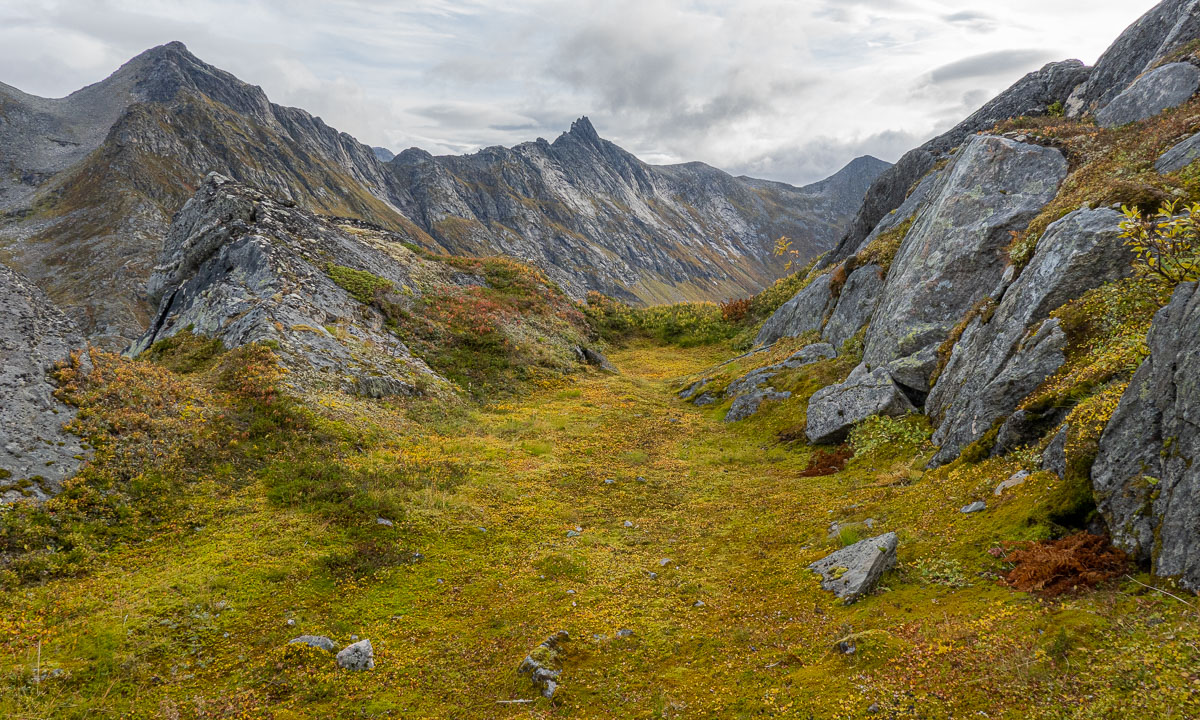
Autumn has been in full swing the last days and most of birch leaves are yellow, while other plants as groundcovers are anything between green, yellow and bright red. Sky today was grey but the colours shone brightly.


After crossing a bog I had started hiking up the mountain from the left side. Or should I say, climb? There was no recognisable path and it was quite steep. Since all rocks were overgrown, terrain was not so easy and I took it slowly and cautiously. I didn’t want to slip or find some hole between the rocks.
As usual the views were gorgeous. The island Tussøya with the pale sea behind, the mountain massif round Skamtinden that rose above the valley while gaining height. or the autumnal coloured marshes with their embedded lakes and small meandering streams.


You can see it on the first photo. The way up stays steep – up to 85% or 40° – until the very top. But finally I crossed the 550 metres level curve and was almost up, because Stappen is only 565.2 metres high. But up does not mean that it was a plateau, it was more a constant up and down and I used my hands a lot when it got steep. Fortunately the ridge was always some metres broad. I’m a bit afraid of heights. And then – after crossing most of the ridge – I reached the top.

Impressive is not the word that you would use to describe this knee-high heap of stones. It was quite obvious, that this mountain is not very popular. It is pretty steep to the sides, so that I could look straight down to the lake Botnvatnet (“the bottom water”). Later I would go round this lake on my way back.

But I was still on the top of the mountain and continued following the ridge that slowly descended. Here you can see two parts of the ridge:


On my way I found a small clearing surrounded by rocks. With the rough mountains around it looked like a secret valley, where dinosaurs still live. Well, they have to be tiny, the clearing was only round ten square metres in size.
This part of Stappen was much less steep, but when I looked back again it looked quite impressive anyhow.

After a while I reached the bogs – still at an altitude of round 330 metres and started to walk back onto the wet and bouncy ground.

Stappen was a nice tour but steeper than expected. At home I read the tour description in the book again. You had to read between the lines: While it was not mentioned, that the ascent is steep, alternative routes were mentioned with the words: “Her er det litt mindre bratt”.
Google translate’s translation: “Here it is a little less steep”.
Olaf’s translation: “Here it is little less steep which is still pretty steep. But other paths – those that you will choose – are much steeper! Anyhow, we marked the tour as blue so you might survive.”
At the end just three pairs of photos of this tour and my tour on 4 December:


This article is part of the series “2022-08: Jämtland and Trøndelag”.

On the photo above you can see the trail from Blåhammaren to Storulvån. It is in fact two trails together: the winter trail that is marked with red crosses and the summer trail that mostly is marked with stones with a large dot of red paint on it. We didn’t follow this trail I only took the photo because of the beautiful evening colours.
Many parts of the trail are just like this. They lead through heather, grass, crowberries, and dwarf birches. Other parts of the trail lead over hills, across rock fields, through forests and sometimes over a reindeer fence.


This is when the trail is dry. But often it isn’t. The trail can just be very wet of last nights rain as we had it on our third day.

The trail can be boardwalks that lead over swampy area or bogs. Some of them may be under the water which makes them rather slippery.


And then there are rivers, streams and brooks. Some of them are crossed by a bridge. Some bridges are big, some are – well – small, simple, and pragmatic.


And then there are rivers that you have to ford. I ’m used to hiking in rubber boots and so I could splash through while my fellow hikers had to switch to sandals and wade through the ice cold water. Already Douglas Adams said: You have to know where your towel is.


And then there is mud. It can be slippery and sometimes quite deep, especially right before or after a plank. When you have a plank.
Especially the first day trail section Storvallen—Blåhammaren was in an extremely poor shape. The others went around all these muddy patches while I – hey, I have rubber boots! – just continued straight ahead. But then at one point it happened. I made a step ahead and my right leg sank thigh deep into the mud. On the trail! Luckily Blåhammaren had a dry room.


But don’t be afraid, that’s not typical. Many sections of the trail look more like this:

How long the trail was? I don’t have the exact numbers but I think we hiked round about 135 km on 8 days, so round 17 km a day.
I was home in Sweden for only three weeks but the time feels long and rich. Annika and I had guests most of the time but some days in between just the two of us.
On 1 July I used my lunch break to paddle to the beach. I took a bath and lunch there and then paddled back to work. Ah, I love this type of lunch breaks!

On 3 July Annika and I took the car to Norrbyn and from there the ferry to the island Norrbyskär. Always worth visiting, especially when the warm weather invites to a bath.


On 4 July Annika and I made a kayak trip to and round the island Tarv. Normally this would be a quite relaxing tour of 10–11 km. But due to the windy weather the sea was pretty choppy and we had to focus a lot on the waves and the rocks.
No one of us took any photos there, but in the more sheltered waters beside and behind the island it was possible to take some photos again. And another bath.


On 7 July it finally rained in Obbola. The rain came too late for the dried up lawn but probably saved a lot of flowers and bushes in our garden.

On 8 July Annika and hiked twice. First round Grössjön together with guests from Germany, then just we two at the Kronören naturreservat. Grössjön is mostly forest and bogs (and a lot of mosquitoes) while Kronören is also open landscape by the sea.


Ten days ago an 10 July I travelled back to Tromsø. Train Departure in Umeå 2:15 in the night, bus arrival in Tromsø was 17:30.
I felt cold and made a Covid test the next day. Bang – positive! Therefore I couldn’t take advantage of the beautiful summer weather in Tromsø but stayed home in bed the week.
I made some short hikes on the weekend but the weather was dull, foggy and rainy.


Slåka (314 m) and Guratinden (424 m) are two mountains on the island Kvaløya. I know them from my book “På tur i Tromsø” where they are described in tour 7. This tour is marked as green, which is the easiest category in this book. I chose it because on the higher mountains there still might be some amount of snow and I wanted to avoid that.
I took the car to the parking place in Skulsfjorden yesterday. The parking place I already knew from another tour. Then I tried to find the hiking trail while the cows starred at me curiously and the bravest of them came to sniff at my hand.

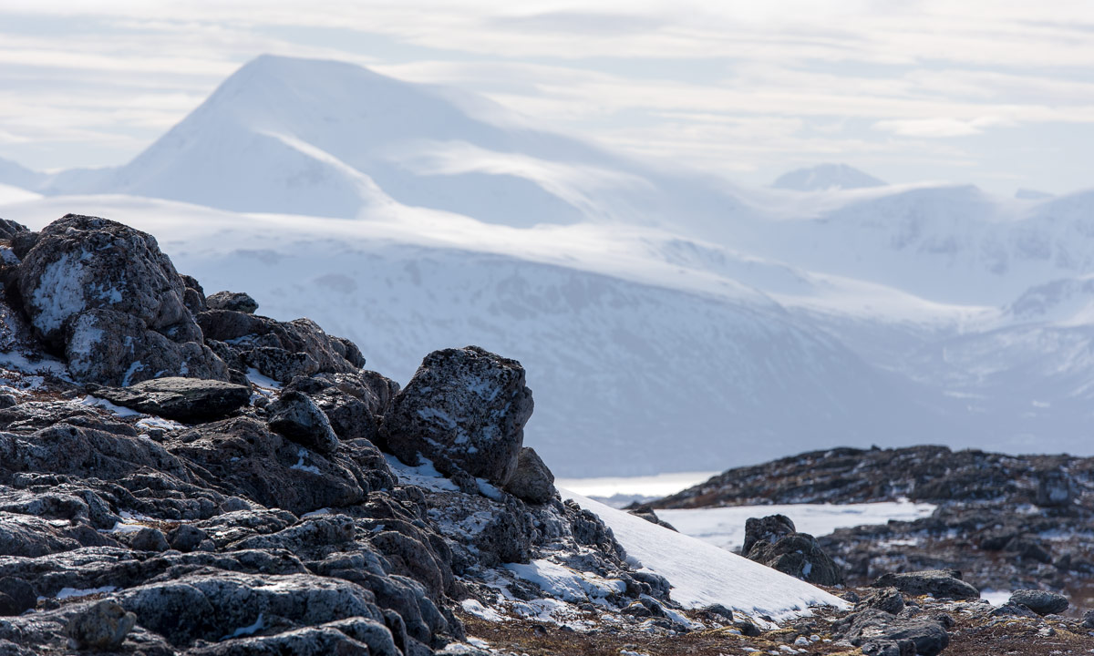
It took a while until I found the way which was not were the map showed it. It forked quite soon and maybe I followed the wrong direction because somewhere over the tree line it faded away somewhere in the heather. Way marks and sign posts you will hardly find when you hike like this in Norway. It is assumed that you can orientate in pathless terrain even on beginner tours. Anyhow a way to the top of the Slåka was easy to find without paths. Here I had a fantastic 360° view. In the north the mountain Nuortagáisi (or Nordtinden), in the south the fjord Kaldfjorden, in the west the island Vengsøya and behind that the open sea. And where there was no sea there were mountains, mountains, mountains, all higher ones still covered in snow.

Without any break I continued to the Guratinden. Again I could not find a reliable hiking trail but more a patchwork of paths, some of them probably animal tracks. Anyhow it’s not far to the Guratinden, where I took a rest to enjoy the view and something to drink.


Although it was the beginning of June it was very chilly on the summit, mostly because of the strong wind. I guess it was 7 °C and at least 15 m/s. Already on my way up I wore gloves and a woollen cap, now I was really glad about my down hoodie. Without I wouldn’t have taken any rest.

On the way back I followed other trails and tracks or I just cut cross country. Sometimes I walked on rocks, sometimes on boggy ground but mostly on heather.


Round three hours later I was at my car after 9 km hiking and round about 650 metres in altitude. And here you can see how it looks on the map when you hardly follow any trails ;-)


38.5 km by car, 5.5 km by foot. Some hundred metres in altitude. Warm and windy weather. Forests, slopes, shallow bogs, mountain paths, water to ford, flowers, snow fields, lakes, tundra, rocks, views to the mountains of Kvaløya, the fjord, the open sea and Greenland. OK, cross out the last point. Anyhow, quite much for a short after work promenade.
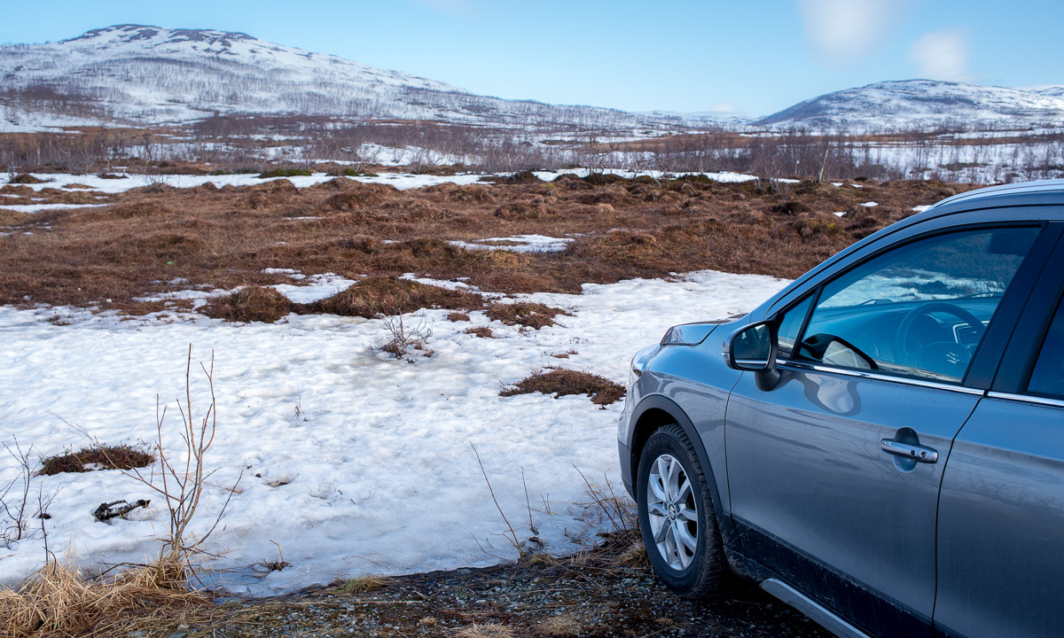
Yesterday at 18:00 I took the car to Elvenes on Kvaløya to start a small mountain tour. Well, mountain or hill – the summit of Grønnlibruna is only 401 metres above sea level. I chose this destination in the hope that it was not completely snowed over as the higher mountains still are.
I parked the car, walked the gravel path and stood before the first obstacle, the stream Finnelva. I did the same tour last November, where it was easy to cross. Now in the thawing period the water was at least 50 cm deep and quite fast . Too deep to cross here, even with rubber boots. Luckily I found a better place to ford a bit upstream. Soon I was in the forest. A very wet and muddy forest where I was not always sure whether I followed the way, crossed a swamp or waded in a brook. But this stopped when I gained a bit of altitude where old snow covered the forest floor.


As soon as was above the tree line the landscape changed again. There were some large snow fields but most of the ground was bare of snow and easy to walk on.


After 4 km of hike and some hundred metres in altitude I stood on the summit enjoying the circular view while the weather cleared up more and more.

I did not take a break but hiked down again. I enjoyed the weather and the fact that the birch trees start to turn green, at least in the lowlands. I crossed Finnelva a second time, now with a sturdy stick that I had found on my way. It’s much easier to keep balance with such a “third leg”. From there it was not far to my parked car that I reached round 21:30.


When I left the supermarket in Eidkjosen it was 22:00 and the sky was blue. It won’t get dark because the last sunset in Tromsø was more than a week ago. Since then we have polar days with 24 hours of daylight. I could drive home or …
I turned left. Left to the road 862 that leads to Sommarøya. Maybe I catch the midnight sun. Sometimes I had to drive slow because of the reindeers, sometimes I had to stop to take a photo …


… but round 23:00 I had crossed the bridge to the island Sommarøya and shortly after I parked at the sandy beach Steinsvika. I was not alone. People stood at the beaches, some lit a fire, some paddled kayak, some camped in the hills.
I checked an app when sun would be lowest. What? 0:45!? I forgot, that we had daylight saving time, so clocks were one hour ahead. I took my camera bag, some water and an old jacket, that I use to have in the car and walked to the northern tip of Kvalneset. Now I had a lot of time to just observe the sun hardly going down. After one and a half hour it was time: 0:45 – the sun was at its lowest position: 1.55°. The photo is completely unspectacular because it only shows a low sun, not the fact that the sun would not get lower than that this night.

I was glad about my jacket because it got a bit colder, I was tired and I sat there for almost two hours in total. At least I had chocolate! I waited for the sun to disappear behind the prominent silhouette of the island Håja.


Then I went back to the car and had about an hour drive back home. I wasn’t in bed before 3:30 but it was completely worth it. For a very good reason: I never ever saw the midnight sun in my life before! Although I have lived in Northern Scandinavia for more than 12 years I hardly was above the arctic circle in summer and then it was cloudy.
But it was more than just checking another item of my bucket list. It was just gorgeous to sit there and enjoy nature. I should do that more often and put the old sleeping bag back into my car. Just in case …
After a springlike Easter week in southern Sweden I travelled back to my “work town” Tromsø on Easter Monday. Yesterday I was outdoors in the fjell. –the first time since the end of January.
What kind of tour will I go for? Is it skis or rubber boots? Let’s pack both, take the car to the parking place by the road 863 on the island Kvaløya and have a look.
OK. Let’s take boots! I lock the car and start crossing the bogs. Some parts are still frozen, others bounce like a wet sponge when being crossed. The terrain rises and soon my boots trudge through snow. Snow is still deep but so compact that I hardly sink more than 5–20 cm.


I slowly ascent the mountain landscape and leave the trees behind. Soon I reach the top of the hill Skavlikollen.

I continue north. I put off my jacket because I am sweating in the warm sun. I realise that I forgot a sun blocker and take my buff for protection. (It worked – no sunburn the next day!) While the higher mountains are still covered with snow I walk also on rocks and heather. The hilly and mountainous landscape looks beautiful in the sunny weather.


After round about 6 km I reach the top of Sørtinden (471 m). I’ve been there twice (1), (2), but only in autumn.

Here I take a rest and enjoy the view of mountains and fjords. I start to freeze and I’m glad about my down hoodie that fits into the camera backpack. The sun provides warmth but the air temperature is hardly above zero.
I choose another way back but get a bit “photo-lazy”. For the birch at the slope however I’ll take my camera out of the backpack.
Partly it is easy to walk down the snowy hills because you can glide, but parts of the snow has softened by the sun and more than once I break into knee deep snow. After 11.5 km of walking and snow trudging I arrive at the car. From there it’s only 20 minutes by car home.

That’s a good start for #onceaweek– my plan to make a new tour every week. Let’s see what I’ll do next weekend. When I look at next week’s weather forecast it might be a ski tour.
While I am writing a lot of blog articles about my time in the Arctic live in Tromsø goes on.
When I arrived Friday a week ago Tromsø was as un-wintry as possible. It was several degrees plus and it rained.


But to be honest, it didn’t affect me a lot. Mentally I was still in the Arctic.
Despite to the torrential downpours that Yr forecasted for this weekend the weather was ok yesterday and nice today. But as the whole week it was really warm: +7 °C. Time for a morning walk. _(Sunny, but much windier than expected.)_


In the afternoon I wondered if it was possible to take a small promenade on Kvaløya. I headed to the parking place from which I started a ski tour seven weeks ago. A lot of other cars were there and snow and ski tracks. I did not have any skis with me today. I tried to walk on the snow just with boots but the snow was at least knee deep. And then I came to the bridge that crossed a rapid meltwater flow. Maybe nice for experienced skiers but I didn’t have any interest in falling into the water. Time for me to return to the parking place.

The good thing: the parking place is just 200 metres away from the coast. So I took a short afternoon promenade there enjoying the colours, the sun, the fresh air and the wind. Yes it was windy – the display at the bridge to Kvaløya showed 20 m/s.


Back again at my car skiers arrived. My skis where home but then I remembered, that I always have snowshoes in my car. I attached them to my rubber boots and so I could make at least a tiny promenade to the next hill some hundred metres away.

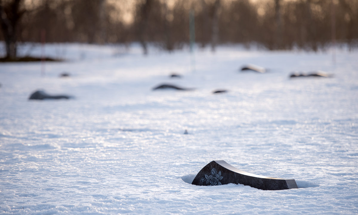
Back in my car. Next stop: Sandnessund Cemetery. Never been there before. Even there a lot of snow.
Next stop was unplanned. I just had to take a photo of the vessel and the mountains of Kvitøya. Luckily the parking place of the Tromsø Havpadleklubb was near.

The Arctic has its own extraordinary beauty and I feel a special connection to it. Tromsø and surroundings however are beautiful too, even when weather has been much too warm for mid-March.
For the records: The first „hestehov“ or Tussilago I (17 March on my way to work).

Last Saturday I travelled to work. Obbola—Tromsø, that’s round 1000 km – the reason why I do not commute weekly. This time it is a bit suspenseful, because there are two obstacles on my way.

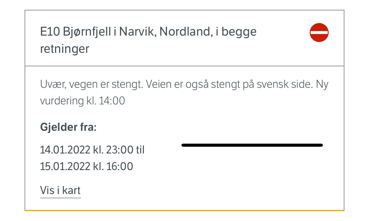
One obstacle is easy: taking a covid test at the test center. The other is much bigger: The road over the Bjørnfjell – the only road – has been closed for many hours due to stow storm conditions. Well, I start my journey anyhow. We’ll see.
At 5:30 in the morning Annika takes me to the train station in Umeå. The first 9½ hours were just a “normal” train journey beside of the train being mostly ahead of time. One change in Boden – nothing special, just long and a bit boring.


I leave the train in Abisko Turiststation where I parked my car. My car – will I find it or is it submerged under a pile of snow? To my relief hardly any snow covers my car. I already hoped so, because Abisko is known for its low precipitation because mountains in the west protect it from bad weather. Much more snow and rain fall on the other side of the mountain range and that’s exactly where I have to go through. Some minutes after leaving Abisko behind it starts snowing. Snowfall increased more and more but isn’t severe and the Swedish mountain road is open. Soon I cross the Norwegian border and …

… have to stop because of a lowered tollgate with a red blinking light. Beside of two trucks I am alone. I am relaxed because I know that the road has been opened for driving in convoy one hour ago (thanks internet!). I just have to wait for the large snowplough to fetch us.
After twenty minutes the tollgate went up and the red light goes out. That’s all that happens. I hesitate. And now? Do I have to wait? Or may I drive? I don’t dare and ask one of the Norwegian truck drivers. He answers I should just go ahead and so I do. The drive is snowy but not bad and soon I arrive at Bjørnfjell brøytestasjonen where the snowploughs are located and now also the Covid19 registration. I register myself, get a covid test and start taking photos while waiting for the result.


I take an image of a snowed in car. The snow plough driver goes to me and asks for what purposes I take photos. “Just for my blog.” “Ah ok, just curious.” Good to talk to him, because so I learn that beside of the mountain passage behind Bjerkvik road conditions are good. Here they got a lot of snow the last 24 hours and one of the cars looks like this:

After round 20 minutes I get a ping ♪. It’s an SMS with a link to my test result. Negative :-). 260 km to go, that’s four hours when conditions were good.
The first 100 km the road conditions are good and weather is ok. The next photo shows how driving looks like.

The next hour it snows a lot. Sight is still good. To my left and right everything is covered with snow, from the largest church to the smallest branch of a tree. Winter wonderland.
Then it starts to get nasty. Snowfall intensifies more and more and the snow has the consistence of superglue. My windscreen wipers hardly manage to push away the gluey snow and finally I have to turn into a side road and de-ice the wipers. Scratch, scratch … . I’m not alone. In front of me a car with a driver doing the same. Behind me another car stops. Am I in the way? No, just another scratch, scratch. On the other side of the side road another one.
I still have some holes to peek through but it is extremely tiring to drive car through the night like that. Alas, after two hours I drive over the large concrete bridge Tromsøbrua and am on the island Tromsøya. Apparently Tromsø’s snow removal has given up. The minor roads are covered with 20 cm of snow with deep tyre tracks. I understand more and more why most Norwegians have cars with all-wheel drive (and so have I).
22:45. I make a last stop at the supermarket nearby that is open until 23:00. I’m lucky because Norwegian supermarkets close on Sundays. By the way: the supermarket’s parking place is in much better condition than the roads.


One other minute driving and I arrive at my flat in Tromsø after 17½ hours travelling. I’m tired but it takes another hour until I’m relaxed enough to sleep. Next week I’ll walk …