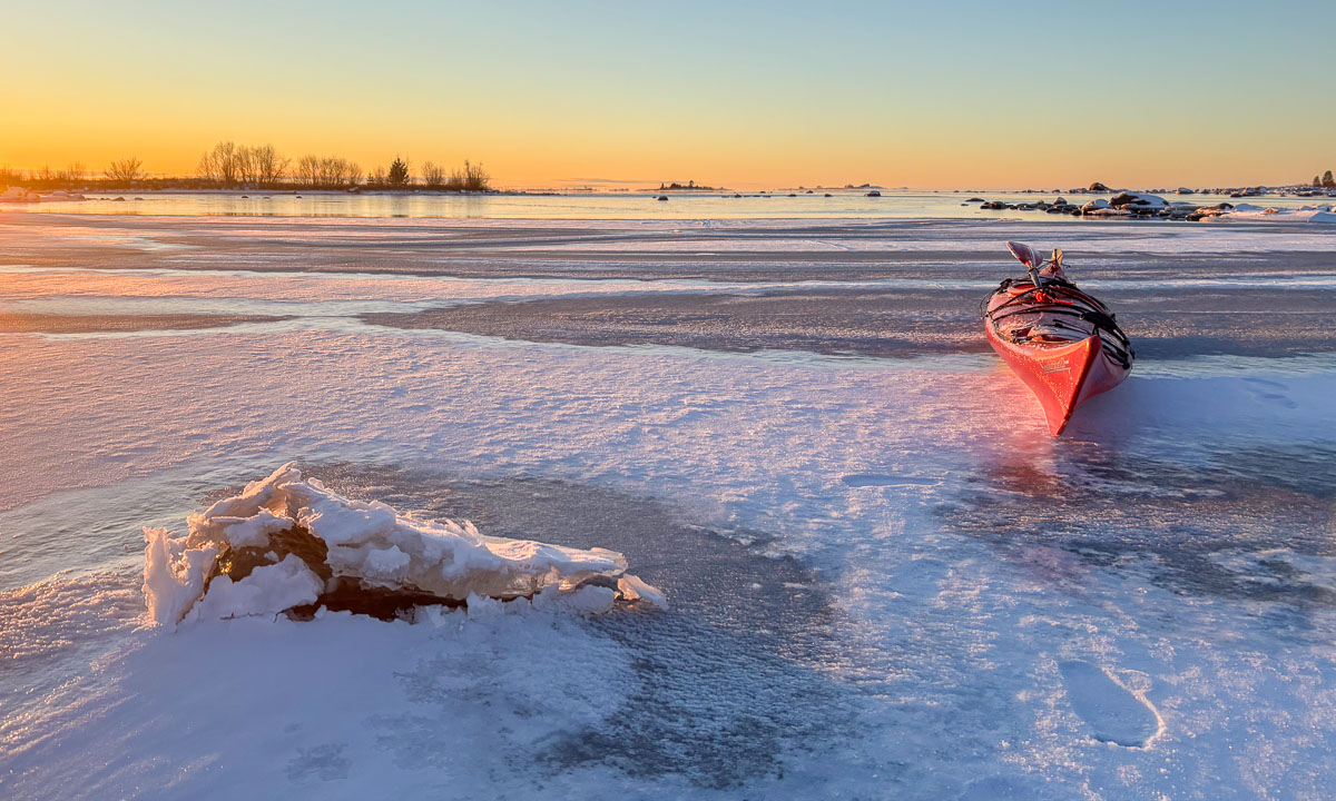
My first winter paddling 2026

It may not look like the ideal conditions for kayaking: -10 °C, snowfall and winds of 7–10 m/s, according to SMHI. Anyway, I wanted to open this year’s kayak season today, though not for a long trip.

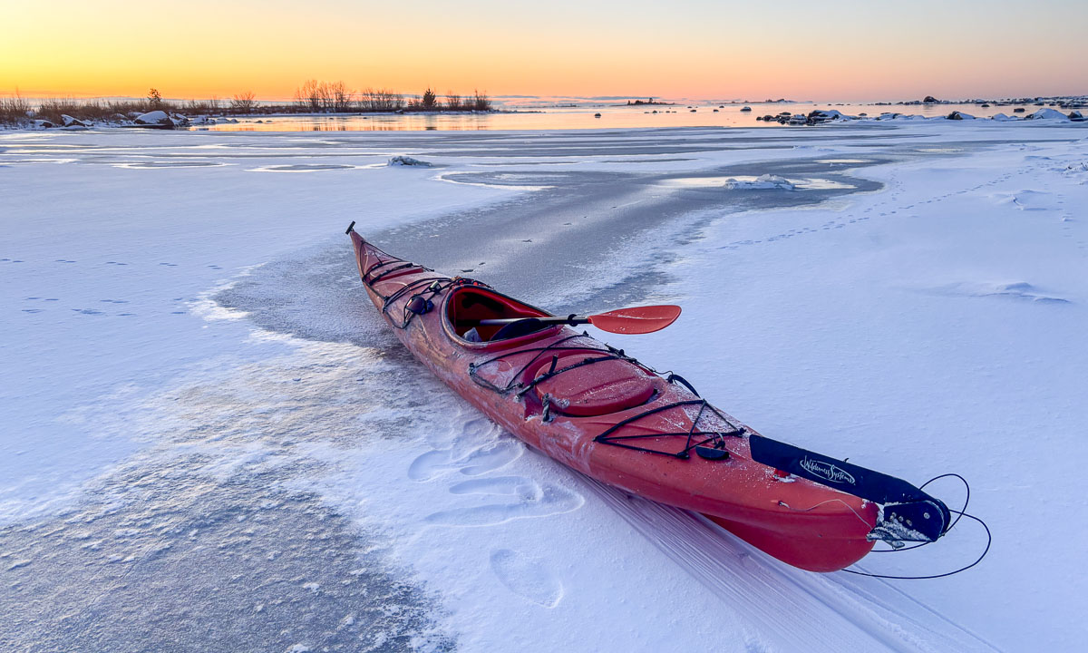
It all start with dressing properly: stay warm, stay dry. Then I dragged my kayak to the small bay. I was lucky, the ice was thick enough to cross, so I was in the water within minutes.

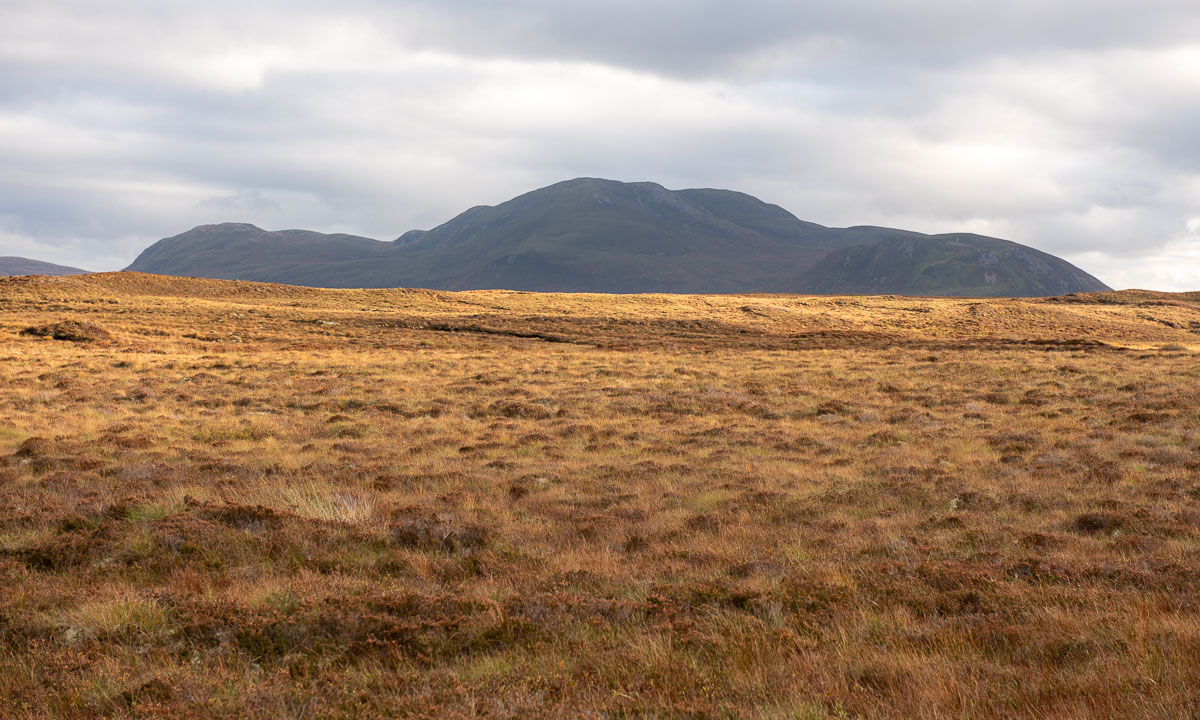
I followed the coastline southwards. I would have loved to come closer to the photo scenes, but there are a lot of underwater rocks there and the waves were breaking on the shore. So I had to keep my distance.

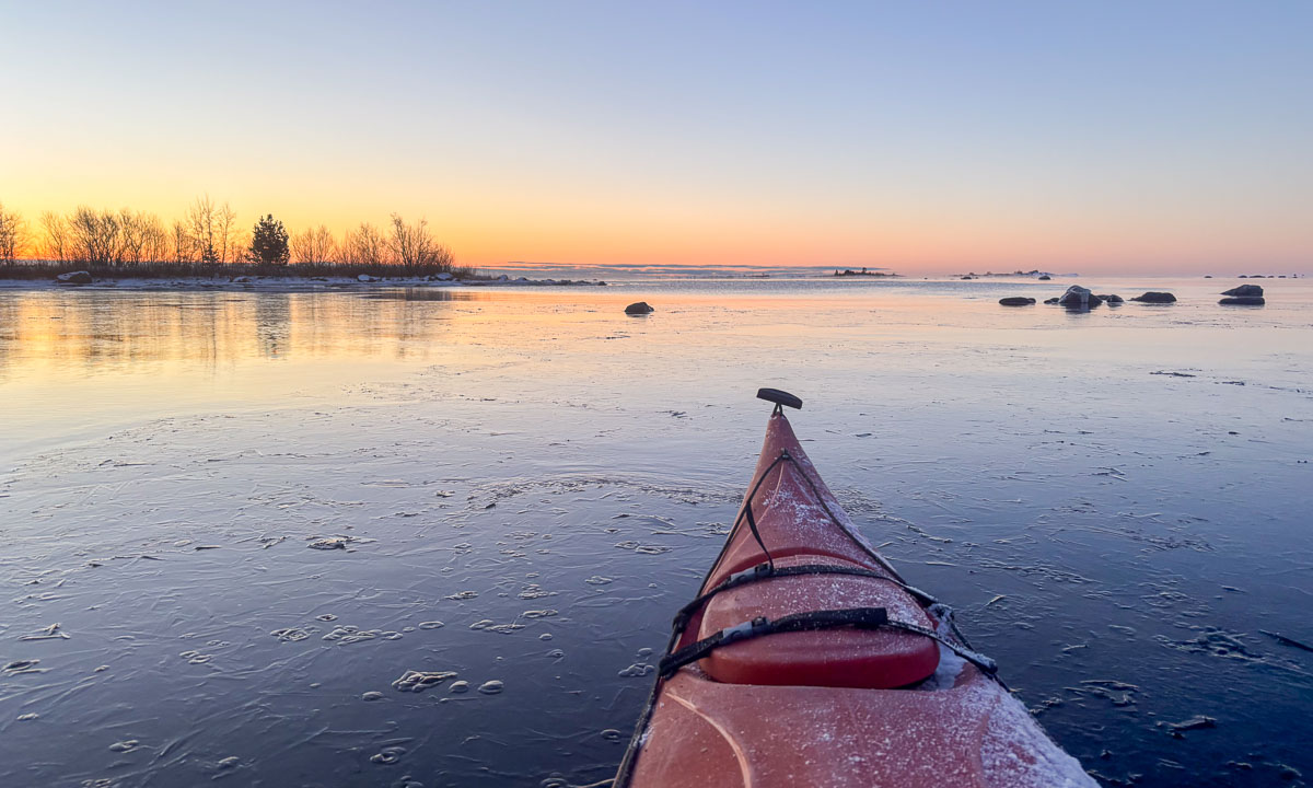
Paddling became much easier with every metre away from shore. Most rocks were covered with ice, a result of the cold, windy weather over the past few days. The sea was open but some long bands of wet ice floes were drifting on the open Baltic Sea.

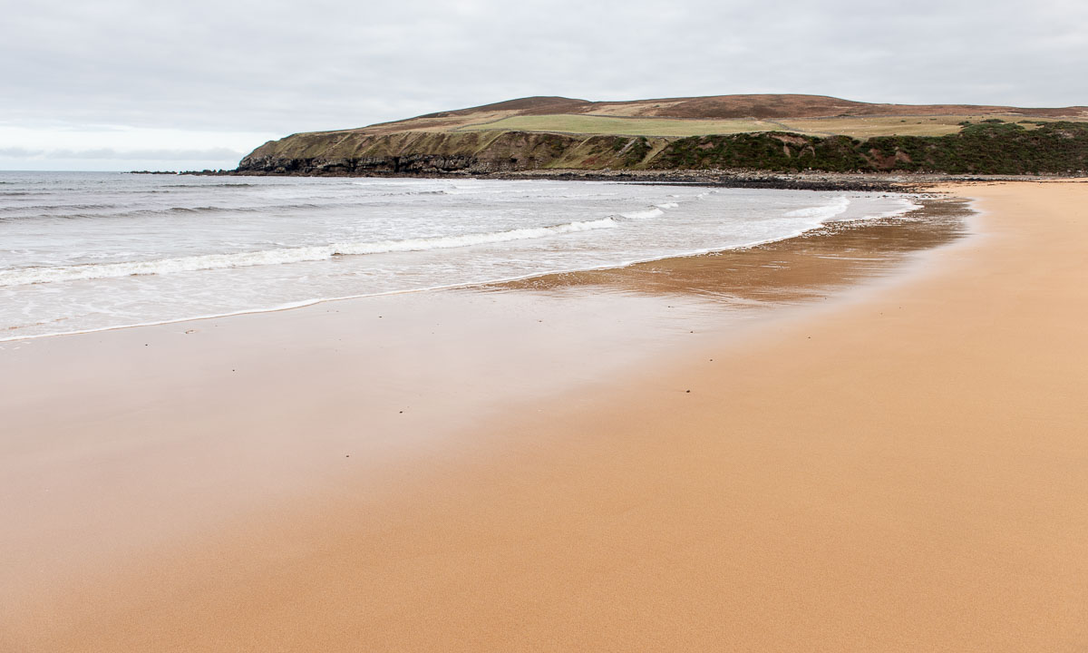
I turned right and headed to Vitskärsudden, our nearest sandy beach.

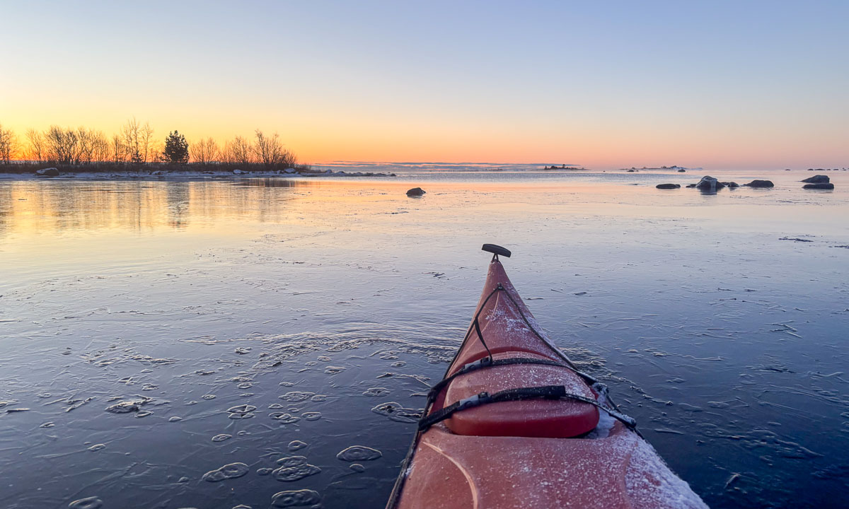
I turned my kayak and paddled the same way back. First to the south, then south-east, and finally east

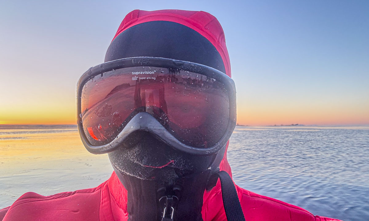
And then home again, which lies to the north-northeast – that’s where the cold wind and snow come from. I can feel the cold air behind my face mask. Time to put on the ski goggles. (Nice side effect of being bundled up like this: you do not have to smile on your selfies ;-) )

I tried to take some more photos but was blown back by winds with around 1 m/s. Time to reach the ice edge – from there it’s less than 100 metres home.

The 3.8 km took me an hour. Partly because of the wind, partly because my neoprene survival suit is pretty stiff but mostly because of the photos I took. Even though my iPhone, in its waterproof case, hangs around my neck, it always takes time to put off the warm mittens and put the paddle aside.

Despite the forecast, it has been snowing all day and the kayak lying on the terrace is covered with snow. The survival suit is still drying in the shower. Sleeves and legs were encrusted with ice when I hung it up.


Low water level in Obbola

On the evening of 23 December, it got colder and frost patterns formed on the windows of the unheated winter garden.

It takes some effort to cross the new layer of ice in the bay when my wife Annika and I go kayaking on the morning of Christmas Eve, but we manage and most of the sea is free of ice.

Two days later – on 26 December – the situation has changed. It has become much warmer – up to +7 °C – and the ice is gone.

Yesterday – on 29 December – the water is gone as well, maybe caused by the storm Johannes that crossed Sweden two days before.

Today I have a day off and used the sunny weather to take a long stroll by the coast. The water level is even lower at –66 cm, so I walk part of my route in the Baltic Sea. Air temperature is around -8 °C and so you can see ice on the sea and on land, as well as huge fields of boulders that normally are underwater. Some photos from this morning:

Larger parts of the shallow bay Nagelhamnsviken by the camping ground Fläse have completely fallen dry. That looks pretty strange, when you know how it normally looks like.

The only thing we do not have at all in Obbola is any snow, but it seems to be a matter of days before it snows. And Tromsø – I’ll travel there at the end of the week – has 60 cm of snow right now.

30 days – 30 photos

19 November – Obbola, Sweden

The morning is cold. -14 °C. The sea has been freezing over. At the horizon lies a layer of clouds. Will they bring snow? Ice fog indicates open water. Later this morning I walk Spåret, the local circular hiking trail. There is hardly any snow, but the ice on the ponds is covered with frost patterns.

27–29 November – Obbola, Sweden

The weather has changed back from winter to autumn. Rain and storm dominate. The crushed sea ice gathers in our bay and big waves roll up the beach of Vitskärsudden. Even the last tiny bit of snow has gone.

1–2 December – Obbola and Umeå, Sweden

We got some centimetres of snow and Vitskärsudden looks completely different. Our plan to take the car to the inland with our German guests however was stopped by the weather. Too slippery the wet and icy roads. At least we make it to Umeå, where parts of the river Umeälven are frozen over.

3–4 December – Obbola, Sweden

The snow is gone. On 4 December my wife Annika and I leave our house behind …

4–5 December — Obbola, Gagsmark, and Pajala, Sweden / Palojoensuu, Finland

… and we are on our way to Tromsø. First stop is the village Gagsmark in Sweden, where we visit friends and stay over night. Next morning we continue our journey. We pass Piteå and Luleå, leave the E4 in Töre and take lunch in Vippabacken, a small restaurant with a back-room museum. We buy food in Pajala and cross the border to Finland. We stay the night in the village Palojoensuu.

6–7 December – Skibotn, Tromsø, Norway

The road between Palojoensuu (FIN) to Kilpisjärvi (FIN) is lonely. Beside of the village Karesuvanto (population: 140) hardly anyone seems to live here and only a few other cars pass. As soon as we cross the border to Norway snowy mountain ranges come into view. Near Skibotn we see the first fjord and at a quarter past two we arrive in Tromsø.

Next day is the second Sunday of advent but I only have a single candle. I have to cheat with a mirror.

7–13 December – Tromsø, Norway

I am member of two choirs and Christmas is near. That results in a pretty busy week, where I have three rehearsals and three concerts beside of my regular work. The first concert is in the hospital, which is in walking distance. While Obbola was free of snow 60 cm lie in Tromsø.

After the second concert, this time with the Sami choir Romssa Rástát we got Northern lights. Annika and I watch them from the balcony. I try to make photos with my Nikon and a tripod as well, but the aurora has weakened and I had some camera issues.

On Saturday we open the skiing season. It is polar night, so we ski round noon, when it isn’t dark. In the evening I am singing the last concert, this time with the choir Ultima Thule in the Tromsø Cathedral, a wooden church in the very centre of Tromsø.

15–18 December – Tromsø, Norway

On Sunday Annika travels back to Obbola. I will take bus and train a week later (that’s tomorrow) and spend the rest of the year there, too. Will we get a white Christmas? Probably not. It is plus degrees and rainy weather both in Tromsø and in Obbola. While the Christmas decoration in the office building looks cozy, the streets in the centre of Tromsø don’t. Brown ice and sleet and water puddles dominate and it is extremely slippery.

On Thursday I have a special workplace: The research ice breaking vessel Kronprins Haakon lies in the port of Tromsø for two days. I walk down with my spiked Icebug shoes. On board of the ship I test some of my software components that read from the ship’s systems. It is always a relief to see your software to work in real life, not only with simulations. And I get a free lunch :-) . I get a bit nostalgic. I joined three scientific cruises on board of this ship. Will I ever join a cruise again, standing on the helicopter deck while we break through the ice? I hope so.

A photo of another Northern light in the evening ends this photo series.

Sunrise winter paddling

Three days ago it thawed and stormy weather crushed all the sea ice. The day after, the temperature dropped below zero again. This morning the weather was clear and calm at -12 °C. Time for another morning kayak tour, just like four days ago.

At 7:50 I stood on the leftovers of the old ice that covered the small bay. In front of me – a fresh layer of new ice. How thick may it be? I have the feeling it will not hold my weight.

You see the photo above? The kayak is tilted sideways. That’s not because of the waves or because I’m edging, but because the kayak is lying on the ice. The ice is stable enough to bear us with me sitting in the kayak. I move forward by using ice safety picks that I drive into the ice in front of me and then pull the kayak and myself forward. It’s exhausting, but it works. I have done it many times before. The ice is approximately 3 cm thick.

But then the ice gets thinner and has exactly the thickness I loathe: between 1.5 cm and 2 cm. Then the kayak breaks through and is jammed in a narrow water channel, where it’s almost impossible to use your paddle – no open water reachable – or the ice picks – the ice will break when pulling. Luckily the water channels often tend to widen, so you can kayak back some metres, get some forward momentum using the paddle and break another two metres of ice. That takes a lot of time and extends the distance paddled by a factor of four or more.

But then – finally – I reach open water by the island Lillskär. It took me almost half an hour for less than 300 metres!

Anyhow I manage to reach the sunrise in time. Now the surface of the sea is multicoloured. The back of the waves are reflecting the orange horizon, the front of the waves the blue sky above.

Now I just paddle a short round, because it is a weekday and I have to work. Just some more photos with my mobile phone in its waterproof bag …

… before I return home. First it is easy, because the channel that I had broken through the ice is open and I can easily follow it. Then the ice gets thicker again. I’m tired and since the water is pretty shallow I exit the kayak and walk the kayak home. I learn that the ice does not bear me at all. So I break it with my knees or – when deeper – with my rear. I would not dare to do this with my kayaking drysuit, but today I wear my survival suit made of thick neoprene, which is very sturdy.

I reach the shallow part of the bay where I manage to grab a large piece of ice and put it upright. Time to play a bit with the translucent motif in front of the sun.

It is two o’clock in the afternoon when I decide to take another break from my desk to watch the sunset. To make a long story short – I got it. No kayaks involved this time.

Season’s first winter paddling in Northern Sweden

While there is a lot of snow in Tromsø, is is only round 2 cm here in Obbola in Northern Sweden. Here it is the coldness that defines the winter. Today I took my kayak and made a small tour on the Baltic Sea which is just outside the garden. With temperatures round -13 °C and a light wind it was pretty chilly. The small bay is frozen and you can walk on it and on the open sea thin layers of ice are building where the sea is calm. Here are some photos from today’s kayak tour.

Now the kayak is lying in the floor of the house. The kayak’s steering mechanism was frozen and is currently thawing.

Scotland NC500 – day 8 – a hidden pass, palm trees, and a famous castle

This article is part of the series “2025-10: Northern Scotland”.

October 20

Today is the eighth day of our road trip in Northern Scotland, which my wife and I are taking together. Last night we slept in a hostel near Applecross. Now we want to take the road over Bealach na Bà pass, that is known for its hairpin bends and scenic views. Unfortunately it is still raining and the clouds are low. The beginning of the road is marked with several warning signs, but Annika can drive single track roads and we do not have wintry conditions, so we can take the road. But clouds we have. Soon we are in the middle of them. It is raining and the visibility is pretty bad. And so is the view of the hairpin turns from the top of the pass. Well, you cannot have everything.

We descend and slowly visibility improves. When we look back we can see the colourful mountain scenery with the summits in the clouds. In front of us we see the other clouds floating down to the sea loch Loch Kishorn, where they start hiding the coastal islands.

Two hours later we arrive in Plockton, a beautiful village by the sea. The climate is particularly mild, so that palm trees can grow here. An older chap I meet in the street tells me that he has different sorts of palms, a eucalyptus tree and other trees I never heard of in his garden.

It is low tide. Some fisher boats lie in the mud and it is possible to go to an island nearby. From the sandy tidal flat you can see the long row of houses by the seaside – sea view for everyone. We spend an hour and a half here to visit the craft fair, to go to the island, to pet a cat, to take photos and to find a geocache. A charming place with views of the sea, an island called Sgeir Bhuidhe, Duncraig Castle, hills, and steep mountains.

Finally we continue our tour. Next stop: Eilean Donan Castle. This castle is regarded one of the most photographed landmarks in Scotland, and it’s very popular with tourists. Visiting the interior costs money, and there’s even a charge to cross the bridge, so I take photos from the outside. It is not easy to take photos without too many tourists in the shot.

From Eilean Donan Castle it is not far to the An Spiris Accommodation at Dundreggan Rewilding Centre, our last overnight stay on our road trip. My highlight of the evening is the toddler in the large common room singing “Do-Re-Mi” from the Sound of Music.


Scotland NC500 – day 7 – a rainy day

This article is part of the series “2025-10: Northern Scotland”.

October 19

According to the weather forecast it will be pretty rainy in Northern Scotland the whole day. So, today we may interrupt our road trip less often than the other days. We will drive to AppleCross, where we’ve got a room in the Hartfield House Hostel & The Bunkhouse. If we arrive early, we may get a nap in the afternoon, which sounds tempting given the weather. We have breakfast in the hotel and take it easy. When we leave, it is half past ten. It is raining.

We make a stop at the visitor centre of the Beinn Eighe National Nature Reserve. There’s a small museum and a cabin, from where you can spot birds. There are also lovely spots outdoors, but  – it is raining.

Next stop: The lake Loch Clair, where I go for a short walk. I put on rubber boots, waterproof trousers and a rain anorak, because – it is raining. Annika prefers to stay inside the car to read. A smart choice, because the trail is just a rather dull gravel road and – did I mention it? – it is raining.

No noteworthy stops after that. We arrive at the bunkhouse at three o’clock. Beside the house there is a fenced in pasture with Scottish highland cattle. They look pretty soaked, but I guess, they are used to this kind of weather.

After an afternoon-nap (we got one!) we take a small car trip southwards. On the photos it looks like the weather has finally brightened up a bit.

But if you see a photo taken from inside the car you realise – it is raining.

One of the last photos I take today is of the seafront of Applecross.

As Google has already told us, the pub is closed. So we head back to the bunkhouse and have our dinner there.

Scotland NC500 – day 3 – from kayak surfers to the inland

This article is part of the series “2025-10: Northern Scotland”.

15 October

My wife Annika and I have stayed in a hostel in the center of Thurso. If you took a ship from here and head north you could reach the North Pole without crossing any land mass. We however have no ship, but a rental car and after breakfast we continue our road trip westward.

Our first stop is Melvick Beach, where we go for a walk. The beach is embedded in a bay. At the eastern end Halladale River flows into the sea. In this section of the beach it smells bad, because large amounts of rotten seaweed cover the sand. Maybe it was torn from the sea by Storm Amy a fortnight ago.

Our next stop is Bettyhill, just 20 km to the west. While there is a beach here as well – we come to this later – there is something else to see: Erected in the Bettyhill Cemetery there is an ancient Pictish symbol stone, the Farr Stone. It is dated to around the year 800. Little is known about the Picts. That makes this carved stone all the more mysterious.

The old tombstones from the 17th century are pretty impressive as well with their pictogram-like symbols: The hourglass, the bell, the coffin, the skull with crossbones and grave-digging tools. When this tombstone was carved, Johann Sebastian Bach was still alive.

Back to the present. And time to visit Farr Beach nearby. We are not alone. There are kayakers out in the sea with short surf kayaks. I wish I had a tenth of their skills. On the beach, we strike up a conversation with a man. We learn that it is his friends being out there playing in the waves. Among them are some of the most skilled kayak surfers in Scotland. The waves are not high, they are just playing around and it is fun to watch them while chatting. I wish I had a twentieth of their skills.

Back in the car we continue west but we make a detour. We follow a small road lined by trees. Sometimes the treetops touch each other so that a tunnel of trees is formed. That makes these single track roads look even narrower. Luckily the road is pretty empty.

We see the island Eilean nan Ron from above. The road rises, then descends nearly to sea level and we come to the main road, where we reach the Kyle of Tongue, a shallow sea loch. Before we cross it using the bridge, we have lunch on the car park by the loch. Each of us has a “meal deal”. That’s a cold meal such as sushi or salad, combined with a drink and a snack. Available in most supermarkets.

It has been pretty grey today, but there are holes in the clouds and the sun illuminates different parts of the mountains in the south.

Our original idea was to follow the NC500 further to Durness further west, but we couldn’t find any affordable accommodation. Therefore we had booked a room in Altnaharra the day before. After the booking we learned that there are many accommodations in Scotland, which are not on booking.com, but today’s room is already booked. So let’s head to the Scottish highlands!

We take the bridge over the Kyle of Tongue and turn left to follow the bay southwards until it looks more like a shallow slough with mudflats sticking out of the water. A pity, that the light is quite dull.

And then we cut through the moorlands in the Scottish highlands. The red-brown colours of the grass are intense – these are the colours of Scotland in my humble opinion.

Forty minutes later we sit by the open fireplace at the reception of the hotel in Altnaharra.

Soon we are given a comfortable room upstairs. To my delight it includes a bathtub. After dinner I’m having my first hot bath in years. Oh – so delightful!

Late summer mountain hike

The forecast was correct – the sky was blue the whole day today. At 9 o’clock I meet my friend Chris on a parking place and we start a mountain hike. The morning air is a bit chilly and some leaves even have frost on them.

After we have crossed the river Tromsdalselva we follow a path and some quiet residential streets and arrive at the way up to Sherpatrappa. That’s is a stone staircase of 1,203 steps leading up the mountain. Today is Sherpatrappa Opp – a competition where people run up the stairs. We however prefer walking and are lucky, that the competition will not start before eleven.

At the end of the stairs the terrain becomes less steep and you have a gorgeous view on the island Tromsøya and its beautiful surroundings. I see the island Håkøya that I circumvented by kayak two days ago. And today there is another competition: Tromsøya rundt, a 24 km long kayak tour round the island. From 400 metres up, we spot a group of kayakers passing below.

I assumed it was too late in the year for cotton grass – a clear sign for wet ground – but by a small and shallow pond we find a field of these candyfloss like flowers.

A lake always gives an awesome extra perspective in the mountainous landscapes, especially when it is as clear and blue as this one.

A white reindeer is grazing by the trail. It is not shy at all and ignores us while looking for food. On the way back we will meet it again.

I will never loose the fascination for the Norwegian landscapes, where sea and summits meet. I paddled to Grindøya – the island in the middle – several times. In the back lies mountain range on the island Kvaløya. This island is more than 1200 times larger than Grindøya and mainland Norways 5th largest island.

The weather has become warm and summery. Anyhow you can see the signs that the summer comes to an end. The colours have started changing.

On our way back we use Sherpatrappa again and get an awesome view on the town. Tromsø in a nutshell: Two Hurtigruten ships – the bridge Tromsøbrua – the iconic church Ishavskatedralen. And in the background the mountain Kjølen, where I’ve seen the midnight sun seven weeks ago (I and II).

Takk for turen, Chris!