Tromsø—Obbola by car

You may know that I have two places to live. My “work home” in Tromsø, where I work at the Norwegian Polar Institute and my “home home” in Obbola near Umeå, where my wife Annika works and we have a house together. Mostly we use the train and the bus to travel, sometimes the plane and occasionally even the car, although it’s a long way.

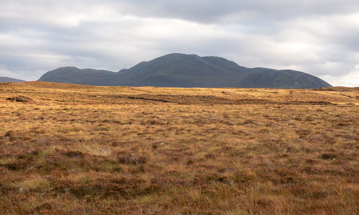
It is early Friday morning, I’m in Tromsø. My car is packed and I’ve cleared last night’s snow. It is mid-November and the conditions are wintry.

Norway

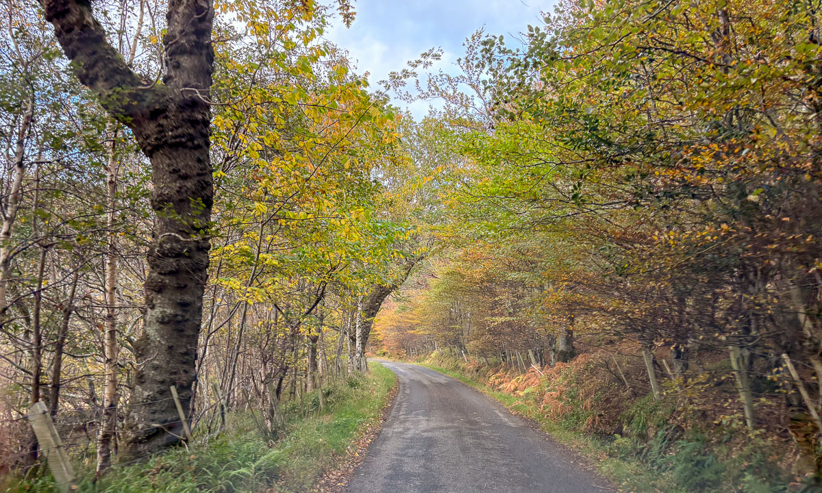
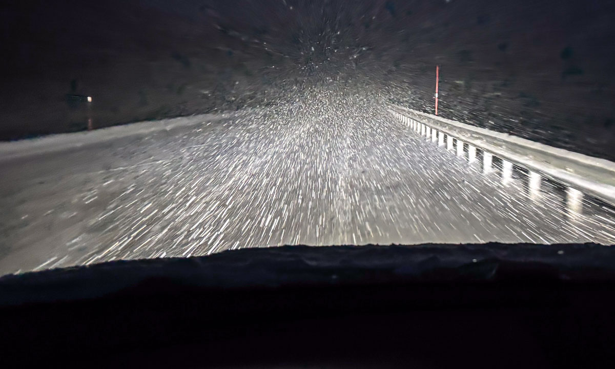
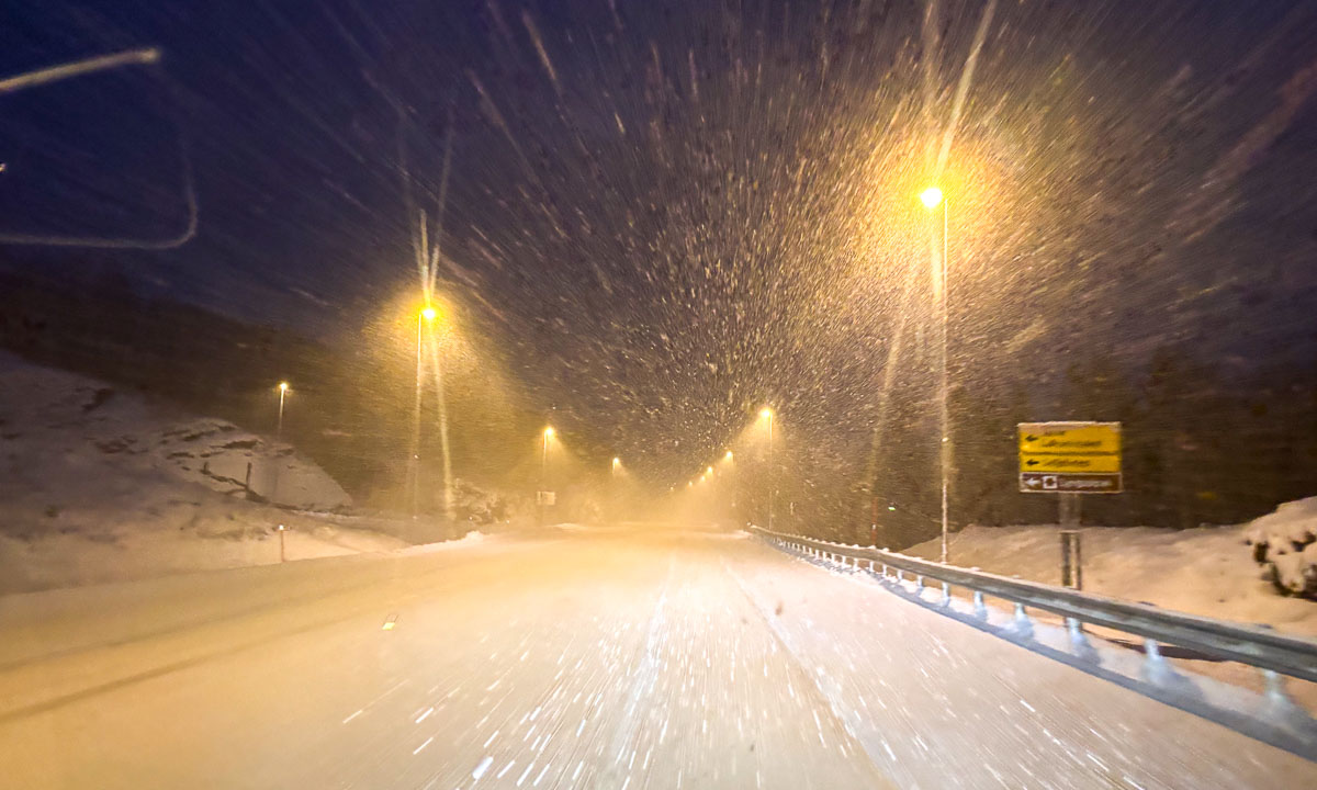
I start the trip at 6:50. In Tromsø the weather is fair, but then I experience some heavy snow showers. When it’s dark the snowflakes seem to form a tunnel that looks a bit as if a spaceship in a science fiction film were going to warp drive. Some short passages have streetlights. That makes seeing the road much easier.

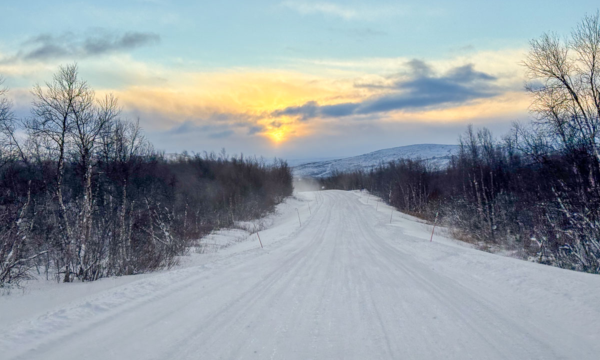
Around half past eight it is bright enough outside to see the landscape, not only a fraction of the road. It is still snowing, but driving is easy. Around 9:20 I reach the border to …

Finland

The snowfall has stopped but a lot of snow lies on the road. I guess up to 15 cm with some deep tracks of a few cars. After a while a snowplough approaches, but it is clearing the opposite lane. In Kilpisjärvi I make a stop at the supermarket and buy some breakfast. The rear of my car is plastered with snow.

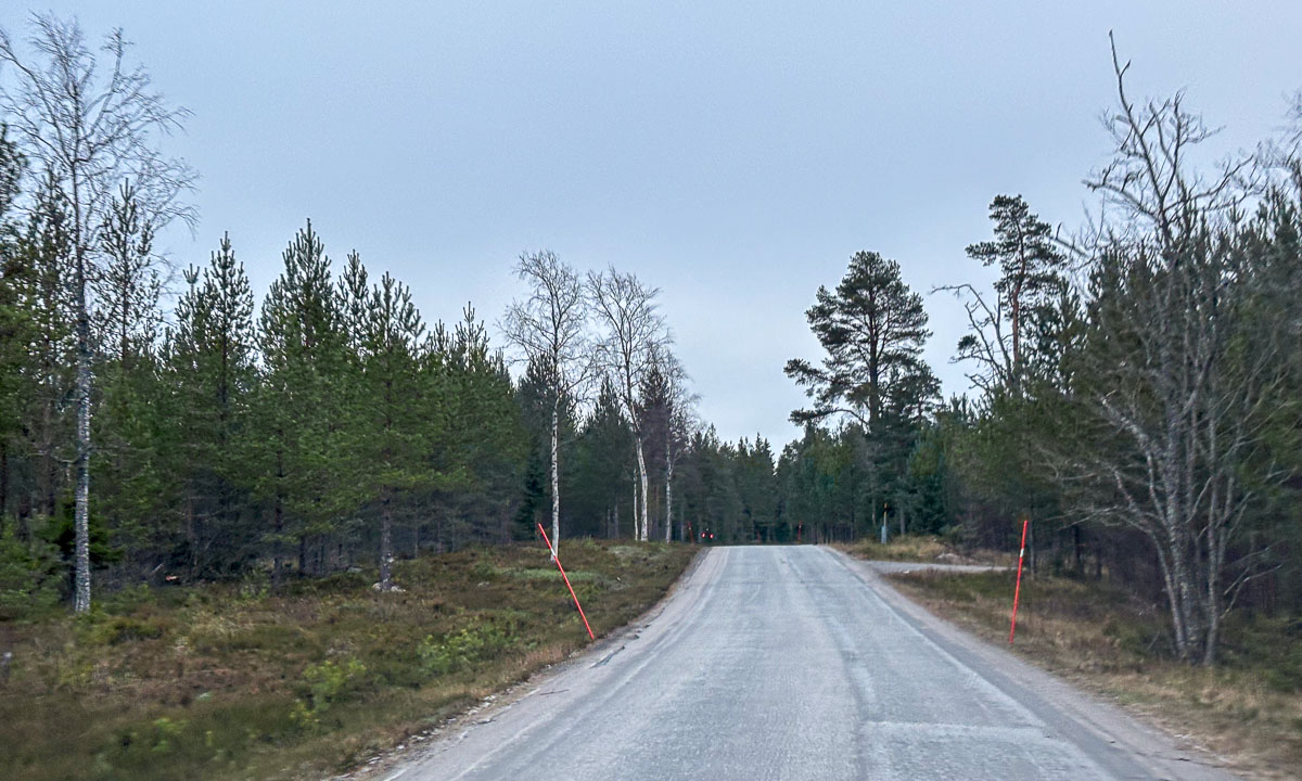
I continue south and it is clearing up. Even the road is in much better shape now. Easy driving.

In the Finnish village Karesuvanto I turn right, cross the Muonio River and thus the border to …

Sweden

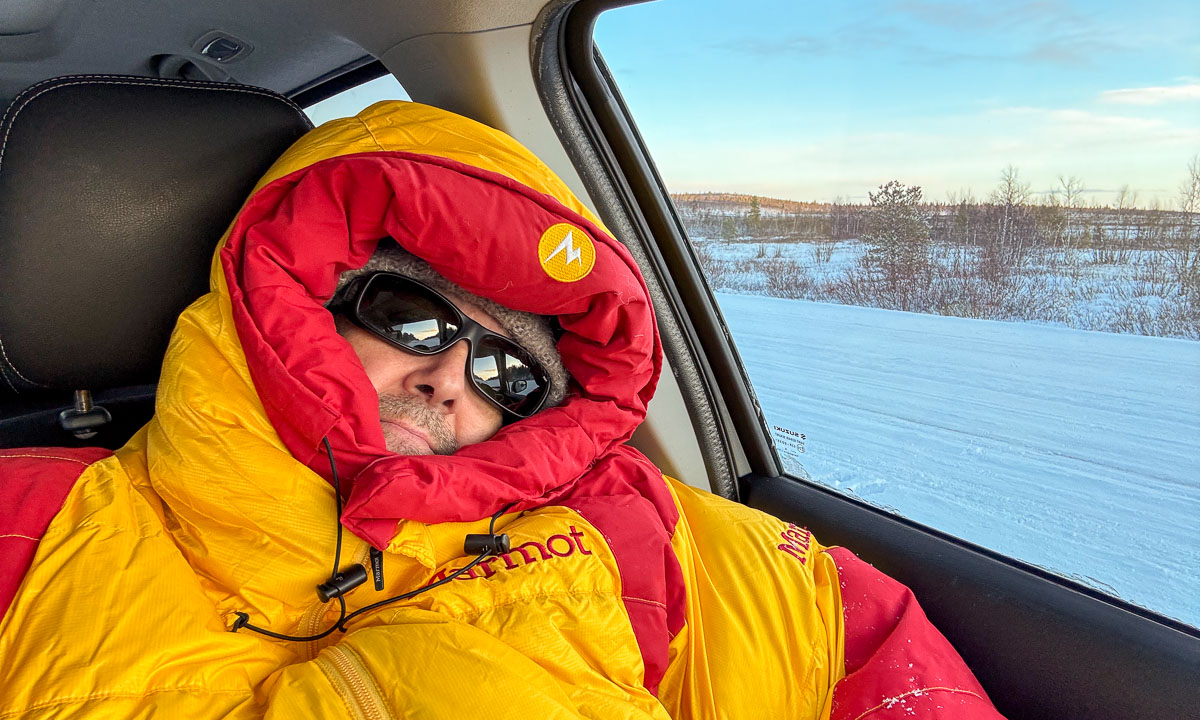
… where I arrive in Karesuando. I turn right again and join the E45 which ends in Gela, Italy. The sky is clear and the outside temperature dropped more and more. In Övre Soppero the display in the car shows -13 °C. It also shows a lot of warnings because the packed snow in front of the car is confusing the sensors for the cruise control. I feel tired and find a parking bay where I take a nap.

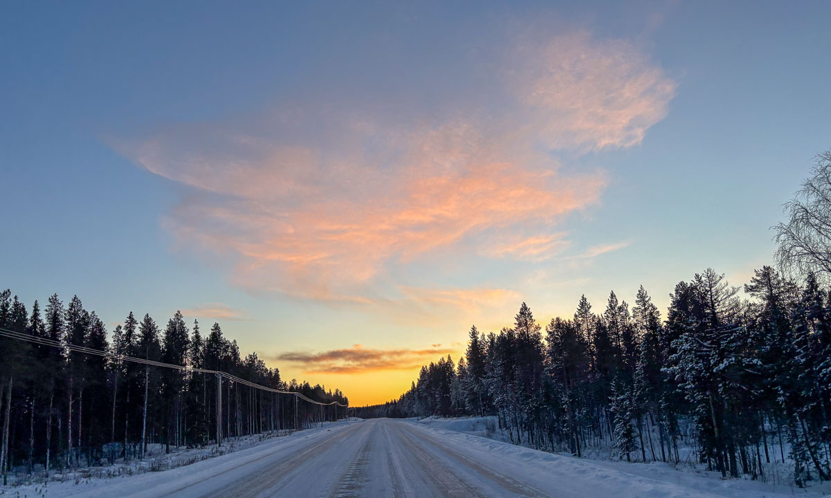
I sleep less than half an hour but I feel refreshed again. I continue my car trip to Vittangi and while I’m following the road see the slowest sunset I can remember. Perhaps, because I’m driving southwards?

In Töre, where I reach the E4 I fill up the car with fuel. From there it is not far to Råneå, where I visit friends and stay overnight. I’m asleep before 9 o’clock.

Still Sweden

After ten hours of sleep and breakfast I feel fit again to continue my car trip. The day before I made already two thirds of the distance and today I’m more or less only on the E4, so driving will be easy. To be honest, it’s a bit boring. That’s also because I’m leaving winter behind. There is less and less snow and it gets warmer. The good thing – the snow on the car has melted and the cruise control is working again.

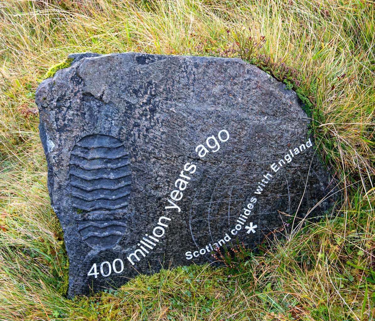
Around 14:15 I pass Obbola and drive southwards to “home home”. No snow.

And then, after driving 966.8 km I am finally home home again. Here I’ll stay for about three weeks, then Annika and I will make the return trip to Tromsø together.

The route

Tromsø—Nordkjosbotn—Kilpisjärvi—Karesuvanto—Karesuando—Övre Soppero—Nedre Soppero—Vittangi—Tärendö—Överkalix—Töre—Råneå—Skellefteå—Umeå—Obbola

Scotland NC500 – day 7 – a rainy day

This article is part of the series “2025-10: Northern Scotland”.

October 19

According to the weather forecast it will be pretty rainy in Northern Scotland the whole day. So, today we may interrupt our road trip less often than the other days. We will drive to AppleCross, where we’ve got a room in the Hartfield House Hostel & The Bunkhouse. If we arrive early, we may get a nap in the afternoon, which sounds tempting given the weather. We have breakfast in the hotel and take it easy. When we leave, it is half past ten. It is raining.

We make a stop at the visitor centre of the Beinn Eighe National Nature Reserve. There’s a small museum and a cabin, from where you can spot birds. There are also lovely spots outdoors, but  – it is raining.

Next stop: The lake Loch Clair, where I go for a short walk. I put on rubber boots, waterproof trousers and a rain anorak, because – it is raining. Annika prefers to stay inside the car to read. A smart choice, because the trail is just a rather dull gravel road and – did I mention it? – it is raining.

No noteworthy stops after that. We arrive at the bunkhouse at three o’clock. Beside the house there is a fenced in pasture with Scottish highland cattle. They look pretty soaked, but I guess, they are used to this kind of weather.

After an afternoon-nap (we got one!) we take a small car trip southwards. On the photos it looks like the weather has finally brightened up a bit.

But if you see a photo taken from inside the car you realise – it is raining.

One of the last photos I take today is of the seafront of Applecross.

As Google has already told us, the pub is closed. So we head back to the bunkhouse and have our dinner there.

Scotland NC500 – day 5 – fog, castle, mountains and forests

This article is part of the series “2025-10: Northern Scotland”.

October 17

My wife Annika and I have left Lairg where we stayed overnight and head west on the A837 through hilly farmland. Some places are covered with patches of dense fog which give even the more common views a magical touch.

We cross the River Oykel. North of the A837 another bridge spans the small river. These stone arch bridges are quite common, but here we can park so that we can take photos. We even get a bit of sun.

Half an hour later we arrive at the Knockan Crag National Nature Reserve. We park the car and have a view of the lake Lochan An Ais and the mountains behind. At least on those parts, that are not covered by fog.

Anyway, we hike the Crag Top Trail, a circular route. It starts drizzling as we follow the path and learn about the geological history of Scotland. Have a look at the seven photos of the stones.

While we continue our hike clouds approach and most of the view vanishes into a white void. But not for long, then lake and mountains are visible again.

Our next accommodation is in Badrallach in the south. However, we have time and first take the road north to Loch Assynt where Ardvreck Castle is located. We already visited this place three years ago.

As we hoped, the weather forecast was correct and it cleared up more and more. The silhouette of the castle ruins looks as impressive as last time, but now the water level is much lower and you can reach the peninsula with dry feet without wearing high rubber boots.

Not far from the castle there is a little waterfall, that is surrounded by birch trees. Now the leaves are bright yellow – one of the reasons why Annika and I love to visit Scotland in autumn.

Back in the car we follow the same roads that we already used three years ago. The same A837 to Lochinver by the sea where we take a light lunch in the very same guesthouse we stayed overnight three years ago. The same ridiculously small and bent single track road, that leads us further south to Badnagyle. Perhaps this is my favourite Scottish road (as long as Annika is driving and not me).

We turn left and reach the highlands again. We pass many mountains, amongst others Stac Pollaidh, that we climbed last time.

And we finally find a parking place where I can take a photo of a gorse bush, that is still in bloom.

Last time we spent a lot of time in Ullapool, now we do not even stop. (Or did we? I don’t remember.) We have to drive around the Loch Broom, a sea loch that cuts deeply into the land. But finally we can leave the main route and take the small road to Badrallach where we will spend the next night. Left and right there are some of the most beautiful trees I have seen for a long time, but again this road is single-track and it is not possible to stop without blocking it completely. Only once we can leave the car to admire the beech forest and to have a curious look at the two fenced in tombstones.

Then Annika and I arrive at our tonight’s accommodation where we get an extraordinarily beautiful room with a Scandinavian wood-burning stove and a large double bed. We take an evening walk to the end of the road and back again. Then we’re winding down the day in our room.

Scotland NC500 – day 3 – from kayak surfers to the inland

This article is part of the series “2025-10: Northern Scotland”.

15 October

My wife Annika and I have stayed in a hostel in the center of Thurso. If you took a ship from here and head north you could reach the North Pole without crossing any land mass. We however have no ship, but a rental car and after breakfast we continue our road trip westward.

Our first stop is Melvick Beach, where we go for a walk. The beach is embedded in a bay. At the eastern end Halladale River flows into the sea. In this section of the beach it smells bad, because large amounts of rotten seaweed cover the sand. Maybe it was torn from the sea by Storm Amy a fortnight ago.

Our next stop is Bettyhill, just 20 km to the west. While there is a beach here as well – we come to this later – there is something else to see: Erected in the Bettyhill Cemetery there is an ancient Pictish symbol stone, the Farr Stone. It is dated to around the year 800. Little is known about the Picts. That makes this carved stone all the more mysterious.

The old tombstones from the 17th century are pretty impressive as well with their pictogram-like symbols: The hourglass, the bell, the coffin, the skull with crossbones and grave-digging tools. When this tombstone was carved, Johann Sebastian Bach was still alive.

Back to the present. And time to visit Farr Beach nearby. We are not alone. There are kayakers out in the sea with short surf kayaks. I wish I had a tenth of their skills. On the beach, we strike up a conversation with a man. We learn that it is his friends being out there playing in the waves. Among them are some of the most skilled kayak surfers in Scotland. The waves are not high, they are just playing around and it is fun to watch them while chatting. I wish I had a twentieth of their skills.

Back in the car we continue west but we make a detour. We follow a small road lined by trees. Sometimes the treetops touch each other so that a tunnel of trees is formed. That makes these single track roads look even narrower. Luckily the road is pretty empty.

We see the island Eilean nan Ron from above. The road rises, then descends nearly to sea level and we come to the main road, where we reach the Kyle of Tongue, a shallow sea loch. Before we cross it using the bridge, we have lunch on the car park by the loch. Each of us has a “meal deal”. That’s a cold meal such as sushi or salad, combined with a drink and a snack. Available in most supermarkets.

It has been pretty grey today, but there are holes in the clouds and the sun illuminates different parts of the mountains in the south.

Our original idea was to follow the NC500 further to Durness further west, but we couldn’t find any affordable accommodation. Therefore we had booked a room in Altnaharra the day before. After the booking we learned that there are many accommodations in Scotland, which are not on booking.com, but today’s room is already booked. So let’s head to the Scottish highlands!

We take the bridge over the Kyle of Tongue and turn left to follow the bay southwards until it looks more like a shallow slough with mudflats sticking out of the water. A pity, that the light is quite dull.

And then we cut through the moorlands in the Scottish highlands. The red-brown colours of the grass are intense – these are the colours of Scotland in my humble opinion.

Forty minutes later we sit by the open fireplace at the reception of the hotel in Altnaharra.

Soon we are given a comfortable room upstairs. To my delight it includes a bathtub. After dinner I’m having my first hot bath in years. Oh – so delightful!

Scotland NC500 – day 1 – the road trip starts

This article is part of the series “2025-10: Northern Scotland”.

13 October

It is one o’clock. Annika has driven the first 70 kilometres in our rental car, and we’ve arrived in Dornoch. We already visited the cathedral with its beautiful stained-glass windows. Now we are sitting at the only table outside the SandStone cafe enjoying the sun. I also enjoy something else: An Irn-Bru, this legendary Scottish soft drink with its bright orange colour. It won’t be the last one the next days.

From there it is not far away to our first beach: Durness beach with its beautiful sandy shoreline. It has some features beyond the usual such as a park with outdoor metal musical instruments or the box where you can lend beach toys.

We continue our road trip, but instead of following the main route we take a detour to the Falls of Shin. It is said that in summer and early autumn the salmons swim up the River Shin to spawn. When they pass the Falls of Shin they have to jump up the rapids. I thought, October was already off-season, but we do not only spot the waterfall but also some jumping salmons. And another species: salmon watchers with their binoculars and cameras with huuuge telephoto lenses. With my smaller telephoto lens I manage to take some photos of a lot of water with a tiny fish. I wonder how the salmons master this waterfall? We have not seen any salmon succeed.

Back in the car we take the road north and pass Lairg. Then we pick minor roads that lead east again. A deer is crossing one of the roads, taking its time.

The sun is setting much faster than in Northern Europe and soon the colours of the scenery become warm. Photographers call this the golden hour and in my humble opinion it is especially beautiful in autumn.

It is not only the golden hour, it is the hour of the pheasants. First we see one here and two there, then some are on the road and all of a sudden a whole flock is blocking the narrow road. completely. They totally ignore our car and I have to exit, running towards them, waving my arms like a madman to shoo them away. Never have I seen so many pheasants in my life.

Near Brora we come back to the main road A9. Another eighteen kilometres and we arrive at the “Song of the Sea, Selkie House” in Helmsdale, our first stay for the night. Just half a day’s drive, and we’ve seen so much already. Now we’re heading to a pub for some food, and before long we’re lying in the huge double bed in our cosy room.

Tomorrow we will continue north.

Scotland NC500 – prelude

This article is part of the series “2025-10: Northern Scotland”.

Oh my, was is really less than two weeks ago, that my wife Annika and I were on holidays in Scotland? It feels like ages ago! Time to start blogging about our trip that is south from were we live, but still kind of way up north, at least from a British perspective.

11 October – arrival

Half past twelve. I have just landed in Aberdeen, Scotland’s 3rd largest town. Annika will arrive late afternoon, my luggage the next day … . I check in at the Station Hotel and realise that I have reached a rainy realm. At the entrance door you can rent umbrellas. 3 £ for 48 hours. Card payment.

I take a stroll through town and start to take photos.

Soon I realise that in Aberdeen it completely makes sense to take photos in upright format.

Later the day I head eastwards to the Aberdeen beach front. I would have taken my bathing gear if my luggage had arrived in time.

When Annika arrives it has become dark. We eat dinner at the Indian restaurant Namaste Delhi where we have great Indian food. I ordered a salty lassi and got a custom one—off the menu! I however didn’t dare to play the grand piano. A rare view nowadays.

12 October – Aberdeen

After having breakfast in our hotel –cereals,  toast, bacon and eggs, beans, haggis, you name it – we take the bus to the Old Town. But before that I try to take a photo of the Marischal College in the center. No, it is not curved like on the photo but even with my 14 mm wide angle lens I had to stitch together six photos to get this colossal building on a single image.

But now: Old town. First the botanical garden, where the Autumn Crocus flowers were in full bloom. Very beautiful and very toxic!

Next stop: St Machar’s cathedral with its Heraldic Roof. Just impressive!

Equally impressive are the huge and ancient trees. We don’t have such trees at home, neither in Umeå, Sweden, nor in Tromsø, Norway. These beech roots I photographed in Seaton Park that lies beside St Machar’s by the river Don.

Next stop: King’s College, founded in 1495 and still part of the university. The wood carvings in the chapel are amazing and the whole place breathes centuries of history.

After a small lunch we take the bus back to the center of Aberdeen, where old and modern architecture live side by side.

We are back at the hotel, but not my luggage. Just minutes after we have entered our room I get a call from the reception. The luggage finally has arrived. Wideroe had failed completely in giving any updates on any communication channel about the luggage’s whereabouts. Now I’m really relieved. We can take the train to Inverness the next day as planned! Now it is time for a nap.

After the nap we want to have a snack for dinner, preferably something that is new to us. We find it in a tiny Georgian restaurant called Oki Doki, where we eat Khinkali for the first time in our lives. Strongly recommended to try it out when you are in Aberdeen!

13 October – Car rental

It is ten o’clock and Leakey’s Bookshop – Scotland’s 2nd largest second-hand bookshop – has just opened. It is a beauty! At least in the eyes of book lovers. It is also overwhelming with its over 100,000 books (including an own section for polar exploration!) and we didn’t buy anything.

We are not in Aberdeen anymore. As planned we took the the train to Inverness in the morning, where Leakey’s Bookshop is located. Here in Inverness we will hire a car and drive the “North Coast 500” (short NC500), a scenic 516-mile (or 830 km) long road trip along the north coast of Scotland. We have eight days.

We have to walk a bit to Arnold Clark, our car rental. Here we receive our SEAT Ibiza – a perfect car for the many narrow single track roads. It is Annika, who is driving. She has already left-hand driving experiences from three years ago and an additional driver (me) would have costed us £ 120.

And off we go – heading north.

Stay tuned for the next chapter …

Just a pick-up at the station…

When Annika travelled to me last weekend, her train from Boden to Narvik was cancelled and the next and last train was heavily delayed. Unfortunately train problems have become common in Northern Sweden over the years. I had to use the airplane several times because trains didn’t run at all for days or it was impossible to buy tickets.

To keep Annika from being stranded, I drive to Narvik to fetch her. From Tromsø it takes me about three and a half hours plus some breaks.

Meanwhile Annika has booked a hostel in Bogen where we stay overnight. Our plan is not to drive back the direct route, but to visit the islands Andøya and Senja.

Monday, 21 July

The next morning starts sunny.

However it soon gets foggy. After crossing the Tjeldsund we are on Hinnøya, the largest Norwegian island (when we ignore Svalbard). We decide against a swim in the sea due to the fog and continue to Refsnes. From here go ferries cross the Gullesfjorden to Flesnes. On my trip to Narvik yesterday it was often 28 °C, now in the fog it is hardly 15 °C.

We have missed the 10 o’clock ferry, but they run hourly and we don’t have to wait for long. The journey itself takes only 20 minutes.

From Flesnes we continue to Risøyhamn. Hurtigruten travellers may know this place not only because it is one of the stops but also because of Risøyrenna – a man-made underwater channel that allows larger vessels to pass between Andøya and Hinnøya. The Hurtigruten ships has to go quite slow there.

We take the bridge over the Risøysundet and drive through Risøyhamn. Twice. Because I didn’t know that it is so small. Only round 200 people live there.

The weather is sunny again and we become more beach focussed. The first beach is for having lunch. We share it with a flock of sheep.

The second beach is for bathing. 16 °C in the water – surprisingly warm for the region.

We continue north. To the west the Norwegian Sea. Next shore westwards is Greenland, more than 1500 kilometres away. Our next stop is much closer: a public toilet at Bukkekjerka. But what a one! It is a designed block of concrete and mirrored glass. From the outside you cannot look in, but from the inside you can switch the huge glass windows between being transparent or opaque.

Around this place – a lighthouse on a peninsula, interesting looking rocks, a baaing sheep and of course the sea.

We follow the coastal road further north to Bleik. Here you can find beaches and turquoise water as well as ridiculously looking rock needles.

After refuelling my car in Andenes we drive south again to Marmelkroken, where we will stay overnight. With an additional photo stop.

To part 2 >

End of April winter in Tromsø

When I woke up yesterday morning (28. April) and looked outside the window of my living room I was pretty surprised. I didn’t rain in the night, it had been snowing.

Round 15 cm of fresh snow had fallen within the last six hours and everything looked wintry again. In the centre of Tromsø however, 88 metres lower in elevation than my apartment only five cm of snow had fallen and the cars had smashed it to brown slush. What a difference!

Home again I watched a ptarmigan in the back yard. First it picked on a twig of a tree, then it dug itself into the snow and rested there for some hours. Couldn’t it see me behind the window pane or did it just ignore me? In the night it was gone.

Today I took my skis to work so that I could ski back home from the lake Prestvannet. This time the forecast was correct: we got a blue sky, the sun was shining at temperatures round +3 °C. At the harbour in the centre the view was quite spring-like.

Taking the bus from the center up to Prestvannet takes only 5 minutes, but there it is still winter season with snow depths round 90 cm. It’s astonishing what a difference in altitude of less than 100 metres can do.

Time to ski back, preferably not on the tracks but through the forests. After four kilometres on skis and 840 metres by foot I was home.

Blowing snow

It looks like winter has come back to Tromsø. At four o’clock the temperature fell below zero, at 17:30 the first heavy snow shower arrived and at 22:00 we got wind gusts up to 18 m/s. It’s not a lot of snow that fell, but the wind gusts take the snow from the ground and blow it through the streets in metre high clouds. Winter parka time, at least when I took this photo.


Three countries in sixteen snapshots

This article is part of the series “2025-02: Finnmark”.

While Annika and I have been travelling through Northern Norway, Finnish Lapland and Northern Sweden I take photos not only with my cameras, but also snapshots with my mobile phone. Here is a small non-landscape selection.

Norway

23 February – Solhov

Solhov, built in 1912–24 as a school provides accommodation today. The wooden building is huge and has a large hall with a piano that is surprisingly in tune.

24 February – Alta

As in Tromsø it is too warm in Alta. Temperatures round +7 °C lead to snowmelt and giant puddles in town.

25 February – Suolovuopmi Fjellstue

In the middle of nowhere there is a café by the road E45 from Alta to Kautokeino. To our delight it is open and we get reindeer burger and omelette with smoked rein for lunch. Delicious!

25 February – Karasjok

We stay two nights in Karasjok, where the Samí parliament is located. Our cabin is cozy. Min Ája, the camping site has a billiards room.

The design of some of the beer cans looks arctic. While most alcohol has to bought in the specialist shop “Vinmonopolet”, beer up to 4.7 % can be bought in supermarkets, too.

26 February – Karasjok

In the tourist shops you can buy a lot of genuine Sámi handicraft. And thick fabrics in wonderful colours. Many traditional Sámi garments use the same colours: blue, yellow, red, and green.

27 February – Finnish-Norwegian borderland

A small shop. A cupboard with lockers. On each locker attached photos, all of them with fishing motives.

Finland

28 February – Utsjoki

As many hotel rooms our room has a wardrobe with hangers. But it has something more: two umbrellas. Could be a useful device here in the warmer months.

28 February – Saariselkä

Saariselkä has many cross-country ski trails. No wonder, that the hotel has an own waxing hut, where you can prepare your skis.

1 March – Saariselkä

It’s not a rumour, there are definitely a lot of Ä-s in the Finnish language.

3 March – Sodankylä

No town without a pizzeria and/or a burger bar. Although the name “Riviera” may not completely match the actual winter weather in Sodankylä.

3 March – Vuostimo

If temperatures are hardly below zero and it is snowing the snow is sometimes like glue and covers your car everywhere.

4 March – Vuostimo

Snow, a birch, a fence, a road in the background. Leaning against the fence: a bicycle. Clearly unused for a while, since it is deeply stuck in the snow. A Northern winter short story.

Sweden

4 March – Tornio/Haparanda

Two countries, two time zones, two languages. At the border two towns: Tornio on the Finnish side, Haparanda on the Swedish. They share a lot of infrastructure such as the bus station. The border itself is not visible, but the two clocks showing Finnish and Swedish time or the cabinet with Finnish and Swedish food.

A border that connects people. A border I like.