Travelling from ice to summer
This article is part of the series “2023-06: Arctic Ocean cruise KPH”.
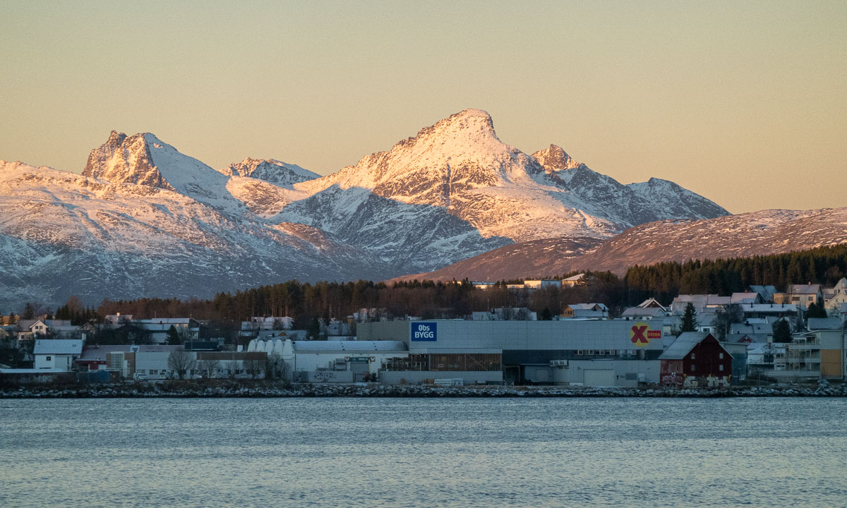
This photo was taken three days ago:

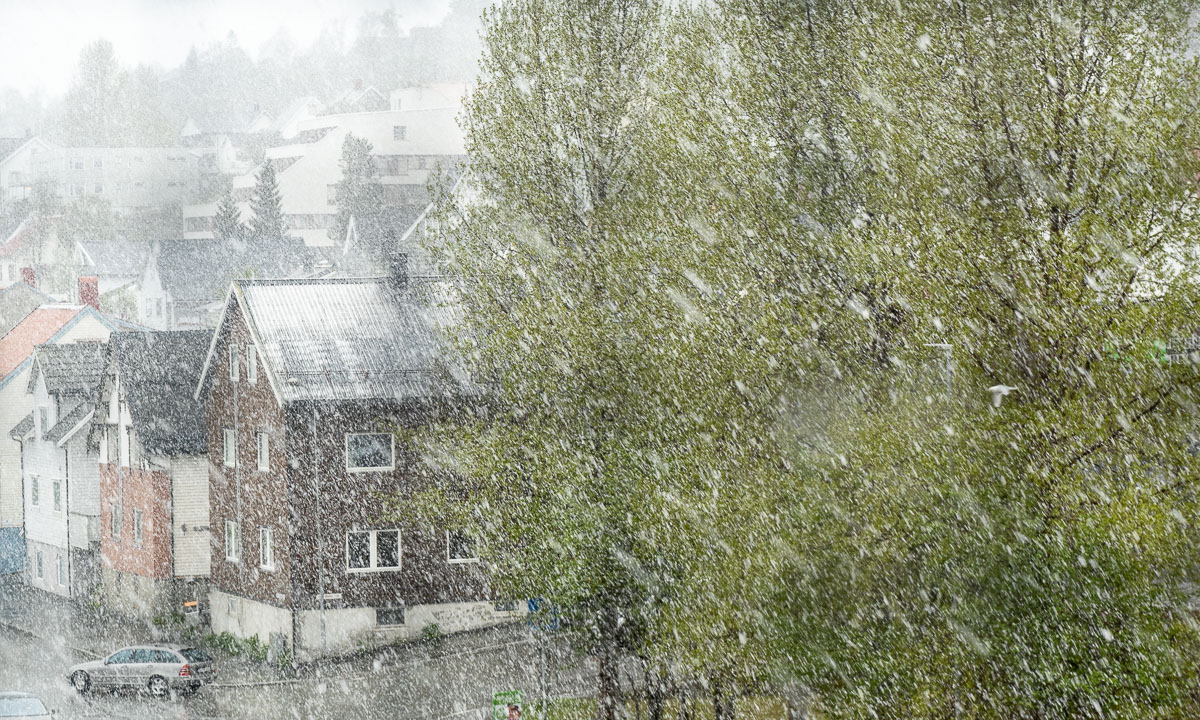
These photos were taken three hours ago:


Quite a contrast, isn’t it?
18 June (four days ago)
I stand on the sea ice for the last time as part of the polar research expedition with the ice breaker Kronprins Haakon. It has become quite foggy and we will close the ice station earlier due to bad visibility. If you cannot spot the polar bears it is not safe and we had quite a few of them the last two weeks.
19 June (three days ago)
Today we stop the ship several times for the usual CTD casts to get the salinity and temperature of the sea water in different depths. For science it is always interesting to get comparable measurements. One way is to do a transect, a series of the same type of measurements in different locations, mostly in a line. Today we do CTD casts at 2° W, 1° W, 0°, 1° E, and 2 °E. So today we have crossed the Prime Meridian.
For doing CTD casts the ship must stand still. At 1° E I use this to fly my private drone from the helicopter deck for the first picture above. (Memo to myself: do not fly a drone in fog, it is hard to land.)
20 June (two days ago)
After four days of fog it finally clears up in the evening. And for the first time in 18 days we can see land again, the long and narrow island Prins Karls Forland.

We can get a lot of information about what’s going on on the TV. On channel 9 there is OLEX, a navigation system. I see, that Helmer Hanssen, another research vessel owned by the University of Tromsø is nearby. The ships are getting closer and closer and I go up to the helicopter deck to take some photos. There’s a reason for the ships to meet. Malin, a researcher in the field of arctic and marine biology is transferred from our ship to Helmer Hanssen by boat. She will join another cruise.

21 June (yesterday)
In the morning we have approached Adventfjorden, where the main city Longyearbyen is located. Due to the touristic cruise ships occupying all dock places we will stop in the open water. From there we are transferred to land by boat as well. I’m in the first boat because I want to meet people in Longyearbyen at Forskningsparken. There UNIS, the university of Svalbard is located and a department of the Norwegian Polar Institute, too.


We get a car transport there and I meet Vegard, that helped me with drone flying and Luke, that I have worked with quite a bit. Luke and I have even time to get some outdoor lunch in the summery town. It’s sunny and more than 10 °C. (Too warm for me.) He mentions that it got quite green in Longyearbyen. And I spot the first flowers.


At the airport there are long queues everywhere. It is not build for large groups of slightly disorientated tourists. But we arrived early. Shortly after half past two we lift off. I glue myself to the window to see the fjords, the mountain chains and the glaciers of Svalbard passing by.


Amidst between Svalbard and Tromsø I manage to spot the arctic island Bjørnøya in the haze. For the first time in my life! The photo is heavily processed to make Bjørnøya visible.

And then we land in Tromsø where the vegetation just has exploded in my three weeks of absence. Everything is green and there are flowers everywhere. I am lucky and get a lift home. (Thank you, Tore!)
22 June (today)
I drop by in the office to meet my colleagues. Good to see them in real life. We talk about the cruise and many other things. But after work I take a bath in the sea. So refreshing when it is summer and 25 °C! That’s more than twenty degrees warmer than four days ago when I navigated my small drone to take a photo of Kronprins Haakon in the sea ice somewhere between Greenland and Svalbard.
23 June (tomorrow)
Tromsø is my work home, but Obbola in Sweden is my home home. Tomorrow I will travel there. If everything goes well it “only” takes 18 hours. And then I finally will be united with my wife Annika again in our cosy house by the Baltic Sea.