Scotland NC500 – day 2 – standing stones and a castle on a cliff

This article is part of the series “2025-10: Northern Scotland”.

14 October

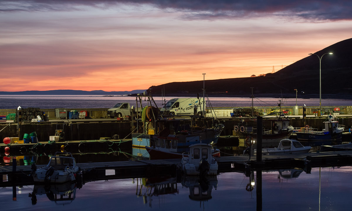
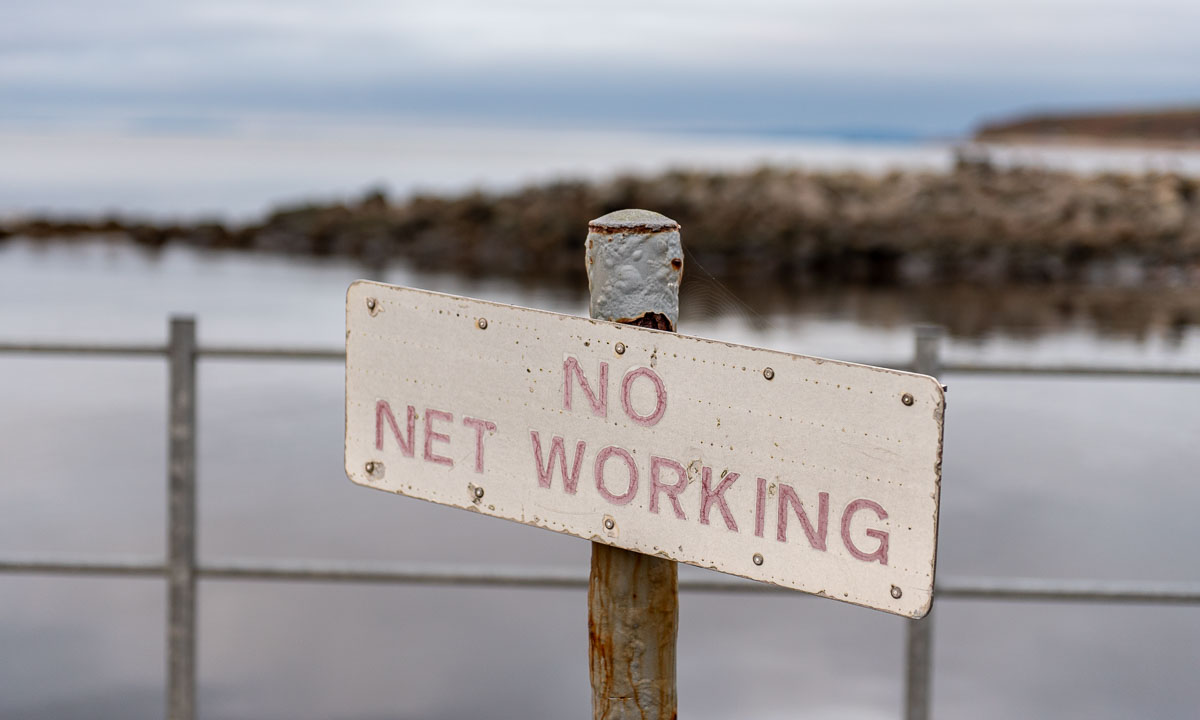
When I wake up in Helmsdale on the Scottish east coast it is still twilight. It is quiet. Only some fisher boats are leaving the harbour and two bird watchers are standing on the pier. I like especially the sign “No net working” which has a completely different meaning here. Context matters!

Back at our guesthouse “Song of the Sea, Selkie House”, Lorna, our host is inviting my wife Annika and me to her big kitchen where she prepares our breakfast. And what a breakfast: Cereals with fresh strawberries, eggs, bacon, mushrooms, toast with home-made jam and more was put on the table while we had a long and cheerful chat with plenty of laughter. I feel so welcome to be here and we only left reluctantly. I think: “If you do not like Lorna’s place you do not know anything about travelling.” If only my English was better and my ability to understand all kinds of Scottish accents.

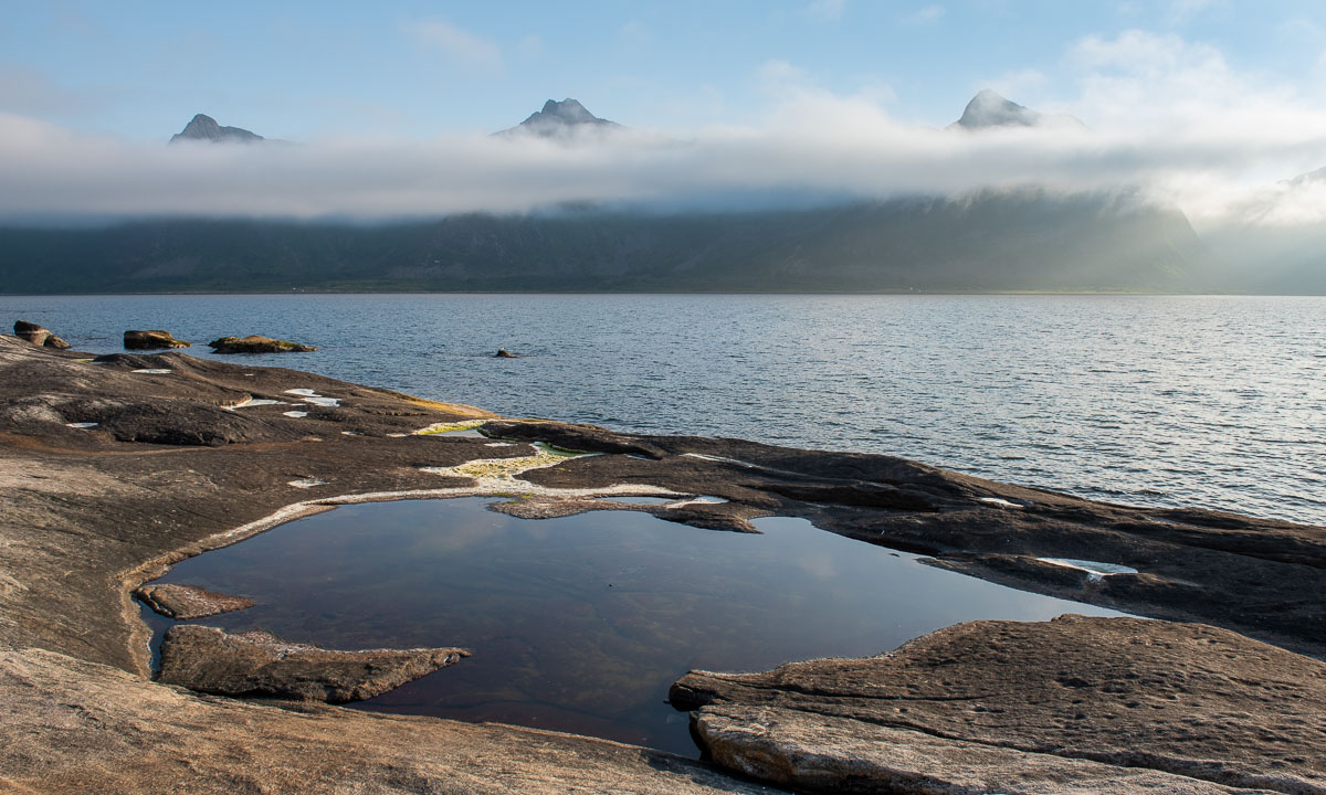
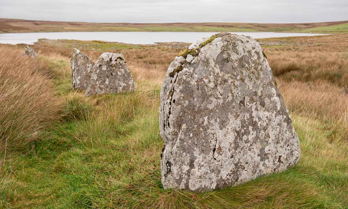
Round half past ten we continue our road trip, heading straight north. Some attractions we find in our guidebook, while others are on using Google Maps. So we have found Achavanich, a megalithic structure literally in the middle of nowhere. We use the tiny parking area und wander around between the lichen-covered stones that are arranged in a horseshoe-shaped pattern. A bit further down – a lake called Loch Stemster.

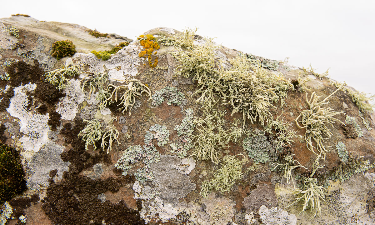
Exercise for lichenologists: how many different species can you count on the second photo?

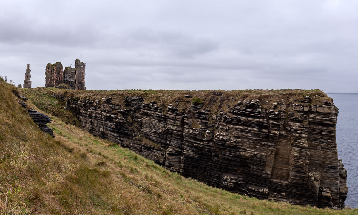
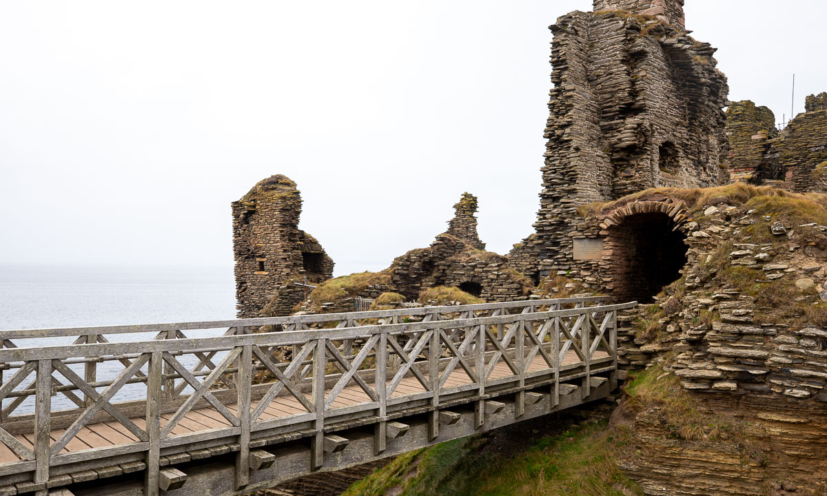
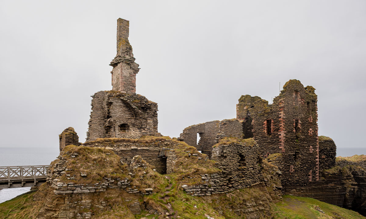
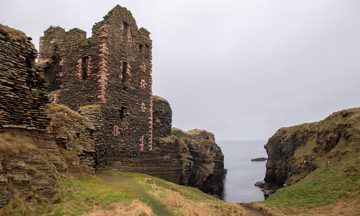
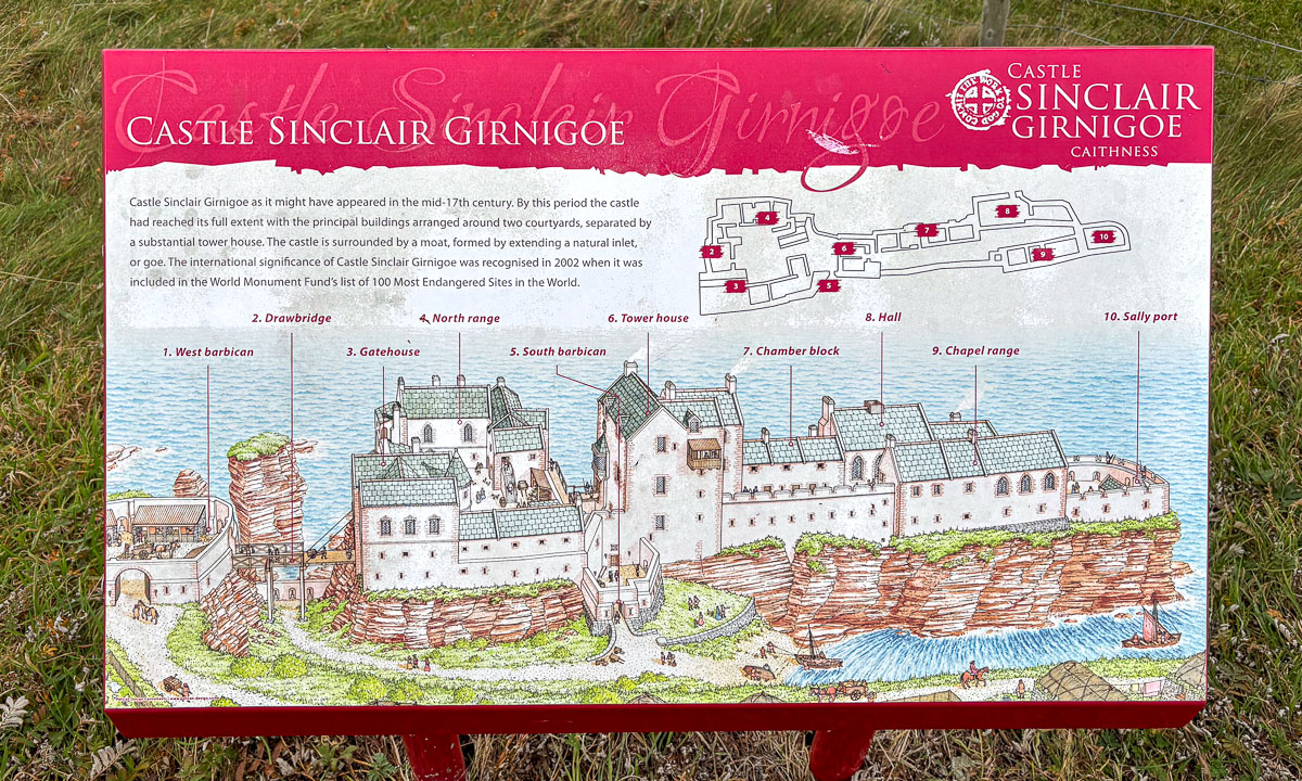
The next attraction is in the book: The Castle Sinclair Girnigoe 5 miles north of the town Wick. This castle – or better said its ruins – is located at the very edge of the coastal cliff. There are educational displays that explain the history, but for me the most impressive detail is the exposed location by the sea. More than an hour Annika and I are strolling round the castle despite of the drizzle. A real highlight on our trip!

This is one of the displays showing how the castle looked centuries ago.

Back in the car we drive back to the A)), follow it north and then take the road to the Duncansby Head Lighthouse which marks the most northeasterly point of the Scottish mainland. Photo. Check!

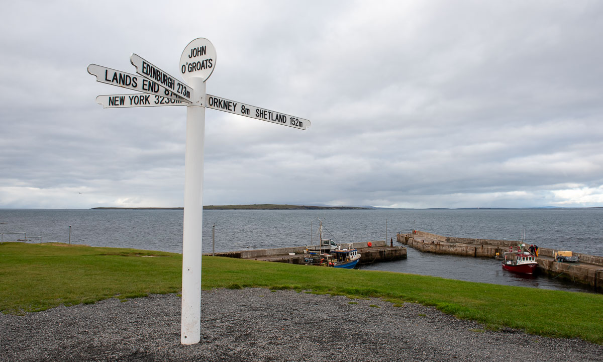
The next stop is only a very short one. I take some photos of the John o’ Groats Signpost, a famous but surprisingly boring signpost. It has four arms pointing to Orkney and Shetland, to Edinburgh, Lands End and New York. That’s it. While I take these photos Annika is slowly driving around because parking is expensive in this commercially focussed place and we are happy to leave it behind.

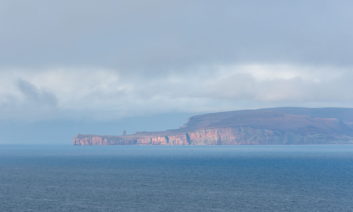
But the signpost is true: The Orkney islands are pretty near and we see the cliffs from different places, such as our next stop Dunnet Head. This is the northernmost point of the UK. Here take a photo of the partially sunlit cliffs of the Orkney islands in the distance.

So Annika, next time Orkney and Shetland? … and Faroe islands? … Iceland again? … Greenland? … Vinland? Sorry, I got slightly distracted. Back to our road trip.

From Dunnet Head it is just about twenty kilometres to Thurso, a surprisingly big town by the north coast of Scotland. Here we stay in a quite shabby hostel, but we can cook, we can sleep and that’s all you really need. Parking the car in town however was adventurous because the rules are pretty cryptic and time-dependent. Anyhow, there is a big car park by the River Thurso, where Annika parked our rental car over night. (Thanks again, Google Maps for the tip.)

The next day we will leave the NC500. We thought, travelling in October would make it easier to find accommodation, but it gets harder, because many guesthouses have been closed for the season.

Scotland NC500 – day 1 – the road trip starts

This article is part of the series “2025-10: Northern Scotland”.

13 October

It is one o’clock. Annika has driven the first 70 kilometres in our rental car, and we’ve arrived in Dornoch. We already visited the cathedral with its beautiful stained-glass windows. Now we are sitting at the only table outside the SandStone cafe enjoying the sun. I also enjoy something else: An Irn-Bru, this legendary Scottish soft drink with its bright orange colour. It won’t be the last one the next days.

From there it is not far away to our first beach: Durness beach with its beautiful sandy shoreline. It has some features beyond the usual such as a park with outdoor metal musical instruments or the box where you can lend beach toys.

We continue our road trip, but instead of following the main route we take a detour to the Falls of Shin. It is said that in summer and early autumn the salmons swim up the River Shin to spawn. When they pass the Falls of Shin they have to jump up the rapids. I thought, October was already off-season, but we do not only spot the waterfall but also some jumping salmons. And another species: salmon watchers with their binoculars and cameras with huuuge telephoto lenses. With my smaller telephoto lens I manage to take some photos of a lot of water with a tiny fish. I wonder how the salmons master this waterfall? We have not seen any salmon succeed.

Back in the car we take the road north and pass Lairg. Then we pick minor roads that lead east again. A deer is crossing one of the roads, taking its time.

The sun is setting much faster than in Northern Europe and soon the colours of the scenery become warm. Photographers call this the golden hour and in my humble opinion it is especially beautiful in autumn.

It is not only the golden hour, it is the hour of the pheasants. First we see one here and two there, then some are on the road and all of a sudden a whole flock is blocking the narrow road. completely. They totally ignore our car and I have to exit, running towards them, waving my arms like a madman to shoo them away. Never have I seen so many pheasants in my life.

Near Brora we come back to the main road A9. Another eighteen kilometres and we arrive at the “Song of the Sea, Selkie House” in Helmsdale, our first stay for the night. Just half a day’s drive, and we’ve seen so much already. Now we’re heading to a pub for some food, and before long we’re lying in the huge double bed in our cosy room.

Tomorrow we will continue north.

Just a pick-up at the station… – part II

< to part 1

Tuesday, 22 July

When I wake up early, the mountains and the sea have vanished. Thick fog surrounds our overnight stay Marmelkroken on the island Andøya. I take a walk through the wet grass to the bird observation place but beside of some seagulls and a lonely curlew that flies around there is nothing to see.

One hour later Annika and I sit inside enjoying our gorgeous breakfast. We get a table-side presentation of the dishes. More or less everything has been produced locally and we eat it all.

Then we head of. We want to catch the one o’clock ferry in Andenes that will bring us to the next island Senja, second largest in Norway (again, when we ignore Svalbard). The weather soon gets fair again, but around the mountains still some clouds are hanging.

Yesterday we took the western road, today we cross the boggy island to take the eastern one. On the way there we pass the village Å. There are several Norwegian places called Å, the most famous one is on the Lofoten. The next stop is the octagonal church in Dverberg.

A bit north near Myrset there is a huge area of peat mining. Andøya has large areas of peat bogs and parts of it has been drained to extract the peat. I climb on a hill of peat – it bounces like a water bed – to take some photos of this moonscape. Then I protect my camera lens, because each step emits a cloud of brown dust. But that’s nothing compared to the huge double-wheeled tractors anyhow that produce huge clouds of peat dust while driving. My car is brown now.

We take it easy, we have time – that’s what I thought. When we however arrive at the ferry terminal it becomes quite obvious that we would not join the next ferry. Too many cars are ahead of us waiting. So the one o’clock the ferry departs without us, leaving us behind but in a much better start position. Now we have to wait for four hours. Time to explore Andenes a bit.

As hoped and expected we find place on the next ferry. Now we are on the way north to Senja. Soon we are in open water, accompanied only by some sea birds.

The ferry trip takes one hour and forty minutes. Then we arrive in Gryllefjord on Senja.

Unfortunately we won’t catch the last ferry to Kvaløya today, they are not coordinated. We have to drive via the mainland – a large detour. Although it is another detour we decide to take the coastal route. 289 more kilometres to go which means a five hour drive in Norway. It is evening and we will make less breaks now.

Stop one – Tungeneset, a scenic rest area.

Stop two – another one of the many beautiful views on a fjord and the mountains on the other side. Here we see something special: a cloud waterfall. Clouds fall down a steep mountain range where they vanish in thin air. New clouds come from behind. The cloud waterfall is several kilometres broad and looks like a huge waterfall in slow motion. An impressive view.

(Note to the meteorologists: is this a orographic cloud spillover?)

We take the bridge from Silsand to Finnsnes. After two days we are on the Norwegian mainland again. Although it is still midnight sun season – the sun won’t set, it just moves lower and lower until it is hidden behind the mountain. I took the next photo at eleven o’clock in the evening.

At half past twelve we arrive home in Tromsø, my “work home”. Although it was only one evening and two days of travelling together it felt like real holidays.

We think about doing the same in half a year. I have to check the ferries, but it would be interesting to visit the same places in wintertime.

Just a pick-up at the station…

When Annika travelled to me last weekend, her train from Boden to Narvik was cancelled and the next and last train was heavily delayed. Unfortunately train problems have become common in Northern Sweden over the years. I had to use the airplane several times because trains didn’t run at all for days or it was impossible to buy tickets.

To keep Annika from being stranded, I drive to Narvik to fetch her. From Tromsø it takes me about three and a half hours plus some breaks.

Meanwhile Annika has booked a hostel in Bogen where we stay overnight. Our plan is not to drive back the direct route, but to visit the islands Andøya and Senja.

Monday, 21 July

The next morning starts sunny.

However it soon gets foggy. After crossing the Tjeldsund we are on Hinnøya, the largest Norwegian island (when we ignore Svalbard). We decide against a swim in the sea due to the fog and continue to Refsnes. From here go ferries cross the Gullesfjorden to Flesnes. On my trip to Narvik yesterday it was often 28 °C, now in the fog it is hardly 15 °C.

We have missed the 10 o’clock ferry, but they run hourly and we don’t have to wait for long. The journey itself takes only 20 minutes.

From Flesnes we continue to Risøyhamn. Hurtigruten travellers may know this place not only because it is one of the stops but also because of Risøyrenna – a man-made underwater channel that allows larger vessels to pass between Andøya and Hinnøya. The Hurtigruten ships has to go quite slow there.

We take the bridge over the Risøysundet and drive through Risøyhamn. Twice. Because I didn’t know that it is so small. Only round 200 people live there.

The weather is sunny again and we become more beach focussed. The first beach is for having lunch. We share it with a flock of sheep.

The second beach is for bathing. 16 °C in the water – surprisingly warm for the region.

We continue north. To the west the Norwegian Sea. Next shore westwards is Greenland, more than 1500 kilometres away. Our next stop is much closer: a public toilet at Bukkekjerka. But what a one! It is a designed block of concrete and mirrored glass. From the outside you cannot look in, but from the inside you can switch the huge glass windows between being transparent or opaque.

Around this place – a lighthouse on a peninsula, interesting looking rocks, a baaing sheep and of course the sea.

We follow the coastal road further north to Bleik. Here you can find beaches and turquoise water as well as ridiculously looking rock needles.

After refuelling my car in Andenes we drive south again to Marmelkroken, where we will stay overnight. With an additional photo stop.

To part 2 >

A short summer journey in Northern Sweden

Annika and I are on holiday and spent this week to travel around northern Sweden by car, mainly to visit friends. Some stopps: Kusfors, Arvidsjaur, Nattavaara, and Gällivare.

Jar museum Rolig & Rusk

We took a short stop at the jar museum in Burträsk. Not to visit the museum, but the small flea market. If you travel in Sweden and love browsing at flea markets, look for the sign “Loppis”.

Smörgåstårta

In Kusfors we visited friends and got Smörgåstårta for lunch. This dish is very Swedish. While its “architecture” resembles a layered cream cake, the taste is savoury and contains ingredients like ham or cheese.

Summer flowers

When there are meadows or pastures in Northern Sweden there are full of flowers in summer. Here you can see for examples dandelions, butter cups, campions, and cow parsley. This patch is by our friend’s house.

A reindeer in the grocery?

Reindeers are typical for Northern Sweden and you have to watch out for them when driving a car. This fellow however is stuffed and stands in the display window of a grocery in Arvidsjaur.

Zzzzzzzzzzzzz…

There are many lakes in Sweden and in summer these lakes always come with mosquitoes, especially in the evening. Luckily they are late this year and I could take this photo without being eaten alive.

Old log cabin

We are spending the night at Renvallen Camping near Arvidsjaur. The camping ground is an old farm and some buildings such as this log cabin are pretty old.

Gravel roads

If you think, your car is too clean, use a Swedish gravel road in rain. The back of you car will be plastered with brownish-grey mud that even the strongest rain cannot wash away.

Sandviken beach

Yes, I wanted to take a bath at Sandviken in Gällivare, but my motivation went near zero, when I stood there in the steady rain looking at the shallow water with its gravelly ground.

Fat Tony’s

If you like burgers, you should give Fat Tony’s in Gällivare a try. Both atmosphere and food are great. And if you are there, do visit the bathroom.

Dundret

Just around the corner from Gällivare lies Dundret, a solitary mountain. When the rain stopped Annika and I took a hike there together with our friend Sascha and his malamute Roxy.

Tyre dealer

Stuff standing around in car garages has always its own aesthetics. The reason, why we needed a tyre dealer on our trip will be told another time (although you already may guess it).

Summer Café in Nattavaara

On Monday we passed Nattavaara. Alas, the summer café is closed on Mondays. On our way back it was open and we stopped to ate cake. Different volunteers come up for short stays to run the café and bake cakes. Most of them are from Switzerland or Germany which strongly increases the cake variety in the region.

From Obbola to Tromsø – home home and work home

Thursday, 20 March – Obbola

Annika and I are in Obbola, my “home home”. In the morning we get visitors. Three deer stand in our garden – always alert. Are they happy, that much of the snow is gone?

In my lunch break I am kayaking round the island Bredskär. That’s just 3 km. There is still some ice round the rocks at the shore, but much snow and ice has melted away the last weeks. What a warm winter.

Friday, 21 March

Annika and I take the car to Tromsø. We will make a stopover in Jokkmokk, because the total distance is almost 1000 km. Hejdå home home!

In warm and sunny weather we head northwards to Piteå and then northwest to Jokkmokk. Now we are north of the Polar Circle.

In Jokkmokk we meet a good friend and take a walk round the lake Talvatissjön. Around the sun a halo appears .

Saturday, 22 March

After a good sleep in the hostel Åsgård Annika and I continue our car trip. Gällivare, Kiruna, Abisko. Torneträsk – the 6th largest lake in Sweden – is still completely frozen. Good for recreation such as skiing.

Parts of the road were closed some days ago. You can still see some remains of the snow storm.

Some weeks ago it would have been impossible to drive from Jokkmokk to Tromsø in daylight. Anyhow two days ago astronomical spring has started and the days are as long as everywhere. After hours of driving the sun is low but visible. It illuminates the beautiful clouds. And then we arrive at our apartment in Tromsø, my “work home”.

Sunday, 23 March

On Sunday the weather gets nasty. Max temperature: +9 °C and wind gusts up to 23.5 m/s. Annika and I take a promenade anyhow. With spiked shoes because some of the ways are just bare, wet ice and the friction is next to zero. We arrive at home before the rain. Good luck.

Monday, 24 March

On my way to work I spot the first spring flowers in front of the Tromsø Cathedral. I could believe in spring …

Tuesday, 25 March

… but do know the forecast and it is correct: Snow, snow, snow on the next day. So it looks like in the morning outside of the apartment …

… and so in the afternoon, when I walked home.

So we did not solely travelled between countries but also between seasons. Anyhow I hope for some more winter days (or weeks), before my seasonal clock will jump to spring mode. Perhaps in mid-May?


Three countries in sixteen snapshots

This article is part of the series “2025-02: Finnmark”.

While Annika and I have been travelling through Northern Norway, Finnish Lapland and Northern Sweden I take photos not only with my cameras, but also snapshots with my mobile phone. Here is a small non-landscape selection.

Norway

23 February – Solhov

Solhov, built in 1912–24 as a school provides accommodation today. The wooden building is huge and has a large hall with a piano that is surprisingly in tune.

24 February – Alta

As in Tromsø it is too warm in Alta. Temperatures round +7 °C lead to snowmelt and giant puddles in town.

25 February – Suolovuopmi Fjellstue

In the middle of nowhere there is a café by the road E45 from Alta to Kautokeino. To our delight it is open and we get reindeer burger and omelette with smoked rein for lunch. Delicious!

25 February – Karasjok

We stay two nights in Karasjok, where the Samí parliament is located. Our cabin is cozy. Min Ája, the camping site has a billiards room.

The design of some of the beer cans looks arctic. While most alcohol has to bought in the specialist shop “Vinmonopolet”, beer up to 4.7 % can be bought in supermarkets, too.

26 February – Karasjok

In the tourist shops you can buy a lot of genuine Sámi handicraft. And thick fabrics in wonderful colours. Many traditional Sámi garments use the same colours: blue, yellow, red, and green.

27 February – Finnish-Norwegian borderland

A small shop. A cupboard with lockers. On each locker attached photos, all of them with fishing motives.

Finland

28 February – Utsjoki

As many hotel rooms our room has a wardrobe with hangers. But it has something more: two umbrellas. Could be a useful device here in the warmer months.

28 February – Saariselkä

Saariselkä has many cross-country ski trails. No wonder, that the hotel has an own waxing hut, where you can prepare your skis.

1 March – Saariselkä

It’s not a rumour, there are definitely a lot of Ä-s in the Finnish language.

3 March – Sodankylä

No town without a pizzeria and/or a burger bar. Although the name “Riviera” may not completely match the actual winter weather in Sodankylä.

3 March – Vuostimo

If temperatures are hardly below zero and it is snowing the snow is sometimes like glue and covers your car everywhere.

4 March – Vuostimo

Snow, a birch, a fence, a road in the background. Leaning against the fence: a bicycle. Clearly unused for a while, since it is deeply stuck in the snow. A Northern winter short story.

Sweden

4 March – Tornio/Haparanda

Two countries, two time zones, two languages. At the border two towns: Tornio on the Finnish side, Haparanda on the Swedish. They share a lot of infrastructure such as the bus station. The border itself is not visible, but the two clocks showing Finnish and Swedish time or the cabinet with Finnish and Swedish food.

A border that connects people. A border I like.


Finnmark birches

This article is part of the series “2025-02: Finnmark”.

Yesterday Annika and I continued our travel from Alta to Karasjok, part of the Norwegian Finnmark. I connect this landscape with birches and snowy hills. Especially by the rivers it often looks like this:

You may think, this looks quite desolate, but I love the simplicity landscape. I find it much less desolate than the wet and ice snow free meadows that we passed the day before. Sign of a winter that has been much too warm (and still is).

The rivers however can be quite beautiful, when they are partly frozen and snowy and partly open. This is the river Kárášjohka where the road 92 crosses it.

Tamokdalen, Rostadalen, Dividalen

Sometimes the trains in Northern Sweden run and sometimes they don’t. Last weekend, when my wife Annika planned to travel from Obbola to Tromsø they didn’t. Anyhow she was lucky and got a lift for most of the distance ending in the town Bardufoss. That’s less than two hours from Tromsø so I fetched her from there.

Sunday morning my car was covered with ice flowers. I was very happy that I got my tyres changed two days ago. Now I have studded winter tyres and I feel ready for winterly road conditions.

On my way to Bardufoss I took a detour through the valley Tamokdalen and the side valleys Rautadalen and Dividalen. Still many trees were clad in colourful leaves but a bit higher there where white of snow.

In Dividalen the temperature dropped to -4 °C and the road in the shadow was icy. Thank you, winter tyres!

The valley Dividalen is long and I didn’t make it to the end. On my way back the sun began to set. I crossed the river Målselva that has some river isles and turned left to the main road.

One other stop for a bog covered with frozen grass and a hill with green pines and spruces and yellow birches.

One day later – Annika and I take a walk through the forests nearby. Nature here may be less impressive but I like it very much as well. Two photos with the same theme: autumn, meet winter. What luxury to have access to nature nearby but only two minutes to the next bus stop.


Summer weather in Tromsø

10:30. I am sitting in my car on my way to Sommarøya – “The summer island”. The sun is shining and it is warm already. Today it is supposed to be 19 °C, much warmer than the last weeks (or months). The first photo stop, a parking place by the sea. Tussilago is blooming everywhere.

The road leaves the sea and leads through the valley Kattfjordeidet. The lake Kattfjordvatnet lies on 149 metres of altitude. Does not sound much, nevertheless it is high enough that most parts of it are still covered with ice. I like the open areas – small waterfalls and beautiful reflections.

The valley is 12 km long. I leave it behind and meet the sea again. And two locals – reindeer that know the traffic rules and walk on the other side of the street (or better said in the ditch).

Just before the tunnel Oterviktunnelen there is a parking place and shortly after a beautiful sandy beach. It looks so warm, but I didn’t measure the water temperature …

I am lucky, I find a nice shell, a “pelican’s foot”. Then I continue my ride and enter the tunnel. It is not long, just 607 m.

Almost wherever you stop there are nice places to explore, for example this tiny beach, less than ten metres wide. It is not far away from the bridge to Sommarøya.

From the bridge you can see a lot of small islands, many of them with sandy beaches. A kayakers paradise, although the weather can be pretty rough. But if you like challenges, take your boat, head west and after 1600 km you are in Greenland. ;-)

The last weeks I have seen three kinds of wild flowers blooming in and around Tromsø. (1) Tussilago – 17 April (always the first). (2) Dandelion – 26 April. (3) Oxlip (or another primula) – 8 May. Today I discovered two others. According to Pl@ntNet, which I use for identification a Goldilocks buttercup (91.2%) and a Purple mountain saxifrage (94.6%).

Would I find one of my favourites flowers as well – the Marsh marigold, which loves wet places and has an incredibly beautiful hue of yellow. Yes? I found some of them beside a small pond.

On Sommarøya I hardly took any picture, on the outer island Hillesøya I took a photo of one of the boat harbours. In my back an open door, a dark room and in there a man cleaning fish.

After taking lunch in the snack restaurant Havfrua (“The mermaid”) it was time to drive back. I chose the way round the south of the island Kvaløya and made some small stops. One at the ponds and puddles in a boggy area, which now are free of ice. Another by the church Hillesøy kirke, which is by the way not on the island Hillesøya.

And then the time came: 20 °C according to the car thermometer! Last time it was so warm here was last August.

I took another stop to take a photo of one of the mighty mountains on the other side of the strait Straumsfjorden. When I looked down into the deep water I spotted a shoal of fish. It was hundreds, probably thousands of fish resting in the shadow. The photo is heavily edited to make the fish more visible.

After a while I came back to more known areas – less than 30 minutes away from my “work flat” in Tromsø. I stopped at a small grave yard. Most tomb stones were free of snow, but those located in the snow drifts will have to wait a bit longer. Anyhow snow in the lowlands has become the exception. Even the bogs that tend to be cold are hardly frozen any more. And so I had to be quite cautious to avoid wet feet, when I looked for a good place to take a picture of that beautiful pine tree other there – the last photo for today.

Those of you that are not so familiar with Norway as a country may ask yourselves: Why did Olaf make an excursion on a Friday? That’s because today it is Constitution Day. On 17 May 1814 the Constitution of Norway was signed and this is the most important day of the year. Even through our street a marching band walked by and all people have their best clothes on – many of them the traditional bunad which shows, from which part of Norway they come from.

And so I shout out: “Gratulerer med dagen, Norge!” – Happy birthday, Norway!

Here is an article from 10 years ago: Syttende mai (German text).