Autumnal high water
It had been more than three month, since I used my kayak the last time. It’s a shame, especially since the kayak has been lying at a small beach right at the Baltic Sea and it would have been so easy to make a short trip in the evening.
Yesterday however I finally found time to make a small tour again. The small beach had almost disappeared because the water level was 60 cm above normal. That’s quite a lot for the Bay of Bothnia. The kayak was partly filled with rainwater and I was glad about my little hand pump with which I could quickly remove the water. Soon I was on the sea again.

My first idea was heading south-east but the wind came from the north-west and I prefer paddling against the wind when I start. I kayaked along the shore to an island I thought was Björkskär. While I tried to paddle around this island I realised, that it was not an island. Accidentally I had entered the bay Djupviken (“the deep bay”) which is anything but deep.

Because of the high water level I could go on paddling much longer than usual. I decided not to return but to carry the boat across small gravel road. Normally it’s more than 100 metres to walk, this time it was only round 20.


I definitely prefer paddling before carrying a 27 kilo boat over land. A gust of wind almost brought me down. A five meter long kayak has quite a large sail area, when you carry it. So I was glad to sit in the boat again this time heading for Björkskär and the bay Harrbäckssand.


Here I turned. This time I paddled along the outer coast of the island and then back across the open sea. It was too windy and wavy to stop paddling and make any photos. Within seconds the wind would have turned the kayak across the wind, making it quite unstable.
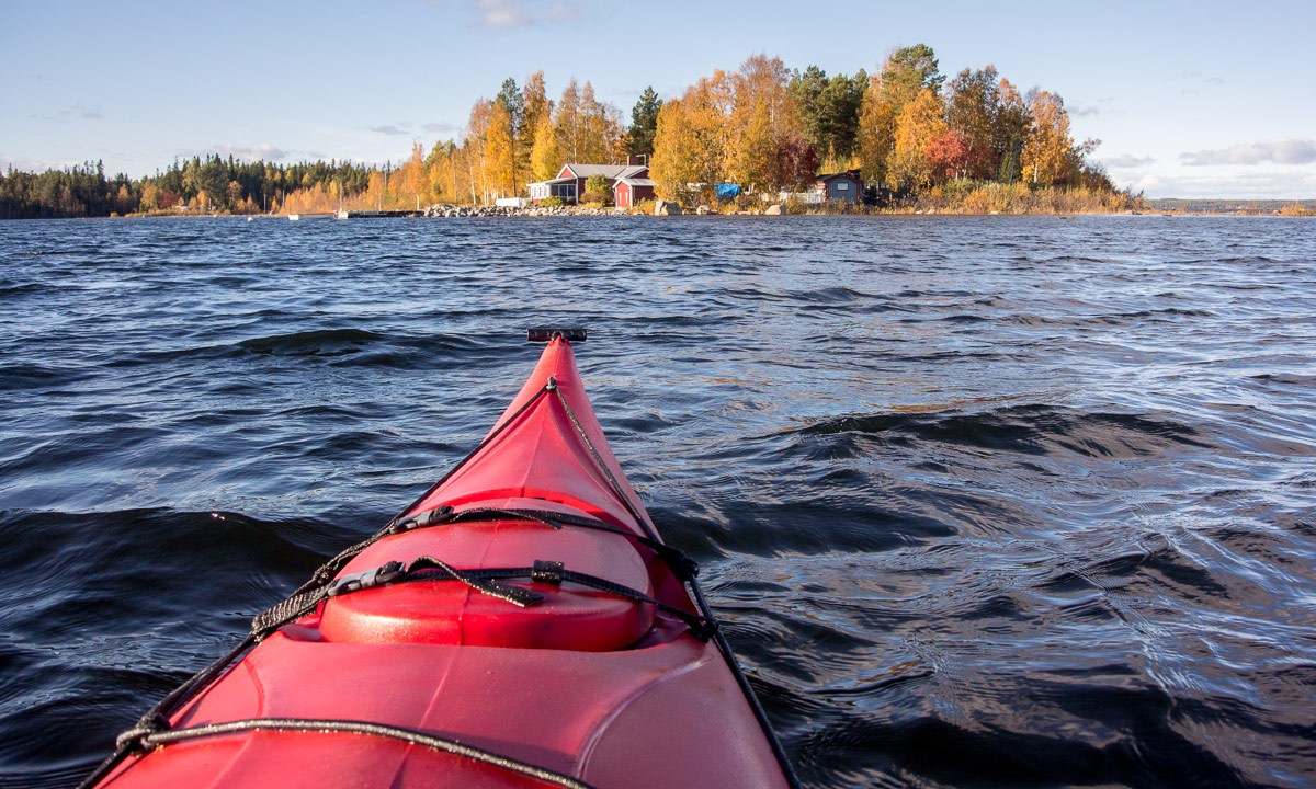
When I approached the island Storgrundet (which is almost home again) I decided to continue my tour. It was fun to sit in my kayak again, i wanted to head the small island with the coloured trees and furthermore I wanted to take the opportunity to cross the island by boat.
Crossing an island by boat? Well, many parts of the islands that lie off the coast of Skelleftehamn are quite flat. Storgrundet has such a part, too. It’s just a passage of rocks that connect the main part of the island with an extra part. Normally you can go there (at least with rubber boots), yesterday it was possible to cross this part by kayak.


From this point it was near to the islet Brottören where I could catch the last sun before clouds approached.


The rest of the kayak tour is quickly told: I went around the island Storgrundet, met a man in a small motorboat (until then I had been completely alone), paddled along the tiny beach where I use to bath (it was mostly flooded) and finally arrived at the starting point again.


2 comments to “Autumnal high water”
Manuel 2018-10-07 21:56
Hej Olaf,
vielen Dank für den Artikel und die Bilder.
Kannst Du was dazu sagen, was für ein Typ Kayak Du hast? Ich kann mich erinnern, dass Du es von einem Freund bekommen hast. Ich konnte aber nichts dazu finden, was für ein Kayak es ist.
way-up-north 2018-10-09 15:22
Das Kajak ist ein Wilderness Systems Sealution XS. Ein robustes Tourenkajak aus Kunststoff, dem es nichts ausmacht, wenn es mal über Felsen schrappt.