Hiking up the Grønnlibruna

Here I stand on top of the small mountain Grønnlibruna (401 m).

I crossed a river and followed a forest trail that sent me deep into the mud. I trudged through knee deep powder snow and then stalked through Styrofoam-like wind-pressed snow to reach the summit and see the mountains in the sun that yr forecasted. Here I stand on top of the small mountain Grønnlibruna and there is no sun. It is snowing. It has been snowing all day and the mountains are hidden by the clouds.

As yesterday I am alone. Apparently the locals do other things in November than hiking up snowy mountains. While I walk around on the plateau of the Grønnlibruna the weather is changing and slowly the mountain ranges come in view and so the bay Sørbotn and the island Håkøya. The sun however I do not see today.

The last photo is taken with my Nikon, the others are edited iPhone snapshots.

For the records: 8 km there and back. Round 400 m in Altitude. Temperature -1 °C … -5 °C. Next time: snow shoes.

Apropos next time: Today we had 4¼ hours of daylight. Next Sunday it will be 2¾ hours. Saturday after that 13 minutes. On Sunday in two weeks we will have polar night in Tromsø until 14 January 2022.

So next time I’ll not only take snow shoes with me but some powerful headlamps, too.


From autumn to winter – a tour to the Litjeblåmannen

This article is part of the series “2021-07: Back in Tromsø”.

My first concert with the chamber choir Ultima Thule was supposed to be today but due to the increasing COVID-19 cases in Tromsø the board decided to cancel the concert. That’s a pity but gave me a free day and the opportunity to continue with my #onceaweek project. I decided for a tour to the Litjeblåmannen (860 metres above sea level).

At 8:40 I have parked my car and start the tour. Temperature is -5 °C. Brr! I regret that I left my long johns home. That changes quickly when I take the first steep climb up the forest path and start to sweat. All trees have shed their leaves and are bare.

At 8:40 is sunrise. Half an hour later I can see the sun rise above the mountains. Ten minutes later I have left the birches behind and the landscape opens. I am gaining altitude and soon the path starts to cross the first snow fields.

Ten other minutes later snow and rocks start to dominate the landscape. It looks like winter. The autumn is left behind in the valley. I see a radio mast, part of the radio station on the Rundfjellet (472 m). Well, that was easy.

I decide to continue the tour. But where? The tour description mentions that I have to go down 50 metres. I hardly see any waymarks or a track but soon some foot steps that I follow. According to map and compass it’s the right direction. The terrain gets rockier, steeper and is partly icy but at least I spot some waymarks again. I stop to strap my spikes under the boots. Safety first! Less than an hour later I pass another radio station. I do not look closer because the terrain behind the building is very steep.

The terrain continues being steep and rocky but after a while I reach a plateau. Now it’s winter. Beside of some tufts of grass covered with frost there’s only snow and rocks.

From now on it’s much simpler to walk on this snow covered plateau and soon I reach the mountain summit Botnfjellet (844 m).

That’s however not my destination. Well, the summit of Litjeblåmannen looks far away but it takes only 20 more minutes to go there.

Break! Summit selfie!

The fur hood is not only for looking wintry on the selfie. It was colder than expected and after the selfies I put on my down pullover. Checking the temperature at Tromsø airport and subtracting 0.6 °C per 100 metres altitude I guess that the temperature is round -7 °C. The wind makes my mind change about wearing long johns a second time.

I eat a bit of chocolate and drink some Sprite before the frost transformed it into slush. I’m completely alone and I haven’t met anyone yet. It’s just beautiful up here with views on snowy mountain chains everywhere but on the snowless lowlands and the fjords as well.

After 20 minutes break I start my way down. First I follow my own tracks until I met the first mountain hiker today. Now I follow her steps. Does she know a better way?

Some impressions from the way down:

While I descend more and more the sun starts to set. I hike cross-country. Less and less snow covers the ground until I reach a terrain consisting of terraces of wetlands and dense birch thickets. The wetlands are easy to cross, since the ground is mostly frozen and I have rubber boots. The birch thickets however take some time to squeeze through. Looking back I can see purple clouds indicating that the sun already has set.

At 14:40 I arrive at the car. -4 °C. According to my app I walked 15 km and 1120 metres in altitude. I started before sunrise and arrived after sunset. This gives me the right to be very lazy the rest of the day. The blog article I want to write anyhow.

I met three persons in total:

  • A woman in my age in clothes that probably have been used on countless tours for many years,
  • A young woman in a grey woollen sweater hiking up quite fast while talking loudly on her cell phone.
  • A packed sleeping bag on a stone in the wetlands. A sleeping bag with a book. Wait! No, it’s a hood with a book. Wait! No, it’s a person leaning against a large rock reading. In the middle of some wet slope on the island Kvaløya. People here really like being outdoors.

So much for today. And now I have to stretch!

Appendix:

I just went to the kitchen and felt, that the outside light had changed. It had! It had snowed some centimetres and is still snowing. Everything is white. Beautiful!

Saskarö in the fog

From Monday and Thursday Annika and I made a trip that I had in mind for a longer while. Travelling round the Bothnian Bay which is the northernmost part of the Baltic Sea. The first days we travelled by car along the sea. The last hours we travelled by ship from Vaasa in Finland to Holmsund in Sweden. From there it’s only a 12½ additional km to our house in Obbola where we live.

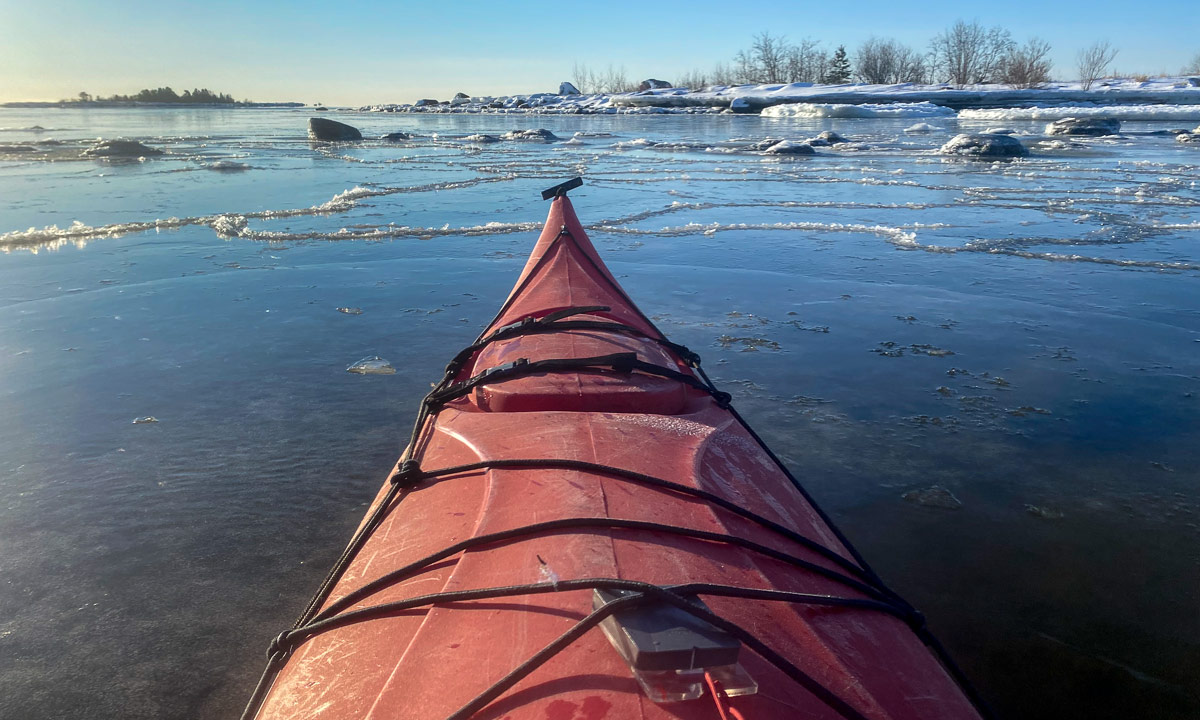
On our way to Haparanda we made a detour to Seskarö, an island that is connected to the mainland by several bridges. As the whole day (and half our journey) it was quite foggy.

Especially by the shores there was not much to see. A near island, a bit of ice, some rocks and and a white sea merging seamlessly into the white sky.

A short tour to Sørtinden

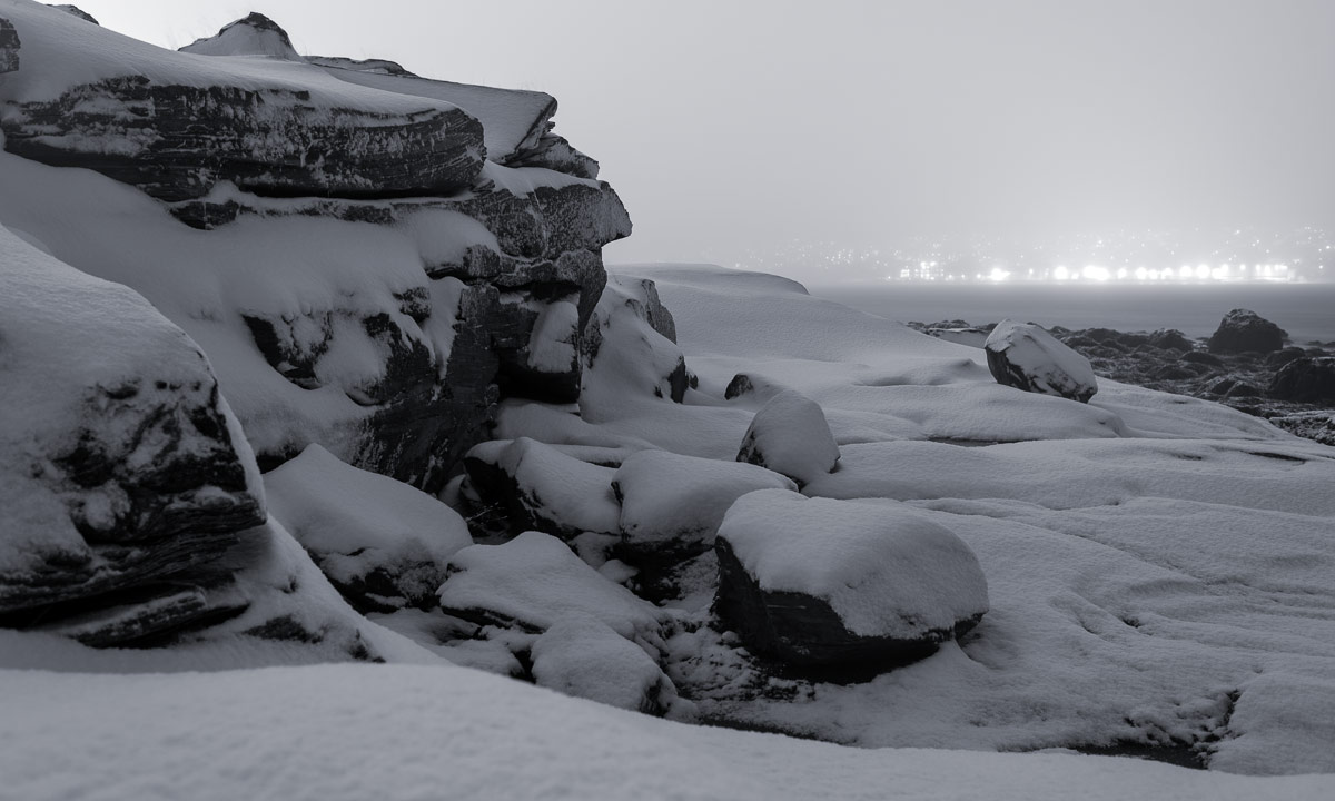
I have to admit that my motivation to go out was low this Saturday where it was grey weather with a slight drizzle that made everything damp. So this time I chose a shorter tour for my project #onceaweek.

And since the light was so dull that the autumnal colours looked pale and grey it was simple to choose a photo project: Only black and white and only rocks.

Tromtinden

This article is part of the series “2021-07: Back in Tromsø”.

It wasn’t planned, that I woke up already before 6 o’clock. Anyhow I took the opportunity to get an early start for my 2nd mountain tour of #onceaweek. Todays destination is the Tromtinden in the northwest of the island Kvaløya. The starting point is 50 km away so I had to take the car. It won’t be the last time.

The car ride however is incredible. Now many trees bear autumnal colouring. It is already impressive in the shadow, but then I suddenly drive into the sun and was almost blinded by these colours, to bright and intense they were.

I have to take another photo, that shows the road to Tromvik. It lies in the shadow while the sun illuminates the bald mountain peaks.

Already at 7:20 I start the tour. It’s 2 °C. It seems that most Norwegians prefer to start their hiking tours much later and so I am completely alone. The first part crosses boggy ground. There are some planks leading over wet parts but they are quite slippery because of ground frost.

The way leads up through a sparse birch forest. Now the path is less muddy and starts being dominated by rocks. No wonder – it’s going to be a mountain tour.

On a small plateau I find some cloudberries. There are overripe and have a bland taste, but the frozen one in the shadow is really tasty. Cloudberry sorbet!

On a saddle between the Mellomtinden and Tromtinden the view opens to the northwest and a mountain lake as well as the sea appears.

I follow the ascending path until I stand on a larger plateau. From here I can see the steep northwest face of the Tromtinden and the marking of the summit.

After traversing the plateau the path gets steeper, leads mostly over rocks and I have to stop several times to look where it continues. Do you see the mark on the next image?

After crossing some rock fields and a bit of level I “climbing” I arrive at the summit plateau with its impressive cairn and an even more impressive 360° view.

9:15 – finally time for breakfast. Three cloudberries didn’t fill me up.

I almost spend one hour on the Tromtinden and enjoy being outdoors completely undisturbed.

Finally I start walking down. Slowly and carefully I take my steps on the rock fields but then the path gets easier and easier. When I am halfway down I meet the first other hiker – a woman with a dog. From now on I meet twelve other people (plus three dogs) until I arrive at the car. The sky is blue and it has become so warm, that I only wear a t-shirt.

I arrive at the car at round 11 o’clock. I’m surprised that the car thermometer shows only 7 °C, but the sun has still quite a lot power. Now I’ll head home, only with a detour to the grocery to buy a huge bowl of salad for lunch.

For the stats: 8.3 km, summit altitude 636 m.

The first polar light of the season

This article is part of the series “2021-07: Back in Tromsø”.

Is the polar light shy? It was quite bright, when I peeked out of the window of my tiny room in Tromsø. It got pale when I took pictures at the bay Telegrafbukta. And it got really bright after that while I was returning home because clouds had been gathering.

Anyhow, it’s the first polar light of the season 2021/22 and therefore worth photographing.

There was another light at least as fascinating as the polar light. Plankton that was washed ashore. This plankton was bioluminescent and glowed blue-turquoise. I have a real ugly photo for the records. When this a common phenomenon I’ll try to take better photos some other time.

A hike to the Stor-Kjølen

This article is part of the series “2021-07: Back in Tromsø”.

Let’s be honest and face it. I’ve been really lazy this year and my outdoor fitness is near non-existent. I don’t like that. There is a simple solution for that: Be more outdoors!

Today I started the project #onceaweek. I want to make an outdoor tour with at least 10 km every week. (Thanks M. for your inspiration.)

I will try to blog about these tours and I want to give each tour some photographical focus. Today’s theme: vegetation zones.

From forest to fjell

The gravel road is quite steep in the beginning. First it leads through birch forests that have started to colorise autumnal. Then the landscape opens and is not dominated by trees anymore.

Gaining height

At the lake I leave the gravel road and the character of the hike starts to get alpine. It’s however still a hiking tour, no climbing needed on the whole tour.

From earth to moon

The vegetation is becoming more and more sparse. Some tufts of grass, a fern, moss, map lichens. And then I pass the first snow field. I look up the mountain I wish to climb. It is just an enormous pile of stones. Fortunately there’s a way round this slope.

The mountain top of the is a plateau of rocks with even less live. It’s almost like being on another planet or moon. And there it is: the space station.

“Oh, the space station looks so cozy inside!” – „Well, that’s not the space station, it’s the varmebua, a small wooden cabin to give shelter to hikers.“

“Um, hikers? On an alien moon?” – “Well, we are on earth and the ‘space station’ is a radar station used for controlling the air traffic of a larger part of Northern Norway.“

I had been almost alone on my way up but on the summit there were many other hikers. Some passed, others took a rest like me.

Looking around

The plateau provided a 360° panoramic view. I could see many mountain chains, the higher tops all snow covered. Anyhow, it’s Tromsø and so fjords and open sea are present as well.

This could be a favourite place of mine in Tromsø’s gorgeous nature. But it is way too early to know this. Remember, it is my first tour of #onceaweek. There will be other places to discover.

For the stats: 16 km, summit altitude: 788 m.

A short and rainy Hurtigruten trip

This article is part of the series “2021-08: Northern Norway”.

After 2700 km by car we had arrived in Bjørnevatn near Kirkenes. From there it would be another 900 km back to Tromsø, my temporary home. So Annika and I had decided to go by ship and use the Hurtigruten for our journey west. Last Friday we went on board of the MS Vesterålen, the smallest and oldest ship of the current Hurtigruten fleet. I left it to be parked while Annika used the regular gangway. The ship departed round 12:30, round 35 hours later we arrived in Tromsø.

The weather was rainy, chilly, windy and although parts of the upper deck are well protected against wind and rain we often sat there alone. While it was quite rainy there were a lot of small holes in the clouds that let the sun peek through. Especially the light on the first day was very wonderful.

I just show some of the photos I made from the upper deck. All of them are made with a telephoto lens and focal lengths between 150 and 600 mm. To avoid blurred images because of the ship vibrations I hardly used a tripod but used ISO 800–1600. But now to the photos:

Grense Jakobselv

This article is part of the series “2021-08: Northern Norway”.

This sign marks the only Russian–Norwegian border station. In February 2018 I crossed this border to Russia together with Annika and two friends. This time we stay in Norway and I take just a photo of the sign.

Our destination today (which is 30 August): Grense Jakobselv, a small border village. As the road to Hamningberg the road there is opened only in summertime and we never have been there before.

It starts like a typical car trip. The road goes along the Jarfjorden and a large lake. In Vintervollen the road turns right and we see the barrier that closes the road in winter. It is open. Now the road leads over the mountains. The rocks here are the oldest in Norway with an average age of 2.9 billion years. I’m not a rock expert and so I take a photo of a birch instead of a random rock whose type and age I cannot determine.

We reach the small river Jakobselva. This small and shallow river is special because here it marks the Norwegian–Russian border. The pink salmon (also called humpback salmon) do not care, they are busy to go upstreams and not all fish succeed.

We continue to the village Grense Jakobselv. For me the biggest surprise was the chapel. In my view every northern Norwegian church is made of wood and painted white. Not the King Oscar II Chapel (built 1869) that is made of stone.

While I wasn’t properly prepared about the church I knew something else: There is a sandy beach. It is at the very end of the road. Annika and I take a bath. Water temperature is about 11–12 °C. It feels quite strange to change clothes for a bath while you can hear the Norwegian army practising shooting.

As many minor roads in northern Norway the road to Grense Jakobselv is a dead-end road and so we have to drive the very same road back. After having been back we get something we have missed on the journey so far: an afternoon nap!