This article is part of the series
“2022-02: Winter cruise KPH”.
Day 5 · 23 February 2022
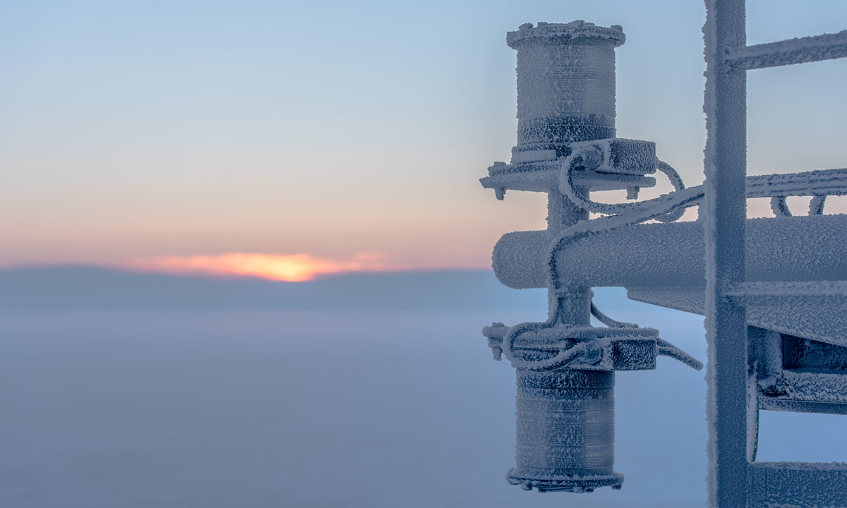
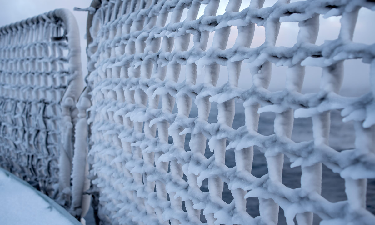
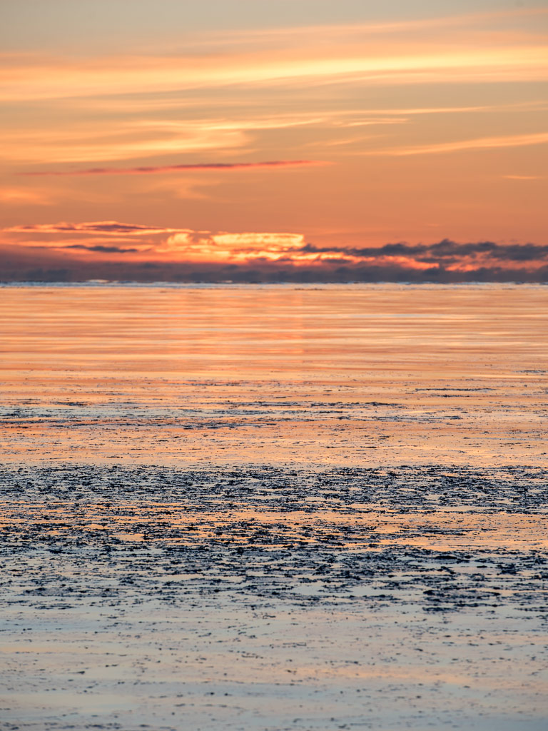
12:30 – it gets colder
Over night it has become much colder and windier. Temperature has dropped to -17 °C and the relative wind speed has increased to 17 m/s (ca. 60 km/h). According to the wind chill formula that feels like -33 °C. The taut nets around the deck are covered with ice structures and ice fog hovers over the still open sea.
14:00 – marine fauna
A large trawl net is being pulled up. Scientist are waiting on deck, they look eager. What will the trawl reveal?
The net is up and the haul is emptied onto the deck.
At once the marine biologists gather round the catch and start browsing, identifying, sorting. I know some of the animals, but neither taxonomy nor latin name. It’s a childhood’s memory – me walking along the shore, my eyes glued to the soil to search for shells, jellyfish, worms, starfish. As a child I wanted to become a researcher but live has changed many times. Anyhow it finally brought me here on this polar expedition on Kronprins Haakon. But I digress, back to some photos of marine fauna and scientists:
I would love to know a bit more about the taxonomy of all these species but this will take some time and efforts, nothing you will get for free.
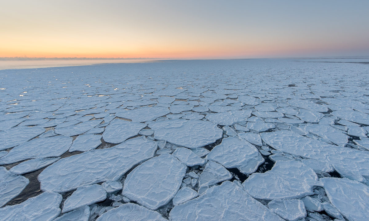
14:37 – the first sea ice
And there it is. The first sea ice is ahead.
The photo is awful. Noisy, underexposed two levels but I want it here in the blog. Not only for you but also for me because it’s the very first photo of sea ice on this cruise.
But there is more. While we continue north, soon the Barents Sea gets covered with pancake ice – called because of the rounded shapes of the ice floes – that soon make place for larger ice floes. That takes only 20 minutes.
(The images are not in chronological order for layout reasons)
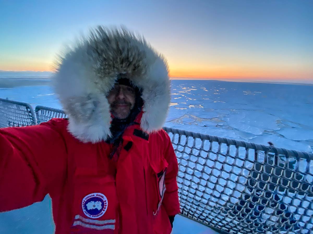
For more than an hour I stand at the bow of the heli deck and watch the changes of the ice coverage. I love ice, I love the sea, I love cold winter and here I can get it all together. I feel happy! And cold it has become. Temperature -22 °C, relative wind speed 16 m/s resulting in a wind chill of -39 °C. The Canada Goose Snow Mantra parka starts to make sense. It shows what it can: keeping me warm under these conditions.
I use a pair of gloves and two pairs of mittens to keep hands and fingers warm. With one exception: Smartphone selfies. These I take bare-handed. While doing that the pinky of my right hand gets really cold and I will feel this for many hours. I’m lucky, the fingertip has no frostbite but I decide to stop making selfies in such harsh conditions. I love the arctic, but I play piano, too. I need my fingers. All of them.
15:59 – dinner pleasures
The haul caught a lot of animals, amongst others a lot of shrimps. Only some of them are needed for research. I help cleaning them, plucking away starfish and other species while a huge pot with salt water starts boiling. And at dinner we all get shrimps. Freshly caught in the Arctic. Delicious!
19:00 – photo shooting
A. a marine taxonomy expert asks me if he can borrow a tripod, he wants to take photos of some of the animals. Oops – I forgot the mount for attaching other cameras. I make another proposal: I’ll drop by and take pictures by myself. From this day I’m the “official court photographer” of non-microscopic animals. That’s work I really like. The first results are not the best, but I’ll share them anyhow:
Species identification taken from the cruise report of Andreas Altenburger. Thanks a lot!
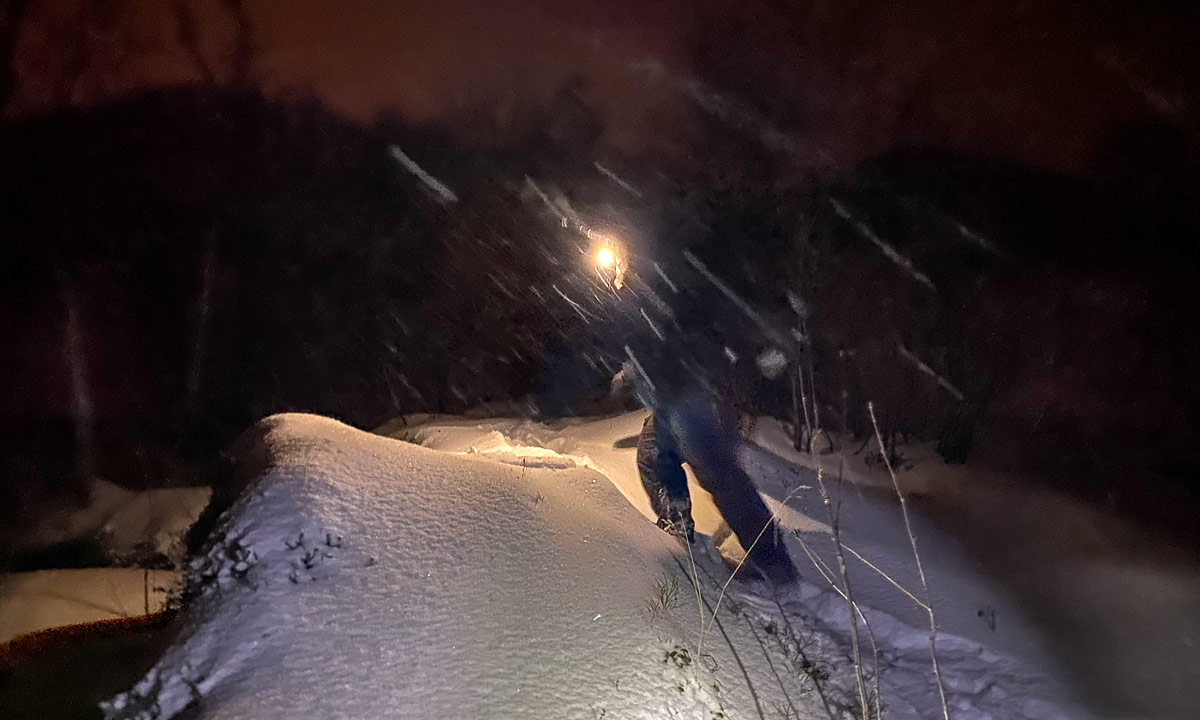
21:30 – Sailing through the night
It’s dark. Ice has become thicker and you can hear the cracking and feel the vibrations from Kronprins Haakon breaking the ice. Again I stand on the heli deck looking ahead. Two strong spotlights illuminate the ice.
And for some minutes there is even a Northern light palely glowing in the sky.
While I stand there, happily watching the ice and the sky, muffled up warmly in my down parka and pants, temperature has dropped even more. -28 °C, windchill -44 °C.
temperate in °C | wind speed relative to the ship in m/s | resulting windchill in °C.