Sun salutation

While the polar night in Tromsø started in the end of November and continues for two more weeks there is no polar light home in Obbola which is 6 degrees south of Tromsø. So if there is clear sky, then there is sun.

After Christmas in Norway Annika and I arrived in Obbola some days ago. First the weather was cloudy and stormy but today  sky was quite clear. Therefore I could witness the sun today for the first time in more than a month. I only had to go 200 metres to the edge of our little bay Grundviken where I waited for the sunrise.

I love sunrises and sometimes I can stand up quite early to witness it. But today it was really special to watch the sun rise higher and higher up the sky while in Tromsø polar night still continues.

After breakfast we took the car to Byviken in Obbola to join the winter bath. Round 40 cars were parked there and a queue of winter bathers waited at the ice hole. Winter bathing has really become a popular sport within the last years. We decided to avoid the queue and continued to our favourite beach at Vitskärsudden where we had to climb over a wall of ice but then we were the only winter bathers. Air: -10 °C, no wind – perfect conditions. Great!

(Photos: Annika Kramer)

We may take another outdoor bath today, but then in the hot water of our friend’s hot tub. I guess this bath could take slightly longer than the previous one.

Cabin days in Christmas time

Christmas eve – Sommarøya and Hillesøy

It’s only 15 km to Sommarøya, a beautiful island reachable by car via a curved bridge. Even in snow fall and twilight you can see the turquoise colour of the sea. Everything is closed, even the hotel.

From there it’s not far to the church Hillesøy kirke, that by the way does not lie on the island Hillesøya but on the mainland. We tried to prebook one of the limited seats for the Christmas service but they where all taken. We are there very early and allowed to have a look in. Eye catcher: the tall wood-burning stove.

We drive back to the cabin – time for lunch while it gets dark outside.

Christmas day – Skitour along the lake Kattfjordvatnet

This day was supposed to be crisp and clear and it was. No clouds, hardly any wind, -10 °C. Perfect conditions for a small ski tour along the lake Kattfjordvatnet. In coastal Sweden we just would have started the tour, in the Norwegian mountains you must check the avalanche risk first. We got round 30 cm of powder snow the last days and the risk was level 3 which is quite high. So a real mountain tour would have been too risky but the terrain by the lake is too flat for avalanches.

And in the early evening we are lucky and get some polar lights. We just have to step outside the door and avoid the motion sensor for the outdoor lighting.

Everything would have been accessible from my apartment in Tromsø as well. Anyhow it feels more like a real holiday to be on a Norwegian mountain cabin over Christmas, just Annika and I. Perhaps we are allowed to use it again sometime.

The middle of the polar night

Today it’s the darkest day of the year, which means, that half of the polar night in Tromsø is over. With the risk of repeating myself, even the darkest day is not dark, especially when it’s a crisp, clear day with a lot of – well no sun – but cloudless sky and warm, colourful light.

No, you couldn’t see the sun, but the direction where it was, because a light pillar created by reflections of ice crystals in the air marked its position.

People where outdoors, not only on land but seaside, too. Two people clad in neoprene doing a long-distance winter swim. Three women paddling and taking a rest at Telegrafbukta. And finally me who after some hesitation took a winter bath. Air temperature -8 °C, water temperature +4 °C, alas no wind. Perfect conditions!

How long it will take until you can see the sun again? Well in Tromsø probably in a month but I’m cheating. In a week Annika and I head to our home in Sweden, where there’ll be at least four hours of sun every day. Beach holiday in the south ;-)


Thaw and cloudbursts

Why, oh why was the forecast of Yr right? Already a week ago it forecasted a period of thaw and heavy rainfall. And Wednesday it started to rain. Just now I’m listening to another cloudburst bucketing down on the roof.

The snow is gone and the ways and small streets are very icy. When it continues raining like this even the ice may have thawed and washed away soon.

It looks almost like autumn but with a huge difference: It’s dark. The photos above I made at lunch break on my last working day this year.

It’s a pity! Just today my wife Annika will arrive so that we can spend Christmas time together. It would have been lovely with a lot of snow but even though it shall be colder again soon it does not look like we get some.

Tromsøya crossing in winter

An almost true story to be read out loud with a deep and rough voice.

I survived one of mankind’s largest expeditions of our times – the crossing of the arctic island Tromsøya from south to north! Probably I’m the first one, who dared to face this extraordinary challenge.

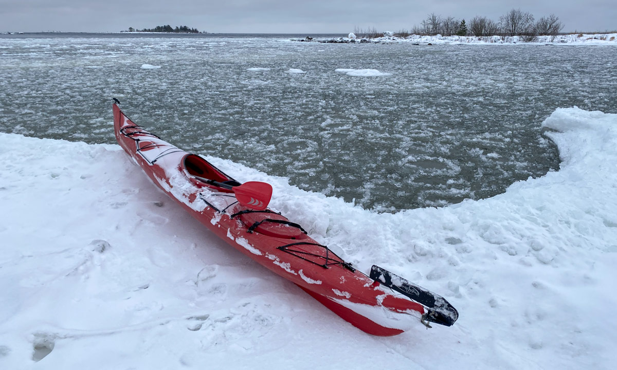
The arctic ice breaker could not approach the harsh coastal line of Tromsøya’s southern tip. Too mighty the storm, too sharp the rocky cliffs, too high the enormous waves! I was forced to row the last mile in a wooden dinghy. When I approached land I realised that despite of months of planning I was without food! Would I survive? Well, the tour must start, with or without provisions. One has to go on in live.

The land was wild and it was hard to find the entry point of my expedition. Where is Sydspissen, the Southern tipp? With my extraordinary orientation skills I finally managed to find this unexplored promontory which would be the starting point for my crossing.

I followed the coastal line through a field of invincible rocks. The storm howled and the surge of waves covered everything in spray. I decided to leave the exposed coast and seek shelter in the inland. To my surprise I found some ancient dwellings.

It seemed that this hostile island had been inhabited earlier. What a discovery! I continued my way and realised that I was not alone. People still seemed to live here. While most of the indigenes hid inside some dared to be outside, guarded by their dogs. The houses were shocking. While the people seemed to have some basic skills in woodcraft, they still lacked the knowledge of constructing right angles.

I continued my way through the forbidding terrain. After a while it opened and gave view to an extent of ice. Could it be a lake? Probably it had been frozen for centuries. Here I spotted more locals. As the others before they ignored me. Didn’t they dare to seek contact? I do not know. First I though they would hunt seal or walrus but they just seemed to wander around without any goal.

Soon I was alone again in the rough mountain scape of this arctic island. Orientation was extremely difficult. Without my compass and sextant I probably would have been lost forever in this pathless country. I was completely on my own.

The terrain descended and gave view to a strange installation. Scaffoldings pointing up to the sky were erected randomly on that slope. Was is temples or other places of worship? Who build them? When? And why? Probably one never will find out.

Since I lost my food I was forced to continue my expedition. Time was precious. The land was bleak and barren. No trees, no bushes, nothing. Maybe some moss seeking shelter between the stone could survive under the eternal snow. For other plants this place is too hostile. 

The mountains became even higher and I got view on a small coastal village, probably abandoned ages ago. One wooden house lay nearby but it lacked a door and most of the walls.

I looked for walkable paths that would lead me further north. The more north I came the more glaciers covered the land.

It started to get dark but without food I did not dare to seek shelter. I was forced to go on and on without any rest. Amidst the mountains I spotted two indigenes. They sat on some kind of toboggan well clad in furs to keep them warm in the harsh sub-zero climate. I did not dare to disturb them and only managed to get a blurred photo as a proof of my observations.

According to my positional measurements the northern tipp of Tromsøya could not be far. I had survived until now. Would I make it to Nordspissen, the northern tip?

Alas – after more efforts and privations I managed to reach Nordspissen. I was grateful that fate allowed me to be the first human who reached this remote spot on foot. To my big surprise the legend was true: There is a mystic monument at Tromsøya’s northern tip and I can prove it:

But my efforts were in vain. I was too late! The last ship of the season just had passed by. Now I was forced to live here on this remote and solitary polar island for another year. But that’s daily routine for tough explorers like me.


Not reaching the top of the Nordtinden

Today I hiked the last daylight tour this season. Next Saturday sunrise is 11:25 and sunset is 11:38. The following day a seven week period of polar night will begin.

I wanted to hike onto the top of the Nordtinden (640 m), which I assumed to have a lot of snow after last Sunday’s experience. But it turned out different than planned.

Let’s start with a funny selfie:

What’s that? Winter jacket and no snow? Aren’t you overdressed, Olaf? Well, first I was glad about the fur-rimmed hood, because it was quite stormy already in the lowlands and then I wanted to gain 600 metres in altitude. It would be colder and windier on the top of the mountain.

Part 1 – hiking the icy gravel road

At 9 o’clock – round one hour before sunrise – I parked my car in Skulsfjord on the island Kvaløya. There was enough light to start the tour. First I followed a gravel road for 2.4 km. Easy peasy when not the whole road had been covered with ice. I had snow shoes with me for later use, but no spikes for the shoes. Mistake.

Part 2 – following the trail up

After 2.4 km I turned left to follow the hiking trail up to the mountain Nordtinden. Well, mostly I avoided following it because it was very icy and slippery. I considered cancelling the tour but often I could walk on the bouncy patches of heather beside the trail and so continue the tour.

Part 3 – gaining height

A steep passage made me doubt again. Shall I return? Continue? Well, let’s go a tiny bit further, just ten other metres up. I was lucky. Now the terrain was less steep. First only a bit of snow covered the stones and the heather but soon more and more snow covered the ground.

Part 4 – coming to a dead end

I knew that I lost the regular way. The way itself was not visible anymore, but I could see on my interactive map that I was a bit lower than the trail. Maybe I could go up somewhere else.

It was stormy and gusty and the wind tried to blow me down several times. The snow was not fluffy but wind pressed and hard and therefore slippery. When I had to traverse a slope I mounted my snowshoes. It took a while because I had some issues with the bindings. Now it dared to traverse the snow field, but since I didn’t take my walking sticks with me (mistake) it was a bit hard to walk up in the wind and gain balance.

And then I came to a dead end. A quite beautiful dead end, but still a dead end. I had to return.

Part 5 – returning, retrying and finally returning

So I walked back until I finally met the trail again, at least according my iPhone map. The way itself was hidden under the snow. Beside of that Norwegian hiking trails can be marked quite poorly, you have to navigate by yourself.

OK, I can navigate. I even had paper map and compass with me. But where the trail supposed to be there were only snow and rocks. And it was quite steep. And the snowshoes were a bit bitchy. And sun would set at 13 o’clock. Therefore I made the decision to not to try to reach the summit but abandon the tour and return. And so I did.

First I walked on snow but then I had to put off my snowshoes. In the lower part I ignored the icy trail and walked down on the heather. Much easier! Three and a half hours later I arrived at my parked car.

Résumé

It was a pity that I didn’t reach the top, but it was a fine though rough tour anyhow. From next week I have to find alternatives that are doable in twilight and darkness using a head torch.

For the records: 9.6 km, ca. 600 metres in altitude.

Hiking up the Grønnlibruna

Here I stand on top of the small mountain Grønnlibruna (401 m).

I crossed a river and followed a forest trail that sent me deep into the mud. I trudged through knee deep powder snow and then stalked through Styrofoam-like wind-pressed snow to reach the summit and see the mountains in the sun that yr forecasted. Here I stand on top of the small mountain Grønnlibruna and there is no sun. It is snowing. It has been snowing all day and the mountains are hidden by the clouds.

As yesterday I am alone. Apparently the locals do other things in November than hiking up snowy mountains. While I walk around on the plateau of the Grønnlibruna the weather is changing and slowly the mountain ranges come in view and so the bay Sørbotn and the island Håkøya. The sun however I do not see today.

The last photo is taken with my Nikon, the others are edited iPhone snapshots.

For the records: 8 km there and back. Round 400 m in Altitude. Temperature -1 °C … -5 °C. Next time: snow shoes.

Apropos next time: Today we had 4¼ hours of daylight. Next Sunday it will be 2¾ hours. Saturday after that 13 minutes. On Sunday in two weeks we will have polar night in Tromsø until 14 January 2022.

So next time I’ll not only take snow shoes with me but some powerful headlamps, too.


Tønsnesvarden

On Tuesday we got some snow in Tromsø. On Wednesday it already has melted away. But last night a bit of snow arrived.

Today I chose a shorter tour from my book “På tur in Tromsø” (On tour in Tromsø) because I just wanted an easy hike, not a full-grown mountain tour. The weather agreed with me.

By the sea only a bit of wet snow and sleet covered the ground but already 50 meter higher the gravel path was covered with 10 cm of snow. Deep tyre tracks were carved in the snow. This part of the tour was very easy. Just follow the road up until you reach the radio unit on the Tønsnesvarden (281 m) and try not to slip, because under the snow there are some icy patches.

This summit has a big radio station on its top. Even in the increasing snow fall is was quite visible. Now I walked through 20 cm of snow. After an hour I arrived at the radio station, where I met the creator of the deep tyre tracks: A six-wheeled ATV.

It wasn’t cold but a windy. It snowed more and more and the wet snow glued itself to my jacket. On my way back I left the main road and followed a small path on my digital map on my iPhone. I stopped in a forest of birches with thin and long stems. I loved the motive, but my Nikon camera gave up in this wet weather. The lens was fogged up in the inside and in the dense and wet snowfall I didn’t dare to change lens. One photo worked out ok anyhow:

Soon I realised that some of the paths drawn on the map did not exist in reality (at least not in winter) while others that exist were not part of the map. So I went cross-county through pathless terrain, partly dens forest, partly wetlands with many small streams to cross. It took only 15 minutes until I reached the other gravel road leading down again. Now the iPhone was in charge for making pictures.

I followed the path down. With each metre altitude I lost there was less snow on the ground and the snow fall became more and more sleet. When I arrived at my car my anorak was soaking wet. Having seat warmers in a car is a great feature after such a tour.

For the records: 6.5 km, round 300 metres in altitude. Temperature round 0°C.

Appendix 1:

When I show pictures of mountain tours and hilly hikes it is easy to forgot, that Norway has not only mountains but the sea, too. This is an iPhone snapshot I took from some metres from my parked car. What you cannot see is the mountains of the island Kvaløya, 3.8 km away. They are hidden in the snow clouds.

Appendix 2:

What do you do with photos taken with a fogged up lens? You start to experiment. I mean, the photo is spoiled anyhow. But the result of today’s experimentation turned out nice in my opinion.

From autumn to winter – a tour to the Litjeblåmannen

This article is part of the series “2021-07: Back in Tromsø”.

My first concert with the chamber choir Ultima Thule was supposed to be today but due to the increasing COVID-19 cases in Tromsø the board decided to cancel the concert. That’s a pity but gave me a free day and the opportunity to continue with my #onceaweek project. I decided for a tour to the Litjeblåmannen (860 metres above sea level).

At 8:40 I have parked my car and start the tour. Temperature is -5 °C. Brr! I regret that I left my long johns home. That changes quickly when I take the first steep climb up the forest path and start to sweat. All trees have shed their leaves and are bare.

At 8:40 is sunrise. Half an hour later I can see the sun rise above the mountains. Ten minutes later I have left the birches behind and the landscape opens. I am gaining altitude and soon the path starts to cross the first snow fields.

Ten other minutes later snow and rocks start to dominate the landscape. It looks like winter. The autumn is left behind in the valley. I see a radio mast, part of the radio station on the Rundfjellet (472 m). Well, that was easy.

I decide to continue the tour. But where? The tour description mentions that I have to go down 50 metres. I hardly see any waymarks or a track but soon some foot steps that I follow. According to map and compass it’s the right direction. The terrain gets rockier, steeper and is partly icy but at least I spot some waymarks again. I stop to strap my spikes under the boots. Safety first! Less than an hour later I pass another radio station. I do not look closer because the terrain behind the building is very steep.

The terrain continues being steep and rocky but after a while I reach a plateau. Now it’s winter. Beside of some tufts of grass covered with frost there’s only snow and rocks.

From now on it’s much simpler to walk on this snow covered plateau and soon I reach the mountain summit Botnfjellet (844 m).

That’s however not my destination. Well, the summit of Litjeblåmannen looks far away but it takes only 20 more minutes to go there.

Break! Summit selfie!

The fur hood is not only for looking wintry on the selfie. It was colder than expected and after the selfies I put on my down pullover. Checking the temperature at Tromsø airport and subtracting 0.6 °C per 100 metres altitude I guess that the temperature is round -7 °C. The wind makes my mind change about wearing long johns a second time.

I eat a bit of chocolate and drink some Sprite before the frost transformed it into slush. I’m completely alone and I haven’t met anyone yet. It’s just beautiful up here with views on snowy mountain chains everywhere but on the snowless lowlands and the fjords as well.

After 20 minutes break I start my way down. First I follow my own tracks until I met the first mountain hiker today. Now I follow her steps. Does she know a better way?

Some impressions from the way down:

While I descend more and more the sun starts to set. I hike cross-country. Less and less snow covers the ground until I reach a terrain consisting of terraces of wetlands and dense birch thickets. The wetlands are easy to cross, since the ground is mostly frozen and I have rubber boots. The birch thickets however take some time to squeeze through. Looking back I can see purple clouds indicating that the sun already has set.

At 14:40 I arrive at the car. -4 °C. According to my app I walked 15 km and 1120 metres in altitude. I started before sunrise and arrived after sunset. This gives me the right to be very lazy the rest of the day. The blog article I want to write anyhow.

I met three persons in total:

  • A woman in my age in clothes that probably have been used on countless tours for many years,
  • A young woman in a grey woollen sweater hiking up quite fast while talking loudly on her cell phone.
  • A packed sleeping bag on a stone in the wetlands. A sleeping bag with a book. Wait! No, it’s a hood with a book. Wait! No, it’s a person leaning against a large rock reading. In the middle of some wet slope on the island Kvaløya. People here really like being outdoors.

So much for today. And now I have to stretch!

Appendix:

I just went to the kitchen and felt, that the outside light had changed. It had! It had snowed some centimetres and is still snowing. Everything is white. Beautiful!

Kayaking in the fog

Before I post some more black-and-white photographs from our car trip through Finland I’ll show you some photos from Annika’s and my kayak tour today. I cannot remember a week as foggy as this one since I moved to Sweden and it was foggy today, too. We couldn’t see the islet Lillskär from our house because it was hidden in the fog. It was however visible from the place where our kayaks lie. Or should I write float, because we had a water level of +45 cm.

Our tour wasn’t long but fun as every kayak tour. Now our kayaks lie on land and are waiting to be cleaned and dried. Then mine will be stored in the garage because I’ll travel to Tromsø on Tuesday and won’t be here before next year.