Polar expedition AeN JC3 – day 14 – 17: Travelling south

This article is part of the series “2022-02: Winter cruise KPH”.

Day 14 – 17 · 4 – 7 March 2022

4 March: after our second polar bear encounter we leave the ice station P7 at the 82th degree of latitude behind and slowly head south.

This journey will take more than two days although its only 250 km to sail. That’s because many scientific activities go on. Not from the ice but from the ship. Just an excerpt from the activity log:

  • CTD with water sample (19×)
  • Box core (4×)
  • Håv-trekk stasjon (2×)
  • Multinet (2×)

I help the benthos people in the lab and learn a lot, I discuss data matters with scientists, I edit photos. At the same time the character of this polar expedition has started to become a bit more leisure-like. A “no-talent show” is organised as well as a table tennis tournament. A quiz evening takes place and J. shows some of his favourite movies. And from time to time I stand on the helicopter deck and take new photos.

7 March: In the morning we arrive at a place between Svalbard’s second largest island Nordaustlandet and the island Kvitøya, that we already passed a week ago. Here we will have a last 24-hour ice station with the adhoc name SIce Kvitøyrenna.


Polar expedition AeN JC3 – day 7 and 8: a stormy intermezzo

This article is part of the series “2022-02: Winter cruise KPH”.

Day 7 and 8 · 25 – 26 February 2022

25. Feb 07:00 – testing clothing concepts for extreme cold weather

Another Arctic morning. It has become slightly warmer with temperatures round -24 °C but at the same time a lot of windier. The average wind speeds of 20 m/s and above. So windchill is still -45 °C and I wonder how to dress just in case I will be on the sea ice the first time this night. No, I do not count on being allowed to enter it under such conditions but you never know. Be prepared and wait …

For safety reasons we always have to wear a special suit on the ice in case of someone breaks through. That’s either the Regatta suit, a floatation suit. This acts as a full body life vest giving you buoyancy in the water. However you will get wet instantly. No big issue because we will always be quite near the ship and conditions are ok. If the circumstances are more extreme or the ice is not trusted a survival suit with attached rubber boots is used. It will keep you completely dry as long as the arm and neck cuffs are tight. It is said however that it is uncomfortable to wear and you easily get very cold feet.

So, let’s get dressed. For the first time I put on the Regatta suit. It is as breathable as a rubber dinghy so you should not sweat too much. Over that, more for the fur hood than the warmth the Canada Goose parka. Yes, I can still move ;-)

Dressed like never before I open the thick door to the helicopter deck and stagger outside. Whoa! That’s some rough weather. I instantly feel every single square millimetre of skin that is still exposed to the wind and even that the zipper of the down pants are not completely closed at the bottom although I wear high rubber boots. In my opinion the hood of the Snow Mantra is ingenious but the gusty storm just pushes it aside in all directions and I can hardly see anything. So I do not check if the selfies taken with the Nikon and three pairs of gloves and mittens are in focus. They are not.

Being in again I understand the first time, why the parka hood is not only fur-trimmed but have this thick fleece rim inside. It keeps away the ice dust that the storm blows in.

The combination of Regatta suit is too warm and too bulky. I test another combination with the shell jacket of the Norwegian Polar Institute and ski goggles. Insight 1: if the hood does not fit perfectly it is completely useless in the storm. Insight 2: my old ski goggles freeze over so fast that within a minute I am functionally blind. I have to remove them to find back to the helicopter hangar. While checking this the storm pushes me around on the deck slippery deck. I really doubt if anyone wants to work on the ice in these extreme conditions. On the other side I do not know anything about polar research. Neither about polar researchers. It’s me who is the newbie.

25. Feb 11:00 +2h – planning for the storm

Aside: The day before we changed the ship’s time to take better advantage of the daylight. When I write +2h it means our privately shifted time. Otherwise it means „normal“ CET time zone.  If you don’t care, just ignore it.

We have a meeting before lunch. A storm approaches. We will seek shelter between Nordaustlandet, Svalbard’s second-largest island and the island Kvitøya. Conditions are too rough for an ice station. Although all four ship engines are running we hardly make progress. There is no time schedule anymore. We just have to sit it out.

25. Feb 16:20 – the swell wracks the ice

At 15:20 I take a long afternoon nap while Kronprins Haakon struggles through the ice. I have on of the frontmost cabins on deck 3 –the noisiest ones. The icebreaker is rumbling, rattling, grinding, squeaking and doing many more noises that I do not have words for. I lie in my bed and feel the mattress vibrating, shaking, bouncing. And I love it. For me it is like an Arctic lullaby and as mostly I fall fast asleep.

z – z – z – z – z

After an hour I wake up all of a sudden. Something has changed. The ship is slowly and strongly pitching. At the same time noises and vibrations are absent. Are we in open water? What happened!?

I have to compensate the ship’s movements while I walk to the dayroom. I peek through the ice crusted windows. Yes, we are in open water. J. sitting there tells me that 10 minutes ago swell waves. They broke up the ice within minutes and now the ice has disappeared. Impressive and a bit frightening, too.

Now we are amidst the storm with an hourly average of 24.2 m/s, that’s round 87 km/h. The highest wind speed measured in this hour is 32.7 m/s, that’s the exactly beginning of Hurricane force or level 12 on the Beaufort scale.

Although the ship is stabilised it is pitching, rolling, yawing, heaving and a lot of people have started to get seasick. I feel quite ok, but a bit stressed and tired. After a while I decide to lie down for a quarter. Good idea! I feel better again after that.

I’m in the day room again, watching the dark waves through the ice encrusted windows . Sometimes the spray splashes up many metres. No, I won’t enter any outside deck today any longer!

25. Feb 19:24 – crossing the 80th degree of latitude

I wanted to see on the digital nautical chart how we cross the 80th degree of latitude but I miss it by some minutes in time. Soon I go to bed quite curious how the next day may look like.

26. Feb morning – Kvitøya

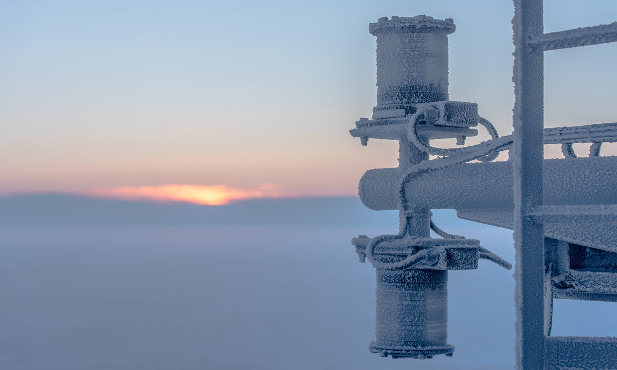
06:10 – The wind has calmed down and I stand on the helicopter deck (on level 6) again. Open water, a bit of ice and in the distance a pale scheme. The island Kvitøya. It looks like the spray has reached the deck because everything is coated in ice and the ice on the floor is slippery and feels like soap powder.

After the breakfast I try to catch Kvitøya on the Nikon sensor.

The last photos are crap from a technical view (taken at 600 mm ƒ/6.3 in twilight on a moving ship and a travel tripod). Anyhow they show the glacial coast of this Arctic island which I think is very impressive. A pity that the weather was so cloudy.

26. Feb morning – we reach ice again

While I take these photos another thing happens: we reach ice again. First fields of beautifully rounded pancake ice floes, then a few hours later we are in ¹⁰/₁₀ of thick ice again. There Kronprins Haakon can show again that it is an icebreaker.

We have another meeting at 09:00 +2h. We learn that it is more than unsure whether station P4 will have any reliable sea ice to work on. The cruise leader asks: shall we try P5 instead? Yes, all scientists agree. So today we will head to P5 at 80.5 °N 34 °E. That’s only an estimated position. First of all a suitable ice floe has to be found and then this floe will drift on the sea and so change position while ice work is ongoing.

26. Feb 16:00 – checking the ice

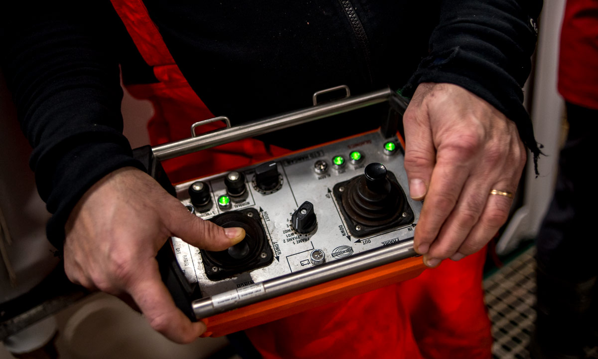
Eight hours later. Together with the cruise leader and the captain the ice experts had looked for a suitable ice floe. When they were satisfied the ship stopped and a derrick lowered the ice gangway. Now four people are on the ice. All equipped with survival suits. Two of them carry rifles. We are in the home of the polar bears.

Will I be allowed to enter the sea ice? Perhaps already tomorrow? I doubt it but I’m really longing. I don’t know where this strong relation for the Arctic comes from but it’s definitely there and it grew the last days. And I want to be part of it as much as possible.

Polar expedition AeN JC3 – day 6: sailing through the ice

This article is part of the series “2022-02: Winter cruise KPH”.

Day 6 · 24 February 2022

We are on our way to P4, our first ice station. P4 lies at 79.75 °N 34.00 °N, round 50 km southeast of the island Kvitøya (white island) that belongs to the Svalbard archipelago. This station is more north than Ny-Ålesund on Svalbard. The estimated time of arrival is tomorrow round lunch time.

However it is not granted that the ice will be safe enough to work on. In addition to that it will become stormy tonight and maybe the whole next day according to windy.com . So even when the ice is safe the weather conditions could be too harsh. So there are several uncertainties. We plan for the station but more we cannot do yet.

Today is a cold day with temperatures maximum of -25.0 °C and minimum of -30.5 °C. I’ve experienced colder temperatures many times in my live in different parts of Lapland, but then the wind was always calm. With the ongoing wind the resulting windchill lies between -36 °C and -49 °C. And windy is right: it starts getting windier in the evening.

temperate in °C | wind speed relative to the ship in m/s | resulting windchill in °C.

I take photos of marine animals, I learn the basics of ice observation but I stand outside quite often today. Watching the icebreaking polar research vessel Kronprins Haakon breaking through the ice. It is a great experience and I’m happy that I may participate.

But now, let the photos speak. The first I made at 3:50 in the night, the last ones at 19:10.


Polar expedition AeN JC3 – day 4: let the science begin!

This article is part of the series “2022-02: Winter cruise KPH”.

Day 4 · 22 February 2022 (part II)

18:14 on the bridge on deck 8. Some metres south of the 76th degree of latitude. People stand by the window, they are staring outside. Outside it’s dark. What are they looking for? What’s happening?

The activities for which we are doing this expedition have finally started. What activities do you realise on a scientific cruise? Collecting samples and data. For yourself and for others.

1 – Seaglider recovery

The very first activity is the recovery of a seaglider, an Autonomous Underwater Vehicle (AUV). It sends its position but still you have to locate it with your own eyes so that the icebreaker Kronprins Haakon can approach it. The recovery is much faster than excepted, already 15 minutes later the glider is on board. Anyhow it takes much more time to deactivate it, clean it thoroughly and most of all to dismantle it so that it fits into its huge plastic boxing that looks like an alien coffin.

To be honest, I don’t know for how long the glider drifted through the Barents Sea until we pulled it up. I don’t know neither what it measured and who will process this data. There is so much happening on this cruise that I do not manage to keep track of everything.

2 – CTD and water samples

There are a lot of abbreviations used on this cruise. One of them you hear frequently is “CTD”, which stands for conductivity, temperature, depth. A CTD is an electronic device that measures these three parameters constantly while it is winched down and up again. The conductivity is used to calculate the salinity, the relative amount of dissolved salt in the water. I will not go into details in this article because I’m not a scientist and I don’t want to write nonsense.

We have to talk about two more terms: “Moon pool” and “Niskin bottles”.

A moon pool is an opening in the floor of a ship deck to have access to water from inside the ship. Where this name comes from no one could explain.

When the moonpool is opened and the winch is ready the CTD is lowered into the water of the moon pool. And then it’s time for waiting – a quite common activity on the cruise. Time for discussions or just watching.

You see this “rosette” of dark, numbered cylinders? That’s Niskin bottles, used for sampling water. They can be opened and closed remotely so that it is possible to fetch water samples from different depths. These samples are used by chemists and marine biologists for different purposes. Since the chemists do the most delicate analysis they come first. The CTD rosette of Kronprins Haakon has 24 bottles. Today 22 of this bottles are filled, each one with water from a particular depth.

3 – plankton nets

It’s half past eight, when parts of the ship’s starboard hull is moved aside. Now it’s time for the first plankton nets. Marine biologists will work till long after midnight to bring down different nets for collecting zooplankton and phytoplankton. And there are many net types with different net sizes for different purposes. I have already worked with marine biological data so I know the names as bongonet or multinet. But now I see them first time in real life and learn about the different purposes and methods. Each net has not only its own construction but needs a distinct speed for being lowered and another one for being pulled up again.

Not all plankton nets are taken from the starboard. Some are so heavy, they need the more powerful winch at the stern of the ship. One of these is the multinet, a combination of five nets for collecting plankton from different depth intervals.

The activities continued the whole night. According to the data the last one was finished at 6:31, one hour before breakfast. I however decided to go to sleep at half past twelve. It was not relevant for my work to watch every activity and I was really tired. I’m a morning lark, not a night owl.

And since this blog article is already quite long I make it optically even longer by finishing it with another photo featuring the multinet.

Arrival in Longyearbyen

This article is part of the series “2022-02: Winter cruise KPH”.

It is half past two in the night between Thursday and Friday. For almost two hours I had stood on the helicopter deck of the icebreaker Kronprins Haakon to witness our arrival in Longyearbyen on Svalbard.

When I went outside two hours ago clouds had just started to gather and the moon was hidden. I could see dark and pale schemes on both sides of the ship and straight ahead another shade of a mountain, decorated with lights.

Slowly the lights came nearer. And since it was the first time I had mobile Internet for many days I could follow our route on the map of the iPhone. Only occasionally because a cold wind on the bow made the quite mild temperatures of -5 °C feel much colder.

There – the airport! And then, after we started to turn into the Adventfjorden, the city LongyearbyenSvalbard’s largest settlement.

The ship slowed down at the harbour and slowly and carefully started to move sideways. Do we still move? I peek down to the pier. There, the first thick rope connects the vessel with land – the first land after we bunkered fuel round 19 days ago!

We have arrived in Longyearbyen. Almost three weeks I worked, learned, photographed, relaxed, ate and slept on Kronprins Haakon. Tomorrow I’ll disembark and in the early afternoon take an airplane back to Tromsø. Yes, I am sad that this incredible journey has now come to its end. But I am also happy and content and full of stories, experiences and memories.

Do I smile on the photo or am I sad? Most of all I am tired and then a bit tense because it is hard to hold the iPhone as still as possible for some seconds with an outstretched arm.

The scientific winter cruise Arven etter Nansen JC3 took almost three weeks. Three very extraordinary weeks. And it will take at least three other weeks to tell some of the stories and show some of the photos here in the blog. So, please be patient – more to come, but step by step.

No whales today

To the left the Brim Explorer, a boat located in Tromsø for amongst other whale watching. To the right the tourists waiting to be boarded. The boat is fully booked, I am not alone.

Before leaving an announcement: The crew will try its best but it’s not granted that we reach the waters where the whales are. Anyone is free to leave and given a full refund. Most people stay and so do I. First of all I’m not surprised, as another tour operator already cancelled today’s tour. And then I just want to be a day on the water. Whales of course would be a nice extra.

To the left Tromsøbrua, the bridge that connects Tromsø with the mainland. To the right the safety on board drill, that everyone had to join.

And then we’re off.

To make it short: What we didn’t get today was whale sightings. What we got today was rough weather in the open parts. The boat was rolling and pitching like a cork in the waves. More than one passenger got sea sick. The unpredictable movements of the boat and the dim light under the grey sky made photographing a bit adventurous. Several times I was forced in and one passage even the doors were locked. The rest I was outside, partly taking photos, partly just looking around and letting the wind blow around my nose.

Conclusion: an awesome tour even without whales. If you want to participate as well: take your warmest clothes with you. And those of you that just want to stay home and look at some whale photos may read my article about Whale watching in Andenes. Enjoy.

Note to myself: TromsøyaRingvassøya/ReinøyaVannøyaNordfugløyaArnøya/LaukøyaSkervøya/KågenLyngenReinøyaTromsøya

From autumn to winter – a tour to the Litjeblåmannen

This article is part of the series “2021-07: Back in Tromsø”.

My first concert with the chamber choir Ultima Thule was supposed to be today but due to the increasing COVID-19 cases in Tromsø the board decided to cancel the concert. That’s a pity but gave me a free day and the opportunity to continue with my #onceaweek project. I decided for a tour to the Litjeblåmannen (860 metres above sea level).

At 8:40 I have parked my car and start the tour. Temperature is -5 °C. Brr! I regret that I left my long johns home. That changes quickly when I take the first steep climb up the forest path and start to sweat. All trees have shed their leaves and are bare.

At 8:40 is sunrise. Half an hour later I can see the sun rise above the mountains. Ten minutes later I have left the birches behind and the landscape opens. I am gaining altitude and soon the path starts to cross the first snow fields.

Ten other minutes later snow and rocks start to dominate the landscape. It looks like winter. The autumn is left behind in the valley. I see a radio mast, part of the radio station on the Rundfjellet (472 m). Well, that was easy.

I decide to continue the tour. But where? The tour description mentions that I have to go down 50 metres. I hardly see any waymarks or a track but soon some foot steps that I follow. According to map and compass it’s the right direction. The terrain gets rockier, steeper and is partly icy but at least I spot some waymarks again. I stop to strap my spikes under the boots. Safety first! Less than an hour later I pass another radio station. I do not look closer because the terrain behind the building is very steep.

The terrain continues being steep and rocky but after a while I reach a plateau. Now it’s winter. Beside of some tufts of grass covered with frost there’s only snow and rocks.

From now on it’s much simpler to walk on this snow covered plateau and soon I reach the mountain summit Botnfjellet (844 m).

That’s however not my destination. Well, the summit of Litjeblåmannen looks far away but it takes only 20 more minutes to go there.

Break! Summit selfie!

The fur hood is not only for looking wintry on the selfie. It was colder than expected and after the selfies I put on my down pullover. Checking the temperature at Tromsø airport and subtracting 0.6 °C per 100 metres altitude I guess that the temperature is round -7 °C. The wind makes my mind change about wearing long johns a second time.

I eat a bit of chocolate and drink some Sprite before the frost transformed it into slush. I’m completely alone and I haven’t met anyone yet. It’s just beautiful up here with views on snowy mountain chains everywhere but on the snowless lowlands and the fjords as well.

After 20 minutes break I start my way down. First I follow my own tracks until I met the first mountain hiker today. Now I follow her steps. Does she know a better way?

Some impressions from the way down:

While I descend more and more the sun starts to set. I hike cross-country. Less and less snow covers the ground until I reach a terrain consisting of terraces of wetlands and dense birch thickets. The wetlands are easy to cross, since the ground is mostly frozen and I have rubber boots. The birch thickets however take some time to squeeze through. Looking back I can see purple clouds indicating that the sun already has set.

At 14:40 I arrive at the car. -4 °C. According to my app I walked 15 km and 1120 metres in altitude. I started before sunrise and arrived after sunset. This gives me the right to be very lazy the rest of the day. The blog article I want to write anyhow.

I met three persons in total:

  • A woman in my age in clothes that probably have been used on countless tours for many years,
  • A young woman in a grey woollen sweater hiking up quite fast while talking loudly on her cell phone.
  • A packed sleeping bag on a stone in the wetlands. A sleeping bag with a book. Wait! No, it’s a hood with a book. Wait! No, it’s a person leaning against a large rock reading. In the middle of some wet slope on the island Kvaløya. People here really like being outdoors.

So much for today. And now I have to stretch!

Appendix:

I just went to the kitchen and felt, that the outside light had changed. It had! It had snowed some centimetres and is still snowing. Everything is white. Beautiful!

Skelleftehamn at night?

No, Skelleftehamn in the afternoon. The days are short and it’s only four days left until winter solstice. So the bay Kallholmsfjärden is pitch black anyway – or better said, it would if it weren’t for Rönnskär, the industrial peninsula.

A morning at the port of Skellefteå

The last weeks – or even months – were filled with work and I took hardly the opportunity to photograph. I drive to work round 6:45 – 2½ hours before sunrise – and arrive home round 16:00 – 2½ hours after sunset. It’s not a lot of daylight I got the last weeks.

Today however I have a day off and visit the port of Skellefteå in Skelleftehamn to check the ice conditions. Although there have been days with plus degrees and rain the bay Kallholmsfjärden has started to freeze over. I stand on a new gravel path that was built for the deepening of the harbour basin. It leads right into the harbour and is surround by ice floes. They are not frozen together but float freely on the water surface where they are lifted by the tiny waves.

The weekend I will have another view on the Baltic Sea. As last year Annika and I will visit the island Holmön and stay there for the weekend. I guess there will be even less snow than last year but probably less rain, too. Well, we’ll see …

A very wintry November weekend

It’s 9th and 10th of November. That sounds like autumn but it’s full winter in Skelleftehamn, although there is little snow. The temperatures this weekend are between -8 °C and -9 °C but the lively gusty wind makes it feel more like -18 °C.¹

I was out several times to check how long the winter has come.

Saturday

1 – Boat harbour Tjuvkistan

When I paddled by Tjuvkistan last Sunday I’m sure that there was open water. Now the whole harbour is covered with dark ice and snow is drifting over the frozen surface.

2 – Next to Tjuvkistan

Outside the harbour the sea is open, but each time a waves rolls ashore it leaves a bit of ice round the rocks and stones. The waves also have formed ice balls that drift back and forth in the cold water.

3 – Storgrundet

Last Sunday I had first to slide over the ice with my kayak, but then there was open water. Not anymore – the Sea between the island Storgrundet and the beach Storgrundet is completely icebound.

4 – River Skellefteälven

Right before the bridge, where the current is greatest, the water is open. The rest of the river seems to be covered with ice as well. (On Sunday I even see the first people on the ice, pretty far away from shore.)

5 – Näsgrundet

The sea water level is quite low: -50 cm. The slowly dropping water level and the waves leave icicles in different forms around the larger rocks. Days ago they were surrounded by water, now they are on dry land.

Sunday

6 – Näsgrundet

Yesterday there was mostly open water, not there are ice floes, turning and colliding in the waves. They build the so-called pancake ice. When it stays cold, it will freeze together.

7 – Away game: Bureå beach

The shallow bay by the camping ground in Bureå is partly covered with thick ice. It snows and the wind tugs at my fur-trimmed hood. 100 Meter away I see waves splashing against the ice shield building small hills of ice.

8 – Home game: Kallholmsfjärden

It’s round 18:00 and it would be pitch black if the industry of Rönnskär would not illuminate the low hanging snow clouds. I kneel in the water to make photos from the ice covered rocks and jetsam. The last photos of the weekend.

Here’s a map of the locations. Bureå is further south and not on the map.

¹ Skelleftehamn: -9 °C. If you think, that’s cold for early November check out that: Karesuando yesterday: -29.4 °C. That was surpassed today: Nikkaluokta: -34.5 °C!