The third ice station – MSS and SUNA
This article is part of the series “2023-06: Arctic Ocean cruise KPH”.
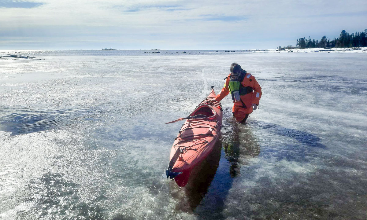
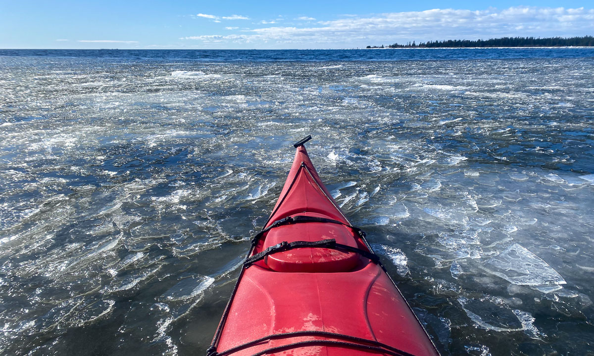
It is 13 June. Kronprins Haakon has approached 6.5° W in the Fram Strait and today we’ll start our 3rd ice station.
The weather seems to be better in the morning so I go out to fly the drone after breakfast. But this time I do not manage to get enough photos for the aerial orthophoto that is supposed to show the whole ice station.
It is probably a combination of wind and drift. The drone uses GPS to keep its position. The ice floe doesn’t. It drifts in the wind and so the drone seems to be drawn off-course all the time. We may have a drift of 0.6 knots, that’s almost 20 metres per minute.
At the same time it is windy in 80 metres height. This exhausts the batteries pretty fast and finally I have to cancel the flight operation. No orthophoto today. Sorry.
Just some non-drone photos from the morning.


In the afternoon I have the opportunity to join Anna and Julie from the oceanography team. Part of their work is done from the ship and part from the ice. Now they will put two instruments into the water: An MSS measuring turbulences and a SUNA measuring nitrates, one of the main nutrients in the sea. Both instruments also act as CTDs and measure conductivity, temperature and depth. I won’t go into detail because I’m not a scientist and this is not a science blog. I only want to mention that conductivity is used to calculate the salinity. By temperature and salinity you can learn whether the water is Arctic or Atlantic. (Is this correct, oceanographers?)
MSS
The first thing was to get ready the MSS. It needs some preparation to first connect battery, converter, power adapter, computer and the MSS and then start the software. Some of the connections are quite fragile. The MSS is connected to the computer and sends continuous data that is shown on the display. When it is put into the water, a recording is started. Then the MSS is supposed to fall freely. Therefore there has to be an amount of extra cable in the water but not so much that it would get tangled. The cable is more than 200 metres long and the recording is manually stopped when the depth has become constant. Now it’s exercise time: Bring up the instrument again. The MSS is still sending data but it is only used to know when to slow down with winching up the instrument.
Normally a series of three casts is done in a row. That helps to find and correct faulty measurements.


SUNA
The SUNA is much easier to power on and to deploy. I’ll help Julie a bit with preparation, then I put the instrument into the water. 50 metres down – nice and evenly – and then 50 metres up again. The instrument is surprisingly heavy even under water. So I’m learning a lot about scientific measurements and get a bit of workout as well today.
While I pull up the SUNA I get informed by other scientists how expensive this instrument is and that there probably is no insurance. Thank you for that ;-)
It happens quite often, that scientists do measurements not for themselves, but for colleagues. So it is the case with the SUNA. The data is collected here and now but then send to other scientists that will process the data later.

Other measurements
On this ice station we have the luxury to work by the open water and do not have to cut a hole into ice which is more than one metre thick. Soon we get neighbours: other scientists getting samples and measurements. As usual all guarded by a polar bear guard that carries a flare gun to scare off polar bears and a rifle. Today it is Harald, our cruise leader.


An unexpected encounter
Julie and Anna have started another series of MSS casts. Dima and Cora are passing by, doing another transect. Rupert is their polar bear guard. After a while I look into their direction and see the four figures of the transect team near an ice ridge. Three are clad in the usual colourful overalls, one figure – further to the right – is white. Why? Is it a piece of ice? No, it is a polar bear standing on its back legs. All these observations and thoughts of mine probably just took a second.
I directly call Harald: “Polar bear, over there”, pointing in the direction. The bear is on all fours again and hidden between the ridge ice. Harald takes the VHF to inform everyone. So Rupert, the polar bear guard of the team that is nearest to the bear gets the information as well.
Dima and team turn around and come to our place. The bridge has spotted the polar bear soon after I did and now we hear in the VHF, that the polar bear is moving away. Perfect! We stay alert for a while, then research is continued.
I however follow Dima to the ship. When the polar bear should decide to come back it’s one person less on the ice.
Usually it is one of the three bridge watches who spots a polar bear. Then the VHF will be used to inform everyone about:
- in which direction is the bear (1 to 12 o’clock)
- how far is it away
- what is it doing (standing, going away, heading to the ship …)
We will never know, why the polar bear was not spotted earlier. One guess is that it had slept all the time well hidden from view. When Dima came nearer with the Magnaprobe, the “beep” of the instrument may have woken up the bear. But it’s still just a guess.
Later at the daily 6 o’clock meeting we talk about this encounter. Harald shows a sketch that he has drawn on the digital whiteboard.

Personally I felt save all the time because there were two experienced and fully equipped polar bear guards nearby. I think however that my communication to Harald although fast could have been more precise. Well, I’m still learning …
This was an interesting day on the ice. I’m only a bit sulky because I didn’t manage to get the drone photos I wanted to.