22 August: Kungsleden day 3 – Kaitumjaure—Singi (13 km)

This article is part of the series “2017-08: Kungsleden hike”.

When we woke up in Kaitumjaure it was cold (4 °C) but sunny. What a beautiful morning! Since the weather can change almost instantly in the mountains I got out at once and made photos from our hut and the place, where one call fill the buckets with fresh water.

Then I went down to a minor pond, part of the lake Bajip Gáidumjávri and enjoyed the awesome weather and the reflections of the mountains on the smooth surface of the pond.

On the way back I cut a bit cross country and came across this traditional sami dwelling, a wooden kåta.

I went back, we four took a breakfast, cleaned up, packed our backpacks and started our tour. Our backpacks weighed between 10 and 15 kilos. I tried to pack really lightweight but only to take six kilos of camera equipment with me. I could use one of Annika’s backpacks that fits perfectly and has room for all my belongings needed on such a tour, including some lenses and a tripod.

I was glad about the weather, not only for myself but for Katrin and Andi as well. They never had been in the Swedish mountains before and I was happy to show them my favourite landscape in the sun.

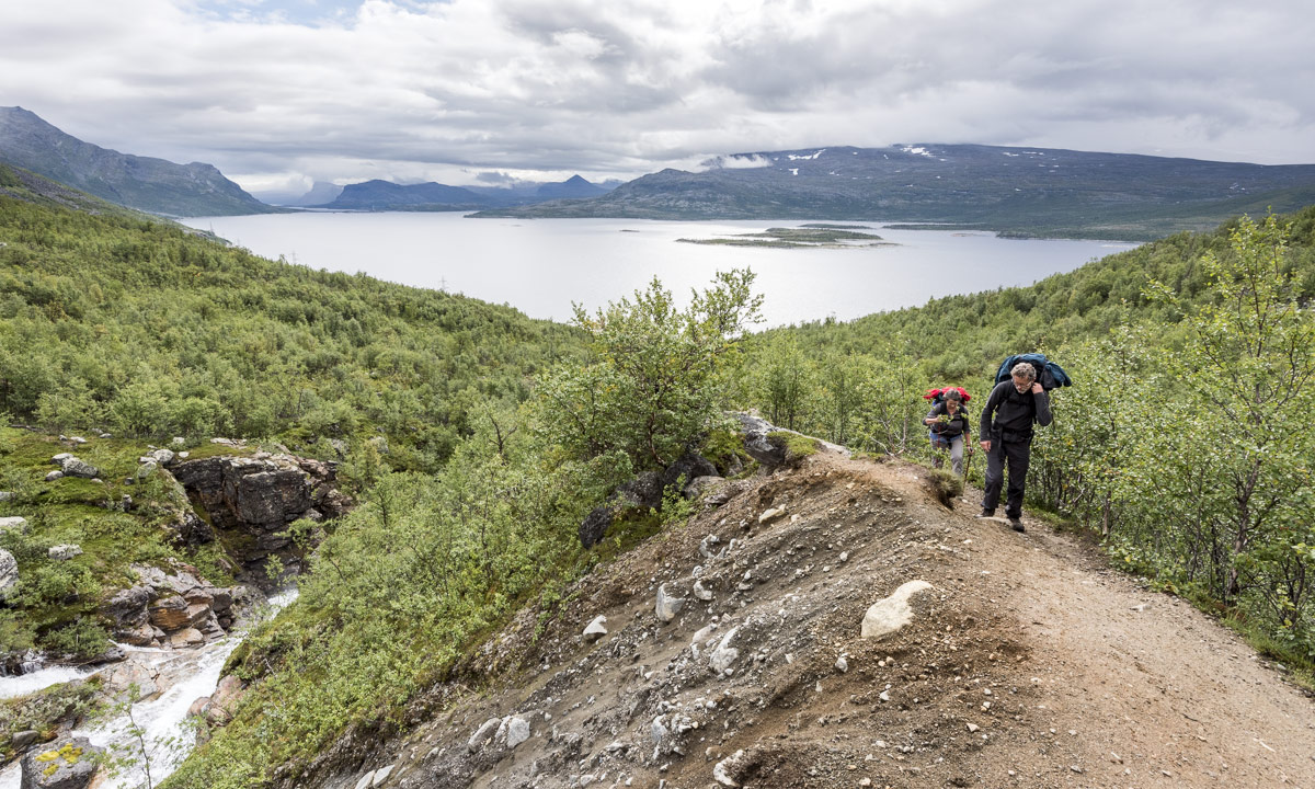
We followed the trail and after some hours we made a 20 minute rest by the riverside of the Čeakčajohka. (The Swedish name is Tjäktjajåkka, but I try to keep the geographical names in sami, since they are the genuine names.)

Sometimes I stayed behind to make some photos. When I tried to outrun the others after making a telelens photo, I realised that I lost my lens cap for that lens. I signalised the others that I would go back to look for it and would come later. Singistugorna (the Singi huts) were already in sight.

I went back and looked for the lens cap for a longer time but as I already suspected couldn’t I find it. It may lie hidden in the heathers for ages …

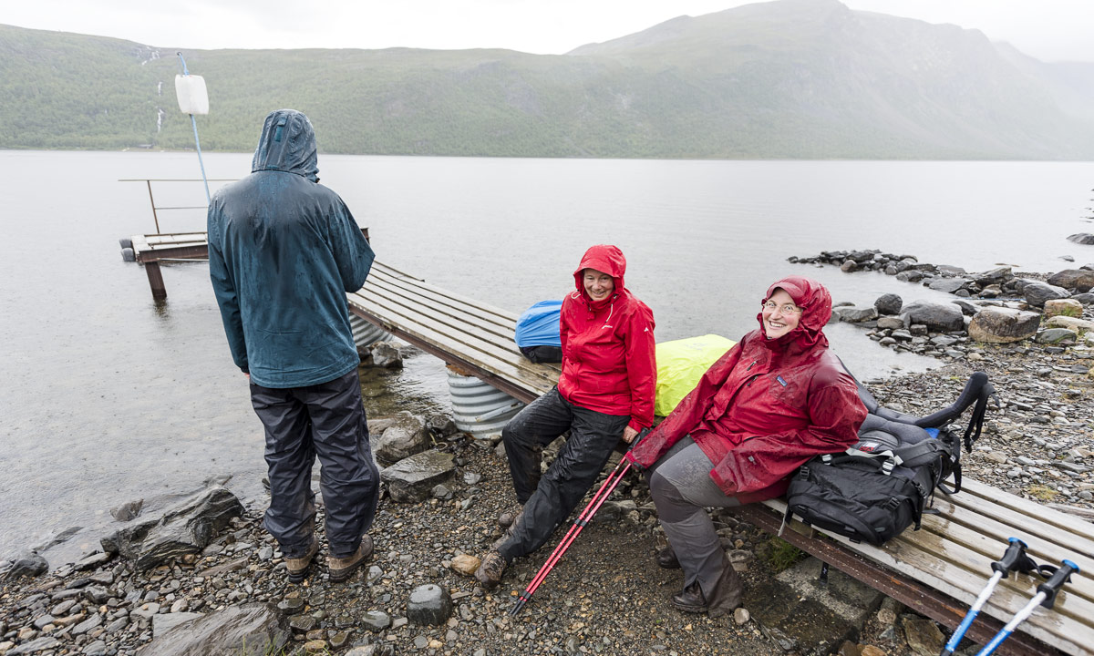
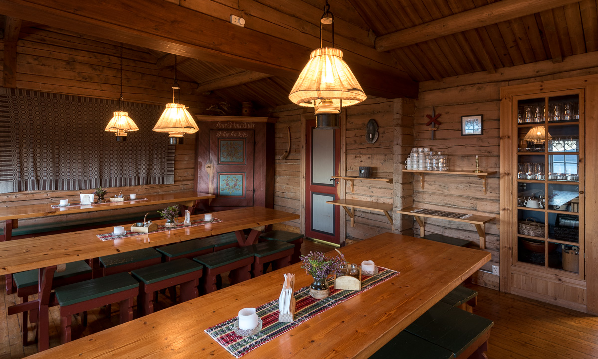
While I searched the lens cap, Annika and Katrin slowed down. Their knees didn’t like the stony and hilly path and so they took it easy. Therefore it was Andi who reached Singi first and booked four beds for us. He just came in time to get a four bed room for ourself. Great – since we planned to stay there for two nights.

I came last and was glad to drop my backpack and be able to focus on something that grows more and more important on such hiking tours: food and eating! This time we had two cans of köttbullar (the swedish meatballs) with potatismos (mashed potatoes) and some self picked blueberries for dinner.

And in addition to that tasty dinner we got real nice sundown colours. Another nice day!

Some words to the food. The good thing: You can buy food in many huts on the Kungsleden. So you don’t have to take all food with you and can keep the backpack weight relatively low. In addition to that you may find leftovers from other hikers. Sometimes it may be noodles, lentils or instant food, sometimes it may be pepper or salt.

Good to have with you (in our opinion):

  • Salami – you may buy some sliced salami, but not everywhere. Great with crisp bread, both for breakfast and lunch
  • Garlic – lightweight and good to spice pasta of all kinds and other dishes
  • Bregott – Swedish margarine, together with crisp bread it will give you kind of a real breakfast
  • Sugar and cinnamon – good to pimp oatmeal and self picked blueberries (many of them weren’t ripe yet)

Some of the things you can buy in most shops:

powdered milk · oatmeal · crisp bread · jam · chocolate · muesli bars · rice · pasta · goulash soup · mashed potato powder · köttbullar · chili con carne · Coca Cola(!) · beer with 3.5 % alcohol(!!!) and more …

21 August: Kungsleden day 2 – Teusajaure—Kaitumjaure (9 km)

This article is part of the series “2017-08: Kungsleden hike”.

One of the less adorable things when you’re hiking from hut to hut is going to the toilet. You have to go to the utedass, the outdoor earth toilet, which is always a bit away. You need to slip in your boots or sandals, put on a jacket to stay warm and dry and in the night you even need a flashlight to find the right way. At least the toilet seats are made of styrofoam which isolates quite well. And there’re always some nice outdoor photos pinned to the wooden walls.

After I already took the camera to my early morning loo visit I stayed outside and took some more photos. It was chilly and cloudy but at least yesterday’s rain had stopped.

After a breakfast (Wasa bread with cheese and muesli with milk made from milk powder) we started our day’s march. It was much easier than the day before since it’s only 9 km to the next hut. We had to climb up round about 250 meters through forest until we reached the kalfjäll above the tree line. And finally the sun managed to find some holes in the clouds and illuminated parts of the alpine landscape.

It didn’t take very long until we crossed the river Kaitumjåkka (sami: Gáidumjohka) using the large chain bridge.

Leaving the river behind us we descended again through green birch forests …

… and arrived at the Kaitumjaure huts at 14:45. I cut up some logs and chipped wood for the sauna but it happened to be so crowded, that Annika and I left it soon. Katrin and Andi didn’t even managed to enter the sauna and the water for cleaning was still cold.

But even without a hot water “shower” day two felt much better than the day before. Now we looked forward to the next day that finally would lead us to the treeless kalfjäll for several days.

Back to the toilets: If you think that using the utedass is quite uncomfortable to use in summer, you won’t like it in winter either. Then you sometimes have to dress like for an arctic expedition just to reach it without hypothermia. Check the second photo in the article Kungsleden ski tour: Singi – from blizzard to clear sky to get an impression.


20 August: Kungsleden day 1 – Vakkotavare—Teusajaure (16 km)

This article is part of the series “2017-08: Kungsleden hike”.

The idea to walk the Kungsleden with my sister Katrin and my brother-in-law Andi had been existing several years. This year we put our plan into action and went this famous Swedish long-distance trail from Vakkotavare to Abisko, which is round about 110 kilometres. Fortunately Annika had time to join us.

We started our tour on 20 August, exactly two weeks ago. As many hikes our tour started with public transport: The bus 93 from Gällivare to Ritsem. The last 130 km of that route are famous for being Sweden’s longest dead-end road.

We however left the bus at Vakkotavare where we immediately started the tour. We had no time to loose since our destination – the Teusajaure hut – is located on the other side of the lake Teusajaure and we hoped for a lift with the motor boat at 19:15 to avoid rowing cross the lake.

The first part of the trail is quite steep and leads along a mountain brook with some waterfalls. 500 metres in altitude can be exhausting, when it’s the first day and the backpacks are still packed with some extra food.

Finally we were on the plateau on the “kalfjäll”, the alpine region above the tree line. I really love that bleak but wide landscape where you can look so far.

Until then we were quite lucky with the weather. It wasn’t sunny but at least it didn’t rain. But the weather worsened. The clouds became darker and it started to rain, first lightly then gradually intensifying. We could see some patches of old snow far away but soon all mountain peaks vanished in the thick layer of clouds.

The last part of the trail descends again. This was probably the most dreadful stage of our whole hike: it rained more and more and the steep stony path downwards was muddy and slippery. Despite of the rain there was not a single wisp of wind. So every second we stopped we were immediately surrounded by clouds of mosquitoes that landed in our eyes and nostrils or tried to get into our ears to suck our blood. Anyway we hardly rested anyhow since we tried to reach the boat.

We managed to reach the landing stage at the lake Teusajaure in time, wound up the signal for the boat (a white plastic jerry can) and waited. At least we were glad that the hut Teusajaure was in sight.

I felt disappointed and frustrated. It was the first hiking tour in Sweden for Katrin and Andi. What would happen if the weather would stay like that? And the muddy trails? And the mosquito clouds? Would we continue or abandon the tour? What would they think about hiking in Lapland? Would they ever come again …?

Soon we could see the boat leaving the other side of the lake. Minutes later it arrived. We put the backpacks onboard, jumped in, put on live wests and soon brought across the lake.

On the other side we unpacked the wet trunks and the stugvärd – the mountain-lodge keeper – gave us four beds to sleep. While Annika and I had hiked in Sweden many times it was brand new to Katrin and Andi and felt like a culture shock:

No electricity, no water tap and no water toilet neither! Instead of that: candles, a wood fired oven, two gas cookers and some buckets with water – partly fresh, partly used. And the earth closet somewhere out in the dusk. Again I felt a bit guilty that I persuaded Katrin and Andi into that Kungsleden hike.

Anyway the first tour day that was long away from being ideal came to a nice end: We had pasta, fresh chanterelle mushrooms and sour cream with us for the first day and therefore could enjoy a dinner far above standard. Now we only hoped for the rain to stop. It didn’t take long until we went to bed and soon we all slept.

What do you do if you don’t want to get a motor boat lift? You row by yourself. That’s round 1 km one way.

There are three rowing boats total. If you have two boats on your side, you’re lucky: Just take the boat and row across the lake.

If you have only one boat on your side, you have to row three times: First you take the boat and cross the lake. Then you row back with the same boat and a second boat in tow. Then you leave that second boat and row again a third time. So it’s ensured that there’s always at least one boat on each side.

Summer in a nutshell

This Saturday Annika and I met our friend Elisabet, who never says no when it comes to being outdoors. Even if we used a car to reach all those nice places round Umeå we indeed were outdoors most of the time.

1. Mountain hike

Elisabet had asked us what we wanted to do this day beside of bathing. Hiking, sleeping, barbecuing? The sea, forest, mountain …?

I mentioned that it wouldn’t be too easy to find mountains round Umeå, but Elisabet knows many nice places and so she suggested to go up the mountain Tavelsjöberget. Since the top is just 284 metres above sea level, it’s not the longest hike up. There’s a 5 km trail leading through wetlands (according to the sign rubber boots are recommended) but the shortest way up is just 700 meters long. That’s the way we took.

After the short but steep and rocky way up we reached the top. Here we took a break and enjoyed the view over the lake Tavelsjön and the landscape around.

Elisabet told us about some caves nearby and we already saw the waymarks leading down. There at the western side the mountain is very steep and rocky. We found all of the four caves but entered only one, since the others were only reachable by crawling.

We took a shortcut along a narrow path until we came to the very same trail that we took uphills. Soon we were back at the car and quite eager to enjoy some ice cream and take a bath.

2. Sandy beach and ice cream

… and so we did! First we bought ice cream and something to drink at the kiosk and then we took a refreshing bath. Water temperature: 19 °C, air temperature: round 22 °C. Just perfect, if you ask me.

After a bath (Elisabet took two) and an ice cream (Annika and I took two) we started to plan the rest of the day. Barbecue: yes! By the water: definitely! But where? And where to get food? Luckily there was a food store in Hissjö quite nearby. There we purchased food, something to drink and Elisabet asked for some plastic knifes and a fork, which we got.

Then we headed to Bäcksjön, a beautiful lake in the forest.

3. Forest lake and barbecue

There’s a grilling place at the southern tip of the Lake. Seven other cars parked on the same parking place so we knew we wouldn’t be alone.

Elisabet is quite independent when it comes to barbecuing. While I always have a tripod and rubber boots in the car for photographing, Elisabet uses to have a grill and charcoal with her. Soon our sausages, bread, halloumi cheese, asparagus and tomatoes lay on her grill getting barbecued and beside of some asparagus we ate it all. And it tasted so good!

After our meal Elisabet and I took another bath. We weren’t successful when it came to swimming because the lake is quite shallow and you have to go a long while until you can start to swim.

We were so lucky: Good food, great company, a beautiful lake, warm summer weather with a slight breeze and – not to be underestimated: hardly any mosquitoes!

Summer in Northern Sweden! It’s hardly imaginable that people skated on the ice of the Tavelsjö only two months ago.

Abroad north – climbing the mountain Roßkopf

I’m at Arlanda Airport, waiting for my flight to Skellefteå. I’m longing home to Skelleftehamn but my thoughts are still in Germany, where I visited C. and O. – two fantastic friends who live in Munich yesterday.

Since the weather promised to be good, we decided to make a tour near Spitzingsee in the German Alps. We soon realised that all lifts and cable cars were closed and so we decided to climb the mountain Roßkopf (1580 m). It won’t be so hard, it’s just 500 meters up and then down the other side to the Albert-Link-Hütte, which is famous for its Kaiserschmarrn!

There was not much snow round the lake Spitzingsee (1084 m) but you could see, that some slopes and mountain tops were still quite white. Anyway I thought that it wouldn’t be so much. The Roßkopf is hardly 100 meter higher than the Feldberg were I’d been the Sunday before.

I had to smile about the man that went down the grass covered ski slope with huge ski boots, shouldering a pair of skis. Did he find any snow to glide down more than ten metres, I wondered. Well, I might have been wrong …

We started going up the grassy slope, partly following the way, partly just going up. There were some leftover snow fields to cross, but mostly we went on bare ground, looking at the countless flowers. When we went up the first slope we turned left and soon the way was completely covered with snow.

We carefully avoided the places round the little brooks and stream to avoid getting wet feet. Anyway I  guessed that the snow was round 50 cm deep – more than expected.

Some skiers approached, effortlessly gliding downhills. We went up until we came to a place with another ski lift. It was closed too. Shall we take the longer but flatter snowy way through the forest or just go uphills? We decided for the latter knowing that we could take as many rests as we wanted. We saw some skiers, but no one on foot as we ourselves.

Well, we managed the slope, but it was hard work and we rested more than once, before we continued plodding through at least knee deep snow. But it was worth it. When we stood on the mountain saddle that leads to the Roßkopf we had a gorgeous view onto the much higher mountain tops in the South.

We went to the Roßkopf were we met some other hikers without skis or snowshoes. We learned that there would be no really easy way down but we soon made up our minds about our way down.

The first steps went well, then we landed in a large patch of much deeper snow. My legs disappeared completely in the wet snow several times. It was easier however to glide down there than on the lower parts of the slope, that were partly snowy, partly grassy and partly covered with slippery clay. None of us managed to go down the whole way without slipping.

I didn’t expect that so much snow would have been left even on the less high mountains in the beginning of May. So I took a picture of me myself being stuck in the snow. It might be a bit overexaggerated perhaps …:

Soon we arrived less steep terrain where we just could plod through the snow again. After another fifteen minutes we were in the land of Spring again.

But when we looked up we could see the land of Winter. That very land that we touch just half an hour before.

So – much snow left in the German mountains. But how about home? Will I still have snow in my backyard in Skelleftehamn? I don’t know. I’ll see it in some hours.


Valborgsmässoafton abroad

Valborgsmässoafton, the day before the Walpurgis Night is a quite important feast in Sweden and uses to be celebrated with a big bonfire.

Personally I connect the 30 April and the 1 May to last seasons snowfalls. It snowed on 1 May 2014, it snowed on 30 April 2015, so it didn’t surprised my that quite a lot of snow fell in Skelleftehamn today – round 5 – 10 cm.

But something was different this year.

I’m not in Skelleftehamn. Nor am I in Sweden. I’m about 2000 km south-southwest in Freiburg near the Black Forest.

I love mountains because you can look far and I love snow. After hesitating a bit – I can be quite lazy! – I picked myself up, packed some clothes, equipment and food, walked to the main station and took the train to High Black Forest to “climb” the Feldberg, Germany’s highest mountain outside of the Alps. The Feldberg has been already free of snow this spring, but the cold weather with high precipitation brought a lot of new snow to the mountain tops this week.

But today it promised to be warm and sunny.

Already from the train you could see some of these snow-covered tops and patches of snow everywhere, but the trees were green and many flowers were blooming. The same in Feldberg-Bärental, where I left the train and started my hike. The path itself was bare of snow, but the slopes beside the path were covered with wet snow.

Soon I arrived at the Feldsee, a lake formed by the last Ice Age. Here I made a short stop, drank some water, took some photos and continued up through the forests, where the path not only got much smaller, but much snowier as well.

I went up the snowy and slippery path through the forest and came first to a Hotel with a parking place. That’s exactly those things I don’t want to see, when I’m outdoors to enjoy nature. Anyway it was just a short interruption, now another way climbed uphills. I wasn’t alone at all and so many people had used the same way before me, that it was almost completely snowless.

Soon (but a bit out of puff; we don’t have mountains in Skelleftehamn) I approached the first top. Not the Feldberg but the Seebugg (1448 m). I guessed that the very top of the Feldberg itself would be quite crowded and took a rest between these two tops.

You see the rubber boots? Quite good for snow but too warm when not cooled by the snow. I put them off while resting right after having taken this photo.

But the Feldberg (1493 m) was near and I continued my tour on the broad snow-ploughed street-like way.

From the top I had several views.

First of all I saw many other people. Then the snow covered slopes other white mountains nearby. Behind them the green springlike lowlands.

And far away in the south I could recognise the faint snow covered mountains of Switzerland, some of them are almost three times as high as the Feldberg!

Many people had sneakers on or flat shoes, but down jackets that I considered much too warm. Since I had left the forest I only had a t-shirt on because I found it really warm, even on the top. On the other side I was probably the only one with rubber boots on today. They belong to my usual baggage, while mountain boots don’t. Anyway the rubber boots have one advantage when combined with a waterproof camera. You can make pictures like these:

You might have guessed it. This photo was taken at/in the Feldsee not on the Feldberg.

The descent was quite unspectacular and much shorter, since I took another way. A bus brought me back to the very same train station were I’d started the tour four hours ago.

Taking advantage of the sun

Yesterday I took the car and drove to Umeå. The sky was blue and the sun was shining. Sounds nice, right? Well, it was nice but hard to drive. The sun melted the frost on the asphalt and the wet street reflected the low hanging sunlight. Sometimes it was really hard to see anything other than just a glaring white nothing.

Today the sky was blue and the sun was shining again. Sounds nice, right? Today it was nice since Annika and I took a longer stroll through the forests near Strömback south from Umeå.

The temperatures were above zero, but parts of the ground were still frost covered. We followed a path between Tjuvvarpet – a lake – and Matsund – part of the Baltic Sea. Anyway you could see neither lake or sea from the path since the forest was too dense and hid the waters which were just 100 meters away.

On the way back we made a short rest at a place on the lake near the hill Tjuvvarpberget. Most of the lake was still free of ice but near the rocky shore you could see the first covering of ice. It almost looked a bit wintry.

Apropos winter: If the weather forecast is right we will get at least 30 cm of snow in Skelleftehamn within the next eight days. Nevertheless I’m quite sceptical. Just two centigrade warmer and it will all pour down as rain.


Torghatten

This article is part of the series “2016-09: Jämtland and Norway”.

16. September

After our five day hiking tour in the Swedish Mountains a week of Annika’s and my holiday was left. We entered the car and left Storulvån. Shortly before we approached the E14 I asked Annika: “Back to Umeå or Norway?” The answer was: “Norway”. So we travelled to Norway …

19. September

After visiting friends near Mosvik we decided to drive north to Mo I Rana, but neither on the direct way, nor on a single day. We made a two-day stopover in a fantastic cottage between Torget and Brønnøysund. On the other day we drove to Torghatten, a mountain in the south of the same island. There’s something special with this mountain: It has a huge hole. From the parking place at the foot of the mountain a path leads up to the hole and through the natural tunnel to the other side. We slipped into our boots, took the cameras and went up.

Some photos:

We put ourselves on a large stone and looked at the landscape behind: The rocky slope, the tiny red farm house, the beaches and the sea with its many islands. We could have continued on that path, which leads further, but then we had to go round the whole mountain on a gravel path at the end. So we just returned the same way.

An impressive tour, that doesn’t take much time. Don’t miss it when you’re near Brønnøysund. And take your wide-angle lens with you!

Jämtland hike part III: back to Sweden and finishing the tour

This article is part of the series “2016-09: Jämtland and Norway”.

After two days in Norway we headed back to the Swedish mountains.

Thursday, 15. September

We started our day with a breakfast.

The Norwegian lodge Nedalshytta is really beautiful, but doesn’t have a kitchen and sells only some snacks, when it comes to food. Luckily we had both own things to eat and a mug with us, so would could enjoy our own breakfast: oat flakes with frothy milk! How to get frothy milk on a mountain tour? Mix milk powder and water in an empty coke bottle, shake it vigorously and voilà: schiuma di latte à la Annika.

After packing our backpacks we started our hike to the Sylarna Fjällstation. It was the first cloudy day since we started our tour three days before and anything was moist and wet. Sometimes we had to take a break to pluck some blueberries, that still tasted fresh and sweet.

We went along the Templet, which is Swedens highest peak of the Sylarna mountain range (1728 m). (Storsylen with its 1762 meter altitude is higher, but on the Norwegian side, just 100 meters from the Swedish border.) Due to the weather we first couldn’t see that much but after a while it started to clear up and the clouds released the view on the huge and barren slopes of the Templet massif. We were so lucky, that we hadn’t to go this part of the trail in fog and clouds.

Soon we arrived at a place called Ekorrdörren – the squirrel door.

We started our tour at 780 m above sea level. Now we were on 1100 meter and would have to go up another 260 meters to reach the Ekorrpasset – the squirrel pass – which is 1360 m above sea level and so the highest point of our tour so long. We started climbing up the slope but had to look back over and over again. The undulating valley of the river Åeruvedurrienjohke with it’s many hills and ponds looked like from another planet.

Our trail got more and more rocky. After a while there was hardly any way left, we just went over angular rocks with gorgeous views of the Templet, including a small glacier and the Slottet, another peak of the Sylarna.

I really love the changes of the landscape you can have within just some hours: From autumnal birch forest with blueberries over to grass covered plateaus and finally up to an asteroid-like landscape that looks like a pile of stones.

Especially the squirrel pass looks both harsh and impressive. Anyway, when you go up a pass you’ll probably go it down as well and even 200 meters altitude make a difference. The Sylarna Fjällstation lies near the river Sylälven that flows through a wide grass covered U-shaped valley and when we came nearer we could see three reindeers standing in front of the cabins. Back to civilisation.

We had hiked four days in a row and were quite eager to take a day off. Sylarna fjällstation would be an ideal place, since it lies beautifully and you can leave that place in six different directions. Alas, there weren’t only reindeers, but people, too. Many people. The place was crowded! There were many hikers and mountain joggers. In the big dining room sat a large group of bankers that got their three-course dinner including candlelight and fresh salad, brought by helicopter. We were unsure, if this should be a good place to rest for a day.

The information we got in the evening shocked us a bit: There were already 100 – 125 booked sleeping-places for that night (in addition to all people that would come without booking). That means, that this place would be even more crowded. Even Helags, which is more in the South had just some single sleeping-places left.

That was the moment, where we decided to escape.

We would stay overnight of course, but the next day we would abandon the tour and hike back to Storulvån, were I parked my car.

Friday, 16. September

I was awake quite early, took my camera and tripod and walked out to wait for the sunrise. The valley Endalen was covered with fog. I looked at the glacier Storsylglaciären,that covers the eastern slope of the Storsylen and a lavvu – a traditional sami dwelling. The sun however showed up quite late, there were too many clouds.

I looked at the less beautiful parts of that place too: An excavator on a flat building site, a welcome sign surrounded by building material and waste.

We started the tour being content to leave Sylarna behind but a bit melancholy, too, because we didn’t plan to leave the mountains already after five days. Annika started to count the approaching hikers, there were quite many …

After half the way we approached something quite funny:

It’s neither a sculpture nor a church, it’s a WiFi-station including a recharging unit for smartphones! It is even marked in the hiking map: “WiFi och laddstn.”. There were many hikers and even some mountain bikers resting, but no one started the WiFi. The cellular network is quite good in that part of the mountains and I guess there’s hardly a young Swede without a mobile internet flat rate.

We continued our tour and slowly hiked down the valley Endalen. After a while we were below the tree line and the landscape got even more colourful.

And just shortly before we reached our starting point, were we had left four and a half days before I spotted a lonely birch tree – almost leafless. A symbol, that winter will come even this year. Fifteen minutes later we reached Storulvåns fjällstation, then the parking place, then my car. Annika has counted almost 150 people hiking, jogging and cycling to Sylarna, just from one direction! That confirmed our decision to leave Sylarna behind.

It has been a fantastic and varying tour with many different experiences in a short time. Tack för turen – Annika!

The End.

“Wait, wait …”
– “… wait, what?”

“How can it be the end? You had two weeks holidays, not only five days!”
– “well, ok, we did continue our journey.”

After changing cloth, using the bath room and drinking a coke we got in the car and I drove the way back to Enafors, that lies at the E14 which connects Trondheim in Norway with Sundsvall in Sweden. We considered some options but didn’t decide yet what to do next. Shortly before we approached the E14 I asked Annika: “Back to Umeå or Norway?” The answer was: “Norway”. So we travelled to Norway …

Stay tuned for the next article telling more about our trip in Norway …

Jämtland hike part II: hejdå Sweden, hei Norge!

This article is part of the series “2016-09: Jämtland and Norway”.

Annika and I are in the mountains in Jämtland and have just reached our first destination: Blåhammaren, where we slept in a 14-bed room.

Tuesday, 13. September

Sleeping in a 14-bed room can be quite demanding, especially if you have this kind of snorers in your room, that could awake a frozen mammoth. However Annika and I were really lucky, no snorers at all! After our breakfast we had to decide where to continue our tour. From Blåhammaren you can hike back to civilisation or continue to two other destinations. Most of the hikers continue to Sylarna which is very central and part of the Jämtland Triangle, a very popular three-day-tour, that connects Storulvån, Blåhammaren and just Sylarna. We were keener to cross the border and hike to the Norwegian lodge Storerikvollen and so we did.

With an altitude of 1086 m Blåhammaren is the highest tourist station of the STF – the Swedish Tourist Association – so first the trail ran over the treeless mountain plateau, over rocks and moss, crossing some swamps and brooks. After a while we descended and the first yellow coloured birch trees came into view again.

Swedish summer trails are marked with red coloured dots on rock or tree, while winter trails are marked with poles bearing red crosses. You really shouldn’t follow the winter trails in summer unless you want to stand in front of a lake or find yourself deep in a bog – both are easy to cross only in wintertime. But quite often there’s a year round trail which makes navigation extremely easy even on less walked routes.

One kilometre behind Endalen, an emergency shelter, where we rested for a short while, the Sweden-Norwegian border came into view. It’s hard to mark a border less spectacularly than this one: A sign amidst of a pile of yellow painted stones, that’s it. The large bridge that crosses the river Enan (Sami: Äjnänjohke) directly after the border offers far more spectacularity.

We detected a real nice resting place on the other side of the river, where we planned to enjoy the warm summerly weather, but two other hikers – by the way the first ones we met that day – coming from the other side chose exactly the same slab of rock to rest. Luckily we found another place, at least as nice as the first one. We unmounted our backpacks, took of our boots and dangled our feet into the ice-cold water.

(I like the photo with the drifting yellow birch leave and the dead mosquito. It illustrates, why I prefer the autumn to summer: Beautiful colours and no biting insects left!)

In Norway the summer trail marks change, now the trail was marked with big bright red T-s. The red T is also the logo of the DNT, the Norwegian Trekking Association.

Do you see the dark piece of something on the top of the stone? It’s animal droppings, but I’m not sure of which species. I asked for help on Facebook and the favourite answers are reindeer and (arctic) fox.

We continued our tour until we came to another swing bridge, this time crossing the river Djupholma. On the other side of that river lies a nice sandy beach where I took a refreshing bath (the only one of the whole tour). It was only two other kilometres to walk to our destination, the cabin Storerikvollen, where we arrived round six o’clock.

Oh, so nice these Norwegian lodges are. They seem less “funkis” (the Swedish functional style) and more “hyggelig” (the Norwegian word for cozy, snug, or homelike). Just gemütlich! And we got a two-bed-room for a good price. The only thing you should know, when you visit the Norwegian side: These cabins hardly sell any food and there is no public kitchen as in the Swedish cabins. So you have three options: (1) take a camp stove with you and cook outside. (2) cold dishes! Hopefully you have all with you. (3) eat the dinner and breakfast provided by the lodges (and pay the Norwegian price).

We chose (2) and had a nice dinner with salami, crisp bread and fresh water outside in the evening sun, enjoying both our simple meal, the warm air and the beautiful view. Later the almost full moon rose above the reddish mountain chain – what a beautiful evening!

Wednesday, 14. September

The next day would lead us to the Nedalshytta, which is between 20 and 24 km away, depending on which map or sign post you rely on. So we got up quite early.

We had to go back yesterdays route 2 or 3 km where the trail divided. Now we turned south and had to ascent. Soon again we were above the treeline. When we looked back, we could see parts of the big lake Essandsjøen and even spotted – beside of some reindeers – the now tiny Storerikvollen, that we left some ours ago.

After a while we came to the river Fiskåa, where we had to ford. My rubber boots were high enough and I just splashed through the water, whereas Annika changed boots with trekking sandals and waded through the river.

Since rivers use to flow through valleys we had to ascend again and walked up along a reindeer fence. The weather was still warm and sunny, but you could see a cloud layer approaching afar. Would it rain in the evening as the forecast told us?

Only the map showed us the progress of our longest tour so far. We went a bit up, a bit down, a bit to the left, a bit to the right, down a small valley and up again. But finally trees came into view once more and soon we stood on an exposed plateau not far away from the yet invisible Nedalshytta.

Come on, just less than a kilometre to go … . Final spurt! A short while later we arrived at the beautiful lodge. Again we got a nice two-bed room, this time right below the grass roof. And we got: pizza! Perhaps not the best I ate in my life, but walk 20 – 24 kilometres with a backpack by yourself and you’ll know, how delicious a warm pizza slice can be!

The tour so far:

Continue with part three …