Jämtland hike part I: Storulvån—Blåhammaren

This article is part of the series “2016-09: Jämtland and Norway”.

After three weeks of travelling I’m back in Skelleftehamn. The first week I was in Germany, then I travelled back to Umeå, where Annika lives. Let’s start there:

Sunday after breakfast Annika and I started our tour through the autumnal Jämtland. However the first day’s focus was on getting there by car. It takes round six and a half hours to get from Umeå to Storulvån. We made a stopover in Åsele to look in on some friends and so it took a bit longer until we reached the STF Storulvån Fjällstation where we parked our car. But anyway, we have semester – holiday – and plenty of time. It was even still daylight left, when we crossed the creek Stor-Ulvån (sami: Stoere Vïerejällanjohke) to get to our cabin.

Monday, 12. September

I awoke quite early the next morning and went out to make some photos of the beautiful morning mood and the autumnal colours of nature.

After our breakfast we shouldered our backpacks and started the tour. My backpack could have been quite lightweight if I hadn’t taken my camera, four lenses and a tripod with me. Nevertheless the weight was less than 15 kilos since we were able to buy food in almost all cabins and mountain lodges.

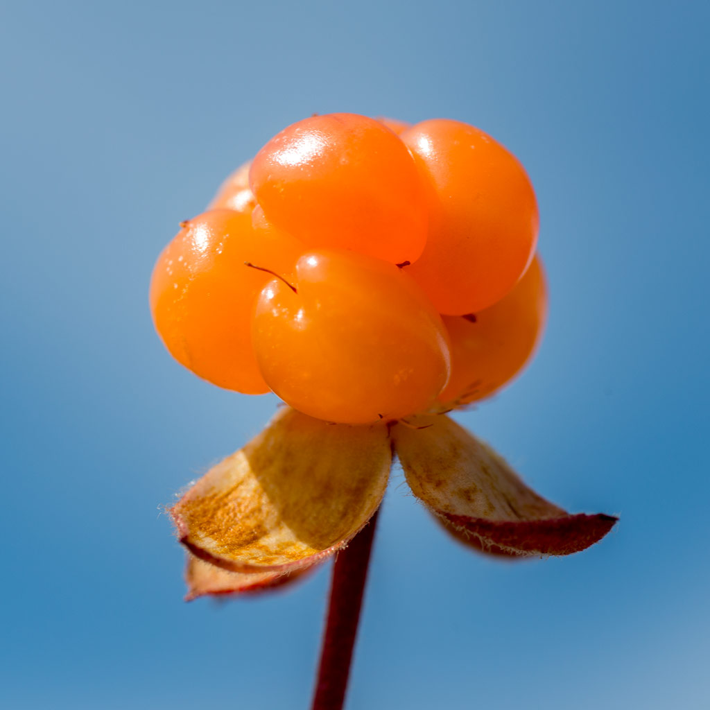
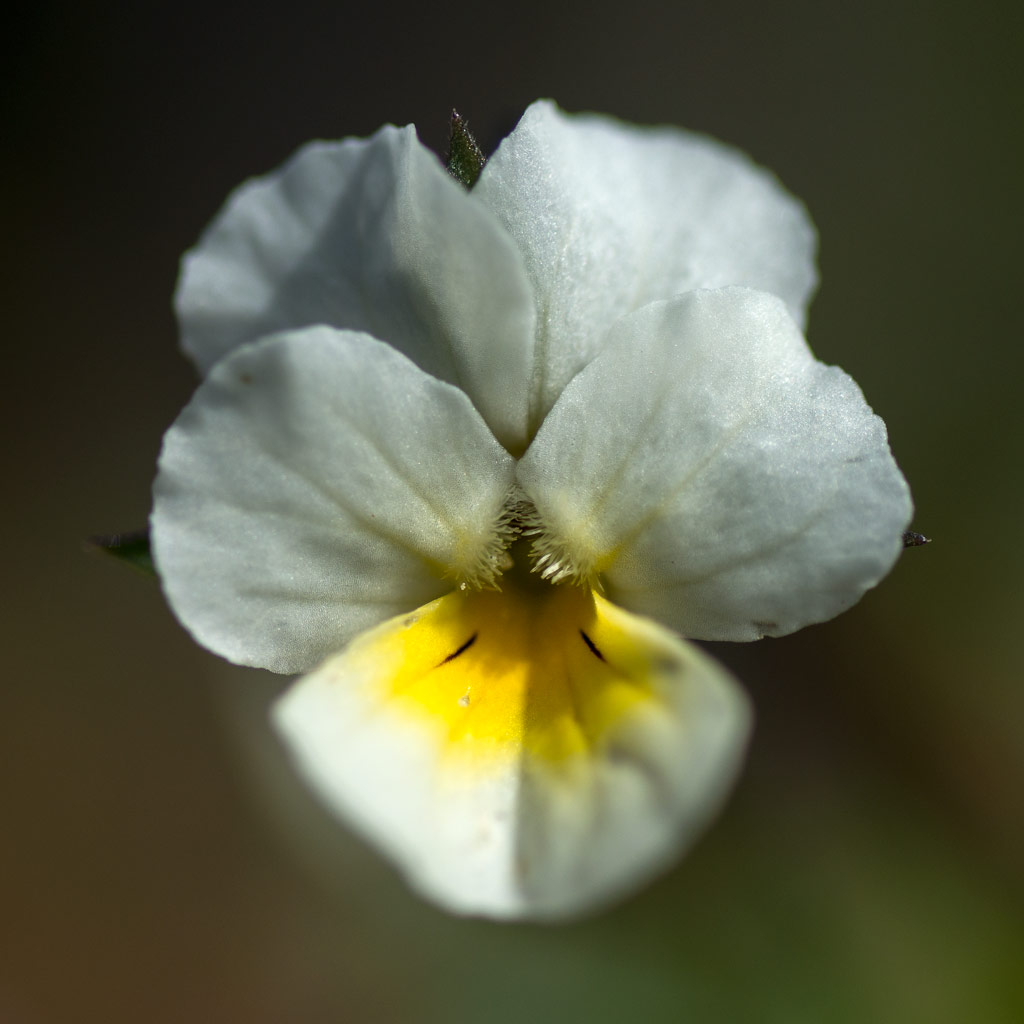
First it was a bit cloudy but soon the sky cleared up more and more and we got a warm autumn day with temperatures up to 20 °C, which is quite warm for the season. The summer trail led us first through autumnal birch forests but after some kilometres we were already on the kalfjäll – the bare mountains above the tree line.

In the middle of the trail between Storulvån and Blåhammaren lies the cot Ulvåtjärn, one of the “emergency cots”. You’re welcome to have a break here, but not to stay overnight beside of emergency situations. Right before this cot you have to cross the Stor-Ulvån again, this time by fording it. When Annika crossed the river three years ago, the water was knee deep, now the water level was much lower and I could just cross it in my rubber boots, while Annika went barefooted.

After a break we continued our tour to Blåhammaren. There were many reindeers on the fjäll. No big herds, but many small groups here and there. They are quite shy and cautious, but on the kalfäll it’s quite obvious, that they are the real residents of the mountains, not we human beings.

We continued our tour on the treeless mountain terrain until the Blåhammaren fjällstation came into view. Here we got two beds in a 14-bed-room and entered the sauna, that has a gorgeous view. After that Annika invited my to a three-course dinner (Blåhammaren is famous for its cuisine) where I got the most delicious reindeer meat I ate in my whole live. Thanks for the invitation, Annika!

While we enjoyed our dinner it started to get dark outside and after a while the beacon in front of the main house was lighted and the first stars came out. Later in the night we got a fantastic crystal clear starry sky, but no Northern lights. I considered about taking some pictures of the milky way, but I was too lazy and too tired.

The tour so far:

Continue with part two …

A weekend in the Skuleskogen National Park

You just leave Umeå by car on the E4, head southwards to Örnsköldsvik and continue a while, leave the E4 in direction Köpmanholmen and Näske and continue to “Entré Nord” (entrance north). You park your car, shoulder your backpacks and follow the signs. And soon you stand amidst the fantastic forests of the Skuleskogen National Park.

Annika got visit of her friend Johanna last week. A good opportunity for us to spend a weekend together in the Skuleskogen National Park. Since our planned tour for Saturday was not so long, we started our hike not until 12 o’clock. In addition to the usual stuff as rain jacket and spare clothes we had a lot of food and water with us. Much water, since we weren’t sure if we would find any near the cottage – much food as potatoes, sausages and a lot of salad because we just wanted to have a bit of luxury.

The first part of the trail through the forest was fantastic, almost magic. Old trees bespangled with lichens, big rocks coated with green moss and from the left a pale light signalising that the Näskefjärden – part of the Baltic Sea – is not far away.

And “not far away” means: just a few meters.

Annika and I looked forward to take a bath, but first we wanted to reach the cottage on the islands Tärnättholmarna to leave some of the heavy luggage there. When Annika told me about the beautiful cabin on the inshore island of the Tärnättholmarna I wondered how we would come there. Is there a bridge? Do we have to take a boat? Wade? Jump? Swim across? Anyway my wonderings were useless: Since the glaciers of the last ice age had melted any,  the land has been rising again – still 8 mm a year! This phenomenon is called post-glacial rebound. That’s why the Tärnättholmarna have been islands in older times, but nowadays are connected with the mainland by a broad band of sand.

It’s not far away to the cottage and we reached it within a good hour. We left most of the food, most of the water, some spare clothes and our sleeping bags and continued much more lightweight. (Beside of me, who had 5 kilos of camera equipment with me, but that’s my problem and most of the time I don’t complain …)

We continued the forest trail southwards. It’s an easy way but not the most interesting part of the National Park in my opinion. Anyway we walked still along the shore and the beaches were sandy and the water was clear and the sun shined … . Time for Annikas and my long yearned-for bath. The water was chillier than expected but so refreshing!

After we have dried in the sun we continued our Saturday hike, now heading north. Here the trail climbs round about 265 meters, if you take the eastern variant. That may not sound much but the change in the landscape is really impressive:

Starting just 200 meters away from the sandy beach you walk through a dense forest of primeval old, large trees. Sometimes the trail is covered with cobblestone-like stones, sometimes with a maze of tree roots, sometimes it just leads over jogged rocks. All of the sudden, the path turns right, leaves the forest and you stand on solid red granite rock. You look up and see more rocks and – yes! – that’s your way up! You follow the marks, sometimes by walking, sometimes by climbing up the steep or rugged passages.

Finally we were up on a rocky and bald plateau and had amazing views over the mountainous forests in the west and the Baltic Sea with its many islands in the east. Unfortunately it was quite cloudy when we went there and I hardly took any pictures. Between the next two photos lie 34 minutes and about 50 metres in height. The descent however is far away from being easy. You have to climb down through rocky terrain with a gradient of 50%.

And then you stand at the upper entrance of the famous Slåttdalsskrevan. Wooden stairs are leading down into that ravine where the trail continues downwards. Inside the ravine it’s so dark, that the contrast to the sky is too high for my Nikon D-800. Either the rocks are just black or sky is just white.

After leaving the ravine we still had to climb down, now again surrounded by forest. After a while we came to the lake Tärnättvattnen. The sky brightened up again and the view of the lake mirroring the blue sky was just marvellous. Johanna, Annika and I agreed in staying at that place overnight, when we should be there once again, even though that cottage is much smaller than our choice.

Now we were not too far away from our todays destination: The cottage on the peninsulas Tärnättholmarna. But even 2.5 kilometres can be demanding if there is another steep and rocky crescent. And so it was. If this passage was in the German Alps there would have been several warning signs about the necessities of alpine experience. In Sweden however you rely on the people, that they know, what they do. It seems to work well.

That’s how a part of the descent looked like when looking back:

I was really exhausted when we were “home” at our cottage, that we shared with two really pleasant Swedes. Annika proofed her abilities of outdoor-cooking while Johanna, though being a total beginner, showed her strong woodchopping skills. The only fault: the sausages were quite disgusting. I shouldn’t complain, it was me, who chose them … . After our outdoor dinner at the fireplace and some talk we all went to bed, glad to stretch the tired back and limbs.

The next day? Nice, smooth and relaxed: A breakfast with yesterday hard-boiled eggs, homemade bread, hot chocolate, and Västerbottens Ost, a local cheese. Strolling around the peninsulas – eating blueberries – sitting on the rocky shore beside the Baltic sea – eating some more blueberries – taking it easy. Taking an outdoor lunch with roast potatoes (with the rest of the sausages) and salad. I took a short nap and after that we packed our now quite empty backpacks, cleaned the cottage and went back to the parking place, where we arrived one hour later. The most challenging part of the day was my car drive back to Umeå, i was so tired!

It was a fantastic weekend. Thanks for the nice company, Johanna and Annika!

Some Sunday expressions in and round the cottage:

Links:

A trip above the treeline

Today the weather was really nice in Venneshamn in Norway. I took the car to drive to a mountain area not far away. At least, if you can fly … . If you take the car in Norway, there’s always at least one fjord you have to drive round, in this case the Verrasundet. So it took a bit longer than excepted taking the ways 191, 193 and 720 round the fjord. Finally I approached the street to the lake Ormsetvatnet. Street, well … it’s more like a steep gravel path, that you can drive up some kilometres to a parking place. The last kilometre to the lake is closed for cars and I had to walk it.

At Ormsetvatnet I crossed a dam wall, walked up a tree covered slope and soon was above the treeline. To be honest, I’m not too fond of forests, when it comes to taking pictures and I’m always glad, when I leave the trees behind when doing a mountain trip.

Now I was on a hilly plateau, the Vakkerheia. Some of the flat mountain tops were marked with piles of stones.

In the plain valley between the hilly tops the ground is soft and wet. Sometimes I had to go round shallow ponds and bogs, but mostly the ground was easy to go. In and round the swampy ponds the cotton grass was blooming. To my big delight there were many cloudberries plants growing in the lesser wet parts and the berries were ripe and ready to eat!

Picking cloudberries can be tedious, because of the many bloodthirsty horseflies that seem to guard them. I think, I slew most of them, but some bit me anyway.

After some hours of a really relaxed mountain hike I took another way back until I came to the gravel road again, where my parked car waited for me.

Half a day later

A thunderstorm approaches from the west. The center seems to be above the very same area that I wandered some hours earlier. The thunder and lightnings were as impressive as the intense colours, that I could see from the other side of the fjord. I was glad, that I haven’t been on that plateau – there would be hardly any place to seek shelter from the massive rain fall or to protect from the dangerous lightnings.

Addendum

And since we’re living in the age of selfies …

Mud walking

Last weekend I walked along the sandy beach of Storsanden, which reminded me of the beaches of the Northern Sea. But there are differences. First of all the water of the Bothnian Bay is hardly salty (only 0.3% – 0.5%). That’s why you cannot find shells, jellyfish, shore crabs and other animals.

Wait, there are exceptions: On the beach of Storsanden I found three tiny mussels, hardly two centimetres long. The shells were so soft, that I squished the first two just by touching them. Anyway I succeed in taking home the third one. Here it is:

There’s another difference: We hardly have any tidal movements. The change between ebb and flood is too weak to notice. Sometimes the water is high or low anyway, although independently from any tides. Yesterday we had more than 50 cm below and since many coastal areas are shallow you could see many mud flats along the shores. This may not sound much, but it happened only once that I experienced a water level that was even lower.

That’s how I came to a rare occasion of a mud walking tour along the bays Ytterviksfjärden and Norra Innerviksfjärden yesterday. The sky was grey, it was quite windy and cold. That may sound quite uncomfortable, but at least it hardly rained and I saw not a single mosquito due to the strong wind.

I guess I walked only six or seven kilometres, but the ground was quite muddy and I was really exhausted after plodding through calf to knee deep mud. When I arrived at the car again, it started to rain.

When I came home, I first showered off my neoprene boots (they have flexible soles and won’t get stuck in the mud) and then myself. Great – a hot shower is just great after such a walk, both for cleaning up and for comfort!

It rained the whole night with temperatures dropping to 3.7 °C. I almost expected snow as for example in Kiruna yesterday. What a contrast to the warm summer days last week.

They say, warm and sunny summer weather is on its way. Let’s see …

Yes, we have beaches!

Skellefteå municipality has round about 400 kilometers coast line (depending on how you measure). Most of the coast is stony or rocky, but there are exceptions. Annika and I used the fine weather yesterday to drive to the peninsula Bjuröklubb, however not directly headed to the lighthouse and the café, but turned right to Storsanden and parked the car. After crossing a sandy grassland that already reminded a bit of the dune landscape of the coastal line of the Northern Sea, we hit a wonderful small bay with a sandy beach.

Round two kilometer to the east, there’s a complete different type of landscape: A long moraine headland, that reaches into the sea called Grundskatan. Normally it’s not easy to reach the peak without getting wet, but yesterday the water level was quite low and we easily reached the peak.

We returned the same way back to the car, drove to the parking place of Bjuröklubb and took the short way to the Café, where we had a late lunch. We went tothe lighthouse, where you have a great view over the Baltic Sea and the coastal scenery. A dark patch on the other side of the bay Gärdviken caught our eyes. Is it solid rock or a a field of big rocky pebbles? Let’s explore …

We took the car and found the way to the coast below the hill Petberget. The way was hardly drivable for my Saab, it’s more a path for forestry machines and jeeps. But – again – what a beautiful place!


Art, sound, and spring flowers

In contrast to the weather forecast yesterdays morning was sunny and sky was blue. I’ve been in Umeå the weekend and after the breakfast Annika and I decided to make just a small trip before weather would get worse.

We drove to Baggböle, 8 km west from Umeå. Here’s the “Arboretum Norr”, a tree collection (or arboretum) along the river Umeälven. We enjoyed the springlike temperatures and the many small flowers that started to blossom everywhere.

It was a bit too early for an extensive visit, since many trees just started to get their leaves, but we had another destination anyway.

In an abandoned turbine sump you can find an orange figure sitting cross-legged just as a statue of a meditating monk. The figure is reflected in the shallow water. This artwork is part of the Konstvägen sju älvar, a 350 km long tourist and sculpture route in Västerbotten. Sju älvar (seven rivers) sounds almost like sju elva (seven eleven), that’s how this artwork got its name: 8 11. Outside it was warm and sunny, inside it was dark and chilly. The ground was still frozen.

Probably the weather missed the forecast, because outside it continued being warm and sunny. So we continued our car trip, first toVännäs to visit another artwork: Eldsoffa (fire sofa) – a brick sofa that you can heat by fire (no picture).

After that we took a detour via Pengsjö and headed to another artwork between Vännäs and Bjurholm: Hägring (mirage).

A model of a church built of pieces of mirror glass seems to hover above a bog. It reflects it’s surroundings and if you go there over the wet boggy ground it reflects you yourself.

If you want to go to that artwork: Take rubber boots with you or you’ll get wet feet, at least in May.

After going round that artwork we continued our tour, had a brief look to Bjurholm and after that we started to return to Umeå again. We took the 353 southwards and would have been in Umeå one hour later if not my curiosity made me turn right into the road to Ågnasbacken, a local ski area. I love standing on hill and mountain tops and enjoy the views, but we discovered something better: The klangvägen (the sound path), a 1.5 km long path on two of the ski slopes with sound objects. Especially Sofie Weibull’s Klockspel – a wind driven installation of metal pieces sounding like bells – fascinated us very much. I did not make any photos because in my opinion it was sound that mattered, not the optical appearance of the installations themselves.

Anyway, I made a photo from one of the ski slopes and the view. And some leftover snow …

We came back to Annika’s flat eight our nine hours after start. Sometimes a short trip can get out of hand a bit …

A wet walk west from Ersmark

At this time of the year it can be quite interesting to go for a walk through the woods. A lot of snow melted in the warmth of the last week and every river, stream or brook is in flood. The heavy rain some days before provided an additional amount of water.

Annika and I started our walk west from Ersmark, seven kilometres north from Umeå. The whole area is a shooting range for the military, but a sign clearly shows, when shooting exercises take place and when it’s safe to hike. Today we were lucky – no military exercises this weekend.

We went along the gravel road. The road was clear of snow, but due to the night frost all mud puddles were covered with a thin layer of ice. We went ahead until we came to a minor path. This path was completely covered with snow. We continued this snowy path until we approached the brook Tavelån. This part of the path was covered with a splintered crust of ice that clearly showed, that this part of the path was flooded a short time ago. More and more water flooded our path and we had to wade to reach the wooden bridge, that crosses the water. The brook was so flooded that the water partly flowed over the planks of the bridge.

After the bridge there was much more water on the way. Parts of the flooded brook flowed over our hiking path, too. I tested the depth, but soon had to give up. The water was too deep for us to continue, although we both wore high rubber boots.

We turned and took the same way back, until we reached the car. Annika, who took care of navigation today, realised, that we could take the car to another starting point to experience the other side of the brook.

A short time later I parked the car on a muddy ground near a small nature reserve with the witty name “Natur 2000” – still the same military shooting range. Larger parts of our new hiking path were covered with ice, but at least the way wasn’t muddy. After a while we headed north trying to cross the Tavelån again, this time at another place. When we came to that place were we expected the bridge, all I could see was some kind of old concrete base – the bridge was gone. I laughed out aloud – another blind end again!?

But we were lucky: Ten metres away some railway sleepers lay across the Tavelån. After some wading again we could safely cross the flooded brook. Anyway, the continuation of the path was a bit challenging again. The snowy path was partly flooded and we had to wade several times, carefully balancing on the wet ground ice. But we succeeded: None of us slipped and we continued our tour – dry and warm, since the spring sun had a lot of power and warmed us gently.

The path ascended and soon we walked on a dry gravel way. The rest of our hiking tour was a bit boring: Broad and straight gravel roads through forest and heather. After a while we reached the car.

We tried to take the minor gravel roads to head back to Umeå but when we almost reached the big road, the last part of our way was prohibited for cars and we had to return.

When we arrived home at Annika’s flat, the thermometer of the car showed +10 °C. Another day in spring with remains of winter.

Vårvinter

Where are we – Annika and I? In the Arctic on our way to the North Pole?  Looking for polar bears?

Well, not really! We’re on the frozen Baltic Sea on our way to the island Gåsören, enjoying the blue sky and the warm sun.

But we didn’t only enjoy the warmth of the sun, but the warmth of the sauna, too – even if we didn’t fire it as hot as it should be for a real sauna experience.

We were not the only ones on the ice of the Baltic Sea yesterday.

There were ski tracks and skiers.

There were snowmobile tracks and snowmobile drivers.

There were moose tracks …

… and there were moose on the ice, too. Far, far away, but clearly visible.

“vårvinter” means “spring winter” and describes this season, where the land is still covered with snow and ice, but the temperatures aren’t longer as cold as in January or February.

No sun today

As you can see in the blog posts before, we had really nice winter weather with a lot of sun the last weeks. Even last night was clear. When I stood up at 7 o’clock we had -15 °C outside, but it was cloudy. Three hours later the temperature has climbed to -5 °C and it started to snow.

Annika and I went outside to go for a walk. It became a bit longer and chillier than planned: We went to the shore and rounded the island Norrskär on the thick ice layer that covers the Baltic Sea. When we returned to the mainland, wind and snowfall had intensified. It’s still snowing, but not very much, just some centimetres, I guess.

This photo shows a nameless stony island between Norrskär and the mainland. What a contrast to the photos of the sunrise some days ago.

It’s not the photo, it’s the whole landscape that looks monochrome and the island Gåsören – 2 kilometres away – was even completely hidden behind the falling snow.