23 August: Kungsleden day 4 – a resting day in Singi

This article is part of the series “2017-08: Kungsleden hike”.

After three hiking days we took a day off in Singi. It was cold and rainy and the higher mountain tops were powdered with a thin layer of fresh snow.

A good day to be lazy! Therefore there’s not much to tell. I’ve been in the sami village Goržževuolli and took some images, but the light was quite dull and soon I returned.

Annika had bought a food dehydrator some weeks ago and dried a lot of food for our Kungsleden hike, among others dried potatoes, dried onions and dried peppers. She had even powdered eggs with her. After rehydrating the potatoes and vegetables by watering them for some time they were ready to be roasted in a frying pan. Yummy!

Andi realised that someone took his hiking boots! Instead another pair of boots were left – the same model and size but much older and well-worn. We made a test hike to check if Andi would be able to hike with these shoes and luckily he was. Since it started to rain again we soon returned to the hut.

It’s said about hobbits that there prefer two warm meals a day when they can get them and so did we. We had rice with dried mushrooms for dinner.

As I said: A good day to be lazy!

22 August: Kungsleden day 3 – Kaitumjaure—Singi (13 km)

This article is part of the series “2017-08: Kungsleden hike”.

When we woke up in Kaitumjaure it was cold (4 °C) but sunny. What a beautiful morning! Since the weather can change almost instantly in the mountains I got out at once and made photos from our hut and the place, where one call fill the buckets with fresh water.

Then I went down to a minor pond, part of the lake Bajip Gáidumjávri and enjoyed the awesome weather and the reflections of the mountains on the smooth surface of the pond.

On the way back I cut a bit cross country and came across this traditional sami dwelling, a wooden kåta.

I went back, we four took a breakfast, cleaned up, packed our backpacks and started our tour. Our backpacks weighed between 10 and 15 kilos. I tried to pack really lightweight but only to take six kilos of camera equipment with me. I could use one of Annika’s backpacks that fits perfectly and has room for all my belongings needed on such a tour, including some lenses and a tripod.

I was glad about the weather, not only for myself but for Katrin and Andi as well. They never had been in the Swedish mountains before and I was happy to show them my favourite landscape in the sun.

We followed the trail and after some hours we made a 20 minute rest by the riverside of the Čeakčajohka. (The Swedish name is Tjäktjajåkka, but I try to keep the geographical names in sami, since they are the genuine names.)

Sometimes I stayed behind to make some photos. When I tried to outrun the others after making a telelens photo, I realised that I lost my lens cap for that lens. I signalised the others that I would go back to look for it and would come later. Singistugorna (the Singi huts) were already in sight.

I went back and looked for the lens cap for a longer time but as I already suspected couldn’t I find it. It may lie hidden in the heathers for ages …

While I searched the lens cap, Annika and Katrin slowed down. Their knees didn’t like the stony and hilly path and so they took it easy. Therefore it was Andi who reached Singi first and booked four beds for us. He just came in time to get a four bed room for ourself. Great – since we planned to stay there for two nights.

I came last and was glad to drop my backpack and be able to focus on something that grows more and more important on such hiking tours: food and eating! This time we had two cans of köttbullar (the swedish meatballs) with potatismos (mashed potatoes) and some self picked blueberries for dinner.

And in addition to that tasty dinner we got real nice sundown colours. Another nice day!

Some words to the food. The good thing: You can buy food in many huts on the Kungsleden. So you don’t have to take all food with you and can keep the backpack weight relatively low. In addition to that you may find leftovers from other hikers. Sometimes it may be noodles, lentils or instant food, sometimes it may be pepper or salt.

Good to have with you (in our opinion):

  • Salami – you may buy some sliced salami, but not everywhere. Great with crisp bread, both for breakfast and lunch
  • Garlic – lightweight and good to spice pasta of all kinds and other dishes
  • Bregott – Swedish margarine, together with crisp bread it will give you kind of a real breakfast
  • Sugar and cinnamon – good to pimp oatmeal and self picked blueberries (many of them weren’t ripe yet)

Some of the things you can buy in most shops:

powdered milk · oatmeal · crisp bread · jam · chocolate · muesli bars · rice · pasta · goulash soup · mashed potato powder · köttbullar · chili con carne · Coca Cola(!) · beer with 3.5 % alcohol(!!!) and more …

21 August: Kungsleden day 2 – Teusajaure—Kaitumjaure (9 km)

This article is part of the series “2017-08: Kungsleden hike”.

One of the less adorable things when you’re hiking from hut to hut is going to the toilet. You have to go to the utedass, the outdoor earth toilet, which is always a bit away. You need to slip in your boots or sandals, put on a jacket to stay warm and dry and in the night you even need a flashlight to find the right way. At least the toilet seats are made of styrofoam which isolates quite well. And there’re always some nice outdoor photos pinned to the wooden walls.

After I already took the camera to my early morning loo visit I stayed outside and took some more photos. It was chilly and cloudy but at least yesterday’s rain had stopped.

After a breakfast (Wasa bread with cheese and muesli with milk made from milk powder) we started our day’s march. It was much easier than the day before since it’s only 9 km to the next hut. We had to climb up round about 250 meters through forest until we reached the kalfjäll above the tree line. And finally the sun managed to find some holes in the clouds and illuminated parts of the alpine landscape.

It didn’t take very long until we crossed the river Kaitumjåkka (sami: Gáidumjohka) using the large chain bridge.

Leaving the river behind us we descended again through green birch forests …

… and arrived at the Kaitumjaure huts at 14:45. I cut up some logs and chipped wood for the sauna but it happened to be so crowded, that Annika and I left it soon. Katrin and Andi didn’t even managed to enter the sauna and the water for cleaning was still cold.

But even without a hot water “shower” day two felt much better than the day before. Now we looked forward to the next day that finally would lead us to the treeless kalfjäll for several days.

Back to the toilets: If you think that using the utedass is quite uncomfortable to use in summer, you won’t like it in winter either. Then you sometimes have to dress like for an arctic expedition just to reach it without hypothermia. Check the second photo in the article Kungsleden ski tour: Singi – from blizzard to clear sky to get an impression.


20 August: Kungsleden day 1 – Vakkotavare—Teusajaure (16 km)

This article is part of the series “2017-08: Kungsleden hike”.

The idea to walk the Kungsleden with my sister Katrin and my brother-in-law Andi had been existing several years. This year we put our plan into action and went this famous Swedish long-distance trail from Vakkotavare to Abisko, which is round about 110 kilometres. Fortunately Annika had time to join us.

We started our tour on 20 August, exactly two weeks ago. As many hikes our tour started with public transport: The bus 93 from Gällivare to Ritsem. The last 130 km of that route are famous for being Sweden’s longest dead-end road.

We however left the bus at Vakkotavare where we immediately started the tour. We had no time to loose since our destination – the Teusajaure hut – is located on the other side of the lake Teusajaure and we hoped for a lift with the motor boat at 19:15 to avoid rowing cross the lake.

The first part of the trail is quite steep and leads along a mountain brook with some waterfalls. 500 metres in altitude can be exhausting, when it’s the first day and the backpacks are still packed with some extra food.

Finally we were on the plateau on the “kalfjäll”, the alpine region above the tree line. I really love that bleak but wide landscape where you can look so far.

Until then we were quite lucky with the weather. It wasn’t sunny but at least it didn’t rain. But the weather worsened. The clouds became darker and it started to rain, first lightly then gradually intensifying. We could see some patches of old snow far away but soon all mountain peaks vanished in the thick layer of clouds.

The last part of the trail descends again. This was probably the most dreadful stage of our whole hike: it rained more and more and the steep stony path downwards was muddy and slippery. Despite of the rain there was not a single wisp of wind. So every second we stopped we were immediately surrounded by clouds of mosquitoes that landed in our eyes and nostrils or tried to get into our ears to suck our blood. Anyway we hardly rested anyhow since we tried to reach the boat.

We managed to reach the landing stage at the lake Teusajaure in time, wound up the signal for the boat (a white plastic jerry can) and waited. At least we were glad that the hut Teusajaure was in sight.

I felt disappointed and frustrated. It was the first hiking tour in Sweden for Katrin and Andi. What would happen if the weather would stay like that? And the muddy trails? And the mosquito clouds? Would we continue or abandon the tour? What would they think about hiking in Lapland? Would they ever come again …?

Soon we could see the boat leaving the other side of the lake. Minutes later it arrived. We put the backpacks onboard, jumped in, put on live wests and soon brought across the lake.

On the other side we unpacked the wet trunks and the stugvärd – the mountain-lodge keeper – gave us four beds to sleep. While Annika and I had hiked in Sweden many times it was brand new to Katrin and Andi and felt like a culture shock:

No electricity, no water tap and no water toilet neither! Instead of that: candles, a wood fired oven, two gas cookers and some buckets with water – partly fresh, partly used. And the earth closet somewhere out in the dusk. Again I felt a bit guilty that I persuaded Katrin and Andi into that Kungsleden hike.

Anyway the first tour day that was long away from being ideal came to a nice end: We had pasta, fresh chanterelle mushrooms and sour cream with us for the first day and therefore could enjoy a dinner far above standard. Now we only hoped for the rain to stop. It didn’t take long until we went to bed and soon we all slept.

What do you do if you don’t want to get a motor boat lift? You row by yourself. That’s round 1 km one way.

There are three rowing boats total. If you have two boats on your side, you’re lucky: Just take the boat and row across the lake.

If you have only one boat on your side, you have to row three times: First you take the boat and cross the lake. Then you row back with the same boat and a second boat in tow. Then you leave that second boat and row again a third time. So it’s ensured that there’s always at least one boat on each side.

Kungsleden: returning to civilisation

This article is part of the series “2016-02: Ski tour on the Kungsleden”.

From the Tjäktjastuagn to Alesjaurestugorna

27 February · 13 km · Link to map

This day I continued to the Alesjaurestugorna, the last mountain hut in the kalfjäll –  the treeless mountain landscape in Lapland. Perhaps that’s why I was a bit sad, because I love the bare mountains and I felt that I had to say farewell to this outstanding landscape soon. I said farewell to quietness a bit, too, since I knew, that Alesjaure would be quite crowded:

But first of all I had a nice trip of thirteen kilometres to go. Weather was good and the way was short and easy, even if there were some patches with hardly any snow that I had to bypass. So I arrived in Alesjaure already at a quarter past one, being the first guest.

Other guests came, from Austria, from Germany, from France and from Denmark – many interesting people. And in between five scooters arrived – all with a trailer loaded with figures dressed in huge black down parkas and ski goggles – the Englishwomen. Their plan was to go back to Abisko on skis in two days with some detours to make it a full marathon distance.

The rest of the day was relaxed and easy-going. First I sat the sauna, then I made dinner (an outdoor meal called “Rice with basil” – quite boring). After that I sat together with all those kind and interesting people. At half past nine one of the Danes started to make pancakes – and I was invited! The Danes told me, that each of them has a surprise for the others on their tour and the pancakes were the first surprise. What a great idea (especially, since I benefitted from this surprise). I went to bed at half past ten – much later than the last days.

From Alesjaure to Abiskojaure

28 February · 20 km · Link to map

The next day I wanted to continue to Abiskojaure, that’s the longest part of my journey. The last tour days had quite short distances between 12 and 14 km and I was rather slow. As a photographer I have a good excuse: It’s making photos, that takes time, not my slow speed! Anyway, today I planned to start very early and decided to go a bit faster to avoid arriving in darkness. But first I had to get water, there was hardly any left.

If you tent in the winter, you’ll have to melt snow in most cases – this takes a lot of time and doesn’t taste well. The mountain huts on Kungsleden have ice holes to get fresh water, either in lakes or rivers. The ice hole of Alesjaure lies exactly below the summer bridge. It is covered with a wooden look to reduce freezing over, but I had to break the fresh ice anyway. It’s almost impossible to fill a 25 litre container with water (lowering the bucket into the small hole – pull it up again – pour water through the funnel – de-ice the funnel – pour water through it again) without getting wet hands. Oh, what I longed for waterproof gloves. My fleece gloves were completely soaked and my fingers got so cold that they itched when I “defrosted” them above the gas oven.

That’s why I started a bit later than planned and at the same time as the marathon skiers. They followed the official winter way, I took the short cut over the frozen lake Alisjávri. Although I took pictures I was faster than the skiers – some of them probably stood on skis the first time – and when I left the lake to join the winter way they already lagged behind.

I tried to go a bit faster, but stopped for some photos:

After I went more than half the way I took a break. It’s quite warm: -5 °C and even the cloud-covered sun warms a bit. For me it was a bit like saying good-bye. Good-bye to the treeless kalfjäll. Soon I will enter the narrow valley Gárddenvággi where terrain declines. And soon after I finished my break and continued the tour I saw the first small birch woods. The sun has disappeared behind a cloud layer and the landscape got monochrome. Dark birches, white snow, only interrupted by some red waymarks.

The last descend to the woodlands is quite steep. I decided to unmount my skis and go on foot. Even so the pulka tried to push me down towards the valley and I had to lean back to avoid being knocked over. After some minutes I was almost level with the Abiskojaurestugorna and went the rest of the tour through denser birch forests on skis again. I have to admit that I found this part a bit boring – we have snow and trees in Skelleftehamn, too, but soon I arrived at the mountain huts, where I spent the rest of the day.

In the evening I met C. who wanted to go to Abisko the next day and we planned to do this last part together.

From Abiskojaure to Abisko Östra and home

29 February · 15 km · Link to map

Let’s make it short: This day was travel day. C. and I woke up at 6 o’clock. Not by our own will but because we had the loudest snorer ever in our room. Jet engine level! We took a short breakfast, packed our pulkas and started our tour. Not to Abisko Turiststation, the classical start and end of the Kungsleden, but to Abisko Östra, the station of the village Abisko. I went on skis, C. just with normal boots, since the snow on the snow mobile tracks was packed and easy to walk on. C. was much faster than I use to be, but we headed for the 12-o’clock-train and I was keen to get it, too. We took two breaks: One for elevenses (or some kind of pre-lunch), one for the reindeer posing in front of the kåta.

We mad it, we even had an hour time until the train arrived. 14 km in 3 hours, 8 minutes (including the two breaks) – that was the fastest part of my tour. Thank you, C. for helping me leaving my comfort zone a bit.

The rest of the tour: Train from Abisko Östra to Luleå. Bus from Luleå to Skellefteå. Bus from Skellefteå to Skelleftehamn. I was home at 21:30 – 13½ hours after starting on skis in Abiskojaure.

Now it’s midnight. I’m sitting in the living room of my house in Skelleftehamn. I really like this place, but I’m already longing to the Swedish Mountains again. Perhaps another ski tour later in April?

Well, we’ll see …

Kungsleden ski tour: Tjäktja

This article is part of the series “2016-02: Ski tour on the Kungsleden”.

From the Sälkastugorna to Tjäktjastugan

25 February · 12 km · Link to map

This day could be a more demanding day. It’s only 12 km to Tjäktja, but first of all i goes up 300 meters and then there’s Tjäktjapasset – the mountain pass, which I remember as being quite steep. In 2005 I skied down the slope, now I have to go up, dragging the pulka behind.

That’s why I started quite early this day. In my pulka: a parcel with food from the shop that stugvärd Z. gave me for stugvärd P. – one kilo more or less doesn’t count so much if you doesn’t have to carry it on your back.

When I started the tour the sky was still cloudy, but soon the clouds disappeared, sun was shining and the sky was blue. I was happy, since according to the weather forecast I expected the whole week being grey and cloudy. Far away in the early sun I could see a chain of mountain – there’s the Tjäktjapass, still far away, and it looked high and steep.

This was the first time that I had skins under my skis that help going up, especially if you carry a pulka that always wants to slide down. The trail led through a hilly landscape and I had to climb many small hills just to go down on the other side of the hill. I asked myself how I should gain altitude going just up and down. Anyway, the landscape was gorgeous, just as the weather, and when I looked back after some time I could see, that I gained more height than I thought. First I could see small brown boxes laying behind – the Sälkastugorna – but after some time they disappeared behind the hilly landscape.

I continued my tour and saw a black bird ahead. It cawed and landed on a dark spot beside another bird. Crows. I remembered, that one of the skiers that I met in Sälka, told me, that he saw a dead reindeer on his way from Tjäktja. This reindeer was killed by a wolverine, one of the biggest carnivores in Scandinavia. I approached the dark spot, the craws cawed again and flew away. There was a heap of something and beside of some patches of reindeer skin it was hardly recognisable. The sight of a frozen hump of meat is neither nice nor beautiful, but it is part of a country, where predators as wolves, bears, lynxes or wolverines still exist.

After taking some photos for this blog I continued my tour. Two other skiers approached from the other side – they just slided down in long, relaxed steps. I however had to climb up. Now, where the pass was near, it was visible that it was neither as steep nor as high as expected. After a bit of effort (I’m not well trained …) I stood on a plateau just below the highest point of the pass. And the view back into the huge valley Tjäktjajåkka (sami: Čeakčajohka) was incredible. The sun shone from a bright blue sky, a rainbow coloured sundog nearby. Ice dust fell from the blue sky that glittered and sparkled against the sun. The broad valley seemed to be endless, the further away mountains looked hazy and I had the impression, that you could walk through this valley forever.

It’s not the first time, that I stood here and gazed in amazement. I’ve been here on my first ski tour in april 2005, too, when I went from Abisko to Kvikkjokk. And now I was just as amazed as at the first time.

I could have stayed for ages, but after I while I broke away from this special place and ascended the last meters of the pass until the small hut Tjäktjatjattja came into sight. I took a break, but instead of seeking shelter in the hut I sat outside in the sun with chocolate and hot tea. It started to snow a bit – always a bit strange if you cannot see a single cloud.

After this sunny break I continued the trail to Tjäktja. The skiers I met left a nice track and the only think I had to do was sliding downwards effortlessly until I arrived in Tjäktja, the smallest mountain hut on my journey. Stugvärd P. got my parcel with food and goodies and I got a room in the stuga.

The sky was clear the whole day and it started to become a bit colder. -15 °C, when I arrived, -19 °C short time later. Time to fire the oven and to eat something warm. But later I went outside again to look at the starlit sky that arched above the Lappish mountainscape.

A day in Tjäktja

The next morning the weather was perfect for skiing: -22 °C, hardly any wind and again an almost cloudless, blue sky.

I stayed a day in Tjäktja and went up the mountain Tjäktjatjåkka, but only half the way. First of all I’m not the most experience skier, and then I was afraid of avalanches. But even going up halfway in this outstanding weather was great.

Going downhill was much faster than uphills. When I arrived in Tjäktja, the thermometer show -18.5 °C, exactly the same temperature as when I started my short day trip and the sun shone from a cloudless sky over the ravine of the stream Čeavččanjira. The next day I will continue to the next mountain hut: Alesjaure.

The next article: returning to civilisation >>

Translation:

EnglishGermanSwedish
wolverineVielfraßjärv

Kungsleden ski tour: Sälka

This article is part of the series “2016-02: Ski tour on the Kungsleden”.

From the Singistugorna to the Sälkastugorna

23 February · 12 km · Link to map

After I stayed in Singi for two days, I continued to Sälkastugorna (or short Sälka), the next mountain hut. The sky was overcast but the sight was good.

The first part took a bit of time, since there were some quite steep snowdrifts to cross, which is not so easy with the pulka always dragging down. After a while the clouds declined, it started to snow and the sight worsened a bit.

Soon the tiny hut Kuoperjåkka came into sight. You can rest in this hut and it even has a little oven, but only for emergency situations. I shovelled away the snow in front of the door, entered the hut and took a small break. Not that I already was tired after five kilometres, but it’s nice to sit there sheltered from snow and wind and look through the window – even if you hardly can see something. (Taking away the door of the toilet would take longer time as you can see on the second photo.)

After the break I continued the tour. Wind increased and I put on the fur rimmed hood. There was not much to see. When I looked down I could see the blue tips of my skis, when I looked up I could see some waymarks, perhaps some rocks or a tuft of grass. Looking down – looking up – the movements are repetitive, even meditative. Looking down – looking up – what’s that? Sälka is already in view. It’s not a long way from Singi to Sälka, just twelve kilometres.

Arriving in Sälka was like a culture shock. In Singi I was the only guest, here I could see a bunch of pulkas standing outside and when I entered the kitchen of the open hut, it was stuffed with people! 18 people fit in this hut (plus two extra in a tiny locked room) and 18 people we were. 18 people firing the oven and drying their shoes … . Jungle climate! But I got my bed and a place to cook, that’s all you really need.

… and a sauna. It’s not essential to have a sauna, but it’s great, especially, when you can pour a bucket full with hot water over yourself feeling refreshed and clean again.

After the sauna I sat inside, prepared and ate my pasta and chatted with the other people, that came from Belgium, Germany and the US. The weather once again became bad. Wind became stormy and it started to snow more heavily. When people went to the utedass – the earth toilet, 200 meters away, they were clad like for an arctic expeditions: face masks, ski goggles, heavy mittens, headlamps – all for a walk to the toilet.

But as fast weather can worsen, it can improve as well. One hour later the snowfall stopped, the wind fell asleep, sky cleared up and the moon lightened the valley and the nearby mountains. It’s these contrasts I love!

A short day trip into the Stuor Reaiddavággi

24 February

The next day I made a short trip up into the Stuor Reaiddavággi. “vággi” is the sami name for valley and this valley leads to Nallo, another mountain hut that was still closed. You can sleep in closed huts, too, they always have an open emergency room, but you’re completely on your own. I didn’t plan to go to Nallo, even if it’s only 9 km.

(Today I think, I should have done it, since Nallo is one of the huts with the most beautiful location I know.)

Anyway, I just went up – first to a ravine, then I climbed up the slope following the Stuor Reaiddavággi. The sky cleared up more and more and all mountain tops came into view. Sälka was miles away and I was alone by myself amid of this great mountainscape.

After a while and a short break with tea and raisins I returned “home” to the Sälkastugorna. The plan for the next day: Continuing my ski tour to Tjäktja.

The next article: Tjäktja >>

Kungsleden ski tour: Singi – from blizzard to clear sky

This article is part of the series “2016-02: Ski tour on the Kungsleden”.

Singi day #1 – 21. February

That’s me on the picture above. It’s 3:45 in the night. I can hear the storm shaking the cabin and howling in all chimneys. When I look out through another window (this one is completely covered with a layer of snow), I can see that it’s still snowing a lot. But it doesn’t help, I have to go to the loo. And since the toilet is a utedass – an earth closet round 50 meters away, I have to dress for it: The headlamp to find my way through the blizzard, the parka to stay warm and the ski goggles for more comfort when I go back against the snow storm.

Some hours later: The blizzard lasts the whole day. Sometimes you cannot see the other cabins standing 50 meters away – just whiteout. Most of the day I stay inside, either in “my” cabin, which I have completely for myself or I visit J., the stugvärd, in his cabin. But I got out to make some pictures (all made with a 35mm lens):

Singi day #2 – 22. February

Still the wind howled, still snowfall from the sky the next day, but I could see some stars shimmering through the clouds above. And after a short while the snowfall stopped and the overcast sky started to clear up. It’s really nice if you’re able to see something again:

I left the cabins for a short ski tour to the near sami village Goržževuoli. Still some snow crystals fell from the clouds above, still snow was drifting over the white ground, but when I looked back, I could see the sun illuminating this landscape with golden and almost magical colours.

After a while sky cleared up and the weather went “normal”. I took some pictures in the village, which is abandoned, at least in winter time. The buildings are a mixture of wooden houses and traditional sami buildings called kåta.

After I while I headed back over white and untouched snow. I love making the first tracks on fresh snow!

When I came back to Singi, wind increased again. The stugvärd told me, that Singi is quite exposed to wind. I crouched behind a two meter high snow drift to make a photo of the drifting snow. After that I had to dry my lens since the snow dust was everywhere.

The blizzard of the last day created snowdrifts up to three meter high and up to 60 meters long behind the lee side of the cabins.

If you are in a mountain hut, you’ll experience big contrasts: Storm or bright sky – inside or outside – day or night. The following two pictures show the same day:

I was quite busy with keeping the hut warm. It has wooden stoves, one for the kitchen, one for each sleeping room. It takes a lot of wood to keep such a cabin warm, especially when strong winds cool it down (and even accelerate the burning). In the morning I had temperatures round 0 °C and was glad about my warm down filled sleeping bag. The wood on the King’s trail comes in long logs. The stugvärd will cut it up to one meter long logs, the rest is up the the guests. The guests? That’s me! I guess I sawed and hacked wood four or five times to keep the fire running and – even more important – to leave enough wood for those that will come after me.

Later in the evening the full moon rose behind the snow covered mountain chain, surrounded by a halo. I just love standing out in the wintry mountains when the moon lights the scenery. Just beautiful.

The next article: Sälka >>

Kungsleden ski tour: From Nikkaluokta to Singi

This article is part of the series “2016-02: Ski tour on the Kungsleden”.

It was 2005 when I was asked by C. from Switzerland, if I wanted to join him on a ski tour on the Kungsleden – the King’s trail. That’s how I came to my first ski tour in the mountains of Swedish Lapland. More tours followed, but sometimes it was hard to find a tour mate. Same thing this year; that’s why I decided to do my first ski tour on my own.

Kungsleden would be ideal for that, since there’s infrastructure as mountain huts and I won’t be alone. Good to know, since even twisting an ankle could be a serious problem in winter if no one’s around. I wanted to start 19 February, the day, when the huts open.

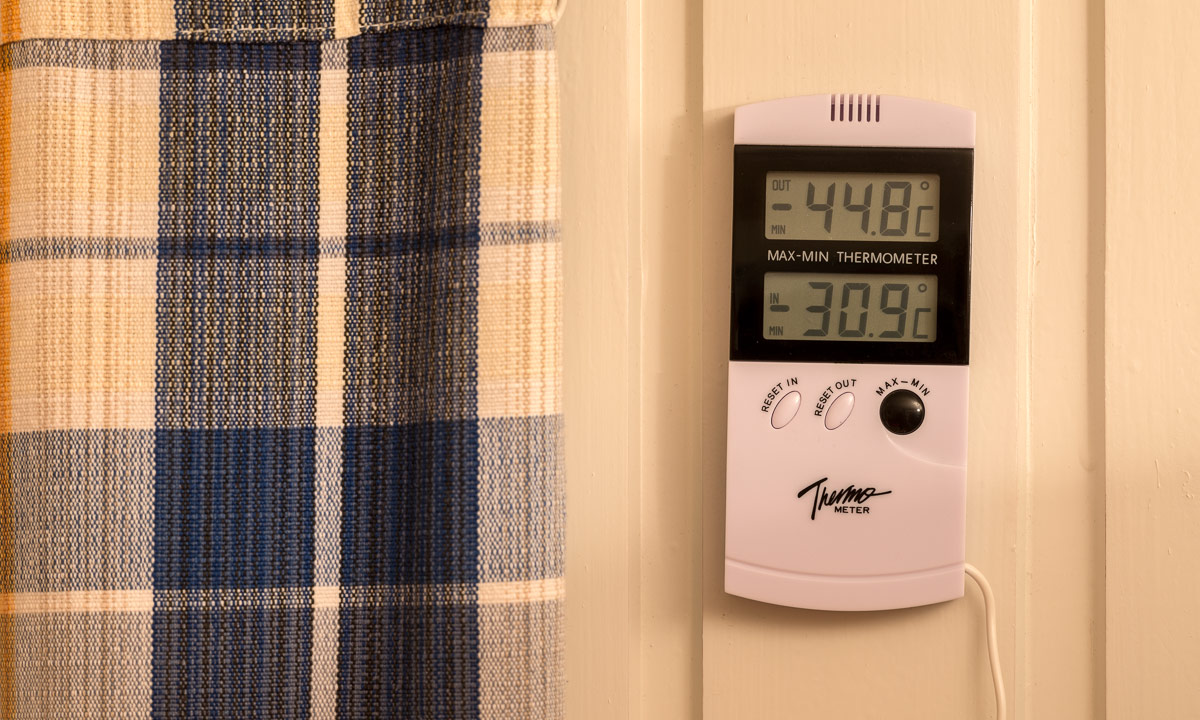
After a long trip I reached Nikkaluokta (many thanks to A. for the lift from Kiruna!) on the evening of the 17th I had one spare day in one of the cosy cabins of family Sarri. This place can be very cold and I had a look at the digital thermometer in the cabin: -44.8 °C minimum since the last reset – brr, that had been a cold day!

I climbed the small church hill and looked west. That’s were I’ll go the next day.

From Nikkaluokta to Kebnekaise Fjällstation

19 February · 19 km · Link to map

Time: 7:40, temperature -17 °C, weather: cloudy. Time to start the tour. I mount my skis, put the belt of the pulka (a sled for transportation) round my hips and after some gliding steps I see the first mark of the winter way to Kebnekaise.

It’s the only mark for a long time, the winter way to the Kebnekaise Fjällstation is not marked, neither on the map nor in real. But it’s easy to find the way, since many snowmobiles take this way and you only have to follow their tracks. Soon I’m at the place where the trail crosses the stream Čievrragorsa. In summer I used the chain bridge, In winter the snowmobile goes right over the frozen and snow covered stream. I can hear the sound of water running underneath the ice – a strange feeling.

After some kilometers I come to the lake Láddjujávri. Here you can eat waffles with cloudberries or burgers at “Lap Dånalds” and even take the boat over the lake to shorten your trip a bit. Well – in summer …

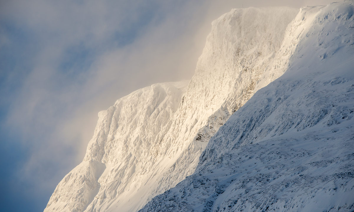
Hardly imaginable that I took a bath here six month ago on a hot summer day, when I was here with Annika. Not it’s winter, all is closed down, the boats lie on land and are covered with snow and I’m completely alone. Anyway it’s not too cold and I take a first rest on my tour. Without waffles, without a refreshing bath, but with the same beautiful view as in summer, since the sky starts to clear up and one mountain top after the other starts to get free from clouds, fogs and haze.

When I continue my tour over the ice of the frozen lake I soon can see the same mountain range as I did in summer. And it’s as beautiful as in summer, too.

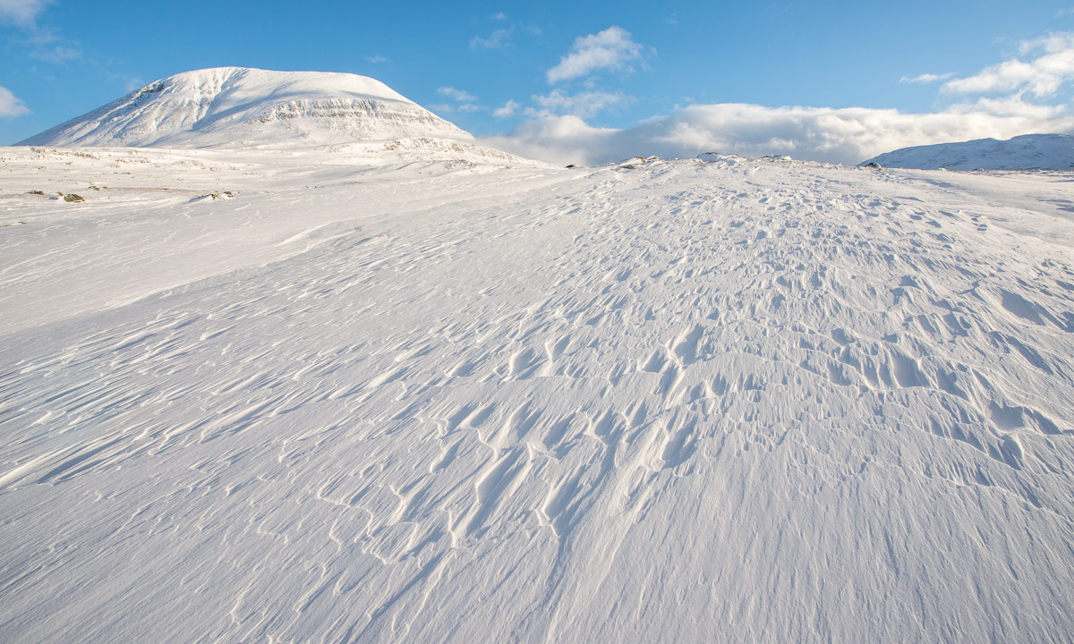
After some kilometres the trail leaves the lake and continues through scattered birch forests and over frozen swamps, some of them covered with ice. The weather is fine and sky is of a clear blue with some clouds.

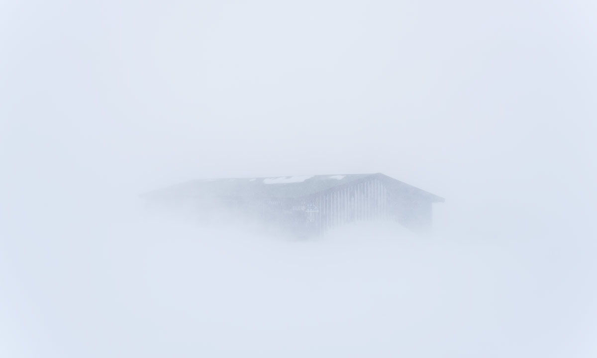
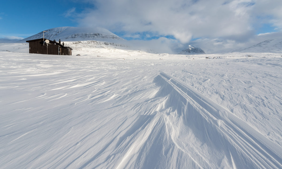
Another rest, this time on top of a rock, with hot tea, chocolate, and a bit of salami. What a beautiful day! I could sit here for hours, but I shouldn’t. I have to reach the huts of the Kebnekaise Fjällstation. I do reach them, but before that I have to work. The trail ascends and I have to make wide V-steps with my skis to be able to pull the pulka uphills. Finally I arrive. This mountain resort is quite huge, since Kebnekaise is the highest mountain in Sweden and very popular among hikers, skiers, and climbers. Anyway it is not opened yet beside of the cabin Jägarn (“the hunter”). Here I’ll stay overnight before I’ll continue to the Singistugorna the next day. Twice I climb on the small hill with the radio mast, first after sundown, then at half past six – where I see the first polar light of the tour.

From Kebnekaise Fjällstation to the Singistugorna

20 February · 14 km · Link to map

When I wake up sky is blue again and -17 °C. I take a short breakfast with muesli and prepare for leaving. That means: packing all things – doing the dishes – cleaning the kitchen and my bed room – checking that I have everything with me – putting on skis and pulka belt. Meanwhile the sky is overcast and it has started snowing. Weather can change quickly in the mountains.

After I have walked some kilometres it clears up a bit, just so much, that you can see some mountain tops shining through the hazy fog.

When I enter the narrow passage of the valley the mountain tops hide again, which is a pity. The mountains here are so beautiful.

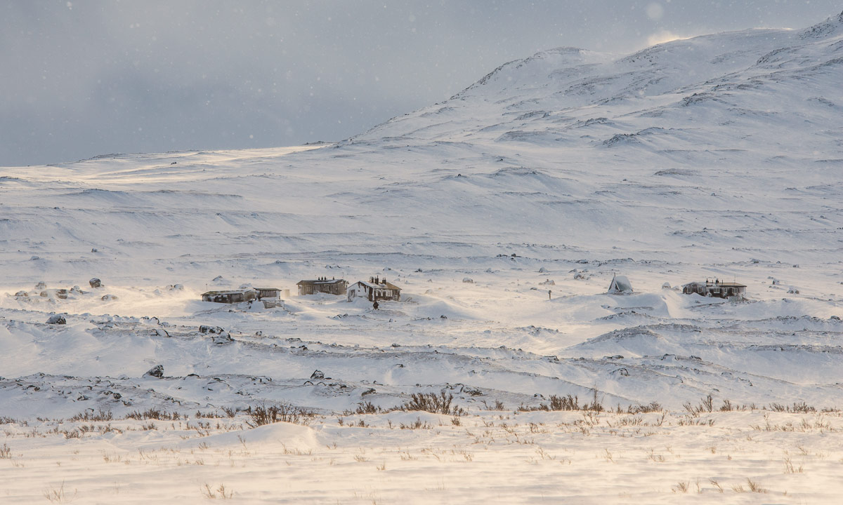
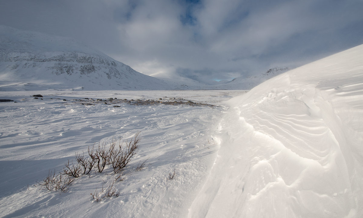
There is not much snow in the mountains this winter. Parts of the marked winter way lead over stony passages with no snow at all. I have to go round these passages to avoid ruining my skis and pulka. Mostly I follow the snowmobile tracks, hoping that the locals know the best way.

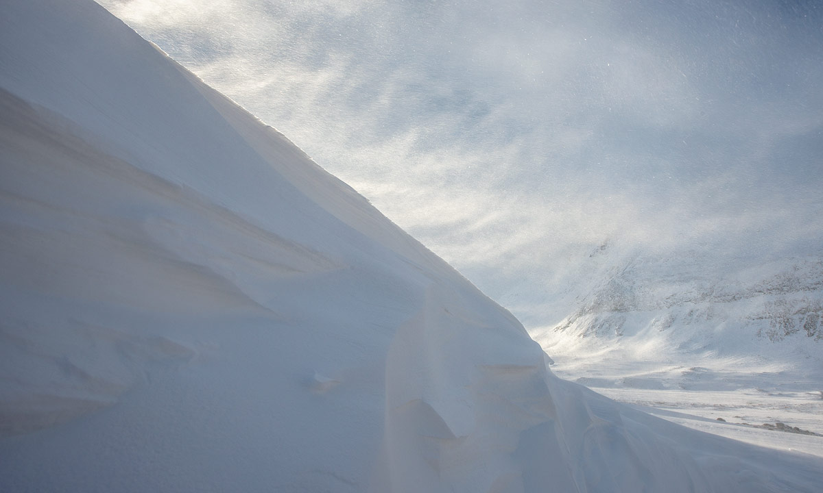
This way leads over the frozen river, but sometimes it’s hard to see, since the snow under the overcast whitish-grey sky don’t show any contours. Wind increases, snow falls as well and the snow starts to drift in the increasing wind. In the narrow valley between the mountains Siŋŋičohhka and Liddubákti more snow lies on the ground which makes it easier to ski but worse to see.

That’s when you are really glad about the winter way marks: Red crosses set on long poles. Sadly plastic crosses are used nowadays. They are ugly, in my opinion harder to see and many of them are broken. But I’m glad to have them anyway. They do not only show you the way, they help you even in guessing whether it’s going up or down, which you cannot see, if visibility and sight are poor.

I always have compass and a good map with me on such tours. Anyway, if you cannot see any landmark these tools are of limited help if you do not count steps or know how fast you are on your skis. That’s when a GPS can be very handy. When I make another rest, longing for the mountain huts Singistugorna, the GPS revealed, that it’s only 970 meter to go. Easy!

Well, not really. The valley opens, wind increases and there are many rocks and snow-free parts on my way. I decide to circumnavigate a steeper passage and ski a bit to the right. To my big amazement I don’t go down but keep on level. Suddenly I feel part of the ground collapsing a bit and realise that I stand on the rim of a soft snow drift, about two meter high. It was absolutely impossible to see it. I’m lucky, that I didn’t fell down! I go back and circumnavigate my circumnavigation until I’m on the marked trail again. There I can see the cabins shining through the drifting and blowing snow. It takes some time to find a good way down to Singi but finally I arrive. Here the wind seems to be even stronger and the snow falls even more intense.

Stugvärd J. shows me my room, light fires in the ovens of the kitchen and my bed room and allows me to take my pulka inside since I’m the only guest. After doing some work he leaves and heads to his own cabin against hard wind and snow.

According to the forecast wind will increase even more and snow fall round 20 cm are expected. I’m glad, that I have time and plan to stay at least one other day in the Singistugorna, perhaps two.

The next article: Singi – from blizzard to clear sky >>

Winter journey in a nutshell

It snowed in Skelleftehamn tonight. It’s hardly a secret, that I love winter, snow and coldness. In Skelleftehamn however it would be too warm, because the Baltic Sea is near.

Therefore I decided yesterday to take a day off today, take camera and car and travel towards winter. In the inland the climate is colder and hopefully there would be more snow. I started at 6:45 in darkness. The first part was no fun to drive. Road salt is used on the big road to Skellefteå and the road further west. With temperatures slightly below zero you always have a film of muddy saltwater on your windscreen while the wipers still are partly frozen and will not work properly. That in combination with approaching cars with bright lights makes it hard to see and much concentration is needed.

That instantly got better when I left the big road 95 (that would bring me to Bodø in Norway) right after Jörn. The smaller roads are covered with ice and hard snow – much easier to drive and the windscreen stays clear. And it looks much more like winter than a wet road. And while in Skelleftehamn even the duck pond is open, here the lakes and some small streams are ice and snow covered.

I continued the road and drove to Storklinten, a small ski hill. Well, it wasn’t so interesting yet with only round about 10 cm snow, but the lake nearby – Lill-Klintträsket – was really nice. It started snowing and the tree covered hills farther away seemed to vanish into a white nothing.

The way to Storklinten is a dead-end road and I had to return. I continued the larger road to Myrheden looking for motives. And I found one. The small river Ålsån:

I was glad I had my chest waders with me, so I could come quite near to the motive. And there were a lot of motives this day. For example reindeers. The first small flock was extremely shy and cautious. It didn’t dare to pass my car and left the road starring at me suspiciously from behind the small trees. You can see that they digged for food in the snow, the noses are snow covered and one of the reindeers even had a twig hanging in its antlers.

Further on the road: Town signs with funny looking names (there was even a village called Hej, which is Swedish for hello), more snow covered roads and trees and two extremely well educated reindeers going beside the road in single file.

I’m looking for motive especially, where there are crash barriers beside of the road – there the street will probably cross a river or a creek. Some of them are open, many broader ones with less current are already covered with ice. And on one of them – far away – I could see a reddish animal and some dark spots. A fox? Birds? I looked for the next parking opportunity – sometimes a real challenge – and walked back.

I was right: There was a fox. And some kind of skeleton, perhaps a roe deer or a reindeer. And some crows. And an eagle! It doesn’t happen often, that I see eagles nearby where I live. I made some photos with my tele lens. Zooming in I could even see some magpies hopping around hoping for a snack. The scene was much too far away to get good pictures, but anyway, I want to show you this one:

After a while I started to get hungry. My car too; the red R-lamp has been glowing for a while. Anyway, the town Arvidsjaur, todays destination, was not so far away anymore. As people in former days first fed their horses before eating themselves I first tanked my car with E95, then myself with beef, mashed potato, mushroom sauce and salad. Then I looked around in the city which I think is really nice. Especially in winter with snow – round 20 cm today.

Even if the “real winter” is not here yet the days are already quite short: Sunset in Arvidsjaur was a quarter past two! At three o’clock I started to use the car’s full beam, half an hour later it was quite dark. Time to head home. I couldn’t see any motives any longer and I navigated to the main road. Now driving became exhausting again for a while since it started to snow quite heavily. And if you use full beam while snowing you just see a tunnel of snow flakes swooshing towards you. It’s a big like old televisions science fiction series, when the spaceships activated their warp-drives. And as in space there is no up or down. The second photo may give you a faint idea.

Luckily the snow shower ended soon and the rest of the trip was just about coming home.

400 km and 500 meters – 11 hours 30 minutes – a straining but great one day trip winterwards.

Back again in Skelleftehamn: Snow is gone, it’s pitch black and it’s raining cats and dogs.