Polar expedition AeN JC3 – day 9: P5, the first ice station
This article is part of the series “2022-02: Winter cruise KPH”.
Day 9 · 27 February 2022
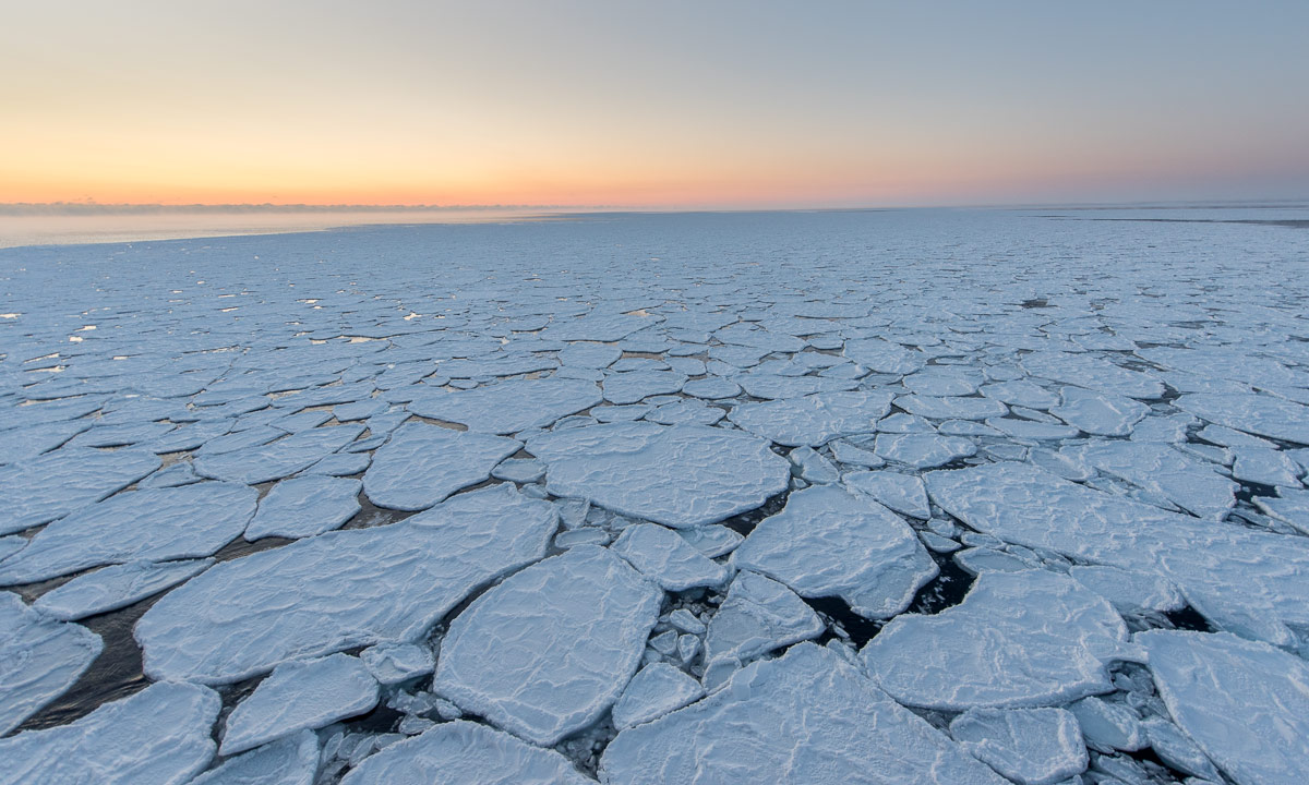
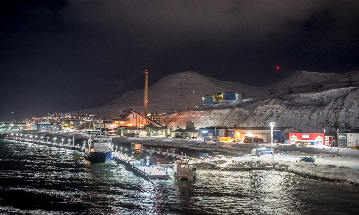
Yesterday we have arrived at P5, our first ice station. In the night the ship left the ice for some plankton nets and trawl. Today morning it carefully moves back to the chosen ice floe. After breakfast the activities on the ice will start. A station with a tent quite near the ship, another one some hundred metres away and A. and B. who do transects of ice and snow depths will wander around somewhere. (A transect is a path along which a series of measurements of the same type is performed.)


A lot of people will be on the ice but not me. The meeting of the previous evening revealed that I will not the enter it today and my status for the next day (tomorrow) is “additional”. Although I understood that the cruise leader did not want to send all people directly onto the ice – especially since it is not very thick – I was disappointed.
After the meeting I tried to ask the cruise leader for the reasons but I communicated quite demanding and stressed her unnecessarily. Today I apologised to her. Even while I write this article I am ashamed for my behaviour. That was not my best hour.
Today I will be involved in the ice station anyhow, but from the ship.
Polar bear watch
Here in the northern part of the Barents Sea we are in the habitat of ursus maritimus – the polar bear. These animal are threatened and need our protection. At the same time they are dangerous and we have to protect ourselves. So the most important thing – both for humans and polar bears – is to avoid encounters on the ice.
That’s where the polar bear watches come in.
Before anyone may enter the ice already three polar bear watches stand on the bridge on deck 8. Each watch has a segment of ca. 150° to watch so that the segments overlap. Than the polar bear watch will have a single task for one hour: constantly watching the segment – with and without binoculars. As soon as a polar bear watch discovers a polar bear on the ice he/she uses the handheld VHF, a two way radio to make a radio call, for example “Polar bear at 10 o’clock, 1000 metres, moving to the ship”. All team leaders and ice bear guards and the cruise leader have a VHF as well and can discuss plans that mostly will result in leaving the ice.
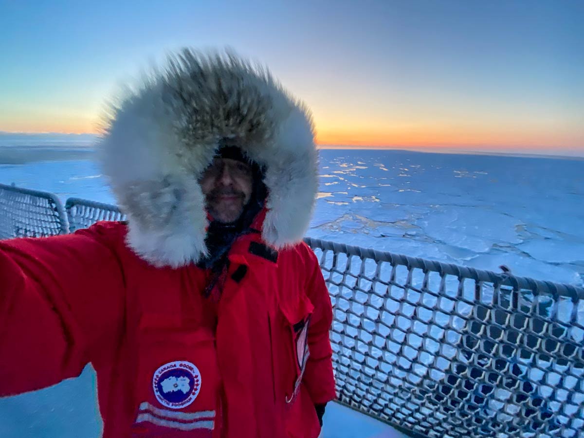
Today I will have three polar watches. 9:30, 12:30, 14:30 +2h. Since I know that this task is very important I am quite nervous while I walk up the staircase to the bridge.
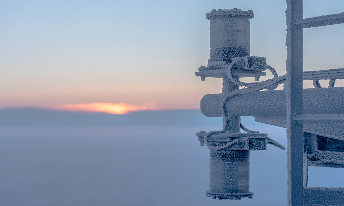
At least the windows that still were salt-encrusted from the storm two nights ago are cleaned. Good for the visibility.


The VHFs are also used to sign in and out people on the ice. As soon as someone enters it a call is emitted: “Bridge, bridge, this is A. B and C on the ice”. The same procedure when people are back on the ship. The person in charge is also on the bridge and will move magnets on a chart to keep track. A bit like a non-magic version of the Weasley Clock in Harry Potter. (Thanks Annika for this metaphor!)


At 9:30 I start my first watch at the port side of the ship. It is a good beginner place because it is farthest away from the ice stations. For one hour I constantly scan the ice from the open water at the stern to the ice at the bow. Sometimes I use the binocular and scan the horizon, sometimes I use my naked eyes to get a better overview. Sometimes I look down to the ship. Some of the ice floes look like polar bears but first they do not move (and soon I know them by heart) and then polar bears are not of this cold blueish white but more a yellowish, creamy colour.


These photos I made after my watch. My job is to watch the ice, not to take selfies for this blog or mobile photos through my binoculars. Yes, I use my own, because I love them more than those on the bridge. I realise that I own these binoculars for almost 40 years. The oldest piece of equipment I brought on this polar cruise.
The biggest challenge: Do not think! Don’t follow your thoughts. Because then you may still look through the binoculars but without paying attention. The 59th minute you do the same as in the 1st minute. Watch the ice. Watch the ice. And again, watch the ice!
So that’s my day. Watch the ice. Take a nap. Eat lunch. Watch the ice. Relax. Watch the ice. Fight tiredness. Eat dinner. Until …
MSS casts on the sea ice
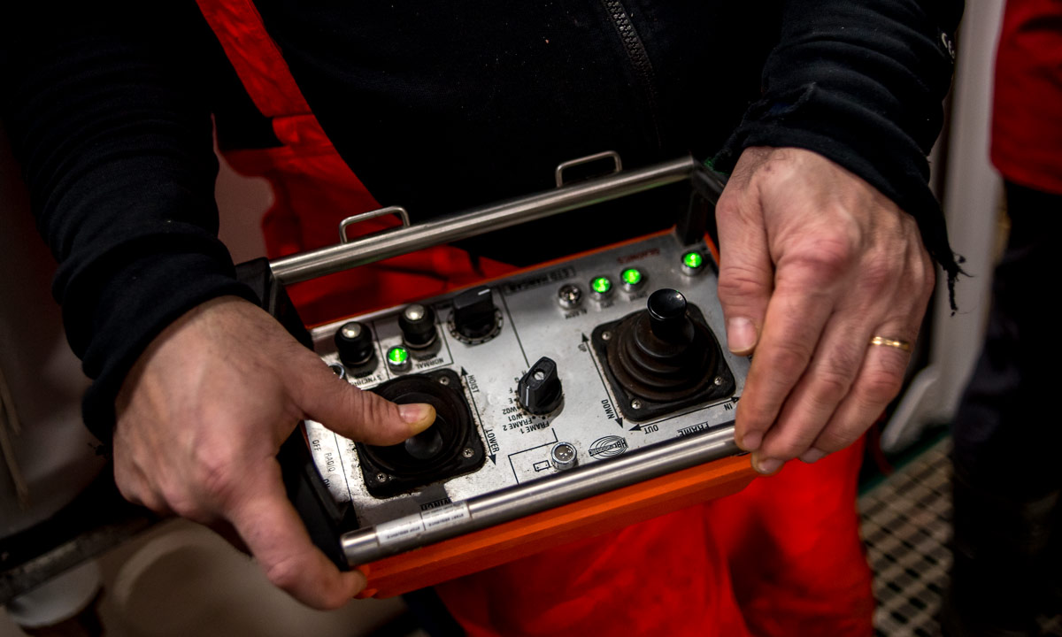
… the cruise leader comes to my chair while I am eating fish, potato gratin and beetroot. She asks me if I was ready to go on the ice at seven. Tomorrow? No, today. What? I mean, of course! I shall follow Z. who will do three MSS casts to measure CTD (conductivity, temperature, depth) and turbulence in an ice hole. I shall dress very warmly. The first opportunity to be on the ice and see how this measuring works. Wow!
At 19:00 I stand outside on the deck waiting for the others. I have to stand outside because I’m dressed in two layers of wool and this non-breathing Regatta suit and I already started sweating while changing clothes.

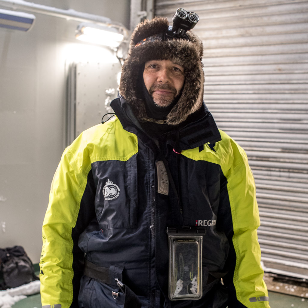
Half an hour later the snowmobile has left me at the green tent. Officially I only got 30 seconds for taking photos – every extra minute will extend the observation time of the three polar watches – but since Z. has to do some preparations I have some minutes to take snapshots in the dark. And to feel very happy.


Then it’s my turn to help. While letting down the MSS needs some experience pulling up is just some mechanical work. Z. did the first one, I do the two others. Z. observes the computer display and signals me when I shall slow down. All I have to do is winding up. Easy work and time for a chat.
After the three measurements Z. is content and calls K. to fetch us with the snowmobile.


This activity from ship to sea ice and back to ship took less than an hour but I will never forget it. Standing in the dark on the ice of the Barents Sea on a place nearer to the North Pole than to my work town Tromsø is just impressive and I feel that I have a strong relation to it.
Next time however I will dress less warmly. It was only -15 °C outside and I had too much clothes on. Alone the Regatta suit is warm and the tent was heated to protect the sensitive electronics.
And you? If you had such an opportunity would you take it or do you prefer warmer locations?
And to those of you who have such an opportunity for me: contact me asap.