Grønnlibruna and Petterbolhaugen

It’s Sunday. Weather forecast looks very promising and I want to go out hiking. I scroll through my tour book and the net and cannot decide. Finally I just grab my stuff and the book and take my car to Kvaløya where I mostly use to hike. I’ll find something.

While driving I remember the small mountain Grønnlibruna where I’ve been already in November and May. There’s a lot of birch forest in the first half of the hike – perhaps a good place to be in autumn. I drive to the place where the tour starts and park my car.

The sky is covered with clouds and clouds flow through the valleys as well. But the yellow birch leaves of the forest I’m hiking though shine colourfully.

I reach the top of Grønnlibruna. Although it is only 401 metres high I am above the tree line. I continue to a smaller hill in the southwest to enjoy the autumnal colours. Later I’ll learn that it has a name: Petterbolhaugen. I reach the top and just in this moment the sun comes out. It already had started to illuminate small parts of the impressive mountains but now it shines on my face.

The weather become sunnier and sunnier and the views on the mountain panoramas are beautiful.

Many trees have lost already many leaves and even tiny puffs of wind take more leaves with them. Soon the colourful autumnal tinted forests will transform into grey collections of bare trees. Then I will hope for the first snow. But today I collect the colours – for the blog, my memory and my soul.

Thursday paddling – from dusk to darkness

It is 29 September and it is Thursday. Time for torsdagspaddlingen – Thursday paddling – with the Tromsø Sea Kayakers Club.

As usual we meet between 5 and 6 o’clock pm to prepare the kayaks, put on our drysuits and life vests and listen to the tour leaders about the plans for today. For several weeks there has been another thing to think of: attach lights to the kayaks and the life vests to be seen. September equinox has been one week ago and it starts getting dark quite soon. Today we are lucky: It is high tide and we don’t have to carry the kayaks more than a few metres.

We are 23 people. 7 will follow the shore to the beach of Telegrafbukta, the others including me want to paddle to Lilje Grindøya that lies behind Grindøya. I’ve never been there. Round 18:00 we sit in our kayaks. As soon as all are on the water we start our tour.

Before we reach the island Grindøya one of the tour leaders lifts the paddle vertically in to the air. That’s the sign for gathering.

Plans are changed. Lilje Grindøya is quite far away and the waves on the sound we crossed were a bit higher than expected. So we head for Grindøya instead.

It it warm and calm. 16 kayaks lie by the beach. We sit our stand around. One paddler passes around homemade cake, another one lights a cosy fire on the sandy beach. Hyggelig!

While we are eating, chatting or taking pictures it is getting darker and darker. The kayaks are hardly visible anymore and in the distance there are the lights of Tromsøya and Kvaløya.

After half an hour it is time to set off and paddle back to shore.

While crossing the sea again I didn’t take photos for three reasons. All of them were related to the darkness.

First:  we want to stick together to be seen and to know we are all there. There may be ships crossing and then you do not want to have a stray paddler around. So I cannot just let the others go to take photos.

Then: my waterproof camera is – well – waterproof but it hardly can take photos in the dark. Even with a better camera it is difficult. Did you ever try to make long exposure photos while sitting in a kayak?

Finally: the waves! The kayak I use is stable as a truck and on our way to Grindøya I didn’t care about the waves a lot. Now it is quite different. I can see the waves because of the reflections of the city lights. But I cannot see how broad, how steep or how high they are. So I have to react by instinct which I don’t yet have. It’s a first time experience and a slightly weird one.

While we are approaching main land the other paddlers come into view. Or better said, their lights. Two of the other kayaks are not illuminated and completely invisible. We take a long turn to the left and follow them. Some of us almost collide with one of the jetties. Everything that isn’t illuminated comes into view at the last moment.

I’m a bit sad because this is the last Thursday paddling this year. Probably we won’t start with it again before end of April. Hopefully there will more kayak opportunities in daytime over the winter.

At 20:15 I  come ashore. Again I want to say to all fellow paddlers: takk for turen! Thanks for the tour!

The first frost – hiking tour on the Laukviktinden

Today was the second day, where my car was covered with ice in the morning. I had to scrape ice after breakfast because I wanted to drive to Kvaløyvågen on the island Kvaløya to hike up the Laukviktinden (587 m) today. The weather was calm and the sky was blue and I enjoyed the views on sea and mountains from the car.

When I passed the shallow bay Finnvika I just had to stop and go there. Large areas were covered with a thin layer of ice that sparkled in the sun. Autumn in Tromsø is a fast season. Last weekend the trees were colourful, now many of them are bare.

20 km later: I just parked my car by the sea and read the tour description. I should follow the road for 80 metres, take the gravel road to the left and leave it when it turns left. The rest of the tour would be pathless but according to the book easy to find.

When I left the gravel road the terrain was a bit tricky. It was more or less overgrown boulders with hidden holes. The trees had shed their leaves and almost looked dead. I was glad when I had reached the mountain ridge where it was much easier to walk. The wet moss was covered with frost and so were the water puddles. Laukviktinden came into view, but I knew that there would be an acsent before. It looked pretty steep. Hopefully it’s just the perspective.

And indeed it was less steep than expected. A bit tricky however because some parts were wet and slippery. And that one of the countless moss pads hid a knee deep water puddle was not nice ;-) ! It is always a satisfying experience when you gain altitude, are above the tree line and can see more and more – both fjords and mountains.

Just straight ahead I spotted the lake Laukvikvatna and its neighbours. They lie 50 metres below. So I first had to climb down before hiking up again. Most of the lakes were covered with a thin layer of ice.

From the lake it is only 200 more metres in altitude to the top – according to the tour book. That meant that most of the the ascent lied behind me. It was easy to go up, only the very last part was a steep boulder field. Probably not the best routeI chose, but that was hard to see from below.

The terrain flattened out and then – all of the sudden – I could see the summit marker: A huge pile of stones with a metal box containing the summit book. And behind that: The open sea with the island Vengsøya.

What do you do on mountain summits beside of adding your name to the summit book? Yes – you take a selfie! After that I went a bit further to a place where the terrain drops off steeply. Here the view was really impressive because I could not only see the open sea and its islands but the bay Laukvika and even the boggy marshland that looked like it was directly under my feet. Here I took my iPhone as camera because it has a wide angle lens.

I took a break, ate some cookies and drank water. I even met another hiker that probably hiked up twice as fast as me. Then I started my way back. I found a better way because it is so much easier to find a good path when you look from above. Later my optimism was dampened when I landed in quite steep terrain and had to traverse it a bit until I was on my old trail.

Round 9½ km later I reached the gravel road again. In the shadow the ground was still frozen, but the car that waited in the sun was warm.

Aurora Lightshow in Tromsø

Hooray – finally the polar light and I were awake the same time!

It’s not the first polar light this season. But either there were clouds or it vanished when I was at the bay Telegrafbukta for taking pictures or I just slept. Today however I was lucky and was at the right place at the right time.


10 days in Scotland

This article is part of the series “2022-10: Autumn in Scotland”.

It has been years, since Annika and I were on holiday outside of Fennoscandia. This October we enjoyed a ten day journey to Scotland from which I just arrived in Tromsø yesterday.

For this article I chose 2 photos for each day. Some more articles will follow later.

6 October – Edinburgh

I landed in the late morning and have the rest of the day strolling through Edinburgh. Blue sky – so it can actual stop raining in  Edinburgh ;-). In the evening I wait for Annika who is taking the tram from the airport. Now it is raining. Finally we are together.

7 October – travelling to Ullapool

We have pre-booked train tickets to Inverness where we will spend three hours before taking the coach to Ullapool. Well, in theory. The trains do not go the whole way due to heavy rain flooding. The rest is operated by replacement buses. So much to rain in Scotland. In Inverness we catch the connecting coach to Ullapool and have even time for a pizza.

8 October – hiking in Ullapool

After two travel days we want to be outdoors and look for the hiking trail to the hill Meall Mor after a hand-drawn sketch. We find it. From the top we have a view to the town, the hills and mountains in sun, clouds and rain.

9 October – taking the ferry to Lewis

After breakfast we take our backpacks through rain and heavy winds to the ferry terminal just to learn that the ferry has been cancelled because of the gusts on the Minch – the straight between Ullapool and the Isle of Lewis. Luckily the afternoon ferry runs according schedule and we arrive in Stornoway at nine o’clock. Scotland premiere: We hire a car. Annika is driving. Left-hand traffic in darkness!

10 October – exploring Lewis

We explore Lewis by car. Great that Annika is brave enough to drive in Scotland (I’m not). Read the article The west coast of Isle of Lewis about this day.

11 October – Peat bogs and Northern Gannets

From Gearrannan Village we take a small way back to Stornoway. In the bogs you can see traces of peat mining. We give back the car, take the ferry back and are watching the elegant aerial manoeuvres of the Northern Gannets. In Ullapool we receive another car that we have hired for the next two days.

12 October – exploring Assynt

We start exploring Assynt, the region north of Ullapool. Read the article Stac Pollaidh about this day.

13 October – taking a bath

Finally – our first bath! At Achmelvich beach. I will write more about this day later …

14 October – travelling to Edinburgh

It is time to give back the rental car and travel back to Edinburgh. First by coach, then by train. This travel confirms my theory that Scottish coaches and trains are designed solely for transport, not for comfort.

15 October – flying back

Short ones, long ones – all holidays comes to their end. Annika takes me to the tram, again it’s me travelling first. What a wonderful holiday. Thank you, Annika!

Scotland: the west coast of Isle of Lewis

This article is part of the series “2022-10: Autumn in Scotland”.

It is 10 October.

Yesterday evening we arrived on the Isle of Lewis, took the reserved rental car (Annika driving) and stayed in the Ravenspoint Community Hostel. Today we want to go by car to explore the west coast of the island.

We do not meet a single person while taking breakfast. We succeed in not raising fire alarm while frying eggs, we pack our backpacks, revert our personal rearrangement of the beds in our twin room and get in our small car – a Kia Picanto. While Annika has been in Scotland much more often than me it is our joint premiere in exploring this country by car.

After taking a detour to a small beach at Tobson we continue to Callanish Stones, one of several arrangements of menhirs. Although yesterdays gale has subsided it is still very windy with some showers of rain. My challenge as a photographer is not only to keep my small Sony dry (first photo is an iPhone photo) but also to take pictures while a large family uses the standing stones for playing hide and seek.

We make a stopover at Doune Braes Hotel for lunch. There we spot the standing stones again – as a colourful leaded window, animals included.

Next stop: the Gearrannan Blackhouses, a village of thatched cottages that was inhabited until 1974. Now it is not only a museum but one of the cottage is a hostel, where we check in and reserve a bunk bed. We have a look at the museum, where a local shows his expert knowledge regarding weaving looms. The view of the coast from the village is quite impressive. The waves are high and smash surf and spray against the rocky cliff.

Now we continue the road north to the headland with the catchy name Butt of Lewis. When we arrive there I’m really flabbergasted. Neither Annika nor I have ever seen waves breaking so high as here at the northern tip of the Isle of Lewis. Extremely impressive, a bit daunting and also a bit wet because sea spray seems to be everywhere. Keep in mind, that the rocks in the next photos are round 10 metres high. Thanks, Google Earth for your elevation data.

It takes some time until I can tear myself away. Next we head for Port of Ness, a harbour village nearby. The sandy beach is broad and shallow. Huge waves roll ashore. While they are breaking the wind gusts blow the spray away – a fascinating view. I decide that today is just not the day to take a relaxing bath in the Atlantic ocean.

We return to our parked car and drive back to our hostel – part of the Gearrannan Blackhouses. The museum is closed and it looks like we are completely alone in our cottage, that can host 13 guests. While we boil water to cook pasta we still can hear the waves splashing ashore at the rocky coast round 100 metres away. After dinner we fall fast asleep . Stormy weather is exhausting, and so is left-hand driving. So, thank you, Annika, my luv, for driving us.


Sleet weather in Tromsø

Last night I was woken up my a crackling noise. I peeked out of my front door – everything was white. It was however not snowing but sleeting heavily and the ground was covered with zillions of small snow pellets.

This morning more sleet showers crossed Tromsø. I took a short promenade to the coast where the beaches where covered with snow pellets as well.

I would have loved to take the car to Kvaløya to places where it actually was cold enough for real and dry snow but my car still has summer tyres. I’m even not sure if I can make it to the appointment for tire change in two days or if the streets are too slippery to get there.

So I did not get real winter snow today but at least I spotted the first snowman. Or should I write snow pellet man?

Later the day sleet turned into wet snow with the result, that the streets are covered now with 5 cm of wet slush.

Scotland: Stac Pollaidh

This article is part of the series “2022-10: Autumn in Scotland”.

It’s 12 October, day 6 of Annika’s and my Scotland holiday this autumn. Today we want to hike round the Stac Pollaidh – or “Stac Polly” – a mountain in the Assynt region of the Northwest highlands. Its twin summit is quite prominent. We start our tour after lunch, where weather was supposed to get better. (And it was.)

Slowly we start hiking up following the excellent cobblestone path.

Technically our tour follows a circular path round the summits, but it climbs up almost on level of the east summit. The west summit is round 80 metres higher and needs a certain amount of scrambling and mountaineering experience that we lack.

It is still cloudy, but the sun starts to peek more and more through breaks in the clouds. Quite soon the views are impressive, from hazy tones of dark grey against the light to circular views that seem to cover the whole Assynt region. Harsh mountain tops – nunataks in the ice age – hilly landscapes – countless lakes, and to the west: the sea.

The ascent gets a bit steeper, the cobblestone path zigzags up the mountain. The passing clouds constantly change the landscape’s appearance. Again and again I have to look back for the views.

Finally we arrive at the junction to the east summit. It is not far to climb it and it rewards with a scenic 360° view, only interrupted by the higher west summit. Stunning! Me meet a local that shows and names all mountain massifs and tops around. Wind increases and we are pretty glad about our windproof clothes.

It’s hard to leave this beautiful place but finally we leave the summit and walk back to our circular route. The first part is near perfection, then it gets quite muddy and slippery. But the views are still awesome.

The more we loose elevation the more we approach our starting point. We can see the harsh rocks of the west summit and partially hidden behind the east summit that we just had visited. The sky is bluer than and Stac Pollaidh looks friendly. Other mountains in directing sun however look sombre and almost hostile.

We reach a last sheep gate and shortly after arrive at the parking place.

Two photos in portrait format – they never blend in with my other landscape format photos. The first is from the ascent, the second from the descent.

Shortly after we have arrived at the car it is starting to rain. Wow, that’s perfect timing! And beyond that it rewards us with one of the most durable double rainbows I ever saw. Intensely it is shining for more than 40 minutes while we are driving to our hostel in Inchnadamph. Even when it gets dark the sun still is illuminating a cloud blanketing a mountain.

Along with our day on Isle of Lewis’ west coast this day is definitely one of my personal highlights of our holiday. Thank you Annika for planning the tour and sharing the experience!


Sandnessundbrua

Last night I dreamed I would go on an arctic expedition today. The ship would depart at 16:00. I was surprised in my dream that I almost forgot and started packing. Three pairs of socks … then I woke up.

Today I went paddling with some members from the Tromsø Sea Kayakers Club. We were six people from five countries. It was cloudy, a bit rainy and +2 °C. It was calm, hardly any wind or waves. According to the forecast wind would increase and come from north, so we headed north to get tailwinds on our way back.

I never paddled north from the club. As soon as we started to round the airport the huge bridge Sandnessundbrua came into view. It connects the islands Tromsøya and Kvaløya, is more than a kilometre lang and has a maximum clearance to the sea of 41 metres.

I use the bridge quite often when I go hiking on Kvaløya but on sea I drove through it only once. That was 19 February with Kronprins Haakon on our way to the Arctic. Some memories popped up while I was approaching the bridge by kayak but soon I was back in the present and took some photos before catching up with the others.

We continued north passing the airport till we reached the bay Sandneshamna. After a very short break – wind has arrived and it felt cold just standing around – we went the same way back. This time we paddled against the current but with wind in our backs.

After 12 kilometres and 2½ hours we were back at the boat houses. Thanks for the tour! Hope to see you again on the water.

Still in my drysuit I took the car to a supermarket and bought some food for lunch. When I left the shop it had started snowing.

Scotland: wetness

This article is part of the series “2022-10: Autumn in Scotland”.

You cannot deny, that Scotland can be a pretty wet land. There are however different kinds of wetnesses.

Bathing in the sea

This kind of wetness I love: bathing in the sea. Finally Annika and I managed to find a sandy beach that looked very promising for taking a bath. And it was perfect. No stones, no currents, no sharp-edged shells, no waves as high as a house. The water was warmer than expected and it hardly rained.

Rain and muddy trails

We continued our road trip through the region of Assynt and parked our car by the Stoer Lighthouse. From there we took a circular hike to the Old Man of Stoer, a 60 metre high sea stack. It rained and the trail was soaking wet and partially quite muddy. I managed to keep my rubber boots dry but Annika’s hiking boots were soaking wet after our hike. Her dancing experience helped her to change to dry shoes.

Adventurous roads

As the days before it was Annika that drove the rental cars. You don’t want to fall asleep while driving in Scotland. Beside the single file tracks with its many meeting points sometimes the roads are blocked by sheep. The road sign warning of a 25% steep hill however looked much more dramatic than the road was.

Ardvreck Castle

We have passed Ardvreck Castle several times the last days. Now it was time to stop and have a look.

The lake Loch Assynt was flooded and so was the path to the castle. I like hiking in rubber boots which is a bit overdressed sometimes. In Scotland however I think it’s perfect footwear. Here they helped me to wade to the castle to take some more photos, while Annika waited ashore.

Sea monsters

I almost forgot to tell: At the beach of Clashnessie I observed sea monsters! Carefully I sneaked up to one of them and I managed to take a photo as a proof. There are sea monsters in Scotland!

10 cm high sea monsters.

10 cm high sea monsters buried in the sand.

10 cm high sea monsters buried in the sand looking suspiciously like seaweed.

The first winter promenade

Down there, that’s the southern part of Tromsø. That’s where I live when working for the Norwegian Polar Institute.

There are reasons why I see Tromsø from above today instead of working in the office. First of all my wife Annika is here this week. Then it is wonderful weather today. I was able to take a day off today and so Annika and I could fetch the first cable car up to Stor­stei­nen, 421 m above sea level. From there you have a fantastic view on the islands Tromsøya and Kvaløya, the strait Tromsøysundet and many, many mountains.

While Tromsøya itself is free of snow all mountains look wintry on this sunny day. Our hiking tour starts in the shadow and it takes some time until we reach the pre-summit of Fløya where the sun shines on our faces the first time.

From there it is not far to the summit of Fløya (671 m).

It has become windy and grains of snow are drifting over the snow. In the low sun they look like grains of gold.

Although it is chilly we stay on the top for a while, because the wintry landscape is so beautiful. The season’s first snow hike is always something special and I’m glad that I can share it with Annika this year.

Slowly we walk back. On the top it was easy to go, later the path gets steeper and the snow makes the path slippery. The sun stands lower now and the drifting snow is even more colourful.

We find a sunny though windy spot to drink warm juice and eat some cookies, then we head back to the mountain station of the cable car. While sunset is near, the almost full moon that has accompanied us the whole day starts rising again above the wintry mountain chains.

Jämtland tour 22 – the landscapes

This article is part of the series “2022-08: Jämtland and Trøndelag”.

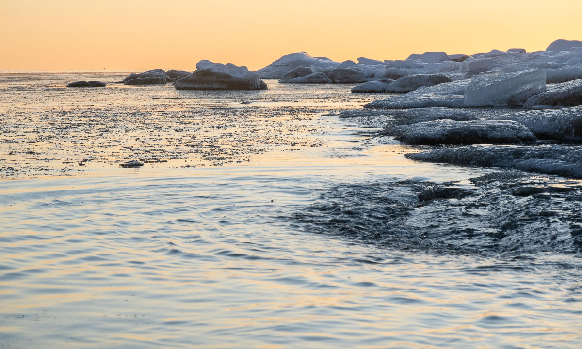
I’m sitting in the train to Umeå. We have a longer stop in Kiruna where the train changes direction. The other trains standing here are cargo trains that transport iron ore from the mines around. Temperature is -10 °C or lower and there are some centimetres of snow covering the ground. Winter finally has arrived in the Swedish fjäll.

I’m so glad to arrive home in Obbola tonight. I haven’t been there since July. Now I’ll stay until Christmas working from home for the Norwegian Polar Institute.

I’ve been however in Sweden in August, too. Not home but for a hiking tour with my sister and family together with my wife Annika.

This reminds me that I almost forgot to publish the last blog article about our hiking trip in the Jämtland. It will take more than seven more hours until I arrive in Umeå, so there’s plenty of time to start blogging now, as long as the mobile net allows. Earlier I’ve written about the cabins, some day trips, the trail and way marks. Today I want to show some photos of the landscape. Let’s go back three months in time. It is late summer in Sweden.

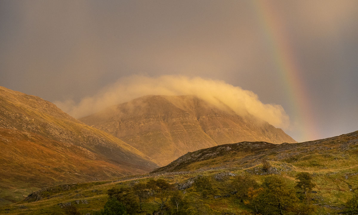
What I love about the Swedish mountains – the fjäll – is its variety. Not only in weather but also in landscapes. In the lowlands there are forests – mostly birch forests – but all Swedish cabins we visited lie above the tree line and here you have a wide view of the mountains, small and large lakes, rivers and streams, bogs and stone deserts. Let’s have a look.

15 August, our first day. The landscape is rising and we have left the forest behind. The trail between Storlien and Blåhammaren leads over many swamps and bogs and is wet and muddy.

16 August. We leave Jämtland and cross the border to Norway. The cabin Storerikvollen lies quite low and we descend through forests of crooked birches.

18 August. Still in Norway we take a resting day at Nedalshytta. I talk a walk along the lake Nesjøen. The water level is extremely low and so I can cross some mud fields that normally are under water. This landscape looks a bit hostile and is not typical for this region.

19 August. Again the terrain is wet and has many small lakes and water puddles. The mountains are hidden behind low hanging clouds.

We start hiking up the Ekorrpasset. Looking back we witness one of the most unphotographable landscapes I know. In reality it is an impressive view of a hilly terrain with uncountable lakes, ponds, streams and puddles. The photos however always look pale, blurred and boring.

Let’s not look back but ahead. The peak of the pass is more than 1300 metres high. That may not be much in the alps, but in these latitudes only few plant can survive these altitudes and so we walk through a desert of stones and rocks. Hidden in between some moss and the flower Ranunculus glacialis.

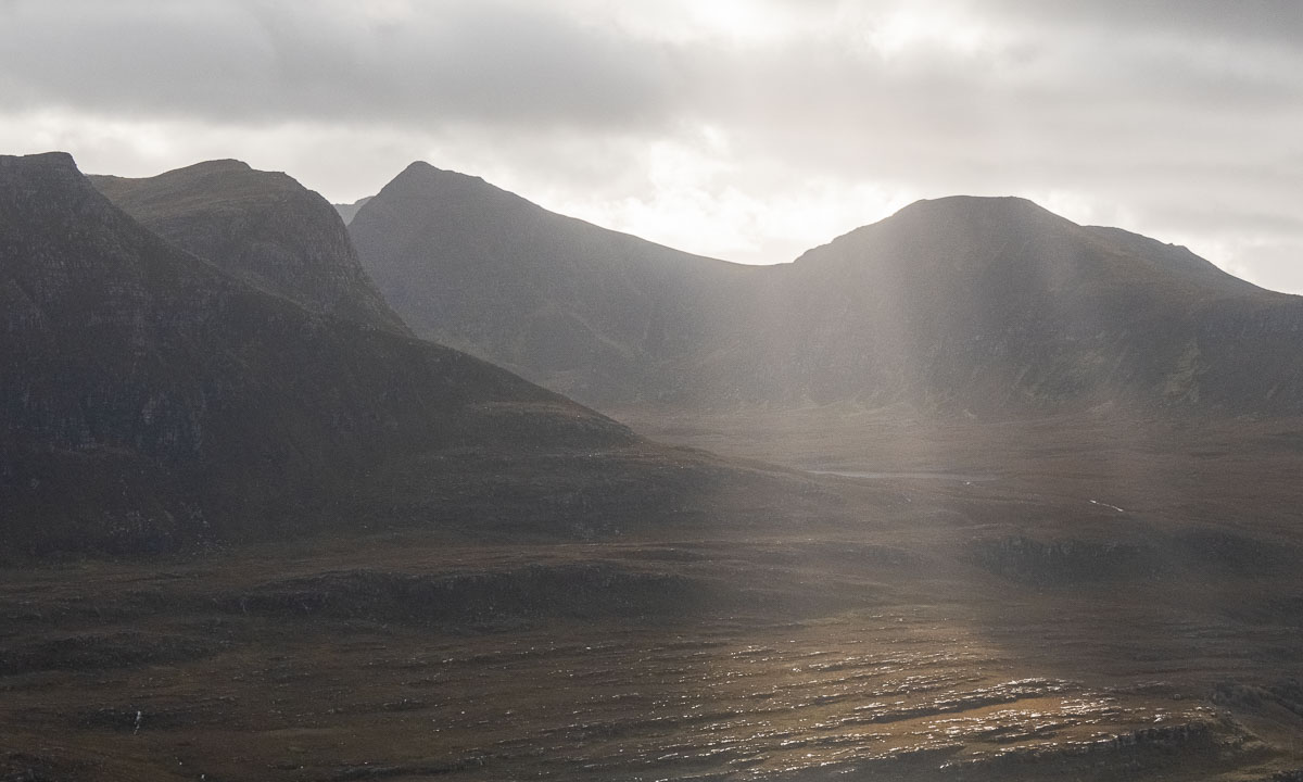
And let’s look aside. We pass the mighty Sylarna massif (1574 m) with its glaciers and rugged rocks. Impressive.

The Sylarna cabins lie lower. Grass and heather cover the ground presenting the landscape much more mellow, especially in the soft colours of dusk.

20 August. We leave Sylarna and continue to Gåsen. For that we have to hike through the valley of the river Handölan. Here we meet birch forests again. And some quite impressive rapids.

22 August. After a resting day in Gåsen we continue to Helags. The landscape is wide and broad. And where it is not too wet there are surely some reindeer around.

24 August. We are on our way to Fältjägaren, the last cabin of our tour. The weather is sunny and we are accompanied by the mountain Predikstolen (the pulpit) which shows itself from some of its many beautiful sides.

In the evening we stand outside watching the sunset and the incoming night. Soon the lakes are the only part of the landscapes visible. The rest is almost black.

25 August. Our last hiking day. On the other side of the valley we can see the gaps in the forests covering the mountain slopes. These are the ski slopes of Ramundberget where we’ll take the bus to Östersund. Back to civilisation.

And back to the present. I’m still sitting in the train. Where am I? Ah – half an hour left to Gällivare. Now I’m longing for a cold and snowy winter. But then I want to change ski boots with rubber boots and go for a hike again.

From Tromsø to Obbola

Friday, 18 November – walking back from work

It’s weekend. Today I stopped working already at 14:15. Sunset was 40 minutes ago and the light is beautiful while I’m walking home.

In Tromsø there’s hardly any snow, but a lot of rime. In the evening there’s polar light, but I only take a smartphone snapshot – tomorrow is a long day.

Saturday, 19 November – taking the bus to Narvik

Today is travel day. Round 16–17 hours it will take me from home to home.

Yes, I have two homes. One “work home” in Tromsø where I work and one “Home home” in Obbola where my wife Annika and I have a house by the Baltic Sea.

The weather is gorgeous and I take many photos through the window of the bus. Therefore some of the motives are blurred. The last one – the large bridge Hålogalandsbron is jittery because it has become dusky.

Saturday, 19 November – taking the train to Umeå

It’s a long ride from Narvik to Umeå. Departure 15:10, arrival 1:40 in the night. But it is a though train. I don’t have anything more to do but being awake on the arrival in Umeå. While I eat my take-away sushi outside of the train station it gets dark and so there is not much to see from the landscape in the train unless it stops.

In the frosty inland where it is quite cold I witness a special phenomenon. The whole forest we are passing is lit in green light. Another aurora? No, it’s cloudy. There are passages where the power lines for the train are coated with rime ice. The layer is so thick, that the current collector of the train looses contact and the electricity jumps over emitting bright green light that illuminates the dark forest.

The train arrives in Umeå in time and Annika already waits at the station. Another half an hour and I’m home home. Bed is waiting!

Sunday, 20 November – winter feelings

Oh, what a blessing it is to be home home. Normally we are supposed to work at the offices of the Norwegian Polar Institute but my boss knows about our long-distance relationship (or is it called long-distance marriage?) and allowed me to do home office until Christmas. Tusen takk! And it is even wintry and a bit sunny and a bit snowy.

From now on I can enjoy the view from my home office.

Monday, 21 November – the first home office day

Enjoying the view from my home office is a pleasure but when all of the sudden the morning sun peeks through the clouds I just have to go outside and make some photos!

And what do I do at lunchtime? This:


Finally it’s sunny again home in Sweden!

After a period of dull and cloudy weather that felt like ages the sun finally came out yesterday. Since I was flexible with working hours in the  morning I could make a small kayak tour.

The first part was easy. Since our house in Obbola is on the coast I only had to change my clothes and drag the kayak from the house to the bay. The bay was covered with ice. As usual I just sat in my kayak and started pushing myself ahead using ice claws. This works surprisingly well until you have a lot of water on the ice as I had yesterday. Although I wore neoprene gloves I got cold fingers. As usual this took some time but finally I reached open water.

It was then that I realised that I had forgot my paddle. Fortunately the bay is shallow and I could leave the kayak, step on the ice and carefully walk back to land to fetch the paddle. Some minutes later I sat in my kayak again ready to circle the island Bredskär. I watched the hooting whooper swans and even four flying goldeneyes, a species of ducks. At the northwestern tip of the island there was a small, slushy ice field, the rest was open water. The big freezing hadn’t started yet. When I reached the eastern side of the island I could watch the sunrise some minutes after 9 o’clock.

The last part of the otherwise calm tour was surprisingly wavy. When one breaking wave came out of nothing and of course directly from the side I was afraid that I could capsize but the wave just lifted me gently up half a metre and down again. I was lucky. Sometimes it’s nice to own a less agile but super stable boat.

Even it was only some degrees minus the kayak was covered with a layer of frost that glittered in the warm light of the sun. I just had to take another photo when I was back on land.

And then? After taking a hot shower I made it to the 10 o’clock meeting. In time!

And suddenly it’s winter

Last Tuesday it got sunny and I paddled kayak.  On Wednesday it got cold and the small sound between island Lillskär and mainland was covered with ice.

Although it’s mid-December and despite temperatures between -10 °C and -14 °C there were still whooper swans around. Don’t they migrate south? In the morning they managed to paddle through last night’s fresh and thin sea ice. In the afternoon the swans had left. Perhaps they finally decided to fly south.

On Thursday it snowed. In the afternoon 10 cm of fresh snow had fallen and everything was white and bright, even in the night.

On Friday Annika and I had a day off and visited friends in for a long weekend. They live in Kusfors in the inland, round 180 km north. On the way there and there we found more winter. It was not very cold but it snowed quite a lot. I took some images from the car while Annika was driving.

Yesterday on Sunday we came back to our house in Obbola round 20:00. Our property was covered with 45 of fresh snow. Since it had been sub-zero all the days the snow was pretty fluffy. We had to do quite a bit of snow shovelling – but after taking a photo.

Today it’s Monday and a new working week has begun. I had a lot of meetings today and therefore no time to paddle kayak. Oh yes, the kayaks … where are they? I know they lie beside the wooden terrace. Here they are, well hidden under a thick blanket of snow, right beside the window of the winter garden.

But there are other things to do as well. For example opening the afterwork ski season in Olles Spår near Umeå together with Annika. The snow is still soft and the cross-country skiing trail still slow but the first time of skiing is always special and we are happy and grateful that we live in a place where winter is around us.

Now it’s half past nine in the evening and I’m blogging. Snow is falling and the thermometer shows -9.5 °C, the same temperature as the last hours.

And you? What kind of winter do you like? Or do you prefer other seasons?

Break at work I – island hopping

The Baltic Sea at Obbola has hardly a tidal range. When we get high water or low water it’s mostly due to the wind. Today we had gusty wind from north that let the air temperature of -12 °C feel much colder and to a sea water level of 70 cm below normal, that’s really rare.

Today I took a break at work to enjoy my beloved winter weather. Today’s plan: island hopping to Lillskär, a skerry less than 250 metres away.

Along the small bay I walked to the sea. A lot of rocks that normally are underwater were visible now, some of them wore rings of ice.

The skerry was even nearer than usual when I took this photo because I already stood on the ice. You see parts of the skerry in the right.

I had a decision to make: Shall I try to cross the ice or just wade through the icy water? I decided to wade, because you can get bruises when you go through the ice, even in my thick neoprene survival overall.

So I waded through the water which was less than hip deep. On the islet I had to wade through some thigh deep snow drifts, then I arrived at the outer shore of the islet.

Oh, I love winter when it’s a bit rough and I enjoyed being out. But not for long. Soon I went more or less the same way back …

… and home. After I had changed clothes I had five more minutes until the 10 o’clock meeting. Good timing.


Break at work II – ice paddling

Today has been another clear and calm day. It was colder than the day before with temperatures round -19 °C. Today’s plan was paddling, at least round Lillskär, the small skerry nearby.

Step 1 – fetching the kayak

I knew exactly where our kayaks are. They lay in the garden – hidden under a layer of powder snow. So the first part of my paddle tour was digging out my kayak.

Step 2 – dressing and get equipment

Survival suit · thick mittens · ice claws · smartphone · camera · waterproof bag for the camera · paddle. Just the basics, I won’t go far.

Step 3 – crossing the ice

After some frosty days the ice on the shallow bay seemed to be thick enough to support my weight. I walked over the ice dragging the kayak behind. At the edge of the bay there was an ice range that I had to cross. I entered the kayak and mostly I used my ice claws to drag myself forward. Sometimes the ice supported the weight of me in the kayak, sometimes we broke through. Although the ice range to cross was only 100 metres wide I had to take several breaks. Some to take photos, some to catch my breath.

Step 3 – paddling

Then I reached open water. Almost. The water was covered with a thin layer of transparent ice needles that made the water look crystallised. It slowed down the waves and I could hear the high-pitched clinking while I was paddling through. Very fascinating!

In addition to that the sea was smoking. When it is as cold as today, the surface water evaporates and quickly resublimes to tiny ice grains that build this moving fog that colours the sea in a pale white.

Step 4 – visiting an ice exhibition

When I passed Lillskär I bent right to the mainland. There were some ice-coated rocks and thicker ice floes there – an extremely beautiful view in the low sunlight. I just went straight ahead. The first ice floes were split by my kayak, on the thicker once I had to use my ice claws again to move forward.

Step 5 – back to land

I realised, that my tour has taken much longer than planned, although the distance was tiny. I was clad in my survival suit, the kayak was on the ice and in 20 minutes my video meeting would begin. I had to hurry up!

The ice near the mainland was too thick to paddle through, but too thin to walk on. So, ice claws again. Not easy, when you lack trained arm and abdominal muscles. When I approached another shallow, I just left the kayak, splashed a bit trough soft ice and knee deep water until I reached the bay again.

From there I could walk on the ice and drag my kayak behind until I reached our property. I went to the house and transformed from paddle guy to IT guy as fast as possible. I informed my boss and colleagues that I would by 5 minutes late. That gave my the chance to take a hot shower, because I was freezing.

Did I miss anything of the meeting? No, the others had to fix audio and that took longer than my shower.

After the meeting, round 12:15 I walked out again to make a photo of the cloud bank and the sea smoke in the low winter sun.

Tomorrow shall be another cold and sunny day. Let’s see how I’ll spend my work break …

Break at work III – running to Vitskärsudden

It’s sunny again and significantly warmer than yesterday, but still -12 °C. I do not have time to take a longer break, so today’s plan is just running to Vitskärsudden. I’m a bit faster on the streets that have been cleared of snow and much slower on the snowy parts. I took a short photo break at the beach of Vitskärsudden, but no winter bath. Would have been a challenge between the ice floes. This break took round 30 minutes, including the photo break.

Break at work IV – skiing through the forest

It’s Friday, the last day before weekend and the last opportunity this week to take a break at work.

In the morning I participated a workshop via video conference from my home office in Obbola. I just love the view through the window, where I can see the sun rising over the Baltic Sea and the snow covered backyard.

The workshop ended at 12:20. Right after that I took my old backcountry skis and dressed for a ski tour through the forests. Sunny, calm, -12°C. I wanted to go “Spåret”, a local forest trail. I followed the gravel road, crossed a ditch and followed the trail. Some hundred metres I was lost. When the snow is fresh everything looks quite alike. So I just made my own path. The fluffy snow was as deep as on the trail.

Later I found Spåret again and followed it. I walked through the shadows because the sun didn’t rise more than 3.3° above the horizon today. But at the part north of the treeless swamp the sun had a chance to peek into the forest edge.

At the road I decided to walk straight ahead instead of turning right to avoid the asphaltwith my skis. This was when I lost Spåret for good. Mostly I followed animal tracks because optical orientation is hard when it looks like this:

But it was fun because there was always something to see, even in a forest covered with 40 cm of snow. A frozen puddle at the rim of a swamp – a small pine covered with rime – thick animal tracks – the temporary (and abandoned) snow cave of a black grouse.

Sometimes I could see a roof of the house or hear a car. It’s Obbola, no wilderness. And so I came to the road that we use to take to town. I didn’t follow it but took a side road today. Less asphalt, more snow!

I arrived home at 13:55, some minutes after sunset. Again the horizon was coloured orange – and again I had a video meeting.

The last two kayak tours 2022

It’s Friday and the day before Christmas Eve. It’s actually my last working day but I worked only short, thanks to flextime. At 11:10 I stopped developing software for this year and went out kayaking.

Two days before the sea was open between our small ice covered bay and the islet Lillskär. Today it is covered with a layer of new ice. I drag the kayak to the end of the bay and start the tour.

Just crossing the 100 metres of ice seems to take ages. The ice is too thick to paddle through, too thin to walk on and too soft to push oneself forward with arms and ice claws. So it’s a lot of back and forth to get a bit of momentum to crash another metre with brute force. The stiff neoprene of my survival suit does not make it easier and I’m so exhausted when I leave the ice behind. I change plans. I won’t visit Obbolstenarna today (farther away) but the island Bredskär again. I turn the kayak and paddle north. Partially to open water, partially through fields of thin feathery ice. Let’s see, how far I’ll come.

I reach Bredskär and start to circle it. Looking at the right I see snow covered islands in the distance and ice fields. It feels and looks quite arctic.

This impression changes directly when I look left and see the forest of Bredskär passing by. Looking straight ahead gives another view: The port of Holmsund with the ferry to Finland. Between that and me: many ice fields.

I pass the small bay with the sandy beach and slowly follow the shore line. When I want to turn left again to enter the sound that leads back I am stopped by another ice field, this one thicker than the others. I remember the first 100 metres today and decide not to break through but to turn. It will make the tour a bit longer but I have holidays and I’m not cold. The outer side of the island is beautiful anyhow in the light of the lowering sun.

Yes, the sun is lowering. The tour took longer than expected. I decide to watch the sunset from the kayak and slow down a bit. My fingers are getting a bit cold, but it’s worth it.

A good two hours later I arrive at the first ice field again. The ice channel that I had created by breaking through has frozen over again but breaks under the weight of my kayak. Shortly before 14 o’clock I stand on the bay ice again. The tour was a bit demanding, but impressive and beautiful. A great start into the Christmas holidays!

I’m however quite sceptical about Annika’s and my idea for tomorrow: Christmas eve paddling together. With temperatures round -10 °C the ice will probably be too thick the next day. A pity!

One day later – Christmas eve. Annika and I peek through the spotting scope to check the ice situation. Looks like the ice has gone. I walk to the ice edge and see our observations confirmed: Yesterday’s ice has gone and beside of some new and thin ice fields the water is open. So let’s take a kayak tour together!

This paddling tour was magic. The sea surface was smooth as silk, the sun felt warm and the new ice was easy to paddle through. The air was so clear that we could spot islands far away and there was almost no wind. Beside of the high frequency noises when crushing the ice with our kayaks and a dog at land barking at us it was completely silent.

It was Annika’s first winter paddling tour and I’m glad and lucky that it was such an exceptionally great one. May many other tours follow in the future! In spring, summer, autumn and winter.