Finally a bit of frost
After a long period of plus degrees, one and a half days of light frost were enough to lay the first cover of ice onto the sheltered parts of the Baltic Sea. Two photos of Storgrundet, Skelleftehamn from this morning.


After a long period of plus degrees, one and a half days of light frost were enough to lay the first cover of ice onto the sheltered parts of the Baltic Sea. Two photos of Storgrundet, Skelleftehamn from this morning.
My friend Hans has not only a Lego shop and a camping site in Bureå but also three rafts, two of them with cabins. You can hire them for an overnight stay and then can use the sauna on the third raft. I’ve been there several times, when they still floated in the bay Kågefjärden north of Skelleftehamn. Not for staying overnight but for having a sauna. This week Hans moved the rafts to the boat harbour in Bureå which is south from Skelleftehamn.
The weather is still quite boring: Some degrees plus, day and night – thick clouds, day and night – fog and drizzle – day and night. I was quite eager to have a sauna and therefore invited myself to Bureå this weekend after Hans told me, that he and two friends would be there.
First we took the motorboat to move the floating rafts a bit farther, while his friends Stefan and Kenneth helped from the rafts. Then we took fika while the sauna was heated up. Before the sauna we all took a bath in the sea. As you can see, I look less relaxed than on the photo from Monday. Hans took these photos right after I climbed into the ice cold water and I hadn’t started to relax (it always takes five or ten seconds for that.) After that we all had a sauna together (with a non-alcoholic beer and chorizo sausages grilled on the sauna oven!)
Cold bath and hot sauna – a good combination to cheer up when the weather is hardly inviting. I’m longing for snow and colder weather but I guess I have to wait a while.


(Hans made photo 3, 5, and 6)


Air: +4 °C · Water +3 °C. A winter bath at the local beach in my lunch break. Feels gorgeous!
The rain of the last days has washed winter away and all snow that had covered my backyard has melted already. When I parked my car in town two days ago the whole parking place was covered with wet ice. I was very glad about my shoe spikes that prevented me from slipping.

Today it cleared up during the morning. I took advantage of the nice weather and made a kayak tour. The tiny bay where I started was still covered with 2 cm of ice but it was so soft that I could paddle through. The rest of the Baltic Sea was open. It was quite windy and so the kayak tour was quite short, but fun anyway.


I measured the water temperature at the beach: +2.8 °C. I considered taking a bath but decided against it. It was less the water temperatures but the vivid wind that discouraged me. Perhaps tomorrow …
It had been more than three month, since I used my kayak the last time. It’s a shame, especially since the kayak has been lying at a small beach right at the Baltic Sea and it would have been so easy to make a short trip in the evening.
Yesterday however I finally found time to make a small tour again. The small beach had almost disappeared because the water level was 60 cm above normal. That’s quite a lot for the Bay of Bothnia. The kayak was partly filled with rainwater and I was glad about my little hand pump with which I could quickly remove the water. Soon I was on the sea again.

My first idea was heading south-east but the wind came from the north-west and I prefer paddling against the wind when I start. I kayaked along the shore to an island I thought was Björkskär. While I tried to paddle around this island I realised, that it was not an island. Accidentally I had entered the bay Djupviken (“the deep bay”) which is anything but deep.
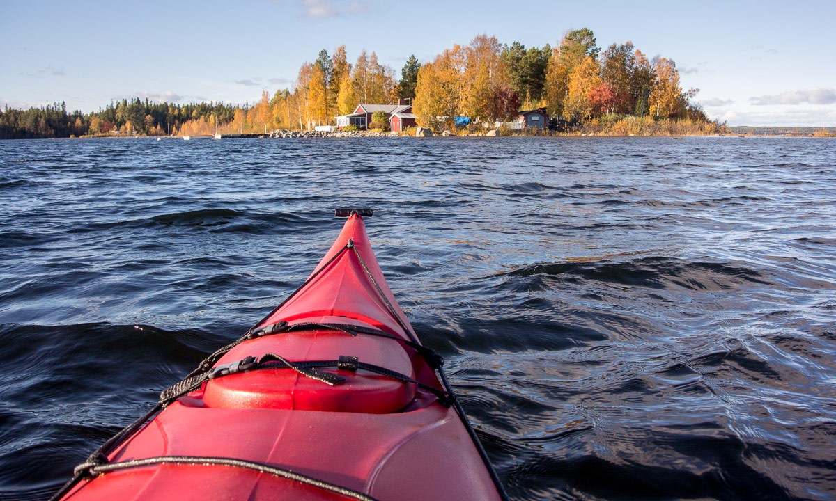

Because of the high water level I could go on paddling much longer than usual. I decided not to return but to carry the boat across small gravel road. Normally it’s more than 100 metres to walk, this time it was only round 20.


I definitely prefer paddling before carrying a 27 kilo boat over land. A gust of wind almost brought me down. A five meter long kayak has quite a large sail area, when you carry it. So I was glad to sit in the boat again this time heading for Björkskär and the bay Harrbäckssand.


Here I turned. This time I paddled along the outer coast of the island and then back across the open sea. It was too windy and wavy to stop paddling and make any photos. Within seconds the wind would have turned the kayak across the wind, making it quite unstable.
When I approached the island Storgrundet (which is almost home again) I decided to continue my tour. It was fun to sit in my kayak again, i wanted to head the small island with the coloured trees and furthermore I wanted to take the opportunity to cross the island by boat.
Crossing an island by boat? Well, many parts of the islands that lie off the coast of Skelleftehamn are quite flat. Storgrundet has such a part, too. It’s just a passage of rocks that connect the main part of the island with an extra part. Normally you can go there (at least with rubber boots), yesterday it was possible to cross this part by kayak.


From this point it was near to the islet Brottören where I could catch the last sun before clouds approached.


The rest of the kayak tour is quickly told: I went around the island Storgrundet, met a man in a small motorboat (until then I had been completely alone), paddled along the tiny beach where I use to bath (it was mostly flooded) and finally arrived at the starting point again.


Two photos from yesterday morning: The Baltic Sea seen from the peninsula Näsgrundet some minutes after sunrise. The frost covered blossom of the autumn hawkbit in my garden.


Today it’s the last day of September. This week brought the first snow to the fjäll and the northernmost parts of the country. Even in Skellefteå and Ursviken some single snow flakes had been spotted some days ago! And according to SHMI it is officially winter in Stekenjokk since 23 September.
From Wikipedia: The Swedish meteorological institute (SMHI) define winter as when the daily mean temperatures go below 0 °C (32 °F) for five consecutive days.
Two days ago was autumnal equinox, start of the astronomical autumn. Today I managed to be at the coast shortly before sunrise at 6:26. The sea was amazingly calm considering the wind of the last days, and the small cotton-wool clouds were coloured rose.

The sun rose over the island Flottgrundet and started to illuminate the rocky shore and the coloured trees.

The mushrooms sprout in the meadow next to the house of the pilot station. I lay down in the grass and made a photo from a small fly agaric covering the sun.

The morning was crisp which temperatures round 1 °C and for the first time I had to scrape ice from the windshield of my new car. While Skelleftehamn looks autumnal, other places as Hemavan or Kilpisjärvi have got the first snow these days. Even though I took my first winter bath already yesterday (water temperature 9.4 °C) it will be some time before winter comes to Skelleftehamn.
Time to collect some warm autumn colours and time for a strongly over-edited photo of the trees on a breakwater. It’s kitsch in some way, but I like it anyway.

This article is part of the series “2018-08: Iceland”.
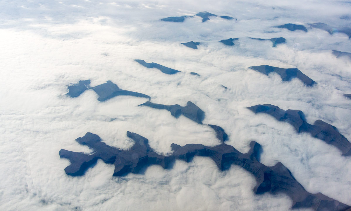
After two weeks in Iceland Annika and I fly back to Sweden today. The first flight from Keflavík to København (Copenhagen) led first over the Føroyar (Faroe Islands), then over Shetland. Luckily there were some holes in the clouds to peek through.


This article is part of the series “2018-08: Iceland”.
Thursday, 6 September
From our overnight stay Sæberg it’s only 177 km to Reykjavík, where we had to return our hired car. That’s not much for one and a half days by car. Therefore we decided to take some more detours.
First we followed the road 68 to Hólmavík, a city on Iceland’s West Fjords. We continued along the coast until we came to a junction, where the gravel road 608 crosses the peninsula. It would be possible to go round the inhabited part of the peninsula, but that’s a detour of 390 km.


Quite near the fjord Þorskafjörður, there’s a small city called Reykhólar. We considered staying there over night but since it was still quite early, we continued instead to the peninsula Snæfellsnes.


The weather had been warm, sunny, calm and friendly for the whole week. But now it worsened, low clouds appeared, it started to drizzle and got very windy. In Ólafsvík – yes, I have my own bay ;-) – we found not only a nice hostel to stay but also a nice restaurant that served us a delicious goat cheese pizza.
Sorry to say, I didn’t make a single photo from Ólafsvík that day. First we were too busy with our dinner, than with re-packing our belongings, because the next day we would have to return our car. Than it was too dark to take photos without tripod and too stormy to take photos with tripod.
The only photo I made is a snapshot I took from the bathroom the next morning. Still stormy, still rainy.

Monday, 3 September
On this day I took most photos through the windscreen while Annika was driving. But we made stops, too. Some photos:


