Scotland: the west coast of Isle of Lewis

This article is part of the series “2022-10: Autumn in Scotland”.

It is 10 October.

Yesterday evening we arrived on the Isle of Lewis, took the reserved rental car (Annika driving) and stayed in the Ravenspoint Community Hostel. Today we want to go by car to explore the west coast of the island.

We do not meet a single person while taking breakfast. We succeed in not raising fire alarm while frying eggs, we pack our backpacks, revert our personal rearrangement of the beds in our twin room and get in our small car – a Kia Picanto. While Annika has been in Scotland much more often than me it is our joint premiere in exploring this country by car.

After taking a detour to a small beach at Tobson we continue to Callanish Stones, one of several arrangements of menhirs. Although yesterdays gale has subsided it is still very windy with some showers of rain. My challenge as a photographer is not only to keep my small Sony dry (first photo is an iPhone photo) but also to take pictures while a large family uses the standing stones for playing hide and seek.

We make a stopover at Doune Braes Hotel for lunch. There we spot the standing stones again – as a colourful leaded window, animals included.

Next stop: the Gearrannan Blackhouses, a village of thatched cottages that was inhabited until 1974. Now it is not only a museum but one of the cottage is a hostel, where we check in and reserve a bunk bed. We have a look at the museum, where a local shows his expert knowledge regarding weaving looms. The view of the coast from the village is quite impressive. The waves are high and smash surf and spray against the rocky cliff.

Now we continue the road north to the headland with the catchy name Butt of Lewis. When we arrive there I’m really flabbergasted. Neither Annika nor I have ever seen waves breaking so high as here at the northern tip of the Isle of Lewis. Extremely impressive, a bit daunting and also a bit wet because sea spray seems to be everywhere. Keep in mind, that the rocks in the next photos are round 10 metres high. Thanks, Google Earth for your elevation data.

It takes some time until I can tear myself away. Next we head for Port of Ness, a harbour village nearby. The sandy beach is broad and shallow. Huge waves roll ashore. While they are breaking the wind gusts blow the spray away – a fascinating view. I decide that today is just not the day to take a relaxing bath in the Atlantic ocean.

We return to our parked car and drive back to our hostel – part of the Gearrannan Blackhouses. The museum is closed and it looks like we are completely alone in our cottage, that can host 13 guests. While we boil water to cook pasta we still can hear the waves splashing ashore at the rocky coast round 100 metres away. After dinner we fall fast asleep . Stormy weather is exhausting, and so is left-hand driving. So, thank you, Annika, my luv, for driving us.


10 days in Scotland

This article is part of the series “2022-10: Autumn in Scotland”.

It has been years, since Annika and I were on holiday outside of Fennoscandia. This October we enjoyed a ten day journey to Scotland from which I just arrived in Tromsø yesterday.

For this article I chose 2 photos for each day. Some more articles will follow later.

6 October – Edinburgh

I landed in the late morning and have the rest of the day strolling through Edinburgh. Blue sky – so it can actual stop raining in  Edinburgh ;-). In the evening I wait for Annika who is taking the tram from the airport. Now it is raining. Finally we are together.

7 October – travelling to Ullapool

We have pre-booked train tickets to Inverness where we will spend three hours before taking the coach to Ullapool. Well, in theory. The trains do not go the whole way due to heavy rain flooding. The rest is operated by replacement buses. So much to rain in Scotland. In Inverness we catch the connecting coach to Ullapool and have even time for a pizza.

8 October – hiking in Ullapool

After two travel days we want to be outdoors and look for the hiking trail to the hill Meall Mor after a hand-drawn sketch. We find it. From the top we have a view to the town, the hills and mountains in sun, clouds and rain.

9 October – taking the ferry to Lewis

After breakfast we take our backpacks through rain and heavy winds to the ferry terminal just to learn that the ferry has been cancelled because of the gusts on the Minch – the straight between Ullapool and the Isle of Lewis. Luckily the afternoon ferry runs according schedule and we arrive in Stornoway at nine o’clock. Scotland premiere: We hire a car. Annika is driving. Left-hand traffic in darkness!

10 October – exploring Lewis

We explore Lewis by car. Great that Annika is brave enough to drive in Scotland (I’m not). Read the article The west coast of Isle of Lewis about this day.

11 October – Peat bogs and Northern Gannets

From Gearrannan Village we take a small way back to Stornoway. In the bogs you can see traces of peat mining. We give back the car, take the ferry back and are watching the elegant aerial manoeuvres of the Northern Gannets. In Ullapool we receive another car that we have hired for the next two days.

12 October – exploring Assynt

We start exploring Assynt, the region north of Ullapool. Read the article Stac Pollaidh about this day.

13 October – taking a bath

Finally – our first bath! At Achmelvich beach. I will write more about this day later …

14 October – travelling to Edinburgh

It is time to give back the rental car and travel back to Edinburgh. First by coach, then by train. This travel confirms my theory that Scottish coaches and trains are designed solely for transport, not for comfort.

15 October – flying back

Short ones, long ones – all holidays comes to their end. Annika takes me to the tram, again it’s me travelling first. What a wonderful holiday. Thank you, Annika!

The first frost – hiking tour on the Laukviktinden

Today was the second day, where my car was covered with ice in the morning. I had to scrape ice after breakfast because I wanted to drive to Kvaløyvågen on the island Kvaløya to hike up the Laukviktinden (587 m) today. The weather was calm and the sky was blue and I enjoyed the views on sea and mountains from the car.

When I passed the shallow bay Finnvika I just had to stop and go there. Large areas were covered with a thin layer of ice that sparkled in the sun. Autumn in Tromsø is a fast season. Last weekend the trees were colourful, now many of them are bare.

20 km later: I just parked my car by the sea and read the tour description. I should follow the road for 80 metres, take the gravel road to the left and leave it when it turns left. The rest of the tour would be pathless but according to the book easy to find.

When I left the gravel road the terrain was a bit tricky. It was more or less overgrown boulders with hidden holes. The trees had shed their leaves and almost looked dead. I was glad when I had reached the mountain ridge where it was much easier to walk. The wet moss was covered with frost and so were the water puddles. Laukviktinden came into view, but I knew that there would be an acsent before. It looked pretty steep. Hopefully it’s just the perspective.

And indeed it was less steep than expected. A bit tricky however because some parts were wet and slippery. And that one of the countless moss pads hid a knee deep water puddle was not nice ;-) ! It is always a satisfying experience when you gain altitude, are above the tree line and can see more and more – both fjords and mountains.

Just straight ahead I spotted the lake Laukvikvatna and its neighbours. They lie 50 metres below. So I first had to climb down before hiking up again. Most of the lakes were covered with a thin layer of ice.

From the lake it is only 200 more metres in altitude to the top – according to the tour book. That meant that most of the the ascent lied behind me. It was easy to go up, only the very last part was a steep boulder field. Probably not the best routeI chose, but that was hard to see from below.

The terrain flattened out and then – all of the sudden – I could see the summit marker: A huge pile of stones with a metal box containing the summit book. And behind that: The open sea with the island Vengsøya.

What do you do on mountain summits beside of adding your name to the summit book? Yes – you take a selfie! After that I went a bit further to a place where the terrain drops off steeply. Here the view was really impressive because I could not only see the open sea and its islands but the bay Laukvika and even the boggy marshland that looked like it was directly under my feet. Here I took my iPhone as camera because it has a wide angle lens.

I took a break, ate some cookies and drank water. I even met another hiker that probably hiked up twice as fast as me. Then I started my way back. I found a better way because it is so much easier to find a good path when you look from above. Later my optimism was dampened when I landed in quite steep terrain and had to traverse it a bit until I was on my old trail.

Round 9½ km later I reached the gravel road again. In the shadow the ground was still frozen, but the car that waited in the sun was warm.

Thursday paddling – from dusk to darkness

It is 29 September and it is Thursday. Time for torsdagspaddlingen – Thursday paddling – with the Tromsø Sea Kayakers Club.

As usual we meet between 5 and 6 o’clock pm to prepare the kayaks, put on our drysuits and life vests and listen to the tour leaders about the plans for today. For several weeks there has been another thing to think of: attach lights to the kayaks and the life vests to be seen. September equinox has been one week ago and it starts getting dark quite soon. Today we are lucky: It is high tide and we don’t have to carry the kayaks more than a few metres.

We are 23 people. 7 will follow the shore to the beach of Telegrafbukta, the others including me want to paddle to Lilje Grindøya that lies behind Grindøya. I’ve never been there. Round 18:00 we sit in our kayaks. As soon as all are on the water we start our tour.

Before we reach the island Grindøya one of the tour leaders lifts the paddle vertically in to the air. That’s the sign for gathering.

Plans are changed. Lilje Grindøya is quite far away and the waves on the sound we crossed were a bit higher than expected. So we head for Grindøya instead.

It it warm and calm. 16 kayaks lie by the beach. We sit our stand around. One paddler passes around homemade cake, another one lights a cosy fire on the sandy beach. Hyggelig!

While we are eating, chatting or taking pictures it is getting darker and darker. The kayaks are hardly visible anymore and in the distance there are the lights of Tromsøya and Kvaløya.

After half an hour it is time to set off and paddle back to shore.

While crossing the sea again I didn’t take photos for three reasons. All of them were related to the darkness.

First:  we want to stick together to be seen and to know we are all there. There may be ships crossing and then you do not want to have a stray paddler around. So I cannot just let the others go to take photos.

Then: my waterproof camera is – well – waterproof but it hardly can take photos in the dark. Even with a better camera it is difficult. Did you ever try to make long exposure photos while sitting in a kayak?

Finally: the waves! The kayak I use is stable as a truck and on our way to Grindøya I didn’t care about the waves a lot. Now it is quite different. I can see the waves because of the reflections of the city lights. But I cannot see how broad, how steep or how high they are. So I have to react by instinct which I don’t yet have. It’s a first time experience and a slightly weird one.

While we are approaching main land the other paddlers come into view. Or better said, their lights. Two of the other kayaks are not illuminated and completely invisible. We take a long turn to the left and follow them. Some of us almost collide with one of the jetties. Everything that isn’t illuminated comes into view at the last moment.

I’m a bit sad because this is the last Thursday paddling this year. Probably we won’t start with it again before end of April. Hopefully there will more kayak opportunities in daytime over the winter.

At 20:15 I  come ashore. Again I want to say to all fellow paddlers: takk for turen! Thanks for the tour!

Kayaking into the dark

It seems, that summer is over. It’s less a matter of temperature but light. Next night will be autumnal equinox and today’s sunset was already at 18:47. Tromsø has almost the same longitude as Budapest.

Anyhow the Thursday paddling of Tromsø Havpadelklubb – the Tromsø sea kayak association – still hold place today. Next week will be the last time for this season. Today we had perfect conditions: No waves, no wind and 10 °C. We had many a summer day worse than that here in Tromsø

May I present, that is D5. It’s one of the many rental kayaks of the association and my standard choice. My own kayak is in Sweden.

Today we were 15 people heading to the island Grindøya on the other side of the sound between Tromsøya and Kvaløya. OK, let’s start …

First we paddled along the coast, then we started crossing the sound. From the boat houses to Grindøya it is round about 4 km.

This time we did not paddle round the island like in June or two weeks ago. Instead we headed for a beach at the northern tip and made a break there. I had a piece of soft chocolate cake with cashew nuts, a welcome leftover of the three day data management workshop that I joined this week. And while we stood or sat there it started getting dark.

Some of my fellow paddlers already had switched on their lights on the way to Grindøya, now we all illuminated our kayaks and ourself. It’s less about seeing but about being seen. There is commercial shipping on the sound. We prepared our kayaks and departed.

While we paddled back it got darker and darker. It’s really a special experience to paddle through the dark in a group. You hear the drone of the city, occasionally interrupted by an airplane or a motorcycle. But that’s far away. Our own sounds are near: soft conversation and the little noises of the paddle entering and leaving the surface of the sea. And since you see less and less, hearing becomes more and more present. And anyhow I tried to paddle as silent as possible not to disturb the quietness.

When we arrived at the boat houses of Tromsø Havpadelklubb it had become dark. The tour lasted only an hour and a half plus a half hour break. But the peaceful sound of kayaking calmly through the darkness lingers still in my ears.


Jämtland tour 22 – signposts and waymarks

This article is part of the series “2022-08: Jämtland and Trøndelag”.

If you want to hike you need either a good map and a compass, or a GPS, or you have an area with designated hiking trails. Then you in most cases have only two issues: find the right trail and follow it.

Easy, isn’t it? Yes, but wait – what’s that?:

Why are there two trails to Storerikvollen? Check the symbols. One shows a skier, the other a hiker. That’s the first think you have to know: There are summer and winter trails in the Swedish mountains. The latter ones are often a bit less hilly but can lead over bogs and lakes. So choose the right track. Quite often they go together for a while and then split up again. That’s where you have either to check a map (take an up-to-date one) or follow the right waymarks.
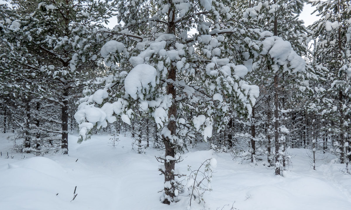
The waymarks for summer trails use stones and red paint. In Norway it is a red T, in Sweden it is mostly a red dot. Mostly they are painted on large stones, rocks or on cairns – heaps of stones. The advantage of cairns: they are easier to spot when it is foggy.

In wintertime most summer waymarks are hidden under a deep snow cover. Then it is the time of the winter waymarks: Red diagonal crosses.

The poles can be several metres long because of the snow, the depth of which can vary greatly. When you have snowstorm conditions in winter you sometimes just can spot the next cross. When you’re lucky. I took the following photo on 20 February 2020 on a ski tour. Two hours later we experienced average wind speeds of 25 m/s. Then you start to love the waymarks that guide you through the storm.

Back to our August Jämtland tour this week. We could watch some people replacing the old winter waymarks by new ones. An important job, probably done on a voluntary base. Voluntary work is so important in Norway that it has its own word: dugnad.

I guess the best sign posts we found in Nedalshytta in Norway. One “summer signpost”, one “winter signpost” and even ratings for the trails from green to black.

It’s always nice to meet some signposts on your way, but not all of them show the distances. I like the last one. The letters are holes in the metal sign, so it won’t snow over so easily in winter time.

But not all signs are about following the trail. They can show you the Swedish-Norwegian border. Or the way to the toilet. Or the toilet – often a “privy” – itself. Or where to park your dog in case you have any.

And some of the signs or marks are quite creative. I almost missed this “in-tree” waymark in Norway. Perhaps more funny than helpful.

But the clearest sign we directly spotted on our first hiking day in Storlien:

The words say henan, dittan and hittn which are apparently words in Jamska, a group of Jämtland dialects. They mean something like here, →there and →here. I cannot express it better. Anyhow this is an article about signposts and waymarks, not about linguistics.

Takk for turen – Thursday paddling – 8 september

Oh, what a wonderful kayak tour! And oh, what wonderful weather!

We were 31 kayakers from the Tromsø Sea Kayakers Club today and split into two groups. 19 paddled to Telegrafbukta, where I’ve been last week, 12 paddled to Grindøya, where I’ve been in June. I joined the Grindøya group and was very glad that I got some training this year. Not because of the waves that we had on the way there but because the group was experienced and quite fast. But I managed to follow and could take some snapshots on the tour.

Now it starts getting dark quite soon and we must have lighting at our life vests and the stern of the kayak. I had only some make-shift light and have to buy some equipment for next Thursday.

But now it’s getting late, so no more words, just some photos. To all today’s fellow paddlers: takk for turen – thanks for the tour.

Jämtland tour 22 – the trail

This article is part of the series “2022-08: Jämtland and Trøndelag”.

On the photo above you can see the trail from Blåhammaren to Storulvån. It is in fact two trails together: the winter trail that is marked with red crosses and the summer trail that mostly is marked with stones with a large dot of red paint on it. We didn’t follow this trail I only took the photo because of the beautiful evening colours.

Many parts of the trail are just like this. They lead through heather, grass, crowberries, and dwarf birches. Other parts of the trail lead over hills, across rock fields, through forests and sometimes over a reindeer fence.

This is when the trail is dry. But often it isn’t. The trail can just be very wet of last nights rain as we had it on our third day.

The trail can be boardwalks that lead over swampy area or bogs. Some of them may be under the water which makes them rather slippery.

And then there are rivers, streams and brooks. Some of them are crossed by a bridge. Some bridges are big, some are – well – small, simple, and pragmatic.

And then there are rivers that you have to ford. I ’m used to hiking in rubber boots and so I could splash through while my fellow hikers had to switch to sandals and wade through the ice cold water. Already Douglas Adams said: You have to know where your towel is.

And then there is mud. It can be slippery and sometimes quite deep, especially right before or after a plank. When you have a plank.

Especially the first day trail section StorvallenBlåhammaren was in an extremely poor shape. The others went around all these muddy patches while I – hey, I have rubber boots! – just continued straight ahead. But then at one point it happened. I made a step ahead and my right leg sank thigh deep into the mud. On the trail! Luckily Blåhammaren had a dry room.

But don’t be afraid, that’s not typical. Many sections of the trail look more like this:

How long the trail was? I don’t have the exact numbers but I think we hiked round about 135 km on 8 days, so round 17 km a day.

Jämtland tour 22 – hiking up the Gåsen

This article is part of the series “2022-08: Jämtland and Trøndelag”.

In Gåsen, one of my favourite cabins in the Swedish mountains we took a day off from our hiking tour. My brother-in-law and I took this as an opportunity to hike up to the summit of the mountain Gåsen, name giver of the cabin.

Gåsen is 1427 metres high. That’s however not a huge ascent, because the cabins lie on 1100 metres.

As everywhere in on our hiking trip there were reindeer around. What do they do on the snow fields? Eating snow? Fleeing the mosquitoes, while there were no around? I don’t know.

We approached the mountain from the south where it is less steep, although Gåsen is quite flat everywhere. While we went up my brother-in-law discovered a snow hare (a.k.a. mountain hare) that ducked to the ground but then sprang away when it realised that we spotted it.

Looking back: the cabins of Gåsen. Looking ahead: the way to the top. And more reindeer.

And there it is – the summit of Gåsen. While the top of the mountain is just a large gravel plateau the 360° panoramic view is quite impressive. It’s not only the mountainscapes that surround Gåsen but the large valleys that made this landscape so huge and seemingly endless.

After a rest – being thankfully for our jackets because it was quite windy – we ascended again, this time more direct to the cabins we stayed over. This time our hike led us over two snow fields. We were not alone, the reindeer seemed to liked the snow fields, too.

At the end we had to go a bit zigzag because the ground was quite wet but after 2½ hours we were back at our cozy cabin. That was fun!

Bonus photo: A cloud. For me it looks like a singing turtle floating effortless though the sky. And you?