27 August: Kungsleden day 8 – Nallo—Vistas (9 km)

This article is part of the series “2017-08: Kungsleden hike”.

Going to bed early, getting up early – the second morning in Nallo we beat a record. We woke up at six and started our tour already at half past seven. The snow has melted away the day before but the night had been cold and some smaller puddles were covered with ice needles.

This year it was easy to cross the watercourse behind the hut Nallostugan. Later on we would have to cross a bigger stream where Annika had to put on her sandals to cross that stream two years ago while I barely managed to cross it in rubber boots.

The first part of the way was still quite arctic and alpine with many rocks and frozen ponds …

… but with each meter in height we descended to Vistas, our next destination, the variety of plants grew. Soon Salix lapponum (downy willow), Empetrum nigrum (crowberry) and Betula nana (dwarf birch) were found again and finally birch trees as well, the first ones for days.

Downy willows like wet places. If you see a long line of them you can be sure that they grow along an alpine brook and if they cover a whole area it certainly will be very wet. Apropos wet – we all managed to cross the river by stepping from stone to stone. Wading was unnecessary. Even if many parts of the trail have been quite muddy this year the water level had been generally low.

This tour was the shortest and easiest of the whole Kungsleden and we used the sunny weather to make a longer rest with lots of chocolate. We would buy new chocolate in Vistas.

The first building we could see was the new Sauna, which is sponsored of a gentlemen’s club called “Fjällrävarna”. Shortly after that the other buildings of Vistasstugan came into sight. We already arrived at 12 o’clock and would have been there even earlier, if we hadn’t been hold up by blueberries …

When we arrived we were alone. D., the German stugvärd left a note that he was hiking and would come back round 4 o’clock. Guests should just choose a bed. So did we. Then we took some items from the self-service shop, put ourselves on the outside stairs of the hut and enjoyed sun. After that we made pancakes with bluebe …

Oh well, the blueberries! I almost forgot them. We hadn’t found many eatable blueberries yet. Many of them were still small and green, probably due to the cold winter, and most blue ones we found turned out to be tasteless or sour. Until today, when we found another field of blueberries on our way to Vistas. This time they were ripe and aromatic. First we ate one or two, then some more. Then we dropped our backpacks and ate some more. Then we dropped ourselves on the ground to collect these tasty berries (and eat some more). It didn’t take long to fill a whole box and some hours later we got a delicious dinner:

Pancakes with fresh blueberries, sugar and cinnamon. They tasted extremely well and it was hardly imaginable, that the pancake dough had been just a powder in Annika’s backpack. Did I mention, that the blueberry garnished pancakes were delicious? I did? Well, you think a lot about food when hiking …

Our dinner was less special: Swedish meatballs in cream with mashed potatoes. It was tasty anyway but not very photogenic. I prefer to show the cans instead of the meal:

Stugvärd D. asked us if he should wake us for polar lights and we accepted gladly. He woke us round 22:30, when it was still dusky. Indeed there were polar lights on the sky, but they were quite weak and hardly spottable. I stayed up another two hours, glad to have a down vest with me, since the temperature already had reached freezing point. The aurora however continued to be weak most of the time. Anyway it was a pleasure to watch. And the stars, the many stars! It was months ago, that it was dark enough to experience such a starry night. At one o’clock I fell into my bed. Another great tour day and the sunniest one yet.

20 August: Kungsleden day 1 – Vakkotavare—Teusajaure (16 km)

This article is part of the series “2017-08: Kungsleden hike”.

The idea to walk the Kungsleden with my sister Katrin and my brother-in-law Andi had been existing several years. This year we put our plan into action and went this famous Swedish long-distance trail from Vakkotavare to Abisko, which is round about 110 kilometres. Fortunately Annika had time to join us.

We started our tour on 20 August, exactly two weeks ago. As many hikes our tour started with public transport: The bus 93 from Gällivare to Ritsem. The last 130 km of that route are famous for being Sweden’s longest dead-end road.

We however left the bus at Vakkotavare where we immediately started the tour. We had no time to loose since our destination – the Teusajaure hut – is located on the other side of the lake Teusajaure and we hoped for a lift with the motor boat at 19:15 to avoid rowing cross the lake.

The first part of the trail is quite steep and leads along a mountain brook with some waterfalls. 500 metres in altitude can be exhausting, when it’s the first day and the backpacks are still packed with some extra food.

Finally we were on the plateau on the “kalfjäll”, the alpine region above the tree line. I really love that bleak but wide landscape where you can look so far.

Until then we were quite lucky with the weather. It wasn’t sunny but at least it didn’t rain. But the weather worsened. The clouds became darker and it started to rain, first lightly then gradually intensifying. We could see some patches of old snow far away but soon all mountain peaks vanished in the thick layer of clouds.

The last part of the trail descends again. This was probably the most dreadful stage of our whole hike: it rained more and more and the steep stony path downwards was muddy and slippery. Despite of the rain there was not a single wisp of wind. So every second we stopped we were immediately surrounded by clouds of mosquitoes that landed in our eyes and nostrils or tried to get into our ears to suck our blood. Anyway we hardly rested anyhow since we tried to reach the boat.

We managed to reach the landing stage at the lake Teusajaure in time, wound up the signal for the boat (a white plastic jerry can) and waited. At least we were glad that the hut Teusajaure was in sight.

I felt disappointed and frustrated. It was the first hiking tour in Sweden for Katrin and Andi. What would happen if the weather would stay like that? And the muddy trails? And the mosquito clouds? Would we continue or abandon the tour? What would they think about hiking in Lapland? Would they ever come again …?

Soon we could see the boat leaving the other side of the lake. Minutes later it arrived. We put the backpacks onboard, jumped in, put on live wests and soon brought across the lake.

On the other side we unpacked the wet trunks and the stugvärd – the mountain-lodge keeper – gave us four beds to sleep. While Annika and I had hiked in Sweden many times it was brand new to Katrin and Andi and felt like a culture shock:

No electricity, no water tap and no water toilet neither! Instead of that: candles, a wood fired oven, two gas cookers and some buckets with water – partly fresh, partly used. And the earth closet somewhere out in the dusk. Again I felt a bit guilty that I persuaded Katrin and Andi into that Kungsleden hike.

Anyway the first tour day that was long away from being ideal came to a nice end: We had pasta, fresh chanterelle mushrooms and sour cream with us for the first day and therefore could enjoy a dinner far above standard. Now we only hoped for the rain to stop. It didn’t take long until we went to bed and soon we all slept.

What do you do if you don’t want to get a motor boat lift? You row by yourself. That’s round 1 km one way.

There are three rowing boats total. If you have two boats on your side, you’re lucky: Just take the boat and row across the lake.

If you have only one boat on your side, you have to row three times: First you take the boat and cross the lake. Then you row back with the same boat and a second boat in tow. Then you leave that second boat and row again a third time. So it’s ensured that there’s always at least one boat on each side.

Summer in a nutshell

This Saturday Annika and I met our friend Elisabet, who never says no when it comes to being outdoors. Even if we used a car to reach all those nice places round Umeå we indeed were outdoors most of the time.

1. Mountain hike

Elisabet had asked us what we wanted to do this day beside of bathing. Hiking, sleeping, barbecuing? The sea, forest, mountain …?

I mentioned that it wouldn’t be too easy to find mountains round Umeå, but Elisabet knows many nice places and so she suggested to go up the mountain Tavelsjöberget. Since the top is just 284 metres above sea level, it’s not the longest hike up. There’s a 5 km trail leading through wetlands (according to the sign rubber boots are recommended) but the shortest way up is just 700 meters long. That’s the way we took.

After the short but steep and rocky way up we reached the top. Here we took a break and enjoyed the view over the lake Tavelsjön and the landscape around.

Elisabet told us about some caves nearby and we already saw the waymarks leading down. There at the western side the mountain is very steep and rocky. We found all of the four caves but entered only one, since the others were only reachable by crawling.

We took a shortcut along a narrow path until we came to the very same trail that we took uphills. Soon we were back at the car and quite eager to enjoy some ice cream and take a bath.

2. Sandy beach and ice cream

… and so we did! First we bought ice cream and something to drink at the kiosk and then we took a refreshing bath. Water temperature: 19 °C, air temperature: round 22 °C. Just perfect, if you ask me.

After a bath (Elisabet took two) and an ice cream (Annika and I took two) we started to plan the rest of the day. Barbecue: yes! By the water: definitely! But where? And where to get food? Luckily there was a food store in Hissjö quite nearby. There we purchased food, something to drink and Elisabet asked for some plastic knifes and a fork, which we got.

Then we headed to Bäcksjön, a beautiful lake in the forest.

3. Forest lake and barbecue

There’s a grilling place at the southern tip of the Lake. Seven other cars parked on the same parking place so we knew we wouldn’t be alone.

Elisabet is quite independent when it comes to barbecuing. While I always have a tripod and rubber boots in the car for photographing, Elisabet uses to have a grill and charcoal with her. Soon our sausages, bread, halloumi cheese, asparagus and tomatoes lay on her grill getting barbecued and beside of some asparagus we ate it all. And it tasted so good!

After our meal Elisabet and I took another bath. We weren’t successful when it came to swimming because the lake is quite shallow and you have to go a long while until you can start to swim.

We were so lucky: Good food, great company, a beautiful lake, warm summer weather with a slight breeze and – not to be underestimated: hardly any mosquitoes!

Summer in Northern Sweden! It’s hardly imaginable that people skated on the ice of the Tavelsjö only two months ago.

Summer experience – a bicycle tour in 7+1 chapters

The advantage of a short workday

How much should I work for a German customer today? It’s Corpus Christi, a holiday in Germany but not in Sweden. Well, what about a half day? I finished work at 11:30 and shortly after I started a bicycle tour. The first one this year. Today’s destination: Budsba, a Thai restaurant at Skellefteå Solbacken.

Soon I was in the forest where I expected to be alone. But after some hundred metres there was a huge herd of children, who were too busy with themselves to let me though. Anyway I managed to squeeze through and soon I left the group behind – no children were harmed.

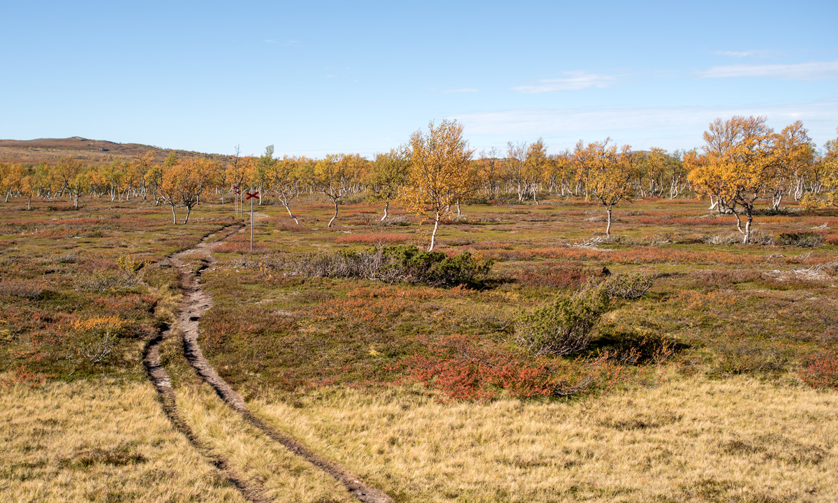
I took the forest path along the lake with the most boring name. It’s called Sjön – “The Lake”.

Some weeks ago parts of the way were quite wet, but now it’s much drier. After some bends I saw a car. Then two people with a table. Camping? Picknick? I came nearer and saw the table packed with plastic cups filled with water and juice. The people invited me to drink and I accepted thankfully. They were teachers and told me that it’s skolavslutning tomorrow – the last school day before nine weeks of summer holidays. Today the pupils of the Örjansskolan had a hiking day.

Thanks for the drink, teachers.

The ways are for the cottages

I continued the small way, which got sandy – not so nice for cycling – but soon I came to a larger way. I turned right and left again and cycled along a gravel road to Södra Skatan, one of the many cottage colonies by the sea.

Some of the cottages are huge and sometimes they surpass their owner’s regular houses. Most roads near the shore are only made for one reason: reaching those cottages. That’s why most ways come from the inland, lead to some summer cottages and end at the last house. They are hardly connected to each other beside of some narrow paths through the forest, if at all. The way after this last cottage was quite broad but stony and muddy so I had to walk the bike for some metres.

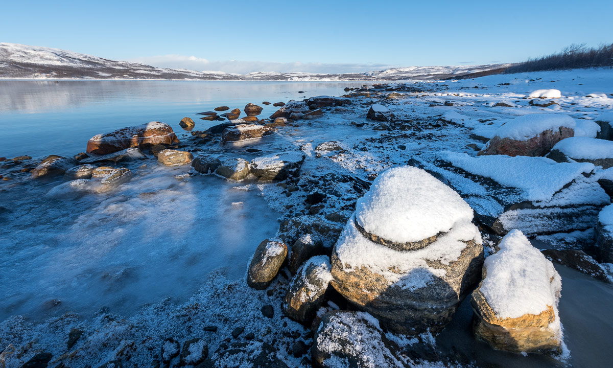
In remembrance of winter

Since there are many cottages along Västerbottens Baltic Sea most of these connection paths are short and soon I was on another road, this time an asphalt street. Beside the street there were many log piles. Almost all Swedish forests are planted for getting timber and piles of logs are a common view in Sweden.

Do you see the white thingy on the left side of the log pile? I stopped the bicycle and looked. I looked again and my first consumption was right: It’s old snow which had transformed to ice. I never saw such nearby so late in the year!

Intermezzo: Best food at the ugliest place

I continued the street until I left it to take the gravel road to Solbacken. It ran through forests and sometimes it was quite stony and hard to bike. Clouds approached, but it was still warm with temperatures between 20 °C and 25 °C. Anyway I passed by another winter souvenir: A snowmobile trail. Some more kilometres and I met civilisation again. On the other side of the European Route E4 I arrived at today’s destination: Budsba.

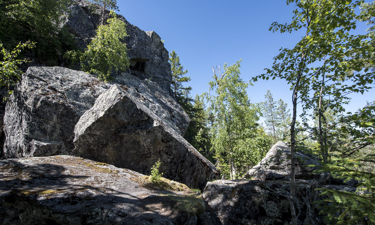
What do you choose – beauty or truth?

I took it easy after the lunch, because I ate too much. That’s the problem with huge lunch buffets of tasty food. And spicy – phew, one of the chilly peppers was quite hot. After lunch I crossed the E4 again looking for the short cut to Fällbacken. I found it and after a short rocky passage the gravel path was quite beautiful and not as steep as expected. Here’s a photo of the way:

It wasn’t so steep, because it was the wrong way! It ended after a hundred metres. I returned and found the right way. This way was quite stony. Then it was quite stony and quite steep. Then it was quite stony, quite steep and quite wet.Here’s a photo of the right way:

First I tried to ride my bicycle but soon my hands started to hurt due to the permanent breaking. Therefore I descended and walked my bicycle until I reached the road that would lead me to Boviksbadet, a sandy beach. There I would clean my muddy feet.

Beach time

An asphalt road again – it was nice and relaxing to just pedal along without looking for stones or glueing my fingers to the handbrakes. I arrived at the beach of Boviksbadet,  the bathing beach of Boviken.

I took a rest but I didn’t bath. It was warm and I would have loved to swim. The sea at Buviksbadet however is extremely shallow. You could walk for ages and still would remain in only knee deep water. I waded in a bit, so at least my feet were clean again.

Come on, it’s just a quick shortcut

After the rest I continued the road and turned left into the Bergviksvägen. This way leads along the Storberget (100 m) and ascends to 90 metres within a kilometre. First I tried to climb the ascend on my bike, using the lowest available gear, but soon I had to rest while my heart beat like a colibri heart. While resting it started to buzz. Some hundred mosquitoes tried to suck my blood. They had a buffet by their own: Hands, neck, eyes, ankles, arms, legs …

Since I ate too much at the Thai restaurant I didn’t want the litte fellows to make the same mistake and so I decided to move on and walk my bike uphills. Walking is less exhausting and so I was on the “top” quite soon. After cycling one kilometre downhills I had to make up my mind.

  • Should I follow all small paths along the coast, which would give me more bathing opportunities but would make the tour longer? Well, no – the sun was almost gone and I was a bit tired, too.
  • Should I continue the way, meat the asphalt road I took on the way there and return the same way? Well, no – I don’t like taking the same way twice the same day.

But there seemed to be another possibility: I could follow the road for three other kilometres and take the small shortcut southwards, where I would meet a road to Ursviken, which is quite near Skelleftehamn.

And so I did. You should know however that it can be quite uncomfortable following me on shortcuts  …

The gravel road descended and was quite broad, but since it was so much gravel on it and potholes in it I didn’t dare to let the bike go and braked from time to time. I approached the shortcut, which didn’t look very promising, but I gave it a try.

I cycled fifty metres away from the main road and looked down to that something that was marked on my map with a black dotted line:

I could return to the main road and just return home the same way, but I still didn’t like the idea. The shortcut would be just some hundred metres and only the first twenty of them seemed to be muddy.

I took my first steps and – splash! – I sank into the mud up to my knees. I freed one foot but unfortunately not the sandal that was still submerged deeply into the mud. It took some time until I could locate it and managed to dig it out. I clamped the sandals on the pannier rack and continued the way barefooted. It was short indeed, hardly 30 metres but my bike was muddy up to the axes and I – well, have a look:

So much to shortcuts …

The “way” became better with some other but less deep mud holes, then it became a grassy path that probably didn’t have been used for a long time (I guess, I know why!)

Now I longed for a bath. My bicycle as well. Anywhere …

Cooling down

… and I was lucky.

The path broadened and soon was covered with gravel again. Marvellous! I knew, that there would be some ponds along the way and I directly stopped at the first one. First I dunked my clothes, then my bike, then myself. After the bath I almost looked civilisation-compatible again. Well, almost!

I continued cycling. The gravel path became a gravel road, became an asphalt street and soon I was on the Skelleftehamnsleden, the road leading to Skelleftehamn, where I arrived round about five hours after my departure.

The daily stage: 42 km biking · ± 800 m walking the bike · ± 100 m bog walking. Not much in distance but in experience.

Crossing and not crossing borders

This article is part of the series “2017-02: Northern Norway”.

Hardly believable that Annika and I started our holiday trip just three days ago when we looked at the arctic landscape today.

On Tuesday we started in Skelleftehamn, Sweden and crossed the first border to Köngäs, Finland. 481 km.

On Friday we continued in Köngäs, Finland and crossed the second border to Kirkenes, Norge, where we’re visiting Christine and Ørjan. Another 387 km.

Yesterday on Saturday we took it easy and relaxed after the two day road trip.

Last night I got sick. (That’s another story but the reason, why we cancelled our ski tour today.) Instead of that we took a short road trip to the Russian border, a border that we cannot cross without a valid visa.

The only border checkpoint between Norway and Russia is at the E105, the road to Murmansk. This checkpoint is only 10 km away from Kirkenes. I’ve been there two years ago.

In Elvenes there’s another small road to Skafferhullet. This place lies at the Russian border, too. There’s no checkpoint, the small road just ends and a fence with some signs marks the border to Russia and warns of crossing it. Here I really had the impression, that the world – as known to me – had come to its end and another kind of secret part of our planet begins right after that wire mesh fence.

Only wild animals can cross borders without any harm. They don’t share my memories of the inner German border, they don’t know anything about the cold war, they don’t have to care borders at all. Lucky them!

Perhaps I’ll witness the day, when the border to Russia is as open as many inner European borders today. Who knows …?

Just before the border checkpoint on the E105 there’s the road 886 to Grense Jakobselv – another place located at the Russian border. Most of the road is closed in winter time, but the first part is open. And this way is quite beautiful. We followed it until the barrier, where only snowmobiles are able to continue. There we took the minor road to Lanabukt located at the Jarfjorden.

Some photos:

What a great day with fantastic winter weather and temperatures round -17 °C. On the way back we stopped at the petrol station to buy me salted sticks and a Coke because unlike in Sweden super markets are closed in Norway on Sundays.

Jämtland hike part III: back to Sweden and finishing the tour

This article is part of the series “2016-09: Jämtland and Norway”.

After two days in Norway we headed back to the Swedish mountains.

Thursday, 15. September

We started our day with a breakfast.

The Norwegian lodge Nedalshytta is really beautiful, but doesn’t have a kitchen and sells only some snacks, when it comes to food. Luckily we had both own things to eat and a mug with us, so would could enjoy our own breakfast: oat flakes with frothy milk! How to get frothy milk on a mountain tour? Mix milk powder and water in an empty coke bottle, shake it vigorously and voilà: schiuma di latte à la Annika.

After packing our backpacks we started our hike to the Sylarna Fjällstation. It was the first cloudy day since we started our tour three days before and anything was moist and wet. Sometimes we had to take a break to pluck some blueberries, that still tasted fresh and sweet.

We went along the Templet, which is Swedens highest peak of the Sylarna mountain range (1728 m). (Storsylen with its 1762 meter altitude is higher, but on the Norwegian side, just 100 meters from the Swedish border.) Due to the weather we first couldn’t see that much but after a while it started to clear up and the clouds released the view on the huge and barren slopes of the Templet massif. We were so lucky, that we hadn’t to go this part of the trail in fog and clouds.

Soon we arrived at a place called Ekorrdörren – the squirrel door.

We started our tour at 780 m above sea level. Now we were on 1100 meter and would have to go up another 260 meters to reach the Ekorrpasset – the squirrel pass – which is 1360 m above sea level and so the highest point of our tour so long. We started climbing up the slope but had to look back over and over again. The undulating valley of the river Åeruvedurrienjohke with it’s many hills and ponds looked like from another planet.

Our trail got more and more rocky. After a while there was hardly any way left, we just went over angular rocks with gorgeous views of the Templet, including a small glacier and the Slottet, another peak of the Sylarna.

I really love the changes of the landscape you can have within just some hours: From autumnal birch forest with blueberries over to grass covered plateaus and finally up to an asteroid-like landscape that looks like a pile of stones.

Especially the squirrel pass looks both harsh and impressive. Anyway, when you go up a pass you’ll probably go it down as well and even 200 meters altitude make a difference. The Sylarna Fjällstation lies near the river Sylälven that flows through a wide grass covered U-shaped valley and when we came nearer we could see three reindeers standing in front of the cabins. Back to civilisation.

We had hiked four days in a row and were quite eager to take a day off. Sylarna fjällstation would be an ideal place, since it lies beautifully and you can leave that place in six different directions. Alas, there weren’t only reindeers, but people, too. Many people. The place was crowded! There were many hikers and mountain joggers. In the big dining room sat a large group of bankers that got their three-course dinner including candlelight and fresh salad, brought by helicopter. We were unsure, if this should be a good place to rest for a day.

The information we got in the evening shocked us a bit: There were already 100 – 125 booked sleeping-places for that night (in addition to all people that would come without booking). That means, that this place would be even more crowded. Even Helags, which is more in the South had just some single sleeping-places left.

That was the moment, where we decided to escape.

We would stay overnight of course, but the next day we would abandon the tour and hike back to Storulvån, were I parked my car.

Friday, 16. September

I was awake quite early, took my camera and tripod and walked out to wait for the sunrise. The valley Endalen was covered with fog. I looked at the glacier Storsylglaciären,that covers the eastern slope of the Storsylen and a lavvu – a traditional sami dwelling. The sun however showed up quite late, there were too many clouds.

I looked at the less beautiful parts of that place too: An excavator on a flat building site, a welcome sign surrounded by building material and waste.

We started the tour being content to leave Sylarna behind but a bit melancholy, too, because we didn’t plan to leave the mountains already after five days. Annika started to count the approaching hikers, there were quite many …

After half the way we approached something quite funny:

It’s neither a sculpture nor a church, it’s a WiFi-station including a recharging unit for smartphones! It is even marked in the hiking map: “WiFi och laddstn.”. There were many hikers and even some mountain bikers resting, but no one started the WiFi. The cellular network is quite good in that part of the mountains and I guess there’s hardly a young Swede without a mobile internet flat rate.

We continued our tour and slowly hiked down the valley Endalen. After a while we were below the tree line and the landscape got even more colourful.

And just shortly before we reached our starting point, were we had left four and a half days before I spotted a lonely birch tree – almost leafless. A symbol, that winter will come even this year. Fifteen minutes later we reached Storulvåns fjällstation, then the parking place, then my car. Annika has counted almost 150 people hiking, jogging and cycling to Sylarna, just from one direction! That confirmed our decision to leave Sylarna behind.

It has been a fantastic and varying tour with many different experiences in a short time. Tack för turen – Annika!

The End.

“Wait, wait …”
– “… wait, what?”

“How can it be the end? You had two weeks holidays, not only five days!”
– “well, ok, we did continue our journey.”

After changing cloth, using the bath room and drinking a coke we got in the car and I drove the way back to Enafors, that lies at the E14 which connects Trondheim in Norway with Sundsvall in Sweden. We considered some options but didn’t decide yet what to do next. Shortly before we approached the E14 I asked Annika: “Back to Umeå or Norway?” The answer was: “Norway”. So we travelled to Norway …

Stay tuned for the next article telling more about our trip in Norway …

Jämtland hike part II: hejdå Sweden, hei Norge!

This article is part of the series “2016-09: Jämtland and Norway”.

Annika and I are in the mountains in Jämtland and have just reached our first destination: Blåhammaren, where we slept in a 14-bed room.

Tuesday, 13. September

Sleeping in a 14-bed room can be quite demanding, especially if you have this kind of snorers in your room, that could awake a frozen mammoth. However Annika and I were really lucky, no snorers at all! After our breakfast we had to decide where to continue our tour. From Blåhammaren you can hike back to civilisation or continue to two other destinations. Most of the hikers continue to Sylarna which is very central and part of the Jämtland Triangle, a very popular three-day-tour, that connects Storulvån, Blåhammaren and just Sylarna. We were keener to cross the border and hike to the Norwegian lodge Storerikvollen and so we did.

With an altitude of 1086 m Blåhammaren is the highest tourist station of the STF – the Swedish Tourist Association – so first the trail ran over the treeless mountain plateau, over rocks and moss, crossing some swamps and brooks. After a while we descended and the first yellow coloured birch trees came into view again.

Swedish summer trails are marked with red coloured dots on rock or tree, while winter trails are marked with poles bearing red crosses. You really shouldn’t follow the winter trails in summer unless you want to stand in front of a lake or find yourself deep in a bog – both are easy to cross only in wintertime. But quite often there’s a year round trail which makes navigation extremely easy even on less walked routes.

One kilometre behind Endalen, an emergency shelter, where we rested for a short while, the Sweden-Norwegian border came into view. It’s hard to mark a border less spectacularly than this one: A sign amidst of a pile of yellow painted stones, that’s it. The large bridge that crosses the river Enan (Sami: Äjnänjohke) directly after the border offers far more spectacularity.

We detected a real nice resting place on the other side of the river, where we planned to enjoy the warm summerly weather, but two other hikers – by the way the first ones we met that day – coming from the other side chose exactly the same slab of rock to rest. Luckily we found another place, at least as nice as the first one. We unmounted our backpacks, took of our boots and dangled our feet into the ice-cold water.

(I like the photo with the drifting yellow birch leave and the dead mosquito. It illustrates, why I prefer the autumn to summer: Beautiful colours and no biting insects left!)

In Norway the summer trail marks change, now the trail was marked with big bright red T-s. The red T is also the logo of the DNT, the Norwegian Trekking Association.

Do you see the dark piece of something on the top of the stone? It’s animal droppings, but I’m not sure of which species. I asked for help on Facebook and the favourite answers are reindeer and (arctic) fox.

We continued our tour until we came to another swing bridge, this time crossing the river Djupholma. On the other side of that river lies a nice sandy beach where I took a refreshing bath (the only one of the whole tour). It was only two other kilometres to walk to our destination, the cabin Storerikvollen, where we arrived round six o’clock.

Oh, so nice these Norwegian lodges are. They seem less “funkis” (the Swedish functional style) and more “hyggelig” (the Norwegian word for cozy, snug, or homelike). Just gemütlich! And we got a two-bed-room for a good price. The only thing you should know, when you visit the Norwegian side: These cabins hardly sell any food and there is no public kitchen as in the Swedish cabins. So you have three options: (1) take a camp stove with you and cook outside. (2) cold dishes! Hopefully you have all with you. (3) eat the dinner and breakfast provided by the lodges (and pay the Norwegian price).

We chose (2) and had a nice dinner with salami, crisp bread and fresh water outside in the evening sun, enjoying both our simple meal, the warm air and the beautiful view. Later the almost full moon rose above the reddish mountain chain – what a beautiful evening!

Wednesday, 14. September

The next day would lead us to the Nedalshytta, which is between 20 and 24 km away, depending on which map or sign post you rely on. So we got up quite early.

We had to go back yesterdays route 2 or 3 km where the trail divided. Now we turned south and had to ascent. Soon again we were above the treeline. When we looked back, we could see parts of the big lake Essandsjøen and even spotted – beside of some reindeers – the now tiny Storerikvollen, that we left some ours ago.

After a while we came to the river Fiskåa, where we had to ford. My rubber boots were high enough and I just splashed through the water, whereas Annika changed boots with trekking sandals and waded through the river.

Since rivers use to flow through valleys we had to ascend again and walked up along a reindeer fence. The weather was still warm and sunny, but you could see a cloud layer approaching afar. Would it rain in the evening as the forecast told us?

Only the map showed us the progress of our longest tour so far. We went a bit up, a bit down, a bit to the left, a bit to the right, down a small valley and up again. But finally trees came into view once more and soon we stood on an exposed plateau not far away from the yet invisible Nedalshytta.

Come on, just less than a kilometre to go … . Final spurt! A short while later we arrived at the beautiful lodge. Again we got a nice two-bed room, this time right below the grass roof. And we got: pizza! Perhaps not the best I ate in my life, but walk 20 – 24 kilometres with a backpack by yourself and you’ll know, how delicious a warm pizza slice can be!

The tour so far:

Continue with part three …

Jämtland hike part I: Storulvån—Blåhammaren

This article is part of the series “2016-09: Jämtland and Norway”.

After three weeks of travelling I’m back in Skelleftehamn. The first week I was in Germany, then I travelled back to Umeå, where Annika lives. Let’s start there:

Sunday after breakfast Annika and I started our tour through the autumnal Jämtland. However the first day’s focus was on getting there by car. It takes round six and a half hours to get from Umeå to Storulvån. We made a stopover in Åsele to look in on some friends and so it took a bit longer until we reached the STF Storulvån Fjällstation where we parked our car. But anyway, we have semester – holiday – and plenty of time. It was even still daylight left, when we crossed the creek Stor-Ulvån (sami: Stoere Vïerejällanjohke) to get to our cabin.

Monday, 12. September

I awoke quite early the next morning and went out to make some photos of the beautiful morning mood and the autumnal colours of nature.

After our breakfast we shouldered our backpacks and started the tour. My backpack could have been quite lightweight if I hadn’t taken my camera, four lenses and a tripod with me. Nevertheless the weight was less than 15 kilos since we were able to buy food in almost all cabins and mountain lodges.

First it was a bit cloudy but soon the sky cleared up more and more and we got a warm autumn day with temperatures up to 20 °C, which is quite warm for the season. The summer trail led us first through autumnal birch forests but after some kilometres we were already on the kalfjäll – the bare mountains above the tree line.

In the middle of the trail between Storulvån and Blåhammaren lies the cot Ulvåtjärn, one of the “emergency cots”. You’re welcome to have a break here, but not to stay overnight beside of emergency situations. Right before this cot you have to cross the Stor-Ulvån again, this time by fording it. When Annika crossed the river three years ago, the water was knee deep, now the water level was much lower and I could just cross it in my rubber boots, while Annika went barefooted.

After a break we continued our tour to Blåhammaren. There were many reindeers on the fjäll. No big herds, but many small groups here and there. They are quite shy and cautious, but on the kalfäll it’s quite obvious, that they are the real residents of the mountains, not we human beings.

We continued our tour on the treeless mountain terrain until the Blåhammaren fjällstation came into view. Here we got two beds in a 14-bed-room and entered the sauna, that has a gorgeous view. After that Annika invited my to a three-course dinner (Blåhammaren is famous for its cuisine) where I got the most delicious reindeer meat I ate in my whole live. Thanks for the invitation, Annika!

While we enjoyed our dinner it started to get dark outside and after a while the beacon in front of the main house was lighted and the first stars came out. Later in the night we got a fantastic crystal clear starry sky, but no Northern lights. I considered about taking some pictures of the milky way, but I was too lazy and too tired.

The tour so far:

Continue with part two …

757.5 – from Mosvik to Skelleftehamn by car

Last week I’ve been in Mosvik (Norway) to visit friends. Yesterday I drove back home, not directly but with a detour via Nordli and Røyrvik (Norway) and Stekenjokk, (Sweden).

According to google maps the direct way is 671 km, taking 8 h 38 min. With the detour it is only 67 km, but 1 h 46 min longer. That says a lot about the small and steep gravel roads near the Swedish–Norwegian border …

For me the journey didn’t take 10.5 hours, but more than 15. For one thing I don’t drive fast, especially in Norway and for another thing I took many smaller rests for taking pictures as well as a lunch and a dinner break. I left at 9 o’clock; at quarter past midnight I finally was home again. Total distance by car: 757.5 km.

See my travelogue of the journey by clicking the first image and navigating through the images. Swipe on touch devices and click or use arrow keys on other computers.

By the way: After nineteen articles without any photo with snow, this is the first article showing at least some patches of snow again.

Kungsleden: returning to civilisation

This article is part of the series “2016-02: Ski tour on the Kungsleden”.

From the Tjäktjastuagn to Alesjaurestugorna

27 February · 13 km · Link to map

This day I continued to the Alesjaurestugorna, the last mountain hut in the kalfjäll –  the treeless mountain landscape in Lapland. Perhaps that’s why I was a bit sad, because I love the bare mountains and I felt that I had to say farewell to this outstanding landscape soon. I said farewell to quietness a bit, too, since I knew, that Alesjaure would be quite crowded:

But first of all I had a nice trip of thirteen kilometres to go. Weather was good and the way was short and easy, even if there were some patches with hardly any snow that I had to bypass. So I arrived in Alesjaure already at a quarter past one, being the first guest.

Other guests came, from Austria, from Germany, from France and from Denmark – many interesting people. And in between five scooters arrived – all with a trailer loaded with figures dressed in huge black down parkas and ski goggles – the Englishwomen. Their plan was to go back to Abisko on skis in two days with some detours to make it a full marathon distance.

The rest of the day was relaxed and easy-going. First I sat the sauna, then I made dinner (an outdoor meal called “Rice with basil” – quite boring). After that I sat together with all those kind and interesting people. At half past nine one of the Danes started to make pancakes – and I was invited! The Danes told me, that each of them has a surprise for the others on their tour and the pancakes were the first surprise. What a great idea (especially, since I benefitted from this surprise). I went to bed at half past ten – much later than the last days.

From Alesjaure to Abiskojaure

28 February · 20 km · Link to map

The next day I wanted to continue to Abiskojaure, that’s the longest part of my journey. The last tour days had quite short distances between 12 and 14 km and I was rather slow. As a photographer I have a good excuse: It’s making photos, that takes time, not my slow speed! Anyway, today I planned to start very early and decided to go a bit faster to avoid arriving in darkness. But first I had to get water, there was hardly any left.

If you tent in the winter, you’ll have to melt snow in most cases – this takes a lot of time and doesn’t taste well. The mountain huts on Kungsleden have ice holes to get fresh water, either in lakes or rivers. The ice hole of Alesjaure lies exactly below the summer bridge. It is covered with a wooden look to reduce freezing over, but I had to break the fresh ice anyway. It’s almost impossible to fill a 25 litre container with water (lowering the bucket into the small hole – pull it up again – pour water through the funnel – de-ice the funnel – pour water through it again) without getting wet hands. Oh, what I longed for waterproof gloves. My fleece gloves were completely soaked and my fingers got so cold that they itched when I “defrosted” them above the gas oven.

That’s why I started a bit later than planned and at the same time as the marathon skiers. They followed the official winter way, I took the short cut over the frozen lake Alisjávri. Although I took pictures I was faster than the skiers – some of them probably stood on skis the first time – and when I left the lake to join the winter way they already lagged behind.

I tried to go a bit faster, but stopped for some photos:

After I went more than half the way I took a break. It’s quite warm: -5 °C and even the cloud-covered sun warms a bit. For me it was a bit like saying good-bye. Good-bye to the treeless kalfjäll. Soon I will enter the narrow valley Gárddenvággi where terrain declines. And soon after I finished my break and continued the tour I saw the first small birch woods. The sun has disappeared behind a cloud layer and the landscape got monochrome. Dark birches, white snow, only interrupted by some red waymarks.

The last descend to the woodlands is quite steep. I decided to unmount my skis and go on foot. Even so the pulka tried to push me down towards the valley and I had to lean back to avoid being knocked over. After some minutes I was almost level with the Abiskojaurestugorna and went the rest of the tour through denser birch forests on skis again. I have to admit that I found this part a bit boring – we have snow and trees in Skelleftehamn, too, but soon I arrived at the mountain huts, where I spent the rest of the day.

In the evening I met C. who wanted to go to Abisko the next day and we planned to do this last part together.

From Abiskojaure to Abisko Östra and home

29 February · 15 km · Link to map

Let’s make it short: This day was travel day. C. and I woke up at 6 o’clock. Not by our own will but because we had the loudest snorer ever in our room. Jet engine level! We took a short breakfast, packed our pulkas and started our tour. Not to Abisko Turiststation, the classical start and end of the Kungsleden, but to Abisko Östra, the station of the village Abisko. I went on skis, C. just with normal boots, since the snow on the snow mobile tracks was packed and easy to walk on. C. was much faster than I use to be, but we headed for the 12-o’clock-train and I was keen to get it, too. We took two breaks: One for elevenses (or some kind of pre-lunch), one for the reindeer posing in front of the kåta.

We mad it, we even had an hour time until the train arrived. 14 km in 3 hours, 8 minutes (including the two breaks) – that was the fastest part of my tour. Thank you, C. for helping me leaving my comfort zone a bit.

The rest of the tour: Train from Abisko Östra to Luleå. Bus from Luleå to Skellefteå. Bus from Skellefteå to Skelleftehamn. I was home at 21:30 – 13½ hours after starting on skis in Abiskojaure.

Now it’s midnight. I’m sitting in the living room of my house in Skelleftehamn. I really like this place, but I’m already longing to the Swedish Mountains again. Perhaps another ski tour later in April?

Well, we’ll see …