Both Annika and I had some days off round last weekend and so we could visit friends of her, who live in Söråsele. That’s in Åsele municipality, 260 kilometres west-southwest from Skelleftehamn. We started our three-day trip on Friday. While all lakes in Skelleftehamn are completely free of ice, many of the lakes in the inland are still covered with soft ice, as for example the southern part of the lake Bjurselet between Bastuträsk and Norsjö. You can still see the numerous snowmobile tracks.
The ground, where I parked my car was quite soft. I left up to 10 cm deep tracks in the muddy ground. But luckily we didn’t get stuck and could continue out tour to Lycksele, where we had a dagens lunch – the lunch of the day. With some other detours and rests – here we met the first mosquitoes of the year, but they didn’t bite us – we proceeded and headed to Åsele. From this town it’s just five other minutes to Söråsele, where M. and F. – Annika’s friends – live.
After saying hello to M. and F. and their dog we said hello to the sheep: six cute adults and three even cuter lambs. I never experienced sheep, that were so cuddly as those little flock – they all came to us, not for begging for food but for being petted and tickled. One of the males bumped the head against my leg every time, when I dared to stop stroking and cuddling him.
Finally I could break free from the sheep to get the camera. I was lucky, none of the sheep licked my wide angle lens, although I came quite near as you can guess from the pictures:
The next day we moved the fence and the wooden shelter for the sheep. We – that’s four people, a smaller farm tractor and a trailer. Moving the shelter took some hours of thinking and doing, but we succeeded. Anyway, that’s another story …
After a fika – the swedish coffee break, we took the car and drove to Sörnoret to go up the the mountain Bergvattenberget (“the mountain water mountain”). At the northeastern side there’s a 120 meter high steep cliff called Offerhällan where according to old legends Sámi people where pushed down when they were too old to follow the reindeers. Hopefully just a myth.
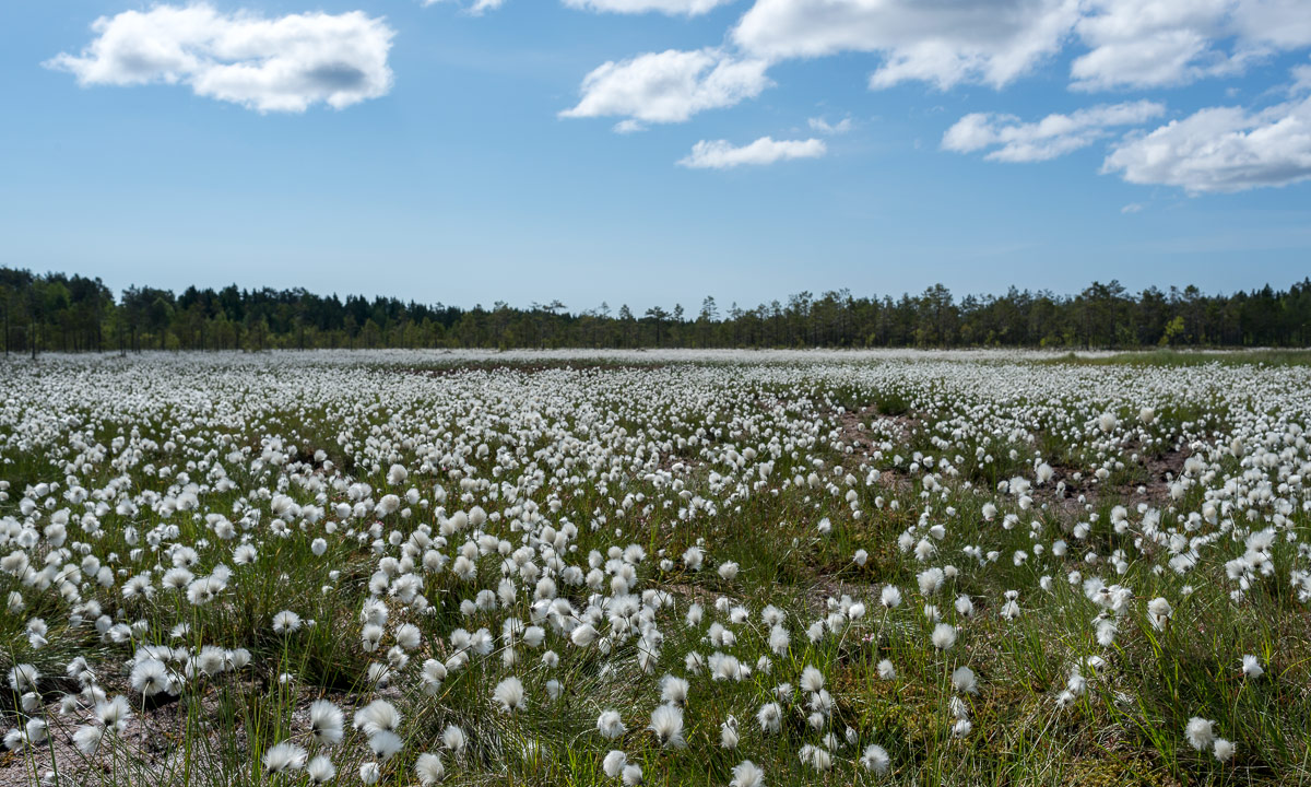
When you want to hike in May, it’s always a good idea to wear rubber boots, since the ground is still very wet after the snow melt.
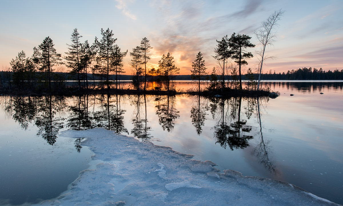
The evening we ate home made Lasagne. A lot of home made Lasagne! Especially I was quite stuffed and so we took a small evening promenade along the coast of the lake Söråselesjön which lays right behind M.’s and F.’s beautiful house. The air still was quite warm and the sunset coloured the feathery clouds.
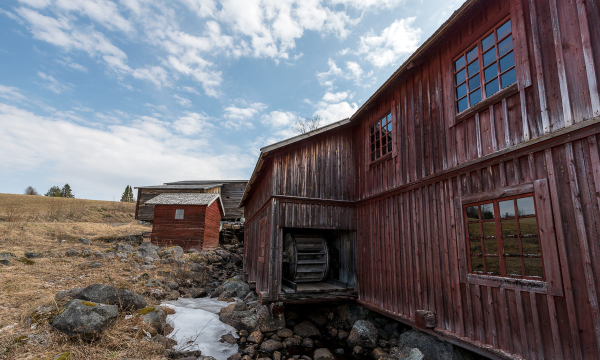
The next day we made another trip, this time to different places. First stop: Torvsjökvarnar, a group of old water mills that form an open-air museum today.
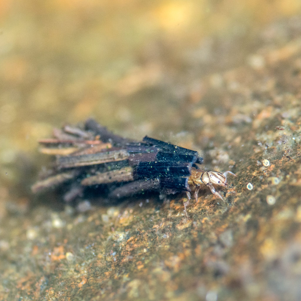
Annika and I already saw some frogs or toads crossing the streets the day before, but here I saw the first frogs from close up. Another spring sign.
Other stops followed but – sorry folks – no photos.
At half past five Annika and I said goodbye and started the way back. We decided to choose another route and took the 92 to Fredrika. A good choice. Here’s one of the artworks of the Konstvägen Sju Älvar (“Art way seven rivers”). It’s called Poem för en imaginär älv (“poem for an imaginary river”) and is erected on a big rock in the midst of an archaic landscape build of rocks, mud flats and tiny lakes. beside of the road the area looks like ice age would have ended just some hundred years ago.
Just some kilometres later there’s a thing you wouldn’t expect in Northern Sweden: A Thai Buddhist temple called Buddharama Temple. The giant statues of the sitting and standing Buddha and the live size elephants made of stone really look a bit strange in the middle of the Lappish woods. In Thailand 95% of the people are buddhists, but in Norra Norrland …?
(Sorry for the bad photos – the sun was definitely at the wrong place when we visited this temple.)
After that we continued our trip back to Skelleftehamn. I drove the car and Annika guided me along the small roads: Baksjöliden – Vargträsk – Örträsk – Ottonträsk – Vindeln – Buberget – Botsmark – Åkullsjön – Bygdsiljum – Flarken – Ånäset and than the E4 northwards until the turnout to Skelleftehamn, where we arrived at 22:54.
Thank you, M. and F. for your kind hospitality. We’ll looking forward to come back some other time. Perhaps there are other things left to be moved ;-)
Appendix
i. Animals on the journey:
Among others: Reindeers, four moose, a fox, cute sheep, cranes, Canada geese, swans, some western curlews and a short-eared owl.
ii. Northern lights:
Yesterday the aurora was really strong with a Kp index between 5 and 6, which says it is visible even in Denmark and Scotland. Now it’s a disadvantage to live as up north as I do. The sky is just too bright even in the dead of night to watch the Northern Lights. I guess, we’ll have to wait until August.