Kronprins Haakon in between

Yesterday

Yesterday I took the car to the northern tipp of Tromsøya to get my tyres changes. When I drove back I had my studded “Nokian Hakkapeliitta 9” tyres in the car’s back and brand new summer tyres on the rims. On my way back I passed the port and there lay the ice breaker Kronprins Haakon.

I continued to the shopping mall Jekta to fetch a photo collage printed on a hard foam board. The photo show scenes from the expedition I joined last year with the very same icebreaker Kronprins Haakon (KPH or even KH for the lazy ones). At time it stands on my dresser. With 75×50 cm it’s larger than expected.

Today

Today I took the car to the port, parked it outside, went to kai 25 and went on board of Kronprins Haakon. Not to join a cruise but to meet my colleague M. on the bridge. Nice to be there anyhow. M. already had installed some GIS software plugins on a computer there. I configured another plugin on my computers that can show the ship’s position in realtime together with other map layers.

In three weeks

The ship’s position in realtime however works only when my computer is connected to KPH’s network. No use to have it home. But in three weeks I’ll enter the vessel again, then in Longyearbyen. Then I’ll join my second arctic cruise with the Norwegian Polar Institute that will lead us to the Arctic Ocean north of Svalbard. There’s a lot to do and I’m nervous because I have some tasks there that I never did before but I’m looking forward to it very much.


My first Thursday paddling 2023

Today I was joining the “Thursday paddling” of the Tromsø Sea Kayakers Club. They started the season two weeks ago, I joined today for the first time this year.

At 18:00 a group of 13 kayakers left the shore by the boat houses and headed to Telegrafbukta, the small bay near my apartment. In the dull weather the kayaks and the paddlers in their drysuits always look quite colourful.

Although I’ve already been paddling in Sweden several times this winter it took me some time to find a rhythm. When I’m alone, I use to paddle slower.

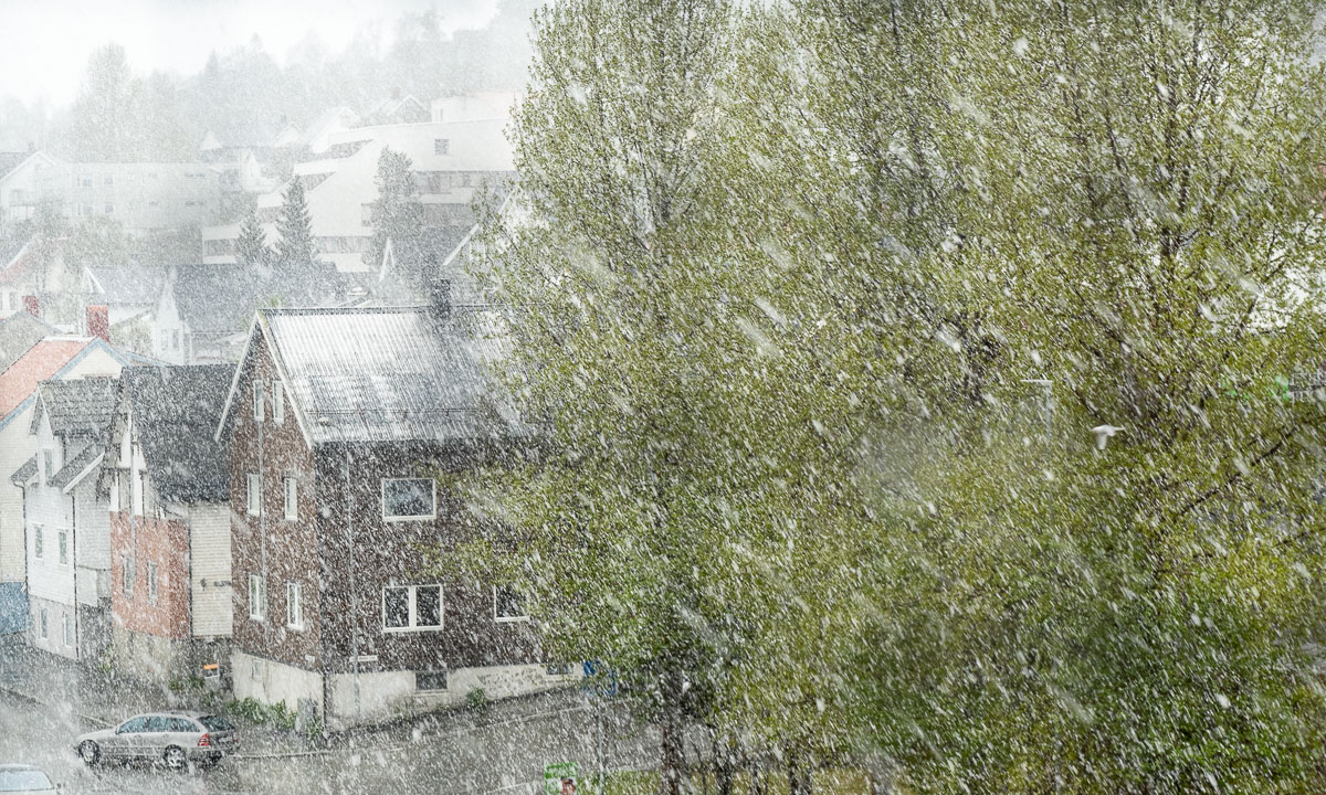
At Telegrafbukta we decided to continue to Sydspissen, the southern tip of the island Tromsøya. There we turned back, paddling through snow showers.

We already saw it on the way there – there was very low water at Telegrafbukta, or just “Bukta” as the locals say. We took a break there but only a short one. The weather was too chilly to be comfortable.

We talked about the weather and came to the conclusion, that summer probably already was on first of May and now summer season is over. I’m not completely sure, if this theory will prove true, but on the way back spring or summer seemed to be far away.

It reminded me at last years first Thursday paddling. It was on 28 April and the weather was as snowy as today. Let’s see how the weather is next week.

A sunny car trip to Jøvik

As in many other countries 1. May is a rød dag, a red day which is an official holiday. The weather is beautiful and I decide to do something I haven’t done for a long time: a car trip.

I take the car to Jøvik, a village in Tromsø municipality located on the peninsula Lyngenhalvøya, home of the impressive mountain range “Lyngen Alps”. As soon as I leave the E8 travelling is slow. On the one hand there’s a lot to see, on the other side the roads are in a pretty bad shape.

Just some photos I took on this wonderful day trip:


Tar du vårbilder?

What is the difference between these two photos?

Half an hour and round about 60 metres in altitude. The first photo shows – quite visible – a bunch of tussilago flowers, the second one – pretty hidden – a tombstone on the Elverhøy graveyard.

I cannot answer why the differences are so immense on the island Tromsøya. I only can observe that while it looks like spring is coming to the coastal parts the ridge of the island is still wintry. There are old ski tracks and the lake Prestvannet (96 m) is still covered with ice and snow.

I walk round the lake. Some parts of the way are free of snow, most aren’t.

I take a photo from a bench. A woman passes by and asks me: “Tar du vårbilder?” – do you take spring pictures? Well, kind of … .

I have an appointment at 18:00 so I leave the “mountains” of Tromsø and descend into town. While the small slide near Prestvannet is still snowed in the playground lower in town is completely free of snow. And I don’t think, they have underfloor heating. (Not impossible in Tromsø.)

Later, at 22:45 I walk to the bus that brings be home. It’s still quite light outside. No wonder, it’s only 20 days left to the period of the midnight sun.


Arctic preparations

Have a look at these two images. They have something in common.

Both are related to my participation in the Arctic Ocean cruise in June. After the Nansen legacy cruise last year this will be my second scientific cruise to the Arctic with the Norwegian Polar Institute. And this time I’ve got extra tasks.

1. Drone flying

A scientist asked if I could fly a drone to map the ice stations. I didn’t have any experience in drone flying so I bought a private one to practise some weeks ago. In addition to that I made the Norwegian online course in drones (class A1 and A3) and the exam. Now I’m registered as a drone pilot in Norway, both in private and for the Norwegian Polar Institute. That was the easy part.

The interesting part starts when I shall take photos with latitude and longitude information from a drifting ice floe. But I’m not there yet (and quite happy that I have another month of preparation).

The drone photo above was taken in Norway. In Sweden it is a lot of paperwork to get permission for the publication of photos, especially when they show the sea as well. In Norway this is not the case, as long as you know the legal rules and restrictions.

2. Ice chart and weather info

To help both the cruise leader and the crew with planning it will be my job to provide them with current information. That’s ice charts coming from a SAR satellite and weather forecasts for e.g. wind, temperature and pressure. The data will be presented using the Open Source Geographic Information System QGIS. The screenshot above is just from a small learning session where I loaded in quite unrelated data as a topographical map of Svalbard, an ice chart from two days ago and current wind information.

The interesting thing will begin when we head north, leaving Svalbard behind. Then we do not have internet access anymore except sending and receiving emails through the slow and expensive Iridium network. So I cannot use all the cool QGIS plugins to gather data directly but I’ll have to send data requests per email and then receive the data later. This will be both interesting and challenging. I’m somewhere in the middle of being quite excited and pretty nervous.

Anyhow I wanted to have jobs and tasks and I’m glad I get the opportunity in a more active role than last year, were I was more like an observer. I guess, I’ll learn a lot.

Arctic Ocean, soon I’ll come!

Tussilago in Tromsø 2023

Yesterday I wrote I would write about Tussilago in Tromsø as soon as i see it. This morning I saw the typical yellow blossoms on my way to work. First a dozen, then a hundred, then a thousand. As early bloomers they apparently don’t have a problem with snow.

Addendum

Even some steps away from my doorstep almost hidden by the snow I found Tussilago.

Winterly Kvaløya

What a misjudgement! Since it was warm the last weeks I didn’t expect so much winter in Tromsø and around. It was a mistake not to take skis or/and snowshoes with me, when I visited the neighboring island Kvaløya today. And here everything was still snowy. Very snowy. So for example the tombstones on the graveyard in Henrikvik. Or a fence nearby, where only the edge looked out of the snow.

How many tombstone there are around? Hard to say. Some of the larger ones were quite visible while other parts of the graveyard were just a white sheet of snow. I’ll have to check in summer.

Although the temperatures were sub-zero the road by the coast was wet and free of snow. This changed when I turned into the road to Sommerøya, the summer island. Although the road is just 150 meters above sea level it was snow covered. During the snow showers it was hard to see the roadside and I slowed down a lot for every car that came my way.

Some other cars parked at the different parking places. Two skiers just started a tour. But I could hardly spot any fresh ski tracks and even some of the avalanche transceiver test station were quite snowed in. No wonder because parts of the lake Kattfjordvatnet are already open and the ice is not safe anymore.

On the other side of the water: a group of trees in the fresh, white snow. Not a single ski track could be seen. At least here ski season seems to be over.

On the other side walking through the snow is not the best idea neither, especially when there are deep, snow-covered ditches …

Back to Tromsø

Friday

This week spring has come to Umeå and Obbola. Temperatures above 15 °C make the snow melt every hour and the first Tussilago blossoms in Obbola peek through the dry, brown grass. I take a promenade wearing a t-shirt and in the evening Annika and I sit by our barbecue place. The very same place that was snowed in up the top edge three weeks ago.

Saturday

The alarm clock rings at 1:00 in the night. It’s a dreadful time to get up, but there is a direct train to Narvik with a bus connection to Tromsø and this train departs in Umeå at 2:12.

Near Bastuträsk, 3:57. The bogs look dull and depressing. – Gällivare, 8:12- It is snowing but everything is wet. How deep might the enormous water puddle on the parking place be?

The lake Torneträsk, 10:29. Here it looks like winter, but I wouldn’t dare to step on the lake any longer. Somewhere in Norway, 12:08. Fresh snow covers the birch trees.

We arrive in Narvik punctual to the minute. Half an hour later the bus to Tromsø departs. A local bus and I’m back at my “work home” in Tromsø. The journey took 16½ hours from door to door.

In Tromsø it looks wintry. The average temperatures were above zero for 18 days, but not it’s slightly subzero and about 10 cm of fresh snow cover my car and parking place.

Sunday

I wake up at 5 o’clock. Sunrise was an hour ago and the sun shines on the freshly fallen snow. – 3 °C. I put on some clothes and walk to the beach to take some photos. But then it’s time to sleep a bit more.

So it looks like winter is still present here. It may take a bit of time until I can see the first Tussilago in Tromsø. I’ll post a photo of the first wild flower as soon as I find one.

Moon, Venus, Aurora

I’m sitting in the train travelling home to in Obbola where I’ll stay for some weeks. First vacation, then work. It’s the first time since Christmas. Time to post some photos I shot in Tromsø last week.

While I was in Longyearbyen it snowed quite a lot in Tromsø. The official snow depths last week were round 130–140 cm.

That ended a period of slush, rain and icy roads and my walks to work had become much more pleasant. I love snow!

Then it cleared up. In the evening of the 23 March I could see the young waxing Moon and the planet Venus. And then the polar light came out. Perhaps nothing new but still beautiful.

Skitour on the Austeråsfjellet

Slowly I’m gaining height with my fjellski. It is sunny and almost windless. Round -6 °C. I seem to be alone. I start traversing a slope while continuing gaining height. I’m nervous. I’m not a downhill skier and every metre I ski up I have to ski down again somewhere.

Mission accomplished: I’m above the tree line. Above me the blue ski, below the white snow. And, while I go further I get another blue: The sea.

When I look back I can see the whole island Tromsøya. Somewhere over there in the south, hidden by the wooded hills is my small rented apartment.

I didn’t plan a route for today. I just wanted to be out enjoying the winter. But when a heap of stones marks a top and it’s easy to reach I have to ski there. Mountain summit 1: Kraknesaksla (ca.335 m). With a nice view into the sound Grøtsundet.

According to the map there are some lakes a bit down. The lakes are invisible. There is only snow. What I can see are the buildings. One small cabin and a wee, tiny shed with a wind turbine. The cabin is closed and I cannot see any sign. Probably it’s private.

I continue my ski trip. I have reached a vidda – a plateau.

Now I start to see other people. A single skier, a group of three going uphills, a skier with a dog in the distance. Most locals love to be outdoors but perhaps not as early as I.

I decide to ski to a mountain top I found on my map app Norgeskart. It’s called Jerremaš (467 m) and is a kilometre away. On the way there I see that the group of three heads into the same direction while two others are already returning. Seems to be a popular place.

And it is. I’m not alone. Several other skiers are sitting there, enjoying the sun, talking Norwegian. Almost all of them are 65+.

I look at the 360 degree panorama. There are snowy mountain chains everywhere, the sound Kvalsundet, the island Ringvassøya and somewhere in the northwest the Norwegian Sea.

How shall I continue the tour? Skiing downhills and letting the others watch how I fall face first into the snow? As I mentioned before, I’m not a downhill skier. The others are probably all former Olympic athletes. I decide to take a small detour …

I start to ski down. To my surprise the hills are gentle and the snow is soft and uniform. I manage to ski downhill the broad, snowy slopes and I’m enjoying it. Sometimes I even think, it is too slow.

Much faster than expected I leave the vidda behind. I pass the first trees and see more and more tracks – and skiers. Many of them are skiing on the prepared ski trail that cuts through the valley like a German Autobahn. Others just sit on a mat in the snow taking a break.

A hole in the snow triggers my curiosity. I ski there and look down. A shallow mountain stream flows down there. Open water. It’s comforting that the snow layer is more than a metre thick.

Now it’s only some more kilometres to ski back to the parking lot where I started my ski tour this morning. Although I’m avoiding the prepared ski trail it is obvious, that more and more skiers have been here the weekend. Ski tracks everywhere.

After round about 17 kilometres I’m back at the car. Pretty exhausted and thirsty but very satisfied.

Here’s a map from today’s ski tour. I went counterclockwise. Red is faster than green but still not fast. I’m not a downhill skier.