From Singi to Sälka and Nallo

This article is part of the series “2015-08: Kungsleden hike”.

August 26 – 29: Day four to seven of the summer hike through the mountains of Swedish Lapland

Singi – Sälka

After three very warm and sunny days clouds came in over night and the sky was quite overcast that morning. Only at the northern sky a larger patch of blue was visible. That fits, we’re going north! The first two kilometres were very well known to us, we went them there and back the day before. The day’s walk was short – just 12 kilometres.

Soon the huts of Sälka came into view. It was funny to see the ads for the shop and the bastu – the sauna – amidst the extend mountain landscape. Only 300 meters left and we entered the reception to check in.

It’s a nice look from Sälka but we had another interest that afternoon: Overall on the ground the ptarmigans were running and there were even sitting on the huge pile of birch wood, so that me, the photographer and them, the models, were on eye level. They let me advance quite near – in fact so near that the tele lens couldn’t focus anymore. The first two images are younger ptarmigans, the last is a grown up – look at these fantastic white feathered feet.

Sälka – Nallo

The next morning there were so many ptarmigans around that you really had to watch yourself not stepping on one of them. I never saw so many and never saw them so near. Our plan was not to continue the King’s Trail but to go northeast to Nallo, a smaller cabin a bit higher up in the mountains. After the common breakfast (muesli with some milkish liquid made from dry milk – yuck!) we started our tour. Even shorter than yesterday: only 9 km but perhaps a bit more demanding since there’re streams to ford, while the whole King’s trail is equipped with Bridges.

We had to look for planks to cross the small rivers behind the cabins but soon we were on our trail.

One hour later we were on the moon …

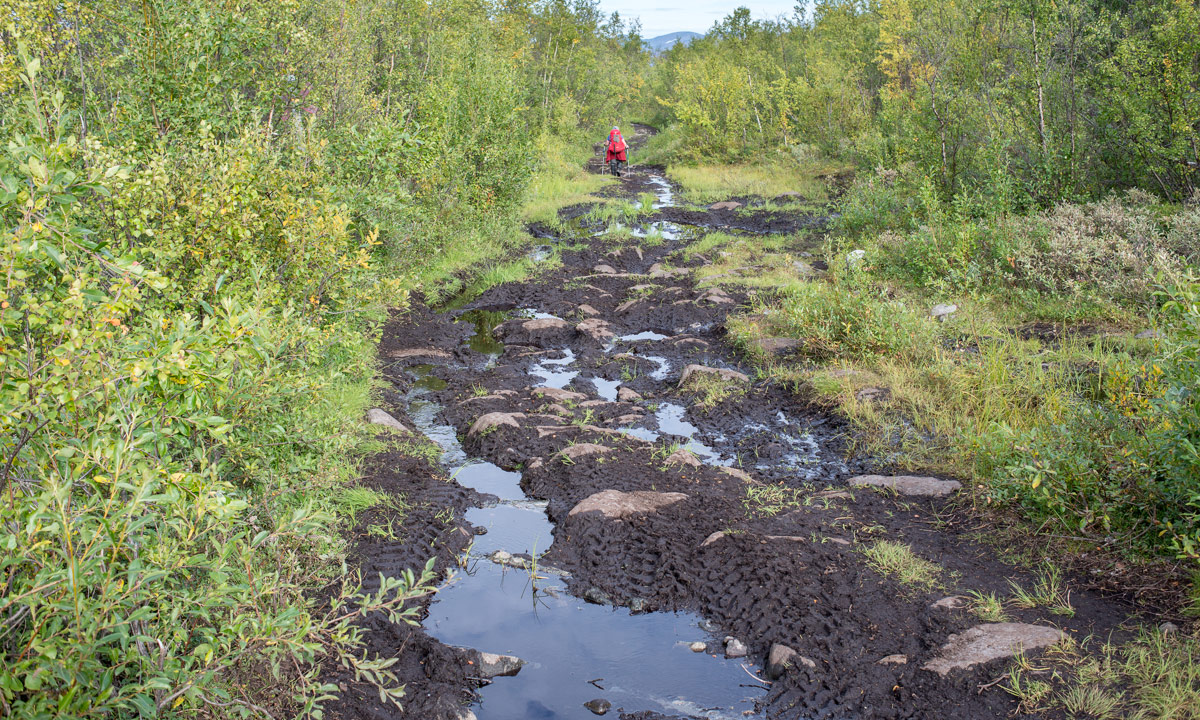
… well, not exactly, but it was such a sharp contrast to the sweet and lovely landscape of the last days. We could hardly see any vegetation. Only moss, grass and some scattered flowers were left. And some reindeers on some of the tabular slopes. There were many small streams and brooks to cross and it was the first day where I was glad, that I walked in rubber boots.

After a while the lake Reaiddájávri that lies on 1056 meter came into view and we went along it. More and more clouds came towards us and swirled around as if they wanted to surround us.

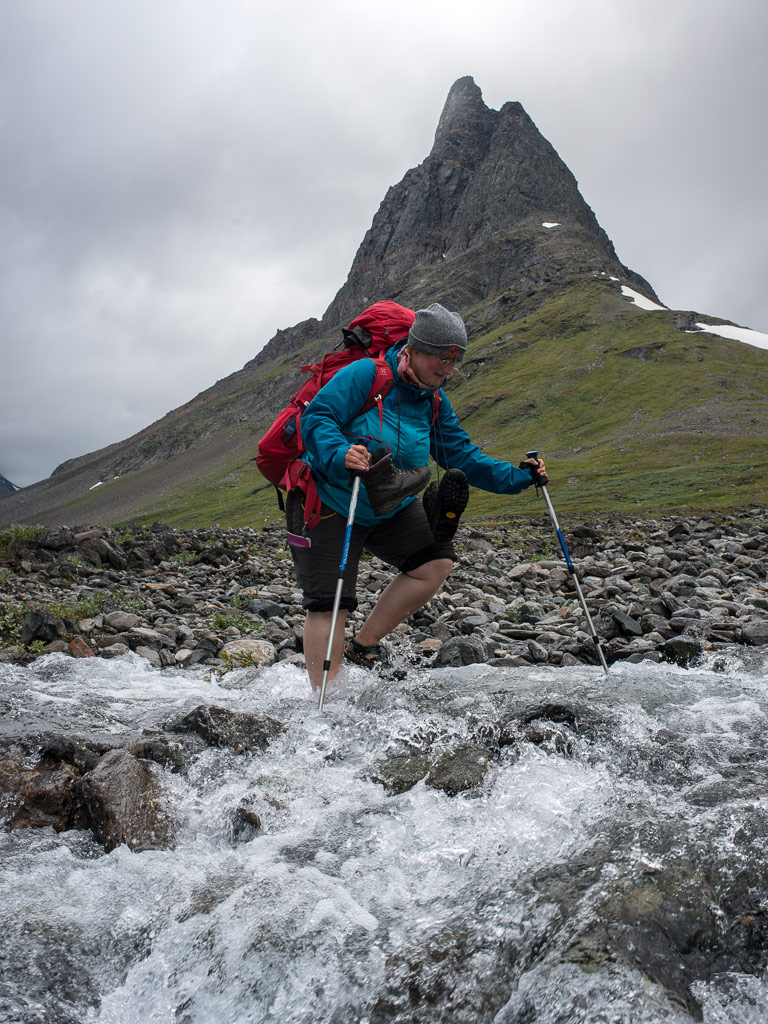
We had to cross the stream that enters the lake at the northern shore. Annika had to switch to sandals and ford the stream, for the water was to high for her hiking boots. It started to drizzle, than to rain and it got windy. Navigation was less easy now since it started to get foggy, there were less marks and some streams and snow patches to cross. Mostly I navigated with the compass, but twice I took the GPS to ensure my navigation. Since wind and rain increased more and more and I was busy with the navigation I packed the camera into the waterproof bag and didn’t make any photo on the last two kilometres. In the end the small Nallostuga came into view and even the huge mountain Nállu in the back lingered through the floating clouds. We got a warm welcome of the stugvärd – the warden of the Nallostuga. And warm was the wood fired oven, too. A good opportunity to dry our wet clothes.

I only went out later that day to take a photo of the wooden signpost and the hut itself. The rest of the day was just gemütlich – the pouring rain outside and we ourselves warm and cozy inside.

Two days of at Nallo

One

We planned to stay a day in Nallo already two days ago. It looked like a good idea since the rain just poured down the whole day and it was very windy. All people out there looked very wet, whether they just crossed the stream – now twice as large and probably twice as deep – or if they just fetched a bucket full of water.

Time to make some photos within the house. Two typical views in Swedish mountain huts: Many of them have two rooms, each has a kitchen and two flanking bedrooms, only separated by a curtain. That make 20 beds in total. Plus one for the stugvärd who has his own little room. The Primus 2388 is a gas cooker, easy to handle and is found in almost each Swedish mountain hut.

Two solo hikers planned to continue their tour that day but after a while they decided to stay. Perhaps not the worst idea when you looked at the young hikers, that came in. They were completely soaked. They poured the water out of their hiking shoes and hang up the dripping-wet sleeping bags for drying. All was just soaking wet! We we’re quite glad to be inside. But finally I took my camera and went out for some photos. Brr, it was really cold (7 °C) and so windy that the spray of the brooks was blown upwards again. Some photos:

I was glad, when I came into the inside of our cozy hut again. Only Simba, the warden’s dog endured the weather stoically.

Later that day: The sleeping bag already has dried, but other clothes were still hanging on the clothes line.

Two

Next day we wanted to continue our trip but I changed plans. Unintentionally. I got ill. I got fever that night and problems with my stomach and intestines, that I definitely don’t want to describe in detail. Otherwise there’s nothing much to report. I didn’t make a single photo (a certain proof that I was really ill) and slept almost the whole day.

Later in the evening, when I felt a bit better I was able to communicate again. I heard about others that went Singi–Sälka, the very same way we went three days before. The trail has been so flooded that the water poured over the wooden planks of the minor bridges making them very slippery and it was so windy that the hikers were really frightened to be blown from the bridge right into one of the swollen rivers. Illness never fits, bit I guess I chose a quite good day for being sick.

I slept the night before, I slept almost the whole day and I slept the next night. That sums up to round about 30 hours of sleep without any larger interruption. That probably was the best medicine and the next day I felt sound and healthy again. The plan for the coming day: Hiking to Vistas.

From Kebnekaise Fjällstation to Singi

This article is part of the series “2015-08: Kungsleden hike”.

August 24 and 25: Day two and three of the summer hike through the mountains of Swedish Lapland

Kebnekaise Fjällstation – Singi

After the crowded Kebnekaise Fjällstation I really longed to continue our hike. Soon after breakfast (with real German bread!) we left and continued westwards. Soon a first wooden bridge over a small creek came into view followed by a larger bridge over the ravine that the stream Láddjujohka has cut into the rock. In the back: The mighty mountain Siŋŋičohkka.

It was as warm as the day before and the sky was incredibly blue. We continued westwards and went round the steep southern slope of the Siŋŋičohkka. Parts of the narrow valley lay in the shadow of the mountains Skárttoaivi and Liddubákti, but soon we came to a sunny place covered with soft heather beside of a small creek – the ideal resting place. It was hard to prevent dozing off and to pull ourselves together to continue after a long while of resting and being lazy.

This daily stage was quite relaxed: only 14 kilometres. Soon the Singistugorna – The Singi cabins – came into view.

We hardly saw any animals yet but round the cabins we saw two quite typical species commonly found in Lapland: The lämmel or lemming and the ripa or ptarmigan (sometimes called snow chicken). They came quite near but gave me a hard time photoing them. I only had a small 100mm-lens with manual focus instead of my great but huge and heavy 70-200mm-lens, so I’m not really content with the results. However, the experience to have these animals so near was more important.

(Later on the journey I got a much better opportunity to take pictures of ptarmigans …)

Singi – Hukejaure – Singi

This day was planned to be a long one! Instead of following the Kungsleden – the King’s trail we planned to go to Hukejaure in the west and then to cross the Swedish-Norwegian border. From Singi to Hukejaure it’s 20 km and it’s just a path, only partly marked.

We started quite early, went north along the stream Tjäktjajåkka and crossed it after two kilometres on another chain bridge.

We had to “climb” over some rocky parts until we came to a beautiful alpine pasture. Do you know the film The Sound of Music? It almost looked alike – without the dancing and singing. Instead of that we got some snow fields and some shallow bogs and ponds. Beautiful anyway:

After a while the path was gone and we had to go up some hundred meters. It was as warm as the other days plus we were on a treeless southern slope – a matter that makes one sweat. We made a rest after 7 or 8 kilometres. It was later than expected and we just made the easy part of our way today. Will we come to Hukejaure in time? Or will it get dark? Is it safe and reasonable to continue? We both didn’t like the decision but since we weren’t sure to reach Hukejaure in time we decided to go back. Next time we have either to start even earlier or take a tent with us. We’ll see …

After 5 kilometres we came to the Tjäktjajåkka again but the light was completely different.

The last two kilometres felt a bit boring and we were glad when we arrived at the Singistugorna that we left the same morning. Other people walk there dogs, we walked our backpacks. After a two-course dinner (noodle soup and tortellini) I went around in the dusk and took pictures of the landscape reflecting in the oxbow lakes of the Tjäktjajåkka.

I was glad that I had my mosquito jacket with me, they were many of them seeking my blood that evening. And when I came back I was glad that all windows are equipped with fly screens to keep out those little bloodsucking vampires.

On the one hand it was a disappointment that we had to change plans, on the other side the tour itself through this side valley was awesome. We probably would never have thought about it without our Hukejaure-plans. Next stop tomorrow: Sälka, only 12 kilometres.

From Nikkaluokta to Kebnekaise Fjällstation

This article is part of the series “2015-08: Kungsleden hike”.

August 23: Day one of the summer hike through the mountains of Swedish Lapland

It’s hardly imaginable that it was only two weeks ago, that Annika and me started our tour through the mountains of Swedish Lapland.

On Saturday, August 22 I shouldered my packed backpack and travelled from Skelleftehamn to Nikkaluokta, this time not by car but by bus and train: The bus to Skellefteå, the bus to Luleå, the train to Kiruna, the bus to Nikkaluokta. The journey took the whole day – hardly surprising, it’s more than 550 kilometres and travelling in Northern Sweden takes time.

The most popular way through the Swedish mountains is the kungsleden, the “King’s trail”. It’s not only possible to sleep in cabins, you even can buy food in some of them to keep your package small. We however preferred another route on the Norwegian side. There’re cabins, too, but you cannot buy food. That’s why we started with quite heavy backpacks that included food for more than a week. (It included my camera, three lenses and a tripod as well, but that’s another story …)

Sunday morning was a sunny morning and already very warm. Our destination today: The Kebnekaise Fjällstation, 19 km away. We started our trip right behind the cabins of Nikkaluokta and soon we left “civilisation” and were out in the beautiful Lappish nature.

But we were not alone. Some other hikers were on their way but most of all there were a lot of helicopters flying there and back. Soon we gave up counting them, they were too many. We were glad that the aerial traffic calmed down after a while.

Our first stop was the beginning of the lake Láddjujávri, quite popular for two reasons: Here you can take a boat over the lake to shorten your trip to the Kebnekaise Fjällstation and you can eat a reindeer burger at “Lap Dånalds”. We neither took the boat (too lazy) or a burger (too early), but we ate waffles with cloudberry jam. Tasty!

The day was really warm: 24 °C. You even may call it hot when you carry 20 kilos on your back. Beads of sweat ran down and before we ordered our waffles, I took a bath in the fresh and cool water of the lake.

After a quite long and relaxed rest we continued our tour. The path is extremely well marked and changes between rocky and wet parts. Almost all wet and muddy passages are bridged with spångar – wooden walkways – but there are exceptions …

After 6 km walk we came to the other pier. Time for a rest, some water and food and another bath. This part of the lake was much colder and the bath was merely a dip into the icy water.

What a nice resting place: Warm, quite and not too many mosquitoes. It was hard to get up and to continue, both because of the great weather and our heavy backpacks that felt quite uncomfortable on the very first day of our hiking trip. But finally we managed to pick ourselves up and continued.

After a while the first chain bridge came into view: The bridge over the Darfáljohka. That meant, it was less than two kilometres to the Kebnekaise Fjällstation where we would stay over night. But before that I saw the first patch of snow. As a snow lover I just had to take a picture of it even though I knew it wouldn’t be the last snow on our journey.

Finally we arrived at the mountain lodge which is quite huge. The Kebnekaise is the highest Swedish mountain and so the lodge is used by many people: Hikers, climbers, mountaineers, and fly-in tourists – remember the helicopters?

Annika invited me to dinner – thank you, Annika! – but sadly it was a bit disappointing. The restaurant changed the menu without letting us know in advance and the cod was so soaked in butter that it hardly had any own taste left. Anyway the starters were great!

But anyway – a really nice first day of our tour.

Continuing to the Vesterålen

This article is part of the series “2015-07: Lofoten and Vesterålen”.

Our third day started with a lot of rain. We put the wet tent into the car and continued our tour to Kabelvåg where we visited a friend of mine. We took a small mountain hike but it was cloudy and wet. Only far away in the east you could see some sunny patches on the top of the snowy mountains.

After the hike Delle and I looked for a camp ground. But first I had to take a picture of the beautiful rainbow near Sildpollen.

This time we tented on a bigger campsite in Sandsletta. When I woke up quite early the next day I could see another rainbow over the Vatnfjorden, but later it started to rain and pour down again. And again we put the soaked tent into the car. We continued on the road 888 to Fiskebøl. The clouds were hanging low and you could hardly see any mountain, just some white and light grey schemes.

Soon we arrived in Fiskebøl where we waited for the ferry. Again we were lucky – we waited hardly half an hour until we entered the ferry for the short crossing to Melbu, the southernmost city of the Vesterålen. We visited friends of mine, this time in Haukenes were we tented near the friend’s house. The cocks tried to wake me up ridiculously early, but in vain. I continued sleeping until 8 o’clock.

Alas it was the first morning without rain (and the only one, too) and we could dry the tent. After a long and lazy breakfast with my friends we said farewell and continued our car trip. We got a tip to visit Stø at the northern end of the Vesterålen island Langøya. What a good tip and what a beautiful landscape – especially after the weather was nice and sunny. We made a short photo stop between Strengelvåg and Klo before we continued to Stø.

In Stø we parked our car and took a short hike over the mountains to a beautiful white sanded beach were we made a rest and I took a short bath. There’s a 15 km hiking trail as well; next time I’ll definitely will go it.

After our rest we slowly walked back and continued by car. First we had to head south to Sortland were we crossed the Sortlandsundet and headed north on the other side. The sky became more and more cloudy and we looked for a nice campground. Finally we found one in Bleik, quite near Andenes, a town at the northern end of the Vesterålen. We put up the tent and – guess what – it started to rain.

It had been raining the whole night and it continued raining. Again a soaking wet bunch of a tent lay in the back of the car. After a while of driving through the greyness we decided to head back to Skelleftehamn. It’s more than 900 kilometres and it took the whole day. Rain became less near Abisko and after we passed Jokkmokk the sky cleared up and we could see the full moon slowly rising. The next photo, which is the last of our car trip through the Lofoten and Vesterålen is taken near Storforsen, one of Europe’s biggest rapids. At 23:50 we were in Skelleftehamn again – and I was home.

  • 2296 kilometres in six days
  • a lot of clouds and rain, but two nice and sunny days, too
  • one night in the car, four in the tent (three of them on campgrounds)
  • two bathes and at least four rainbows
  • – a nice trip!


Almost like summer

For me it’s not the warmth, that makes a Swedish summer, it’s the colours! Blue sky, green birch trees and meadows with yellow flowers – dry ones with dandelions or very wet ones with marsh-marigold – both are just beautiful.

Translations:

EnglishGerman
DandelionLöwenzahn
Marsh-marigoldSumpfdotterblume

Paddling round Storgrundet

Two weeks ago the sea between the island Storgrundet and the mainland was still partly ice covered. Today I paddled round Storgrundet and couldn’t discover any ice left. The view of the blue sea almost looked like spring, but it didn’t felt like spring at all, it was very windy and chilly. When I left the protected bay I tried to make some photos but soon gave up since I was blown back ashore faster than I could take my camera out of its pocket. I only made a selfie on which it’s quite visible that – measured by temperature – spring hasn’t come far yet.

At the outside of the island I didn’t had a chance to release the paddle for a photo, too high were the waves. I regretted soon that I paddled without spray deck, because some of the bigger waves made it into my kayak. The next photo I made in a sheltered bay, where the water finally was calm enough and I could empty my kayak with a sponge (it wasn’t so much water, that came in).

Some hours later …

I had a look at “kanotudden” (literally: the canoe bay), a bay of the river Skellefteälven, where the ice is finally gone, too. Almost. There is some leftover ice, mostly crushed to small bits that were jingling and clanging with each arriving wave. But even the small bits were still solid enough to bear a wandering wagtail looking for food.

The canoe club, which is located at kanotudden still seems to be in hibernation, I’ll have to check later …


A small sightseeing tour in Norsjö kommun

One of the disadvantages of a long journey as I made it this winter is that you cannot meet your local friends for a long time. It felt like ages ago, that I was in Kusfors to visit my good friends Martine and Lasse, that I got to know the very first day when I arrived in Skellefteå five years and some days ago.

Kusfors is 70 km away from my home and it usually takes my exactly one hour car drive. Yesterday it took longer since I made some detours. There’s a nice minor road along the river Skellefteälven which still is partly ice covered – at the end of April!

Martine, Lasse and I made a short trip to Norsjö and Lasse showed us around. For example the beautiful wooden church:

Or the ski slope nearby. (We where quite lucky that we didn’t get stuck in the rough clay road when we went up and down):

Or the farm shop in Svansele, that is specialised in carrots and is open 24-7.

But my favourite spot and motive was the old abandoned mill near Norsjö – Norrsjövallens kvarn:

I definitely have to visit this place again with more time and better light, probably in the evening, or even in the night time. (Perhaps with some polar light? …)

Addendum: A black and white version of the last motive:

And the snow?

Winter may has gone, but still a lot of snow is left.

All streets in Skelleftehamn have been snow free for a while now, but you can still see the big snow piles from the winter. Some of them are still several meters high and they probably won’t be melted down before the end of May.

Yesterday I was invited by friends to join them in their stuga – their summer cottage – in Bygdeträsk. Some images from the way.

When I arrived at the summer cottage, the property looked like this:

In front the barbecue area and the grasslands, behind the birch trees the Sundet, part of the big lake Göksjön, still mostly ice covered, but you can see the first open patch, where a small stream enters the lake.

Cross-country skiing in Äkäslompolo – part two

Last Friday I travelled to Kittilä in Finland, to make a one week holiday with Annika and and Medi, a friend of hers. I wrote already about the first days in “Cross-country skiing in Äkäslompolo – part one”.

Wednesday. We took the ski bus to Äkäsmylly and we were not the only ones. Some busses arrived at the parking place and spit out round hundred cross-country skiers, most of them dressed in skin-tight racing suits. And if the children were too small to stand on their own skis, they were pulled behind in a pulka sledge. That looked really snugly.

We didn’t like to start within a crowd and so we waited, until the most skiers had started. But we didn’t go very far. The Äkäsmylly Café is just round the corner and it’s really extremely cozy. An old man played traditional Finnish songs on his accordion and yes – they all were in moll. We peeked into the text books to sing along, but even if we knew the melody the Finnish language with its long and unfamiliar words gave us a hard time. But it was fun anyway!

Finally we broke away from the warm Café and started the tour. As the days before it snowed most of the day. I made less and less photos each day but today I had to make a break and leave the ski trail for this lonely tree in the snow fall. It took some time, because the snow didn’t bear the thin cross-country skis and I was up to my knees in snow.

I didn’t have to leave the comfortable ski trail for the next photo, a bridge over a completely snowed in brook.

We made our last stop in the Karilan Navettagalleria, the beautiful café and gallery that I already visited the day before.

Thursday. With 25 km our longest tour from Totovaara via Tammitupa, Karhunkota Hanguskurun and again Karilan Navettagalleria back to Äkäslompolo, and by the way my birthday tour.

I think, this is the first day where we neither used the private sauna in our lodge nor lit the fireplace after the ski tour. Instead we went to a bar nearby and listened again to the karaoke. It was just wonderful, listening to the singers – some men had really nice voices. People browsed the set lists to see what they could sing next and at least one pair was dancing to the karaoke songs all the time. Unfortunately some of the people got extremely drunk quite quickly. One of them was so intrusive and pushy that we left the bar soon. I guess that’s also part of the Finnish culture, just as karaoke.

Friday. A short but more demanding tour in the south-west with some nasty descents. I was glad that the trails were in good shape and hardly icy, although it was so warm. I didn’t make a single photo, because I started to get bored of the cloudy sky and the forest, that looked more or less alike everywhere. I enjoyed the week, but since I’m more in nature for the landscape than for the sports, a week was long enough for me and I started to long home a bit. And again I had back luck with the weather; the two weeks before were cold and sunny.

Saturday. Phew, that was early! We stood up at 4:45 local time (that’s 3:45 Central European Summer Time) and 5:35 I said good-bye to Annika and Medi that took the early bus to the airport. Then I drove home. After 425 km and six hours (some ways were in quite bad shape) I was home in Skelleftehamn again.

Addendum:

I hardly saw any animals when I was on the ski trails. That changed on my way back to Skelleftehamn: I saw a fox, a mountain hare, two reindeers, two squirrels and some black grouses, all from my car. I guess, animals are seen best when driving ;-)