Thursday paddling – from dusk to darkness
It is 29 September and it is Thursday. Time for torsdagspaddlingen – Thursday paddling – with the Tromsø Sea Kayakers Club.
As usual we meet between 5 and 6 o’clock pm to prepare the kayaks, put on our drysuits and life vests and listen to the tour leaders about the plans for today. For several weeks there has been another thing to think of: attach lights to the kayaks and the life vests to be seen. September equinox has been one week ago and it starts getting dark quite soon. Today we are lucky: It is high tide and we don’t have to carry the kayaks more than a few metres.


We are 23 people. 7 will follow the shore to the beach of Telegrafbukta, the others including me want to paddle to Lilje Grindøya that lies behind Grindøya. I’ve never been there. Round 18:00 we sit in our kayaks. As soon as all are on the water we start our tour.


Before we reach the island Grindøya one of the tour leaders lifts the paddle vertically in to the air. That’s the sign for gathering.


Plans are changed. Lilje Grindøya is quite far away and the waves on the sound we crossed were a bit higher than expected. So we head for Grindøya instead.

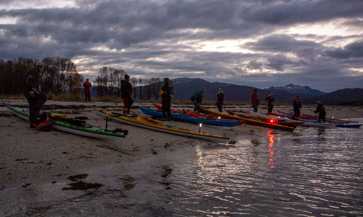
It it warm and calm. 16 kayaks lie by the beach. We sit our stand around. One paddler passes around homemade cake, another one lights a cosy fire on the sandy beach. Hyggelig!


While we are eating, chatting or taking pictures it is getting darker and darker. The kayaks are hardly visible anymore and in the distance there are the lights of Tromsøya and Kvaløya.


After half an hour it is time to set off and paddle back to shore.


While crossing the sea again I didn’t take photos for three reasons. All of them were related to the darkness.
First: we want to stick together to be seen and to know we are all there. There may be ships crossing and then you do not want to have a stray paddler around. So I cannot just let the others go to take photos.
Then: my waterproof camera is – well – waterproof but it hardly can take photos in the dark. Even with a better camera it is difficult. Did you ever try to make long exposure photos while sitting in a kayak?
Finally: the waves! The kayak I use is stable as a truck and on our way to Grindøya I didn’t care about the waves a lot. Now it is quite different. I can see the waves because of the reflections of the city lights. But I cannot see how broad, how steep or how high they are. So I have to react by instinct which I don’t yet have. It’s a first time experience and a slightly weird one.
While we are approaching main land the other paddlers come into view. Or better said, their lights. Two of the other kayaks are not illuminated and completely invisible. We take a long turn to the left and follow them. Some of us almost collide with one of the jetties. Everything that isn’t illuminated comes into view at the last moment.
I’m a bit sad because this is the last Thursday paddling this year. Probably we won’t start with it again before end of April. Hopefully there will more kayak opportunities in daytime over the winter.
At 20:15 I come ashore. Again I want to say to all fellow paddlers: takk for turen! Thanks for the tour!