Dark, windy and wet

This article is part of the series “2020-10: New in Tromsø”.

Perhaps you saw the photos that I took on my way to work five weeks ago. The sky was blue, it was quite warm and the sun was shining.

Today it was completely different. For the first it was dark. Dark on my way to work and dark again on my way back. Sunrise was at 8:33 and sunset already at 14:21.

Then it was quite windy and very rainy the whole day. Sometimes it just rained a bit, sometime it was bucketing down huge amounts.

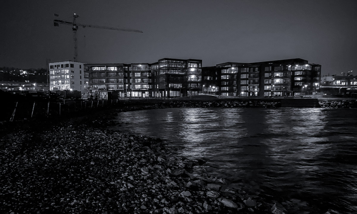
Here are some photos from my way to work. Taken with my iPhone and black-and-white again.

The way back was more exciting. When I went round the Framsenteret – the marina to my left – I first thought I was totally lost in the dark. I didn’t know that there was a huge artificial lake to the right. I never saw it before. Carefully I tested with my rubber boot, it was 25 cm deep. Then I realised that this was no lake but the parking place. It was completely flooded. Did it really rain so much? Apparently.

I continued stomping through huge water puddles. My outfit: rubber boots – rain pants — waterproof parka – reflective vest to be seen by others – headlamp (in one of the parka pockets)

Then I realised that even the sea water level was exceptionally high. Would I be able to go back the very same gravel path you can see on the second photo? That path lies quite low and in the morning I could see a chain of seaweed lying on the side facing land. When I arrived, the way was completely gone. I could only see the water of the sea up to the site fence.

To make a long story short: I continued the path. Mostly it was 30 cm of sea water covering the gravel. That still worked with my rubber boots, but it shouldn’t have been more. I was really glad to have a bright LED lamp. Probably I wouldn’t have dared without it. And not it beacme clear that there will come a day where this part of my favourite way to work will be impassable without offshore survival equipment.

Appendix one: and the sun?

Tromsø is located at the latitude of 69° 39′ N, almost 350 km north from the polar circle. That means, that the days not only get shorter and shorter but that there’ll be a time where the sun doesn’t rise and set at all. This time is quite near: In three weeks it will be the last time you’ll be able to see the sun and then again in January.

To illustrate this I made some charts. The y axis of each chart shows the dates from 1 January (top) to 31 December (bottom). Each row shows the solar altitude for that day by color.

From left to right: München, Germany – Obbola, Sweden (my home) – Tromsø, Norway (my current workplace)

Sun | Sun (golden hour) | civil twilight | nautical twilight | astronomical twilight | deep night

These are the main differences:

München has sun each day, but a real dark night, too.

In Obbola in Northern Sweden there’s always at least 4 hours of sun (if the clouds allow it) but it hardly gets dark in summer.

Tromsø has the most extreme changes of sun altitude during the year: Round seven weeks of polar night in winter and almost ten weeks of polar days with midnight sun between May and July.

So there’s much to experience here. The next experience will be the technique sea kayak course this weekend. Probably with a lot of rain at 3 °C and on Saturday even gusty winds round 14 m/s.


October snow in Tromsø

This article is part of the series “2020-10: New in Tromsø”.

Yesterday evening it started to snow and this morning it still has been snowing. 10 cm of snow cover the streets, cars, houses, trees – it’s the first noteworthy snowfall in Tromsø, since I’ve been here.

The beauty of the snow won’t last long because already on Saturday it will be warmer again and it will thaw away. But hey, it’s only late October. Winter hasn’t even started yet.

And now I’ll take a short breakfast and walk to work.

Sea kayaking in the dark

This article is part of the series “2020-10: New in Tromsø”.

It’s 2 °C air temperature, a cloudless sky and sunset at 3 o’clock in the afternoon. A good day to end working at 14:30 and do some kayaking.

The reason for that I kayaked today is that I want to join a kayak course the weekend after next but I do not have all the required skills. So Tim, the course leader I’ve been in contact with gave me private lessons today.

I came to the meeting place right before sunset, where I met Tim. We changed clothes in the club house of the “Trulle” sea kayaking association, put on our dry suits, sprayskirts and life jackets and finally chose two kayaks from a large selection.

Then I stopped making photos. First of all I had to focus on everything that Tim showed and taught me. I learned a lot because Tim is an excellent teacher. The first half was mostly about paddle techniques, the second half more about rescue manoeuvres, which literally means capsizing by purpose. Into quite cold water in the dark.

Was it dark? Not really. Although the moon was too low to illuminate the sea there were street lights nearby, some light of the near airport, the lights attached to the stern of the kayaks and our head lights. What a wonderful atmosphere! And as the icing on the cake we got a stunning aurora, that covered half the sky – swirling and moving in green, red, and violet colours.

Tim managed to take pictures from the scenery. So I’m not the photographer of the next photo, I’m the motive.

(Photo: Tim Vanhoutteghem – True North Adventures)

I have to admit that I was quite nervous before the private lessons today but now I’m really looking forward to the technique seakayaking course.

Thank you Tim for giving me private lessons today. I can warmly recommend his company True North Adventures.

A Weekend in black and white

This article is part of the series “2020-10: New in Tromsø”.

Ok everyone, let’s talk about making photos. I say “making” instead of “taking” on purpose. Photos are not lying around just waiting for you to pick up some of them. It’s you yourself that has to create a photo – or as I use to write to “make” it. It’s about two things: Your camera and your choices.

The better your camera equipment the more choices you have. Each piece gives you additional possibilities whether it is a telephoto lens, a flashlight or a sturdy tripod. Sometimes the choices can be overwhelming. Which photos do I want to make today? Landscape? Architecture? Sea birds? Night shots? People waiting at bus stops? Some of them? All of them? Phew!

I want to become a better photographer. To get better you have to practise. For me practising mostly means focussing on a certain aspect of the whole. This weekend I drastically reduced my possibilities. Instead of using my Nikon DSLR (digital single lens reflex camera) I used my new iPhone. Instead of the normal camera app I used an app called Lenka which only takes black and white photos with a fixed focal length (which means you cannot zoom). The only freedom I took was to post-process the photos by changing the contrast and the aspect ratio (and a bit more).

Here are the results. I’ll show the photos without any detailed comments.

Saturday – Sydspissen, the southern tip of the island Tromsøya – clouds and some rain

Sunday – Kvaløya, 430 metres above sea level – winter impressions

Sunday – Kvaløya, a short stroll at the coast – mostly sunny

I’m not content with the last photo. Maybe it’s because the house lacks three-dimensionality but I’m not sure. Beside from that it was real fun to use my self-set restrictions to get another kind of view on the motives around.

But no practising without a goal! My goal is to use the black-and-white photo app to train finding good motives and even when using my DSLR making full-color photos to be able to imagine how it will look black and white.

And you? What do you think about these photos? Criticism is welcome.

Winter sneak preview – the first snow hike

This article is part of the series “2020-10: New in Tromsø”.

This weekend I planned to take the Fjellheisen. Fjell is Norwegian for mountain(s) and heis for lift or elevator. Fjellheisen however is not a vertical lift but a cable car up to the mountain Storsteinen (421 m above sea level) where you can have an incredible view on Tromsø, visit the café and most of all can start countless hiking tours.

Today morning I took the bus and changed to another bus near the polar museum. The second bus crossed the large bridge Tromsøbrua over the strait Tromsøysundet and ascended to the bus stop Fjellheisen. I planned to buy a multiple ticket (much cheaper) but the payment failed three times. To my delight I got a free return ticket. Soon the cable car arrived, two other guests and I entered it and Fjellheisen started its way up while I was looking down to the autumnal town Tromsø.

I got of the cable car, walked up some stairs, went through the door and then there it was: Winter ❄︎!

First I just strolled around. The snow was 10–20 cm deep and it was quite easy to walk. Few others people were around although the weather was quite fine – even though not as sunny as I expected. I decided to start my hiking tour by hiking up the nearest summit Fløya (671 m). Sometimes I had to cross knee deep snow, but mostly it was less. I followed some footprints – I wasn’t first this day – and soon arrived at the landmark – whatever it is – on a small pre-summit of Fløya and then on the near summit.

That didn’t take much time. So I continued in direction of the summit Romssavákkivárri (Sami) or Bønntuva (Norwegian) (776 m). Parts of the slopes looked steep but still it was relatively easy to ascend beside of the fact that the snow was deeper here. In the lee it was mostly knee deep and wind-pressed. This type of snow it quite easy to sink in and then you have to take the leg up the very same way it went down, since the snow is way too hard to plunge through. Sometimes I felt like a stork with balance problems.

On the way there were many heaps of stones which are used as waymarks. But you should be very cautious to follow these waymarks strictly in this part of the mountains because there are many tourists how just love to build heaps of stones everywhere. Anyhow, they are nice photo motives.

And so are the mountain ranges in the southeast. It could be the famous Lyngen Alps, but I’m not sure.

On the summit of the Romssavákkivárri I took a selfie. It was sub-zero (my Cola froze) and windy and I was glad about my winter anorak. Next time I’ll take warmer pants with me as well as woollen mittens.

What you may forget when you see these photos is the surroundings. All the snowy mountains are surrounded by straits and fjords of the Norwegian Sea. Here’s a panorama photo taken from the summit.

If you take the telephoto lens (most photos were made with it) you also see the snow line, which is quite low but not low enough to cover the lowlands with snow, too. That have to wait probably some more weeks.

After a while of photographing, eating cookies, drinking, watching, resting and enjoying I started my way back. Some other hikers had passed by and left tracks in the snow that made it easier to walk most of the time. I looked down at Tromsø and watched the weather worsen. From the north clouds with dense snow showers approached.

Several times I stopped. Once to talk to a skier – the only one I met today. He was British, lived in the Netherlands and was in Scandinavia quite often. Later I would meet him again at the cable car and he would give me a lift back to Tromsø. Thanks a lot!

Mostly however I stopped to take more photos.

Up here it was quite sunny and when finally the first snow flakes fell down I already was near the summit station of the Fjellheisen, where I had vegetarian lasagne for a late lunch in the café. It was a quite small portion and of course expensive as almost everything in Norway, but it was tasty. After that I went out again. The sun has started to set and the western sky was orange.

When I looked east I looked into a void. A huge shower cloud had approached and it started to snow. Seven minutes the same motive looked like this:

At 17:00 I took the cable car down, got the mentioned lift of the British man and was back in central Tromsø where I hardly could believe, that I just made my first winter hiking tour. Down in the city everything was just wet and just a bit slippery.

Conclusion: That was a great day with hiking through a winter’s sneak preview. I’m lucky since the snow will probably last for half a year, at least in the mountains.

As usual I made most of the photos with my Nikon D750 DLSR and different lenses. Today however I had another “camera” with me, my new iPhone 11 that I got from my employer, the Norwegian Polar Institute. It’s a huge improvement to my old iPhone SE. First of all the camera is much better and it has a real wide angle lens. Then the phone works in the cold! My iPhone SE would hardly have survived this day while the iPhone 11 was still ⅔ loaded when I ended my tour. Having these advantages I can live with the fact, that the iPhone 11 is bigger and feels twice as heavy than the SE. No ad, just my two cents.

iPhone photos today (all edited with Adobe Lightroom): The 1st one, the panorama and the last one.

Bathing gets colder

Yesterday afternoon. It had been quite foggy the whole day and so it still was at the small sandy beach at Vitskärsudden. Annika and I had bathed several times the week the last months. We both could see and feel how the water temperature slowly had decreased. Yesterday the bath thermometer showed 10 °C and slightly above and the water started to feel cold, especially in the fingers. But we still enjoyed the bathing, the beauty of the place and the sensation afterwards.

Today I’ll fly to Tromsø and probably I won’t be back home before Christmas. I’m curious whether the sea at Vitskärsudden will already be frozen over or if there will be open water where we can take a real winter bath.

A walk in the bog Torsmyran

Annika googled it, then we visited it shortly last Saturday, yesterday I took the opportunity to visit this bog with more time: The Torsmyran Nature Reserve.

The parking place is right next to the E4, 45 km southwest from Umeå. You open a gate (and close it behind you to keep the moose away from the road). Then you walk to a small forest strip and follow a round 100 metres long wooden ramp leading into the bog. The platform at the end of the ramp is raised so you have a nice view over the 8.3 km² large bog.

That’s it.

As long as you don’t dare to enter the bog by foot. At first the bog looks flat, but if you take a closer look you see that there are slightly higher parts, mostly covered with heather. Even pine trees grow here and the ground is safe to walk. Beside of these parts there are large areas covered with peat moss, a sure sign that you will get wet walking onto. Even with rubber boots! And there are depressions. Some are covered with water, others with brown mud.

Is the mud deep? Well, have a look at the next photo:

You see the bit of a stick sticking in the mud? That’s my walking stick that I use when hiking through bogs. It’s two metres long. Without any effort I could stick it into the mud like that. Anyhow it was possible to avoid such treacherous places in this labyrinth of humps and pools, even though I came quite near to take same pictures.

After a while I come to a line of wooden planks. Old wooden planks. Old, half rotten planks with rusty nails looking out. I decide to follow the path. First it is quite easy, but then the planks go submarine. Since both my camera and I myself are packed waterproof I continue. Although the planks were slippery I succeed without taking a bath.

There is a signpost in the middle of the bog, leading to cities and places in the area. Who needs a signpost at such a remote place? Well, winter is coming and the bog will be frozen and covered with snow. Then the whole area is easily accessible by snowmobile. And that’s what the signpost is for: Helping the snowmobile drivers.

I leave the signpost behind and continue the path. Partly the planks lie directly on the mud. *Crack!*. One of the planks breaks under my right foot but still supports my weight. When I come to another watercourse to cross and see the the planks deeply sunken into the water I decide to turn back. This passage looks quite challenging and for a round trip I would have to cross the watercourse again at another place.

Slowly I walk back to the platform at the end of the ramp. I have to zigzag a lot to avoid open water or muddy patches but I arrive. I’m quite wet and muddy from taking some photos. I however already suspected that and have spare clothes in the car and a canister with water for cleaning. And something even more important: Chocolate and something to drink!

Disclaimer: It’s not the first time that I hiked on boggy ground. It needs some experience to avoid the soft patches and knowing how to free yourself when sinking in mud. That’s why I have a long and stable walking stick with me that could support my weight in case of sinking. Take care!


Fjell and fjäll

Fjell/fjäll is the word for mountain or mountains. Fjell is Norwegian, fjäll is Swedish. As similar the words are as different the fjell/fjäll can be.

When Annika and I started our way back home from Tromsø yesterday we could experience the inaccessible steep mountains in Norway with the dark grey summits hanging in the evenly dark clouds as well as the colourful autumnal mountain plateaus between Abisko and Kiruna.

Different ways of kayaking

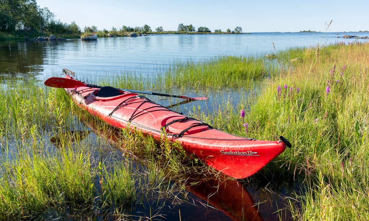
Since Annika doesn’t have a kayak yet I use to paddle alone. Mostly it’s short tours as for example the day before yesterday. I paddled to the beach Bredviks havsbad to join the yoga group at 8:30. To my surprise it’s shorter to paddle than to take the bicycle or car and so I was 20 minutes early.

After yoga I took a small tour – first north and then along the coast of Obbola.

Then I took an early lunch at the boat harbour since I didn’t had any breakfast. The kiosk there has not only hamburgers but tasty dishes as hummus or ćevapčići and Annika and I eat there quite often. After lunch I slowly paddled home. Slowly, because (a) being stuffed with food, (b) being lazy and (c) the increasing wind from the front.

Yesterday afternoon Annika and I got guests. Corry and Mark from Germany have written on Facebook about the difficulty of finding good tenting places at Västerbottens coast. They have been on a long kayak tour that they started in Haparanda four weeks ago. A common friend commented on the post asking us whether we wouldn’t have a nice meadow for tenting in our garden. Well, we have, and we even have our own little guest house, that Mark and Corry gladly accepted after they had arrived here yesterday afternoon. Last weekend Svitlanda and Ebbe (almost) came by sailing yacht, now we got our first guests that landed by sea directly at our house. It’s fun to live by the sea!

We had a nice evening together with outdoor cooking over open fire and inspiring conversations yesterday. This morning Corry and Mark continued their sea kayak tour. I had the honour to join them a bit.

At 8:15 we started by setting in the kayaks and paddling south. Since they have inflatable kayaks they have to be more careful of rocks and shallows. So we paddled further away from the coast than I use to do. I got some technique tipps about paddling more effortlessly and I really enjoyed the company.

Anyhow I decided to say farewell after an hour. Mark and Corry started crossing more open water and I wouldn’t dare to return the same route alone. Thanks a lot, Corry and Mark for nice company!

While the adventurers headed for the horizon I circled the island Tarv and slowly headed back. To my amazement the whole tour took only 2½ hours; I’ve miscalculated.

Now I know, that there are many destinations to be discovered by kayak and that they are not far away. It’s fun to live by the sea!