Three trips round Tromsø

This article is part of the series “2017-07: Tromsø”.

It’s me who is thrilled by the North, who loves to travel to places like Tromsø or Kirkenes. It’s my mother however who has been much northerly than I was. She was in Spitsbergen/Svalbard with a cruise ship many years ago. But on the way back the route had to be changed due to fields of drifting ice and therefore the travellers couldn’t leave the ship in Tromsø. So my mother missed Tromsø on that cruise.

This year we managed to close this gap: three weeks ago my mother took a plane to Munich, another plane to Oslo and a third plane to Tromsø, where Annika and I picked her up from the airport. That’s why we’d travelled to Tromsø by car two days before.

We had four days in Tromsø, I will write mostly about the first two:

Monday, 10 July

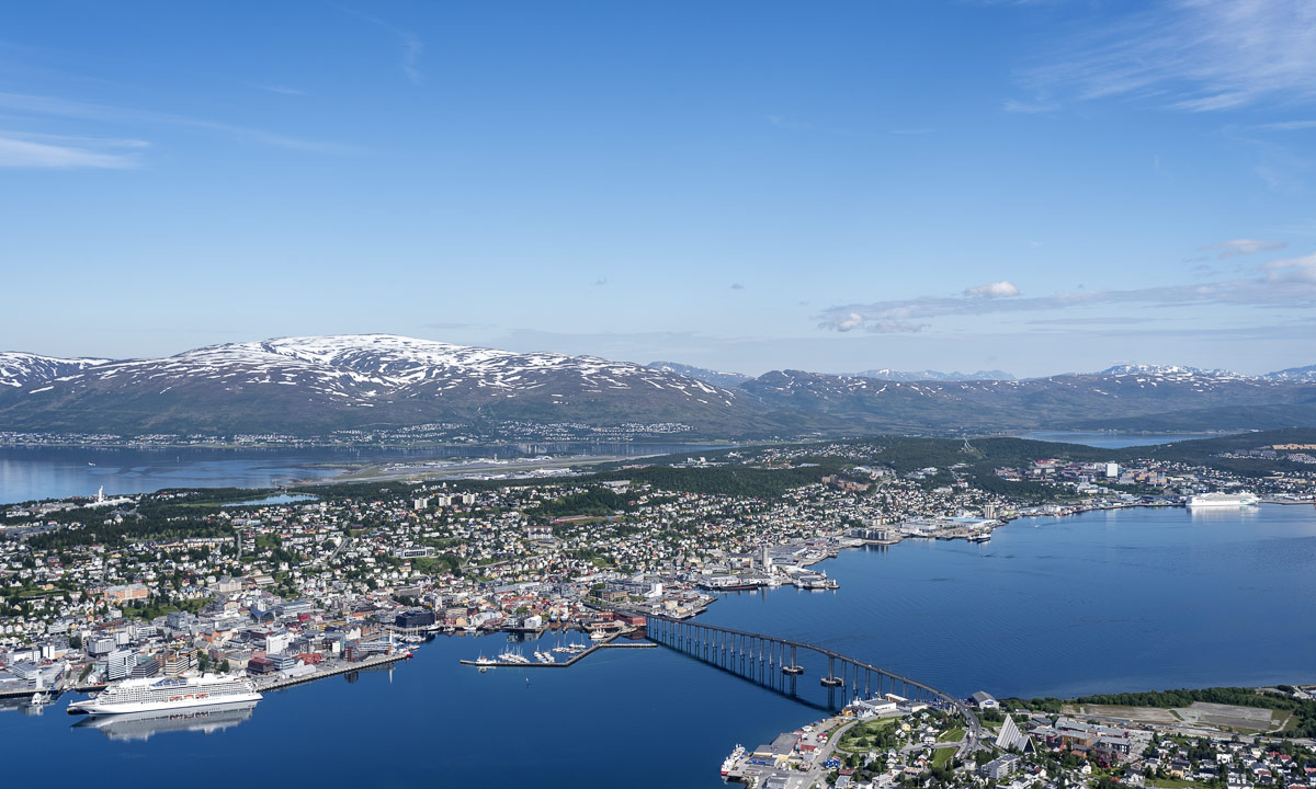
Weather was better than forecasted and so the first thing we did after breakfast was taking the car, crossing the Tromsøysundet on the Tromsø Bridge and taking the Fjellheisen on the other side of the town. Fjellheisen is a cable car up the mountain Storsteinen (approx. 420 m), where you have an incredible view over the town Tromsø, the island Tromsøya and the mountain ranges on the neighbouring islands.

We stayed there the whole morning, enjoying the view, walking around, eating ice cream and looking at the arctic flowers that grew everywhere.

Finally we went down with the cable car again driving back to Tromsø and since the weather was sunny and nice we just continued driving, leaving Tromsøya again, this time using the Sandnessund Bridge. We continued our trip on the island Kvaløya (Whale island), Norway’s fifth largest island. At the western end there’s a bridge leading to the island Sommarøya which sometimes looks like like a caribbean island with it’s turquoise blue bays.

Annika and I were very keen to take a bath, but we all were hungry too, so we took a lunch first. While we were eating our fried fish, clouds approached and soon it started to rain. So much to our summer bath plans …

After looking around on Hillesøya (another bridge, another island) we drove back, this time taking the coastal way in the south of Kvaløya. Finally even the sun came back and illuminated the bright yellow blossoms of Lotus corniculatus, or common bird’s-foot trefoil that covered the sides of the narrow road.

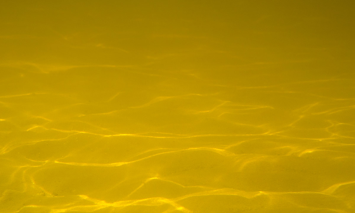
Have a look at the beach photo above. It’s not sand, it’s corals covering this beach, which makes them looking even more caribbean – at least as long it’s sunny.

Late in the afternoon we arrived at our hotel after our first day together.

Tuesday, 11 July

After the rainfalls of the night sun came out again. Time for another trip to the surroundings – this time the island Senja, Norway’s second largest island (beside of Svalbard).

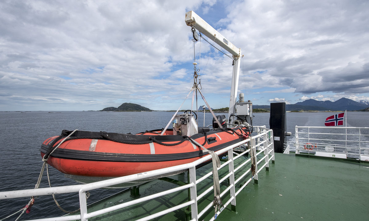
The first part of the tour was the same as the trip to Sommarøya the day before, but instead of turning right the last T-junction we turned left to Brensholmen and waited for the ferry to Botnhamn/Senja. Annika downloaded an app to pay the passage, since it was much cheaper than paying cash. As in Sweden it has become quite unusual to pay cash. The idea to start early was a good one, we were one of the last cars to fit on the ferry. Some others were unlucky – they had to wait for many hours or change plans.

Hour plan was to take a round trip on Senja using the roads 862, 86 and 861. In addition to that we planned to take some side trips.

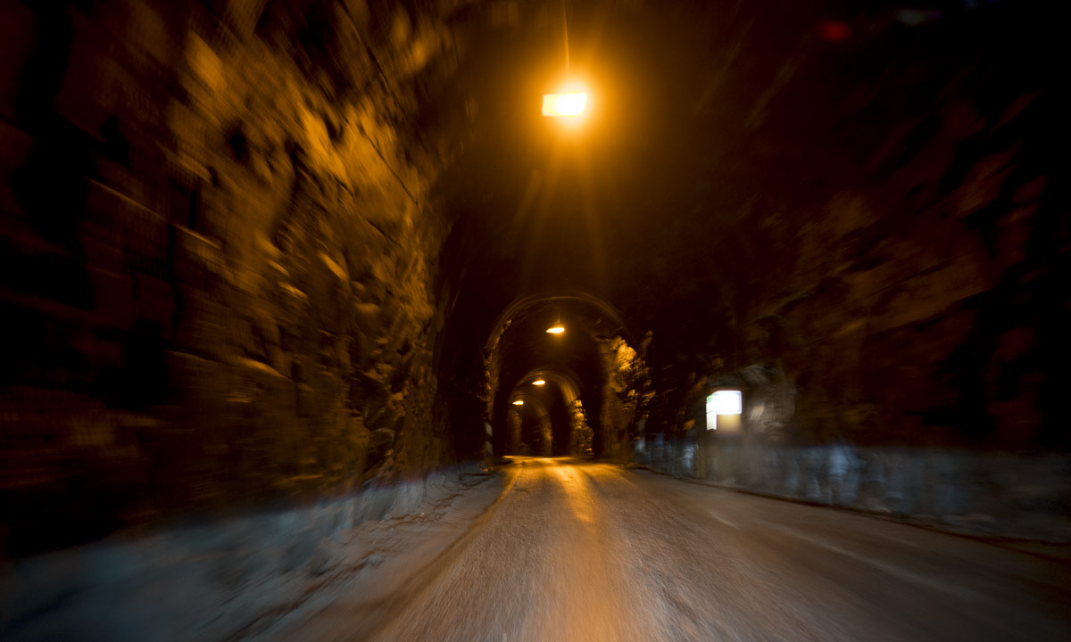
The first side trip was special, since it led through a dark tunnel cut into the rock, that much too narrow for two cars to pass. In addition to that it was curved and bent so that you couldn’t see other approaching cars in advance. There were lay-bys were you could try to squeeze in and let others pass and I was really glad that the regular bus had left the tunnel minutes ago.

But when we left the tunnel we got “Norway in a nutshell”: Wide bogs, birch and pine forests, clear blue lakes, green meadows and fields and most impressive: big snow covered mountains, some of them looking unreachable by foot, so steep and harsh they were.

But it wouldn’t be Norway without the fjords. Sometimes the coast is as rocky as the mountains, sometimes it provides sandy beaches in beautiful bays. And finally we came to our bath, all three of us. Of course the water was cold, but the air was warm and we stayed in the water quite a long time.

We continued our round trip, again some clouds approached and again some rain drops fell. I thought we’d have to wait an hour for the ferry back, the ferry arrived simultaneously. I realised that I looked wrong when I checked the timetable, but we were lucky and found a place on the ship anyway.

On the way back we didn’t stop for taking pictures any longer. First of all the weather had become grey and dull and then we were tired and hungry. So we stopped only at the supermarket to buy some food for the dinner.

The other days

We did it right, making the larger trips in the beginning, because the other two days it was cloudy and rainy. Time for some sight seeing and indoor activities in the city that we hardly touched the last two days.

We visited the Polarmuseet – we went shopping (kind of) – we tried to visit the Tromsø Cathedral (in vain, it was closed).  We visited a photo exhibition in the Universitetsmuseet – we were on board of the seal hunting ship Polstjerna (another museum) – we strolled around in the beautiful botanical garden (hard to find!). We ate lunch or dinner at the harbour – we visited the park Prestvannet – we visited the Hurtigruten ship Trollfjord, the very same ship Annika and I travelled with last winter. Did I forgot something? Certainly!

On friday we started our road trip back to Skelleftehamn were I live, but that’s another story.

Travelling to Tromsø

This article is part of the series “2017-07: Tromsø”.

Sometimes I’m just too lazy to blog and so was I the last weeks. Today however I finally want to write about a great trip to Tromsø, that Annika and I started on 7 July, almost three weeks ago.

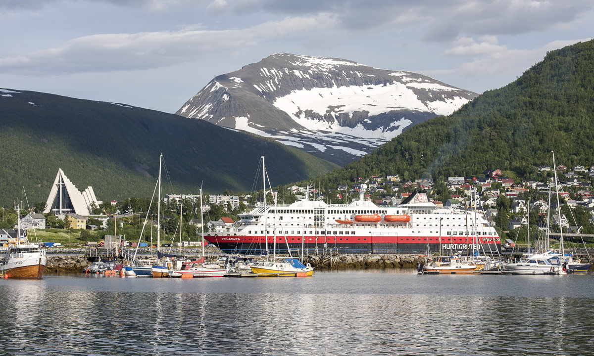
Tromsø is in located in the North. Very far north. It lies 344 km north of the polar circle and is the northernmost town of the world with more than 50,000 inhabitants. It has the northernmost university, both the northernmost cathedral and mosque, the northernmost brewery and probably some more northernmost things of the world.

The shortest route by car from Skelleftehamn to Tromsø leads over Luleå, Pajala, Kilpisjärvi (Finland) and Nordkjosbotn (Norway) and that’s the route Annika and I took.  We had a lot of time and planned to stay overnight twice, but didn’t plan where.

The first part of the route, the E4 leading north, is kind of boring. At least you’re allowed to drive 110 km/h – the maximum allowed speed of the whole journey. In Töre we left the E4, took a break and ate in the Restaurang Roady – the first KRAV-certified sidewalk restaurant.

After lunch we continued northwards. After 50 km we reached Holgers Traktor Museum in Svartbyn, which is always worth a visit. Since it was late – we started our trip in the afternoon – we just made a short stop to take a picture and then continued our trip.

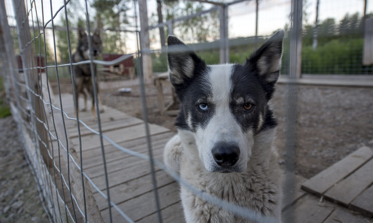
Where to stay? Perhaps we could stay with Katharina whom I met last winter. She lives in Miekojärvi between Överkalix and Övertorneå. We tried to ring her, but she didn’t answer the call. Anyway it’s just a detour of 30 kilometres so we just gave it a try. Katharina has round 20 huskies and someone has to feed them. When we arrived at her house, a man left the shed, looked at us and we were quite surprised to meet Sascha whom we met before in Solberget several times. What a lucky coincidence! So we found not only our first overnight stay but great company, too! Thank you, Katharina (abroad) and Sascha for your hospitality!

The next day we continued our tour after a nice and rich breakfast. We crossed the arctic circle and watched the reindeers.

First stop: Pajala, where a big market took place. Here you could buy a lot of things between tradition and modern age.

After two hours we left the hurly-burly and entered the car again. We crossed the Swedish–Finnish border and followed the E8 which was more construction site than main road. We passed Karesuvanto, where I was sure to meet a food store. All stores however are on the Swedish side, in Karesuando. Not a problem, if you have bread with you and then are given butter, cheese and salami as a present on the super-nice camping ground Lätäsenon Majat near Enontekiö, where we stayed overnight.

Next day we passed Kilpisjärvi near the border triangle, where Sweden, Finland, and Norway meet and soon we were in Norway. Norway is my favourite country in summer because the landscape is so varying and beautiful that even I make photos from within the car:

In Skibotn we saw the first fjord – the Lnygen – and made a break. Annika used it for jogging and I for looking around and taking pictures. I love to stand at the shore, the feet in the water, the view either on the shells or on the fjord and the still snow covered mountains. But the seagulls didn’t like me standing there and they flew some feint attacks, luckily in vain. They don’t dare to come really close.

In Nordkjosbotn we ate hamburgers for lunch. It’s not easy to get anything other than burgers and pizza in Northern Norway outside the cities, but sometimes I like fast food, especially when travelling. From Nordkjosbotn it’s only another hour to Tromsø, where we arrived in the afternoon.

Here we would stay for four whole days with … but that’s another story for another blog article. Stay tuned!


Summer in a nutshell

This Saturday Annika and I met our friend Elisabet, who never says no when it comes to being outdoors. Even if we used a car to reach all those nice places round Umeå we indeed were outdoors most of the time.

1. Mountain hike

Elisabet had asked us what we wanted to do this day beside of bathing. Hiking, sleeping, barbecuing? The sea, forest, mountain …?

I mentioned that it wouldn’t be too easy to find mountains round Umeå, but Elisabet knows many nice places and so she suggested to go up the mountain Tavelsjöberget. Since the top is just 284 metres above sea level, it’s not the longest hike up. There’s a 5 km trail leading through wetlands (according to the sign rubber boots are recommended) but the shortest way up is just 700 meters long. That’s the way we took.

After the short but steep and rocky way up we reached the top. Here we took a break and enjoyed the view over the lake Tavelsjön and the landscape around.

Elisabet told us about some caves nearby and we already saw the waymarks leading down. There at the western side the mountain is very steep and rocky. We found all of the four caves but entered only one, since the others were only reachable by crawling.

We took a shortcut along a narrow path until we came to the very same trail that we took uphills. Soon we were back at the car and quite eager to enjoy some ice cream and take a bath.

2. Sandy beach and ice cream

… and so we did! First we bought ice cream and something to drink at the kiosk and then we took a refreshing bath. Water temperature: 19 °C, air temperature: round 22 °C. Just perfect, if you ask me.

After a bath (Elisabet took two) and an ice cream (Annika and I took two) we started to plan the rest of the day. Barbecue: yes! By the water: definitely! But where? And where to get food? Luckily there was a food store in Hissjö quite nearby. There we purchased food, something to drink and Elisabet asked for some plastic knifes and a fork, which we got.

Then we headed to Bäcksjön, a beautiful lake in the forest.

3. Forest lake and barbecue

There’s a grilling place at the southern tip of the Lake. Seven other cars parked on the same parking place so we knew we wouldn’t be alone.

Elisabet is quite independent when it comes to barbecuing. While I always have a tripod and rubber boots in the car for photographing, Elisabet uses to have a grill and charcoal with her. Soon our sausages, bread, halloumi cheese, asparagus and tomatoes lay on her grill getting barbecued and beside of some asparagus we ate it all. And it tasted so good!

After our meal Elisabet and I took another bath. We weren’t successful when it came to swimming because the lake is quite shallow and you have to go a long while until you can start to swim.

We were so lucky: Good food, great company, a beautiful lake, warm summer weather with a slight breeze and – not to be underestimated: hardly any mosquitoes!

Summer in Northern Sweden! It’s hardly imaginable that people skated on the ice of the Tavelsjö only two months ago.

Summer experience – a bicycle tour in 7+1 chapters

The advantage of a short workday

How much should I work for a German customer today? It’s Corpus Christi, a holiday in Germany but not in Sweden. Well, what about a half day? I finished work at 11:30 and shortly after I started a bicycle tour. The first one this year. Today’s destination: Budsba, a Thai restaurant at Skellefteå Solbacken.

Soon I was in the forest where I expected to be alone. But after some hundred metres there was a huge herd of children, who were too busy with themselves to let me though. Anyway I managed to squeeze through and soon I left the group behind – no children were harmed.

I took the forest path along the lake with the most boring name. It’s called Sjön – “The Lake”.

Some weeks ago parts of the way were quite wet, but now it’s much drier. After some bends I saw a car. Then two people with a table. Camping? Picknick? I came nearer and saw the table packed with plastic cups filled with water and juice. The people invited me to drink and I accepted thankfully. They were teachers and told me that it’s skolavslutning tomorrow – the last school day before nine weeks of summer holidays. Today the pupils of the Örjansskolan had a hiking day.

Thanks for the drink, teachers.

The ways are for the cottages

I continued the small way, which got sandy – not so nice for cycling – but soon I came to a larger way. I turned right and left again and cycled along a gravel road to Södra Skatan, one of the many cottage colonies by the sea.

Some of the cottages are huge and sometimes they surpass their owner’s regular houses. Most roads near the shore are only made for one reason: reaching those cottages. That’s why most ways come from the inland, lead to some summer cottages and end at the last house. They are hardly connected to each other beside of some narrow paths through the forest, if at all. The way after this last cottage was quite broad but stony and muddy so I had to walk the bike for some metres.

In remembrance of winter

Since there are many cottages along Västerbottens Baltic Sea most of these connection paths are short and soon I was on another road, this time an asphalt street. Beside the street there were many log piles. Almost all Swedish forests are planted for getting timber and piles of logs are a common view in Sweden.

Do you see the white thingy on the left side of the log pile? I stopped the bicycle and looked. I looked again and my first consumption was right: It’s old snow which had transformed to ice. I never saw such nearby so late in the year!

Intermezzo: Best food at the ugliest place

I continued the street until I left it to take the gravel road to Solbacken. It ran through forests and sometimes it was quite stony and hard to bike. Clouds approached, but it was still warm with temperatures between 20 °C and 25 °C. Anyway I passed by another winter souvenir: A snowmobile trail. Some more kilometres and I met civilisation again. On the other side of the European Route E4 I arrived at today’s destination: Budsba.

What do you choose – beauty or truth?

I took it easy after the lunch, because I ate too much. That’s the problem with huge lunch buffets of tasty food. And spicy – phew, one of the chilly peppers was quite hot. After lunch I crossed the E4 again looking for the short cut to Fällbacken. I found it and after a short rocky passage the gravel path was quite beautiful and not as steep as expected. Here’s a photo of the way:

It wasn’t so steep, because it was the wrong way! It ended after a hundred metres. I returned and found the right way. This way was quite stony. Then it was quite stony and quite steep. Then it was quite stony, quite steep and quite wet.Here’s a photo of the right way:

First I tried to ride my bicycle but soon my hands started to hurt due to the permanent breaking. Therefore I descended and walked my bicycle until I reached the road that would lead me to Boviksbadet, a sandy beach. There I would clean my muddy feet.

Beach time

An asphalt road again – it was nice and relaxing to just pedal along without looking for stones or glueing my fingers to the handbrakes. I arrived at the beach of Boviksbadet,  the bathing beach of Boviken.

I took a rest but I didn’t bath. It was warm and I would have loved to swim. The sea at Buviksbadet however is extremely shallow. You could walk for ages and still would remain in only knee deep water. I waded in a bit, so at least my feet were clean again.

Come on, it’s just a quick shortcut

After the rest I continued the road and turned left into the Bergviksvägen. This way leads along the Storberget (100 m) and ascends to 90 metres within a kilometre. First I tried to climb the ascend on my bike, using the lowest available gear, but soon I had to rest while my heart beat like a colibri heart. While resting it started to buzz. Some hundred mosquitoes tried to suck my blood. They had a buffet by their own: Hands, neck, eyes, ankles, arms, legs …

Since I ate too much at the Thai restaurant I didn’t want the litte fellows to make the same mistake and so I decided to move on and walk my bike uphills. Walking is less exhausting and so I was on the “top” quite soon. After cycling one kilometre downhills I had to make up my mind.

  • Should I follow all small paths along the coast, which would give me more bathing opportunities but would make the tour longer? Well, no – the sun was almost gone and I was a bit tired, too.
  • Should I continue the way, meat the asphalt road I took on the way there and return the same way? Well, no – I don’t like taking the same way twice the same day.

But there seemed to be another possibility: I could follow the road for three other kilometres and take the small shortcut southwards, where I would meet a road to Ursviken, which is quite near Skelleftehamn.

And so I did. You should know however that it can be quite uncomfortable following me on shortcuts  …

The gravel road descended and was quite broad, but since it was so much gravel on it and potholes in it I didn’t dare to let the bike go and braked from time to time. I approached the shortcut, which didn’t look very promising, but I gave it a try.

I cycled fifty metres away from the main road and looked down to that something that was marked on my map with a black dotted line:

I could return to the main road and just return home the same way, but I still didn’t like the idea. The shortcut would be just some hundred metres and only the first twenty of them seemed to be muddy.

I took my first steps and – splash! – I sank into the mud up to my knees. I freed one foot but unfortunately not the sandal that was still submerged deeply into the mud. It took some time until I could locate it and managed to dig it out. I clamped the sandals on the pannier rack and continued the way barefooted. It was short indeed, hardly 30 metres but my bike was muddy up to the axes and I – well, have a look:

So much to shortcuts …

The “way” became better with some other but less deep mud holes, then it became a grassy path that probably didn’t have been used for a long time (I guess, I know why!)

Now I longed for a bath. My bicycle as well. Anywhere …

Cooling down

… and I was lucky.

The path broadened and soon was covered with gravel again. Marvellous! I knew, that there would be some ponds along the way and I directly stopped at the first one. First I dunked my clothes, then my bike, then myself. After the bath I almost looked civilisation-compatible again. Well, almost!

I continued cycling. The gravel path became a gravel road, became an asphalt street and soon I was on the Skelleftehamnsleden, the road leading to Skelleftehamn, where I arrived round about five hours after my departure.

The daily stage: 42 km biking · ± 800 m walking the bike · ± 100 m bog walking. Not much in distance but in experience.

It’s summer

When you look out of your window and see long green grass in the urgent need of being cut, where 4 weeks ago a snow shower covered the whole garden with white

When you go along the river Skellefteälven and finally other flowers started to bloom than only tussilago

When nights are no dark nights any longer and it will take many weeks until you can see the first stars again …

When you paddle on the river Skellefteälven, barefoot, just with t-shirt and shorts, not with a drysuit as three weeks ago and you even enjoy becoming wet by some breaking waves, because it’s so refreshing …

… then it’s summer in Northern Sweden.

And summer is more than welcome after the long winter. By the way, summer solstice is just 10 days away.

From winter to summer in seven days.

I hardly can remember the intense snow fall a week ago, when I look at a day as today.

Today in a nutshell: sun, shorts, temperatures between 15° and 22° C, sandals, blue sky, t-shirt only, ice cream.

It looked like early spring with only some of the birches starting to come into leaf but it felt more like high summer with today’s temperatures.

Annika and I have been in the “Arboretum Norr” today, just five days later as last year. Last year we could see many different species of flowers, this year only some, mostly Tussilago and Alpine Penny-cress, the two flowers that use to bloom first in the season. No wonder, April and May has been colder than last year. But today warmth attracted many butterflies, such as this European peacock.

And Tussilago is a beautiful flower anyway.

The first polar light of the season

When Annika woke me up, a strong and colourful polar light covered the northern sky. In the short time it took to go in for getting my camera and tripod it already got much weaker, but it was still strong enough to take a picture with a quite short exposure time.

The first polar light of the season is always something special, especially when it’s still August. Almost unbelievable, that only one month ago the nightly sky was so bright, that you hardly could see a single star.

To see the Northern lights from your own garden is still pure luxury. Now I’m looking forward to the next time …

(ISO 800 · 14mm · f/2.8 · 5.0 sec)

A cruise from Skelleftehamn to Bjuröklubb

It doesn’t happen often, that you can make boat trips from Skelleftehamn, were I use to live. Only one week once a year the Laponia Rederi from Luleå comes down to Skelleftehamn for some cruises. Last Saturday Annika and I took the opportunity to attend a five hour cruise to Bjuröklubb, where I’ve been quite a lot, but never by ship. When we arrived in good time before 11 o’clock people already started entering the small ship.

We boarded, too and thereby lowered the average age some years. I sniffed around the boat and got the permission to enter the bridge for some photos.

Five minutes before schedule the ship put out to sea, cruising along the industrial peninsula Rönnskär.

While Annika and I were standing on the top deck looking at the sea, the islands, the sky and the waves, all other people stayed inside and started focussing on the main topic: the lunch buffet. Anyway I have to admit, that especially the salmon was extremely delicious, and the bread as well.

I once thought about making a kayak trip to Bjuröklubb, an exposed peninsula and the easternmost point of the county Västerbotten. It would take me some days, since for one thing I’m slow and for another thing I would follow the coastline and never dare to take the much shorter direct route long away from the mainland. The ship, however was fast and took the “directissima”. Therefore it took only 90 minutes to cruise there.

At the small harbour we all went ashore and the ship continued to a larger harbour nearby where it waited for us. We got a guided tour and went up to the lighthouse where we left the croud for a good reason: Just that day was the International Lighthouse and Lightship Weekend, the only day where the lighthouse – which is still in use – is open for visitors. I went up, waiting for the other visitors – max 4 at the same time – to leave and made some photos. Not only the cut glass mirror construction was incredible but the colourful reflections of the sunlight, too.

Since we already left the group we took a hike to the other harbour, where we entered the ship again. Why it took us more than half an hour to walk for just some hundred meters? Well, there were blueberries, there were raspberries … and we picked and ate a lot of them.

The crew untied all the ropes connecting the ship to the land. I’m sure they are nautical terms for those ropes, you are free to post their proper names in the comments. Then the ship started, fetched the other passengers at the other small harbour and headed back to Skelleftehamn. Annika and I sat on the upper deck and enjoyed sun, clouds, wind, and waves as well as the view on the islands Skötgrönnan and Gåsören.

Ninety minutes later we arrived again in Skelleftehamn, where we came off the ship, while one of the crew played farewell music on the accordion.

Conclusion: A relaxed cruise and the opportunity to play tourist in my adopted homeland for one day.

A weekend in the Skuleskogen National Park

You just leave Umeå by car on the E4, head southwards to Örnsköldsvik and continue a while, leave the E4 in direction Köpmanholmen and Näske and continue to “Entré Nord” (entrance north). You park your car, shoulder your backpacks and follow the signs. And soon you stand amidst the fantastic forests of the Skuleskogen National Park.

Annika got visit of her friend Johanna last week. A good opportunity for us to spend a weekend together in the Skuleskogen National Park. Since our planned tour for Saturday was not so long, we started our hike not until 12 o’clock. In addition to the usual stuff as rain jacket and spare clothes we had a lot of food and water with us. Much water, since we weren’t sure if we would find any near the cottage – much food as potatoes, sausages and a lot of salad because we just wanted to have a bit of luxury.

The first part of the trail through the forest was fantastic, almost magic. Old trees bespangled with lichens, big rocks coated with green moss and from the left a pale light signalising that the Näskefjärden – part of the Baltic Sea – is not far away.

And “not far away” means: just a few meters.

Annika and I looked forward to take a bath, but first we wanted to reach the cottage on the islands Tärnättholmarna to leave some of the heavy luggage there. When Annika told me about the beautiful cabin on the inshore island of the Tärnättholmarna I wondered how we would come there. Is there a bridge? Do we have to take a boat? Wade? Jump? Swim across? Anyway my wonderings were useless: Since the glaciers of the last ice age had melted any,  the land has been rising again – still 8 mm a year! This phenomenon is called post-glacial rebound. That’s why the Tärnättholmarna have been islands in older times, but nowadays are connected with the mainland by a broad band of sand.

It’s not far away to the cottage and we reached it within a good hour. We left most of the food, most of the water, some spare clothes and our sleeping bags and continued much more lightweight. (Beside of me, who had 5 kilos of camera equipment with me, but that’s my problem and most of the time I don’t complain …)

We continued the forest trail southwards. It’s an easy way but not the most interesting part of the National Park in my opinion. Anyway we walked still along the shore and the beaches were sandy and the water was clear and the sun shined … . Time for Annikas and my long yearned-for bath. The water was chillier than expected but so refreshing!

After we have dried in the sun we continued our Saturday hike, now heading north. Here the trail climbs round about 265 meters, if you take the eastern variant. That may not sound much but the change in the landscape is really impressive:

Starting just 200 meters away from the sandy beach you walk through a dense forest of primeval old, large trees. Sometimes the trail is covered with cobblestone-like stones, sometimes with a maze of tree roots, sometimes it just leads over jogged rocks. All of the sudden, the path turns right, leaves the forest and you stand on solid red granite rock. You look up and see more rocks and – yes! – that’s your way up! You follow the marks, sometimes by walking, sometimes by climbing up the steep or rugged passages.

Finally we were up on a rocky and bald plateau and had amazing views over the mountainous forests in the west and the Baltic Sea with its many islands in the east. Unfortunately it was quite cloudy when we went there and I hardly took any pictures. Between the next two photos lie 34 minutes and about 50 metres in height. The descent however is far away from being easy. You have to climb down through rocky terrain with a gradient of 50%.

And then you stand at the upper entrance of the famous Slåttdalsskrevan. Wooden stairs are leading down into that ravine where the trail continues downwards. Inside the ravine it’s so dark, that the contrast to the sky is too high for my Nikon D-800. Either the rocks are just black or sky is just white.

After leaving the ravine we still had to climb down, now again surrounded by forest. After a while we came to the lake Tärnättvattnen. The sky brightened up again and the view of the lake mirroring the blue sky was just marvellous. Johanna, Annika and I agreed in staying at that place overnight, when we should be there once again, even though that cottage is much smaller than our choice.

Now we were not too far away from our todays destination: The cottage on the peninsulas Tärnättholmarna. But even 2.5 kilometres can be demanding if there is another steep and rocky crescent. And so it was. If this passage was in the German Alps there would have been several warning signs about the necessities of alpine experience. In Sweden however you rely on the people, that they know, what they do. It seems to work well.

That’s how a part of the descent looked like when looking back:

I was really exhausted when we were “home” at our cottage, that we shared with two really pleasant Swedes. Annika proofed her abilities of outdoor-cooking while Johanna, though being a total beginner, showed her strong woodchopping skills. The only fault: the sausages were quite disgusting. I shouldn’t complain, it was me, who chose them … . After our outdoor dinner at the fireplace and some talk we all went to bed, glad to stretch the tired back and limbs.

The next day? Nice, smooth and relaxed: A breakfast with yesterday hard-boiled eggs, homemade bread, hot chocolate, and Västerbottens Ost, a local cheese. Strolling around the peninsulas – eating blueberries – sitting on the rocky shore beside the Baltic sea – eating some more blueberries – taking it easy. Taking an outdoor lunch with roast potatoes (with the rest of the sausages) and salad. I took a short nap and after that we packed our now quite empty backpacks, cleaned the cottage and went back to the parking place, where we arrived one hour later. The most challenging part of the day was my car drive back to Umeå, i was so tired!

It was a fantastic weekend. Thanks for the nice company, Johanna and Annika!

Some Sunday expressions in and round the cottage:

Links:

A trip above the treeline

Today the weather was really nice in Venneshamn in Norway. I took the car to drive to a mountain area not far away. At least, if you can fly … . If you take the car in Norway, there’s always at least one fjord you have to drive round, in this case the Verrasundet. So it took a bit longer than excepted taking the ways 191, 193 and 720 round the fjord. Finally I approached the street to the lake Ormsetvatnet. Street, well … it’s more like a steep gravel path, that you can drive up some kilometres to a parking place. The last kilometre to the lake is closed for cars and I had to walk it.

At Ormsetvatnet I crossed a dam wall, walked up a tree covered slope and soon was above the treeline. To be honest, I’m not too fond of forests, when it comes to taking pictures and I’m always glad, when I leave the trees behind when doing a mountain trip.

Now I was on a hilly plateau, the Vakkerheia. Some of the flat mountain tops were marked with piles of stones.

In the plain valley between the hilly tops the ground is soft and wet. Sometimes I had to go round shallow ponds and bogs, but mostly the ground was easy to go. In and round the swampy ponds the cotton grass was blooming. To my big delight there were many cloudberries plants growing in the lesser wet parts and the berries were ripe and ready to eat!

Picking cloudberries can be tedious, because of the many bloodthirsty horseflies that seem to guard them. I think, I slew most of them, but some bit me anyway.

After some hours of a really relaxed mountain hike I took another way back until I came to the gravel road again, where my parked car waited for me.

Half a day later

A thunderstorm approaches from the west. The center seems to be above the very same area that I wandered some hours earlier. The thunder and lightnings were as impressive as the intense colours, that I could see from the other side of the fjord. I was glad, that I haven’t been on that plateau – there would be hardly any place to seek shelter from the massive rain fall or to protect from the dangerous lightnings.

Addendum

And since we’re living in the age of selfies …