Yes, we have beaches!

Skellefteå municipality has round about 400 kilometers coast line (depending on how you measure). Most of the coast is stony or rocky, but there are exceptions. Annika and I used the fine weather yesterday to drive to the peninsula Bjuröklubb, however not directly headed to the lighthouse and the café, but turned right to Storsanden and parked the car. After crossing a sandy grassland that already reminded a bit of the dune landscape of the coastal line of the Northern Sea, we hit a wonderful small bay with a sandy beach.

Round two kilometer to the east, there’s a complete different type of landscape: A long moraine headland, that reaches into the sea called Grundskatan. Normally it’s not easy to reach the peak without getting wet, but yesterday the water level was quite low and we easily reached the peak.

We returned the same way back to the car, drove to the parking place of Bjuröklubb and took the short way to the Café, where we had a late lunch. We went tothe lighthouse, where you have a great view over the Baltic Sea and the coastal scenery. A dark patch on the other side of the bay Gärdviken caught our eyes. Is it solid rock or a a field of big rocky pebbles? Let’s explore …

We took the car and found the way to the coast below the hill Petberget. The way was hardly drivable for my Saab, it’s more a path for forestry machines and jeeps. But – again – what a beautiful place!


View from Odenskrapan

I’ve always loved standing on viewpoints, mountain tops or roofs of high buildings. Just to be able to look far. My apartment in Munich – an expensive town, when it comes to accommodation – had just one room, but a big roof terrace, where I even could see a tiny bit of the alps. You have to prioritise …

Yesterday we had a party with the Skellefteå Kammarkör – the local chamber choir. We were invited by K., who has an apartment in the new built Odenskrapan, a twelve-storey house in the center of Skellefteå. As the weather was fine, we celebrated on the huge roof terrace, where you have an awesome view over the whole city.

I never looked at Skellefteå like this – from high above – and of course I took some pictures (the first one is a panorama made of three photos).

Since I may come to this fine place again – I already have some ideas in mind – these probably won’t be the last pictures of Skellefteå from high above.

From Singi to Sälka and Nallo

This article is part of the series “2015-08: Kungsleden hike”.

August 26 – 29: Day four to seven of the summer hike through the mountains of Swedish Lapland

Singi – Sälka

After three very warm and sunny days clouds came in over night and the sky was quite overcast that morning. Only at the northern sky a larger patch of blue was visible. That fits, we’re going north! The first two kilometres were very well known to us, we went them there and back the day before. The day’s walk was short – just 12 kilometres.

Soon the huts of Sälka came into view. It was funny to see the ads for the shop and the bastu – the sauna – amidst the extend mountain landscape. Only 300 meters left and we entered the reception to check in.

It’s a nice look from Sälka but we had another interest that afternoon: Overall on the ground the ptarmigans were running and there were even sitting on the huge pile of birch wood, so that me, the photographer and them, the models, were on eye level. They let me advance quite near – in fact so near that the tele lens couldn’t focus anymore. The first two images are younger ptarmigans, the last is a grown up – look at these fantastic white feathered feet.

Sälka – Nallo

The next morning there were so many ptarmigans around that you really had to watch yourself not stepping on one of them. I never saw so many and never saw them so near. Our plan was not to continue the King’s Trail but to go northeast to Nallo, a smaller cabin a bit higher up in the mountains. After the common breakfast (muesli with some milkish liquid made from dry milk – yuck!) we started our tour. Even shorter than yesterday: only 9 km but perhaps a bit more demanding since there’re streams to ford, while the whole King’s trail is equipped with Bridges.

We had to look for planks to cross the small rivers behind the cabins but soon we were on our trail.

One hour later we were on the moon …

… well, not exactly, but it was such a sharp contrast to the sweet and lovely landscape of the last days. We could hardly see any vegetation. Only moss, grass and some scattered flowers were left. And some reindeers on some of the tabular slopes. There were many small streams and brooks to cross and it was the first day where I was glad, that I walked in rubber boots.

After a while the lake Reaiddájávri that lies on 1056 meter came into view and we went along it. More and more clouds came towards us and swirled around as if they wanted to surround us.

We had to cross the stream that enters the lake at the northern shore. Annika had to switch to sandals and ford the stream, for the water was to high for her hiking boots. It started to drizzle, than to rain and it got windy. Navigation was less easy now since it started to get foggy, there were less marks and some streams and snow patches to cross. Mostly I navigated with the compass, but twice I took the GPS to ensure my navigation. Since wind and rain increased more and more and I was busy with the navigation I packed the camera into the waterproof bag and didn’t make any photo on the last two kilometres. In the end the small Nallostuga came into view and even the huge mountain Nállu in the back lingered through the floating clouds. We got a warm welcome of the stugvärd – the warden of the Nallostuga. And warm was the wood fired oven, too. A good opportunity to dry our wet clothes.

I only went out later that day to take a photo of the wooden signpost and the hut itself. The rest of the day was just gemütlich – the pouring rain outside and we ourselves warm and cozy inside.

Two days of at Nallo

One

We planned to stay a day in Nallo already two days ago. It looked like a good idea since the rain just poured down the whole day and it was very windy. All people out there looked very wet, whether they just crossed the stream – now twice as large and probably twice as deep – or if they just fetched a bucket full of water.

Time to make some photos within the house. Two typical views in Swedish mountain huts: Many of them have two rooms, each has a kitchen and two flanking bedrooms, only separated by a curtain. That make 20 beds in total. Plus one for the stugvärd who has his own little room. The Primus 2388 is a gas cooker, easy to handle and is found in almost each Swedish mountain hut.

Two solo hikers planned to continue their tour that day but after a while they decided to stay. Perhaps not the worst idea when you looked at the young hikers, that came in. They were completely soaked. They poured the water out of their hiking shoes and hang up the dripping-wet sleeping bags for drying. All was just soaking wet! We we’re quite glad to be inside. But finally I took my camera and went out for some photos. Brr, it was really cold (7 °C) and so windy that the spray of the brooks was blown upwards again. Some photos:

I was glad, when I came into the inside of our cozy hut again. Only Simba, the warden’s dog endured the weather stoically.

Later that day: The sleeping bag already has dried, but other clothes were still hanging on the clothes line.

Two

Next day we wanted to continue our trip but I changed plans. Unintentionally. I got ill. I got fever that night and problems with my stomach and intestines, that I definitely don’t want to describe in detail. Otherwise there’s nothing much to report. I didn’t make a single photo (a certain proof that I was really ill) and slept almost the whole day.

Later in the evening, when I felt a bit better I was able to communicate again. I heard about others that went Singi–Sälka, the very same way we went three days before. The trail has been so flooded that the water poured over the wooden planks of the minor bridges making them very slippery and it was so windy that the hikers were really frightened to be blown from the bridge right into one of the swollen rivers. Illness never fits, bit I guess I chose a quite good day for being sick.

I slept the night before, I slept almost the whole day and I slept the next night. That sums up to round about 30 hours of sleep without any larger interruption. That probably was the best medicine and the next day I felt sound and healthy again. The plan for the coming day: Hiking to Vistas.

From Nikkaluokta to Kebnekaise Fjällstation

This article is part of the series “2015-08: Kungsleden hike”.

August 23: Day one of the summer hike through the mountains of Swedish Lapland

It’s hardly imaginable that it was only two weeks ago, that Annika and me started our tour through the mountains of Swedish Lapland.

On Saturday, August 22 I shouldered my packed backpack and travelled from Skelleftehamn to Nikkaluokta, this time not by car but by bus and train: The bus to Skellefteå, the bus to Luleå, the train to Kiruna, the bus to Nikkaluokta. The journey took the whole day – hardly surprising, it’s more than 550 kilometres and travelling in Northern Sweden takes time.

The most popular way through the Swedish mountains is the kungsleden, the “King’s trail”. It’s not only possible to sleep in cabins, you even can buy food in some of them to keep your package small. We however preferred another route on the Norwegian side. There’re cabins, too, but you cannot buy food. That’s why we started with quite heavy backpacks that included food for more than a week. (It included my camera, three lenses and a tripod as well, but that’s another story …)

Sunday morning was a sunny morning and already very warm. Our destination today: The Kebnekaise Fjällstation, 19 km away. We started our trip right behind the cabins of Nikkaluokta and soon we left “civilisation” and were out in the beautiful Lappish nature.

But we were not alone. Some other hikers were on their way but most of all there were a lot of helicopters flying there and back. Soon we gave up counting them, they were too many. We were glad that the aerial traffic calmed down after a while.

Our first stop was the beginning of the lake Láddjujávri, quite popular for two reasons: Here you can take a boat over the lake to shorten your trip to the Kebnekaise Fjällstation and you can eat a reindeer burger at “Lap Dånalds”. We neither took the boat (too lazy) or a burger (too early), but we ate waffles with cloudberry jam. Tasty!

The day was really warm: 24 °C. You even may call it hot when you carry 20 kilos on your back. Beads of sweat ran down and before we ordered our waffles, I took a bath in the fresh and cool water of the lake.

After a quite long and relaxed rest we continued our tour. The path is extremely well marked and changes between rocky and wet parts. Almost all wet and muddy passages are bridged with spångar – wooden walkways – but there are exceptions …

After 6 km walk we came to the other pier. Time for a rest, some water and food and another bath. This part of the lake was much colder and the bath was merely a dip into the icy water.

What a nice resting place: Warm, quite and not too many mosquitoes. It was hard to get up and to continue, both because of the great weather and our heavy backpacks that felt quite uncomfortable on the very first day of our hiking trip. But finally we managed to pick ourselves up and continued.

After a while the first chain bridge came into view: The bridge over the Darfáljohka. That meant, it was less than two kilometres to the Kebnekaise Fjällstation where we would stay over night. But before that I saw the first patch of snow. As a snow lover I just had to take a picture of it even though I knew it wouldn’t be the last snow on our journey.

Finally we arrived at the mountain lodge which is quite huge. The Kebnekaise is the highest Swedish mountain and so the lodge is used by many people: Hikers, climbers, mountaineers, and fly-in tourists – remember the helicopters?

Annika invited me to dinner – thank you, Annika! – but sadly it was a bit disappointing. The restaurant changed the menu without letting us know in advance and the cod was so soaked in butter that it hardly had any own taste left. Anyway the starters were great!

But anyway – a really nice first day of our tour.

Back from Lappland

This article is part of the series “2015-08: Kungsleden hike”.

Hello, I’m back!

Back from two weeks of (mostly) hiking through the mountains of Swedish Lapland.

The route

NikkaluoktaKebnekaise fjällstationSingiHukejaure – SingiSälkaNalloVistasAlesjaureAbiskojaureAbisko Östra.

That’s between 130 and 140 km; probably some more for the photos and some evening walks.

The weather

All from sun and blue sky (25 °C) to storm and rain with overflowing rivers (7 °C) to early morning fog (-2.5 °C)

The photos

Many. I made 1088 photos with my Nikon camera. I’ll show some of them in the next articles where I’ll also write more about the tour and the experiences. Stay tuned …

An overnight stay on the island Gåsören

Saturday

The advantage of short kayak trips with overnight stay: you can start quite late. It was 7 p.m. when I started pulling my loaded kayak from home to shore. A quarter later I sat in the kayak and started paddling. It’s only four, five kilometres to the island Gåsören that shone in the warm light of the evening sun.

The first thing to do: Put up the tent before sundown. The second thing to do: Taking a picture of the lighthouse before sundown. The stomach reminded me of thing number three: Preparing food and eating. Todays dinner: Graved salmon on fire roasted bread à la plein air.

I was quite curious if I would catch the first polar light. The short term forecast of Soft Serve News wasn’t too bad. But even if the sun already went down round 9 o’clock – two and a half hours earlier than eight weeks ago – I still had to wait for the sky getting darker. After a while however I could see the first faint greenish garlands. My first Northern Lights of the season 2015/16! Great!

But then I saw something in the sky that I thought was much more fascinating: Right above the red coloured northern sky I could see a layer of lucent clouds. They looked really strange because there weren’t red or purple – they were pale white! I never saw something like that before. They looked extremely far away, almost extraterrestrial. I wondered if this perhaps could be noctilucent clouds – clouds that are found in extremely high altitudes of round about 80 kilometres. I stayed awake for a long time, I just couldn’t tear my eyes away from this wonderful phenomenon. Two pictures of the clouds:

Of course I checked my hypothesis directly, when I went home. Yes – I guessed right. My first noctilucent clouds ever. I was really lucky and I’m happy that I could see them just from my tent.

But let’s leave the Mesosphere and go back to earth again. If you tent on the island Gåsören, you can see other lights, too. Lights of civilisation: The peninsula Rönnskär is quite nearby. On Rönnskär there is Boliden Rönnskär, one of the most efficient copper smelters. You think industry is unsightly and ugly? Well, not Rönnskär by night in my opinion:

Sunday

I woke up in broad daylight although it was only half past five. I took one halfhearted picture out of my tent and then I started reading.

I started the book “Norwegen der Länge nach” written by Simon Michalowicz that was published just some weeks ago. Simon hiked from the Southern tip of Norway to the North Cape – round about 3000 kilometres.

I read in the tent – I read sitting in front of the island’s sauna — I read sitting or lying on a floating boat bridge, only interrupted by a short bath in the Baltic Sea. I followed Simon’s tour and just couldn’t stop reading. It was noon when I finally finished the book. If can warmly recommend it to all German readers that love Scandinavia or are interested in hiking. There’s a website as well: www.simonpatur.de.

I wasn’t alone on the island. Some people hired the old lotshus – the pilot’s house for an overnight stay. The first motor boats came in for a day visit. And both summer cottages – there’re only two on Gåsören – were used, too. From T. who owns one of the cottages I learned that it was international lighthouse day today. So before I packed all my stuff together and paddled home I went up the two stairs in the old lighthouse and made a last photo.

I was home again half past two. Many experiences and a good book in less than twenty hours – that’s a fine weekend.

Translation:

EnglishGermanSwedish
Noctilucent cloudsLeuchtende NachtwolkenNattlysande moln

Cloudberries – the gold of Lapland

The very short version:

The longer version for those who don’t know these berries:

These berries are called cloudberries (German: Moltebeere, Swedish: hjortron, Norwegian: multe). Cloudberries like bogs and wetlands where they bloom and bear fruit in July and August. That’s exactly the heyday of the mosquitos, that like bogs and wetlands, too. The berries are found quite outspread and it takes some efforts to collect them. (Remember the wetlands? Remember the mosquitos?)

Cloudberries have a quite special taste. I love them but not all share this liking. They are very healthy and contain three times more vitamin C than oranges.

I went berrying yesterday and checked some bogs near Bygdeträsk, where I stayed the weekend with good friends. I wasn’t very lucky. I hoped I would find enough of them to freeze them for later use, but this small amount will not survive the next days. But I was lucky in another way: hardly any mosquitos.

But I found other things. A small deep pond in the middle of the first pond, a so-called bog pond. If you stand beside such a bog pond you should remember that you’re standing on water or mud, that silted up and became overgrown. Be careful, this ground can be very treacherous!

And I found another thing: A plant, that’s special because it’s flesh-eating: A sundew. What a pity that it didn’t bloom yet.

Sundew is quite common here and grows on wet patches and mud. This one, however, grew directly on water that was covered with just one millimetre of peat. I never saw this before.

By the way: I met a neighbour today, he went cloudberry picking as well. He was a bit disappointed because he picked only 4 kilos. I definitely have to check more bogs to find better places.


Translations:

EnglishGermanSwedish
cloudberriesMoltebeerehjortron
to silt upverlanden
sundewSonnentausileshår
peatTorftorv

Continuing to the Vesterålen

This article is part of the series “2015-07: Lofoten and Vesterålen”.

Our third day started with a lot of rain. We put the wet tent into the car and continued our tour to Kabelvåg where we visited a friend of mine. We took a small mountain hike but it was cloudy and wet. Only far away in the east you could see some sunny patches on the top of the snowy mountains.

After the hike Delle and I looked for a camp ground. But first I had to take a picture of the beautiful rainbow near Sildpollen.

This time we tented on a bigger campsite in Sandsletta. When I woke up quite early the next day I could see another rainbow over the Vatnfjorden, but later it started to rain and pour down again. And again we put the soaked tent into the car. We continued on the road 888 to Fiskebøl. The clouds were hanging low and you could hardly see any mountain, just some white and light grey schemes.

Soon we arrived in Fiskebøl where we waited for the ferry. Again we were lucky – we waited hardly half an hour until we entered the ferry for the short crossing to Melbu, the southernmost city of the Vesterålen. We visited friends of mine, this time in Haukenes were we tented near the friend’s house. The cocks tried to wake me up ridiculously early, but in vain. I continued sleeping until 8 o’clock.

Alas it was the first morning without rain (and the only one, too) and we could dry the tent. After a long and lazy breakfast with my friends we said farewell and continued our car trip. We got a tip to visit Stø at the northern end of the Vesterålen island Langøya. What a good tip and what a beautiful landscape – especially after the weather was nice and sunny. We made a short photo stop between Strengelvåg and Klo before we continued to Stø.

In Stø we parked our car and took a short hike over the mountains to a beautiful white sanded beach were we made a rest and I took a short bath. There’s a 15 km hiking trail as well; next time I’ll definitely will go it.

After our rest we slowly walked back and continued by car. First we had to head south to Sortland were we crossed the Sortlandsundet and headed north on the other side. The sky became more and more cloudy and we looked for a nice campground. Finally we found one in Bleik, quite near Andenes, a town at the northern end of the Vesterålen. We put up the tent and – guess what – it started to rain.

It had been raining the whole night and it continued raining. Again a soaking wet bunch of a tent lay in the back of the car. After a while of driving through the greyness we decided to head back to Skelleftehamn. It’s more than 900 kilometres and it took the whole day. Rain became less near Abisko and after we passed Jokkmokk the sky cleared up and we could see the full moon slowly rising. The next photo, which is the last of our car trip through the Lofoten and Vesterålen is taken near Storforsen, one of Europe’s biggest rapids. At 23:50 we were in Skelleftehamn again – and I was home.

  • 2296 kilometres in six days
  • a lot of clouds and rain, but two nice and sunny days, too
  • one night in the car, four in the tent (three of them on campgrounds)
  • two bathes and at least four rainbows
  • – a nice trip!


From Å to Rystad

This article is part of the series “2015-07: Lofoten and Vesterålen”.

Day 2

Next morning when we woke up in Å we could see blue sky through the fogged car windows. The rain has stopped. We made a walk through the little fishing village and had breakfast on the cliff with a fantastic view on the mountains and the sea.

After that we continued our trip through the incredible landscape of the Lofoten. We had to stop several times to take pictures, for example of this small mountain lake near the road to Nusfjord:

Later we came to a place that became quite famous over the years: Uttakleiv – a beautiful sandy beach that just invites you to jump into the turquoise-coloured water. It almost looks Caribbean but as soon as you enter the ice cold water you’re reminded of being in Northern Norway, not in the south. The bath was fun, anyway.

Here we stayed for a while and enjoyed the sun. But after a while we continued our road trip to Brenna on the island Austvågøy. We didn’t find a camping ground at the end of the road and turned, but soon we stopped the car again. Actually because I wanted to take pictures of the sheep that lay at the sandy beach, but some children nearby discovered something much more interesting: A fox cub. I changed to the telephoto lens and I came quite near. Probably the fox hadn’t made any bad experiences with humans yet.

After that we stopped at a camping ground near Rystad that we already saw on the way to Brenna and decided to stay overnight. Soon the tent was put up on the grassy ground. Slowly the sun went round the mountains and sank down. The next hours were incredible – the light was so wonderful, both the sunlit main land in the south and the sea in the north glowed in the most fantastic colours. But have a look by yourself:

Round one o’clock we lay down in our tent, but only because clouds came and it started to rain a bit. What a wonderful first day on the Lofoten!

A hike and three tests

Do you remember Nokia? Cell phones and rubber boots? Today I tested a quite similar combination: Rubber boots and a Nikon lens. Plus a hiking trail.

A few weeks ago I discovered a big information board at a forest edge in Skelleftehamn. It describes the “kraftleden”The force trail or The energy trail. Perhaps the trail is named after Skellefteå Kraft, one of the sponsors I thought when I read the information.

Today I decided to try to hike the 18km long trail. I had two new things with me: My new rubber boots Tretorn Sarek which are made for hiking and my new lens Nikon 100mm f/2.8 (Series E), that I bought secondhand some days ago.

After a one kilometer walk I was at the starting point.

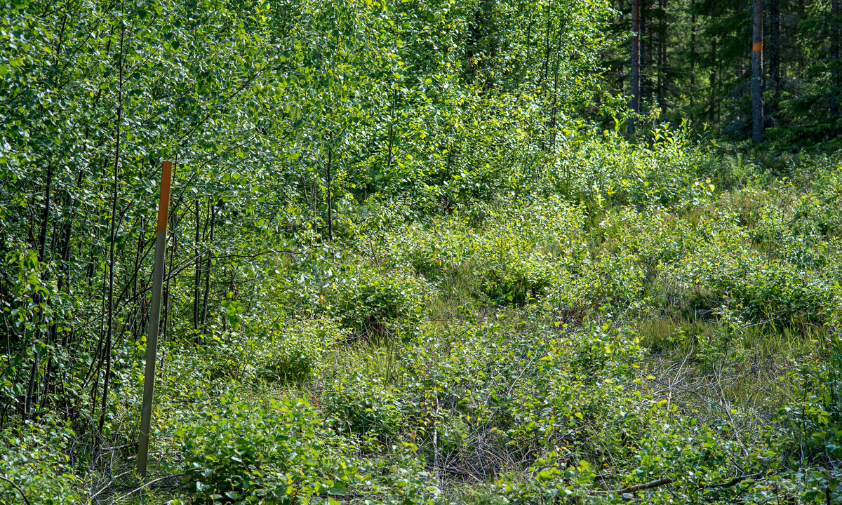
At the first junction I was lost, since I couldn’t see a sign. But after checking my photos of the information board I learned that the way marks where orange coloured blazes round the trees. That’s easy. The trail itself however wasn’t easy at all. It looked more like an area where you cut down trees and bushes. Like a stork I stalked through the cut down branches and twigs that lay criss-cross on this so-called trail hoping for a better path.

And the trail got better. But I still was slow. This time not because of the trail but of my new lens. It’s my first lens ever without an autofocus. This means that I have to focus manually at the lens itself. It took some time until I got used to it, but I still had to control every single shot on the display and I had to make some photos five times until I was satisfied.

I continued the trail – now a nice stony path until I came to the Örberget – altitude 40 meters, 30 meters higher than the starting point. It doesn’t take much to be called a mountain here. I made a photo of a “gravröse”, a tomb from the Bronze Age. Probably it was build at the shore some thousand years ago but the land has been rising round a centimeter a year since then.

I continued the walk. The ground became wet and muddy and after a while I stood in front of a bog. In the middle of the bog I saw a wooden post with an orange blaze. OK, let’s go …

… now I knew, that the new rubber boots were not only comfortable but really waterproof. I didn’t get soaked, but it was quite close.

I always had to look down carefully to avoid the deep water and mud puddles, and I had to look forward to find my way. When I looked up I started to suspect why the trail was called kraftleden. Almost the whole trail followed the transmission lines and the Swedish word for transmission lines is kraftledning. That’s a really pragmatic approach to make a trail since some kind of path was made already to mount the power poles. But it’s not very inspiring just following the lines and not beautiful neither.

After round 11 kilometers I made a rest on a high seat normally used for hunting moose.

I continued the tour but I started to lose interest a bit. Parts of the way were hard to walk, harder than many mountain trails but without the reward of a beautiful landscape or great views. In addition of that I started the tour round half past two and I didn’t want to come to town too late. So I left the kraftleden and walked southwards through the forest. At the beginning I found some nice flowers and I changed the lens to a macro. First two additional test images of the new 100mm lens, then two flowers – a dactylorhiza maculata and a linnaea borealis:

OK, I have to admit: I tested four different things, not only three. Number four was a mosquito protection jacket, that came in quiet handy when I shot the macros of the flowers. Flocks of mosquitos darted for my blood, but they didn’t had a chance beside of biting into my unprotected hands.

After taking the flower images I had to walk some other kilometers until I came to the main road and another one to come to the bus station where I had to wait half an hour for the next bus. Happily I slipped of my rubber boots to try my socks, sat down and waited. Finally the bus came and half an hour later I was home. The GPS displayed:

19.0 kilometers · average when moving: 4.3 km/h · total average: 3.3 km/h

And here come todays test candidates:

Rubber boots Tretorn Sarek: Really nice and comfortable boots, perhaps a nuance too tight for me. They are made of natural rubber and it’s easy to turn the upper upside down. They could be a bit higher.

For me: 8 points out of 10.

Nikon 100mm f/2.8 (Series E): A small, lightweight lens with manual focus. I have to practise focussing. I prefer my huge Nikon 70-200mm VR II, but there’s a reason why I bought the former one: At the end of August I’ll start a two week hiking tour in the Scandinavian mountains and I want to save weight. The 70-200 weights more than 1500 gram, the new 100mm only 215 gram. Got the point? And it was cheap, too – only 53 Euros.

For me: 7 points out of 10.

The trail kraftleden: The only advantage of the trail is that you avoid navigation. Beside of that it’s an awkward combination of a trail a bit too hard to be nice and a bit too boring to be beautiful. I wouldn’t recommend it. If you want to give it a try, take high rubber boots and plenty of time with you. Take care and follow the way marks if you don’t want to end in almost knee deep mud as it happened to me today.

For me: 3 points out of 10.

The nameless mosquito jacket: Perhaps it’s not fun to walk within some kind of mosquito net but it was great, when I took the macro photos of the flowers. The hood is too big. Since it’s very light – only 214 gram – I will take it with me on all summer photo tours and perhaps even on the planned mountain hike. And with costing only 18 Euros it was a bargain, too.

For me: 6 points out of 10.

Translations:

EnglishGermanSwedish
Dactylorhiza maculata / heath spotted-orchid / moorland spotted orchidGeflecktes KnabenkrautFläcknycklar
linnaea borealisMoosglöckchenLinnea
upperSchaft (am Schuh)skaft