Jämtland tour 22 – hiking up the Gåsen
This article is part of the series “2022-08: Jämtland and Trøndelag”.
In Gåsen, one of my favourite cabins in the Swedish mountains we took a day off from our hiking tour. My brother-in-law and I took this as an opportunity to hike up to the summit of the mountain Gåsen, name giver of the cabin.
Gåsen is 1427 metres high. That’s however not a huge ascent, because the cabins lie on 1100 metres.
As everywhere in on our hiking trip there were reindeer around. What do they do on the snow fields? Eating snow? Fleeing the mosquitoes, while there were no around? I don’t know.

We approached the mountain from the south where it is less steep, although Gåsen is quite flat everywhere. While we went up my brother-in-law discovered a snow hare (a.k.a. mountain hare) that ducked to the ground but then sprang away when it realised that we spotted it.


Looking back: the cabins of Gåsen. Looking ahead: the way to the top. And more reindeer.


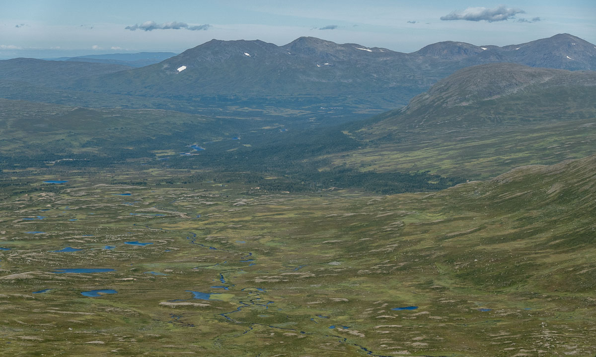
And there it is – the summit of Gåsen. While the top of the mountain is just a large gravel plateau the 360° panoramic view is quite impressive. It’s not only the mountainscapes that surround Gåsen but the large valleys that made this landscape so huge and seemingly endless.


After a rest – being thankfully for our jackets because it was quite windy – we ascended again, this time more direct to the cabins we stayed over. This time our hike led us over two snow fields. We were not alone, the reindeer seemed to liked the snow fields, too.


At the end we had to go a bit zigzag because the ground was quite wet but after 2½ hours we were back at our cozy cabin. That was fun!
Bonus photo: A cloud. For me it looks like a singing turtle floating effortless though the sky. And you?