Winter on the Vesterålen

This article is part of the series “2017-02: Northern Norway”.

I’m sitting in a small mobile home in Nordnes near Røkland, Saltdalen, Norway. This morning Annika and I left Haukenes on the Vesterålen, where we had visited friends for some days. It had been gorgeous days, not only because it’s always fun to visit friends, but because of the fabulous winter weather we got those days.

Arrival

Last friday we left the Hurtigruten ship in Stokmarknes that we entered in Vardø two days before. My friends told us that there hadn’t been any snow one week before, but since then almost half a meter snow had fallen and snowfall hadn’t stopped yet.
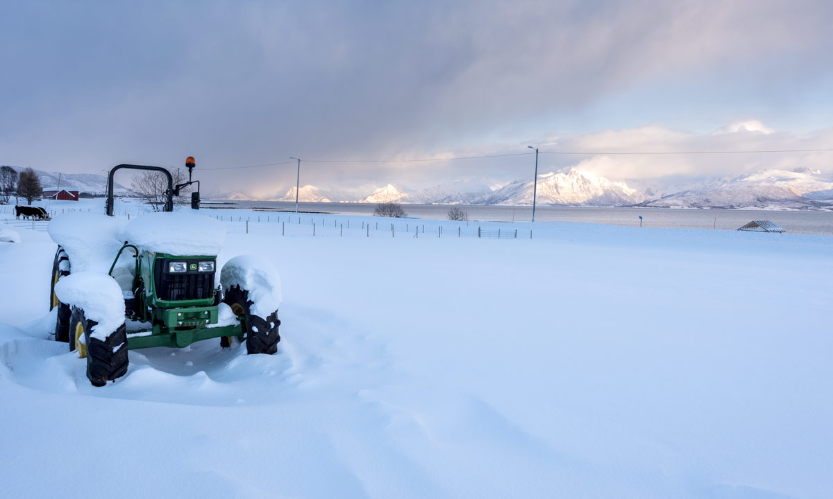
Saturday

It snowed another ten centimetres the night and it continued snowing in the morning.

Sometimes the Norwegian weather forecast is right and so it was this day: As predicted it cleared up and promised to be a nice and sunny day later on. Annika and I took our skis and joined J. and B. together with Frits, the dog, on a ski promenade right behind their house . J. and B. returned after a while, we continued through the forest to the boggy valley Dalmyra over which we returned. Two small streams we had to cross with our skis but they were narrow enough to be crossable without problems.

Back again I looked at the snowy mountain range of the Lofoten that you can see from my friends house. The sinking sun changed colours of the snowy peaks every moment, from bright white to pale yellow, to “peach”, to orange, to colour shades I’m not able to name.

Sunday

Another sunny day awaited us. Annika and I planned to ascend the Hovden, a mountain, not high (285 – 323 m) but steep. So we left home our skis and took snowshoes, first to hike on snow covered ways and paths to Marka, were we went up the Hovden. Phew, that was quite exhausting.

Annika went back while I continued a bit, first along the waymarks, then using my GPS.

I just love being above the treeline in Norway, where the view is wide and includes snow covered mountains and solitary trees just as blue coloured open fjords.

I descended the top and came to the small lake, where I took a break with water and „Kvikk Lunsj“ chocolate.

The descend from the lake was far from being optimal, I chose a very steep passage and it took a while and some concentration until I was on sea level again, were I walked back to my friends house, first on a minor road, than across a snow covered bog.

Monday

I might bore you, but even this day the weather was fantastic. Annika and I followed a tip of J., took the car to Sandnes and skied to Årneset, a place by the bay Årnesbukta. Here’s a cosy cabin were you can seek shelter, when weather is bad and a row of beautiful sandy beaches. I never ever skied along sandy beaches and open water and I really enjoyed this ski premiere.

Tuesday

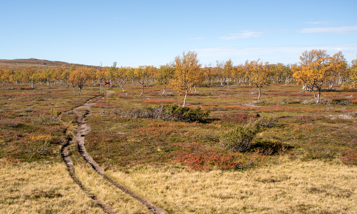
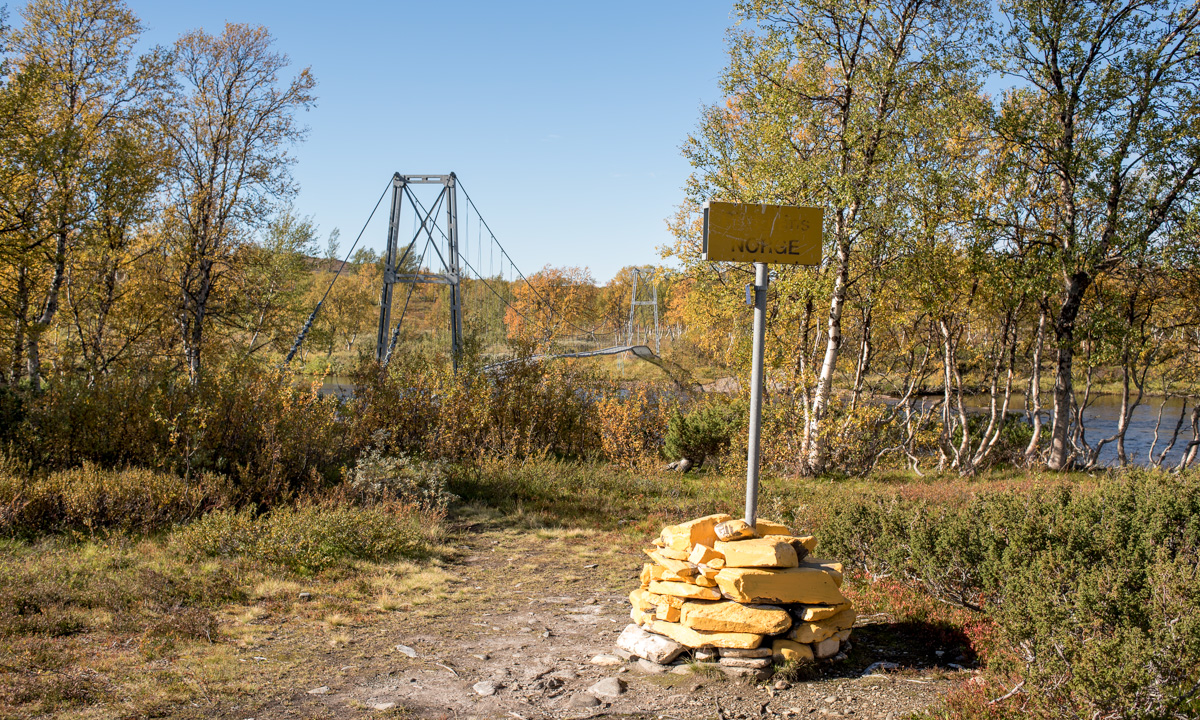
Our last day on the Vesterålen and guess what: Weather was great again! Anyway I was quite lazy, so Annika and I didn’t use skis or snow shoes but the car to drive round the southern part of the island Langøya on which my friends – now our friends – live. Some impressions:

That was our last day on the Vesterålen. Thank you, J. and R. for your hospitality. I hope, you’ll visit us in Sweden someday. You’re more than welcome!

Tomorrow we’ll continue our return journey, first 40 km to the Norwegian—Swedish border, than round 380 km home to Skelleftehamn.


Two days on the Hurtigruten

This article is part of the series “2017-02: Northern Norway”.

On Wednesday we left Kirkenes and started our journey to the next destination: Stokmarknes on the Vesterålen where we planned to visit good friends of mine.

KirkenesStokmarknes would be 1000 km by car and take at least 14 hours, if you take the faster way through Finland and Sweden. Anyway there’s an alternative: The Hurtigruten express route, which connects many coastal towns, among others Kirkenes and Stokmarknes. That’s why we took the Hurtigruten ship instead of driving for at least two days. In Vardø we entered the vessel Trollfjord and 16:45 we started our two day long tour.

The first night we went to bed quite early and I only took some pictures in Berlevåg. Since the ship already was moving again I decided to make a longer exposure with the camera on a tripod. That’s Berlevåg by night seen from the Hurtigruten:

We missed Mehamn, Kjøllefjord, Honningsvåg. The first place with a landing stage I saw was Havøysund, were we anchored from 7:45 to 8:00. Shortly after we met the Lofoten, the oldest and smallest ship of the Hurtigruten fleet today. It was tiny compared to the much bigger Trollfjord (which is tiny compared to modern cruise ships).

I tried to be as much outside as possible. It was cold and quite windy, not only because of the airflow, but the gusty wind, too. First I thought, that I would be extremely overdressed in my Canada Goose expedition parka, but soon I found it quite comfortable to wear it in the chilly weather.

In Hammerfest we left the Hurtigruten, looked round in town and bought food. In Øksfjord it started to get dark and the black-white mountain ranges became blue.

… and blurred if you wanted to …

… and it got darker …

Then it started to snow. Sometimes the snowfall was quite heavy especially with the wind and I was even more glad about my warm parka.

In Tromsø we arrived at 23:35 and I made some night shots of this favourite town of me.

We could have left the ship for a visit of Tromsø but we preferred sleeping. We’ll probably visit Tromsø this summer.

The next morning came and the last day aboard began. Good for me, because even if I was glad to slip the car ride it’s not my world to be on a large ship looking at the landscape rolling by. Last night snow fall has brought much snow on the top deck. I never waded through snow drifts on a ship before.

At the same time the Trollfjord anchored in Harstad, a town on the island Hinnøya.

On our way to the next destination Risøyhamn it got extremely windy, the stabilised ship started to roll and to pitch and heavy snow showers appeared, reducing the view to some hundred metres.

Suddenly the wind calmed down, the snow showers were left behind and for the first time of the whole cruise patches of blue sky and finally the sun came out. We approached Sortland, the last stop before our destination Stokmarknes where I gazed at the beautiful mountains of the Lofoten archipelago in the south.

I generally dislike the last 30 minutes of transportation, if it’s by train or by plane. I just want to arrive, and so it was on the Hurtigruten. Impatiently I waited in the inside of the Trollfjorden for its arrival in Stokmarknes, then another fifteen minutes for the allowance to enter the car deck and another ten until I was allowed to drive the car onto the very same car elevator which I used to enter the ship almost 46 hours ago.

I could write a lot more about the Hurtigruten and its passengers, but that’s another story. Short résumé: I love those ships for transportation, but cruising is not my cup of tea. (Anyway, the outside jacuzzi on the top deck is really great!)

The Varanger Peninsula

This article is part of the series “2017-02: Northern Norway”.

Never have I been so far northeast before, travelling from Kirkenes to Vardø, where Annika and I would enter the Hurtigruten vessel Trollfjord. After the visit of the Sjøsamisk Museum we were glad to be in the warm car again as it was quite stormy outside with temperatures round -12 °C.

We left the E6 in Varangerbotn and continued eastwards on the E75. While there were many trees along the E6, the landscape became more and more arctic now. Between Varangerbotn and Vadsø there were still small and scattered birch trees and thickets, but there’s hardly any visible vegetation left between Vadsø and Vardø in wintertime. On the left side of the street lay snow covered mountains, hills and tundra plains, on the right side the rough Barents Sea. Hardly believable that people live here, but they do, mostly on places quite exposed to the sea and of course near to the E75, the only street.

We had to catch the Trollfjord the same day, a pity, since there was so much to look, to explore, to photograph. Next time I would plan an additional overnight stay to have more time.

Far away at the horizon of the Barents Sea we could see something rectangular. A container ship or our Trollfjord? Coming further and the ship coming nearer we could see that it indeed was the Trollfjord that left Kirkenes some hours after us.

We didn’t have much time to visit Vardø, just a very brief run through the witchcraft trials memorial, then we had to enter the big ship by car. I was the only car boarding; most passengers are cruisers, either taking the whole tour Bergen—KirkenesBergen, or the much shorter Tromsø—Kirkenes—Tromsø.

We got our room (small, but sufficient), I bought internet for two days (quite poor, since it blocks a lot of urls and ports, among others my mail traffic) and then we left Vardø by Hurtigruten.

Since then Annika and I have been on the Trollfjord. In three hours we’ll be in Tromsø, tomorrow afternoon we’ll leave the ship in Stokmarknes and will stay on the Vesterålen for some days.

4×4 winter impressions of Kirkenes

This article is part of the series “2017-02: Northern Norway”.

Kirkenes – the harbour

While Annika and our friends in Kirkenes enjoyed their breakfast in the Hotel Thon I took a short promenade along the Johan Knudtzens gata to take some pictures. Already the view from the hotel terrace over the fjord is quite impressive and shows the beauties of the arctic nature while the harbour shows the more practical sides of living here: fishing, both commercially and just for fun.

A hike onto the top of the Lyngberget

After the breakfast we took the car to Jakobsnes and a bit further to take a promenade up the mountain Lyngberget, which lies on the other side of the Bøkfjorden. Here you can have a wide view over the whole town of Kirkenes – at least as long it doesn’t snow, as it did on our way back. I just love these wintry landscapes where you have views over fjell and fjord, but the wind was quite chilly and soon we looked like the participants of an arctic expedition.

The Huskies of the Kirkenes Snowhotel

Today we played tourists and visited the Kirkenes Snowhotel, which is just some hundred metres away. The Snowhotel has 180 Huskies including the seniors plus 30 puppies. The huskies are like we humans – some are working, some are resting, some are curious and some are shy. But they are all very kind and friendly.

Inside the Kirkenes Snowhotel

I slept in tents, in igloos and outside in wintertime. I even slept in the Kirkenes Snowhotel two years ago. This time Annika and I enjoy sleeping in the inside of our friends house (Thank you for your great hospitality, Christine and Ørjan) but gave the Snowhotel a visit. And it was worth it – especially the lounge with it carved ice blocks is very impressive.

Tomorrow we’ll leave this fine place, take the car to Vardø in the North (yes, that’s still possible!) and take the Hurtigruten from there to our next destination.

Crossing and not crossing borders

This article is part of the series “2017-02: Northern Norway”.

Hardly believable that Annika and I started our holiday trip just three days ago when we looked at the arctic landscape today.

On Tuesday we started in Skelleftehamn, Sweden and crossed the first border to Köngäs, Finland. 481 km.

On Friday we continued in Köngäs, Finland and crossed the second border to Kirkenes, Norge, where we’re visiting Christine and Ørjan. Another 387 km.

Yesterday on Saturday we took it easy and relaxed after the two day road trip.

Last night I got sick. (That’s another story but the reason, why we cancelled our ski tour today.) Instead of that we took a short road trip to the Russian border, a border that we cannot cross without a valid visa.

The only border checkpoint between Norway and Russia is at the E105, the road to Murmansk. This checkpoint is only 10 km away from Kirkenes. I’ve been there two years ago.

In Elvenes there’s another small road to Skafferhullet. This place lies at the Russian border, too. There’s no checkpoint, the small road just ends and a fence with some signs marks the border to Russia and warns of crossing it. Here I really had the impression, that the world – as known to me – had come to its end and another kind of secret part of our planet begins right after that wire mesh fence.

Only wild animals can cross borders without any harm. They don’t share my memories of the inner German border, they don’t know anything about the cold war, they don’t have to care borders at all. Lucky them!

Perhaps I’ll witness the day, when the border to Russia is as open as many inner European borders today. Who knows …?

Just before the border checkpoint on the E105 there’s the road 886 to Grense Jakobselv – another place located at the Russian border. Most of the road is closed in winter time, but the first part is open. And this way is quite beautiful. We followed it until the barrier, where only snowmobiles are able to continue. There we took the minor road to Lanabukt located at the Jarfjorden.

Some photos:

What a great day with fantastic winter weather and temperatures round -17 °C. On the way back we stopped at the petrol station to buy me salted sticks and a Coke because unlike in Sweden super markets are closed in Norway on Sundays.

Back to Sweden

This article is part of the series “2016-09: Jämtland and Norway”.

20. September

The day after our walk to and through the Torghatten we took a breakfast in our fantastic cottage Feriehus ved Lille Torgvatnet we hired for two days. After that we tidied a bit, packed our baggage into the car and continued the tour.

We took the 17 to the north to Horn, where we took the ferry to Andalsvågen. We drove 17 km to Forvik, where we took another Ferry to Tjøtta including some intermediate stations.

Have a look at the 2nd photo above: „Tricky stopover in Stokka“. You see the car with the trailer? Look closer. Did you realise, that the taillights are on? The car isn’t leaving the ferry, it’s entering it. Backwards! All cars in Stokka had to embark the ferry backwards – whether that car with the trailer or the camping van. I never expected that you have to enter a ferry like this. The next port we experienced an even bigger oddity: The car with the trailer even left the ferry backwards. Really strange!

We continued on the 17 – now without any ferries – but left the road near Leira to continue to Mo I Rana. From that town it’s just another 40 km to the Swedish border.

Annika and I enjoyed the incredible autumnal colours of the trees on our way back and I looked for a place to make some last photos of the tour. 2.8 km behind the border I found it:

After looking at these stunning and extreme colours we continued to Tärnaby, where we stayed over night. The next day we drove back to Umeå, where we arrived in the afternoon.


Torghatten

This article is part of the series “2016-09: Jämtland and Norway”.

16. September

After our five day hiking tour in the Swedish Mountains a week of Annika’s and my holiday was left. We entered the car and left Storulvån. Shortly before we approached the E14 I asked Annika: “Back to Umeå or Norway?” The answer was: “Norway”. So we travelled to Norway …

19. September

After visiting friends near Mosvik we decided to drive north to Mo I Rana, but neither on the direct way, nor on a single day. We made a two-day stopover in a fantastic cottage between Torget and Brønnøysund. On the other day we drove to Torghatten, a mountain in the south of the same island. There’s something special with this mountain: It has a huge hole. From the parking place at the foot of the mountain a path leads up to the hole and through the natural tunnel to the other side. We slipped into our boots, took the cameras and went up.

Some photos:

We put ourselves on a large stone and looked at the landscape behind: The rocky slope, the tiny red farm house, the beaches and the sea with its many islands. We could have continued on that path, which leads further, but then we had to go round the whole mountain on a gravel path at the end. So we just returned the same way.

An impressive tour, that doesn’t take much time. Don’t miss it when you’re near Brønnøysund. And take your wide-angle lens with you!

Jämtland hike part III: back to Sweden and finishing the tour

This article is part of the series “2016-09: Jämtland and Norway”.

After two days in Norway we headed back to the Swedish mountains.

Thursday, 15. September

We started our day with a breakfast.

The Norwegian lodge Nedalshytta is really beautiful, but doesn’t have a kitchen and sells only some snacks, when it comes to food. Luckily we had both own things to eat and a mug with us, so would could enjoy our own breakfast: oat flakes with frothy milk! How to get frothy milk on a mountain tour? Mix milk powder and water in an empty coke bottle, shake it vigorously and voilà: schiuma di latte à la Annika.

After packing our backpacks we started our hike to the Sylarna Fjällstation. It was the first cloudy day since we started our tour three days before and anything was moist and wet. Sometimes we had to take a break to pluck some blueberries, that still tasted fresh and sweet.

We went along the Templet, which is Swedens highest peak of the Sylarna mountain range (1728 m). (Storsylen with its 1762 meter altitude is higher, but on the Norwegian side, just 100 meters from the Swedish border.) Due to the weather we first couldn’t see that much but after a while it started to clear up and the clouds released the view on the huge and barren slopes of the Templet massif. We were so lucky, that we hadn’t to go this part of the trail in fog and clouds.

Soon we arrived at a place called Ekorrdörren – the squirrel door.

We started our tour at 780 m above sea level. Now we were on 1100 meter and would have to go up another 260 meters to reach the Ekorrpasset – the squirrel pass – which is 1360 m above sea level and so the highest point of our tour so long. We started climbing up the slope but had to look back over and over again. The undulating valley of the river Åeruvedurrienjohke with it’s many hills and ponds looked like from another planet.

Our trail got more and more rocky. After a while there was hardly any way left, we just went over angular rocks with gorgeous views of the Templet, including a small glacier and the Slottet, another peak of the Sylarna.

I really love the changes of the landscape you can have within just some hours: From autumnal birch forest with blueberries over to grass covered plateaus and finally up to an asteroid-like landscape that looks like a pile of stones.

Especially the squirrel pass looks both harsh and impressive. Anyway, when you go up a pass you’ll probably go it down as well and even 200 meters altitude make a difference. The Sylarna Fjällstation lies near the river Sylälven that flows through a wide grass covered U-shaped valley and when we came nearer we could see three reindeers standing in front of the cabins. Back to civilisation.

We had hiked four days in a row and were quite eager to take a day off. Sylarna fjällstation would be an ideal place, since it lies beautifully and you can leave that place in six different directions. Alas, there weren’t only reindeers, but people, too. Many people. The place was crowded! There were many hikers and mountain joggers. In the big dining room sat a large group of bankers that got their three-course dinner including candlelight and fresh salad, brought by helicopter. We were unsure, if this should be a good place to rest for a day.

The information we got in the evening shocked us a bit: There were already 100 – 125 booked sleeping-places for that night (in addition to all people that would come without booking). That means, that this place would be even more crowded. Even Helags, which is more in the South had just some single sleeping-places left.

That was the moment, where we decided to escape.

We would stay overnight of course, but the next day we would abandon the tour and hike back to Storulvån, were I parked my car.

Friday, 16. September

I was awake quite early, took my camera and tripod and walked out to wait for the sunrise. The valley Endalen was covered with fog. I looked at the glacier Storsylglaciären,that covers the eastern slope of the Storsylen and a lavvu – a traditional sami dwelling. The sun however showed up quite late, there were too many clouds.

I looked at the less beautiful parts of that place too: An excavator on a flat building site, a welcome sign surrounded by building material and waste.

We started the tour being content to leave Sylarna behind but a bit melancholy, too, because we didn’t plan to leave the mountains already after five days. Annika started to count the approaching hikers, there were quite many …

After half the way we approached something quite funny:

It’s neither a sculpture nor a church, it’s a WiFi-station including a recharging unit for smartphones! It is even marked in the hiking map: “WiFi och laddstn.”. There were many hikers and even some mountain bikers resting, but no one started the WiFi. The cellular network is quite good in that part of the mountains and I guess there’s hardly a young Swede without a mobile internet flat rate.

We continued our tour and slowly hiked down the valley Endalen. After a while we were below the tree line and the landscape got even more colourful.

And just shortly before we reached our starting point, were we had left four and a half days before I spotted a lonely birch tree – almost leafless. A symbol, that winter will come even this year. Fifteen minutes later we reached Storulvåns fjällstation, then the parking place, then my car. Annika has counted almost 150 people hiking, jogging and cycling to Sylarna, just from one direction! That confirmed our decision to leave Sylarna behind.

It has been a fantastic and varying tour with many different experiences in a short time. Tack för turen – Annika!

The End.

“Wait, wait …”
– “… wait, what?”

“How can it be the end? You had two weeks holidays, not only five days!”
– “well, ok, we did continue our journey.”

After changing cloth, using the bath room and drinking a coke we got in the car and I drove the way back to Enafors, that lies at the E14 which connects Trondheim in Norway with Sundsvall in Sweden. We considered some options but didn’t decide yet what to do next. Shortly before we approached the E14 I asked Annika: “Back to Umeå or Norway?” The answer was: “Norway”. So we travelled to Norway …

Stay tuned for the next article telling more about our trip in Norway …

Jämtland hike part II: hejdå Sweden, hei Norge!

This article is part of the series “2016-09: Jämtland and Norway”.

Annika and I are in the mountains in Jämtland and have just reached our first destination: Blåhammaren, where we slept in a 14-bed room.

Tuesday, 13. September

Sleeping in a 14-bed room can be quite demanding, especially if you have this kind of snorers in your room, that could awake a frozen mammoth. However Annika and I were really lucky, no snorers at all! After our breakfast we had to decide where to continue our tour. From Blåhammaren you can hike back to civilisation or continue to two other destinations. Most of the hikers continue to Sylarna which is very central and part of the Jämtland Triangle, a very popular three-day-tour, that connects Storulvån, Blåhammaren and just Sylarna. We were keener to cross the border and hike to the Norwegian lodge Storerikvollen and so we did.

With an altitude of 1086 m Blåhammaren is the highest tourist station of the STF – the Swedish Tourist Association – so first the trail ran over the treeless mountain plateau, over rocks and moss, crossing some swamps and brooks. After a while we descended and the first yellow coloured birch trees came into view again.

Swedish summer trails are marked with red coloured dots on rock or tree, while winter trails are marked with poles bearing red crosses. You really shouldn’t follow the winter trails in summer unless you want to stand in front of a lake or find yourself deep in a bog – both are easy to cross only in wintertime. But quite often there’s a year round trail which makes navigation extremely easy even on less walked routes.

One kilometre behind Endalen, an emergency shelter, where we rested for a short while, the Sweden-Norwegian border came into view. It’s hard to mark a border less spectacularly than this one: A sign amidst of a pile of yellow painted stones, that’s it. The large bridge that crosses the river Enan (Sami: Äjnänjohke) directly after the border offers far more spectacularity.

We detected a real nice resting place on the other side of the river, where we planned to enjoy the warm summerly weather, but two other hikers – by the way the first ones we met that day – coming from the other side chose exactly the same slab of rock to rest. Luckily we found another place, at least as nice as the first one. We unmounted our backpacks, took of our boots and dangled our feet into the ice-cold water.

(I like the photo with the drifting yellow birch leave and the dead mosquito. It illustrates, why I prefer the autumn to summer: Beautiful colours and no biting insects left!)

In Norway the summer trail marks change, now the trail was marked with big bright red T-s. The red T is also the logo of the DNT, the Norwegian Trekking Association.

Do you see the dark piece of something on the top of the stone? It’s animal droppings, but I’m not sure of which species. I asked for help on Facebook and the favourite answers are reindeer and (arctic) fox.

We continued our tour until we came to another swing bridge, this time crossing the river Djupholma. On the other side of that river lies a nice sandy beach where I took a refreshing bath (the only one of the whole tour). It was only two other kilometres to walk to our destination, the cabin Storerikvollen, where we arrived round six o’clock.

Oh, so nice these Norwegian lodges are. They seem less “funkis” (the Swedish functional style) and more “hyggelig” (the Norwegian word for cozy, snug, or homelike). Just gemütlich! And we got a two-bed-room for a good price. The only thing you should know, when you visit the Norwegian side: These cabins hardly sell any food and there is no public kitchen as in the Swedish cabins. So you have three options: (1) take a camp stove with you and cook outside. (2) cold dishes! Hopefully you have all with you. (3) eat the dinner and breakfast provided by the lodges (and pay the Norwegian price).

We chose (2) and had a nice dinner with salami, crisp bread and fresh water outside in the evening sun, enjoying both our simple meal, the warm air and the beautiful view. Later the almost full moon rose above the reddish mountain chain – what a beautiful evening!

Wednesday, 14. September

The next day would lead us to the Nedalshytta, which is between 20 and 24 km away, depending on which map or sign post you rely on. So we got up quite early.

We had to go back yesterdays route 2 or 3 km where the trail divided. Now we turned south and had to ascent. Soon again we were above the treeline. When we looked back, we could see parts of the big lake Essandsjøen and even spotted – beside of some reindeers – the now tiny Storerikvollen, that we left some ours ago.

After a while we came to the river Fiskåa, where we had to ford. My rubber boots were high enough and I just splashed through the water, whereas Annika changed boots with trekking sandals and waded through the river.

Since rivers use to flow through valleys we had to ascend again and walked up along a reindeer fence. The weather was still warm and sunny, but you could see a cloud layer approaching afar. Would it rain in the evening as the forecast told us?

Only the map showed us the progress of our longest tour so far. We went a bit up, a bit down, a bit to the left, a bit to the right, down a small valley and up again. But finally trees came into view once more and soon we stood on an exposed plateau not far away from the yet invisible Nedalshytta.

Come on, just less than a kilometre to go … . Final spurt! A short while later we arrived at the beautiful lodge. Again we got a nice two-bed room, this time right below the grass roof. And we got: pizza! Perhaps not the best I ate in my life, but walk 20 – 24 kilometres with a backpack by yourself and you’ll know, how delicious a warm pizza slice can be!

The tour so far:

Continue with part three …

Jämtland hike part I: Storulvån—Blåhammaren

This article is part of the series “2016-09: Jämtland and Norway”.

After three weeks of travelling I’m back in Skelleftehamn. The first week I was in Germany, then I travelled back to Umeå, where Annika lives. Let’s start there:

Sunday after breakfast Annika and I started our tour through the autumnal Jämtland. However the first day’s focus was on getting there by car. It takes round six and a half hours to get from Umeå to Storulvån. We made a stopover in Åsele to look in on some friends and so it took a bit longer until we reached the STF Storulvån Fjällstation where we parked our car. But anyway, we have semester – holiday – and plenty of time. It was even still daylight left, when we crossed the creek Stor-Ulvån (sami: Stoere Vïerejällanjohke) to get to our cabin.

Monday, 12. September

I awoke quite early the next morning and went out to make some photos of the beautiful morning mood and the autumnal colours of nature.

After our breakfast we shouldered our backpacks and started the tour. My backpack could have been quite lightweight if I hadn’t taken my camera, four lenses and a tripod with me. Nevertheless the weight was less than 15 kilos since we were able to buy food in almost all cabins and mountain lodges.

First it was a bit cloudy but soon the sky cleared up more and more and we got a warm autumn day with temperatures up to 20 °C, which is quite warm for the season. The summer trail led us first through autumnal birch forests but after some kilometres we were already on the kalfjäll – the bare mountains above the tree line.

In the middle of the trail between Storulvån and Blåhammaren lies the cot Ulvåtjärn, one of the “emergency cots”. You’re welcome to have a break here, but not to stay overnight beside of emergency situations. Right before this cot you have to cross the Stor-Ulvån again, this time by fording it. When Annika crossed the river three years ago, the water was knee deep, now the water level was much lower and I could just cross it in my rubber boots, while Annika went barefooted.

After a break we continued our tour to Blåhammaren. There were many reindeers on the fjäll. No big herds, but many small groups here and there. They are quite shy and cautious, but on the kalfäll it’s quite obvious, that they are the real residents of the mountains, not we human beings.

We continued our tour on the treeless mountain terrain until the Blåhammaren fjällstation came into view. Here we got two beds in a 14-bed-room and entered the sauna, that has a gorgeous view. After that Annika invited my to a three-course dinner (Blåhammaren is famous for its cuisine) where I got the most delicious reindeer meat I ate in my whole live. Thanks for the invitation, Annika!

While we enjoyed our dinner it started to get dark outside and after a while the beacon in front of the main house was lighted and the first stars came out. Later in the night we got a fantastic crystal clear starry sky, but no Northern lights. I considered about taking some pictures of the milky way, but I was too lazy and too tired.

The tour so far:

Continue with part two …