After work snowmobile tour

This article is part of the series “2023-03: Svalbard”.

This week I’m working at UNIS, the university centre in Svalbard together with friend and colleague Luke Mardsen. He is data manager for The Nansen Legacy. This week we collaborate on some of the software he wrote for this research project. Interesting stuff, but maybe not for this blog.

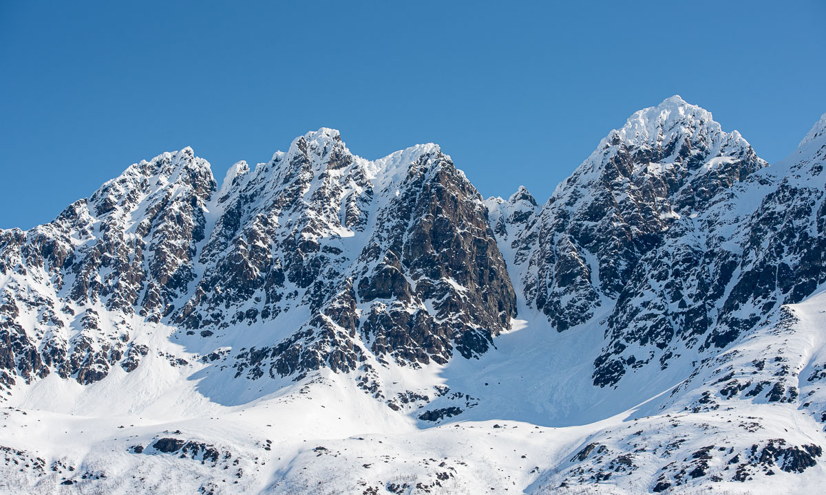
Today Luke invited me to an after work snowmobile trip up the glacier Longyearbreen. I borrowed a helmet, ski goggles and warm mittens from the Norwegian Polar Institute whose colleagues I had coffee break with today. Then I dressed like being in the high Arctic, but hey, I am in the high Arctic. Luke picked me up from the UNIS Guesthouse and then we started the tour. Luke was driving the snowmobile, I was sitting behind him. First through town, under the water pipes – duck! – and past Huset, where Annika and I had food ten days ago. Then we ascended the valley and then the glacier. Today we have had the finest whether thinkable: crisp, clear, blue sky and so we got to see the beauty of the sunset colours on the snowy mountains around as well as on the other side of the Adventdalen.

But beside of marvelling the beauty of nature there were other attractions waiting. Another ice cave, probably larger than that Annika and I visited a week ago and a bit more need of climbing. We got a tip of a colleague of Luke to visit a side room and it was astonishing. A large and high, beautiful room with a roof covered with large feather-like ice plates. I never saw something like this before. Without torches it was pitch black in the cave and so photographing took more time and efforts. I managed to take some snapshots anyhow.

After some exploring we returned and climbed up the ladders to the cave entrance. Now the blue hour had started and the light was less colourful but equally beautiful.

Back we went on Luke’s snowmobile. He in the front, I in the back. It was only two hours later when we arrived at the guesthouse again, but I had completely fallen out of time, especially in the ice cave.

I lack the words to thank you for this wonderful after work trip, Luke. See you tomorrow in the office.

An almost outdoor barbecue on Kvaløya

Some days ago I got a message from Elisabeth. She already had organised several events with friends and acquaintances – always outdoors – and in this message she asked me:

Lyst å bli med på grilling på fredag etter jobb?

(Would you) like to join (us) for a barbecue on Friday after work?”  That sounded like fun and I gladly accepted the invitation.

Friday evening was calm and clear and with -12 °C pretty cold for Tromsø – the coldest day this season. So I put some food and a lot of warm clothes with me. I met Elisabeth and two of her friends at the parking place and we went down to the barbecue hut by the sea. It looked like just a normal wooden house. Only without door, without window panes and without any floor. Instead of this a huge fire place in the middle.

More people dropped by until we were eleven people in total. Some of them had reindeer skins with them but they were hardly used. You know these parties where all people gather in the kitchen? It was a bit alike, all of us stood round the fireplace in the middle of the hut. Some to make stick bread or sausages, some to grill marshmallows or prepare waffles and some just to stay warm.

It’s always great to meet interesting, nice people. It gets however a bit harder when most of them are native speakers, because my Norwegian is still not so well. But it gets better and better. While I couldn’t take photos from the conversations I could take photos from the beautiful surroundings, even from within the hut. Remember, no window panes.

After three hours people started to leave. I was the last one left, just to take some more photos, then I took the car home as well.

Thank you Elisabeth for the organisation and for inviting me. Or more Norwegian: takk for i går – thanks for yesterday!


The last two kayak tours 2022

It’s Friday and the day before Christmas Eve. It’s actually my last working day but I worked only short, thanks to flextime. At 11:10 I stopped developing software for this year and went out kayaking.

Two days before the sea was open between our small ice covered bay and the islet Lillskär. Today it is covered with a layer of new ice. I drag the kayak to the end of the bay and start the tour.

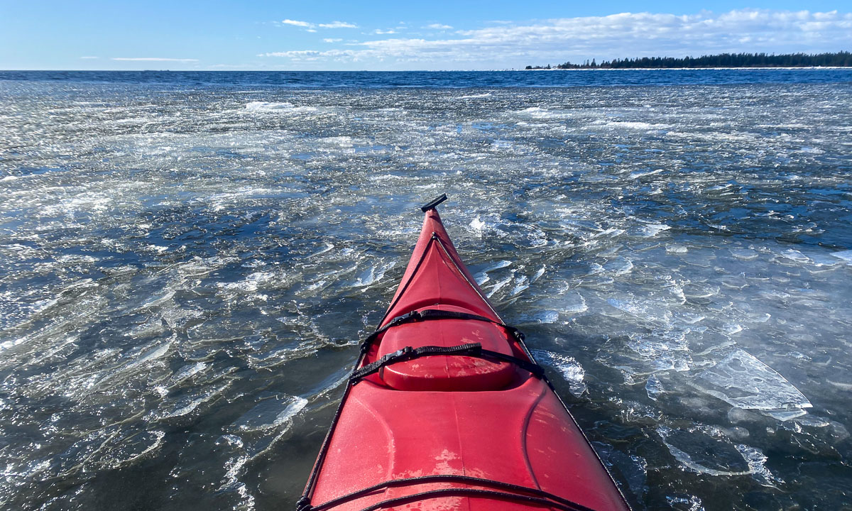
Just crossing the 100 metres of ice seems to take ages. The ice is too thick to paddle through, too thin to walk on and too soft to push oneself forward with arms and ice claws. So it’s a lot of back and forth to get a bit of momentum to crash another metre with brute force. The stiff neoprene of my survival suit does not make it easier and I’m so exhausted when I leave the ice behind. I change plans. I won’t visit Obbolstenarna today (farther away) but the island Bredskär again. I turn the kayak and paddle north. Partially to open water, partially through fields of thin feathery ice. Let’s see, how far I’ll come.

I reach Bredskär and start to circle it. Looking at the right I see snow covered islands in the distance and ice fields. It feels and looks quite arctic.

This impression changes directly when I look left and see the forest of Bredskär passing by. Looking straight ahead gives another view: The port of Holmsund with the ferry to Finland. Between that and me: many ice fields.

I pass the small bay with the sandy beach and slowly follow the shore line. When I want to turn left again to enter the sound that leads back I am stopped by another ice field, this one thicker than the others. I remember the first 100 metres today and decide not to break through but to turn. It will make the tour a bit longer but I have holidays and I’m not cold. The outer side of the island is beautiful anyhow in the light of the lowering sun.

Yes, the sun is lowering. The tour took longer than expected. I decide to watch the sunset from the kayak and slow down a bit. My fingers are getting a bit cold, but it’s worth it.

A good two hours later I arrive at the first ice field again. The ice channel that I had created by breaking through has frozen over again but breaks under the weight of my kayak. Shortly before 14 o’clock I stand on the bay ice again. The tour was a bit demanding, but impressive and beautiful. A great start into the Christmas holidays!

I’m however quite sceptical about Annika’s and my idea for tomorrow: Christmas eve paddling together. With temperatures round -10 °C the ice will probably be too thick the next day. A pity!

One day later – Christmas eve. Annika and I peek through the spotting scope to check the ice situation. Looks like the ice has gone. I walk to the ice edge and see our observations confirmed: Yesterday’s ice has gone and beside of some new and thin ice fields the water is open. So let’s take a kayak tour together!

This paddling tour was magic. The sea surface was smooth as silk, the sun felt warm and the new ice was easy to paddle through. The air was so clear that we could spot islands far away and there was almost no wind. Beside of the high frequency noises when crushing the ice with our kayaks and a dog at land barking at us it was completely silent.

It was Annika’s first winter paddling tour and I’m glad and lucky that it was such an exceptionally great one. May many other tours follow in the future! In spring, summer, autumn and winter.


Break at work IV – skiing through the forest

It’s Friday, the last day before weekend and the last opportunity this week to take a break at work.

In the morning I participated a workshop via video conference from my home office in Obbola. I just love the view through the window, where I can see the sun rising over the Baltic Sea and the snow covered backyard.

The workshop ended at 12:20. Right after that I took my old backcountry skis and dressed for a ski tour through the forests. Sunny, calm, -12°C. I wanted to go “Spåret”, a local forest trail. I followed the gravel road, crossed a ditch and followed the trail. Some hundred metres I was lost. When the snow is fresh everything looks quite alike. So I just made my own path. The fluffy snow was as deep as on the trail.

Later I found Spåret again and followed it. I walked through the shadows because the sun didn’t rise more than 3.3° above the horizon today. But at the part north of the treeless swamp the sun had a chance to peek into the forest edge.

At the road I decided to walk straight ahead instead of turning right to avoid the asphaltwith my skis. This was when I lost Spåret for good. Mostly I followed animal tracks because optical orientation is hard when it looks like this:

But it was fun because there was always something to see, even in a forest covered with 40 cm of snow. A frozen puddle at the rim of a swamp – a small pine covered with rime – thick animal tracks – the temporary (and abandoned) snow cave of a black grouse.

Sometimes I could see a roof of the house or hear a car. It’s Obbola, no wilderness. And so I came to the road that we use to take to town. I didn’t follow it but took a side road today. Less asphalt, more snow!

I arrived home at 13:55, some minutes after sunset. Again the horizon was coloured orange – and again I had a video meeting.

Break at work II – ice paddling

Today has been another clear and calm day. It was colder than the day before with temperatures round -19 °C. Today’s plan was paddling, at least round Lillskär, the small skerry nearby.

Step 1 – fetching the kayak

I knew exactly where our kayaks are. They lay in the garden – hidden under a layer of powder snow. So the first part of my paddle tour was digging out my kayak.

Step 2 – dressing and get equipment

Survival suit · thick mittens · ice claws · smartphone · camera · waterproof bag for the camera · paddle. Just the basics, I won’t go far.

Step 3 – crossing the ice

After some frosty days the ice on the shallow bay seemed to be thick enough to support my weight. I walked over the ice dragging the kayak behind. At the edge of the bay there was an ice range that I had to cross. I entered the kayak and mostly I used my ice claws to drag myself forward. Sometimes the ice supported the weight of me in the kayak, sometimes we broke through. Although the ice range to cross was only 100 metres wide I had to take several breaks. Some to take photos, some to catch my breath.

Step 3 – paddling

Then I reached open water. Almost. The water was covered with a thin layer of transparent ice needles that made the water look crystallised. It slowed down the waves and I could hear the high-pitched clinking while I was paddling through. Very fascinating!

In addition to that the sea was smoking. When it is as cold as today, the surface water evaporates and quickly resublimes to tiny ice grains that build this moving fog that colours the sea in a pale white.

Step 4 – visiting an ice exhibition

When I passed Lillskär I bent right to the mainland. There were some ice-coated rocks and thicker ice floes there – an extremely beautiful view in the low sunlight. I just went straight ahead. The first ice floes were split by my kayak, on the thicker once I had to use my ice claws again to move forward.

Step 5 – back to land

I realised, that my tour has taken much longer than planned, although the distance was tiny. I was clad in my survival suit, the kayak was on the ice and in 20 minutes my video meeting would begin. I had to hurry up!

The ice near the mainland was too thick to paddle through, but too thin to walk on. So, ice claws again. Not easy, when you lack trained arm and abdominal muscles. When I approached another shallow, I just left the kayak, splashed a bit trough soft ice and knee deep water until I reached the bay again.

From there I could walk on the ice and drag my kayak behind until I reached our property. I went to the house and transformed from paddle guy to IT guy as fast as possible. I informed my boss and colleagues that I would by 5 minutes late. That gave my the chance to take a hot shower, because I was freezing.

Did I miss anything of the meeting? No, the others had to fix audio and that took longer than my shower.

After the meeting, round 12:15 I walked out again to make a photo of the cloud bank and the sea smoke in the low winter sun.

Tomorrow shall be another cold and sunny day. Let’s see how I’ll spend my work break …

Break at work I – island hopping

The Baltic Sea at Obbola has hardly a tidal range. When we get high water or low water it’s mostly due to the wind. Today we had gusty wind from north that let the air temperature of -12 °C feel much colder and to a sea water level of 70 cm below normal, that’s really rare.

Today I took a break at work to enjoy my beloved winter weather. Today’s plan: island hopping to Lillskär, a skerry less than 250 metres away.

Along the small bay I walked to the sea. A lot of rocks that normally are underwater were visible now, some of them wore rings of ice.

The skerry was even nearer than usual when I took this photo because I already stood on the ice. You see parts of the skerry in the right.

I had a decision to make: Shall I try to cross the ice or just wade through the icy water? I decided to wade, because you can get bruises when you go through the ice, even in my thick neoprene survival overall.

So I waded through the water which was less than hip deep. On the islet I had to wade through some thigh deep snow drifts, then I arrived at the outer shore of the islet.

Oh, I love winter when it’s a bit rough and I enjoyed being out. But not for long. Soon I went more or less the same way back …

… and home. After I had changed clothes I had five more minutes until the 10 o’clock meeting. Good timing.


Scotland: wetness

This article is part of the series “2022-10: Autumn in Scotland”.

You cannot deny, that Scotland can be a pretty wet land. There are however different kinds of wetnesses.

Bathing in the sea

This kind of wetness I love: bathing in the sea. Finally Annika and I managed to find a sandy beach that looked very promising for taking a bath. And it was perfect. No stones, no currents, no sharp-edged shells, no waves as high as a house. The water was warmer than expected and it hardly rained.

Rain and muddy trails

We continued our road trip through the region of Assynt and parked our car by the Stoer Lighthouse. From there we took a circular hike to the Old Man of Stoer, a 60 metre high sea stack. It rained and the trail was soaking wet and partially quite muddy. I managed to keep my rubber boots dry but Annika’s hiking boots were soaking wet after our hike. Her dancing experience helped her to change to dry shoes.

Adventurous roads

As the days before it was Annika that drove the rental cars. You don’t want to fall asleep while driving in Scotland. Beside the single file tracks with its many meeting points sometimes the roads are blocked by sheep. The road sign warning of a 25% steep hill however looked much more dramatic than the road was.

Ardvreck Castle

We have passed Ardvreck Castle several times the last days. Now it was time to stop and have a look.

The lake Loch Assynt was flooded and so was the path to the castle. I like hiking in rubber boots which is a bit overdressed sometimes. In Scotland however I think it’s perfect footwear. Here they helped me to wade to the castle to take some more photos, while Annika waited ashore.

Sea monsters

I almost forgot to tell: At the beach of Clashnessie I observed sea monsters! Carefully I sneaked up to one of them and I managed to take a photo as a proof. There are sea monsters in Scotland!

10 cm high sea monsters.

10 cm high sea monsters buried in the sand.

10 cm high sea monsters buried in the sand looking suspiciously like seaweed.

Scotland: the west coast of Isle of Lewis

This article is part of the series “2022-10: Autumn in Scotland”.

It is 10 October.

Yesterday evening we arrived on the Isle of Lewis, took the reserved rental car (Annika driving) and stayed in the Ravenspoint Community Hostel. Today we want to go by car to explore the west coast of the island.

We do not meet a single person while taking breakfast. We succeed in not raising fire alarm while frying eggs, we pack our backpacks, revert our personal rearrangement of the beds in our twin room and get in our small car – a Kia Picanto. While Annika has been in Scotland much more often than me it is our joint premiere in exploring this country by car.

After taking a detour to a small beach at Tobson we continue to Callanish Stones, one of several arrangements of menhirs. Although yesterdays gale has subsided it is still very windy with some showers of rain. My challenge as a photographer is not only to keep my small Sony dry (first photo is an iPhone photo) but also to take pictures while a large family uses the standing stones for playing hide and seek.

We make a stopover at Doune Braes Hotel for lunch. There we spot the standing stones again – as a colourful leaded window, animals included.

Next stop: the Gearrannan Blackhouses, a village of thatched cottages that was inhabited until 1974. Now it is not only a museum but one of the cottage is a hostel, where we check in and reserve a bunk bed. We have a look at the museum, where a local shows his expert knowledge regarding weaving looms. The view of the coast from the village is quite impressive. The waves are high and smash surf and spray against the rocky cliff.

Now we continue the road north to the headland with the catchy name Butt of Lewis. When we arrive there I’m really flabbergasted. Neither Annika nor I have ever seen waves breaking so high as here at the northern tip of the Isle of Lewis. Extremely impressive, a bit daunting and also a bit wet because sea spray seems to be everywhere. Keep in mind, that the rocks in the next photos are round 10 metres high. Thanks, Google Earth for your elevation data.

It takes some time until I can tear myself away. Next we head for Port of Ness, a harbour village nearby. The sandy beach is broad and shallow. Huge waves roll ashore. While they are breaking the wind gusts blow the spray away – a fascinating view. I decide that today is just not the day to take a relaxing bath in the Atlantic ocean.

We return to our parked car and drive back to our hostel – part of the Gearrannan Blackhouses. The museum is closed and it looks like we are completely alone in our cottage, that can host 13 guests. While we boil water to cook pasta we still can hear the waves splashing ashore at the rocky coast round 100 metres away. After dinner we fall fast asleep . Stormy weather is exhausting, and so is left-hand driving. So, thank you, Annika, my luv, for driving us.


The first frost – hiking tour on the Laukviktinden

Today was the second day, where my car was covered with ice in the morning. I had to scrape ice after breakfast because I wanted to drive to Kvaløyvågen on the island Kvaløya to hike up the Laukviktinden (587 m) today. The weather was calm and the sky was blue and I enjoyed the views on sea and mountains from the car.

When I passed the shallow bay Finnvika I just had to stop and go there. Large areas were covered with a thin layer of ice that sparkled in the sun. Autumn in Tromsø is a fast season. Last weekend the trees were colourful, now many of them are bare.

20 km later: I just parked my car by the sea and read the tour description. I should follow the road for 80 metres, take the gravel road to the left and leave it when it turns left. The rest of the tour would be pathless but according to the book easy to find.

When I left the gravel road the terrain was a bit tricky. It was more or less overgrown boulders with hidden holes. The trees had shed their leaves and almost looked dead. I was glad when I had reached the mountain ridge where it was much easier to walk. The wet moss was covered with frost and so were the water puddles. Laukviktinden came into view, but I knew that there would be an acsent before. It looked pretty steep. Hopefully it’s just the perspective.

And indeed it was less steep than expected. A bit tricky however because some parts were wet and slippery. And that one of the countless moss pads hid a knee deep water puddle was not nice ;-) ! It is always a satisfying experience when you gain altitude, are above the tree line and can see more and more – both fjords and mountains.

Just straight ahead I spotted the lake Laukvikvatna and its neighbours. They lie 50 metres below. So I first had to climb down before hiking up again. Most of the lakes were covered with a thin layer of ice.

From the lake it is only 200 more metres in altitude to the top – according to the tour book. That meant that most of the the ascent lied behind me. It was easy to go up, only the very last part was a steep boulder field. Probably not the best routeI chose, but that was hard to see from below.

The terrain flattened out and then – all of the sudden – I could see the summit marker: A huge pile of stones with a metal box containing the summit book. And behind that: The open sea with the island Vengsøya.

What do you do on mountain summits beside of adding your name to the summit book? Yes – you take a selfie! After that I went a bit further to a place where the terrain drops off steeply. Here the view was really impressive because I could not only see the open sea and its islands but the bay Laukvika and even the boggy marshland that looked like it was directly under my feet. Here I took my iPhone as camera because it has a wide angle lens.

I took a break, ate some cookies and drank water. I even met another hiker that probably hiked up twice as fast as me. Then I started my way back. I found a better way because it is so much easier to find a good path when you look from above. Later my optimism was dampened when I landed in quite steep terrain and had to traverse it a bit until I was on my old trail.

Round 9½ km later I reached the gravel road again. In the shadow the ground was still frozen, but the car that waited in the sun was warm.

Stappen in the autumn

Reader, meet Stappen. Stappen, meet reader.

Hiking up Stappen is tour 54 in my book “På tur i Tromsø” – On tour in Tromsø – and it is marked blue, which somehow means that it is moderately easy. I tried to hike up Stappen in winter last year but gave up because of the steep terrain paired with snow. Today I gave it another try.

Autumn has been in full swing the last days and most of birch leaves are yellow, while other plants as groundcovers are anything between green, yellow and bright red. Sky today was grey but the colours shone brightly.

After crossing a bog I had started hiking up the mountain from the left side. Or should I say, climb? There was no recognisable path and it was quite steep. Since all rocks were overgrown, terrain was not so easy and I took it slowly and cautiously. I didn’t want to slip or find some hole between the rocks.

As usual the views were gorgeous. The island Tussøya with the pale sea behind, the mountain massif round Skamtinden that rose above the valley while gaining height. or the autumnal coloured marshes with their embedded lakes and small meandering streams.

You can see it on the first photo. The way up stays steep – up to 85% or 40° – until the very top. But finally I crossed the 550 metres level curve and was almost up, because Stappen is only 565.2 metres high. But up does not mean that it was a plateau, it was more a constant up and down and I used my hands a lot when it got steep. Fortunately the ridge was always some metres broad. I’m a bit afraid of heights. And then – after crossing most of the ridge – I reached the top.

Impressive is not the word that you would use to describe this knee-high heap of stones. It was quite obvious, that this mountain is not very popular. It is pretty steep to the sides, so that I could look straight down to the lake Botnvatnet (“the bottom water”). Later I would go round this lake on my way back.

But I was still on the top of the mountain and continued following the ridge that slowly descended. Here you can see two parts of the ridge:

On my way I found a small clearing surrounded by rocks. With the rough mountains around it looked like a secret valley, where dinosaurs still live. Well, they have to be tiny, the clearing was only round ten square metres in size.

This part of Stappen was much less steep, but when I looked back again it looked quite impressive anyhow.

After a while I reached the bogs – still at an altitude of round 330 metres and started to walk back onto the wet and bouncy ground.

Stappen was a nice tour but steeper than expected. At home I read the tour description in the book again. You had to read between the lines: While it was not mentioned, that the ascent is steep, alternative routes were mentioned with the words: “Her er det litt mindre bratt”.

Google translate’s translation: “Here it is a little less steep”.

Olaf’s translation: “Here it is little less steep which is still pretty steep. But other paths – those that you will choose – are much steeper! Anyhow, we marked the tour as blue so you might survive.”

At the end just three pairs of photos of this tour and my tour on 4 December: