21 August: Kungsleden day 2 – Teusajaure—Kaitumjaure (9 km)

This article is part of the series “2017-08: Kungsleden hike”.

One of the less adorable things when you’re hiking from hut to hut is going to the toilet. You have to go to the utedass, the outdoor earth toilet, which is always a bit away. You need to slip in your boots or sandals, put on a jacket to stay warm and dry and in the night you even need a flashlight to find the right way. At least the toilet seats are made of styrofoam which isolates quite well. And there’re always some nice outdoor photos pinned to the wooden walls.

After I already took the camera to my early morning loo visit I stayed outside and took some more photos. It was chilly and cloudy but at least yesterday’s rain had stopped.

After a breakfast (Wasa bread with cheese and muesli with milk made from milk powder) we started our day’s march. It was much easier than the day before since it’s only 9 km to the next hut. We had to climb up round about 250 meters through forest until we reached the kalfjäll above the tree line. And finally the sun managed to find some holes in the clouds and illuminated parts of the alpine landscape.

It didn’t take very long until we crossed the river Kaitumjåkka (sami: Gáidumjohka) using the large chain bridge.

Leaving the river behind us we descended again through green birch forests …

… and arrived at the Kaitumjaure huts at 14:45. I cut up some logs and chipped wood for the sauna but it happened to be so crowded, that Annika and I left it soon. Katrin and Andi didn’t even managed to enter the sauna and the water for cleaning was still cold.

But even without a hot water “shower” day two felt much better than the day before. Now we looked forward to the next day that finally would lead us to the treeless kalfjäll for several days.

Back to the toilets: If you think that using the utedass is quite uncomfortable to use in summer, you won’t like it in winter either. Then you sometimes have to dress like for an arctic expedition just to reach it without hypothermia. Check the second photo in the article Kungsleden ski tour: Singi – from blizzard to clear sky to get an impression.


Three trips round Tromsø

This article is part of the series “2017-07: Tromsø”.

It’s me who is thrilled by the North, who loves to travel to places like Tromsø or Kirkenes. It’s my mother however who has been much northerly than I was. She was in Spitsbergen/Svalbard with a cruise ship many years ago. But on the way back the route had to be changed due to fields of drifting ice and therefore the travellers couldn’t leave the ship in Tromsø. So my mother missed Tromsø on that cruise.

This year we managed to close this gap: three weeks ago my mother took a plane to Munich, another plane to Oslo and a third plane to Tromsø, where Annika and I picked her up from the airport. That’s why we’d travelled to Tromsø by car two days before.

We had four days in Tromsø, I will write mostly about the first two:

Monday, 10 July

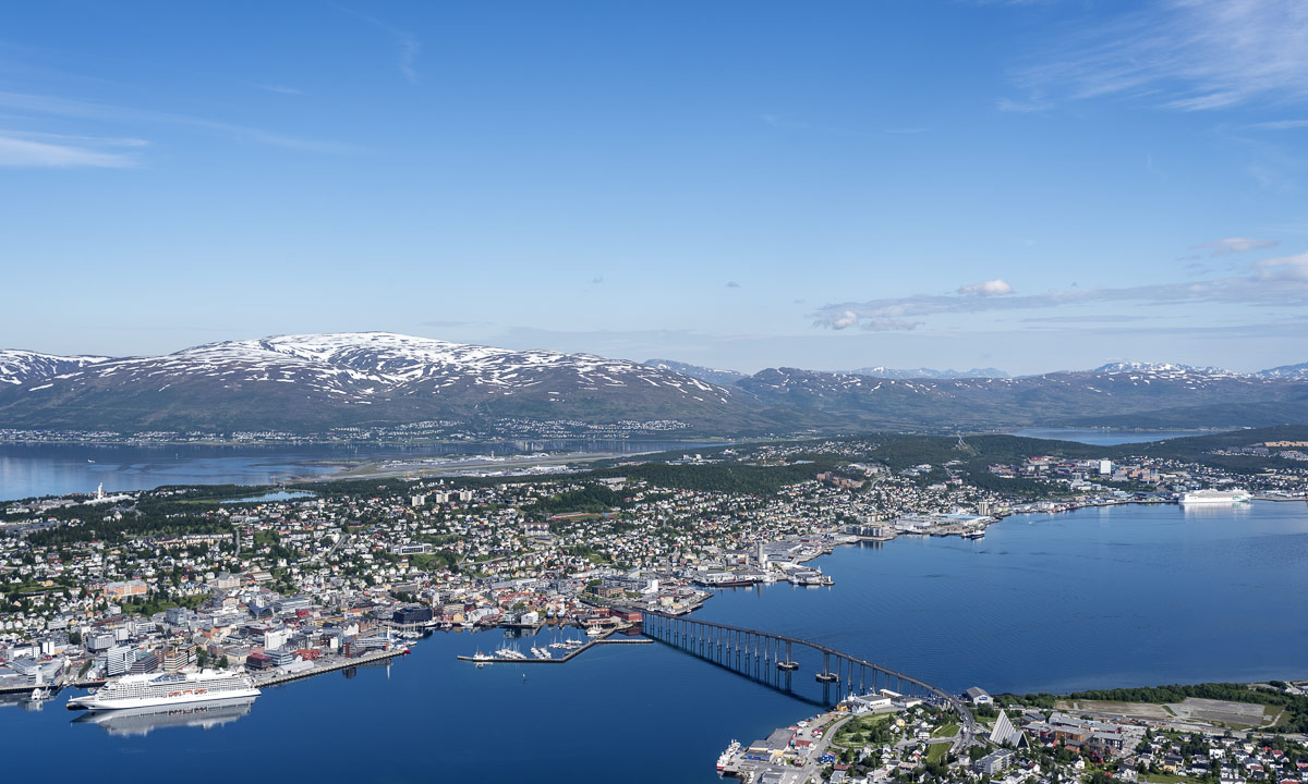
Weather was better than forecasted and so the first thing we did after breakfast was taking the car, crossing the Tromsøysundet on the Tromsø Bridge and taking the Fjellheisen on the other side of the town. Fjellheisen is a cable car up the mountain Storsteinen (approx. 420 m), where you have an incredible view over the town Tromsø, the island Tromsøya and the mountain ranges on the neighbouring islands.

We stayed there the whole morning, enjoying the view, walking around, eating ice cream and looking at the arctic flowers that grew everywhere.

Finally we went down with the cable car again driving back to Tromsø and since the weather was sunny and nice we just continued driving, leaving Tromsøya again, this time using the Sandnessund Bridge. We continued our trip on the island Kvaløya (Whale island), Norway’s fifth largest island. At the western end there’s a bridge leading to the island Sommarøya which sometimes looks like like a caribbean island with it’s turquoise blue bays.

Annika and I were very keen to take a bath, but we all were hungry too, so we took a lunch first. While we were eating our fried fish, clouds approached and soon it started to rain. So much to our summer bath plans …

After looking around on Hillesøya (another bridge, another island) we drove back, this time taking the coastal way in the south of Kvaløya. Finally even the sun came back and illuminated the bright yellow blossoms of Lotus corniculatus, or common bird’s-foot trefoil that covered the sides of the narrow road.

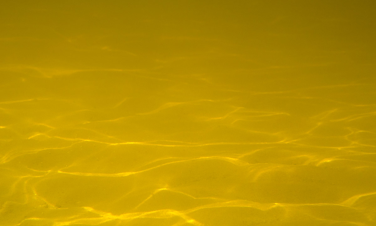
Have a look at the beach photo above. It’s not sand, it’s corals covering this beach, which makes them looking even more caribbean – at least as long it’s sunny.

Late in the afternoon we arrived at our hotel after our first day together.

Tuesday, 11 July

After the rainfalls of the night sun came out again. Time for another trip to the surroundings – this time the island Senja, Norway’s second largest island (beside of Svalbard).

The first part of the tour was the same as the trip to Sommarøya the day before, but instead of turning right the last T-junction we turned left to Brensholmen and waited for the ferry to Botnhamn/Senja. Annika downloaded an app to pay the passage, since it was much cheaper than paying cash. As in Sweden it has become quite unusual to pay cash. The idea to start early was a good one, we were one of the last cars to fit on the ferry. Some others were unlucky – they had to wait for many hours or change plans.

Hour plan was to take a round trip on Senja using the roads 862, 86 and 861. In addition to that we planned to take some side trips.

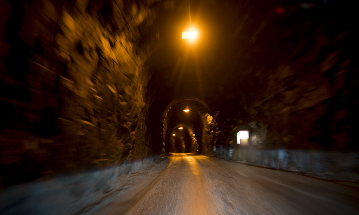
The first side trip was special, since it led through a dark tunnel cut into the rock, that much too narrow for two cars to pass. In addition to that it was curved and bent so that you couldn’t see other approaching cars in advance. There were lay-bys were you could try to squeeze in and let others pass and I was really glad that the regular bus had left the tunnel minutes ago.

But when we left the tunnel we got “Norway in a nutshell”: Wide bogs, birch and pine forests, clear blue lakes, green meadows and fields and most impressive: big snow covered mountains, some of them looking unreachable by foot, so steep and harsh they were.

But it wouldn’t be Norway without the fjords. Sometimes the coast is as rocky as the mountains, sometimes it provides sandy beaches in beautiful bays. And finally we came to our bath, all three of us. Of course the water was cold, but the air was warm and we stayed in the water quite a long time.

We continued our round trip, again some clouds approached and again some rain drops fell. I thought we’d have to wait an hour for the ferry back, the ferry arrived simultaneously. I realised that I looked wrong when I checked the timetable, but we were lucky and found a place on the ship anyway.

On the way back we didn’t stop for taking pictures any longer. First of all the weather had become grey and dull and then we were tired and hungry. So we stopped only at the supermarket to buy some food for the dinner.

The other days

We did it right, making the larger trips in the beginning, because the other two days it was cloudy and rainy. Time for some sight seeing and indoor activities in the city that we hardly touched the last two days.

We visited the Polarmuseet – we went shopping (kind of) – we tried to visit the Tromsø Cathedral (in vain, it was closed).  We visited a photo exhibition in the Universitetsmuseet – we were on board of the seal hunting ship Polstjerna (another museum) – we strolled around in the beautiful botanical garden (hard to find!). We ate lunch or dinner at the harbour – we visited the park Prestvannet – we visited the Hurtigruten ship Trollfjord, the very same ship Annika and I travelled with last winter. Did I forgot something? Certainly!

On friday we started our road trip back to Skelleftehamn were I live, but that’s another story.

Rainy Tromsø impressions

This article is part of the series “2017-07: Tromsø”.

Two weeks ago: I’m in Tromsø, it’s quite early in the morning and I cannot sleep any longer. Time to ignore the grey rainy weather, take the camera with the 35mm lens and go out for an hour to make some photos of Tromsø when the weather isn’t so nice, but neither bad.

Summer experience – a bicycle tour in 7+1 chapters

The advantage of a short workday

How much should I work for a German customer today? It’s Corpus Christi, a holiday in Germany but not in Sweden. Well, what about a half day? I finished work at 11:30 and shortly after I started a bicycle tour. The first one this year. Today’s destination: Budsba, a Thai restaurant at Skellefteå Solbacken.

Soon I was in the forest where I expected to be alone. But after some hundred metres there was a huge herd of children, who were too busy with themselves to let me though. Anyway I managed to squeeze through and soon I left the group behind – no children were harmed.

I took the forest path along the lake with the most boring name. It’s called Sjön – “The Lake”.

Some weeks ago parts of the way were quite wet, but now it’s much drier. After some bends I saw a car. Then two people with a table. Camping? Picknick? I came nearer and saw the table packed with plastic cups filled with water and juice. The people invited me to drink and I accepted thankfully. They were teachers and told me that it’s skolavslutning tomorrow – the last school day before nine weeks of summer holidays. Today the pupils of the Örjansskolan had a hiking day.

Thanks for the drink, teachers.

The ways are for the cottages

I continued the small way, which got sandy – not so nice for cycling – but soon I came to a larger way. I turned right and left again and cycled along a gravel road to Södra Skatan, one of the many cottage colonies by the sea.

Some of the cottages are huge and sometimes they surpass their owner’s regular houses. Most roads near the shore are only made for one reason: reaching those cottages. That’s why most ways come from the inland, lead to some summer cottages and end at the last house. They are hardly connected to each other beside of some narrow paths through the forest, if at all. The way after this last cottage was quite broad but stony and muddy so I had to walk the bike for some metres.

In remembrance of winter

Since there are many cottages along Västerbottens Baltic Sea most of these connection paths are short and soon I was on another road, this time an asphalt street. Beside the street there were many log piles. Almost all Swedish forests are planted for getting timber and piles of logs are a common view in Sweden.

Do you see the white thingy on the left side of the log pile? I stopped the bicycle and looked. I looked again and my first consumption was right: It’s old snow which had transformed to ice. I never saw such nearby so late in the year!

Intermezzo: Best food at the ugliest place

I continued the street until I left it to take the gravel road to Solbacken. It ran through forests and sometimes it was quite stony and hard to bike. Clouds approached, but it was still warm with temperatures between 20 °C and 25 °C. Anyway I passed by another winter souvenir: A snowmobile trail. Some more kilometres and I met civilisation again. On the other side of the European Route E4 I arrived at today’s destination: Budsba.

What do you choose – beauty or truth?

I took it easy after the lunch, because I ate too much. That’s the problem with huge lunch buffets of tasty food. And spicy – phew, one of the chilly peppers was quite hot. After lunch I crossed the E4 again looking for the short cut to Fällbacken. I found it and after a short rocky passage the gravel path was quite beautiful and not as steep as expected. Here’s a photo of the way:

It wasn’t so steep, because it was the wrong way! It ended after a hundred metres. I returned and found the right way. This way was quite stony. Then it was quite stony and quite steep. Then it was quite stony, quite steep and quite wet.Here’s a photo of the right way:

First I tried to ride my bicycle but soon my hands started to hurt due to the permanent breaking. Therefore I descended and walked my bicycle until I reached the road that would lead me to Boviksbadet, a sandy beach. There I would clean my muddy feet.

Beach time

An asphalt road again – it was nice and relaxing to just pedal along without looking for stones or glueing my fingers to the handbrakes. I arrived at the beach of Boviksbadet,  the bathing beach of Boviken.

I took a rest but I didn’t bath. It was warm and I would have loved to swim. The sea at Buviksbadet however is extremely shallow. You could walk for ages and still would remain in only knee deep water. I waded in a bit, so at least my feet were clean again.

Come on, it’s just a quick shortcut

After the rest I continued the road and turned left into the Bergviksvägen. This way leads along the Storberget (100 m) and ascends to 90 metres within a kilometre. First I tried to climb the ascend on my bike, using the lowest available gear, but soon I had to rest while my heart beat like a colibri heart. While resting it started to buzz. Some hundred mosquitoes tried to suck my blood. They had a buffet by their own: Hands, neck, eyes, ankles, arms, legs …

Since I ate too much at the Thai restaurant I didn’t want the litte fellows to make the same mistake and so I decided to move on and walk my bike uphills. Walking is less exhausting and so I was on the “top” quite soon. After cycling one kilometre downhills I had to make up my mind.

  • Should I follow all small paths along the coast, which would give me more bathing opportunities but would make the tour longer? Well, no – the sun was almost gone and I was a bit tired, too.
  • Should I continue the way, meat the asphalt road I took on the way there and return the same way? Well, no – I don’t like taking the same way twice the same day.

But there seemed to be another possibility: I could follow the road for three other kilometres and take the small shortcut southwards, where I would meet a road to Ursviken, which is quite near Skelleftehamn.

And so I did. You should know however that it can be quite uncomfortable following me on shortcuts  …

The gravel road descended and was quite broad, but since it was so much gravel on it and potholes in it I didn’t dare to let the bike go and braked from time to time. I approached the shortcut, which didn’t look very promising, but I gave it a try.

I cycled fifty metres away from the main road and looked down to that something that was marked on my map with a black dotted line:

I could return to the main road and just return home the same way, but I still didn’t like the idea. The shortcut would be just some hundred metres and only the first twenty of them seemed to be muddy.

I took my first steps and – splash! – I sank into the mud up to my knees. I freed one foot but unfortunately not the sandal that was still submerged deeply into the mud. It took some time until I could locate it and managed to dig it out. I clamped the sandals on the pannier rack and continued the way barefooted. It was short indeed, hardly 30 metres but my bike was muddy up to the axes and I – well, have a look:

So much to shortcuts …

The “way” became better with some other but less deep mud holes, then it became a grassy path that probably didn’t have been used for a long time (I guess, I know why!)

Now I longed for a bath. My bicycle as well. Anywhere …

Cooling down

… and I was lucky.

The path broadened and soon was covered with gravel again. Marvellous! I knew, that there would be some ponds along the way and I directly stopped at the first one. First I dunked my clothes, then my bike, then myself. After the bath I almost looked civilisation-compatible again. Well, almost!

I continued cycling. The gravel path became a gravel road, became an asphalt street and soon I was on the Skelleftehamnsleden, the road leading to Skelleftehamn, where I arrived round about five hours after my departure.

The daily stage: 42 km biking · ± 800 m walking the bike · ± 100 m bog walking. Not much in distance but in experience.

Two days on the Hurtigruten

This article is part of the series “2017-02: Northern Norway”.

On Wednesday we left Kirkenes and started our journey to the next destination: Stokmarknes on the Vesterålen where we planned to visit good friends of mine.

Kirkenes—Stokmarknes would be 1000 km by car and take at least 14 hours, if you take the faster way through Finland and Sweden. Anyway there’s an alternative: The Hurtigruten express route, which connects many coastal towns, among others Kirkenes and Stokmarknes. That’s why we took the Hurtigruten ship instead of driving for at least two days. In Vardø we entered the vessel Trollfjord and 16:45 we started our two day long tour.

The first night we went to bed quite early and I only took some pictures in Berlevåg. Since the ship already was moving again I decided to make a longer exposure with the camera on a tripod. That’s Berlevåg by night seen from the Hurtigruten:

We missed Mehamn, Kjøllefjord, Honningsvåg. The first place with a landing stage I saw was Havøysund, were we anchored from 7:45 to 8:00. Shortly after we met the Lofoten, the oldest and smallest ship of the Hurtigruten fleet today. It was tiny compared to the much bigger Trollfjord (which is tiny compared to modern cruise ships).

I tried to be as much outside as possible. It was cold and quite windy, not only because of the airflow, but the gusty wind, too. First I thought, that I would be extremely overdressed in my Canada Goose expedition parka, but soon I found it quite comfortable to wear it in the chilly weather.

In Hammerfest we left the Hurtigruten, looked round in town and bought food. In Øksfjord it started to get dark and the black-white mountain ranges became blue.

… and blurred if you wanted to …

… and it got darker …

Then it started to snow. Sometimes the snowfall was quite heavy especially with the wind and I was even more glad about my warm parka.

In Tromsø we arrived at 23:35 and I made some night shots of this favourite town of me.

We could have left the ship for a visit of Tromsø but we preferred sleeping. We’ll probably visit Tromsø this summer.

The next morning came and the last day aboard began. Good for me, because even if I was glad to slip the car ride it’s not my world to be on a large ship looking at the landscape rolling by. Last night snow fall has brought much snow on the top deck. I never waded through snow drifts on a ship before.

At the same time the Trollfjord anchored in Harstad, a town on the island Hinnøya.

On our way to the next destination Risøyhamn it got extremely windy, the stabilised ship started to roll and to pitch and heavy snow showers appeared, reducing the view to some hundred metres.

Suddenly the wind calmed down, the snow showers were left behind and for the first time of the whole cruise patches of blue sky and finally the sun came out. We approached Sortland, the last stop before our destination Stokmarknes where I gazed at the beautiful mountains of the Lofoten archipelago in the south.

I generally dislike the last 30 minutes of transportation, if it’s by train or by plane. I just want to arrive, and so it was on the Hurtigruten. Impatiently I waited in the inside of the Trollfjorden for its arrival in Stokmarknes, then another fifteen minutes for the allowance to enter the car deck and another ten until I was allowed to drive the car onto the very same car elevator which I used to enter the ship almost 46 hours ago.

I could write a lot more about the Hurtigruten and its passengers, but that’s another story. Short résumé: I love those ships for transportation, but cruising is not my cup of tea. (Anyway, the outside jacuzzi on the top deck is really great!)

Crossing and not crossing borders

This article is part of the series “2017-02: Northern Norway”.

Hardly believable that Annika and I started our holiday trip just three days ago when we looked at the arctic landscape today.

On Tuesday we started in Skelleftehamn, Sweden and crossed the first border to Köngäs, Finland. 481 km.

On Friday we continued in Köngäs, Finland and crossed the second border to Kirkenes, Norge, where we’re visiting Christine and Ørjan. Another 387 km.

Yesterday on Saturday we took it easy and relaxed after the two day road trip.

Last night I got sick. (That’s another story but the reason, why we cancelled our ski tour today.) Instead of that we took a short road trip to the Russian border, a border that we cannot cross without a valid visa.

The only border checkpoint between Norway and Russia is at the E105, the road to Murmansk. This checkpoint is only 10 km away from Kirkenes. I’ve been there two years ago.

In Elvenes there’s another small road to Skafferhullet. This place lies at the Russian border, too. There’s no checkpoint, the small road just ends and a fence with some signs marks the border to Russia and warns of crossing it. Here I really had the impression, that the world – as known to me – had come to its end and another kind of secret part of our planet begins right after that wire mesh fence.

Only wild animals can cross borders without any harm. They don’t share my memories of the inner German border, they don’t know anything about the cold war, they don’t have to care borders at all. Lucky them!

Perhaps I’ll witness the day, when the border to Russia is as open as many inner European borders today. Who knows …?

Just before the border checkpoint on the E105 there’s the road 886 to Grense Jakobselv – another place located at the Russian border. Most of the road is closed in winter time, but the first part is open. And this way is quite beautiful. We followed it until the barrier, where only snowmobiles are able to continue. There we took the minor road to Lanabukt located at the Jarfjorden.

Some photos:

What a great day with fantastic winter weather and temperatures round -17 °C. On the way back we stopped at the petrol station to buy me salted sticks and a Coke because unlike in Sweden super markets are closed in Norway on Sundays.

Kayak – is it a boat or a sledge?

Today I was out and did some canoeing. There was a special reason for that: Johan from Sweet Earth wanted to make a short film about kayaking in wintry conditions for Skellefteå kommun, the municipality of Skellefteå. He asked me whether I wanted to be the canoeist and I accepted gladly. Since the weather forecast looked good for today we planned to make the film today.

And the weather was good – it was fantastic! When I woke up at 6 o’clock, the sky was still dark but starry and completely free of clouds. The thermometer showed -13.8 °C – the coldest temperature in Skelleftehamn this season. I was curious about Storgrundet, where it happened to be open water the day before. How would it look like today?

Some minutes later I stood on Storgrundet’s boat bridge and lit my strong flashlight. As almost excepted the water has completely frozen over last night and the rim of the new ice was about 3 cm thick. Too thick to break through with my kayak. Anyway, it could be less thick a bit farther away, I considered.

At 7 o’clock Johan arrived and we discussed the possibilities:

  • Plan A: starting at the Lotsstation farther away, where there’s open water and probably no ice at all, but perhaps less motives.
  • Plan B: trying to start at Storgrundet, where it might be impossible to kayak, but it would look nicer. And there would even be a Plan B2.

We decided for Plan A. I fetched the kayak from the garage and pulled it through the deep snow to the street where I put it onto the trolley. I pulled the kayak to the beach while Johan followed by car filming. Soon I arrived at Storgrundet’s parking place, but not Johan. Some minutes later my phone rang: Johan’s car got bogged down in the snow and he had to shovel it free. I returned to give him a push. Luckily his car was free soon again and we arrived at Storgrundet for sunrise.

I took off my winter anorak and slipped into my waterproof immersion suit – ugly but vital. I removed the kayak from the trolley and pulled it to the end of the boat bridge. Near the shore and round that boat bridge the ice was white, it was older and thicker. Some metres away it was transparent and you could see the sea bottom. That ice was less than 12 hours old. I positioned the kayak at the rim of the white ice that bore my weight and entered slowly the fresh ice. It took just some steps and – Splat! – the ice broke and I stood in chest deep water. Well, that came not unexpected. That’s why I had the waterproof suit on and my isdubbar round my neck.

“Isdubbar” or ice claws are sharp spikes with handles. These are attached to a cord to be worn round your neck. If you fall through the ice you can use the spikes of the ice claws to pull yourself out of the ice hole back to safety. A must have when going onto the ice in early winter or unknown terrain!

I managed to crawl onto the ice even without the ice claws, because the immersion suit has so much buoyancy. I put the kayak onto the little ice hole and climbed in. Unfortunately the kayak wasn’t heavy enough to break the ice. I tried and pushed, wiggled and jiggled until I managed to forge ahead perhaps ten meters. Anyway I only succeeded into bending down the fresh and soft ice, instead of breaking it. Since the paddle had zero grip on the wet ice I couldn’t steer at all and turning was completely impossible. Finally I gave up and pushed myself backwards with the glove protected hands.

When I came to the older and slightly higher ice I was kind of trapped. I couldn’t push myself backwards hard and fast enough to come up onto the safe ice surface. I tried several times and at last I just left the kayak – Splat! – went through the ice again, crawled onto the safe ice and dragged the kayak back to the boat bridge.

The result: Paddling on ice: round 25 m. Paddling in water: 0 m. Baths taken: 2. Photos taken: zero. I hope, that Johan filmed my abortive efforts. It will make me laugh watching it.

But as I said, there was Plan B2:

500 meters to the northwest the Baltic Sea is not in the lee of the island Storgrundet anymore. Here at the bay Flunderviken it usually takes much longer for the water to freeze over. While Johan had to take the save way on land I could go straight ahead by crossing the ice with my kayak in tow. First I had to plunge through soft ice and water again but then the ice was of the older and stronger kind and it was easy to get ahead. I knew, that Johan would be slower and I would had time to make some pictures.

Anyway even Plan B2 was in danger: Flunderviken was iced, too. At least I could see open water 100 or 150 meters ahead. Perhaps the ice would be weaker and I could go through the ice howsoever and reach open water. But first I had to wait for Johan who had to stomp through more than knee-deep snow to arrive. Time for another photo, time for going through the ice again, this time only knee-deep. Even here the ice was 3 cm thick – too thick to paddle.

Soon Johan arrived and I made my reservations. I didn’t believe in “ice-paddling” that far. Johan got an idea: Wouldn’t it possible to use the ice claws to push oneself forward? Well, I could try. The idea appeared to be brilliant. It was quite easy to push oneself forward, even it was hard work for my non-existing arm muscles. It went great until the ice got weaker and the kayak started to break it. Here it was hard to reach ice solid enough to pull oneself forward with the spikes. It took a long time and I had to take breath several times until I reached the last meters of the ice cover where ice was so thin that I could use the paddle again and finally I was free. Hip, hip, hooray!

Now I was able to paddle freely as on a warm summer day. Beside of the floating ice needles. Beside of wearing my heavy immersion suit. Beside of the snow that covered all shores. Beside of the ice crust on my kayak …

And beside of my exhaustion because of the struggles traversing the ice. Anyway I wasn’t here for a long tour but for being filmed. I didn’t want to get too far away from Johan who was landbound. Therefore I took just a short round and made some more photos before I started back.

I followed my old route where the ice already was cut and it was much easier to get ahead. Soon I reached the thicker ice – first still cracking under the weight of me and my kayak, then thick enough to bear us without any complaints – and then the shore where I had to plunge in into knee-deep water for the last time before I went ashore.

Conclusion

It was great fun testing out the limits of winter paddling in Skelleftehamn today. It won’t be the last time that I do such. However this is only possible with proper equipment. Without immersion suit or dry suit, isdubbar and such this tour wouldn’t have been possible at all.

So, folks: Be crazy and be safe!

And – as promised – the link to the video.

A bit of cold

Tomorrow I want to canoe. So I checked the potential starting points today. Where could I set in my kayak?

Näsgrundet

That’s where Skelleftehamn’s pilot station is. As expected the Baltic Sea is completely open. Here it would be possible to start the tour, but I had to go 2.5 km.

Killingörviken

The nearest place, only 600 metres away, but this small bay has been already ice-covered for some days.

Storgrundet

We’ll, this should rather be frozen over, too, but to my surprise there was a broad band of open water left. I guess that the water level, that changed several times the last days prevented parts of the water surface to freeze over. The distance to Storgrundet is 1.6 km and I think I’ll try out this place tomorrow.

Anyway I’m not completely sure, if there will be open water tomorrow in the morning, too. Today has been the first day, where the temperature dropped below -10 °C and maybe there will be ice on today’s open water tomorrow. Either a bit that cracks when you traverse it by kayak or a bit more making it impossible to squeeze through.

Seasons are a bit in between. The open sea is completely free of ice beside of some sheltered bays having a thin, but solid ice cover. When such an ice cover breaks in the waves, pancake ice is formed. Pancake ice are ice floes that move, twist and turn, scrubbing each other until they are round, like pancakes. I found some of them when I drove to the peninsula Rönnskär to have a look at the sundown. They floated in the sheltered boat harbour near the shore.

Boat bridge by day and night (featuring Aurora)

Two photos of the small wooden, floating boat bridge at Storgrundet, the nearest beach from my house in Skelleftehamn. Both are made today.

One is a snapshot, made 10:30 in broad daylight. The sky is bright blue, the birch leaves are still yellow, slowly turning brown. A boat has just put out to the near island. The sun still warms, but it is windy and the air is fresh. Tiny waves make the boat bridge wobble and you can hear the waves gurgle.

Almost twelve hours later, att 22:08 I make the second image, this time with a tripod and 10 sec exposure time. The sun went done at 6 o’clock and the temperature has dropped to 4 °C. A cloudless and starry sky arches above the near island and the rests of a polar lights are flickering above the horizon. Just as this morning the boat bridge is wobbling in the tiny gurgling waves – that’s way this photo is jittered.

I like either views, both the autumn leaves in the sun and the polar light in the night. However while I enjoy the autumn days just as they are, the polar light increases the anticipation of the coming winter – still months away, but coming for sure.

Second kayak tour 2016

What a contrast to the first kayak tour six weeks ago: Last time dry suit, today t-shirt. Last time between ice floes, today birches with fresh leaves. Last time Baltic Sea, today the river Skellefteälven.

I put my kayak onto the new two-wheeled dolly (the old one broke down) and dragged it to the small bay Killingörviken, where I started my today’s tour. First I paddled along the harbour, then I turned right into the channel Kejsar Ludvigs Kanal. It always reminds me a bit of the “Ruhrgebiet” in Western Germany, where I lived for eleven years. After the last tunnel waited the Sörfjärden.

There I left harbour and industry behind and considered, where to go. The tour into the Nördfjärden wan, since it was windier than expected and I didn’t want to cross the Sörfjärden. So I paddeled upstream.

After a while the peninsula Örviken to my left ended. That’s where the Nördfjärden starts. I knew the first part and paddled to one of the rotten wooden piers. Luckily I realised that there were also under water parts – there were almost everywhere. I slowed down to avoid a collision with one of the big rusty underwater-nails. Finally I came to one of the four old platforms that probably formed an old pier, too – many, many years ago.

Now it was not far to the small island Gustavsgrönnan, where I made a short break. The whole shore is wet and covered with reeds, that lay flat on the ground.

I continued my tour by surrounding the island and paddled to the islands Stensgrönnan and Björnsholmen. To these islands you can drive by car and I was curious, if there would be a bridge or a tunnel to allow me continuing my trip.

First try Stensgrönnan: No chance! A solid dam connects the island to the main land.

Second try Björnsholmen: A small chance … . This island is connected to Stensgrönnan by bridge, but it looked really low. I didn’t believe I could manage to squeeze me underneath it until the end, but it worked. I had to bend my upper body onto the kayak and drag myself forward slowly by hand.

(Reminder to myself: This tour works only when water level is ±0. 20 cm more water and I wouldn’t fit under the bridge. 20 cm less and paddling could be hard due to the shallow water round the islands.)

Now I paddled downstream, which was not as much help as expected since the wind increased and came right from the front. But soon the bridge of the Sundgrundsleden was in view, the tiny cabins ashore and the dry dock with the read ship that I already saw on the way there.

I was a bit exhausted when I turned left to enter the bay Kurjoviken on the other side of Kallholmen. Now I was almost home, I just have to take the tiny tunnel “Lappstrupen” and I’m …

… well, that didn’t work. Due to roadworks this tunnel was completely blocked. Can I traverse the tunnel anyway? No. Do I want to walk and get the jetty? Neither. So I returned to the open water again and had another two kilometres against the wind until I entered the Kejsar Ludvigs Kanal again.

Now I headed back to my starting point. Another kilometer to go and I was onshore again. Phew – the last part was exhausting!

Today’s tour: Round 19 km total. (3.2 km extra because of the blocked tunnel Lappstrupen.)