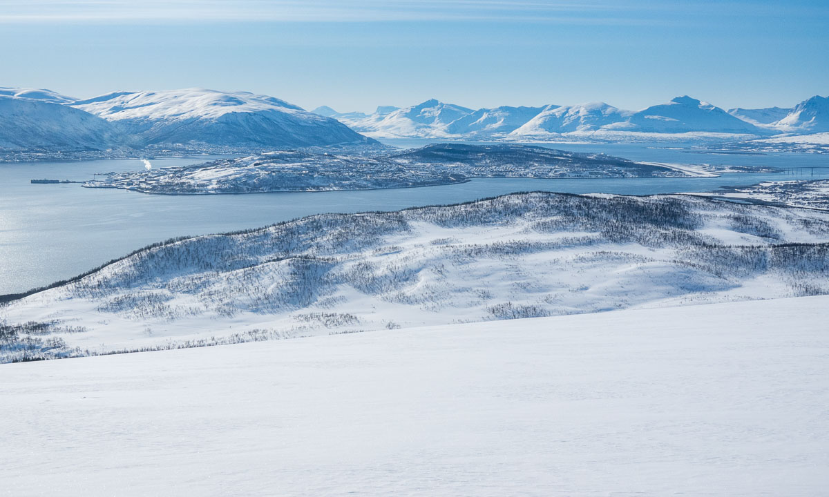
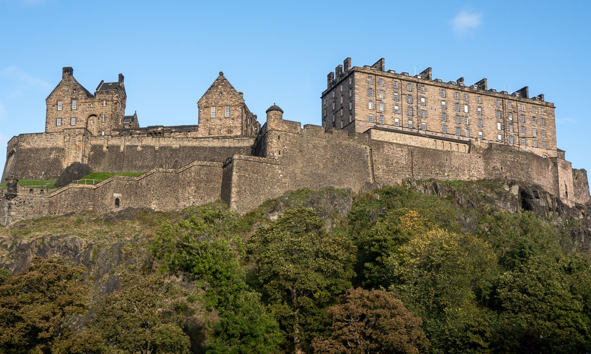
The last Thursday kayaking 2023

No, I haven’t joined many of “torsdagspadlinger” organised by the Tromsø sea kayak association this year. But at least the first one on the 4th of May and the last one this evening.

We were a group of ten heading to the island Grindøya in the west. When I arrived at the boat houses round half past five the sun was already disappearing behind the mountains of Kvaløya. Half an hour later we were on the water. The weather was quite warm and it was very calm –perfect conditions for a relaxed tour.

We headed to a sea mark – resting place for a small flock of cormorants. They flew away, when we gathered there.

While we were continuing to the northern tip of the island it was becoming dusky. We all had lights at our kayaks or our lifejackets. Less to see but to be seen.

After we passed the northern tip of Grindøya we turned left (meaning south) and calmly paddled along the forested island.

When we arrived at the beach at the southern tip it already had become pretty dark. The lights of the mainland illuminated the horizon. The single light at the left top corner of the next photo is the mountain station of the cable car Fjellheisen.

On the way back it was really dark. We paddled in pairs to ensure that no one was left behind and it was too dark to take snapshots. Just before we arrived at the boat houses again I took the iPhone out of its waterproof bag and took a photo. With a bit of help from Lightroom it’s surprisingly sharp.

It’s a pity that this was the last torsdagspadling but understandable, because it gets darker and darker every week. And if the weather forecast is correct it may snow next week.

Takk for turen – thanks for the tour, especially to the tour guides. See you next year.

Autumn tour to the glacier Steindalsbreen

After being abroad in Germany, “home home” in Sweden and on vacation in the Netherlands for almost a month I have returned to Tromsø, my “work home” one week ago. Time to work again for the Norwegian Polar Institute but not only that …

Some days ago my colleague Marika asked me if we should go out for a hike to the glacier Steindalsbreen in the weekend. I knew the place from hearsay but never have been there. I gladly accepted – I like hiking with good company. Yesterday on Sunday we met at 7 o’clock and off we went. First by car.

Car trip

Steindalen is on the Lyngen peninsula and round about 100 km away. According to Google it takes 100 minutes but we stopped several times, either to take pictures of the reflections in the fjord or the curious fox beside the road.

Through the forest

After the car was parked we started our tourat 9:25. The birch and alder trees were clad in autumnal colours. The path led westwards through the forest along a small mountain river.

To the cabin

After the path going up and down it led nearer to the river. We passed some moraines – witnessed from the ice age – and spotted a waterfall falling vertically down from a mountain. Then the cabin Steindalshytte came into view. There is a wooden bridge to cross one of the rivers.

Through the U-shaped valley

We followed an inflow of the stream and soon the valley opened more and more. And there it was – still in the distance – the glacier!

It gets rocky

The path went further up and the ground started go get rockier and we left the delta like wetlands behind. But still there were many crouching plants present, many of them in the brightest autumnal colours.

Approaching the glacier

A hill and the glacier Steindalsbreen came in full view, another hill also the glacial lake in the front. Quite depressing were the signs that marked the retreat of the glacier. Oh – so many hundred metres in so few years ;-(

Nearer and nearer …

The first photos Marika and I took from the edge of the glacial lake. Then we followed a path to the right that brought us nearer to the ice. Here we walked on gravel covered ice. I found a hole, perhaps 80 cm in diameter and 150 cm deep.

On the mud flats

As usual I hiked with rubber boots and so I could walk on the sandy mudflats right in front of the glacier. Oh, so beautiful the turquoise blocks of ice!

Mud, ice, and water

I also took some photos of the ground. Was it sand? Hard mud? Ice? Sometimes probably all the three.

Then I looked back to the lake. Hard to imagine that we hiked through autumnal forests some hours ago. This landscape looks eternal somehow although it is the opposite: very fragile and threatened by the global warming.

Heading back

After a meal break by a large rock it was time to head back. The times of midnight sun and bright nights are over and at 7 o’clock in the evening it would be dark. Just some more photos from our way back.

After round eight hours we were back at my car. What I great tour!

Takk for turen, Marika!

Everything will be fine

This summer vacation with Annika had a clear photographical focus: showing the bathing areas we or I hopped in. It was ponds, lakes and rivers where we enjoyed bathing and swimming on our one week trip through northern Sweden and Finland.

The places and bodies of waters were:

Bygdeträsk (Göksjön) — Mårdseleforsen (Vindelälven) — Harads (Luleälven) — Tolkibadet — Harriniva (Etuväylä/Torne älv) — Kittilä (Ounasjoki) — Aarniluosto (Aarnilampi) — 2× Ylitornio (Etuväylä/Torne älv) — Hovlösjön.

And the motto? Allt kommer att bli bra. Everything will be fine.

Skitour on the Austeråsfjellet

Slowly I’m gaining height with my fjellski. It is sunny and almost windless. Round -6 °C. I seem to be alone. I start traversing a slope while continuing gaining height. I’m nervous. I’m not a downhill skier and every metre I ski up I have to ski down again somewhere.

Mission accomplished: I’m above the tree line. Above me the blue ski, below the white snow. And, while I go further I get another blue: The sea.

When I look back I can see the whole island Tromsøya. Somewhere over there in the south, hidden by the wooded hills is my small rented apartment.

I didn’t plan a route for today. I just wanted to be out enjoying the winter. But when a heap of stones marks a top and it’s easy to reach I have to ski there. Mountain summit 1: Kraknesaksla (ca.335 m). With a nice view into the sound Grøtsundet.

According to the map there are some lakes a bit down. The lakes are invisible. There is only snow. What I can see are the buildings. One small cabin and a wee, tiny shed with a wind turbine. The cabin is closed and I cannot see any sign. Probably it’s private.

I continue my ski trip. I have reached a vidda – a plateau.

Now I start to see other people. A single skier, a group of three going uphills, a skier with a dog in the distance. Most locals love to be outdoors but perhaps not as early as I.

I decide to ski to a mountain top I found on my map app Norgeskart. It’s called Jerremaš (467 m) and is a kilometre away. On the way there I see that the group of three heads into the same direction while two others are already returning. Seems to be a popular place.

And it is. I’m not alone. Several other skiers are sitting there, enjoying the sun, talking Norwegian. Almost all of them are 65+.

I look at the 360 degree panorama. There are snowy mountain chains everywhere, the sound Kvalsundet, the island Ringvassøya and somewhere in the northwest the Norwegian Sea.

How shall I continue the tour? Skiing downhills and letting the others watch how I fall face first into the snow? As I mentioned before, I’m not a downhill skier. The others are probably all former Olympic athletes. I decide to take a small detour …

I start to ski down. To my surprise the hills are gentle and the snow is soft and uniform. I manage to ski downhill the broad, snowy slopes and I’m enjoying it. Sometimes I even think, it is too slow.

Much faster than expected I leave the vidda behind. I pass the first trees and see more and more tracks – and skiers. Many of them are skiing on the prepared ski trail that cuts through the valley like a German Autobahn. Others just sit on a mat in the snow taking a break.

A hole in the snow triggers my curiosity. I ski there and look down. A shallow mountain stream flows down there. Open water. It’s comforting that the snow layer is more than a metre thick.

Now it’s only some more kilometres to ski back to the parking lot where I started my ski tour this morning. Although I’m avoiding the prepared ski trail it is obvious, that more and more skiers have been here the weekend. Ski tracks everywhere.

After round about 17 kilometres I’m back at the car. Pretty exhausted and thirsty but very satisfied.

Here’s a map from today’s ski tour. I went counterclockwise. Red is faster than green but still not fast. I’m not a downhill skier.


12 more photos of Longyearbyen

This article is part of the series “2023-03: Svalbard”.

3 March

It is the first evening of Annika’s and my stay in Longyearbyen, Spitsbergen, Svalbard. We already strolled through the settlement after arrival. Now it is dark but the full moon illuminates the end of the road of Nybyen, one of Longyearbyen’s districts. What a special feeling to be in one of the world northernmost settlements on Earth. And a slightly tense one. It’s the edge of town, are there any polar bears around?

8 March

When you are in Svalbard you have to keep distance to animals to protect them. The animals do not follow this rule. This is a Svalbard reindeer, an own species of reindeer living here. It is looking for food in the middle of the city.

9 March

I didn’t expect to see ptarmigans on Svalbard but on our guided minibus tour we get to see a whole flock, again in Longyearbyen. Magnus is so kind to stop so that I could take a photo from the road.

10 March

This day is quite warm for Longyearbyen: Only -8 °C. When I took this photo however it was windy. Average wind wind 16 m/s, gusts 21 m/s and snow is blowing in the streets.

12 March

Annika is on her way home, I’ll stay for another week and today I enjoy the beautiful weather by the coast. The mountains on the other side of the fjord Isfjorden look quite near today – especially through the big telephoto lens.

15 March

I take an after work stroll along the coast and through town. It is cold and even with the modest wind of 6 m/s windchill is below -30 °C. It looks arctic, it smells arctic (the nose hairs freeze together immediately) and it feels arctic. No wonder – I am in the Arctic. Even the petrol prices show, that you are not in mainland Norway any longer. Petrol is cheap because Svalbard has reduced taxes.

18 March

Another walk in town. Up the hill to Taubanesentrale (the central of coal mining cableway), down to the center and up again to the elevated way in the east, part of the avalanche protection.

19 March

Sunday. Tomorrow I’ll fly back to Tromsø, today I’m quite lazy but finally I walk to the coast again because of the wonderful weather. Even with my hood on I can hear something above me. I look up and see the first two seagulls since I have arrived here. It is two glaucous gulls that draw large circles above the coastal line.

I try even to take pictures of the incredibly coloured mountains on the other side of the Isfjorden but the turbulences in the air make clear pictures impossible. I’ll keep it in my memory as I’ll do with my whole stay in Longyearbyen.


Guided minibus tour with Magnus

This article is part of the series “2023-03: Svalbard”.

Thursday morning Annika and I joined a guided tour by minibus. Magnus, our guide and driver has moved to Svalbard in 1964 and has spent most of his life here. I’ll show you some pictures of the tour, but the real experience were the incredible stories Magnus told us. About the times, when there was no shop in Longyearbyen, when the island could be cut off from the mainland the whole winter, when it was a mining town hardly visited by any tourists. What makes the stories special is that they seem to tell from ancient times but some took place just one generation ago. I could listen to Magnus for ages.

And now some photos. From the road up to Gruve 7, the last active coal mine that will be closed in 2025. From the Svalbard Global Seed Vault, where more than one million seed samples are stored. From the cable car facility that was used to transport coal from the mines to the quay until the 80th and from a special guest, the ice breaker Kronprins Haakon, that I travelled with last year. And of course from the famous polar bear warning sign on the road to Gruve 7.

This tour is strongly recommended if you want to get first hand information about Longyearbyen’s history. Longyearbyen Guiding AS. The web site is only in Norwegian, but the guiding is in English.


A first day in Longyearbyen

This article is part of the series “2023-03: Svalbard”.

Today Annika and I have the first full day in Longyearbyen. There’s a lot to see, even for us, for whom Northern Norway in general is nothing new.

House on mountain slope

We have seen houses, we have seen mountains, we have seen houses by and in mountains. But the mountains in Svalbard are really special and quite recognisable.

Arctic town

It is not only the mountains, that give Longyearbyen a very special character. It is amongst others the traces of the coal mining that is still present although there is no active mining in town any longer.

Avalanche fences

In December 2015 an avalanche buried ten houses in Longyearbyen. Two people died. Today some houses in Longyearbyen are abandoned because they lie in critical areas and the mountain Sukkertoppen (the sugar peak) is covered with avalanche fences.

Snowmobiles

In Northern Sweden snow mobiles are very popular, for work, transportation and for leisure. In Northern Norway there are much more restrictions and you do not see them as often. In Svalbard there are more snow mobiles than people. No wonder in a place with very long winters and hardly any road network.

Chilly temperatures

In Northern Sweden temperatures of -19.7 °C are not seldom in winter, but then it is mostly calm weather. Today in Longyearbyen it was pretty gusty and windy which made the temperature appear significantly lower.

Fjords

Yes, there are fjords in Tromsø. But there are roads and settlements, too. On Svalbard there are not many settlements at all and the fjords do not only look much more icy and arctic, but also untouched. The small dots on the right of the first image however tell another story: There is a lot of snowmobile traffic.

Northernmost church?

There is a church in Longyearbyen lying on a small hill. It looks cosy and if you go in you realise, it is. It is the northernmost Lutheran church in the world, only topped by an Eastern Orthodox church in the Russian Franz Josef Land. (Source: wikipedia)

Mukluks

Of course people in Longyearbyen have warm clothes. When it comes to boots Mukluks are quite popular. The origin of these shoes lies in the Inuit culture of the North American Arctic and there are great for dry and cold weather. You hardly see them in mainland Scandinavia.

Impressive mountains

Did I mention the impressive mountains? I did? Well, anyhow – they are impressive!

Surprises

This solitary house goes by the name Huset – the house. The name is as pragmatic as the architecture. But it contains a surprise. The restaurant Huset does not only have quite high-priced dinner, but also a “Saturday beef” on Saturdays 15-18. By chance we passed the house at 14:45 and it is Saturday today. So we decided to eat there. A good choice because the food was very delicious and costed only 190 crowns – a bargain in Norway!

Polar bears

One of the very special things about Svalbard: there are more polar bears than human beings on this Archipelago. While the town Longyearbyen is protected the surroundings aren’t. If you leave town you have to carry a rifle and a flare gun and must know how to handle incidents with polar bears. Signs warn you when you leave the safe space.

Neither Annika nor I can and may handle a rifle so we stay within town beside of guided tours.

Treacherous weather

When we left the restaurant Huset, weather had changed. It was as windy as before but now it was snowing and the wind gusts blew snow everywhere. Into the face and into the pockets of my parka. It was however less than a kilometre walk until we reached our accommodation Coal Miner’s Cabin.


An almost outdoor barbecue on Kvaløya

Some days ago I got a message from Elisabeth. She already had organised several events with friends and acquaintances – always outdoors – and in this message she asked me:

Lyst å bli med på grilling på fredag etter jobb?

“(Would you) like to join (us) for a barbecue on Friday after work?”  That sounded like fun and I gladly accepted the invitation.

Friday evening was calm and clear and with -12 °C pretty cold for Tromsø – the coldest day this season. So I put some food and a lot of warm clothes with me. I met Elisabeth and two of her friends at the parking place and we went down to the barbecue hut by the sea. It looked like just a normal wooden house. Only without door, without window panes and without any floor. Instead of this a huge fire place in the middle.

More people dropped by until we were eleven people in total. Some of them had reindeer skins with them but they were hardly used. You know these parties where all people gather in the kitchen? It was a bit alike, all of us stood round the fireplace in the middle of the hut. Some to make stick bread or sausages, some to grill marshmallows or prepare waffles and some just to stay warm.

It’s always great to meet interesting, nice people. It gets however a bit harder when most of them are native speakers, because my Norwegian is still not so well. But it gets better and better. While I couldn’t take photos from the conversations I could take photos from the beautiful surroundings, even from within the hut. Remember, no window panes.

After three hours people started to leave. I was the last one left, just to take some more photos, then I took the car home as well.

Thank you Elisabeth for the organisation and for inviting me. Or more Norwegian: takk for i går – thanks for yesterday!


The first winter promenade

Down there, that’s the southern part of Tromsø. That’s where I live when working for the Norwegian Polar Institute.

There are reasons why I see Tromsø from above today instead of working in the office. First of all my wife Annika is here this week. Then it is wonderful weather today. I was able to take a day off today and so Annika and I could fetch the first cable car up to Stor­stei­nen, 421 m above sea level. From there you have a fantastic view on the islands Tromsøya and Kvaløya, the strait Tromsøysundet and many, many mountains.

While Tromsøya itself is free of snow all mountains look wintry on this sunny day. Our hiking tour starts in the shadow and it takes some time until we reach the pre-summit of Fløya where the sun shines on our faces the first time.

From there it is not far to the summit of Fløya (671 m).

It has become windy and grains of snow are drifting over the snow. In the low sun they look like grains of gold.

Although it is chilly we stay on the top for a while, because the wintry landscape is so beautiful. The season’s first snow hike is always something special and I’m glad that I can share it with Annika this year.

Slowly we walk back. On the top it was easy to go, later the path gets steeper and the snow makes the path slippery. The sun stands lower now and the drifting snow is even more colourful.

We find a sunny though windy spot to drink warm juice and eat some cookies, then we head back to the mountain station of the cable car. While sunset is near, the almost full moon that has accompanied us the whole day starts rising again above the wintry mountain chains.

10 days in Scotland

This article is part of the series “2022-10: Autumn in Scotland”.

It has been years, since Annika and I were on holiday outside of Fennoscandia. This October we enjoyed a ten day journey to Scotland from which I just arrived in Tromsø yesterday.

For this article I chose 2 photos for each day. Some more articles will follow later.

6 October – Edinburgh

I landed in the late morning and have the rest of the day strolling through Edinburgh. Blue sky – so it can actual stop raining in  Edinburgh ;-). In the evening I wait for Annika who is taking the tram from the airport. Now it is raining. Finally we are together.

7 October – travelling to Ullapool

We have pre-booked train tickets to Inverness where we will spend three hours before taking the coach to Ullapool. Well, in theory. The trains do not go the whole way due to heavy rain flooding. The rest is operated by replacement buses. So much to rain in Scotland. In Inverness we catch the connecting coach to Ullapool and have even time for a pizza.

8 October – hiking in Ullapool

After two travel days we want to be outdoors and look for the hiking trail to the hill Meall Mor after a hand-drawn sketch. We find it. From the top we have a view to the town, the hills and mountains in sun, clouds and rain.

9 October – taking the ferry to Lewis

After breakfast we take our backpacks through rain and heavy winds to the ferry terminal just to learn that the ferry has been cancelled because of the gusts on the Minch – the straight between Ullapool and the Isle of Lewis. Luckily the afternoon ferry runs according schedule and we arrive in Stornoway at nine o’clock. Scotland premiere: We hire a car. Annika is driving. Left-hand traffic in darkness!

10 October – exploring Lewis

We explore Lewis by car. Great that Annika is brave enough to drive in Scotland (I’m not). Read the article The west coast of Isle of Lewis about this day.

11 October – Peat bogs and Northern Gannets

From Gearrannan Village we take a small way back to Stornoway. In the bogs you can see traces of peat mining. We give back the car, take the ferry back and are watching the elegant aerial manoeuvres of the Northern Gannets. In Ullapool we receive another car that we have hired for the next two days.

12 October – exploring Assynt

We start exploring Assynt, the region north of Ullapool. Read the article Stac Pollaidh about this day.

13 October – taking a bath

Finally – our first bath! At Achmelvich beach. I will write more about this day later …

14 October – travelling to Edinburgh

It is time to give back the rental car and travel back to Edinburgh. First by coach, then by train. This travel confirms my theory that Scottish coaches and trains are designed solely for transport, not for comfort.

15 October – flying back

Short ones, long ones – all holidays comes to their end. Annika takes me to the tram, again it’s me travelling first. What a wonderful holiday. Thank you, Annika!