#snowember16 – part V
This article is part of the series “2016-11: #snowember16”.
Last night it snowed another 15 cm, increasing the snow depth in my backyard to 76 cm and finally the fence in my backgard was gone, hidden by the snow.

You see, that the picture looks a bit hazy? That’s because it snowed still a lot, when I made this picture this morning at 6 o’clock. You see that blending light to the right of the house? It’s a tractor that already had started to plough away the snow.
Some hours later Annika and I took the car to Bureå – another “snow pocket” nearby. As a matter of fact I was curious, if there was even more snow as here in Skelleftehamn.
Finally I could take a picture of the beautiful pavilion Åbacka paviljong which lies near Bureå on the other side of the E4. A huge pile of snow left by a tractor came in handy to get a higher perspective.

And we saw buried cars. And half buried tractors, and really buried cars, and a quite snowed in bicycle.


I heard from some people living in Bureå, that at least one meter of snow has fallen, but I couldn’t find such places in town. I seemed to be as much snow as home, perhaps a bit more.
When we took a detour, left Bureå and headed to Burvik over the hill Bureberget (altitude: 99 meters!) the snow walls at the sides of the road increased. I stopped the car on the side of the street and just took some steps into the forest. Here the snow was really much deeper, I should say round 110 cm! Here seems to be Bureå’s “snow center”.
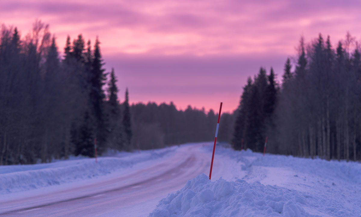
I left Annika at the bus station and took the E4 to Skellefteå where I had a meeting at one o’clock. Well, I tried to take the E4, but from the next exit on it was closed due to an accident. I left the E4 and took a secondary route. There were many trucks and other cars taking the same detour and since the road was quite snowy and it still snowed the drive was at quite a low pace. Following a truck is no fun since you hardly see anything beside of the white snow whirling through the air. That is called snörök – “snow smoke”. Sometimes it was not easy to follow the street because all meadows and fields are just as white as the road and the red sticks marking the road hardly help in the snörök.
I took it easy, stopped the car in one of the rare snow-free parking bays and made a photo from the collapsed barn buried in the deep snow.

When I came home the snow fall had stopped and the streets where ploughed. On each corner you could see piles of snow up to four meters high. And finally even my elder bush seemed to realise that summer is over and has started to cast of its leaves.


Tomorrow I’ll take a day off and enjoy the early winter. Skis or snowshoes? I haven’t decided yet.
Some other snow depth:
- The neighbour at the other side of the street: 86 cm.
- Some people in Bureå: 100 cm, already four days ago.
- Someone in Lycksele in the inland: 2 cm!