Vårvinter

Where are we – Annika and I? In the Arctic on our way to the North Pole?  Looking for polar bears?

Well, not really! We’re on the frozen Baltic Sea on our way to the island Gåsören, enjoying the blue sky and the warm sun.

But we didn’t only enjoy the warmth of the sun, but the warmth of the sauna, too – even if we didn’t fire it as hot as it should be for a real sauna experience.

We were not the only ones on the ice of the Baltic Sea yesterday.

There were ski tracks and skiers.

There were snowmobile tracks and snowmobile drivers.

There were moose tracks …

… and there were moose on the ice, too. Far, far away, but clearly visible.

“vårvinter” means “spring winter” and describes this season, where the land is still covered with snow and ice, but the temperatures aren’t longer as cold as in January or February.

Kungsleden ski tour: Tjäktja

This article is part of the series “2016-02: Ski tour on the Kungsleden”.

From the Sälkastugorna to Tjäktjastugan

25 February · 12 km · Link to map

This day could be a more demanding day. It’s only 12 km to Tjäktja, but first of all i goes up 300 meters and then there’s Tjäktjapasset – the mountain pass, which I remember as being quite steep. In 2005 I skied down the slope, now I have to go up, dragging the pulka behind.

That’s why I started quite early this day. In my pulka: a parcel with food from the shop that stugvärd Z. gave me for stugvärd P. – one kilo more or less doesn’t count so much if you doesn’t have to carry it on your back.

When I started the tour the sky was still cloudy, but soon the clouds disappeared, sun was shining and the sky was blue. I was happy, since according to the weather forecast I expected the whole week being grey and cloudy. Far away in the early sun I could see a chain of mountain – there’s the Tjäktjapass, still far away, and it looked high and steep.

This was the first time that I had skins under my skis that help going up, especially if you carry a pulka that always wants to slide down. The trail led through a hilly landscape and I had to climb many small hills just to go down on the other side of the hill. I asked myself how I should gain altitude going just up and down. Anyway, the landscape was gorgeous, just as the weather, and when I looked back after some time I could see, that I gained more height than I thought. First I could see small brown boxes laying behind – the Sälkastugorna – but after some time they disappeared behind the hilly landscape.

I continued my tour and saw a black bird ahead. It cawed and landed on a dark spot beside another bird. Crows. I remembered, that one of the skiers that I met in Sälka, told me, that he saw a dead reindeer on his way from Tjäktja. This reindeer was killed by a wolverine, one of the biggest carnivores in Scandinavia. I approached the dark spot, the craws cawed again and flew away. There was a heap of something and beside of some patches of reindeer skin it was hardly recognisable. The sight of a frozen hump of meat is neither nice nor beautiful, but it is part of a country, where predators as wolves, bears, lynxes or wolverines still exist.

After taking some photos for this blog I continued my tour. Two other skiers approached from the other side – they just slided down in long, relaxed steps. I however had to climb up. Now, where the pass was near, it was visible that it was neither as steep nor as high as expected. After a bit of effort (I’m not well trained …) I stood on a plateau just below the highest point of the pass. And the view back into the huge valley Tjäktjajåkka (sami: Čeakčajohka) was incredible. The sun shone from a bright blue sky, a rainbow coloured sundog nearby. Ice dust fell from the blue sky that glittered and sparkled against the sun. The broad valley seemed to be endless, the further away mountains looked hazy and I had the impression, that you could walk through this valley forever.

It’s not the first time, that I stood here and gazed in amazement. I’ve been here on my first ski tour in april 2005, too, when I went from Abisko to Kvikkjokk. And now I was just as amazed as at the first time.

I could have stayed for ages, but after I while I broke away from this special place and ascended the last meters of the pass until the small hut Tjäktjatjattja came into sight. I took a break, but instead of seeking shelter in the hut I sat outside in the sun with chocolate and hot tea. It started to snow a bit – always a bit strange if you cannot see a single cloud.

After this sunny break I continued the trail to Tjäktja. The skiers I met left a nice track and the only think I had to do was sliding downwards effortlessly until I arrived in Tjäktja, the smallest mountain hut on my journey. Stugvärd P. got my parcel with food and goodies and I got a room in the stuga.

The sky was clear the whole day and it started to become a bit colder. -15 °C, when I arrived, -19 °C short time later. Time to fire the oven and to eat something warm. But later I went outside again to look at the starlit sky that arched above the Lappish mountainscape.

A day in Tjäktja

The next morning the weather was perfect for skiing: -22 °C, hardly any wind and again an almost cloudless, blue sky.

I stayed a day in Tjäktja and went up the mountain Tjäktjatjåkka, but only half the way. First of all I’m not the most experience skier, and then I was afraid of avalanches. But even going up halfway in this outstanding weather was great.

Going downhill was much faster than uphills. When I arrived in Tjäktja, the thermometer show -18.5 °C, exactly the same temperature as when I started my short day trip and the sun shone from a cloudless sky over the ravine of the stream Čeavččanjira. The next day I will continue to the next mountain hut: Alesjaure.

The next article: returning to civilisation >>

Translation:

EnglishGermanSwedish
wolverineVielfraßjärv

Räven raskar över isen

“Räven raskar över isen”, which means “The fox rushes over the ice”  is a popular Swedish folksong which is performed as a singing game at midsummer.

Today I was out quite early, because the weather was still nice: -6 °C and not completely cloudy. And while I took some more images of the ice outside of Storgrundet, wondering when the ice will bear my weight I saw a fox crossing the ice and rushing from one island to the other. I immediately remembered the song.

(The photo itself is a cropped image, the fox was too far away for my 70-200 mm telephoto lens. By the way: the clouds were of an incredibly intense red – even more than the photos)

Soon more clouds came in and it started to get warmer. In the afternoon it started to rain transforming the cold roads into slippery, wet ice tracks. I would deeply recommend to wear broddar – spikes for your shoes when weather is like this.

Winter journey in a nutshell

It snowed in Skelleftehamn tonight. It’s hardly a secret, that I love winter, snow and coldness. In Skelleftehamn however it would be too warm, because the Baltic Sea is near.

Therefore I decided yesterday to take a day off today, take camera and car and travel towards winter. In the inland the climate is colder and hopefully there would be more snow. I started at 6:45 in darkness. The first part was no fun to drive. Road salt is used on the big road to Skellefteå and the road further west. With temperatures slightly below zero you always have a film of muddy saltwater on your windscreen while the wipers still are partly frozen and will not work properly. That in combination with approaching cars with bright lights makes it hard to see and much concentration is needed.

That instantly got better when I left the big road 95 (that would bring me to Bodø in Norway) right after Jörn. The smaller roads are covered with ice and hard snow – much easier to drive and the windscreen stays clear. And it looks much more like winter than a wet road. And while in Skelleftehamn even the duck pond is open, here the lakes and some small streams are ice and snow covered.

I continued the road and drove to Storklinten, a small ski hill. Well, it wasn’t so interesting yet with only round about 10 cm snow, but the lake nearby – Lill-Klintträsket – was really nice. It started snowing and the tree covered hills farther away seemed to vanish into a white nothing.

The way to Storklinten is a dead-end road and I had to return. I continued the larger road to Myrheden looking for motives. And I found one. The small river Ålsån:

I was glad I had my chest waders with me, so I could come quite near to the motive. And there were a lot of motives this day. For example reindeers. The first small flock was extremely shy and cautious. It didn’t dare to pass my car and left the road starring at me suspiciously from behind the small trees. You can see that they digged for food in the snow, the noses are snow covered and one of the reindeers even had a twig hanging in its antlers.

Further on the road: Town signs with funny looking names (there was even a village called Hej, which is Swedish for hello), more snow covered roads and trees and two extremely well educated reindeers going beside the road in single file.

I’m looking for motive especially, where there are crash barriers beside of the road – there the street will probably cross a river or a creek. Some of them are open, many broader ones with less current are already covered with ice. And on one of them – far away – I could see a reddish animal and some dark spots. A fox? Birds? I looked for the next parking opportunity – sometimes a real challenge – and walked back.

I was right: There was a fox. And some kind of skeleton, perhaps a roe deer or a reindeer. And some crows. And an eagle! It doesn’t happen often, that I see eagles nearby where I live. I made some photos with my tele lens. Zooming in I could even see some magpies hopping around hoping for a snack. The scene was much too far away to get good pictures, but anyway, I want to show you this one:

After a while I started to get hungry. My car too; the red R-lamp has been glowing for a while. Anyway, the town Arvidsjaur, todays destination, was not so far away anymore. As people in former days first fed their horses before eating themselves I first tanked my car with E95, then myself with beef, mashed potato, mushroom sauce and salad. Then I looked around in the city which I think is really nice. Especially in winter with snow – round 20 cm today.

Even if the “real winter” is not here yet the days are already quite short: Sunset in Arvidsjaur was a quarter past two! At three o’clock I started to use the car’s full beam, half an hour later it was quite dark. Time to head home. I couldn’t see any motives any longer and I navigated to the main road. Now driving became exhausting again for a while since it started to snow quite heavily. And if you use full beam while snowing you just see a tunnel of snow flakes swooshing towards you. It’s a big like old televisions science fiction series, when the spaceships activated their warp-drives. And as in space there is no up or down. The second photo may give you a faint idea.

Luckily the snow shower ended soon and the rest of the trip was just about coming home.

400 km and 500 meters – 11 hours 30 minutes – a straining but great one day trip winterwards.

Back again in Skelleftehamn: Snow is gone, it’s pitch black and it’s raining cats and dogs.

From Nallo to Vistas, Alesjaure, Abiskojaure and back to civilization

This article is part of the series “2015-08: Kungsleden hike”.

August 30 – September 2: Day eight to eleven of the summer hike through the mountains of Swedish Lapland

Nallo – Vistas

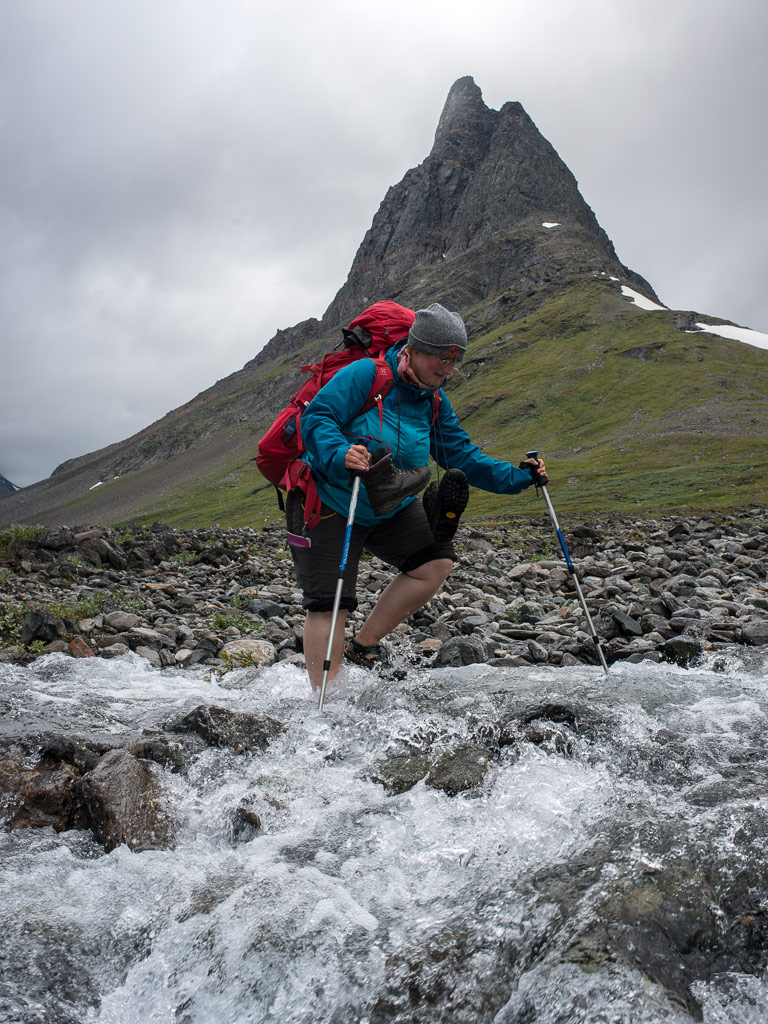
After two days in Nallo Annika and I were eager and keen to move on. After our breakfast we said goodbye to stugvärd Janne and started to ford the stream behind of the hut. Fortunately the water level dropped to normal again and quite easily we could cross the stream.

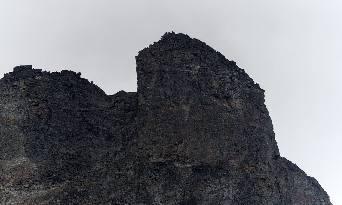
Then we went along the Nallú, a fantastic mountain that changed its appearance every other second because of the moving clouds and the changing light situations. We never tired of looking at this big mountain that seemed to accompany us a long way.

After a while another stream that we had to cross, came down from the lake Nállujávrrit. While I managed to splash through with my high rubber boots, Annika decided to take of her shoes and wade through it in her sandals – brr, the water was really ice cold!

We continued the hike through the fast-changing scenery. Quite soon we saw the first trees and realised that the big mountain ahead was the Vássačorru, that lies behind the valley Visttasvággi, where our next destination, the Vistasstuga is located.

Soon we crossed the Visttasjohka on the chain bridge and arrived at the cabin to meet the stugvärd – the warden.

Oh look: Coke and beer are priced down! That’s because the season only lasts three other weeks. After that the huts are closed down until their reopening for the skiers in February or March. But because none of the cans would survive the frost, all liquids has to be drunk in the next three weeks or poured away. We decided to save some cokes from this cruel destiny.

We were placed in the outhouse – the main building was in the act of being renovated. There we sat on the front stairs, ate, drank and looked on the river Visttasjohka. And we took a bath in this cold river. Chilling but refreshing! Finally the sun came out. I crossed the bridge to make a photo of our cabin.

Later – it started getting dark – we got a visitor: A big moose stood beside the river. I went out, where I could observe this huge animal, how it ate leaves and grass, less than 10 meters away. It looked at me but wasn’t disturbed by me at all, it even passed quite near until it vanished between some trees. This was one of the moments were I was glad and touched as a “normal person”, but a bit grumpy with myself, that I was too lazy to carry my big tele lens for better and sharper pictures. I never experienced a moose so near and so fearless.

Vistas – Alesjaure

The trip the day before was short: only 9 kilometres, this day it would be twice as much: 18 km. The first kilometres were a bit boring since they went through birch forests and quite muddy passages. But after a while the landscape opened and we could see the mountain Siehtagas with its glacier Siehtagasglaciären. In front of the mountain there were alpine meadows and small birch forests. In front of that the turquoise water of the Visttasjohka glimmered in the sunlight.

We went up again until we again were over the treeline. This part of the valley Visttasvaggi is beautiful and very varying. The first rest we made in the lee side of a huge cuboid rock. We weren’t the first – someone built a bench by laying a plank over two stones. The second rest we made at the Tjatjajaurekåtan (there’s not much left of it).

After a while I saw some reindeers grassing. There were shy and quickly went away when I came nearer. We saw (probably) them again when we had a view at the sami village Alisjávri that lies at the lake with the the same name. From that it’s not far to the mountain huts of Alesjaure – the Swedish version of Alisjávri. The Alesjaurestugorna are the biggest mountain huts of the STF – the Swedish tourist association. I prefer the smaller ones as e.g. Nallo, but it’s fine to have a shop, a drying room and especially a sauna. And we used it all! It’s nice to go to sleep after being in the sauna and having a wash in the river Aliseatnu.

Alesjaure – Abiskojaure

I didn’t make many pictures of this part of our tour. I was a bit bored of this part of the trail and found nothing special in the landscape. Just some photos of human evidence: Tent poles for a lavvu and a crossing over a long reindeer fence.

It was the first time, that I was really impatient and just wanted to arrive. Some kilometres before Abiskojaure we came below the treeline. Most of the birch trees still were green but you could see, that autumn is near. No wonder, it was the 1st of September, beginning of autumn for the meteorologists.

Finally we reached another chain bridge and shortly after it arrived in Abiskojaure. The sun came out and even though it was much colder than one week ago we could sit and lie on the short-cut lawn in front of the hut. I took the last bath of the journey and strolled around making some photos. After crossing a small swamp I came to a quite huge sandy beach beside the lake Ábeskojávri. A beautiful place!

The evening it started to become chilly, hardly 3 °C. I was curious if we would get the first frost of the season next morning …

Abiskojaure – Abisko Östra

… and yes, we got frost. -2.5 °C showed the scientific thermometer of the swedish weather service, when I had my first look. On the water surface of the buckets lay a layer of ice and round the leaves of lower plants I could see the first autumnal hoarfrost.

I was up very early that morning and I went to the beach at the lake again. First it looked quite normal but then it started to get foggy and misty while the sun rose behind the mountain Giron. What a beautiful sight! I stood there for at least an hour and only walked back to get another full battery for my camera. Later I met Annika, showed her the place and was glad that I could share this awesome experience.

I was a bit sad – this would be the last day of hiking through the wonderful mountain landscape of Swedish Lapland. But each journey has some kind of end and so had ours. We started our tour through the birth forests along the lake Ábeskojávri, than along the river Abiskojåkka.

After a while a famous landmark came into sight: Lapporten – “The Lapponian Gate”, a U-shaped valley framed of two mountains that give this valley its specific and recognizable shape. However, since this photo is taken from the backside, it hardly shows this special shape.

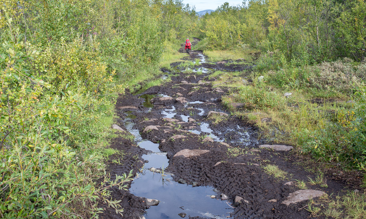
Since Alesjaure we followed the Kungsleden – the King’s Trail, but right after the bridge over the stream Nissonjohka we left the main trail that leads to the Abisko Mountain Station and turned right to Abisko Östra, the village, were we planned to stay for two other days. The way, however, was not much fun to go. A lot of all-terrain vehicles has turned the way into mud. Since I lost my lens cap and I was afraid that mud would splatter my lens, I packed the camera into its waterproof bag long before the worst mud patches. And that’s why this is the last photo of our hiking tour:

Thank you Annika, för trevligt sällskap – for nice company. Where should we hike next?

Any suggestions?

From Kebnekaise Fjällstation to Singi

This article is part of the series “2015-08: Kungsleden hike”.

August 24 and 25: Day two and three of the summer hike through the mountains of Swedish Lapland

Kebnekaise Fjällstation – Singi

After the crowded Kebnekaise Fjällstation I really longed to continue our hike. Soon after breakfast (with real German bread!) we left and continued westwards. Soon a first wooden bridge over a small creek came into view followed by a larger bridge over the ravine that the stream Láddjujohka has cut into the rock. In the back: The mighty mountain Siŋŋičohkka.

It was as warm as the day before and the sky was incredibly blue. We continued westwards and went round the steep southern slope of the Siŋŋičohkka. Parts of the narrow valley lay in the shadow of the mountains Skárttoaivi and Liddubákti, but soon we came to a sunny place covered with soft heather beside of a small creek – the ideal resting place. It was hard to prevent dozing off and to pull ourselves together to continue after a long while of resting and being lazy.

This daily stage was quite relaxed: only 14 kilometres. Soon the Singistugorna – The Singi cabins – came into view.

We hardly saw any animals yet but round the cabins we saw two quite typical species commonly found in Lapland: The lämmel or lemming and the ripa or ptarmigan (sometimes called snow chicken). They came quite near but gave me a hard time photoing them. I only had a small 100mm-lens with manual focus instead of my great but huge and heavy 70-200mm-lens, so I’m not really content with the results. However, the experience to have these animals so near was more important.

(Later on the journey I got a much better opportunity to take pictures of ptarmigans …)

Singi – Hukejaure – Singi

This day was planned to be a long one! Instead of following the Kungsleden – the King’s trail we planned to go to Hukejaure in the west and then to cross the Swedish-Norwegian border. From Singi to Hukejaure it’s 20 km and it’s just a path, only partly marked.

We started quite early, went north along the stream Tjäktjajåkka and crossed it after two kilometres on another chain bridge.

We had to “climb” over some rocky parts until we came to a beautiful alpine pasture. Do you know the film The Sound of Music? It almost looked alike – without the dancing and singing. Instead of that we got some snow fields and some shallow bogs and ponds. Beautiful anyway:

After a while the path was gone and we had to go up some hundred meters. It was as warm as the other days plus we were on a treeless southern slope – a matter that makes one sweat. We made a rest after 7 or 8 kilometres. It was later than expected and we just made the easy part of our way today. Will we come to Hukejaure in time? Or will it get dark? Is it safe and reasonable to continue? We both didn’t like the decision but since we weren’t sure to reach Hukejaure in time we decided to go back. Next time we have either to start even earlier or take a tent with us. We’ll see …

After 5 kilometres we came to the Tjäktjajåkka again but the light was completely different.

The last two kilometres felt a bit boring and we were glad when we arrived at the Singistugorna that we left the same morning. Other people walk there dogs, we walked our backpacks. After a two-course dinner (noodle soup and tortellini) I went around in the dusk and took pictures of the landscape reflecting in the oxbow lakes of the Tjäktjajåkka.

I was glad that I had my mosquito jacket with me, they were many of them seeking my blood that evening. And when I came back I was glad that all windows are equipped with fly screens to keep out those little bloodsucking vampires.

On the one hand it was a disappointment that we had to change plans, on the other side the tour itself through this side valley was awesome. We probably would never have thought about it without our Hukejaure-plans. Next stop tomorrow: Sälka, only 12 kilometres.

Continuing to the Vesterålen

This article is part of the series “2015-07: Lofoten and Vesterålen”.

Our third day started with a lot of rain. We put the wet tent into the car and continued our tour to Kabelvåg where we visited a friend of mine. We took a small mountain hike but it was cloudy and wet. Only far away in the east you could see some sunny patches on the top of the snowy mountains.

After the hike Delle and I looked for a camp ground. But first I had to take a picture of the beautiful rainbow near Sildpollen.

This time we tented on a bigger campsite in Sandsletta. When I woke up quite early the next day I could see another rainbow over the Vatnfjorden, but later it started to rain and pour down again. And again we put the soaked tent into the car. We continued on the road 888 to Fiskebøl. The clouds were hanging low and you could hardly see any mountain, just some white and light grey schemes.

Soon we arrived in Fiskebøl where we waited for the ferry. Again we were lucky – we waited hardly half an hour until we entered the ferry for the short crossing to Melbu, the southernmost city of the Vesterålen. We visited friends of mine, this time in Haukenes were we tented near the friend’s house. The cocks tried to wake me up ridiculously early, but in vain. I continued sleeping until 8 o’clock.

Alas it was the first morning without rain (and the only one, too) and we could dry the tent. After a long and lazy breakfast with my friends we said farewell and continued our car trip. We got a tip to visit Stø at the northern end of the Vesterålen island Langøya. What a good tip and what a beautiful landscape – especially after the weather was nice and sunny. We made a short photo stop between Strengelvåg and Klo before we continued to Stø.

In Stø we parked our car and took a short hike over the mountains to a beautiful white sanded beach were we made a rest and I took a short bath. There’s a 15 km hiking trail as well; next time I’ll definitely will go it.

After our rest we slowly walked back and continued by car. First we had to head south to Sortland were we crossed the Sortlandsundet and headed north on the other side. The sky became more and more cloudy and we looked for a nice campground. Finally we found one in Bleik, quite near Andenes, a town at the northern end of the Vesterålen. We put up the tent and – guess what – it started to rain.

It had been raining the whole night and it continued raining. Again a soaking wet bunch of a tent lay in the back of the car. After a while of driving through the greyness we decided to head back to Skelleftehamn. It’s more than 900 kilometres and it took the whole day. Rain became less near Abisko and after we passed Jokkmokk the sky cleared up and we could see the full moon slowly rising. The next photo, which is the last of our car trip through the Lofoten and Vesterålen is taken near Storforsen, one of Europe’s biggest rapids. At 23:50 we were in Skelleftehamn again – and I was home.

  • 2296 kilometres in six days
  • a lot of clouds and rain, but two nice and sunny days, too
  • one night in the car, four in the tent (three of them on campgrounds)
  • two bathes and at least four rainbows
  • – a nice trip!


From Å to Rystad

This article is part of the series “2015-07: Lofoten and Vesterålen”.

Day 2

Next morning when we woke up in Å we could see blue sky through the fogged car windows. The rain has stopped. We made a walk through the little fishing village and had breakfast on the cliff with a fantastic view on the mountains and the sea.

After that we continued our trip through the incredible landscape of the Lofoten. We had to stop several times to take pictures, for example of this small mountain lake near the road to Nusfjord:

Later we came to a place that became quite famous over the years: Uttakleiv – a beautiful sandy beach that just invites you to jump into the turquoise-coloured water. It almost looks Caribbean but as soon as you enter the ice cold water you’re reminded of being in Northern Norway, not in the south. The bath was fun, anyway.

Here we stayed for a while and enjoyed the sun. But after a while we continued our road trip to Brenna on the island Austvågøy. We didn’t find a camping ground at the end of the road and turned, but soon we stopped the car again. Actually because I wanted to take pictures of the sheep that lay at the sandy beach, but some children nearby discovered something much more interesting: A fox cub. I changed to the telephoto lens and I came quite near. Probably the fox hadn’t made any bad experiences with humans yet.

After that we stopped at a camping ground near Rystad that we already saw on the way to Brenna and decided to stay overnight. Soon the tent was put up on the grassy ground. Slowly the sun went round the mountains and sank down. The next hours were incredible – the light was so wonderful, both the sunlit main land in the south and the sea in the north glowed in the most fantastic colours. But have a look by yourself:

Round one o’clock we lay down in our tent, but only because clouds came and it started to rain a bit. What a wonderful first day on the Lofoten!

A curious squirrel

I love to take pictures from animals. Most animals doesn’t share this pleasure and flee – either from me or the camera with the big telephoto lens. Today I was lucky. A squirrel sitting in the tree stared curiously at me giving me time to change lens and make some pictures. It’s only after I went directly to the tree to come nearer, the squirrel scurried up the tree. But I got my portrait.

Travelling back in time

Believe it or not, it is possible to travel back in time, at least some weeks.

Here in Skelleftehamn near the coast the ice on the Baltic Sea, the river Skellefteälven and all lakes is gone and all birch trees are bedecked with green leaves.

Yesterday I had a gig in the Skidstugan Stenabäck – a small ski hut between Norsjö and Lycksele. On the way there I could see the birch trees being less and less green until they were leafless again. As I said – like travelling back in time. But I was even more fascinated by the fact, that parts of the lake Stor kvammarn were still covered with ice.

Just at the driveway to the ski hut some reindeers were hanging around. I saw them again several times this weekend. The group was easy to recognise because of the white reindeer with the pale pink horns.

I stayed over night and so I got the opportunity to make a picture of the incredible evening sky. It looked like clouds burning in slow motion.

Today I took a short tour by car with R. who drove along some forest roads nearby. We saw a young moose standing in the forest and just beside the road a Western capercaillie probably looking for a hen.

Then I took my own car and drove home, not the fast and boring main roads but the smaller ones. I saw four more moose on three different  places. Five moose total – a new record, but there all were quite camera-shy, trotted away and hid in the dense forest – one even crossed a small river and even if I couldn’t see her anymore I could still hear her feet splashing through the water.

One photo through the windscreen – just for the records.

Translation:

EnglishGermanSwedish
western capercaillie, wood grouse, heather cockAuerhuhn/Auerhahntjäder