A skitour from cabin to cabin – part 1
This article is part of the series “2020-03: Ski tour Jämtland II”.
I already have made ski tours in Scandinavia. The first one was 2005 and others in 2006, 2007, 2009, 2013, 2016, 2018, 2019 and 2020. What I never did before was doing two ski tours in a row. This year is a premiere. Four days after the last tour day with Arne and Jonas I had the pleasure to do another tour with Annika.
As the tour before we planned to start in Vålådalen and even parts of the tour were equal, only we skied the other way around. If you ask me, travelling the same area twice doesn’t matter, because the weather you cope, the people you meet, the experiences you have, they are all different.
2 March – Vålådalen – Stensdalen Fjällstuga
Annika and I start our ski tour at 9:30. 5 cm of fresh snow cover all snowmobile tracks. Only some fresh ski tracks show us that we are not the first ones.
We ski through the forest. The weather is grey, it snows a bit, -9 °C. I think the forest looks boring in this dull light. Today I hardly take the cameras out of my backpack. Only a small pine tree gets my attention.

Will I take any photos on this second ski tour? Well – I don’t have to. We’ll see …
We arrive in Stensdalen Fjällstuga, the first cabin at 15:00. We can choose: the old or the new cabin? We are curious about the new cabin and get a six bed room. We are four people in the room which is equipped with three bunk beds. I sleep in the upper bed and can look through the tiny square window. Annika’s window is snowed in.
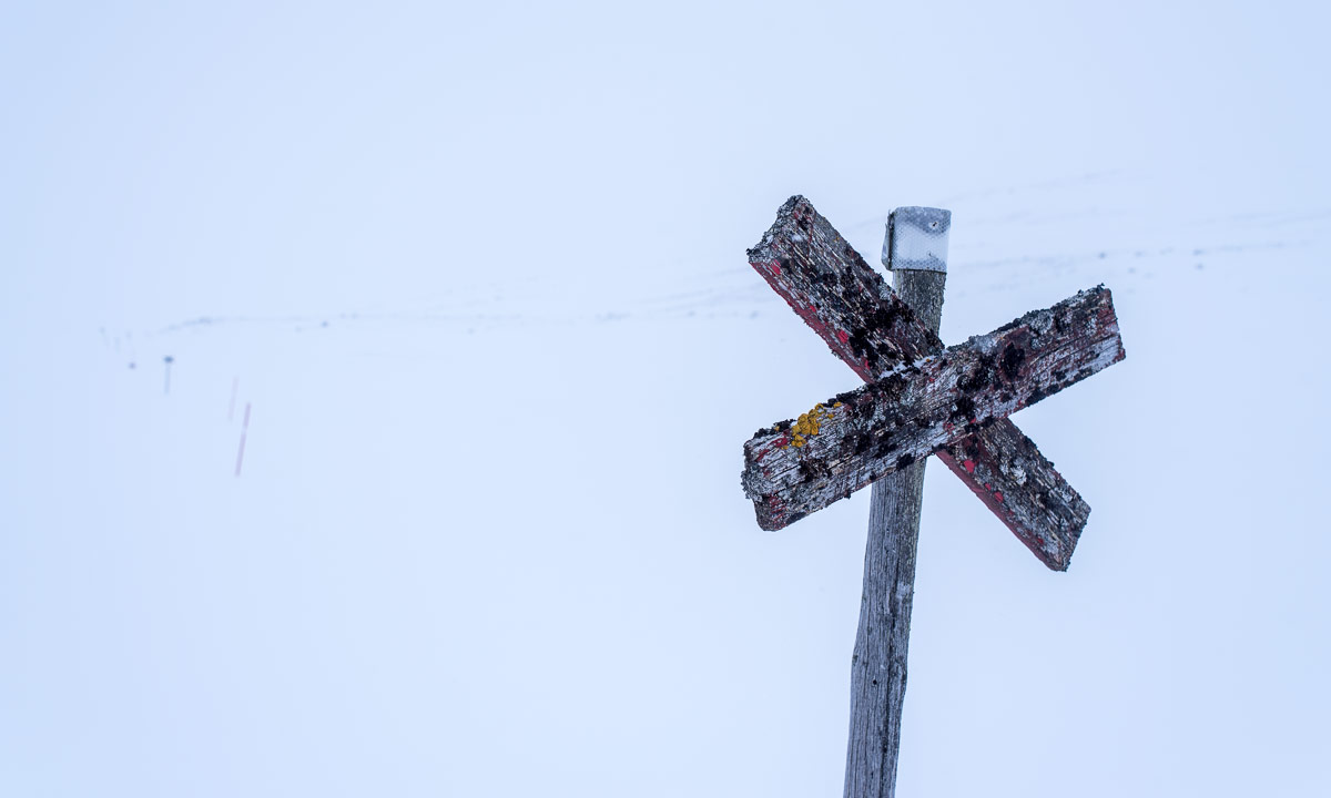
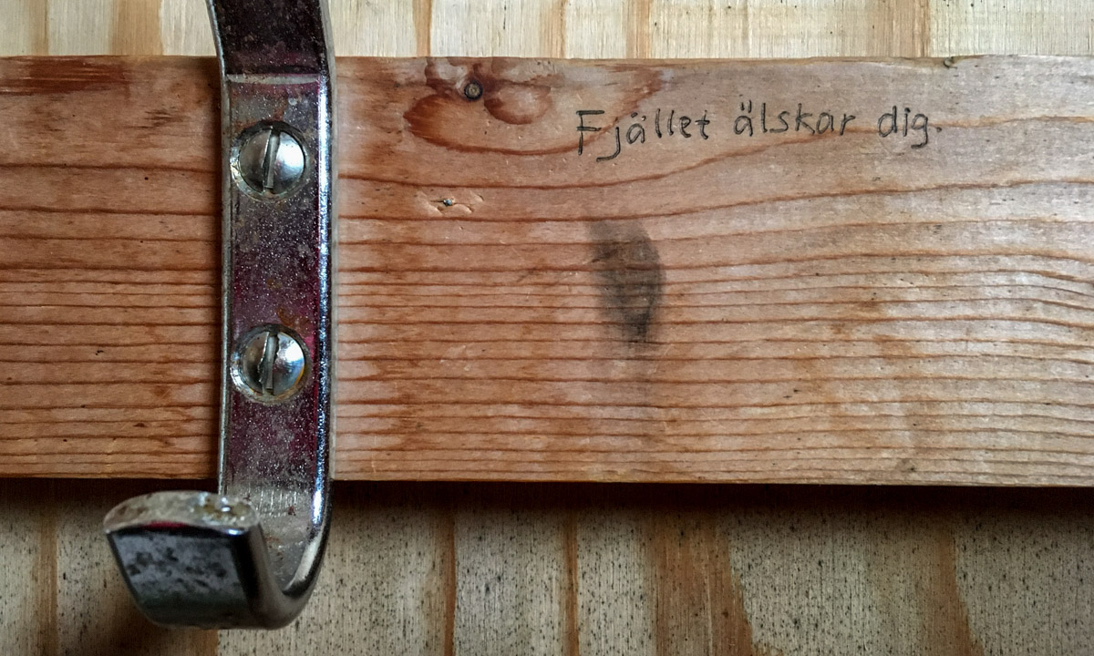
People who know me know that I prefer the mountains to the forest. Does the mountains like me, too? It seems so. On the plywood wall of one of the earth closets it is written: “Fjället älskar dig.” – “The mountains love you.”
The rest of the day? Sauna — dinner — early bedtime. Tomorrow we want to get up at 6:30. It’s only 14 km to Gåsen but it is 350 metres higher than Stensdalen and we are not sure how long it will take.
3 March – Stensdalen Fjällstuga – Gåsen
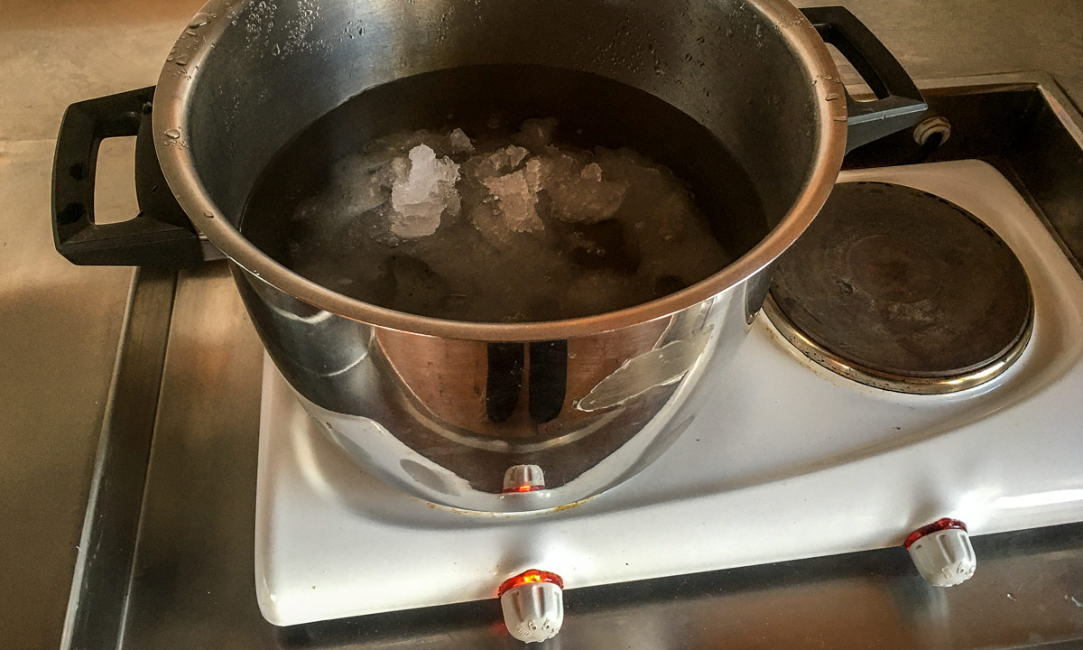
6:00. The alarm clock hasn’t rung yet but we are already awake. We leave our sleeping room and enter the huge common room with kitchen, where I light the huge wood stove. Annika is boiling water for tea. We have a full breakfast with bread, cheese, and eggs – all leftovers from our breakfast at the hostel the day before.
We like the style of the new cabin. It may be less cozy than the old ones but the separation of the sleeping room is nice and there’s a lot of space so that even with a lot of people it is hardly crowded.


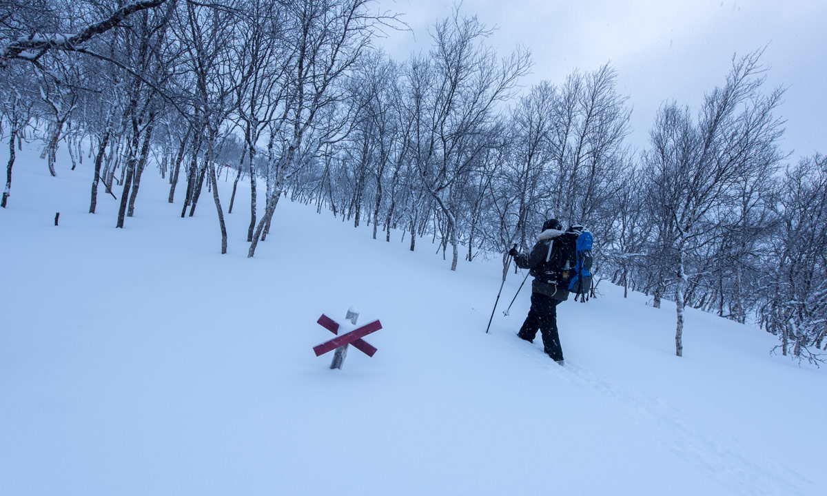
8:20. We just walked across the wooden bridge by the sauna and strap on our skis. 8 cm fresh snow have fallen. We ski through birch forests. Our skis sink 10-15 cm into the snow.


Suddenly Annika makes a sign to stop and to be quiet. It’s a bird – a woodpecker chopping on an old tree trunk. Carefully I get out my camera with the telephoto lens and slowly I ski towards the bird. It seems to ignore me. When I’m hardly three metres away I start to crouch. Frrrr … the woodpecker flies away. For the bird lovers (and Google): It’s a three toed woodpecker.

The snow is soft and we are slow. How long will it take us to Gåsen? I hope that the snow is less deep in the kalfjäll – the parts above the timberline. After 4, 5 km the forest opens and a large ascending mountain slope comes into view. We meet two skiers that come from Gåsen (they have been really fast). We thank each other for making a trace. A trace that we hardly need for now the snow is much harder. So it’s less exhausting to ski although we have to ski up. Less than two hours later we have approached Stähtja, an emergency hut that we use for a break.


When we continue the sun has started to peek through holes in the clouds. The lighting moods are great and sometimes hardly believable. Snow is purple in the shadow and yellow in the sun, sometime the scenery looks like big studio lights have been set up for filming. I think it’s nearly impossible to catch these sophisticated moods but of course I try anyway.


We ski about a large snowy saddle that looks infinite. A sign says “Gåsen 3km”. First we are completely alone but then another skier approaches. It’s stugvärd Ebbe, one of the cabin wardens whom I already met on the other ski tour. He welcomes us and continues skiing. We continue, too. On the highest point of the saddle Gåsen comes into view.

Just before we arrive Ebbe returns from his ski trip and welcomes us again, this time with hot berry juice – the traditional welcome on the STF mountain cabins. We are the only guests and in the same room as Arne, Jonas and me nine days before. The proof? The garlic that we had forgot is still there.
Later four French people arrive. They hardly speak to us. I guess they only feel comfortable speaking French, a language we cannot speak.
The wind increases. We do not care. We want to stay here at least one more night.

4–5 March – two days at Gåsen
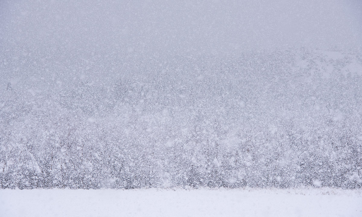
It’s windy in the morning. Outside its -8 °C, inside our cabin temperature has dropped to 7 °C. I fire the “Upland” wood stove. It is very slow and it will take half the day until the cabin is warm again. The French group leaves. I do not envy them because the wind is increasing and it is snowing.


At 10:00 we leave our cabin and go to the stugvärdarnas cabin. Ebbe has invited us to fika – coffee – and Svitlana has baked a delicious chocolate cake. We sit there and talk for almost two hours until we hear the sound of an approaching snowmobile. It transports food and goods, both for Svitlana and Ebbe as well as for the Fältjägaren Fjällstuga, 30 km in the south.

We invite Svitlana and Ebbe for dinner. Annika had dried potatoes, onions and vegetables at home to spare weight. Now she is watering the dried food.
Later that day I have another appointment. Ebbe and I fetch water from the waterhole. Ebbe wanted to do that in the afternoon when the wind has calmed down, since it’s a bit to go to. You see the tiny square right from Ebbe’s head on the first photo? That’s the waterhole. It’s four metres deep, so you take a bucket to pull up the water, fill it into the plastic containers and then use the sledge to pull it back. One container for the warden’s, one for our cabin.


And the used water? There are own buckets for it and an own place where to pour out them. They are marked with the word slusk.

At 18:00 Svitlana and Ebbe arrive. Annika has used milk powder, egg powder and the watered potatoes and vegetables to make frittata. It’s enough to invite Magnus from Göteborg as well. He slept in the tent the nights before and now stays in the same cabin as us. Svitlana brings fresh bread and Annika’s frittatas taste great. We even have some Florentine biscuit as dessert. A luxury multi-course dinner at Gåsen with great company. What a fantastic evening!
Annika and I decide to stay another day. Magnus is not sure yet.
We take it easy this morning. Magnus has decided to stay, too. So Magnus and I can help Ebbe with the gas cylinders. Full gas cylinders have to be connected to the warden’s cabin. The gas connection is at the back of the cabin and was completely snowed in, since here the snow reaches over the roof. Ebbe has already dug down to the door and Magnus and I use a rope to slowly lower the heavy gas cylinders down to Ebbe. These are jobs, where a stugvärd needs support of the guests and we are glad to help.

Not only the back of the stugvärd cabin is snowed in. The old cabin is also surrounded of snow and with a single step you could climb on the roof. Ebbe told us, that a snow groomer would come in two weeks to dig out the cabin.


This day more people arrive. First to constantly talking women, than a party of six. Magnus already fled the crowd by moving to the other room, Annika and I follow soon. There it is cold, but quite.


The weather has got better and tomorrow both Magnus and us want to start early. He will return to Storulvån, we want to continue to Vålåstugan.
Continue with part 2 >