This article is part of the series
“2015-08: Kungsleden hike”.
August 30 – September 2: Day eight to eleven of the summer hike through the mountains of Swedish Lapland
Nallo – Vistas
After two days in Nallo Annika and I were eager and keen to move on. After our breakfast we said goodbye to stugvärd Janne and started to ford the stream behind of the hut. Fortunately the water level dropped to normal again and quite easily we could cross the stream.
Then we went along the Nallú, a fantastic mountain that changed its appearance every other second because of the moving clouds and the changing light situations. We never tired of looking at this big mountain that seemed to accompany us a long way.
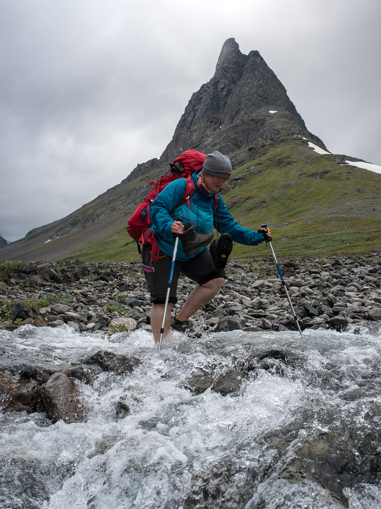
After a while another stream that we had to cross, came down from the lake Nállujávrrit. While I managed to splash through with my high rubber boots, Annika decided to take of her shoes and wade through it in her sandals – brr, the water was really ice cold!
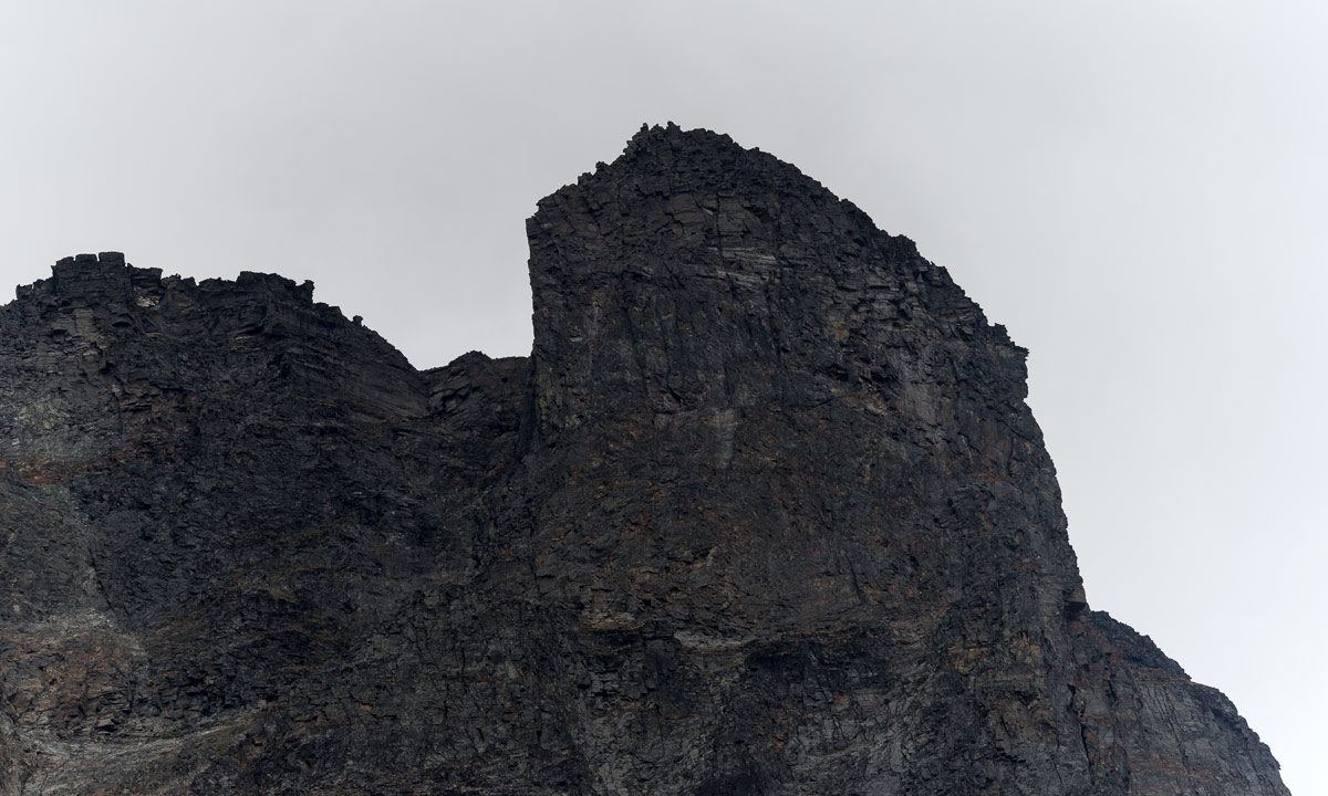
We continued the hike through the fast-changing scenery. Quite soon we saw the first trees and realised that the big mountain ahead was the Vássačorru, that lies behind the valley Visttasvággi, where our next destination, the Vistasstuga is located.
Soon we crossed the Visttasjohka on the chain bridge and arrived at the cabin to meet the stugvärd – the warden.
Oh look: Coke and beer are priced down! That’s because the season only lasts three other weeks. After that the huts are closed down until their reopening for the skiers in February or March. But because none of the cans would survive the frost, all liquids has to be drunk in the next three weeks or poured away. We decided to save some cokes from this cruel destiny.
We were placed in the outhouse – the main building was in the act of being renovated. There we sat on the front stairs, ate, drank and looked on the river Visttasjohka. And we took a bath in this cold river. Chilling but refreshing! Finally the sun came out. I crossed the bridge to make a photo of our cabin.
Later – it started getting dark – we got a visitor: A big moose stood beside the river. I went out, where I could observe this huge animal, how it ate leaves and grass, less than 10 meters away. It looked at me but wasn’t disturbed by me at all, it even passed quite near until it vanished between some trees. This was one of the moments were I was glad and touched as a “normal person”, but a bit grumpy with myself, that I was too lazy to carry my big tele lens for better and sharper pictures. I never experienced a moose so near and so fearless.
Vistas – Alesjaure
The trip the day before was short: only 9 kilometres, this day it would be twice as much: 18 km. The first kilometres were a bit boring since they went through birch forests and quite muddy passages. But after a while the landscape opened and we could see the mountain Siehtagas with its glacier Siehtagasglaciären. In front of the mountain there were alpine meadows and small birch forests. In front of that the turquoise water of the Visttasjohka glimmered in the sunlight.
We went up again until we again were over the treeline. This part of the valley Visttasvaggi is beautiful and very varying. The first rest we made in the lee side of a huge cuboid rock. We weren’t the first – someone built a bench by laying a plank over two stones. The second rest we made at the Tjatjajaurekåtan (there’s not much left of it).
After a while I saw some reindeers grassing. There were shy and quickly went away when I came nearer. We saw (probably) them again when we had a view at the sami village Alisjávri that lies at the lake with the the same name. From that it’s not far to the mountain huts of Alesjaure – the Swedish version of Alisjávri. The Alesjaurestugorna are the biggest mountain huts of the STF – the Swedish tourist association. I prefer the smaller ones as e.g. Nallo, but it’s fine to have a shop, a drying room and especially a sauna. And we used it all! It’s nice to go to sleep after being in the sauna and having a wash in the river Aliseatnu.
Alesjaure – Abiskojaure
I didn’t make many pictures of this part of our tour. I was a bit bored of this part of the trail and found nothing special in the landscape. Just some photos of human evidence: Tent poles for a lavvu and a crossing over a long reindeer fence.
It was the first time, that I was really impatient and just wanted to arrive. Some kilometres before Abiskojaure we came below the treeline. Most of the birch trees still were green but you could see, that autumn is near. No wonder, it was the 1st of September, beginning of autumn for the meteorologists.
Finally we reached another chain bridge and shortly after it arrived in Abiskojaure. The sun came out and even though it was much colder than one week ago we could sit and lie on the short-cut lawn in front of the hut. I took the last bath of the journey and strolled around making some photos. After crossing a small swamp I came to a quite huge sandy beach beside the lake Ábeskojávri. A beautiful place!
The evening it started to become chilly, hardly 3 °C. I was curious if we would get the first frost of the season next morning …
Abiskojaure – Abisko Östra
… and yes, we got frost. -2.5 °C showed the scientific thermometer of the swedish weather service, when I had my first look. On the water surface of the buckets lay a layer of ice and round the leaves of lower plants I could see the first autumnal hoarfrost.
I was up very early that morning and I went to the beach at the lake again. First it looked quite normal but then it started to get foggy and misty while the sun rose behind the mountain Giron. What a beautiful sight! I stood there for at least an hour and only walked back to get another full battery for my camera. Later I met Annika, showed her the place and was glad that I could share this awesome experience.
I was a bit sad – this would be the last day of hiking through the wonderful mountain landscape of Swedish Lapland. But each journey has some kind of end and so had ours. We started our tour through the birth forests along the lake Ábeskojávri, than along the river Abiskojåkka.
After a while a famous landmark came into sight: Lapporten – “The Lapponian Gate”, a U-shaped valley framed of two mountains that give this valley its specific and recognizable shape. However, since this photo is taken from the backside, it hardly shows this special shape.
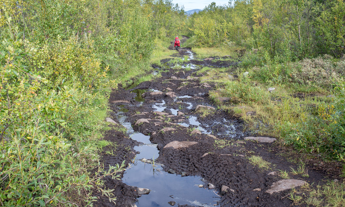
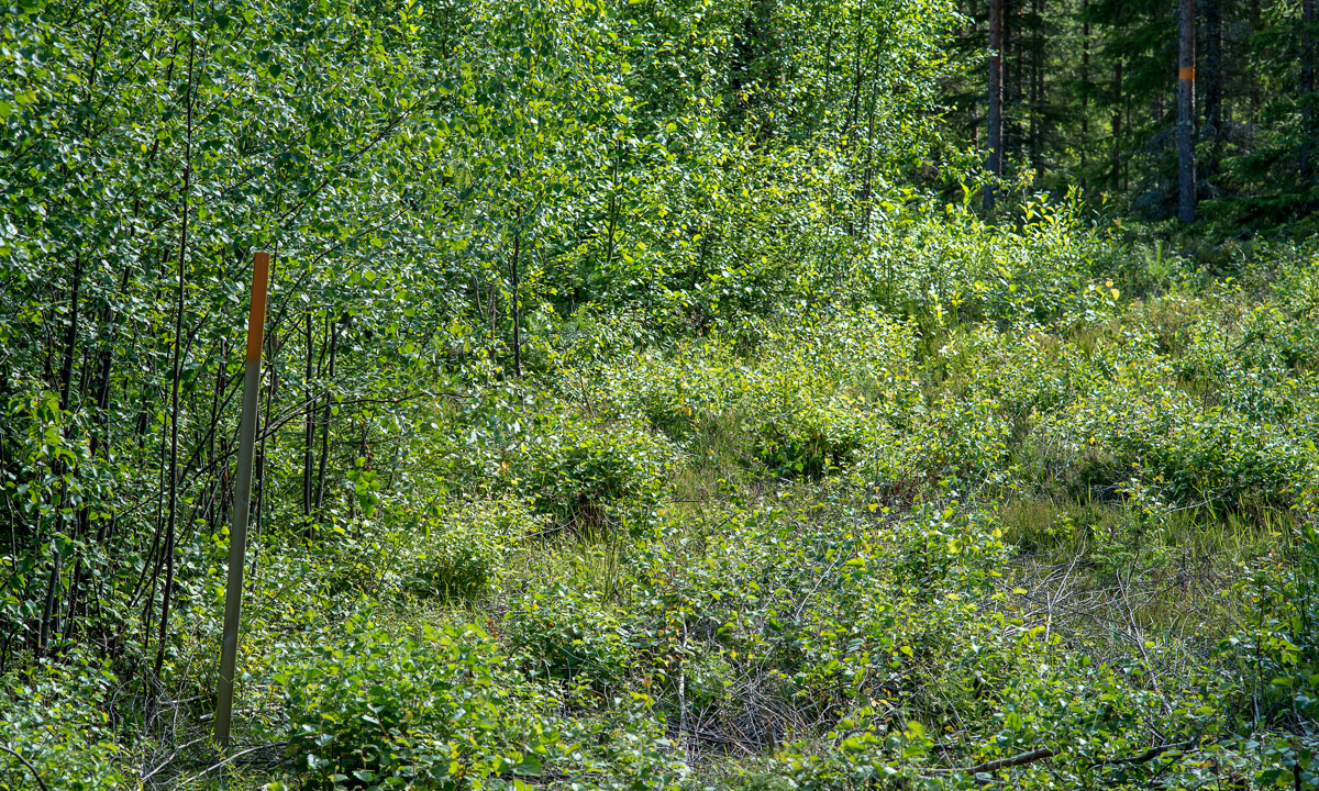
Since Alesjaure we followed the Kungsleden – the King’s Trail, but right after the bridge over the stream Nissonjohka we left the main trail that leads to the Abisko Mountain Station and turned right to Abisko Östra, the village, were we planned to stay for two other days. The way, however, was not much fun to go. A lot of all-terrain vehicles has turned the way into mud. Since I lost my lens cap and I was afraid that mud would splatter my lens, I packed the camera into its waterproof bag long before the worst mud patches. And that’s why this is the last photo of our hiking tour:
Thank you Annika, för trevligt sällskap – for nice company. Where should we hike next?
Any suggestions?