From autumn to winter – a tour to the Litjeblåmannen

This article is part of the series “2021-07: Back in Tromsø”.

My first concert with the chamber choir Ultima Thule was supposed to be today but due to the increasing COVID-19 cases in Tromsø the board decided to cancel the concert. That’s a pity but gave me a free day and the opportunity to continue with my #onceaweek project. I decided for a tour to the Litjeblåmannen (860 metres above sea level).

At 8:40 I have parked my car and start the tour. Temperature is -5 °C. Brr! I regret that I left my long johns home. That changes quickly when I take the first steep climb up the forest path and start to sweat. All trees have shed their leaves and are bare.

At 8:40 is sunrise. Half an hour later I can see the sun rise above the mountains. Ten minutes later I have left the birches behind and the landscape opens. I am gaining altitude and soon the path starts to cross the first snow fields.

Ten other minutes later snow and rocks start to dominate the landscape. It looks like winter. The autumn is left behind in the valley. I see a radio mast, part of the radio station on the Rundfjellet (472 m). Well, that was easy.

I decide to continue the tour. But where? The tour description mentions that I have to go down 50 metres. I hardly see any waymarks or a track but soon some foot steps that I follow. According to map and compass it’s the right direction. The terrain gets rockier, steeper and is partly icy but at least I spot some waymarks again. I stop to strap my spikes under the boots. Safety first! Less than an hour later I pass another radio station. I do not look closer because the terrain behind the building is very steep.

The terrain continues being steep and rocky but after a while I reach a plateau. Now it’s winter. Beside of some tufts of grass covered with frost there’s only snow and rocks.

From now on it’s much simpler to walk on this snow covered plateau and soon I reach the mountain summit Botnfjellet (844 m).

That’s however not my destination. Well, the summit of Litjeblåmannen looks far away but it takes only 20 more minutes to go there.

Break! Summit selfie!

The fur hood is not only for looking wintry on the selfie. It was colder than expected and after the selfies I put on my down pullover. Checking the temperature at Tromsø airport and subtracting 0.6 °C per 100 metres altitude I guess that the temperature is round -7 °C. The wind makes my mind change about wearing long johns a second time.

I eat a bit of chocolate and drink some Sprite before the frost transformed it into slush. I’m completely alone and I haven’t met anyone yet. It’s just beautiful up here with views on snowy mountain chains everywhere but on the snowless lowlands and the fjords as well.

After 20 minutes break I start my way down. First I follow my own tracks until I met the first mountain hiker today. Now I follow her steps. Does she know a better way?

Some impressions from the way down:

While I descend more and more the sun starts to set. I hike cross-country. Less and less snow covers the ground until I reach a terrain consisting of terraces of wetlands and dense birch thickets. The wetlands are easy to cross, since the ground is mostly frozen and I have rubber boots. The birch thickets however take some time to squeeze through. Looking back I can see purple clouds indicating that the sun already has set.

At 14:40 I arrive at the car. -4 °C. According to my app I walked 15 km and 1120 metres in altitude. I started before sunrise and arrived after sunset. This gives me the right to be very lazy the rest of the day. The blog article I want to write anyhow.

I met three persons in total:

  • A woman in my age in clothes that probably have been used on countless tours for many years,
  • A young woman in a grey woollen sweater hiking up quite fast while talking loudly on her cell phone.
  • A packed sleeping bag on a stone in the wetlands. A sleeping bag with a book. Wait! No, it’s a hood with a book. Wait! No, it’s a person leaning against a large rock reading. In the middle of some wet slope on the island Kvaløya. People here really like being outdoors.

So much for today. And now I have to stretch!

Appendix:

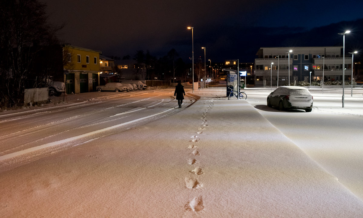
I just went to the kitchen and felt, that the outside light had changed. It had! It had snowed some centimetres and is still snowing. Everything is white. Beautiful!

Saskarö in the fog

From Monday and Thursday Annika and I made a trip that I had in mind for a longer while. Travelling round the Bothnian Bay which is the northernmost part of the Baltic Sea. The first days we travelled by car along the sea. The last hours we travelled by ship from Vaasa in Finland to Holmsund in Sweden. From there it’s only a 12½ additional km to our house in Obbola where we live.

On our way to Haparanda we made a detour to Seskarö, an island that is connected to the mainland by several bridges. As the whole day (and half our journey) it was quite foggy.

Especially by the shores there was not much to see. A near island, a bit of ice, some rocks and and a white sea merging seamlessly into the white sky.

Winter weekend in Kusfors

Annika and I used the weekend to visit good friends in Kusfors. While it was still autumn home in Obbola by the sea, the inland experienced an onset of winter with 20 cm of snow and frost below  -10°C. And so did we in Kusfors.

There’s a reason why it’s a good idea to change to winter tyres already in October.

Travelling from Tromsø to Obbola

Live from the journey …

Part 1 – written in Hotell Sørreisa.

Saturday 16 October at 12:17 my train to Umeå will depart. Not from Tromsø (no train station), but from Abisko Östra. From there the train to Umeå will take nine hours. Then it’s only twenty more kilometres to our home in Obbola.

From Tromsø to Abisko I’ve planned to take the car. And this was the forecast for the Swedish mountains four days ago:

Half a metre snow! Holy moly! Luckily you can rely on the fact, that these forecasts are unreliable. Now only some centimetres of snow are forecasted for tomorrow.

Wednesday

While some trees in town shed there coloured leaves the mountains are already clad in snow. The first photo is taken in the centre of Tromsø, the other one near where I live.

Thursday

I change to winter tyres, a must have for crossing the Norwegian/Swedish mountains. Due to unsure weather conditions I decide to start my car trip already on Friday and book a room with breakfast in Sørreisa.

Friday

Half past three I have packed my stuff (why is the large suitcase so heavy again?) and start my car trip TromsøSørreisaAbisko. The first fifteen minutes stop and go in town, then over the bridge and onto the E6 that I follow for round 130 km south. The temperature slowly drops from +3 °C to -2 °C and gradually snow is not something far on the mountain slopes but lies left and right from the road E6.

It starts getting dark quite early. Sun down here in is already at 17:20. Here, that is Sørreisa Hotell, where I’ll stay overnight. This hotel does not only provided affordable rooms but really good Thai food as well.

Part 2 – written in Kiruna, sitting in the train to Boden.

Saturday

The next morning my car windows were covered with frost and the temperatures were slightly sub-zero. I had enough time to avoid the main road and instead took road 84 that has both mountain and coastal stages. I can warmly recommend this detour.

The smaller lakes in the mountains were mostly frozen. To my surprise even parts of the fjord Sagfjorden near Sjøvegan  were covered with thin ice. I thought it would take longer to make the saltwater freeze.

After I joined the main road E6 I left it again to follow the E10 to Sweden. There was some snow on the ground, but it wasn’t snowing.

45 minutes later I arrived in Abisko Östra. Here’s a cozy cabin, where I had stayed several times to explore Abisko. The owners generously allowed me to park my car here for free, while I am in Sweden. Thank you, Anneli and Thomas! It was nice meeting you again!

In Abisko it started snowing. I bought some lemonade and then waited for the train to come. It came in time. I got into the train. Now it’s only round nine hours to Umeå. With the car it is 700 km to Umeå so taking the train is not only more ecological and comfortable but also faster.

Part 3 – written in the train between Kiruna and Gällivare

When the train arrived in Kiruna it was winter. Everything was covered with snow, it was windy and constantly snowing. We had a stay of half an hour and I went out to take some photos. My anorak was warm enough, the summer barefoot shoes weren’t. No problem, since the train was overheated I quickly got  warm again.

After we left Kiruna more and more snow sticked to the slightly warmer train windows until I could hardly see through the window anymore.

Part 4 – written in the connection train somewhere between Älvsbyn and Jörn.

In Gällivare and Nattavaara there was more snow, but then the train approached the coastal region where it uses to be slightly warmer. The ground was also snow covered but the snow looked wet and probably won’t last long.

Meanwhile it had started to get dark. We were late but the connection train in Boden was supposed to wait for us. And so it did.

In Älvsbyn I took the last out-of-the-train photo today. It was dark and mostly I took photos from my own reflections, not from the outside.

I’m glad when I can leave the train. First of all I’m tired and want to arrive home. Then the train compartment is strongly overheated, too. I’ve been in saunas colder than this!

Part 5 – written from home on Sunday.

There’s not much more to tell. Leaving the town Vindeln behind I could see less and less snow until soon no more snow covered the ground. At 21:09 the train arrived in Umeå where Annika already waited on the platform. Half an hour I finally was home.

Today, after a rich breakfast:

I’m so glad to be here. At more than two weeks I’ll spend home in Obbola until I’ll take the same way back to Tromsø in early November.

A hike round the peninsula Klubben

This article is part of the series “2021-07: Back in Tromsø”.

#onceaweek tour 5

Today I didn’t choose a mountain top but a small coastal promenade as my #onceaweek tour. I took the car to the village Lyfjorden on Kvaløxya and went round the peninsula Klubben. I love hiking up mountains to get the view but at the coast you get views for free ;-).

One of the things that still impresses me is how tiny some houses look standing in front of huuuge mountain faces that often look like vertical walls.

Klubben lies in the Kaldfjorden (the cold fjord). On the other side lies the mountain Store Blåmannen (1044 m) – always an imposing view.

The birches on Klubben had only some yellow leaves left. Since it was quite windy (15 m/s on the bridge to Kvaløya) they will be bare soon. Soon the autumnal colours will be history for this year.

Although this tour was marked as green (easy, for beginners) you still had to watch where to go. Sometimes the path was boggy but mostly stony and I had to watch my steps.

A quite loud noise, like someone inhaling loudly through the teeth interrupted me. I looked for the sound source and spotted a whale quite nearby. Although I had the camera with telephoto lens in my hands it took me a second before I managed to make a photo of the dorsal fin just before the small whale submerged again. I saw it two more times but in quite a distance. The photo is poor but the experience to spot a whale just by chance from your Sunday afternoon walk was extraordinary.

I continued my walk but now the path had vanished and the ground was only rocks. Did I miss the path? Possibly. I checked with the map app of Norgeskart and realised that the way was a bit higher up. I went and climbed up the steep slope but did not find any path. Higher and higher I ascended until it was clear that the map wasn’t as accurate as assumed. Probably the rocks were the path.

I didn’t want to descend that slope again and so continued to ascend it until I met a small gravel road that led to some houses – the first modern and cuboid, the second traditional with a grass roof.

Soon the area had become less steep and I could cut short to the coast again.

On the way back I took an extra stop in Finnes, Kvaløya . The small reindeer herd that I’ve seen there several times was still grazing. Probably they live there.

Today’s tour was only 4 km (elevation gain and loss round 250 m) but I cannot say that it was less fun or less exciting. I have however to admit that it was much less exhausting than the mountain tours. Training effect: ±0.

Aurora hunting – failing and cheating

It’s always the same: when you wake up in the night and see the polar lights illuminating the sky it doesn’t mean, that you can take good pictures of them. In the time you need to dress, take camera and tripod and walk outside to a nice place it’s likely that they disappear again. Polar lights are shy fellows.

Last night it was the same: I saw a nice aurora from my sleeping room. But when I arrived at the bay Telegrafbukta no distinct aurora was visible anymore.

Anyhow the sky looked a bit pale. Clouds or polar lights? Let’s take a handheld photo with a long exposure. Cl… …ick.

Yes. The sky is definitely green. I set up the tripod, configure the camera and wait.

Nothing happens.

So I start taking a long expose shot of the sea, the mountains and the lights of Kvaløysletta.

And you can see the polar lights, at least a bit. No surprise because I exposed the photo for 30 seconds with ISO 560 and an exposure of ƒ/3.2. That puts enough light onto the sensor to catch even faint polar lights that are hardly visible to the naked eye. So this is not really an aurora photo, it’s more cheating.

Before I went back to my bed I wanted to take at least one photo with some kind of a motive. It became a shed nearby, illuminated by the moon and again with a faint polar light in the background.

Today I have to go to bed early, I have to catch up on sleep.

A hike to the Stor-Kjølen

This article is part of the series “2021-07: Back in Tromsø”.

Let’s be honest and face it. I’ve been really lazy this year and my outdoor fitness is near non-existent. I don’t like that. There is a simple solution for that: Be more outdoors!

Today I started the project #onceaweek. I want to make an outdoor tour with at least 10 km every week. (Thanks M. for your inspiration.)

I will try to blog about these tours and I want to give each tour some photographical focus. Today’s theme: vegetation zones.

From forest to fjell

The gravel road is quite steep in the beginning. First it leads through birch forests that have started to colorise autumnal. Then the landscape opens and is not dominated by trees anymore.

Gaining height

At the lake I leave the gravel road and the character of the hike starts to get alpine. It’s however still a hiking tour, no climbing needed on the whole tour.

From earth to moon

The vegetation is becoming more and more sparse. Some tufts of grass, a fern, moss, map lichens. And then I pass the first snow field. I look up the mountain I wish to climb. It is just an enormous pile of stones. Fortunately there’s a way round this slope.

The mountain top of the is a plateau of rocks with even less live. It’s almost like being on another planet or moon. And there it is: the space station.

“Oh, the space station looks so cozy inside!” – „Well, that’s not the space station, it’s the varmebua, a small wooden cabin to give shelter to hikers.“

“Um, hikers? On an alien moon?” – “Well, we are on earth and the ‘space station’ is a radar station used for controlling the air traffic of a larger part of Northern Norway.“

I had been almost alone on my way up but on the summit there were many other hikers. Some passed, others took a rest like me.

Looking around

The plateau provided a 360° panoramic view. I could see many mountain chains, the higher tops all snow covered. Anyhow, it’s Tromsø and so fjords and open sea are present as well.

This could be a favourite place of mine in Tromsø’s gorgeous nature. But it is way too early to know this. Remember, it is my first tour of #onceaweek. There will be other places to discover.

For the stats: 16 km, summit altitude: 788 m.

Fylkesvei 8100

This article is part of the series “2021-08: Northern Norway”.

There are places that are so fascinating, that you want to return there for a longer time. For me the road to Hamningberg is one of these places.

Originally Annika and I didn’t have the plan to visit Hamningberg. It’s a detour of 2×40 km just to see a former fishing village whose houses are now used as summer cottages. On the other side the road 8100 that leads there is closed in wintertime and we never had the chance before to drive there.

So right before Vardø we spontaneously decided to turn left into the road Fylkesvei 8100. We could turn if it was boring. Well, it wasn’t. We were both extremely fascinated by the roughness of the landscape and the many light moods because of the constantly changing weather

The photos are just some snapshots I made on our tour. Maybe I have time to return there some other time with more time for making photos.

Norwegian summer journey II

This article is part of the series “2021-08: Northern Norway”.

Annika and I continue our tour through Northern Norway. Four days ago we left Hammerfest behind, now we are in Bjørnevatn 10 km south of Kirkenes. We have seen many places before, but only in winter. The differences between the seasons are huge and we discover a lot: Oh, here is a lake! Oh, here are fields of flowers …

Ten more images looking back:

10 – We just have arrived at our final destination Bjørnevatn where we visit friends for a few days. I have to climb up the hill (55 m) by our friends house to get a summery view. (Here are some winter photos.)

9 + 8 – the “Sjøsamiske samlinger” (Sea Sami Collections) in Byluft is always worth a stop. We have coffee and a chat with Helmer Losoa, the owner and collector of this exceptional museum who recognises us from former visits. (More about the museum.)

7 – this bird observation place near Vardø is very welcome as a shelter against the cold wind, when Annika and I have a lunch break. We do not see any special birds but a rainbow.

6 – after an overnight stay in Kiberg I climb up a hill to make a photo of the wideness and extent of the Varanger Peninsula in the sun. Well, the sun has mostly gone when I stand on the top, but I take some photos anyway.

5 – Annika and I just take a small evening promenade in Kiberg. It starts on a gravel road by the sea and ends in us walking cross-country and looking for dry patches between the small bogs. The sun colours the clouds which are reflected in the many water pools.

4 – Silfar Canyon? Never heard about it before. We were lucky that we decided to stop and have a look. Bad light for taking pictures but we got impressing views on the deeply carved canyon.

3 + 2 – We visit a small beach near Hammerfest together with a friend that just moved back there some months ago. We could take a bath but there is so much to talk about. The reindeer are everywhere. Here they graze, in town they stroll around and eat the front garden flowers.

1 – Before we meet our friend we take a small trip up the mountains. Here we get views in all directions, amongst others on the different parts of the town Hammerfest.