Autumn colours on the bog


Some photos from yesterday’s autumn walk over Langmyra and other bogs on the island Kvaløya.
Some photos from yesterday’s autumn walk over Langmyra and other bogs on the island Kvaløya.
Reader, meet Stappen. Stappen, meet reader.

Hiking up Stappen is tour 54 in my book “På tur i Tromsø” – On tour in Tromsø – and it is marked blue, which somehow means that it is moderately easy. I tried to hike up Stappen in winter last year but gave up because of the steep terrain paired with snow. Today I gave it another try.
Autumn has been in full swing the last days and most of birch leaves are yellow, while other plants as groundcovers are anything between green, yellow and bright red. Sky today was grey but the colours shone brightly.


After crossing a bog I had started hiking up the mountain from the left side. Or should I say, climb? There was no recognisable path and it was quite steep. Since all rocks were overgrown, terrain was not so easy and I took it slowly and cautiously. I didn’t want to slip or find some hole between the rocks.
As usual the views were gorgeous. The island Tussøya with the pale sea behind, the mountain massif round Skamtinden that rose above the valley while gaining height. or the autumnal coloured marshes with their embedded lakes and small meandering streams.


You can see it on the first photo. The way up stays steep – up to 85% or 40° – until the very top. But finally I crossed the 550 metres level curve and was almost up, because Stappen is only 565.2 metres high. But up does not mean that it was a plateau, it was more a constant up and down and I used my hands a lot when it got steep. Fortunately the ridge was always some metres broad. I’m a bit afraid of heights. And then – after crossing most of the ridge – I reached the top.

Impressive is not the word that you would use to describe this knee-high heap of stones. It was quite obvious, that this mountain is not very popular. It is pretty steep to the sides, so that I could look straight down to the lake Botnvatnet (“the bottom water”). Later I would go round this lake on my way back.

But I was still on the top of the mountain and continued following the ridge that slowly descended. Here you can see two parts of the ridge:


On my way I found a small clearing surrounded by rocks. With the rough mountains around it looked like a secret valley, where dinosaurs still live. Well, they have to be tiny, the clearing was only round ten square metres in size.
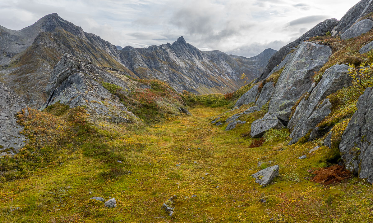
This part of Stappen was much less steep, but when I looked back again it looked quite impressive anyhow.

After a while I reached the bogs – still at an altitude of round 330 metres and started to walk back onto the wet and bouncy ground.

Stappen was a nice tour but steeper than expected. At home I read the tour description in the book again. You had to read between the lines: While it was not mentioned, that the ascent is steep, alternative routes were mentioned with the words: “Her er det litt mindre bratt”.
Google translate’s translation: “Here it is a little less steep”.
Olaf’s translation: “Here it is little less steep which is still pretty steep. But other paths – those that you will choose – are much steeper! Anyhow, we marked the tour as blue so you might survive.”
At the end just three pairs of photos of this tour and my tour on 4 December:


This article is part of the series “2022-08: Jämtland and Trøndelag”.
If you want to hike you need either a good map and a compass, or a GPS, or you have an area with designated hiking trails. Then you in most cases have only two issues: find the right trail and follow it.

Easy, isn’t it? Yes, but wait – what’s that?:

Why are there two trails to Storerikvollen? Check the symbols. One shows a skier, the other a hiker. That’s the first think you have to know: There are summer and winter trails in the Swedish mountains. The latter ones are often a bit less hilly but can lead over bogs and lakes. So choose the right track. Quite often they go together for a while and then split up again. That’s where you have either to check a map (take an up-to-date one) or follow the right waymarks.
The waymarks for summer trails use stones and red paint. In Norway it is a red T, in Sweden it is mostly a red dot. Mostly they are painted on large stones, rocks or on cairns – heaps of stones. The advantage of cairns: they are easier to spot when it is foggy.


In wintertime most summer waymarks are hidden under a deep snow cover. Then it is the time of the winter waymarks: Red diagonal crosses.

The poles can be several metres long because of the snow, the depth of which can vary greatly. When you have snowstorm conditions in winter you sometimes just can spot the next cross. When you’re lucky. I took the following photo on 20 February 2020 on a ski tour. Two hours later we experienced average wind speeds of 25 m/s. Then you start to love the waymarks that guide you through the storm.

Back to our August Jämtland tour this week. We could watch some people replacing the old winter waymarks by new ones. An important job, probably done on a voluntary base. Voluntary work is so important in Norway that it has its own word: dugnad.


I guess the best sign posts we found in Nedalshytta in Norway. One “summer signpost”, one “winter signpost” and even ratings for the trails from green to black.


It’s always nice to meet some signposts on your way, but not all of them show the distances. I like the last one. The letters are holes in the metal sign, so it won’t snow over so easily in winter time.

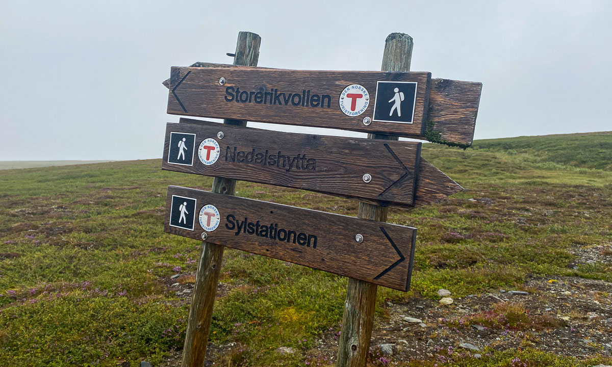

But not all signs are about following the trail. They can show you the Swedish-Norwegian border. Or the way to the toilet. Or the toilet – often a “privy” – itself. Or where to park your dog in case you have any.


And some of the signs or marks are quite creative. I almost missed this “in-tree” waymark in Norway. Perhaps more funny than helpful.

But the clearest sign we directly spotted on our first hiking day in Storlien:

The words say henan, dittan and hittn which are apparently words in Jamska, a group of Jämtland dialects. They mean something like here, →there and →here. I cannot express it better. Anyhow this is an article about signposts and waymarks, not about linguistics.
#justaphoto

Oh, what a wonderful kayak tour! And oh, what wonderful weather!
We were 31 kayakers from the Tromsø Sea Kayakers Club today and split into two groups. 19 paddled to Telegrafbukta, where I’ve been last week, 12 paddled to Grindøya, where I’ve been in June. I joined the Grindøya group and was very glad that I got some training this year. Not because of the waves that we had on the way there but because the group was experienced and quite fast. But I managed to follow and could take some snapshots on the tour.
Now it starts getting dark quite soon and we must have lighting at our life vests and the stern of the kayak. I had only some make-shift light and have to buy some equipment for next Thursday.
But now it’s getting late, so no more words, just some photos. To all today’s fellow paddlers: takk for turen – thanks for the tour.


This article is part of the series “2022-08: Jämtland and Trøndelag”.

On the photo above you can see the trail from Blåhammaren to Storulvån. It is in fact two trails together: the winter trail that is marked with red crosses and the summer trail that mostly is marked with stones with a large dot of red paint on it. We didn’t follow this trail I only took the photo because of the beautiful evening colours.
Many parts of the trail are just like this. They lead through heather, grass, crowberries, and dwarf birches. Other parts of the trail lead over hills, across rock fields, through forests and sometimes over a reindeer fence.


This is when the trail is dry. But often it isn’t. The trail can just be very wet of last nights rain as we had it on our third day.

The trail can be boardwalks that lead over swampy area or bogs. Some of them may be under the water which makes them rather slippery.


And then there are rivers, streams and brooks. Some of them are crossed by a bridge. Some bridges are big, some are – well – small, simple, and pragmatic.


And then there are rivers that you have to ford. I ’m used to hiking in rubber boots and so I could splash through while my fellow hikers had to switch to sandals and wade through the ice cold water. Already Douglas Adams said: You have to know where your towel is.


And then there is mud. It can be slippery and sometimes quite deep, especially right before or after a plank. When you have a plank.
Especially the first day trail section Storvallen—Blåhammaren was in an extremely poor shape. The others went around all these muddy patches while I – hey, I have rubber boots! – just continued straight ahead. But then at one point it happened. I made a step ahead and my right leg sank thigh deep into the mud. On the trail! Luckily Blåhammaren had a dry room.


But don’t be afraid, that’s not typical. Many sections of the trail look more like this:

How long the trail was? I don’t have the exact numbers but I think we hiked round about 135 km on 8 days, so round 17 km a day.
The weather forecast promised sun for most of the day today. Nice conditions for hiking up the Stor-Kjølen. I’ve been there once almost exactly one year ago, today I chose the other route coming from the Northeast.
I was there, my camera was there, however the sun wasn’t. Thick and low clouds hung over the whole mountainscape.
5-5½ km long, leading up 560 metres in altitude. It is well marked and a visible trail most of the time. One boulder field has to be crossed and the last part is mainly pathless, but not steep.


Much less shy than the Jämtland reindeer. They let me get quite close and one of them came within 3 metres. It seemed to be very curious and I expected it to touch me with its soft nose asking for goodies, but it went away. Another reindeer with huge antlers was much more careful and stayed with its small herd.


Visible from a lot of places in and round Tromsø because of its prominent, mushroom shaped flight radar station at the top. Beneath the station – a small hut. It’s the varmebua, a heated hut driven by Troms Turlag. Very welcoming today, when it was foggy and round 4 °C.


According to yr.no 4 °C and sunny. While the temperature might have been correct the rest wasn’t. It was cloudy and foggy and partially also drizzly. But then the sea started to shine and glare. While the sun itself was still hidden by clouds the reflection of the water surface sent sunlight upwards to the Stor-Kjølen. Amazing light, nearly unphotographable.
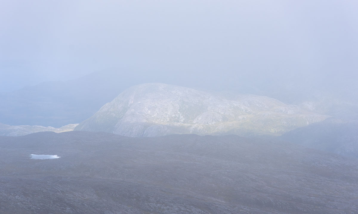

I waited in the hut for the weather to change, but in vain. On my way back to the car the cloud layer lifted and I could see a bit more of the fantastic surrounding scenery. But if took some more hours until the sun came out today and then I was long home.

A nice tour anyway. Or as the Norwegians say: ut på tur aldri sur – Out on a trip, never sour.
It was five weeks ago that I joined the Thursday paddling of my kayak club in Tromsø last time. That time we were only three paddlers, today we were 19. Could be the weather ;-)
One group of eight returned after a while, we others continued to the beach at Telegrafbukta where we took a longer break. While we had the wind in our backs on the way there, the wind already started to die down on our way back. Good luck! It was beginning to get dark, but many paddlers were prepared and had lights on their kayaks and themselves to be seen.
Some photos from today:


Takk for turen!
This article is part of the series “2022-08: Jämtland and Trøndelag”.
On our hiking tour in the Swedish Jämtland and a bit of Norway we hiked from cabin to cabin. These cabins are quite different, both in concept and in standard.

Ok, the photo above does not show a mountain cabin, it shows the Ringve Musikkmuseum in Trondheim that we visited the day before. Sorry folks, I couldn’t resist.
Since the weather in the Swedish mountains can be quite rough, there are emergency huts on the trail. The first one lies between Storvollen and Blåhammaren, our first destination. You may rest inside the hut, but do not touch the fire wood or the emergency box – they are meant to save life.


With an altitude of 1086 metres it is the highest STF mountain cabin. Famous for its fire beacon and its three-course dinner. We however use the self-catering kitchen to cook pasta with tomato sauce. A great first stay on our tour.


Another emergency hut. The sun comes out and invites us to take a break. From here it’s only a kilometre to the Norwegian border.

Two signs, that we are not in Sweden anymore: All roofs are grass-covered and the inside is full of carpets, wall pictures and other things to make the cabin individual and hyggelig – cozy.


A thing that makes Storerikvollen special: free-roaming sheep and Icelandic horses.


After the longest distance of ca. 23 km we gladly arrive at Nedalshytta. As in Storerikvollen this cabin does not provide a self-catering kitchen in the season. We have pre-booked half board and now order dinner. What we do not know yet: the cook is very gifted and the dinners are awesome! A good place for a rest day.


This is by the way the only cabin with road access on our tour.
We are back in Sweden again. Time to take a short rest in the hut Ekkordörren before we follow the trail over the pass.

Without loosing too many words: this is the worst cabin I know! A tiny shop with ridiculous prices, a dysfunctional self-catering kitchen with five soup plates in total, insufficient drying space and so on, and so on. The personal is friendly and pretty uninterested.


We will meet other people on our trip – cabin hosts as well as guests. No one likes Sylarna. But it’s only a single night and now it gets better. Much better!
Stay tuned for part 2 of the cabin article. Coming soon …
This article is part of the series “2022-08: Jämtland and Trøndelag”.
Hello, my dear blog readers. Three weeks of holiday have come to an end today. Mostly I was aborad. The main attraction: an eleven day hiking tour with my wife, my sister, my brother-in-law and my younger nephew.
We mostly hiked in the Swedish Jämtland but visited two Norwegian cabins as well. Our route: Storlien – Blåhammaren – Storerikvollen (Norway) – Nedalshytta (Norway) – Sylarna – Gåsen – Helags – Fältjägaren – Ramundberget. That’s a total of about 135 km.
Today I scrolled through the photos I made on the tour – it’s more than 1500. So it will take some time to go though, edit them and write some blog articles.
Anyhow, here is a sneak preview. 9 photos of the tour.


