Today I was out and did some canoeing. There was a special reason for that: Johan from Sweet Earth wanted to make a short film about kayaking in wintry conditions for Skellefteå kommun, the municipality of Skellefteå. He asked me whether I wanted to be the canoeist and I accepted gladly. Since the weather forecast looked good for today we planned to make the film today.
And the weather was good – it was fantastic! When I woke up at 6 o’clock, the sky was still dark but starry and completely free of clouds. The thermometer showed -13.8 °C – the coldest temperature in Skelleftehamn this season. I was curious about Storgrundet, where it happened to be open water the day before. How would it look like today?
Some minutes later I stood on Storgrundet’s boat bridge and lit my strong flashlight. As almost excepted the water has completely frozen over last night and the rim of the new ice was about 3 cm thick. Too thick to break through with my kayak. Anyway, it could be less thick a bit farther away, I considered.
At 7 o’clock Johan arrived and we discussed the possibilities:
- Plan A: starting at the Lotsstation farther away, where there’s open water and probably no ice at all, but perhaps less motives.
- Plan B: trying to start at Storgrundet, where it might be impossible to kayak, but it would look nicer. And there would even be a Plan B2.
We decided for Plan A. I fetched the kayak from the garage and pulled it through the deep snow to the street where I put it onto the trolley. I pulled the kayak to the beach while Johan followed by car filming. Soon I arrived at Storgrundet’s parking place, but not Johan. Some minutes later my phone rang: Johan’s car got bogged down in the snow and he had to shovel it free. I returned to give him a push. Luckily his car was free soon again and we arrived at Storgrundet for sunrise.

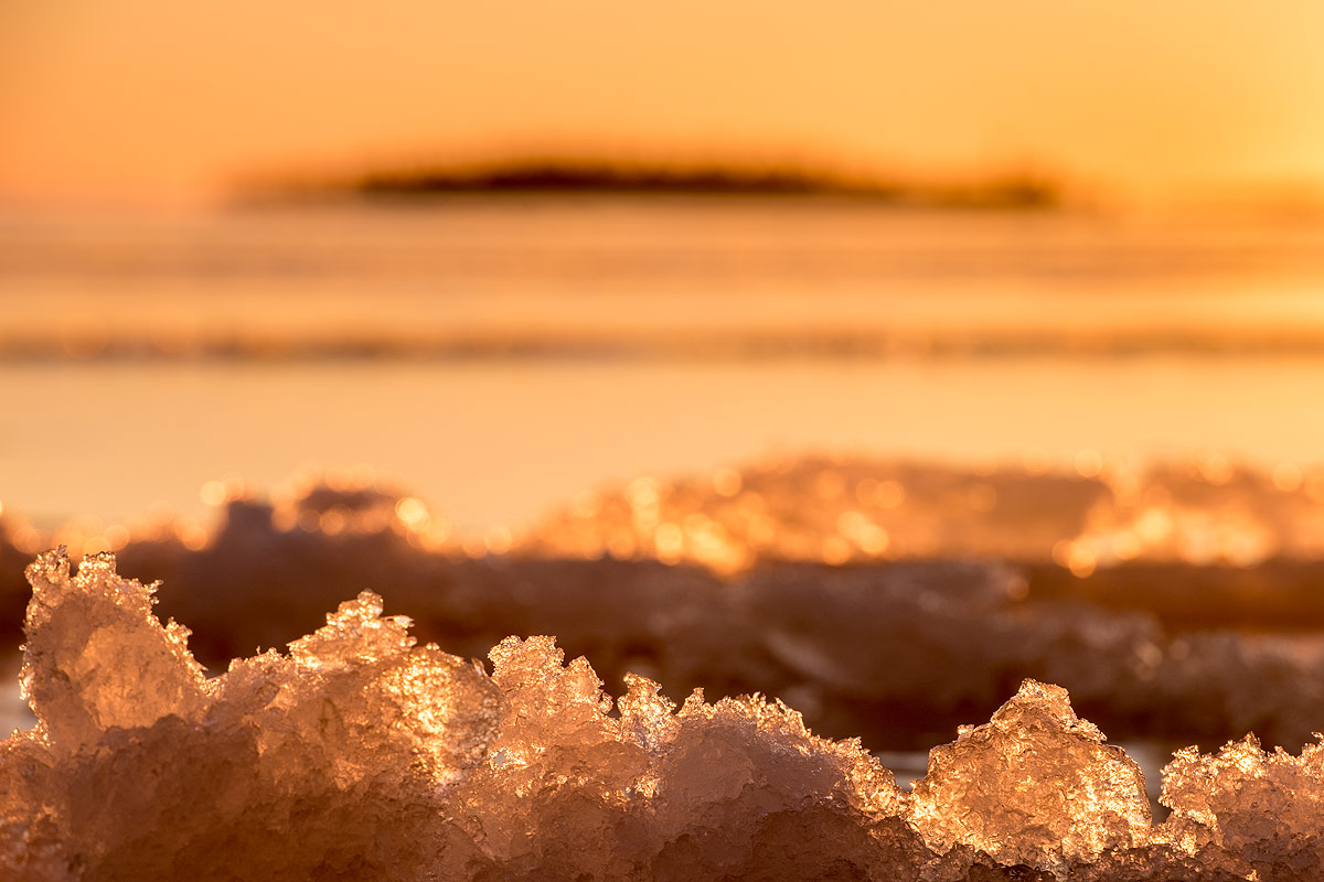
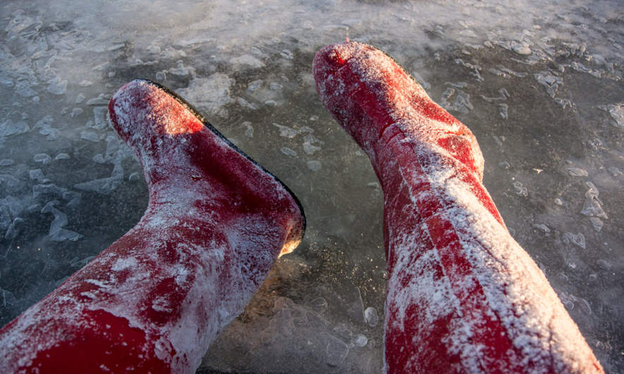
I took off my winter anorak and slipped into my waterproof immersion suit – ugly but vital. I removed the kayak from the trolley and pulled it to the end of the boat bridge. Near the shore and round that boat bridge the ice was white, it was older and thicker. Some metres away it was transparent and you could see the sea bottom. That ice was less than 12 hours old. I positioned the kayak at the rim of the white ice that bore my weight and entered slowly the fresh ice. It took just some steps and – Splat! – the ice broke and I stood in chest deep water. Well, that came not unexpected. That’s why I had the waterproof suit on and my isdubbar round my neck.
“Isdubbar” or ice claws are sharp spikes with handles. These are attached to a cord to be worn round your neck. If you fall through the ice you can use the spikes of the ice claws to pull yourself out of the ice hole back to safety. A must have when going onto the ice in early winter or unknown terrain!
I managed to crawl onto the ice even without the ice claws, because the immersion suit has so much buoyancy. I put the kayak onto the little ice hole and climbed in. Unfortunately the kayak wasn’t heavy enough to break the ice. I tried and pushed, wiggled and jiggled until I managed to forge ahead perhaps ten meters. Anyway I only succeeded into bending down the fresh and soft ice, instead of breaking it. Since the paddle had zero grip on the wet ice I couldn’t steer at all and turning was completely impossible. Finally I gave up and pushed myself backwards with the glove protected hands.
When I came to the older and slightly higher ice I was kind of trapped. I couldn’t push myself backwards hard and fast enough to come up onto the safe ice surface. I tried several times and at last I just left the kayak – Splat! – went through the ice again, crawled onto the safe ice and dragged the kayak back to the boat bridge.
The result: Paddling on ice: round 25 m. Paddling in water: 0 m. Baths taken: 2. Photos taken: zero. I hope, that Johan filmed my abortive efforts. It will make me laugh watching it.
But as I said, there was Plan B2:
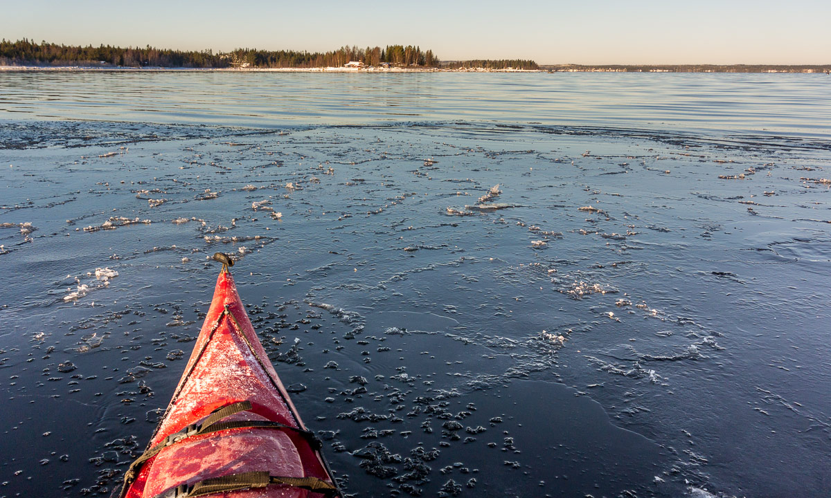
500 meters to the northwest the Baltic Sea is not in the lee of the island Storgrundet anymore. Here at the bay Flunderviken it usually takes much longer for the water to freeze over. While Johan had to take the save way on land I could go straight ahead by crossing the ice with my kayak in tow. First I had to plunge through soft ice and water again but then the ice was of the older and stronger kind and it was easy to get ahead. I knew, that Johan would be slower and I would had time to make some pictures.
Anyway even Plan B2 was in danger: Flunderviken was iced, too. At least I could see open water 100 or 150 meters ahead. Perhaps the ice would be weaker and I could go through the ice howsoever and reach open water. But first I had to wait for Johan who had to stomp through more than knee-deep snow to arrive. Time for another photo, time for going through the ice again, this time only knee-deep. Even here the ice was 3 cm thick – too thick to paddle.

Soon Johan arrived and I made my reservations. I didn’t believe in “ice-paddling” that far. Johan got an idea: Wouldn’t it possible to use the ice claws to push oneself forward? Well, I could try. The idea appeared to be brilliant. It was quite easy to push oneself forward, even it was hard work for my non-existing arm muscles. It went great until the ice got weaker and the kayak started to break it. Here it was hard to reach ice solid enough to pull oneself forward with the spikes. It took a long time and I had to take breath several times until I reached the last meters of the ice cover where ice was so thin that I could use the paddle again and finally I was free. Hip, hip, hooray!
Now I was able to paddle freely as on a warm summer day. Beside of the floating ice needles. Beside of wearing my heavy immersion suit. Beside of the snow that covered all shores. Beside of the ice crust on my kayak …
And beside of my exhaustion because of the struggles traversing the ice. Anyway I wasn’t here for a long tour but for being filmed. I didn’t want to get too far away from Johan who was landbound. Therefore I took just a short round and made some more photos before I started back.
I followed my old route where the ice already was cut and it was much easier to get ahead. Soon I reached the thicker ice – first still cracking under the weight of me and my kayak, then thick enough to bear us without any complaints – and then the shore where I had to plunge in into knee-deep water for the last time before I went ashore.
Conclusion
It was great fun testing out the limits of winter paddling in Skelleftehamn today. It won’t be the last time that I do such. However this is only possible with proper equipment. Without immersion suit or dry suit, isdubbar and such this tour wouldn’t have been possible at all.
So, folks: Be crazy and be safe!
And – as promised – the link to the video.