Torneträsk and Port of Narvik

On thursday – three days ago – Annika and I drove to Abisko to enjoy some winter days in the Swedish mountains. Skelleftehamn is in Northern Sweden, Abisko is in Northern Sweden, but it’s still 570 km to go by car.

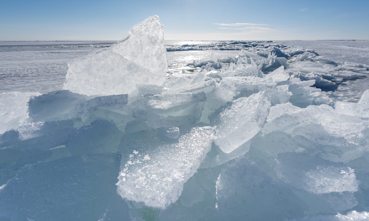
Yesterday I stood up quite early, because the sun was shining and I wanted to go onto the lake Torneträsk (one of Sweden’s biggest lakes – 70 km long) to make some photos. The whole lake is covered by a thick layer of ice and a thin layer of snow.

In the front you can see stacked up ice that builds along the fissures in the sheet of ice, in the background you can see Lapporten – the landmark of the region.

After a while fog came down and when you looked against the sun you only could see vague shades and pale colours. It looked more like standing in a sandy desert, not on the icy surface of the Torneträsk.

Some hours later: Annika and I had planned to do a ski tour near the Swedish-Norwegian border. We packed the car with our skis, cameras and hot tea and set off. It’s 38 km to the border. Behind that border – on the Norwegian side – there’re a lot of cottages and since it’s Easter and probably every single Norwegian is in his cottage there were a lot of parked cars, too.

We looked for a parking place as well. The most parking places were stuffed with cars and were furthermore only for private use. I continued driving and we looked for a public parking place. Well, we found one but the surrounded mountains were too steep for skiing. We stopped anyway to check our position on the map. After that we helped some Norwegians to dig out their car that was completely stuck in the packed snow – on the very same parking place! There’s a reason, that most of the locals have all-terrain vehicles or at least cars with all-wheel drive.

My Saab doesn’t have such and from now on I was even more cautious in choosing a potential place to park. To make a long story short: We didn’t found a single parking place that was (a) available, (b) public, and (c) not too snowy. That’s why we changed plans and continued to Narvik, which is 46 km behind the border.

There’re (at least) three signs for leaving the mountain plateau and approaching Narvik:

  • The road is narrower
  • The road has much more curves and bends
  • It gets much warmer. (down to -9 °C in Sweden, +5 °C near Narvik)

Soon we saw the first fjord, the Rombaken:

We continued to Narvik that seemed to be completely closed due to the Easter Saturday. Therefore we headed to the Port of Narvik and looked around there. Most ports I know are locked and fenced off. Not in Narvik. Here it’s possible to walk around, enter the piers and have a closer look to the ships. And we were completely alone.

Narvik is a huge contrast compared to Abisko! Even if I prefer landscape and nature to towns, I like this place.

But anyway we drove back to the wintry mountains of Swedish Lapland quite soon and round an hour later we arrived again at our fine and cozy room at Abisko Cabin.

Wintry Scandinavia in a nutshell (without the skiing).
Långhällan again

Two days ago Annika and I walked on the sea ice outside of Långhällan and had a view on large patches of open water.

Today I visited this place once more, but the whole area was covered with ice again. Some areas were covered with dark solid ice, some with ice floes that have frozen together. You could see walls of broken ice and dark channels between the different parts.

When I entered the terra incognita I half expected to fall through the ice and was equipped with the following:

  • my immersion suit, which is completely waterproof (and warm due to the thick neoprene)
  • isdubbar – handles with sharp peaks for pulling oneself out of an ice hole
  • my Nikon AW1 – a waterproof camera

To my big surprise all ice was thick and stable enough to bear my weight.

I couldn’t see any open water, but I could hear the sounds of ice and water below me. The cracking and clicking, the low, sonor pulsing drones echoing under the icy surface and sometimes even rhythmical beeping noises – like the Baltic Sea sending Morse code. An experience both fascinating and frightening.

Some impressions of today:

First day of spring

Today it’s the first day of spring. In the forest you could see the first snowless patches of soil covered with blueberry plants and the first birds sang their spring songs. But if you continued your walk through the woods until you reached the shore and had a look over the Baltic Sea, it looked like winter would be endless and continue forever:

But if you went on the ice and looked closer you could see, that the frozen surface only covered parts of the Baltic Sea. There was open water ahead. Blue open water. Blue open water with tiny little waves.

Oh, what I longed for my kayak – I would have loved to paddle on the crystal clear sea to the icebergs that you could see near the horizon.

The first day of spring in Skelleftehamn – still wintry but with a promise of spring coming soon.

Thaw

When it’s more than 10 °C in mars for two days a lot of snow thaws and transforms normal streets into a proving ground for jeeps. Soft slush, sheer ice, deep tracks and huge puddles cover the streets and crossings and I wait for the day where I’ll get stuck twenty metres from home.

On the other side the scenery can look almost nice, at least when you lower your camera as much as possible:

Colourful sunset

After a really warm day (+12 °C!) we got a colourful sunset. Unfortunately I was too late to catch the most colourful period.

The ice on the Baltic Sea is still thick, but the snow melted and left many ice water puddles between the snowmobile tracks.

Vårvinter

Where are we – Annika and I? In the Arctic on our way to the North Pole?  Looking for polar bears?

Well, not really! We’re on the frozen Baltic Sea on our way to the island Gåsören, enjoying the blue sky and the warm sun.

But we didn’t only enjoy the warmth of the sun, but the warmth of the sauna, too – even if we didn’t fire it as hot as it should be for a real sauna experience.

We were not the only ones on the ice of the Baltic Sea yesterday.

There were ski tracks and skiers.

There were snowmobile tracks and snowmobile drivers.

There were moose tracks …

… and there were moose on the ice, too. Far, far away, but clearly visible.

“vårvinter” means “spring winter” and describes this season, where the land is still covered with snow and ice, but the temperatures aren’t longer as cold as in January or February.

Kungsleden: returning to civilisation

This article is part of the series “2016-02: Ski tour on the Kungsleden”.

From the Tjäktjastuagn to Alesjaurestugorna

27 February · 13 km · Link to map

This day I continued to the Alesjaurestugorna, the last mountain hut in the kalfjäll –  the treeless mountain landscape in Lapland. Perhaps that’s why I was a bit sad, because I love the bare mountains and I felt that I had to say farewell to this outstanding landscape soon. I said farewell to quietness a bit, too, since I knew, that Alesjaure would be quite crowded:

But first of all I had a nice trip of thirteen kilometres to go. Weather was good and the way was short and easy, even if there were some patches with hardly any snow that I had to bypass. So I arrived in Alesjaure already at a quarter past one, being the first guest.

Other guests came, from Austria, from Germany, from France and from Denmark – many interesting people. And in between five scooters arrived – all with a trailer loaded with figures dressed in huge black down parkas and ski goggles – the Englishwomen. Their plan was to go back to Abisko on skis in two days with some detours to make it a full marathon distance.

The rest of the day was relaxed and easy-going. First I sat the sauna, then I made dinner (an outdoor meal called “Rice with basil” – quite boring). After that I sat together with all those kind and interesting people. At half past nine one of the Danes started to make pancakes – and I was invited! The Danes told me, that each of them has a surprise for the others on their tour and the pancakes were the first surprise. What a great idea (especially, since I benefitted from this surprise). I went to bed at half past ten – much later than the last days.

From Alesjaure to Abiskojaure

28 February · 20 km · Link to map

The next day I wanted to continue to Abiskojaure, that’s the longest part of my journey. The last tour days had quite short distances between 12 and 14 km and I was rather slow. As a photographer I have a good excuse: It’s making photos, that takes time, not my slow speed! Anyway, today I planned to start very early and decided to go a bit faster to avoid arriving in darkness. But first I had to get water, there was hardly any left.

If you tent in the winter, you’ll have to melt snow in most cases – this takes a lot of time and doesn’t taste well. The mountain huts on Kungsleden have ice holes to get fresh water, either in lakes or rivers. The ice hole of Alesjaure lies exactly below the summer bridge. It is covered with a wooden look to reduce freezing over, but I had to break the fresh ice anyway. It’s almost impossible to fill a 25 litre container with water (lowering the bucket into the small hole – pull it up again – pour water through the funnel – de-ice the funnel – pour water through it again) without getting wet hands. Oh, what I longed for waterproof gloves. My fleece gloves were completely soaked and my fingers got so cold that they itched when I “defrosted” them above the gas oven.

That’s why I started a bit later than planned and at the same time as the marathon skiers. They followed the official winter way, I took the short cut over the frozen lake Alisjávri. Although I took pictures I was faster than the skiers – some of them probably stood on skis the first time – and when I left the lake to join the winter way they already lagged behind.

I tried to go a bit faster, but stopped for some photos:

After I went more than half the way I took a break. It’s quite warm: -5 °C and even the cloud-covered sun warms a bit. For me it was a bit like saying good-bye. Good-bye to the treeless kalfjäll. Soon I will enter the narrow valley Gárddenvággi where terrain declines. And soon after I finished my break and continued the tour I saw the first small birch woods. The sun has disappeared behind a cloud layer and the landscape got monochrome. Dark birches, white snow, only interrupted by some red waymarks.

The last descend to the woodlands is quite steep. I decided to unmount my skis and go on foot. Even so the pulka tried to push me down towards the valley and I had to lean back to avoid being knocked over. After some minutes I was almost level with the Abiskojaurestugorna and went the rest of the tour through denser birch forests on skis again. I have to admit that I found this part a bit boring – we have snow and trees in Skelleftehamn, too, but soon I arrived at the mountain huts, where I spent the rest of the day.

In the evening I met C. who wanted to go to Abisko the next day and we planned to do this last part together.

From Abiskojaure to Abisko Östra and home

29 February · 15 km · Link to map

Let’s make it short: This day was travel day. C. and I woke up at 6 o’clock. Not by our own will but because we had the loudest snorer ever in our room. Jet engine level! We took a short breakfast, packed our pulkas and started our tour. Not to Abisko Turiststation, the classical start and end of the Kungsleden, but to Abisko Östra, the station of the village Abisko. I went on skis, C. just with normal boots, since the snow on the snow mobile tracks was packed and easy to walk on. C. was much faster than I use to be, but we headed for the 12-o’clock-train and I was keen to get it, too. We took two breaks: One for elevenses (or some kind of pre-lunch), one for the reindeer posing in front of the kåta.

We mad it, we even had an hour time until the train arrived. 14 km in 3 hours, 8 minutes (including the two breaks) – that was the fastest part of my tour. Thank you, C. for helping me leaving my comfort zone a bit.

The rest of the tour: Train from Abisko Östra to Luleå. Bus from Luleå to Skellefteå. Bus from Skellefteå to Skelleftehamn. I was home at 21:30 – 13½ hours after starting on skis in Abiskojaure.

Now it’s midnight. I’m sitting in the living room of my house in Skelleftehamn. I really like this place, but I’m already longing to the Swedish Mountains again. Perhaps another ski tour later in April?

Well, we’ll see …

Already spring or still winter?

Yesterday I found the first blooming flower in Umeå – a tussilago, one of the heralds of spring in Sweden. On the other side I did something, that is quite typical for the winter season: I took a winter bath (and swam twenty meters).

Is it spring or winter? The Swedes have an own word for it: vårvinter – “spring-winter”. It’s the season round March and April, when snow still covers the ground – at least in Northern Sweden, but it’s less cold as in January or February.


Kungsleden ski tour: Tjäktja

This article is part of the series “2016-02: Ski tour on the Kungsleden”.

From the Sälkastugorna to Tjäktjastugan

25 February · 12 km · Link to map

This day could be a more demanding day. It’s only 12 km to Tjäktja, but first of all i goes up 300 meters and then there’s Tjäktjapasset – the mountain pass, which I remember as being quite steep. In 2005 I skied down the slope, now I have to go up, dragging the pulka behind.

That’s why I started quite early this day. In my pulka: a parcel with food from the shop that stugvärd Z. gave me for stugvärd P. – one kilo more or less doesn’t count so much if you doesn’t have to carry it on your back.

When I started the tour the sky was still cloudy, but soon the clouds disappeared, sun was shining and the sky was blue. I was happy, since according to the weather forecast I expected the whole week being grey and cloudy. Far away in the early sun I could see a chain of mountain – there’s the Tjäktjapass, still far away, and it looked high and steep.

This was the first time that I had skins under my skis that help going up, especially if you carry a pulka that always wants to slide down. The trail led through a hilly landscape and I had to climb many small hills just to go down on the other side of the hill. I asked myself how I should gain altitude going just up and down. Anyway, the landscape was gorgeous, just as the weather, and when I looked back after some time I could see, that I gained more height than I thought. First I could see small brown boxes laying behind – the Sälkastugorna – but after some time they disappeared behind the hilly landscape.

I continued my tour and saw a black bird ahead. It cawed and landed on a dark spot beside another bird. Crows. I remembered, that one of the skiers that I met in Sälka, told me, that he saw a dead reindeer on his way from Tjäktja. This reindeer was killed by a wolverine, one of the biggest carnivores in Scandinavia. I approached the dark spot, the craws cawed again and flew away. There was a heap of something and beside of some patches of reindeer skin it was hardly recognisable. The sight of a frozen hump of meat is neither nice nor beautiful, but it is part of a country, where predators as wolves, bears, lynxes or wolverines still exist.

After taking some photos for this blog I continued my tour. Two other skiers approached from the other side – they just slided down in long, relaxed steps. I however had to climb up. Now, where the pass was near, it was visible that it was neither as steep nor as high as expected. After a bit of effort (I’m not well trained …) I stood on a plateau just below the highest point of the pass. And the view back into the huge valley Tjäktjajåkka (sami: Čeakčajohka) was incredible. The sun shone from a bright blue sky, a rainbow coloured sundog nearby. Ice dust fell from the blue sky that glittered and sparkled against the sun. The broad valley seemed to be endless, the further away mountains looked hazy and I had the impression, that you could walk through this valley forever.

It’s not the first time, that I stood here and gazed in amazement. I’ve been here on my first ski tour in april 2005, too, when I went from Abisko to Kvikkjokk. And now I was just as amazed as at the first time.

I could have stayed for ages, but after I while I broke away from this special place and ascended the last meters of the pass until the small hut Tjäktjatjattja came into sight. I took a break, but instead of seeking shelter in the hut I sat outside in the sun with chocolate and hot tea. It started to snow a bit – always a bit strange if you cannot see a single cloud.

After this sunny break I continued the trail to Tjäktja. The skiers I met left a nice track and the only think I had to do was sliding downwards effortlessly until I arrived in Tjäktja, the smallest mountain hut on my journey. Stugvärd P. got my parcel with food and goodies and I got a room in the stuga.

The sky was clear the whole day and it started to become a bit colder. -15 °C, when I arrived, -19 °C short time later. Time to fire the oven and to eat something warm. But later I went outside again to look at the starlit sky that arched above the Lappish mountainscape.

A day in Tjäktja

The next morning the weather was perfect for skiing: -22 °C, hardly any wind and again an almost cloudless, blue sky.

I stayed a day in Tjäktja and went up the mountain Tjäktjatjåkka, but only half the way. First of all I’m not the most experience skier, and then I was afraid of avalanches. But even going up halfway in this outstanding weather was great.

Going downhill was much faster than uphills. When I arrived in Tjäktja, the thermometer show -18.5 °C, exactly the same temperature as when I started my short day trip and the sun shone from a cloudless sky over the ravine of the stream Čeavččanjira. The next day I will continue to the next mountain hut: Alesjaure.

The next article: returning to civilisation >>

Translation:

EnglishGermanSwedish
wolverineVielfraßjärv