Yesterday
Yesterday at 17:40 my tent was set up on a snowy plane near the sea ice where I planned to stay for the night.
The dinner was part luxury (a really cold coke), part pragmatism (some instant curry chicken of dubious consistency) and part necessity (chocolate!). After the dinner I walked along the shore, which was completely covered with ice and snow. First I walked on land, then on the sea ice. You may think, that a landscape that solely consists of snow and ice must be quite colourless, but no, when there’s light there are colours!
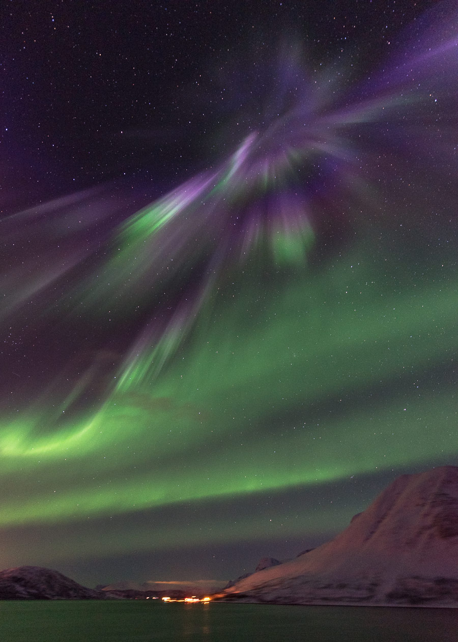
When I came back to my tent, it already had become dark and the almost full moon hovered over the tent. And that was my view from the tent, too: The moon, some stars, snow, ice and the icebound sea.
You might wonder, where I am. Good point, I’ll explain. Let’s go back half a day.
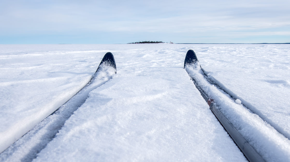
Yesterday I worked only half a day and was home early. I had a plan in my mind: as long as the sea ice is as thick as just now, why shouldn’t I ski over the Baltic Sea to the island Gåsören and spend the night there. I’ve done that in summer twice by kayak but never in wintertime. So I picked myself up, packed skis and pulka and took the car to the small harbour Tjuvkistan.
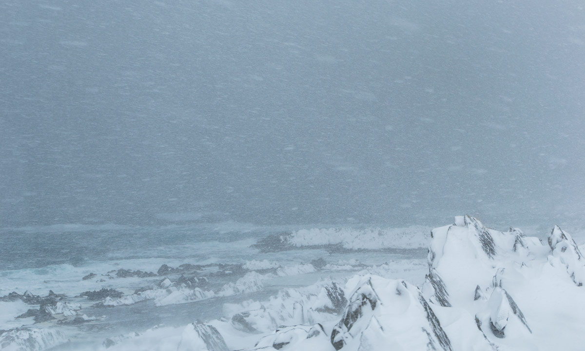
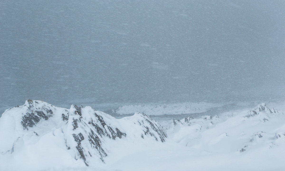
While the Baltic Sea was open one year ago it is still covered with thick ice this year. Instead of open water one can spot only a snow covered plane and some tracks – made by hare, a moose, another skier, but mostly by snowmobiles, the favourite winter vehicle of many locals. I however do not own such a snöskoter but prefer skiing anyway.
The linear distance between Tjuvkistan and Gåsören is only 2,3 km and so I arrived at the island soon. In summer it’s hard to find a tenting place (I know only one), since almost the whole island is covered with stones and rocks. This winter however Gåsören is covered with at least 50 cm of snow and so it was easy to find a good place to tent. Scroll up to the first photo and you see it.
OK, back to the story …
At nine a clock it was quite dark and a layer of clouds approached. Good arguments for cuddling up in my warm down sleeping bag and go to sleep. Good night, world.
Today
At five a clock I woke up and felt fairly well rested. I got up for taking some photos. Although it’s already the end of March the nights can be quite chilly and I guess that we had temperatures round -10 °C. I put on more or less all clothes that I had with me and made some photos. The moon had wandered on its orbit to the west and hovered above Gåsören’s old lighthouse.
That photo looks like being shot at the dead of night, doesn’t it? So let’s turn around and look to the east:
It’s less than 8 minutes between the previous two images and it’s more the cardinal direction than the time difference that is responsible for the different light and colours. I walked around for two hours and was just happy to be there at that fantastic place that fantastic morning and to experience all these different kinds of ice and light.
I became hungry so I returned to the tent. or tried … . Just a photo of the lighthouses behind the ice. And another one of my camp site.
But now: finally breakfast. Water, crisp bread and cheese. That may not be the most exciting food, but I didn’t care, I enjoyed the incredible view over the icebound Baltic Sea in winter.
After breakfast I walked around another time and took some more photos.
Another break. This time just pure luxury. Since I wasn’t in a hurry the tent was still set up. So I could cuddle up in my cozy sleeping bag again and took a long daytime nap. The temperature was still below zero but the sun was high up in the sky and warmed the tent. And there was even chocolate left. Just “gemütlich”!
When I woke up an hour later a layer of stratus clouds had approached and the light had become dull. A good time to pack anything back into the pulka, to put on my skis again and to start the “long” way home. Good bye, Gåsören. Next time when I visit you it will probably be with the kayak. I love winter, but paddling in summertime is great, too.
When I had arrived at the car after Jonas’ and my previous ski tour, it was in Kvikkjokk, 400 km from home. This time the car was parked less than 3 km from my house. I’ve been living in Skelleftehamn for many years now but still I’m happy about the beautifulness of it.
This article is the first one of the new series #escapism. It’s about being outdoors and leaving civilisation behind in excursions that take less than 24 hours. Everyone should have time for such!
My packing list (excerpt)
tent with snow pegs · inflatable camping mat · down sleeping back (a warm one!) · clothes for skiing · spare clothes · winter anorak · thermal pants · warm boots · woollen cap · 2 pairs of gloves · down west · skis with poles and boots · pulka with hip belt · water (both cool and hot) · food (a lot!) · knife · camping stove · matches · kitchen stuff · mobile phone · power bank · headlamp · sunglasses · thermometer (it broke) · compass · isdubbar (essential emergency equipment in case of breaking into the ice) · toilet paper · snow shovel · camera equipment · tripod · grand piano (just kidding)