The magic ice world

Today I was in another universe. At least it looked a bit like it.

After my adventure on the “ice shelf” last night I longed to see the place by daylight. Breakfast was late but so was sunrise and right after I’ve eaten I drove to Näsgrundet again. We had -17 °C (more or less the whole day by the way) and some snow crystal fluttered out of the grey stratus clouds. I put on my grödels – simple crampons – to be able to go on the ice slope. Soon I stood at the rim and looked down into the calmed down sea. The view was quite impressive …

… but …

it would be great to see the ice walls with its icicles from the seaside. It’s not, that I didn’t think about it before, that’s why I had both my waterproof camera and my waterproof survival suit with me. I undressed a bit (not the funniest thing when it’s -17 °C outside) and slipped into the red suit. Then I took the camera and glided into the water. And that’s where I entered another universe. But enough words, the photos! Here they are:

I really loved to paddle in the ice water and to look at the ice walls that where decorated so beautifully wich icicles. Since the attached rubber gloves are waterproof, but not warm at all, my right hand index finger didn’t like the adventure as much as I did and got a bit of frostbite (it still hurts a bit but nothing serious, fortunately). And that’s how I looked like today when I took all these photos:

Winter intensifies

Did I write about the “just normal” winter two days before? Well that changed a bit. Right after I wrote the last article the snowfall intensified and brought 10 cm new snow within 16 hours. It got both windier and colder and still snowed a lot.

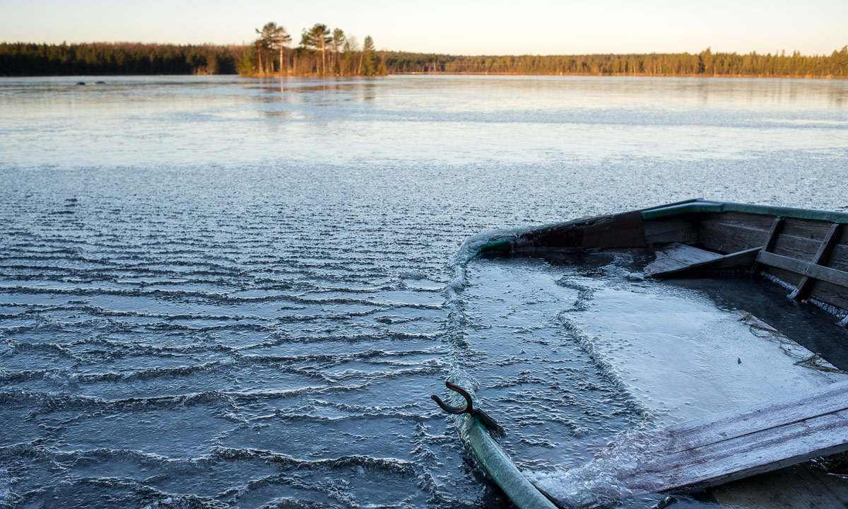
Today¹ I took a walk round the small lake Rudtjärnen. Snow fell in thick, heavy flakes and made it impossible to look farther than 100 meters. The squalls whirled up the snow morphing the view into a grey-white nothing. And it was even windier on the slope by the lake. The trees on the 2nd photo were hardly 50 metres away!

That was a nice and not so long walk (which was intended since I don’t want to overstrain myself right after the infection), but it wasn’t enough. I wanted to go out again. And so I did. This time with food and drink, (of course) my camera, my new flashlight and my new down clothes for some testing. I already guessed that I couldn’t drive to the small boat harbour because the way wasn’t ploughed and snow was too deep for my car. So I decided to continue to the peninsula Näsgrundet. What a piece of luck!

I dressed up for cold weather, lit my new strong flashlight and went to the rocky beach. Normally the shore descends to the open sea but not tonight where – I couldn’t believe my eyes – the shore was an ice shelf rising up at least one meter before dropping into a black nothing. I could hear the sea behind but I couldn’t see it. Where am I? What happened? Then I heard a rolling wave and – SPLAT! – I could see water and foam rising high up behind the brink and clashing onto the ice shelf! It took a moment or two until I realised what happened: The brisk northern wind presses the waves ashore where they rocket up into the air several meters. I guess that the water and foam first landed on the rocks where it probably froze almost instantly – remember, it’s -15 °C  out there. The rocks became more and more ice covered until they vanished under a growing layer of ice. When I came to this place this evening some parts of the ice were already two meters above sea level! And still some of the waves managed to toss a lot of water onto the ice where it froze and enlarged the ice shelf. What a fantastic experience!

I was both happy to be out there and a bit disappointed that I couldn’t share this moment. If I at least could take a photo, but how to take pictures of waves when it’s so dark. Wait a moment – dark? – My new flashlight was described as extremely bright – Let’s test. I switched the flashlight to the brightest mode, laid it onto my backpack and adjusted the beam to the waves. Then I took tripod and camera and started to experiment. And that’s the result:

I’m impressed. The new Flashlight is really bright. So bright that I can take such pictures at night time. (For the photo freaks: 1/20 sec at f / 4.5, ISO 1600. 35mm)

OK. The flashlight succeeded the test. But what’s with the rest? I was curious how warm the new bought down parka and down pant would be. I just wore a single layer of woollen underwear and my thin but windproof Norrøna-jacket, mostly to test the fur under the down clothes, that was all. (Not mentioning boots and gloves, of course). I’ve been out more than an hour, first taking pictures, then measuring wind and temperature, than taking my frugal evening meal. And yes – the Marmot down combination is as warm, snugly and cozy as it looks like. Almost too warm when sitting although we had an average wind speed of 10 m/s resulting in a wind chill of  -27 C. That’s good to know.

Now I’m longing to sunrise. I want to visit the spot again and take some daylight pictures. That’s perhaps evan a reason to postpone my journey another day. I’m not in a hurry. But tomorrow, when I’ll visit the place again I’ll wear something less water-sensitive than down, because tonight I always expected a huge monster wave would flood half the shelf and soak me completely.

Finally just two selfies from today, one when I walked round the lake, the other when I sat outside after the evening meal.

Foot note:

¹ As a matter of fact: Yesterday. It will already be Monday when I publish this article.

Some vocabularies for my German readers:

squall – Windböe
down – (hier) Daune
foam – (hier) Gischt
flashlight – Taschenlampe
fur – Pelz

For equipment nerds:

Flashlight: Nitecore EA41 Pioneer
Down clothes: Marmot 8000M Parka, Marmot 8000M Pant. Older (or simpler) models.

Just for the archives:

Friday 2015-01-09 21:45 ca. 30 cm -4.6 °C
Saturday 2015-01-10 13:40 ca. 40 cm -7.1 °C
Sunday 2015-01-09 09:15 ca. 45 cm -8.6 °C
Sunday 2015-01-09 16:55 ca. 52 cm (47 cm backyard, 57 cm front yard) -15.0 °C

Just a normal winter

Living at the coast of the Bothnian Bay, the most northern part of the Baltic Sea can be a bit surprising, when it comes to weather. Let’s take the weather one year ago, for example. January started with rain falling on the frozen ground and the roads where so slippery that you hardly could use the car, even with spiked tyres on it. (German article: “Eisflächen”). One week later we had a lake effect in Skelleftehamn and got 83 cm of snow on bare ground within 24 hours! The city Skellefteå, hardly 20 kilometres away got a millimetre! (German articles: “Schneekanonen 2014”).

Just now we have winter. Just winter. It’s -5 °C – not too warm, not too cold. There a 30 cm of snow in the backyard – not very much but not very little neither. And it has been snowing for almost two days, not much, but anyway. That’s what the Swedes call lagom, a word that’s perhaps translated best with “just the right amount”.

The high water mark of the Baltic Sea sank from +104 cm to +40 cm within the last days, leaving the beach of Storgrundet covered with ice and fresh fallen snow making the high water completely invisible.

The lake Snesviken is covered with ice and snow, too and parts of the old boat that I photographed two month ago have been vanished in snow as well. The sky is grey and the trees on the other side of the lake look a bit blurred since it is still snowing. Not much, just lagom.

I’ve been ill since sunday but today is the first day where I feel better. Tomorrow I’ll start with the last preparations for the tour and I planned to depart on next Wednesday, the 14th. I’m really looking forward to travel way up north and will hopefully provide you with many articles and photos – as long as my laptop doesn’t freeze do death.

Shortest day in Skelleftehamn

Sunrise 09:40, sundown 13:25 – that’s less than four hours sunlight with the sun hardly rising above the horizon. But you can add at least three hours dusk and dawn, so it’s not pitch-dark 20 hours and the snow that fell two nights before lightens up the scenery, too. The image below shows the river Skellefteälven which is almost completely ice covered, at least in Ursviken where the river is broad and the current is week.

Déjà vu

An addendum to “Roller coaster weather”

Yesterday I already guessed that I would have a déjà vu today – and I got it! The day resembled last Wednesday in so many details: The same temperature rise the night before, the same car ride to the car service station (some additional fixes) and the same way back home by foot. Maybe a bit more rain, maybe a bit less storm, but the same clothing as  altogether the same: Waterproof parka, rain pants, rubber boots and – most important of all – spikes you can attach to your boots.

Definitely not my favourite type of winter. I definitely prefer cold weather and loads of snow.

Roller coaster weather

This December the weather is like a roller coaster, going up and down, bringing frost, rain, hail, sleet and storm. It’s not at all the winter you imagine when you think on Northern Sweden.

Monday started with sunny weather and temperatures round 1 °C – cold enough to cover the windscreen with a thick layer of window frost. (I prefer the German name “Eisblumen” which means ice flowers.) Then it got colder.

Tuesday it was quite clear and cold with temperatures round -7 °C with a minimum of -9 °C at 22:00. In the next three hours temperatures rose by 10 °C and the next morning we had +3 °C and heavy winds. I left my car at the car service station to get it checked before my winter journey and took some photos on the way back home. I attached spikes to my boots because the wet icy roads where extremely slippery. When I went back some hours later to get the car I was surprised at the high water level. This day the water level climbed 70 cm, that’s a lot for the Baltic Sea and only happened because of the storm pressing the sea water ashore.

The next two days were cloudy, temperatures round + 2 °C with some drizzle that instantly froze on the cold ground. Saturday evening – which was yesterday – it started to get colder and rain started to mix with snow and some soft hail. In the evening it finally started to clear up a bit und got colder.

Today it was quite clear, temperatures round -8 °C and I took a tour to the peninsula Örviken. Örviken has an area of 1 km², 400 people are living here. Even if it is quite near I hardly has being there, which is a pity since it’s a nice place, especially if it’s clear and you’re waiting for the sun rise.

And that’s what I did today. A good activity if you caught a cold and want to take it easy.

On the photos you can see the impacts of the weather: The storm destroyed the ice cover leaving a lot of floating ice floes, but in the cold night the surface started to freeze over again. Do you see the stacked ice in front of the trees? Its laying on land and I guess it was left there after the high water some days before.

After that I drove to another place I already knew and took some photos of the last motif today:

Now it’s half past five and -7.4 °C outside. The weather tomorrow? +2 °C and rain! Probably the whole day! Onto the frozen ground! Sounds familiar?

Some vocabularies for my German readers:

roller coaster – Achterbahn
drizzle – Sprühregen
soft hail – Graupel
peninsula – Halbinsel
Ice floe – Eisscholle

What a Diff’rence a Day Makes

Today (6th of November) was probably the coldest day this season by now. When I left the house the thermometer showed -11 °C. I was a bit in a hurry to get the sunrise photo in time. After that I had a bit more time and drove to the lake Snesviken where I made the boat photos yesterday and last night. When I looked at the lake I was stunned! Yesterday only a minor bay was covered with thin ice, today – just 24 hours later – the whole lake.

And we’re not talking about a tiny duck pond, but about a lake one kilometre long and up to 500 meter broad. Amazing, how a single frost day can change the surface from small gurgling waves into a solid ice cover.

The evening before I was a bit angry with myself that I already dragged the kayak home again some days before, but when I came to the little beach Storgrundet I realized, that even this sheltered part of the Baltic Sea was completely covered with ice. Ice you almost could stand on and therefore much too thick to break it with the plastic blades of the paddle without ruining them.

It will get warmer the next days with even some rain, but I guess that kayak season is over, at least as long as I want to set in the kayak at the beach Storgrundet or at the boat harbour Killingören.

From bed to sun rise in 11 minutes?

Today I woke up 7:26, sun rise should be 7:37. That’s eleven minutes to get into warm clothes (-11 °C!), get the camera, change the lens, change camera mode, get the tripod, put all stuff into the car and drive to the peninsula Näsgrundet. This should be one of the last days where I can make a photo of the sun going up behind the light tower of the island Gåsören. Eleven minutes were slightly too short and I arrived two minutes late. So I was a bit in a haste but at least could capture the motif just in time, even if the light tower is not perfectly in the center of the rising sun. But anyway, it was really nice to be outside and I continued being outdoors.


First onset of winter?

Yesterday I took in my kayak and that might have been a good idea, since according to SMHI we’ll get a snowstorm tomorrow afternoon. Today SMHI, the Swedish Meteorological and Hydrological Institute, released a level 2 warning snowfall for the coastal Västerbotten, which is quite high since there are only three warning levels.

Varning klass 2 snöfall som kan ge kraftig drivbildning

(Warning level 2 snowfall which can give strong snowdrifts)

smhi, 2014-11-03

SMHI writes about 15 cm snow fall (locally more) and wind up to 19 m/s, which is almost 70 km/h. The days after we’ll get permanent frost so that snow will remain on the ground which will instantly transform dark and rainy autumn into light, white and snowy winter, at least for some days.

Especially in Skelleftehamn, where I live, and in Bureå 10 km southward, we sometimes get a weather situation called lake effect, which can bring huge amounts of snow in a short time. People living near the Great Lakes know what I’m talking about. So I’m quite curious how much snow we’ll get this time. 10 cm? 40 cm? 80 cm? I bet on only 10 cm, but who knows …

Here’re some photos from the lake effect snow we got on the 1st of December, 2012:
From bare ground to 83 cm snow in 24 hours.

Update (4th of November, 15:07)

An interesting combination: The level two warning is still active and the wind already increased, but the SMHI forecasts exactly 0 mm precipitation for Skelleftehamn. So I guess we won’t get a single snow flake this time.

Update (5th of November, 07:53)

When I was out shopping food yesterday I saw some lonely snowflakes that immediately melted on the still wet ground. That was all. This morning we have -6 °C but no snow at all. Pity!

Kajak home

Two photos from a small kayak trip today: Between these two photos lie round 2.5 kilometer, enough for a change from idyllic islands to grey industry, and 30 minutes, enough for a weather change with gathering dark clouds and increasing wind.

But it’s the same tour, the “bring-the-kayak-back-into-the-garage-tour”. Yes, I could have gone to the tiny private beach where my kayak lay under the summer, take it and just drag it homewards. But that’s boring. So I paddled it to the small boat harbour Killingörviken, which is quite nearby from my house. The tour is just 6.5 kilometer long but shows the different sides of Skelleftehamn: The beautiful small islands with forest and summer houses, the open sea, the industry on the peninsula Rönnskär, the small but active port and last not least the small boat harbour that probably won’t see any boat before April next year. Season is over.

We’ll see when kayak season will be over. As long as parts of the Baltic Sea are clear of ice I’ll try to be out, but that may change quite soon. At least the kayak is back in the garage where it is sheltered from the upcoming winter weather.