Jämtland hike part II: hejdå Sweden, hei Norge!

This article is part of the series “2016-09: Jämtland and Norway”.

Annika and I are in the mountains in Jämtland and have just reached our first destination: Blåhammaren, where we slept in a 14-bed room.

Tuesday, 13. September

Sleeping in a 14-bed room can be quite demanding, especially if you have this kind of snorers in your room, that could awake a frozen mammoth. However Annika and I were really lucky, no snorers at all! After our breakfast we had to decide where to continue our tour. From Blåhammaren you can hike back to civilisation or continue to two other destinations. Most of the hikers continue to Sylarna which is very central and part of the Jämtland Triangle, a very popular three-day-tour, that connects Storulvån, Blåhammaren and just Sylarna. We were keener to cross the border and hike to the Norwegian lodge Storerikvollen and so we did.

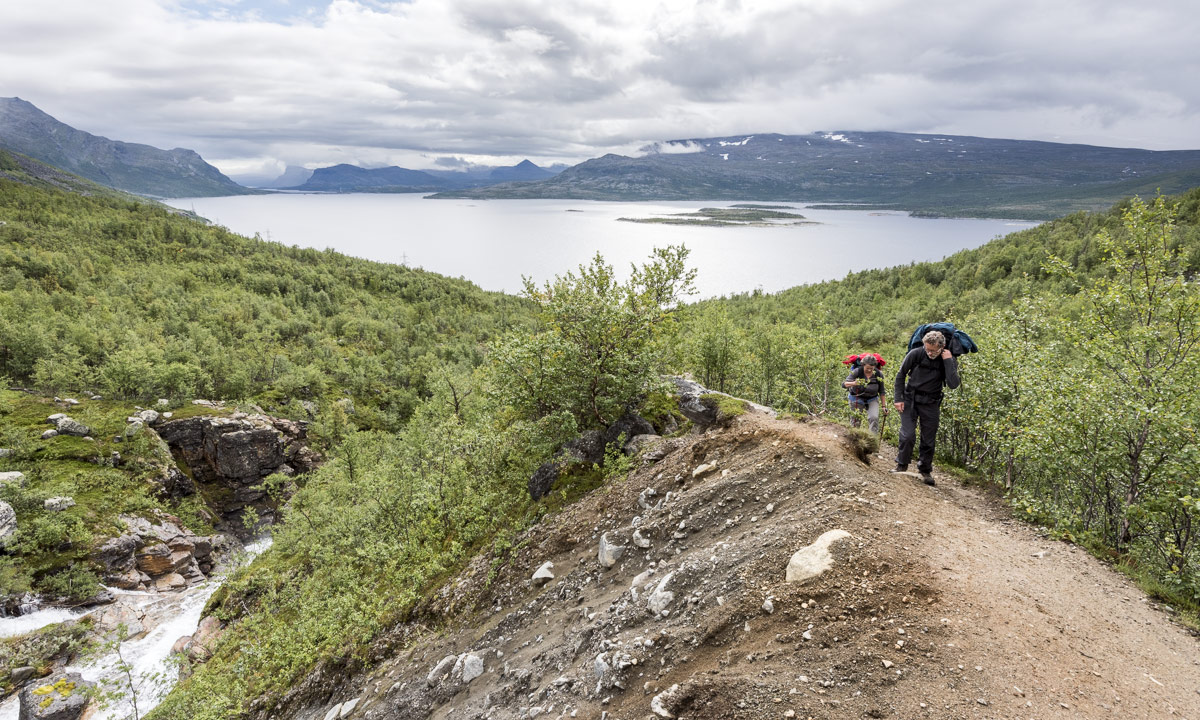
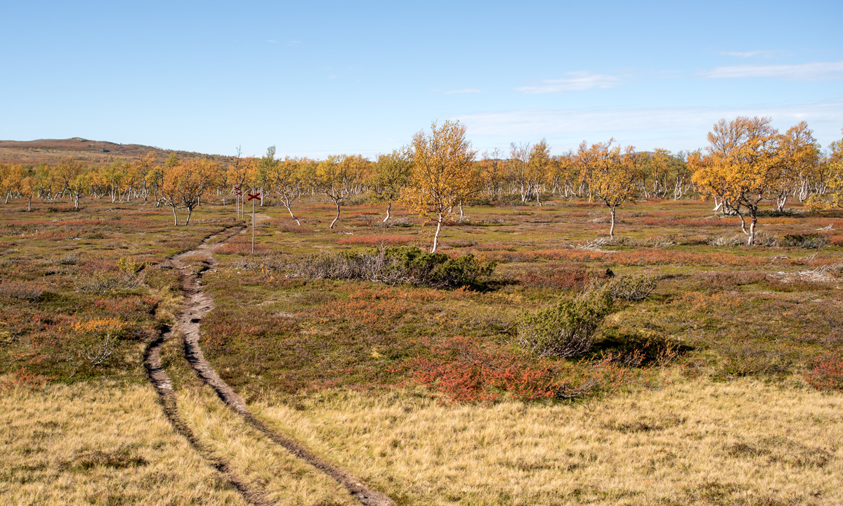
With an altitude of 1086 m Blåhammaren is the highest tourist station of the STF – the Swedish Tourist Association – so first the trail ran over the treeless mountain plateau, over rocks and moss, crossing some swamps and brooks. After a while we descended and the first yellow coloured birch trees came into view again.

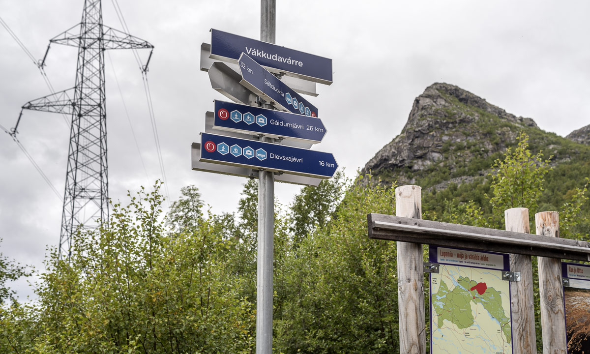
Swedish summer trails are marked with red coloured dots on rock or tree, while winter trails are marked with poles bearing red crosses. You really shouldn’t follow the winter trails in summer unless you want to stand in front of a lake or find yourself deep in a bog – both are easy to cross only in wintertime. But quite often there’s a year round trail which makes navigation extremely easy even on less walked routes.

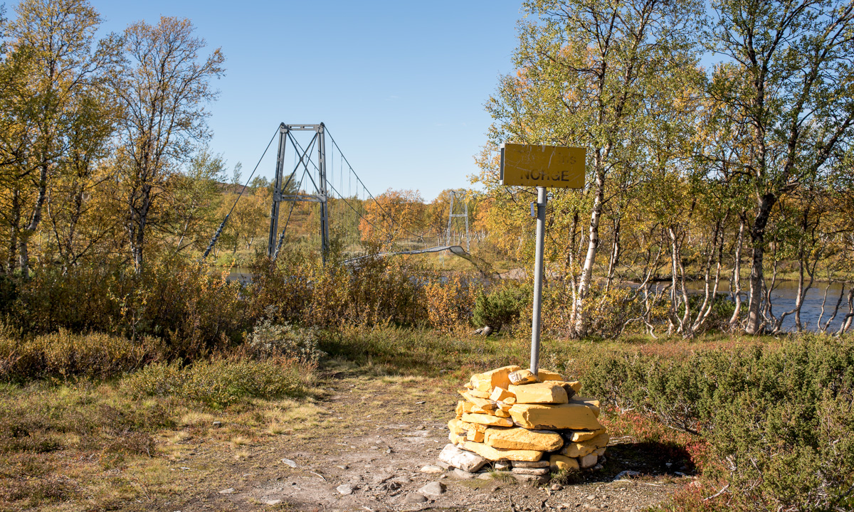
One kilometre behind Endalen, an emergency shelter, where we rested for a short while, the Sweden-Norwegian border came into view. It’s hard to mark a border less spectacularly than this one: A sign amidst of a pile of yellow painted stones, that’s it. The large bridge that crosses the river Enan (Sami: Äjnänjohke) directly after the border offers far more spectacularity.

We detected a real nice resting place on the other side of the river, where we planned to enjoy the warm summerly weather, but two other hikers – by the way the first ones we met that day – coming from the other side chose exactly the same slab of rock to rest. Luckily we found another place, at least as nice as the first one. We unmounted our backpacks, took of our boots and dangled our feet into the ice-cold water.

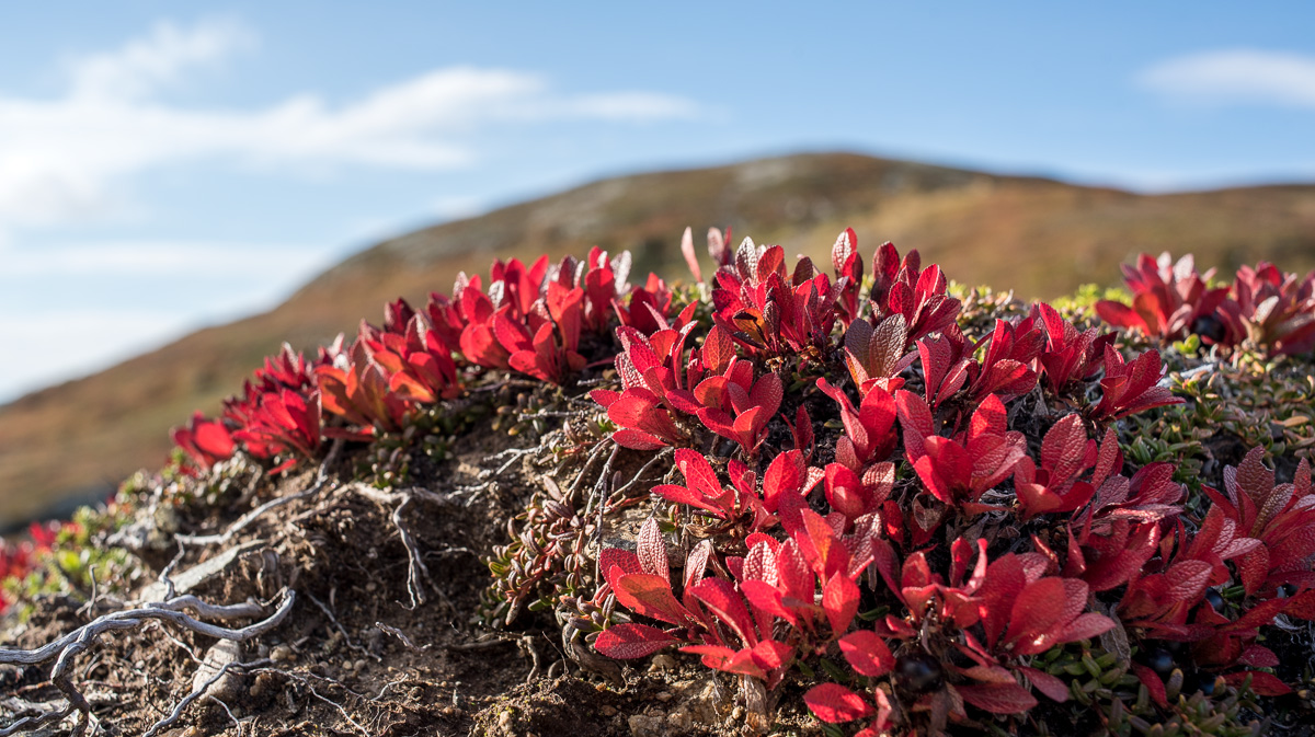
(I like the photo with the drifting yellow birch leave and the dead mosquito. It illustrates, why I prefer the autumn to summer: Beautiful colours and no biting insects left!)

In Norway the summer trail marks change, now the trail was marked with big bright red T-s. The red T is also the logo of the DNT, the Norwegian Trekking Association.

Do you see the dark piece of something on the top of the stone? It’s animal droppings, but I’m not sure of which species. I asked for help on Facebook and the favourite answers are reindeer and (arctic) fox.

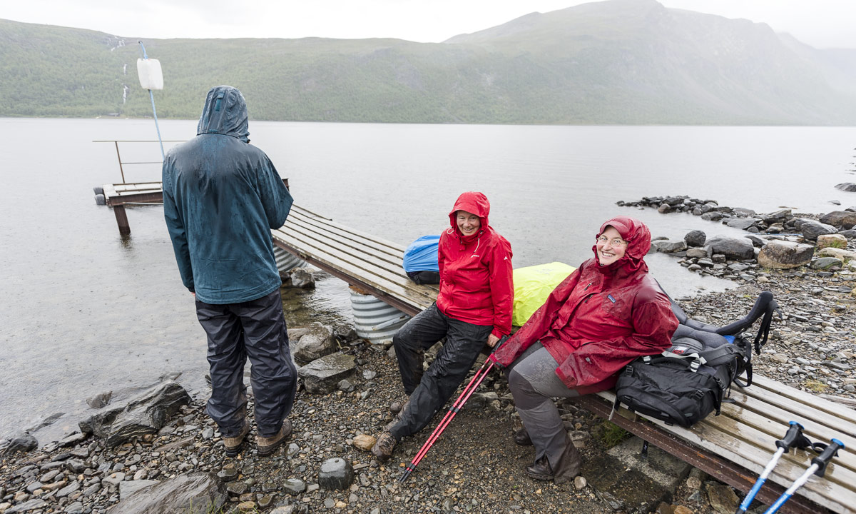
We continued our tour until we came to another swing bridge, this time crossing the river Djupholma. On the other side of that river lies a nice sandy beach where I took a refreshing bath (the only one of the whole tour). It was only two other kilometres to walk to our destination, the cabin Storerikvollen, where we arrived round six o’clock.

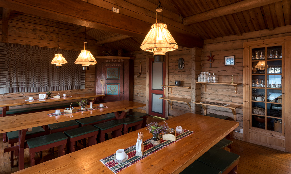
Oh, so nice these Norwegian lodges are. They seem less “funkis” (the Swedish functional style) and more “hyggelig” (the Norwegian word for cozy, snug, or homelike). Just gemütlich! And we got a two-bed-room for a good price. The only thing you should know, when you visit the Norwegian side: These cabins hardly sell any food and there is no public kitchen as in the Swedish cabins. So you have three options: (1) take a camp stove with you and cook outside. (2) cold dishes! Hopefully you have all with you. (3) eat the dinner and breakfast provided by the lodges (and pay the Norwegian price).

We chose (2) and had a nice dinner with salami, crisp bread and fresh water outside in the evening sun, enjoying both our simple meal, the warm air and the beautiful view. Later the almost full moon rose above the reddish mountain chain – what a beautiful evening!

Wednesday, 14. September

The next day would lead us to the Nedalshytta, which is between 20 and 24 km away, depending on which map or sign post you rely on. So we got up quite early.

We had to go back yesterdays route 2 or 3 km where the trail divided. Now we turned south and had to ascent. Soon again we were above the treeline. When we looked back, we could see parts of the big lake Essandsjøen and even spotted – beside of some reindeers – the now tiny Storerikvollen, that we left some ours ago.

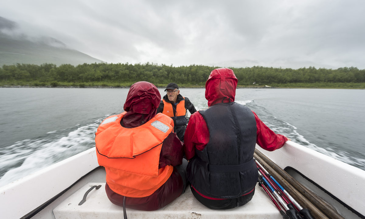
After a while we came to the river Fiskåa, where we had to ford. My rubber boots were high enough and I just splashed through the water, whereas Annika changed boots with trekking sandals and waded through the river.

Since rivers use to flow through valleys we had to ascend again and walked up along a reindeer fence. The weather was still warm and sunny, but you could see a cloud layer approaching afar. Would it rain in the evening as the forecast told us?

Only the map showed us the progress of our longest tour so far. We went a bit up, a bit down, a bit to the left, a bit to the right, down a small valley and up again. But finally trees came into view once more and soon we stood on an exposed plateau not far away from the yet invisible Nedalshytta.

Come on, just less than a kilometre to go … . Final spurt! A short while later we arrived at the beautiful lodge. Again we got a nice two-bed room, this time right below the grass roof. And we got: pizza! Perhaps not the best I ate in my life, but walk 20 – 24 kilometres with a backpack by yourself and you’ll know, how delicious a warm pizza slice can be!

The tour so far:

Continue with part three …

A trip above the treeline

Today the weather was really nice in Venneshamn in Norway. I took the car to drive to a mountain area not far away. At least, if you can fly … . If you take the car in Norway, there’s always at least one fjord you have to drive round, in this case the Verrasundet. So it took a bit longer than excepted taking the ways 191, 193 and 720 round the fjord. Finally I approached the street to the lake Ormsetvatnet. Street, well … it’s more like a steep gravel path, that you can drive up some kilometres to a parking place. The last kilometre to the lake is closed for cars and I had to walk it.

At Ormsetvatnet I crossed a dam wall, walked up a tree covered slope and soon was above the treeline. To be honest, I’m not too fond of forests, when it comes to taking pictures and I’m always glad, when I leave the trees behind when doing a mountain trip.

Now I was on a hilly plateau, the Vakkerheia. Some of the flat mountain tops were marked with piles of stones.

In the plain valley between the hilly tops the ground is soft and wet. Sometimes I had to go round shallow ponds and bogs, but mostly the ground was easy to go. In and round the swampy ponds the cotton grass was blooming. To my big delight there were many cloudberries plants growing in the lesser wet parts and the berries were ripe and ready to eat!

Picking cloudberries can be tedious, because of the many bloodthirsty horseflies that seem to guard them. I think, I slew most of them, but some bit me anyway.

After some hours of a really relaxed mountain hike I took another way back until I came to the gravel road again, where my parked car waited for me.

Half a day later

A thunderstorm approaches from the west. The center seems to be above the very same area that I wandered some hours earlier. The thunder and lightnings were as impressive as the intense colours, that I could see from the other side of the fjord. I was glad, that I haven’t been on that plateau – there would be hardly any place to seek shelter from the massive rain fall or to protect from the dangerous lightnings.

Addendum

And since we’re living in the age of selfies …

Freezing over – day two

Another chilly morning, with -7 °C it was the coldest in Skelleftehamn this season. Again I woke up quite early and took a tour to Storgrundet. There lay more ice on the sea than yesterday and you could see that it was partly ice floes that froze together the night before. However, the beautiful ice rim that I photographed yesterday was gone.

I made a short stop at the lake Snesviken, that is round about one kilometer long. Since we had only two frosty nights after a longer warm period with day temperatures above 10 °C, I was sure that the lake was completely open with perhaps a bit of ice at the shore.

I couldn’t believe my eyes when I realised that almost the whole lake was covered with ice – after only two frosty nights. Incredible how fast it goes!

This evening I had a meeting in Ursviken at the Kanotudden – the canoe bay, where the canoe club has its location. This bay is part of the Skellefte River and it starts to freeze over, too. I really like the clubhouse. It’s a pity that it’s hardly used in winter time – it would be the perfect location for a public winter bath site!

Another frosty morning

-5.6 °C showed the thermometer when I woke up at 6:15. I don’t need to look through the window to know that it’ll be a nice morning with mostly blue sky when it’s so cold in early October. And so it was.

The photo above is taken almost at the same place as the 1st photo three days ago. I prefer the older motive but like the intense colour of the sunlit clouds in the background. To other shots:

Have a look at the second photo, the one with the grass in the foreground. Why isn’t the horizon straight? That’s because I stood knee deep in the water myself, breaking the ice. When this happens, water from the hole will start to cover the ice. I just could take my camera, look through the finder and – click! – take a picture. One second later parts of the ice were covered by a thin layer of water.

That was the main problem: There is no save ground round these swamp ponds, where you could take your time for making pictures or even use a tripod. No, you stand knee deep in water on unstable ground, knowing that another step could bring you in much deeper water. I’m always afraid I could fall into the water and drown my expensive camera. It will me much easier when the ice is thick enough to stand on.

After a while the sun started to rise. Time for some more experimental images:

I realised the frozen bug on the second photo first, when I looked through the images at home. It’s hardly 2 mm big but looks quite huge on this macro photo. Learning: look at the motive even more precisely.

Continuing to the Vesterålen

This article is part of the series “2015-07: Lofoten and Vesterålen”.

Our third day started with a lot of rain. We put the wet tent into the car and continued our tour to Kabelvåg where we visited a friend of mine. We took a small mountain hike but it was cloudy and wet. Only far away in the east you could see some sunny patches on the top of the snowy mountains.

After the hike Delle and I looked for a camp ground. But first I had to take a picture of the beautiful rainbow near Sildpollen.

This time we tented on a bigger campsite in Sandsletta. When I woke up quite early the next day I could see another rainbow over the Vatnfjorden, but later it started to rain and pour down again. And again we put the soaked tent into the car. We continued on the road 888 to Fiskebøl. The clouds were hanging low and you could hardly see any mountain, just some white and light grey schemes.

Soon we arrived in Fiskebøl where we waited for the ferry. Again we were lucky – we waited hardly half an hour until we entered the ferry for the short crossing to Melbu, the southernmost city of the Vesterålen. We visited friends of mine, this time in Haukenes were we tented near the friend’s house. The cocks tried to wake me up ridiculously early, but in vain. I continued sleeping until 8 o’clock.

Alas it was the first morning without rain (and the only one, too) and we could dry the tent. After a long and lazy breakfast with my friends we said farewell and continued our car trip. We got a tip to visit Stø at the northern end of the Vesterålen island Langøya. What a good tip and what a beautiful landscape – especially after the weather was nice and sunny. We made a short photo stop between Strengelvåg and Klo before we continued to Stø.

In Stø we parked our car and took a short hike over the mountains to a beautiful white sanded beach were we made a rest and I took a short bath. There’s a 15 km hiking trail as well; next time I’ll definitely will go it.

After our rest we slowly walked back and continued by car. First we had to head south to Sortland were we crossed the Sortlandsundet and headed north on the other side. The sky became more and more cloudy and we looked for a nice campground. Finally we found one in Bleik, quite near Andenes, a town at the northern end of the Vesterålen. We put up the tent and – guess what – it started to rain.

It had been raining the whole night and it continued raining. Again a soaking wet bunch of a tent lay in the back of the car. After a while of driving through the greyness we decided to head back to Skelleftehamn. It’s more than 900 kilometres and it took the whole day. Rain became less near Abisko and after we passed Jokkmokk the sky cleared up and we could see the full moon slowly rising. The next photo, which is the last of our car trip through the Lofoten and Vesterålen is taken near Storforsen, one of Europe’s biggest rapids. At 23:50 we were in Skelleftehamn again – and I was home.

  • 2296 kilometres in six days
  • a lot of clouds and rain, but two nice and sunny days, too
  • one night in the car, four in the tent (three of them on campgrounds)
  • two bathes and at least four rainbows
  • – a nice trip!


From Å to Rystad

This article is part of the series “2015-07: Lofoten and Vesterålen”.

Day 2

Next morning when we woke up in Å we could see blue sky through the fogged car windows. The rain has stopped. We made a walk through the little fishing village and had breakfast on the cliff with a fantastic view on the mountains and the sea.

After that we continued our trip through the incredible landscape of the Lofoten. We had to stop several times to take pictures, for example of this small mountain lake near the road to Nusfjord:

Later we came to a place that became quite famous over the years: Uttakleiv – a beautiful sandy beach that just invites you to jump into the turquoise-coloured water. It almost looks Caribbean but as soon as you enter the ice cold water you’re reminded of being in Northern Norway, not in the south. The bath was fun, anyway.

Here we stayed for a while and enjoyed the sun. But after a while we continued our road trip to Brenna on the island Austvågøy. We didn’t find a camping ground at the end of the road and turned, but soon we stopped the car again. Actually because I wanted to take pictures of the sheep that lay at the sandy beach, but some children nearby discovered something much more interesting: A fox cub. I changed to the telephoto lens and I came quite near. Probably the fox hadn’t made any bad experiences with humans yet.

After that we stopped at a camping ground near Rystad that we already saw on the way to Brenna and decided to stay overnight. Soon the tent was put up on the grassy ground. Slowly the sun went round the mountains and sank down. The next hours were incredible – the light was so wonderful, both the sunlit main land in the south and the sea in the north glowed in the most fantastic colours. But have a look by yourself:

Round one o’clock we lay down in our tent, but only because clouds came and it started to rain a bit. What a wonderful first day on the Lofoten!

Abisko: A first small ski tour

Day 17

Finally – my first time on skis! I didn’t dare to use them in the Tromsø mountains, they are too steep for my mediocre skiing abilities. The mountains – the fjäll – in Abisko however is not so hard.

EquipmentWhat do I need for a (short) day trip? Let’s see …

  • windproof clothes
  • a down jacket for resting
  • warm woolen mittens
  • hot tea
  • goodies
  • a compass
  • a good map
  • my GPS with spare batteries
  • first aid kit
  • headlamp
  • camera equipment
  • bivy bag
  • some money (just in case)

I love it when I can start a ski tour just from the doorstep. Weather was fine, partly blue sky, partly clouds, -15 °C and no wind at all. The first time in this winter I put on my ski shoes, attached the skis, unattached them again to get the other mitten that still was in the house, attached the skis again, took the backpack and ski poles and started the tour. First the tunnel under the railway (Stockholm–Narvik) then up the street and into the open woodland. First I followed the snowmobile tracks. That’s easy because the snow is solid and it’s easy to go. But it’s a bit boring, too. So I left the trail after a while and went cross-country. The snow is new – it snowed 30-40 cm the last days and quite soft. Soon the skis were more under than on the snow, mostly calf deep, later sometimes more than knee deep.

In average the snow was 70 cm deep – that’s not so much for the fjäll, but I was quite glad that I could continue cross-country even if it was a bit exhausting. Again and again the snow around me slumped down under my weight sometimes snapping like a whip, sometimes growling like thunder. This is what avalanches are build of. It was clear that I had to avoid all steeper terrain today.

Soon the valley Lapporten, that you can see from Abisko as well, came into view again.

I hit another snowmobile tracks and followed them. An a slope ahead a snowmobile approached and I stepped aside to make place – sinking into snow almost knee deep again. The snowmobile was followed by eleven tourists that booked a dog sledding tour. I laid down into the snow to make pictures and since the dogs came to a stop I could make a photo of the husky with its snow-covered nose.

The dogs continued and so did I. But now I had a minor challenge. The track on the slope was quite steep and so narrow, that I couldn’t make V-steps big enough to go up on skis without sliding back. So I left the track and tried to go up zigzag beside the track. But after ten steps I was bogged down into the snow more then knee deep. I tried to go up, but impossible, at least for me. I returned to the hard snowmobile track, unmounted the skis and went up afoot.

Up on a bleak plateau I left the snowmobile trail and continued cross-country again in direction Lapporten. On the treeless plateaus it has been much windier and the snow was pressed and beared my weight. I continued a bit further and enjoyed the beautiful views and impressions.

But soon I headed back and skied down again through the untouched terrain. Downhill skiing was a bit thrilling: Some patches where hard and the skis ran fast but soon a patch filled with deep soft snow waited for you. It was pure luck that I didn’t fell. Four hours later I was in front of the house – right before the doorstep. A nice tour.

Ice pears and frozen splashes

A starry night was followed by a cloudy and frosty day.

First stop: The bay Kallholmsfjärden. The sea was open but the stems of the reeds were ice coated. The attached ice looked a bit like ice pears.

Next stop: Storgrundet. This sheltered part of the sea started to freeze over again with soft and thin new ice.  Because of the sinking sea level some of the older ice pieces stood erect. One of them looked like a frozen splash!

Last stop before it got dark: The lake Snesviken. Despite the last week with temperatures slightly above zero the lake is not only frozen, but you could see the first tracks of ice skating.

Some of the locals are quite experienced and they know exactly whether the ice will bear their weight or not. I’m not experienced at all. Therefore I’m nervous even if I have 20 cm ice under my feet which means that the ice would easily bear a car. Today I only crawled two meters onto the icy surface of the lake to take the last photo, well knowing that the water isn’t deep near the shore.

November: sun and ice

I love the combination of sun and snow, or sun and ice. Today I got the latter. I woke up 5:45 and after a short breakfast I drove to Långhällan, where I’ve been four weeks ago. First I tested my new lens, but quickly changed to my old wide angel lens, since I don’t have a 52mm filter adapter for the new one. It was quite cold for the first of November: between -8 °C and -9 °C. The sun slowly went up but was hidden behind a wall of clouds. Långhällan is just a big rugged rock but I could take photos again and again, always trying to find new and better motives. Today I tried to catch both the cold ice covered puddles and the sky with its warm daybreak colours.

After a while I turned the car and drove back a bit, but stopped at another shallow beach. In contrast to Långhällan which is quite exposed, this small bay starts to freeze over. The ice is still very thin and even small waves can break it into large, irregular pieces.

All grass and reeds where covered with hoarfrost which gave the landscape a quite wintry mood, even if it’s only first of November. First I was annoyed with myself because I left home the macro lens. But the new wide angle is surprisingly good for near shots, too.

Now it got cloudy and warmer, +1 °C. So I guess I can have a lie-in tomorrow.