Båtsfjord – Ørnes by Hurtigruten

This article is part of the series “2018-03: Varanger peninsula”.

Days 41 to 44 of my winter journey 2018

13 March at 19:45 the Hurtigruten ship MS Nordnorge docked in Båtsfjord. Annika went on board with all our luggage that we would need the next days, while I drove the car into the elevator. The next 59 hours we would travel many miles but stay in the same cabin. Cabin number 305. Kind of luxury. We would even get breakfast because of a campaign. On 16 March round 7:00 we would leave the ship in Ørnes and drive home.

I will not write much about this part of the winter journey but showing photos from the Hurtigruten trip with some comments.

13 March 20:30 – finally on the Hurtigruten. Shop, reception, restaurant and people cruising.

13 March 22:00 Berlevåg – the westernmost of the four Hurtigruten stops Vadsø, Vardø, Båtsfjord and Berlevåg. Some days ago we stood on the breakwater to see the ships coming in, now I stand outside on the bow of the ship to see the very same breakwater passing as we approached the peer.

14 March 05:25 – very early and quite cold in the wind. I’m the only one outside beside of people working.

14 March 05:40 – approaching Honningsvåg on the island Magerøya. Main attraction of that island: the North Cape.

14 March 06:35 – I stay outside and look at the constantly changing weather.

14 March 08:25 – two ships pass. First a smaller boat, twenty minutes later the Hurtigruten ship Kong Harald. It’s snowing.

14 March 11:15 – we approach Hammerfest. Normally the ship will lie there for two hours, but today the ship is late.

14 March 15:45 – I’m outside for some hours and enjoy the view at the landscape. Everything is constantly changing: The mountains, the perspective, the light.

14 March 20:15 – strong polar lights cover the sky. Many people are outside and so are we. I already showed some photos in the article Aurora on the Hurtigruten.

14 March 23:45 – we approach Tromsø. Annika and I are already in our cabin and ready for sleep, but I can see the Tromsø Cathedral through our porthole. (We booked a cabin with limited view to save money and our porthole is more like a tube.)

15 March 07:30 – it’s not cold but very windy on the bow of the ship. My advise for such a winter journey: take the warmest jacket you have.

15 March 07:35 – we approach Harstad.

15 March 10:20 – we reach Risøyrenna – the Risøy Channel, build between 1911 and 1922 to enable bigger ships pass between the islands Andøya and Hinnøya. Only seven meters deep.

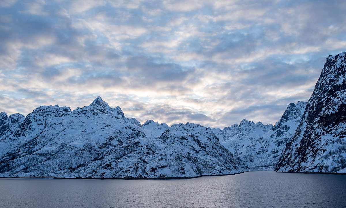
15 March 17:00 – we approach the quite famous Trollfjord. In winter however the Hurtigruten ships do not enter it.

15 March 18:30 – we arrive in Svolvær, largest town on the Lofoten. It’s a longer stop and Annika and I leave the boat for looking around.

16 March 06:00 – the alarm clock rings. At 7 o’clock we will arrive in Ørnes, leave the ferry and drive to Skelleftehamn. 583 km by car then I’ll be home again after more than six weeks of travelling.

Kjølnes Fyr

This article is part of the series “2018-03: Varanger peninsula”.

Days 38 to 40 of my winter journey 2018

Saturday

After our stopover in Kongsfjord we continued the road 890 in direction Berlevåg. The road follows the coastal line of first the fjord Kongsfjorden and then the open Barents Sea. Our destination for today is Kjølnes Fyr where we planned to stay over for one or two nights.

Kjølnes Fyr is located on a small headland called Kjølneset 5 km east from Berlevåg. We had booked a two-bed room at this place because it looked more interesting than the “large” city Berlevåg with its round thousand inhabitants. At half past one we arrived.

I directly fell in love with this place. The lighthouse – some other houses around – a rugged rocky coast, partly covered with snow, partly with seaweed – to the west bare mountains and to all other sides the open Barents Sea.

If you started a boat trip from Kjølnes Fyr heading north, the next land you would approach would be Kongsøya, part of Svalbard.

Viggo who operates the lodging gave us the key to the lighthouse and we took a closer look. The original lighthouse from 1916 was destroyed in World War II, the new lighthouse was built in 1949 and has a very functional and sober appearance. We went up and looked over the Barents Sea watching the high waves breaking at the rocky shore.

Viggo and his wife moved to Kjølnes Fyr in last autumn. He has rented the houses, that are protected as a historic monument. He told us from a winter storm that he experienced in January. Wind speed was up to 70 m/s (~250 km/h) and the upper floor of their house was shaken so violently, that the vibrations moved around the furnitures inside. Compared to that experience we had it quite calm.

The only thing we made over daytime was driving to Berlevåg to buy food. In Norway almost all shops are closed on Sundays and there were things we needed (spaghetti …) and things we wanted (chocolate …).

Later that evening we drove to Berlevåg again to see the Hurtigruten ships coming in.

Sunday

Under the night the wind got a bit stronger and the waves approaching from the north had become higher. Annika and I took a really lazy day. I was outside several times, but only for taking photos of waves. They never broke at the same place twice and gave me a hard time making pictures.

Weather became worse the whole day: The wind increased more and more and it started to snow, which means that snow was thrown into my face vertically when I dared to look into the wind. When it started to get dark, the ice and snow covered rocks in the cold light of the blue hour made the landscape look as what is actually is: arctic.

Already in the afternoon the Norwegian Meteorologisk institute had issued a class one wind warning for the whole area. I started to get a bit nervous. The next day we wanted to continue to Båtsfjord, our last stay on our Varanger trip but I was not sure whether the weather would allow it. Anyway, all roads were still open.

Monday

It had snowed a lot in the night and still was snowing heavily. Due to the stormy wind parts of the ground were completely bare of snow while other parts were covered with knee deep snow. At the same time it was quite warm, hardly below zero. The weather warning was extended to the afternoon but wind should decrease a bit over the day, so we planned to start round 12 o’clock. I was out and took some more photos, but it was really rough weather, especially for the camera.

Right after breakfast Viggo got a call of another guest approaching from Berlevåg by car. She couldn’t find the departure to Kjølnes Fyr due to severe weather conditions and asked for help. He took the car and drove to the main road just to mark the departure visually. When she came in she looked quite exhausted from the short car trip. She advised us not to continue the trip that day and told us, that visibility was partly only 10 meters which would make it impossible to see the next way mark.

We waited some time but despite of the stormy wind the visibility looked really good. Therefore we decided to give it a try and drive at least to Kongsfjord, that we passed two days ago. Here we could either continue our trip or take a room and stay in Kongsfjord overnight.

So we packed the car, said goodbye, removed the snow from the car and started our car trip to Båtsfjord at 11 o’clock.


A tour to the easternmost point of mainland Norway

This article is part of the series “2018-03: Varanger peninsula”.

Day 29 and 30 of my winter journey 2018

Yesterday we continued our journey to Ytre Kiberg which is 13 south of Vardø, one of the Hurtigruten stops. We started in Vadsø – another Hurtigruten stop – after a breakfast with our host Nils, bought a basis of food for the next days and took the E75 northwards. We made a stopover in Ekkerøy, a village on a peninsula near Vadsø. We like this place and will try to stay there for some nights next week.

At lunchtime we reached Cape East Arctic Adventure, our stay for four nights. We were welcomed by Trond, the owner and operator of Cape East Arctic Adventure and were shown our cozy bedroom, the kitchen and the homely living room. After making ourselves at home we went along the beach to the village and the harbour.

In the evening we were invited to a three course dinner based on freshly caught cod: Fish soup – cod with potatoes and carrots and finally cod roe. Everything was extremely tasty and it was Annika’s and my first time where we tasted cod roe. Yummy!

In Kiberg you are as east as you can be in the Central European Timezone, therefore sun is rising already at 6:24. I was awake very early and took a morning walk round 6 o’clock. Some snow drifts had been created by snow and wind over night but now the weather was less windy and quite sunny. At least for a short time. While I went the way to Indre Kiberg clouds approached, wind increased and it started to snow. It was hardly imaginable that it was sunny just a short time before. Weather changes here quite often as Annika and I should find out later.

After breakfast Annika and I took the car to the other side of the village, put on our snow shoes and started a hike to Kibergsneset, easternmost point of mainland Norway. This place is more east than e.g. St. Petersburg, Kairo or Istanbul! It was windy but quite sunny, when we started our tour but weather changes fast on the Varanger Peninsula:

Actually this hike is just a promenade but the weather may transform it into a small expedition. We were exposed to wind and snow and grateful, that we didn’t experienced a full storm. The weather was rough anyway and I was glad about my windproof jacket and two pairs of mittens.

We continued on a small hiking trail, first with, then without snowshoes because the thin snow layer was hardened by the wind and easy to walk onto. There’s a coastal fortress build by Germans in WW2 on Kibergsneset but we couldn’t see it in the snow weather. Instead of looking for it we continued to the small lighthouse at Kibergsneset that marks the easternmost point of mainland Norway (and most of Europe). Shortly before we reached it the sun came out and we continued the last metres in full sun. While I made some photos a small snow shower approached with the sun still shining.

From the lighthouse there was an amazing view over the arctic coast of the Barents Sea, but only for some moments. Soon the next snow shower came by and hid most of the view onto both the coast and the sea.

The way back was much shorter because we knew the way and went downwards. Even though the view was limited by the snow showers Ytre Kiberg came into view again soon and surprisingly the weather was nice and sunny again.

After this very windy promenade we were glad to find shelter in my car. We took the car to Vardø to eat something and after that we tried the road to Hamningberg. We knew that the road was closed in winter but we curious how long we would come.

Well, not very long. We managed to get to Smelror, some kilometres north from Vardø.

The main road however was definitely closed as you can see. There are no people living in Hamningberg permanently and the only motorised way to reach it in wintertime is by snowmobile. For car it is open less than half the year.

We took the car back to Kiberg, enjoyed the incredible and unbelievable colours of the sky and were surprised by a strange weather phenomenon: -6 °C and rain (including a faint rainbow!)

The rest of the day? -10 °C and wind outside, no more photos, no more excursions.

Fun fact: We took the E75 northwards. If you would take it southwards you could travel more than 4000 km and finally would arrive on Crete, Greece.

A ski tour in the Kvikkjokk mountains – day 5 and 6

This article is part of the series “2018-02: Ski tour near Kvikkjokk”.

Day 11 and 12 of my winter journey 2018

After our second night in the tent (it was 20 °C warmer than the first night) I woke up at 7 o’clock. My thick isolated sleeping bag was much too warm and I was glad to get out of “bed”. Time for some photos of our tent and the surroundings.

Today we wanted to leave the trees behind and ascend to the kalfjäll – the treeless mountains region. Since we already were level with the treeline we soon came to the place where you hardly see anything more than snow, some rocks and the winter waymarks.

Jonas is interested in many things, among others bouldering. When we came to a nice large boulder after some hours of skiing, he took the opportunity for a (very) short bouldering session. Here’s the evidence photo:

After that short break we continued our tour over the kalfjäll. It snowed and it was quite windy. The boulder was quite near to the mountain shelter Kurajaure, where we arrived half an hour later.

The wind had grown stronger and stronger and we were glad to enter the shelter. We took the pulkas in, too. These mountain shelters aren’t made for overnight stays beside of emergency situations. We however decided to stay in this shelter anyway for some reasons I won’t reveal here.

Of course we didn’t use the woodstove and firewood. We took our own paraffin stove, prepared food and slept in our sleeping bags, since unheated the shelter was as cold outside as it was inside. But there was a big difference: We were protected against the strong snowfall and the rough winds. I went outside anyway to take some photos in the dusk.

This time we did something new: we set the alarm clock for the next day. We wanted to reach the mountain hut Tarrekaisestugan which we passed two days before and suspected that we had to ski through a lot of fresh snow against rough headwinds and strong snowfall. Since we didn’t know how much time it would take we had set the alarm clock to 7 o’clock. The plan was to leave 8:30, but it became 9:20 when we started our 6th tour day.

It was -12 °C and quite stormy. I guess the windchill was round -30 C. I closed my fur trimmed hood as much as possible and later I took even a buff over mouth and nose to protect against the icy snow that the wind threw into my face. I used three pairs of gloves and mittens – one over the others – to protect hands and fingers. Here’s a selfie of me (left) and Jonas (right) made on the kalfjäll.

There was a lot of new snow, probably 10 to 15 cm. All snowmobile tracks (and our own from the day before) had disappeared. We returned the very same way that we went the day before. Although weather was rough, skiing was easier than expected, because we went more down- than uphills. The steep part however was a real disappointment. This stage had costed a lot of efforts to climb the day before, now it took less than ten minutes to ski down. After a passage over the frozen lake Tarrekaisestugan came into view.

It took more time than expected to cross the lake, but the most exhausting part was the slope by the lake that we had to climb up to reach the mountain hut. Here at least 30 cm of fresh snow had been falling and even the deepest snowmobile tracks were hardly visible. After we arrived and removed our skis I removed ice from the outside of the window. I had to plunge through hip deep snow to reach it. The snow depth behind the hut was at least two meters.

After two cold nights we were glad to dry both sleeping bags and clothes and hung up mittens, jackets, boots, caps and much more and to heat the woodstove.

Our dinner: couscous with roasted salami, dried tomatoes and ready-made champignon sauce. Tasty!

The two photos showing me on skis are made of Jonas Balbasus.


A clear winter morning at Långhällan

Today I took time off work. I stood up quite early and at 7:30 I took the car to Långhällan, a place by the coast which I love for photographing. Today I tried out my new Tamron telephoto lens (150 – 600 mm) and I’m very contended. All photos shown here are made with this lens and focal lengths between 400 and 600 mm.

The morning was cold with temperatures round -10 °C and the sky was completely clear beside of a layer of clouds at the southeastern horizon. The locals call this cloud phenomenon “vinterväggen” – the winter wall. Although it was more than one hour before sunrise, the horizon was already of a bright orange colour. The first photo.

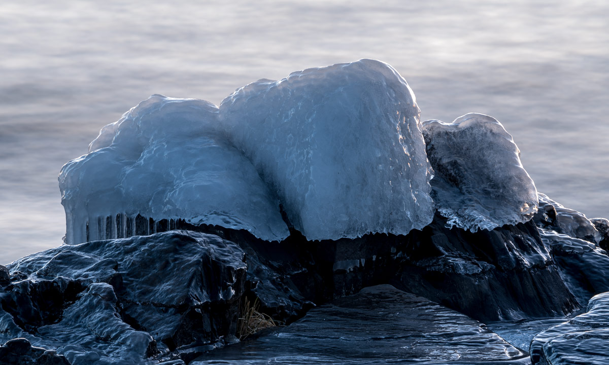
As usual the other side of the celestial sphere was of a pale purple colour. The ice and rocks however were still of cold blueish colours. I could have waded to the rock with its shining ice cap, but I wanted to test my new lens. Photo number two.

Långhällan’s shore is partly solid rock, partly round stones of different sizes. Each of the stones, that are partly below and partly above water has such an ice cap as on photo number two. Photo number three – just for the impression.

On one of the rocky salients there’s a small but deep puddle of water which was covered with ice too thin to bear me. I could have tried to walk on it (I wore waterproof chest waders) but probably I would have destroyed the motive: a small ice pane sticking out from the icy surface. Another good argument for a telephoto lens. Photo number four.

While I looked round and breathed the crisp air the sun has started to rise, still invisible since it was behind the vinterväggen but the rim of the clouds were illuminated in a bright glowing orange. I had taken some other pictures of the lighthouse before, but this photo wins. Photo number five.

When waves splash water on the frozen stones long chains of icicles are formed. Some of them were already in the sun (Photo number six) …

… while most others still were in the shadows of other rocks. These icicles had reached the ground and created a row of ice pillars in a ice portal. Photo number seven.

I looked at the sea. Parts of the ice covered rocks were sunlit and glowed orange-colours as if they would gleam from the inside. The good thing with chest waders is that you can kneel down into the water for a better perspective without getting wet. Photo number eight and the last one of today’s series.


A short visit at the coast

Yesterday morning temperatures were +3 °C, it rained and the still frozen roads were wet and incredibly slippery. Half a day later temperatures had dropped to -3 °C and it snowed – much better in my opinion!

This morning it was -6 °C and 5 cm of white fresh snow covered the ground. Not enough for skiing but enough for looking nice and most of all for brightening the day.

That’s a photo of the coast line at Näsgrundet this morning. While the sky is still clear in the south, a thick layer of clouds approaches from the north. Unfortunately the clouds doesn’t bring any snow, but according to the weather forecast more snow is to come as from tomorrow.


28 August: Kungsleden day 9 – Vistas—Alesjaure (18 km)

This article is part of the series “2017-08: Kungsleden hike”.

Today Katrin, Annika, Andi and I would continue to Alesjaure, the longest distance to walk so far.

The morning was frosty with -2 °C and the petals of the flowers called rallarros (rosebay willowherb or fireweed) were covered with ice.

The sky was blue, the sun was shining, we had picture-book weather. As a photographer I would have preferred to hike two weeks later when leaf coloration would be in progress, but you can’t have everything. Anyway, the photo of the bridge over the Visttasjohka right at the Vistasstugan looks like a postcard motif:

This spot looked quite Canadian or Alaskan to me. I almost expected to spot some huge grizzly bears catching salmon in the river. But we’re still in Sweden where bears are brown bears and (luckily) very shy.

The first kilometres of the trail to Alesjaure lead through dense birch forest. Then gradually the forest got less and less dense and the snow covered mountains that frame the valley Visttasvággi were revealed.

The first kilometres were said to be muddy and they were, but not more than many other passages that we walked the days before. Unfortunately the trail continued to be both rocky and muddy and therefore wasn’t easy to walk.

After we left the birch forest the landscape became more rocky again. We found the resting place I remembered from two years ago. Someone had used a plank and some stones to build a bench in front of a huge block of stone. Still the sun was shining but gradually the sky become cloudy. Will we manage to arrive before the rain comes? We still hadn’t walked half of the distance.

We continued our tour until we reached the bridge over the stream Moarhmmájohka. Andi and I went down to refill out water bottles, then we took only a short rest since we were eager to arrive not too late.

After having crossed the bridge we had to go uphills quite steeply and we all slowed down more or less. Then we arrived at the plateau and looked back a last time into the beautiful valley Visttasvággi.

The clouds became denser, the wind increased but still it was dry. We passed the lakes Vuolip Čazajávri and Bajip Čazajávri. We went on and the sami village Alisjávri, located by the lake of the same name came into view. Now it was only 1.5 km left to the Alesjaurestugorna, our destination. As the day before we spotted the sauna first.

At 4 o’clock we arrived at Alesjaure and we stayed dry. Alesjaure is the largest mountain hut that we would stay at. It has as much as 86 regular beds (and more place if needed.)

I already found out, that stugvärd J. would be here, he whom Annika and I met in Nallo two years before and I again on my winter tour in Singi for some days. And really, he indeed was there and I was very glad to meet him again.

To meet J. means also to meet Simba, his kingsize dog. Simba dosed in the outside, stoically ignoring the mosquitoes in her eyes and on her nose. I said hello and started to pet her, which she apparently liked: she sighed and slumped onto her side. The photos I made before and afterwards:

Alesjaure has several houses, which appear more like a youth hostel than a mountain hut. That may look less cozy but we all enjoyed our big beds in our own four-bed-room. Katrin and Annika went to the sauna and after that we cooked one kilo (!) of pasta with goulash soup as a sauce. No, we didn’t manage to eat it all, the rest would follow us to Abiskojaure the next day.

Alesjaure would the last place in the kalfjäll above the treeline on this tour. Tomorrow we would continue to Abiskojaure, which is round 22 km away. This could be the longest day’s march, but we took a shortcut …


27 August: Kungsleden day 8 – Nallo—Vistas (9 km)

This article is part of the series “2017-08: Kungsleden hike”.

Going to bed early, getting up early – the second morning in Nallo we beat a record. We woke up at six and started our tour already at half past seven. The snow has melted away the day before but the night had been cold and some smaller puddles were covered with ice needles.

This year it was easy to cross the watercourse behind the hut Nallostugan. Later on we would have to cross a bigger stream where Annika had to put on her sandals to cross that stream two years ago while I barely managed to cross it in rubber boots.

The first part of the way was still quite arctic and alpine with many rocks and frozen ponds …

… but with each meter in height we descended to Vistas, our next destination, the variety of plants grew. Soon Salix lapponum (downy willow), Empetrum nigrum (crowberry) and Betula nana (dwarf birch) were found again and finally birch trees as well, the first ones for days.

Downy willows like wet places. If you see a long line of them you can be sure that they grow along an alpine brook and if they cover a whole area it certainly will be very wet. Apropos wet – we all managed to cross the river by stepping from stone to stone. Wading was unnecessary. Even if many parts of the trail have been quite muddy this year the water level had been generally low.

This tour was the shortest and easiest of the whole Kungsleden and we used the sunny weather to make a longer rest with lots of chocolate. We would buy new chocolate in Vistas.

The first building we could see was the new Sauna, which is sponsored of a gentlemen’s club called “Fjällrävarna”. Shortly after that the other buildings of Vistasstugan came into sight. We already arrived at 12 o’clock and would have been there even earlier, if we hadn’t been hold up by blueberries …

When we arrived we were alone. D., the German stugvärd left a note that he was hiking and would come back round 4 o’clock. Guests should just choose a bed. So did we. Then we took some items from the self-service shop, put ourselves on the outside stairs of the hut and enjoyed sun. After that we made pancakes with bluebe …

Oh well, the blueberries! I almost forgot them. We hadn’t found many eatable blueberries yet. Many of them were still small and green, probably due to the cold winter, and most blue ones we found turned out to be tasteless or sour. Until today, when we found another field of blueberries on our way to Vistas. This time they were ripe and aromatic. First we ate one or two, then some more. Then we dropped our backpacks and ate some more. Then we dropped ourselves on the ground to collect these tasty berries (and eat some more). It didn’t take long to fill a whole box and some hours later we got a delicious dinner:

Pancakes with fresh blueberries, sugar and cinnamon. They tasted extremely well and it was hardly imaginable, that the pancake dough had been just a powder in Annika’s backpack. Did I mention, that the blueberry garnished pancakes were delicious? I did? Well, you think a lot about food when hiking …

Our dinner was less special: Swedish meatballs in cream with mashed potatoes. It was tasty anyway but not very photogenic. I prefer to show the cans instead of the meal:

Stugvärd D. asked us if he should wake us for polar lights and we accepted gladly. He woke us round 22:30, when it was still dusky. Indeed there were polar lights on the sky, but they were quite weak and hardly spottable. I stayed up another two hours, glad to have a down vest with me, since the temperature already had reached freezing point. The aurora however continued to be weak most of the time. Anyway it was a pleasure to watch. And the stars, the many stars! It was months ago, that it was dark enough to experience such a starry night. At one o’clock I fell into my bed. Another great tour day and the sunniest one yet.

25 August: Kungsleden day 6 – Sälka—Nallo (10 km)

This article is part of the series “2017-08: Kungsleden hike”.

Today we would leave the Kungsleden. Instead of the route SälkaTjäktjaAlesjaure (25 km) we would go SälkaNalloVistasAlesjaure (37 km). Annika and I have been in Nallo two years before and fell in love with that place.

Again we woke up early, again it was cold with temperatures round +2 °C and again snow had covered the mountains over night, this time not only the highest peaks. After our breakfast—cleaning—packing routine we left the crowded Singistugorna hoping for less people in Nallo.

We went up a bit, but were on the wrong side of some alpine brooks. Katrin and Andi returned to use the small bridges, Annika crossed the brooks by balancing over some stones, I just waded through – one of the advantages of using rubber boots.

First the landscape didn’t seem to change but gradually the flowers and other plants lessened and the terrain became stony and harsh.

The mountains that framed the valley Stuor Reaiddávággi were rugged and rocky and powdered with snow. The lack of plants let them appear colourless.

More and more we had to cross boulder fields and some smaller streams. Water ran everywhere and we had to look for the path that was marked with piles of stone. Not easy to find in a landscapes made of rocks and boulders, even if some of the top stones were of white quartz.

It was cold, windy and then it started to snow.

We went along the lake Reaiddájávri. We would have to cross the river right behind the lake before it cuts down into a deep uncrossable ravine. Two years before Annika had to wade through in sandals, because the water was to deep for her boots. There are nicer things than wading through ice cold water while it’s snowing …

We were lucky. The water level was low and someone obviously had build a fort of stones that were quite easy to cross. We were cautious anyway, because no one wants to fall into icecold water with a backpack and fully clothed.

We succeeded and took a short rest to eat some chocolate (crucial food on hiking tours!) but we continued soon because of the chilly weather. We followed the Stuor Reaiddávággi and crossed some side valleys with old snow fields – reminders of last winter.

The precipitation got stronger, more rain than snow. While the others continued through the alpine and arctic landscape I went to the ravine to take pictures of the waterfall, but I soon gave up, since the rain fall grew too strong. The last photo after catching up with the others is blurred from the rain on my lens.

Finally we arrived at Nallo 12:30 and were delighted, that only few others had come there as well. We cooked an instant noodle soup and took a midday nap.

In the afternoon it had started to snow stronger and the wind speed increased while the temperature dropped to +1.5 °C.

The ground was still bare of snow – a good thing for the reindeers, that grazed in the valley.

Snowfall however continued the whole day and evening and slowly started to cover the ground. How good that we planned to take a day of in Nallo the next day.

21 August: Kungsleden day 2 – Teusajaure—Kaitumjaure (9 km)

This article is part of the series “2017-08: Kungsleden hike”.

One of the less adorable things when you’re hiking from hut to hut is going to the toilet. You have to go to the utedass, the outdoor earth toilet, which is always a bit away. You need to slip in your boots or sandals, put on a jacket to stay warm and dry and in the night you even need a flashlight to find the right way. At least the toilet seats are made of styrofoam which isolates quite well. And there’re always some nice outdoor photos pinned to the wooden walls.

After I already took the camera to my early morning loo visit I stayed outside and took some more photos. It was chilly and cloudy but at least yesterday’s rain had stopped.

After a breakfast (Wasa bread with cheese and muesli with milk made from milk powder) we started our day’s march. It was much easier than the day before since it’s only 9 km to the next hut. We had to climb up round about 250 meters through forest until we reached the kalfjäll above the tree line. And finally the sun managed to find some holes in the clouds and illuminated parts of the alpine landscape.

It didn’t take very long until we crossed the river Kaitumjåkka (sami: Gáidumjohka) using the large chain bridge.

Leaving the river behind us we descended again through green birch forests …

… and arrived at the Kaitumjaure huts at 14:45. I cut up some logs and chipped wood for the sauna but it happened to be so crowded, that Annika and I left it soon. Katrin and Andi didn’t even managed to enter the sauna and the water for cleaning was still cold.

But even without a hot water “shower” day two felt much better than the day before. Now we looked forward to the next day that finally would lead us to the treeless kalfjäll for several days.

Back to the toilets: If you think that using the utedass is quite uncomfortable to use in summer, you won’t like it in winter either. Then you sometimes have to dress like for an arctic expedition just to reach it without hypothermia. Check the second photo in the article Kungsleden ski tour: Singi – from blizzard to clear sky to get an impression.