A kayak trip shorter than expected

About neoprene suits, the post-glacial rebound and changed lunch plans.

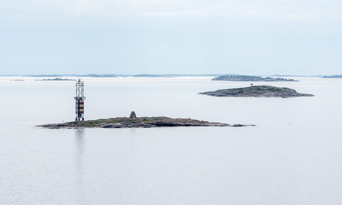
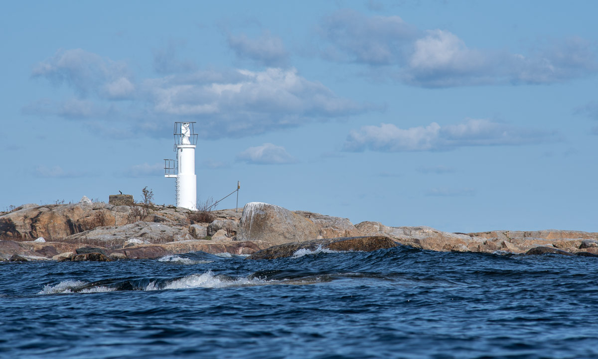
Today I wanted to paddle to Själagrundet, an island 1.6 km from mainland. The air may be warm but the water is still cold and that’s the element you should be prepared for in case of capsizing. Today I decided against the bulky drysuit and chose a thin neoprene suit for the first time.

The suit is very tight (especially if you each too much chocolate …) and hard to put on. After I managed to squeeze myself into the suit and to close the back zipper it felt quite comfortable. Until I started paddling. It was much harder to move the paddle than usual because of the tight neoprene sleeves. Every paddle stroke felt like training with a rubber band. I got used to it after a while, but neoprene will probably not become my favourite choice of kayak clothing.

I passed the island Storgrundet and headed northeast. The waves came exactly from the side which is the worst direction regarding stability. So I zigzagged a bit to avoid the waves rocking the kayak too much. Nevertheless the island came closer and closer and soon I got out of the kayak and dragged it ashore. The seagulls didn’t like my arrival. Screeching loudly they rose in the air, sailed in the wind and didn’t dare to land as long as I occupied their private property.

There are many islands whose name ends with -grundet. From Skelleftehamn for example you can paddle to Storgrundet, Norrskärsgrundet or Nygrundet. The Swedish word grund means (among others) shallow, so the translations of the islands mentioned above are: the Large-Shallow, the North-Skerry-Shallow, the New-Shallow.

Who is to blame? The post-glacial rebound! After the last glacial period the glaciers started to melt. Slowly the land, that had been compressed by the huge weight of the ice sheet started to expand. It is still expanding and rising – round 8–9 mm a year. Therefore some islands are quite new. Själagrundet for example is hardly older than 100 years. They got their names from the old times when they weren’t islands yet but shallow underwater-banks that the fishermen had to take care of.

Today Själagrundet still is mainly a large gravel bank. Only on the higher eastern side plants had started to grow. Mostly it’s flowers, but two small bushes and a small willow tree have settled there as well.

I walked around and had a look at the 260 meter long island until I got hungry and wanted to eat my lunch – salad and a chocolate bar. When I looked at the dark grey clouds that seemed to approach the island I changed my plans. Did I hear the rumble of thunder? When I would be hit by a thunderstorm on this flat island without any shelter I could get into serious trouble. I checked the speed of the clouds and decided that the best option was to paddle back to mainland, now and quickly.

I had a fast start and paddled quicker than usual until half of the distance lay behind me. It was quite exhausting –remember the neoprene suit? When I realised that there was no immediate danger of thunderstorm and lightning I slowed down. I took my dinner on the island Storgrundet. A save place with summer houses and hardly 100 metres from mainland. Then I paddled back to the small beach at the mainland, took off the neoprene suit and had a refreshing bath in the Baltic Sea in the sun.


Starting the summer holidays

This article is part of the series “2019-07: Southern Sweden”.

8 July – Umeå – Majors/Malax

Two days ago I left Skelleftehamn with my car full of things: clothes, camera equipment, rubber boots, a cooling box, tent, sleeping bag and much more. At lunch time I arrived at Annika’s home in Umeå.

Annika and I have four weeks of holidays together. Normally we use to head north, but this time we had decided to travel to a place, that is hardly known to us: Southern Sweden! We want to visit friends at places like Åbo, Bjärnum, Oskarshamn, Sparsör, Vetlanda, and Falun. I have been in Vetlanda many years before, all other places are completely unknown to us.

Yesterday we packed Annika’s VW Golf. Although the car is smaller than mine our whole luggage fitted in easily, even my optional items as a snorkel mask or the large telephoto lens.

While all travel destinations lie south we started heading east. At 10:30 vi arrived at the ferry terminal in Holmsund, 20 km from Umeå and waited for the ferry to Finland. At 17:30 Finnish time we arrived in Vaasa.

Wait a moment – Finland? On the way to Southern Sweden? Well, we extended our trip a bit, first to make it a perfect round trip but first of all to visit a blog friend in Åbo, which is the Swedish word for Turku in Southern Finland. Turku, that’s round 350 km in the south, but our first stop was much nearer.

When we had used the same ferry in April we’d met Stefan from Malax. He did not only have time to meet us but we were also invited to stay overnight in his cozy summer cottage by the lake Majorsträsket. A beautiful place! We had a great evening together with a lot of talking, grilling sausages and going to the sauna.

Later in the evening he said goodbye and soon Annika and I went to bed. Later in the night I had to go to the toilet, a small hut with an earth closet. It was much darker than it uses to be in Skelleftehamn but still it was quite light.

Now we had breakfast, did the dishes and the article is written. We’ll pack our stuff into the car and continue our trip, now really heading south.

I wrote this article a bit in a hurry – we want to continue to Åbo/Turku today. We want to take it easy and arrive not too late. So please ignore the mistakes. Hear you soon …

Day 3 – a day in Turku

This article is part of the series “2019-07: Southern Sweden”.

10 July, Turku

Our second (and last) Finnish stay is Turku, about 300 km south of Majors, our last stay. Here we meet Karen and Family. Karen is an active blog author and it’s the first time that we meet her in real life.

Annika and I arrive in the afternoon and have a nice and relaxed evening. The only thing we have to do is to put up our tent in the garden. The garden is small but our tent fits.

Karen and the children have summer holidays, but the daughter is away. Her husband has to work, so it’s Karen and her two sons with whom we spend the next day.

After breakfast we take the vesibussi – the water bus, part of the public transport system. We take the normal bus into town and walk along the river Aura until we reach the pier for the small boat.

I love to explore a new town by boat or ship. The weather is warm and sunny and Turku looks beautiful which its combination of new houses and old castle – old sailing ship, restaurant raft and modern racing yachts.

We take the boat to the island Runsala were we take a long walk. We cannot access the whole island because of a music festival a week ago. The area is still fenced, but there are many other ways and paths leading back to the boat stop. I really admire the tall leaf trees with their huge barky trunks, especially the oak trees. We do not have such home in Västerbotten.

We take the boat back to town and the bus to the china restaurant Yangtze. Great, delicious food and some dishes I never tasted before. Recommendation!

Later that day we take the car to Vähä-Joumo, a nice bathing place with a sandy beach, a bathing raft and – most important of all – a Finnish sauna. Countless times we jump into the water, swim to the platform and back or warm up in the sauna.

It is quite late when we finally return to our host’s home, where we eat dinner – fresh bread with a huuuge bowl of salad – and talk until Annika and I crawl into the tent again were we quickly fall asleep.

Thank you Karen, Vidal and children for a nice stay! It was great meeting you and you’re warmly welcome in Västerbotten on the other side of the Baltic Sea.

Karen’s blog: Suomalainen Päiväkirja | Live aus Turku (German)

Day 4 – a day on the ferry

This article is part of the series “2019-07: Southern Sweden”.

11 July, Turku—Stockholm—Jogersö

After our side trip to Finland we are sitting in the car and waiting to be allowed to drive on the car ferry Amorella, that connects Turku with Stockholm. Soon we enter the car deck.

We go up the stairs until we reach the upper deck. The journey takes eleven hours. While we wait for the departure another large ferry leaves Turku.

At 8:43 the ferry leaves. We drive through the Turku Archipelago that consists of more than 20000 islands and skerries. The large islands are wooded. Impressive wooden villas are hiding between the trees and small huts that look like carved are by the sea.

After a while we reach more open water. The islands nearby are smaller skerries, some wooded, some rocky.

While the islands pass by there’s a lot of entertainment inside. Bingo – minigolf – dance band – face painting for kids and much more.

At lunch time we enjoy the extensive buffet on board. Here is an expert of the menu. Although it’s Finnish some of the words like paprikaa or palsternakkaa are understandable.

The ferry makes a stopover in Mariehamn, capital of Åland. Here several ferries meet. They connect Åland with Sweden, Finland and Estonia.

Åland is an autonomous territory. Although it lies under Finnish sovereignty it is Swedish-speaking. At the terminal nine flags are fluttering in the wind. From left to right it’s:

Sweden, Norway, Greenland, EU, Iceland, Faroe Islands, Denmark, Finland and Åland.

After the stopover we continue our journey to Sweden. Sometimes it’s cloudy, sometimes it’s sunny and we can sit or lie on the top deck. There’s a small wooden platform right in front of the huge chimney that is perfect for sunbathing. We say goodbye to the islands of Åland and an open water passage lies before us.

After a while we see the first rocky skerry, the first trees, the first houses. We have reached the Stockholm Archipelago, that consists of ca. 24000 islands. We are back in Sweden and slowly we are approaching Stockholm.

Before we dock in Södermalm, we have to leave the top deck to enter our car. It’s Annika who is going to drive. I’m too scared to drive in Stockholm.

Our plan is to leave the greater Stockholm area as fast as possible and look for a campsite. Annika masters the chaos on the road behind the ferry terminal, where’s a big pushing and shoving. Priority rules? Who cares …! She masters the huge four-lane motorway, too.

South of Södertälje the traffic decreases. Now it’s only one hour left to Oxelösund where we want to look for a place to stay. We drive to the island Jogersö and arrive six minutes after the reception of the campsite has closed. Luckily the receptionist is still there and we are allowed to come in. All small cabins are occupied but there’s always place for a tent. So we put up our tent, eat bread and cheese and finally I have to take a bath in the sea before going to sleep.

When we lie in our sleeping bags ready to fall asleep it starts to rain. Just gemütlich!


Day 5 – Götaland

This article is part of the series “2019-07: Southern Sweden”.

12 July, Jogersö—Gränna—Bjärnum

It always seems to be the third night in a tent, when I got used to the camping mat and sleep very well. Nevertheless I’m looking forward to a real bed. Annika and I dry the sleeping bags and the tent in the sun and have breakfast. Half past nine we start our journey farther south. We have to drive 413 km, mostly on the E4, the very same European route, that connects UmeåSkellefteå, Piteå and Luleå.

Here it connects Nyköping, Norrköping, Linköping and Jönköping. While å stands for river, köping means market town.

We stop in Gränna, a town by the lake Vättern which is Sweden’s second largest lake. Here’s a large campsite, a lovingly designed minigolf course, a ferry to the island Visingsö and – most important for us now: several restaurants and ice cream shops. Children are wading in the water, grown up are sunbathing on the public benches, the place is touristic but not crowded.

There are nice bathing places along the coast of the Vättern, so we bath twice, first in Röttle, then near Sjöbergen. Since the Vättern is so large you can think that you bath in the North Sea or Baltic Sea – until you taste the water. It’s fresh, not brackish or salty.

Röttle has another attraction besides its bathing place: there were severals water mills. Here we stroll around for a while.

After our long break we continue our car trip southwards. We cross the border to Skåne, the southernmost part of Sweden. In the evening we arrive in Bjärnum.

You see the light behind the front window of the house? That’s our place for the next days.

A word to the title of the article: Sweden is divided into three parts: Norrland in the north, Svealand in the middle and Götaland in the south. The population density in Götaland and Svealand is more than ten times as high as in Norrland.

Day 6 – Finjasjön

This article is part of the series “2019-07: Southern Sweden”.

13 July, Hovdala and Finja

When we leave the car at the parking place of the castle Hovdala slott the first think I see and hear are the bees at the beehives. The bees are lucky, they have their own huge flower field, where red poppy, blue cornflowers, white oxeye daisies and many other flowers bloom.

We take some ice cream at the café and start our promenade. We want to go north to the lake Finjasjön, walk along the lake and head south again. It’s quite easy to get lost, because there are zillions of paths, tracks and small roads. Many of them are marked but not necessarily at the important points. Therefore we randomly follow some tracks or roads, trying to use a local paper map and the sun for orientation.

We follow some signs to the Trädhuset – the tree house, a café build on a high wooden platform between the trees. First all people sit outside but that changes with the incoming thunderstorm. It’s raining hard and Annika and I consider how to get back to the car. We don’t have rain clothes with us.

We are lucky, the thunderstorm is moving away and soon the sun is shining again. We walk back, this time using the smartphone for navigation. Although it’s barely 20 °C the air feels damp and hot. With the digital guidning we are soon back at the car, just before it starts raining again.

Since it is raining we cancel our bathing plans. Instead we had north where we take another promenade and visit the Finja Church. Finja itself is a small locality with 600 inhabitants. The church however had great importance in the middle age. It was build in the 12th century and some of the old chalk paintings are created round 1140.

We were lucky that the church was open and we even got a guided tour. The guide mentioned that this church comes from the end of the viking time, long before the existence of nations like Denmark or Sweden.

The weather was still showery, so we decided to postpone bathing and drive back to our hosts house.


Day 9 – Ystad and Österlen

This article is part of the series “2019-07: Southern Sweden”.

16 July – Bjärnum—Ystad—Mälarhusen

After some wonderful relaxing days in Bjärnum Annika and I continue our tour through Southern Sweden. Today we will reach Ystad, our southernmost destination on our journey. From Ystad to Kilpisjärvi in the north it’s almost 2000 km by car.

From Bjärnum to Ystad however it’s less than two hours. Ystad is a beautiful medieval town. We strolled through the streets and alleys and I only took some snapshots because we looked for a place for lunch.

We found a restaurant near the boat harbour where we ate fish and looked at the sea, the small sailing boats and the big ferries. From Ystad you can take the ferry to Bornholm (Denmark) and Świnoujście (Poland).

Next stop: Ales stenar (Ale’s Stones), a megalithic monument east of Ystad. It consists of 59 large boulders formed in a shape of a boat, probably 1400 years old.

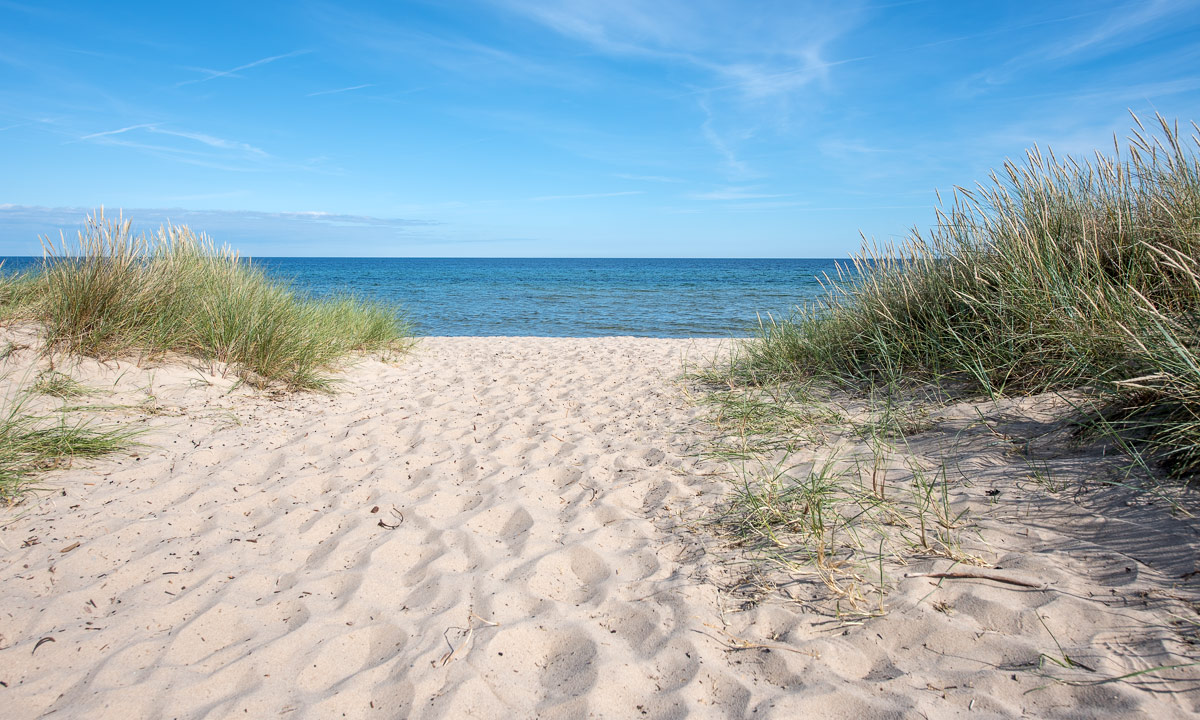
Next stop: Sandhammaren. Dunes, a long sandy beach and the clear Baltic Sea invites us to take a bath. Or two. Summer holidays.

We decide to look for an overnight stay. We pass a small wooden sign by car. It says “Stuga for 2” – cabin for two. We are lucky. Although it’s main season the stuga is free and we can stay for a night. It’s in Mälarhusen in the corner of a garden, incredible cozy and the beach is not far away.

We take the car to the next ICA to buy food. After a dinner with pasta and salad we take another promenade along the beach. At the horizon we spot land – the Danish island Bornholm. Finally a reason to fetch the tripod and the huge 150-600mm telephoto lens from the car and make a photo of Bornholm, where I have been more than 40 years ago.

Day 10 – leaving Skåne

This article is part of the series “2019-07: Southern Sweden”.

17 July – Mälarhusen—Figaholm

Today we leave Skåne and continue to the historical province Småland, home of Astrid Lindgren and many of her characters. But before we start our tour we have breakfast and before breakfast we take a morning bath in the Baltic Sea. 12 °C water temperature – a bit chilly. We lock the tiny, cozy house where we stayed the night and start our car trip north.

We make many small stopovers and bath three other times this day, enjoying the fresh water and the warm sun.

Some photos:

Day 11 and 12 – Figeholm and Kalmar

This article is part of the series “2019-07: Southern Sweden”.

18–19 July

Three days Annika and I stay with our Friends Astrid and Hein in Figeholm in the historical province Småland. The first two days we make day excursions.

Astrid recommends to visit Stensjö By, an untouched village with houses from the 18th and 19th century, surrounded by an old cultural landscape. We stroll around the wooden houses, where chicken are picking and scratching for food and follow two of the round trails along dry-stone walls or the typical braided fences.

From Stensjö by it’s not far away to Figeholm, where we take a stop (and ice cream). A small channel branches from the sea. It looks like a “gracht” in the Netherlands and makes the town look a bit Dutch.

Home again we take a long bath in the lake Frisksjön right behind Astrid’s and Hein’s house together with their children. The photo from the water lilies is taken while swimming.

In the evening I take some photos of another building on the property. It is the old residential building but it has gone to rack. At least it is not in danger of collapsing and I can enter it. Hein, who is a professional carpenter wants to rebuild that house, probably a large-scale project … .

The next day Annika and I drive to Kalmar, a beautiful town on the sea with roots in the middle age. We park by the sea and walk to the cathedral which is open.

After lunch we walk to the old water tower, which contains private flats nowadays. From here we head to the castle grounds, where there is a variety of old trees. I love especially the huge leaf trees and admire them; we don’t have such in Northern Sweden.

Soon we approach the “main attraction”, Kalmar Castle, one of the best-preserved renaissance castles in Europe. Beautiful in the sun!

We go along the castle moat until we reach the sea. Here’s a long bathing jetty – what a pity that we do not have our bathing clothes with us.

We are quite eager to bath, but we decide to choose another place. Just some kilometres east in the Baltic Sea there’s the island Öland. It is 137 km long and has almost 26000 inhabitants. From Kalmar there’s a 6 km long bridge to the island. It takes us just a quarter-hour to reach Öland and another ten minutes to reach the bathing place Präskviksbadet in Lökenäs. Finally we kan take a refreshing bath at the small sandy beach, while we look on the coastal line of the main land.

Day 13 – sailing

This article is part of the series “2019-07: Southern Sweden”.

20 July – Figeholm and Baltic Sea

Saturday, the last day in Figaholm. Hein and Astrid take Annika and me for sailing. First we motor out of the skerries then they the sails are raised and we sail – first between the larger wooded islands, then between the smaller islets and rocky skerries. We anchor in front of an island and have lunch – several kilos of shrimps. Then we continue our cruise, this time farther away from land where the wind is stronger and the waves higher. We can see the island Öland in the distance. After several turns we reach the skärgård (archipelago) again and Hein and Astrid manage to sail back the whole way, even though the wind is very calm and constantly changes direction.

Ten hours later we are back on land – me with cold, wet feet (I wore sandals) and sunburnt, but richer in experience. Thank you, Astrid and Hein for the sailing trip.

Day 14 – Eksjö

This article is part of the series “2019-07: Southern Sweden”.

21 July – from Figeholm to Sparsör

After the days in Figeholm we have another “transport day”, where we drive to Sparsör,  3½ hours car drive west. Here we’ll visit our friends Annika and Jonas. After they visited us already two times, this is the long overdue return visit.

We make a short stop in Vimmerby, Astrid Lindgren’s birth place. We do not pay to enter “Astrid Lindgrens Näs” where you can see her birth house, we just take a short look in the shop.

We make a longer stop in Eksjö, a beautiful  locality in Småland and one of the few places in Southern Sweden where I have been before – 12 years ago with friends from Munich. A must: Lennarts Konditori, the confectionery!

In Jönköping we cross our own travel route, then we continue west until we stand in front of Annika’s and Jonas’ house where we are warmly welcomed. Here we’ll stay the next days and I will increase my laziness. That’s the reason, why the last few blog articles have become shorter.


Day 15–18 – Meanwhile in Sparsör …

This article is part of the series “2019-07: Southern Sweden”.

22–25 July – Sparsör, Öresjö and Borås

It’s already Friday, Annika and I have been in Sparsör near Borås since Sunday afternoon and I have been extraordinary lazy. Today it’s going to be the hottest day yet with temperatures round 30 °C or above, so my laziness will definitely continue and the most exhausting action will be going to the bath place nearby.

23 July – hiking round the Öresjö

The weather is still cloudy and not so warm. Perfect hiking weather. When we have to climb the hill Örekullen we sweet anyway. The way is steep. We meet sheep in a forest by the lake and a sow with her two piglets. When we are at the south tip, we have some lunch and take a bath in the bay of Almenäs.

Later this day we drive to the city Borås and eat extremely delicious tapas and dessert in the fantastic restaurant La Copita.

25 July – a very warm day

-40 ° C I seek, +40 °C i flee. Luckily it’s not as hot as in Germany¹, but even temperatures round 30 °C are too warm for me to feel comfortable. Fortunately there are many bathing places around, one of them in walking distance. I am bathing and snorkelling. I see schools of fish and hundreds of river mussels underwater, but also a half meter long pike. Anyway the pike is much too fast to be photographed.

Later the evening we drive to Borås another time. A vivid town, especially when there’s a live concert on the town square and a dance band (far away from playing live …) playing in the city park. The air is cooler, but still round 25 °C and even the statues seem to seek refreshment in the water of the river Viskan.

¹ 42.6 °C were measured in Lingen yesterday, the hottest temperature in Germany ever measured. Even though a single hot day is no proof for the ongoing climate shift it is one of the many, many signs.

Day 19 – +30 °C

This article is part of the series “2019-07: Southern Sweden”.

July 26 – Crea Diem Bokcafé in Od Kyrkby and Solviken bathing place

It’s really hot weather in Europe and so in Sweden (though not as extreme as e.g. in Germany). Time to focus on drinking lemonade in the shadow in the book café, not moving too much, trying to avoid the wasps, eating ice cream and of course taking long baths in the lake Ärtingen together with our friends and hosts Annika and Jonas.

And with this recipe the day becomes another nice one on Annika’s and my summer holiday.

Later that day – after an abundant dinner – we played music together. Clarinet, viola, double bass and piano. Sorry, no recordings and no photos neither.

Day 20–21 – Småland again

This article is part of the series “2019-07: Southern Sweden”.

July 27–28 – Store Mosse National Park, Sävsjö and Vetlanda

After some hot yet relaxing days with Annika and Jonas in Sparsör near Fristad Annika and I take the car east again to visit L. in Vetlanda in Småland.

Småland is very well known because of Astrid Lindgren and her books. She grew up there and many of her stories take place in Småland as for example Emil of Lönneberga. We expected many tourists, especially German ones, but even Vimmerby, Astrid Lindgrens place of birth that we passed a week ago was not crowded at all.

We leave Sparsör and Fristad behind and take minor roads that lead east. It’s not easy to navigate. In contrary to Norrland, the Northern part of Sweden there are many ways in Southern Sweden – from big multi-lane roads to small, winding gravel paths that Google Maps try to avoid.

We make a stopover at the Store Mosse National Park, a huge bog that according to our guidebooks looks like as you were in Lapland. We disagree and think, that it looks quite different, but beautiful anyway.

We take a very late lunch in the Café Timjan mellan VärnamoVrigstad, then we want to continue non-stop to Vetlanda. Until we see the huge castle ruins on an island in a lake we pass by. It’s Eksjöhovgård, a hunting château from the 17th century. We stop the car and use the wooden bridge to have a closer look.

Shortly after 18 o’clock we arrive at the cosy house of L. in Vetlanda, where we stay for two nights. Just two photos of another castle ruins: Hultaby slott, which is in walking distance of L’s. house.

Day 23 – travelling north again

This article is part of the series “2019-07: Southern Sweden”.

July 30 – Falun—Grövelsjön

Yesterday morning a guest room in Vetlanda in the forestal Småland – today evening a tenting place in Grövelsjön in Dalarna’s fells. We are travelling north again.

Yesterday we travelled from Vetlanda to Hosjö/Falun where we met Alex in real life the first time. It was just an overnight stay because we wanted to take a detour on our journey home that would take a bit of time.

Tuesday, seven o’clock. We say goodbye to Alex who has to leave for work. I take a bath in the lake Hösjön nearby. After breakfast Annika and I pack our things together and leave Alex’ cosy house behind.

As Alex recommended we follow tiny roads through Dalarna County – a county I’ve never visited before. As parts of Småland the scenery is extremely charming and looks a bit like “Sweden in a nutshell”.

In Leksand we reach the Siljan, Sweden’s seventh largest lake. We take the southern road to Mora via Sollerön, an island in the Siljan. Although the road is near to the lake it leads mostly through forest so that we can see the lake only from time to time. That’s quite typical for Swedish roads.

In Åsen we take a short stop to take pictures of the wooden chapel.

We follow the road 70 to Idre and turn right in the road to Grövelsjön. The trees become smaller and the mountains on the horizon higher. I’m glad to approach the fjäll, my favourite Swedish landscape. We make a last stopover at the church …

… then we arrive at our destination for today: Grövelsjön Fjällstation. This mountain station is operated by the STF – the Swedish Tourist Association. As we already have expected there are no rooms left, but we have a tent with us, that we set up in a sparse birch forest in the middle of other colourful tents. After dinner – pasta with pesto cooked in the common kitchen – Annika goes into the sauna while I take a short hike up the mountain. I do not reach the top of the Jakobshöjden, but at least the kalfjäll above the treeline.

There are no mountains home in Skelleftehamn, but after the sandy beaches of Österlen in Skåne and the mixed woodlands of Småland I feel home again when I see these landscapes. It’s still more than 630 km to Umeå and 750 to Skelleftehamn. But we do not plan to drive home yet – au contraire! Tomorrow we will travel to Norway.


Back home

After almost four weeks of travelling in southern Scandinavia I’m back home in Skelleftehamn again. Yesterday afternoon Annika and I arrived in Umeå, Annika’s residence. Before I drove back to Skelleftehamn today we hiked round the lake Grössjön which is just some kilometres southeast from Umeå. The circular track is very beautiful and leads through pine forests and bogs. A wonderful place, that gives me a stronger “Sweden-feeling” and makes me much more home than many places we travelled the last weeks.

Today the Swedish proverb “borta bra men hemma bäst” feels right. It’s literal translation is: “(being) away good, but (being) home best.”

It’s still summer but some things have changed since I drove away from Skelleftehamn four weeks ago. It gets dark again in the night. Now – at 23:15 – I can go out, look up into the sky and see the star Vega in the constellation of Lyra. And it gets cool again in the night. Just now it’s 5 °C. So that the house can cool down. Good for a person like me who prefers temperatures below -25 °C to those above +25 °C.

Day 24–26 – a detour to Norway and travelling home

This article is part of the series “2019-07: Southern Sweden”.

July 31 – August 1 – Grövelsjön, Röros, Flatruet, Ljungdalen, Stugun, Åsele

July 31

After a tent night in Grövelsjön (temperature minimum 5.7 °C) I take a morning stroll with several purposes: enjoying the fresh air, taking pictures and buying fresh bread for breakfast. My promenade starts at the “troll workshop” where guests are welcome to build their own wooden troll and place it beside the “troll trail”. From there I can spot some “wintry things”: a prohibition sign for scooters and red crosses marking the winter trail. I follow the red signs over a bog until I come to a road from where it isn’t far to Grövelsjön’s mountain bakery.

Annika and I have breakfast in the mountain lodge. Hm, the Brötchen are extremely delicious!

Actually I have planned to take a bath in the lake Guevteljaevrie nearby. The water was very clear but the car tires and metal scrap at the ground discouraged us.

You may realise that the name of the lake doesn’t look Swedish. You’re right. We are not only in Sweden but also in Laponia – the area of the Sámi people. Therefore towns, rivers, lakes and mountains have two names, a Sámi and a Swedish one. The Swedish name of Guevteljaevrie is Grövelsjön, as the village.

A small part of the lake is on Norwegian territory and Norway is our next destination, hardly 10 km away. Soon we are at the border.

We already met reindeers on the Swedish side, in Norway however they seem to be more numerous and they love to block roads.

In the lake Femund – Norways third largest lake – we catch up with the bathing. 13 °C in the water, much warmer in the sun. A nice place to relax.

Two and a half hours later we are in Røros. In this old mining town one could stay for days and write long articles. We however stay only for two hours. Just some snapshots:

After filling up the car we follow a small gravel road that leads us to a Norwegian mountain hut – a possible accommodation for the night. 2.5 km before the hut the road stops – at least for cars. Our luggage is chosen for travelling by car, not for hiking. So this hut that even may be fully booked is out of bounds. Will we find a shelter for the night?

#cliffhanger

August 1

Next morning we wake up in a bunk bed in our hostel in Funäsdalen. Of course we found an accommodation, not in Norway but in Sweden. After breakfast we pack our things – a daily routine – and start the next daily stage.

In Mittådalen we take a spontaneous stop. We have just crossed the river Mittån and spot a Sámi resort with souvenir shop. Beside the river there’s a kåta, a traditional Sámi hut. The word kåta is Swedish. The Sámi have several related languages and so their names for this type of dwelling vary: goahti, goahte, gábma, gåhte, gåhtie or gåetie.

We buy some souvenirs and continue. Soon we reach Flatruet, a place I’ve been especially looking forward to. Flatruet is a plateau above the tree line with a gorgeous view to all directions.

The last photo above shows the Helags massif with the Helags summit (1797metres above sea level).

I’ve been there in winter 2006 on a ski tour with J. and T. . It had been very stormy for two days and one of the huskies was so scared that she hid under the bed. We decided to abandon our ski tour. We skied to Ljungdalen where T. waited for a lift to Fjällnäs where he parked the car. Hours later he came back and we took the car over Flatruet. I had never experienced anything that looked as arctic as this snowy road leading through an infinite white void. Here’s a photo that I took from the car 12½ years ago:

That’s the reason why you should visit all Scandinavian places at least twice. In winter they are completely different than in summer.

Back to present: I hardly can tear my eyes away from Flatruet but we have to leave. It’s at least 400 km to Åsele, our today’s destination. Some more stops on the way – some of them caused by reindeers again.

In the evening we arrive in Åsele. Here we will visit M. and F. and stay overnight. Before dinner there’s time to cuddle some sheep.

Now we’re almost home. To Annika’s flat in Umeå it’s only 164 km and another 130 km to my house in Skelleftehamn. “Peanuts” compared with the long distance the last days.

Next day Annika will be home again and the day after me, too. What a wonderful journey!

A marvellous bathing place

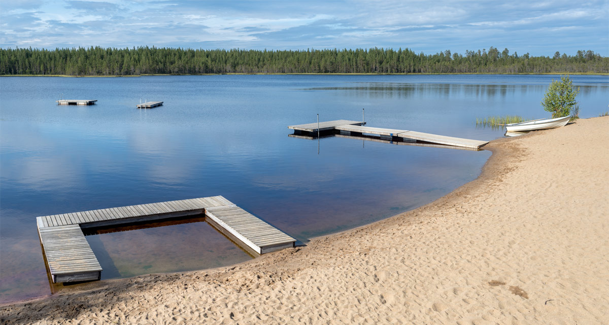
Last Saturday in Gagsmark, a village one hour away, where Annika and I visited our friends T. and J. . First past the curious cows, then through the spruce forest and there it is: A lake with a beautiful sandy beach and blue water that invites you to take a bath.

There’s a playground, an open hut for changing clothes, two anchored rafts you can swim to and much more, but hardly other people. Mostly we were alone although it was a sunny Saturday afternoon. We spend a nice time there together, taking a bath or two (17 °C) and enjoying the sun. Then we walked back another way. No curious cows, but beautiful wooden buildings painted in the typical dark falun-red.

Soon the temperatures will drop and the water in the lake Ytterträsket will cool down. If the water is colder than 10 °C it is called “winter swimming”. And one day in autumn – hardly more than two months away – the lake will start to freeze over and you have to saw a hole into the ice to do some ice swimming.


Lighthouse day on Gåsören

Gåsören is probably my favourite island in the small archipelago off Skelleftehamns coast. It has two lighthouses, the old house-like built 1879–81, and the new tower-like built in 1921. The latter one is still in service. Yesterday was fyrens dag – lighthouse day – on Gåsören. Annika and I wanted to go but beside of my kayak I don’t a boat. How good that Mats – active both in the jazz club and the boat club – gave us a lift from the small boat harbour Tjuvkistan. The wind had weakened but the sea was still choppy and Mats had to drive slowly against the waves. Gåsören however is not far away and soon we dock the boat in the small harbour.

There were not many people on the island yet, more were expected for 21 o’clock. Tommy, who has a summer cottage on the island lit a cosy fire, while I went around and took pictures of the lighthouses and the brick-built cellar, that I’ve never been in before.

Round 21 o’clock the new lighthouse was lit automatically. The summer days of eternal daylight is history for 2019. The flag of the Swedish Cruising Association fluttered in the wind.

Round 21:30 Tommy lights the bulb of the old lighthouse and welcomes the guests. More than expected had come – round 30–40 people.

I take the opportunity to take some pictures from the top of the old lighthouse, where you can climb outside through a little wooden door. In the west it’s the industry of Rönnskär that gives light, in the east it’s the moon.

The people started to leave. Some of them have come by the booked tour boat, other by their own boat. Soon only a few people were left. Those who would stay in their summer cottages (there are only two on the island) plus Mats, Annika and me.

Round 23 o’clock we leave the island. Hopefully I’ll have some more opportunities to visit Gåsören this year.

Another kayaking

On Friday came a lot of rain, but yesterday on Saturday the weather was forecasted to be nice – and so it was. Time for a longer tour with my kayak, that I hardly used this year. A quarter past 9 I was on the water.

Soon after I passed the near-shore island Storgrundet the sea became quite wavy. Still no dangerously large waves but enough to keep me busy instead of photographing. Shortly before the island Medgrundet I came into the lee of the island and the water calmed down. There I could take photos again and it was easy to go ashore.

Do you see the brown stuff covering the stones? It guess it was some kind of algae washed ashore. Phew – the smell was awful! On the island I saw probably the last blooming circumpolar pea for this year. Other plants were already bearing bean pods. It was end of August and you could see autumn approaching.

In opposite to most other islands nearby, there are no summer cottages or other buildings on Medgrundet. I went through the forest to the other side of the island, which is hardly wider than 200 m at its widest point. There are some beautiful trees in the small forest, a nice contrast to the many commercial forests in Northern Sweden. From the other side I could spot my next two paddle destinations for today: Snusan and Kågnäshällan. On my way back I accidentally found a shelter amidst the forest. Maybe it’s new, I’ve never seen it before but probably it’s Medgrundet’s first building.

When I approached Snusan I scared away an eagle. It rose into the air to the big dislike of a seagull that tried to shoo the raptor away. The eagle hardly noticed the seabird but spiralled higher and higher into the air. I observed it only en passant, I had to focus on the waves.

Again I approached the island from the lee side. While Medgrundet is covered with a forest – mostly pines – Snusan is quite bleak and looks more like a huge flat rock. Probably it’s quite young, an old map from 1926 shows that it had been much smaller then.

On the north side of the island I could see the island Kågnäshällan, but also the breaking waves, that I already had heard a while before going ashore.

Parts of the island were very wet with a lot of water puddles, inhabited by small fishes and aquatic insects of the family Corixidae. Other parts of the island were very dry and many of the rowan looked dried up. Probably there’s hardly any soil that can store water for a longer time.

I continued paddling. First I had to cross some quite large waves then the sea was much calmer so that I could take a picture of the next island to visit: Kågnäshällan.

The calmness however was only temporary, because I kayaked along the outer coast of Kågnäshällan, where there are a lot of rocks and shallow areas – invitations for the waves to break. I went round the island, just focussing on the waves to come until I reached the sheltered bay on the land-facing side. On the outside I could hear the roar of a water scooter, at the horizon I could spot a white sail of a sailing boat – two very different ways to travel on water. My preference however is still the kayak.

After a yoghurt as a snack and remembering the last time I’ve been here six month ago I continued my kayak tour. To Kågnäshällan I had paddled quite directly over open sea, now I would follow the coast until I would be back again.

I passed Kågnäsudden, a fishing village, and a lot of summer cottages. Some people were working (mostly involving tools or vehicles with a motor), some were just sitting in front of their houses enjoying the warm and sunny weather. And warm it was, although some clouds were gathering. Since I left Kågnäshällan the sea was much calmer and I could take pictures from the kayak.

That made paddling much easier but also a bit more boring. It’s nice to have waves as long as you feel safe. Part of my safety was the drysuit that I put on when starting the tour. And a life vest of course, but that’s common sense and hardly mentionable.

Now I looked for the beach I use to bath sometimes but I just hopped over that very bay. What a pity! Anyway I found a nice replacement, a small and shallow sandy beach.

Lunchtime! The menu: Västerbotten cheese on crisp bread garnished with grapes. One of the ants liked the cheese, too and robbed a large piece. It dragged it over the beach that still was wet from last days rain until it got stuck.

After lunch break I continued paddling, passed the beach Harrbäckssand, the island Björkskär and then I could see on of the summer cottages, where my kayak uses to lie in summertime. One longer final spurt and I was back again, very glad that I could make this extraordinary fine summer kayak tour. Hopefully not the last for this season.

Appendices

I Paddling

More and more I start to enjoy paddling in the waves. I guess I should learn how to use a kayak sometimes. Perhaps next year?

II Tour stats

17.5 km / 3 hours 40 minutes plus a lot of breaks. That’s less than 5 km/h. It’s more leisure than sports.

According to my tracking app the elevation gain (and loss) was 287 meter. The waves?

III Wildlife photography

I saw the eagle, I had a camera, but I didn’t take a photo. Why? Well, there’s a rule set for that, the Eagle’s legals:

(1) When you see me – the eagle – you will not have a camera with you (I had)
(2) But if you have, then you will not have the telephoto lens with you (I had)
(3) But if you have, then you will not have it mounted on the camera (that’s right)
(4) But if you have, then you will be busy with other things until I’m long away (true, I was struggling with the waves)

IV A riddle

I found this shell of a cockle on the island Snusan. It lay on the rock. There are no cockles in the Bothnian Bay, this part of the Baltic Sea. The next place where you can find them is in Norway, 400 km away. How does this shell come to this place? I know that seagulls use to take shells in their beaks and let them fall down on rocks to crack the shell and get to the meat. But would a seagull transport it such a long distance? How? And why? A riddle that probably remains unsolved.